- New Hartford (village), New York
-
- For other places with this name, see New Hartford (disambiguation).
New Hartford, New York — Village — Location within the state of New York
 New Hartford, New York
Coordinates: 43°4′9″N 75°17′18″W / 43.06917°N 75.28833°WCoordinates: 43°4′9″N 75°17′18″W / 43.06917°N 75.28833°W Country United States State New York County Oneida Area – Total 0.6 sq mi (1.6 km2) – Land 0.6 sq mi (1.6 km2) – Water 0.0 sq mi (0.0 km2) Elevation 541 ft (165 m) Population (2000) – Total 1,886 – Density 3,087.0/sq mi (1,191.9/km2) Time zone Eastern (EST) (UTC-5) – Summer (DST) EDT (UTC-4) ZIP code 13413 Area code(s) 315 FIPS code 36-50298 GNIS feature ID 0958418 New Hartford is a village in Oneida County, New York, United States. The population was 1,886 at the 2000 census. The name was provided by early settlers for New Hartford, Connecticut.
The Village of New Hartford is inside the Town of New Hartford near the border with Utica, New York.
Contents
History
The village was founded in 1789 by the construction of a log cabin by the Sanger family, who later constructed mills nearby. The village was a commercial success, until the opening of the Erie Canal gave Utica a big advantage.
The village of New Hartford was incorporated in 1869.
There are a few houses along Oxford Road that were used to hide slaves on the Underground Railroad.
St. Stephen's Church was listed on the National Register of Historic Places in 1996.[1]
Geography
New Hartford is located at 43°4′9″N 75°17′18″W / 43.06917°N 75.28833°W (43.069169, -75.28846)[2].
According to the United States Census Bureau, the village has a total area of 0.6 square miles (1.6 km²).None of the area is covered with water.
Demographics
As of the census[3] of 2000, there were 1,886 people, 857 households, and 501 families residing in the village. The population density was 3,087.0 people per square mile (1,193.8/km²). There were 901 housing units at an average density of 1,474.8 per square mile (570.3/km²). The racial makeup of the village was 96.98% White, 0.69% Black or African American, 0.21% Native American, 1.11% Asian, 0.27% from other races, and 0.74% from two or more races. Hispanic or Latino of any race were 0.80% of the population.
There were 857 households; out of which 24.9% had children under the age of 18 living with them, 47.5% were married couples living together, 9.2% had a female householder with no husband present, and 41.5% were non-families. 37.9% of all households were made up of individuals and 21.7% had someone living alone who was 65 years of age or older. The average household size was 2.19 and the average family size was 2.93.
In the village the population was spread out with 22.2% under the age of 18, 5.7% from 18 to 24, 26.2% from 25 to 44, 24.3% from 45 to 64, and 21.7% who were 65 years of age or older. The median age was 42 years. For every 100 females there were 85.4 males. For every 100 females age 18 and over, there were 77.7 males.
The median income for a household in the village was $43,563, and the median income for a family was $56,406. Males had a median income of $35,833 versus $27,139 for females. The per capita income for the village was $23,177. About 3.2% of families and 5.7% of the population were below the poverty line, including 6.0% of those under age 18 and 2.9% of those age 65 or over.
References
- ^ "National Register Information System". National Register of Historic Places. National Park Service. 2009-03-13. http://nrhp.focus.nps.gov/natreg/docs/All_Data.html.
- ^ "US Gazetteer files: 2010, 2000, and 1990". United States Census Bureau. 2011-02-12. http://www.census.gov/geo/www/gazetteer/gazette.html. Retrieved 2011-04-23.
- ^ "American FactFinder". United States Census Bureau. http://factfinder.census.gov. Retrieved 2008-01-31.
External links
Municipalities and communities of Oneida County, New York Cities 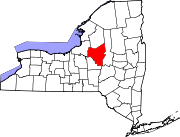
Towns Annsville | Augusta | Ava | Boonville | Bridgewater | Camden | Deerfield | Florence | Floyd | Forestport | Kirkland | Lee | Marcy | Marshall | New Hartford | Paris | Remsen | Sangerfield | Steuben | Trenton | Vernon | Verona | Vienna | Western | Westmoreland | Whitestown
Villages Barneveld | Boonville | Bridgewater | Camden | Clayville | Clinton | Holland Patent | New Hartford | New York Mills | Oneida Castle | Oriskany | Oriskany Falls | Prospect | Remsen | Sylvan Beach | Vernon | Waterville | Whitesboro | Yorkville
CDP Other
hamletsAdrian | Cassville | Deansboro | Durhamville | Jewell | Point Rock | Sauquoit | Taberg | Verona Mills | Washington Mills
Categories:- Villages in New York
- Utica–Rome metropolitan area
- Populated places in Oneida County, New York


Wikimedia Foundation. 2010.