- Manlius (town), New York
-
Manlius, New York — Town — A neighborhood in the hills of the Town of Manlius outside the Village of Manlius. Location within the state of New York
 Manlius, New York
Coordinates: 43°02′53″N 75°58′58″W / 43.04806°N 75.98278°WCoordinates: 43°02′53″N 75°58′58″W / 43.04806°N 75.98278°W Country United States State New York County Onondaga Established 1794 Government – Type Town Board – Supervisor Edmond J. Theobald (R) – Councilors List- John R. Loeffler (R), Deputy Supervisor
- Vincent Giordano (R)
- David M. Marnell, Sr. (R)
- Karen Green (R)
- Nicholas J. Marzola (R)
- Sandra A. Schepp (R)
Area – Total 50.0 sq mi (129.4 km2) – Land 49.6 sq mi (128.5 km2) – Water 0.4 sq mi (0.9 km2) Elevation 669 ft (204 m) Population (2010) – Total 32,370 – Density 652.6/sq mi (251.9/km2) Time zone Eastern (EST) (UTC-5) – Summer (DST) EDT (UTC-4) ZIP code 13057, 13066, 13082, 13104, 13116 Area code(s) 315 FIPS code 36-45029 GNIS feature ID 0979192 Website www.townofmanlius.org Manlius is a town in Onondaga County, east of the city of Syracuse, New York, United States. The population was 32,370 at the 2010 census, making it the third largest suburb in metropolitan Syracuse.[1][2] In 2005, the town was ranked #98 on CNN Money's list of Best Places to Live.[3]
The Town of Manlius includes the villages of Fayetteville, Manlius, and Minoa, and is located on the eastern border of Onondaga County.
Contents
History
The town was a township of the former Central New York Military Tract. Manlius is the name of several important Romans, but exactly which one was being honored is no longer known. The current town was first settled around 1790.
The Town of Manlius was created in 1794, along with Onondaga County, as a much larger entity, which was decreased by the formation, in part or in whole, of new towns (DeWitt, Onondaga, Salina) and part of Syracuse.
The economy related to trade generated by the Erie Canal contributed to the early development of the town.
Geography
The east town line is the border of Madison County, New York, marked in part, by the Chittenango Creek. The town of DeWitt is to the west, the town of Pompey is to the south, and the town of Cicero is to the north.
According to the United States Census Bureau, the town has a total area of 50.0 square miles (129.4 km²), of which, 49.6 square miles (128.5 km²) of it is land and 0.3 square miles (0.9 km²) of it (0.68%) is water.
The New York State Thruway (Interstate 90) crosses the north part of Manlius. New York State Route 290 crosses the northwest corner of the town. New York State Route 5 (in part, Genesee Turnpike) and New York State Route 173 (Seneca Turnpike) are east-west highways. New York State Route 257 is a north-south state highway. New York State Route 92 (Cazenovia Rd) is a northwest-southeast highway.
Demographics
As of the census[4] of 2000, there were 31,872 people, 12,553 households, and 8,887 families residing in the town. The population density was 642.3 people per square mile (248.0/km²). There were 13,071 housing units at an average density of 263.4 per square mile (101.7/km²). The racial makeup of the town was 94.70% White, 0.87% Black or African American, 0.24% Native American, 2.94% Asian, 0.01% Pacific Islander, 0.17% from other races, and 1.07% from two or more races. Hispanic or Latino of any race were 0.97% of the population.
There were 12,553 households out of which 34.5% had children under the age of 18 living with them, 60.2% were married couples living together, 8.0% had a female householder with no husband present, and 29.2% were non-families. 25.3% of all households were made up of individuals and 10.9% had someone living alone who was 65 years of age or older. The average household size was 2.51 and the average family size was 3.04.
The population in the town was spread out with 26.4% under the age of 18, 4.7% from 18 to 24, 26.7% from 25 to 44, 26.7% from 45 to 64, and 15.5% who were 65 years of age or older. The median age was 41 years. For every 100 females there were 91.3 males. For every 100 females age 18 and over, there were 86.4 males.
The median income for a household in the town was $60,118, and the median income for a family was $70,655. As of the 2008 estimate, however, these figures had risen to $71,830 and $88,272, respectively.[5] Males had a median income of $52,065 versus $31,486 for females. The per capita income for the town was $31,825, but had risen to $39,688 in 2008.[5] About 2.0% of families and 3.3% of the population were below the poverty line, including 3.5% of those under age 18 and 4.7% of those age 65 or over.
Education
The Fayetteville-Manlius Central School District is a public school system, serving the majority of the Town of Manlius.
Students residing in the Town of Manlius may also reside within the East Syracuse-Minoa Central School District, or choose to attend Christian Brothers Academy, Manlius Pebble Hill, or other private schools in Metro Syracuse. Before the school district was formed, the historic Mycenae Schoolhouse was used.
Elementary schools
- Fayetteville Elementary School
- Mott Road Elementary School
- Enders Road Elementary School
Middle schools
- Wellwood Middle School (formerly Fayetteville High School)
- Eagle Hill Middle School
High school
Private secondary
- The Manlius School, formerly St. John's Military School, which merged with the Pebble Hill School in 1970 to become Manlius Pebble Hill. As a result of the merger, the campus was closed in 1974.
Communities and locations in the Town of Manlius
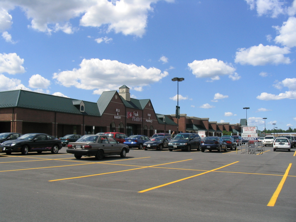
 Fayetteville Towne Center Shopping Plaza has the greatest number of stores and restaurants in the Town of Manlius.
- Eagle Village – A hamlet northeast of Manlius village on NY-173.
- Fayetteville – The Village of Fayetteville is by the west town line at the junction of NY-257 and NY-5.
- Fayetteville Towne Center — a major outdoor shopping plaza strip mall that was formerly Fayetteville Mall .
- Fillmore Corners – A hamlet west of Manlius village on NY-173.
- Fremont Heights — A suburban hamlet near the west town line, south of Minoa.
- Fremont Hills — A suburban hamlet near the west town line, south of Minoa.
- Green Lakes State Park – A state park southeast of Minoa containing two unique lakes.
- High Bridge — A hamlet at the west town line on NY-92.
- Kirkville — A hamlet east of Minoa.
- Limestone Creek
- Manlius – The Village of Manlius is near the south town line at the junction of NY-92 and NY-173.
- Manlius Center — A location south of Minoa and north of Fayetteville at the junctiono of NY-257 and NY-290.
- Minoa – The Village of Minoa is in the northern part of the town on NY-257.
- Mycenae – A hamlet near the east town line on NY-5.
- North Manlius — A hamlet by the north town line and Chittenango Creek.
- Peck Hill – A hamlet by the east town line, east of Manlius village.
- Polkville – A location northwest of Minoa.
- Saintsville — A hamlet in the north part of the town, east of Minoa.
- Schepps Corner — A hamlet near the north town line on NY-298.
- Snyders Crossing — A location between Minoa and Kirkville.
The three libraries located in the Town of Manlius - Village of Manlius Library, Fayetteville Free Library, and Village of Minoa Library; are branches of the Onondaga County Public Library.
Notable residents
- Laurie Halse Anderson, New York Times bestselling author, graduate of Fayetteville-Manlius High School
- Grover Cleveland, 22nd and 24th President of the United States and Governor of New York
- Larry Costello, American professional basketball player and coach, NBA Hall of Fame member and six-time All-Star, from Minoa.
- Matilda Joslyn Gage, abolitionist and suffragist
- Douglas Holtz-Eakin, former faculty member at Syracuse University, former Director of the Congressional Budget Office, and former chief economic policy adviser to U.S. Senator John McCain's 2008 presidential campaign. His children graduated from Fayetteville-Manlius High School.
- Thomas J. McIntyre, United States Senator from New Hampshire
- Steven Page, former member and co-founder of alternative rock band Barenaked Ladies.
- Greg Paulus, former basketball player at Duke University, and former starting quarterback for the Syracuse Orange football team.
- John J. Peck, Civil War general
References
- ^ Annual population estimates for Manlius town, Onondaga County, New York. United States Census Bureau. Retrieved 2009-08-02.
- ^ Datasets, Montana through Wyoming. United States Census Bureau. Retrieved 2010-07-12.
- ^ CNNMoney.com Best Places to Live 2005
- ^ "American FactFinder". United States Census Bureau. http://factfinder.census.gov. Retrieved 2008-01-31.
- ^ a b 2006-2008 American Community Survey 3-Year Estimates for Manlius (town), Onondaga County, New York. United States Census Bureau. Retrieved 2010-08-11.
External links
- US Census Bureau Fact Sheet for the Town of Manlius
- USGS Feature Data for the Town of Manlius
- Town of Manlius, NY
- Manlius history/genalogy
- Manlius Historical Society
Municipalities and communities of Onondaga County, New York City 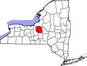
Towns Villages Baldwinsville | Camillus | East Syracuse | Elbridge | Fabius | Fayetteville | Jordan | Liverpool | Manlius | Marcellus | Minoa | North Syracuse | Skaneateles | Solvay | Tully
CDPs Brewerton‡ | Bridgeport‡ | Fairmount | Galeville | Lakeland | Lyncourt | Mattydale | Nedrow | Seneca Knolls | Village Green | Westvale
Other
hamletsAmber | Amboy | Apulia | Apulia Station | Borodino | Cardiff | Cedarvale | Clintonville | Collingwood | Delphi | Delphi Falls | Geddes | Hart Lot | Hinsdale | Howlett Hill | Indian Village | Jack's Reef | Jamesville | Long Branch | Marietta | Memphis | Messina Springs | Mottville | Mycenae | Navarino | Onondaga Hill | Oran | Otisco | Plainville | Pompey Center | Rose Hill | Shepard Settlement | Skaneateles Falls | South Onondaga | South Spafford | Southwood | Spafford Valley | Split Rock | State Fair Grounds | Taunton | Thorn Hill | Vesper | Warners | Watervale
Indian
reservationFootnotes ‡This populated place also has portions in an adjacent county or counties
Categories:- Towns in New York
- Syracuse metropolitan area
- Populated places in Onondaga County, New York


Wikimedia Foundation. 2010.