- Islip (town), New York
Infobox Settlement
official_name = Islip, New York
settlement_type =Town
nickname =
motto =
imagesize =
image_caption =
image_pushpin_
mapsize = 250x200px
map_caption =
mapsize1 =
map_caption1 =subdivision_type = Country
subdivision_name =United States
subdivision_type1 = State
subdivision_name1 =New York
subdivision_type2 = County
subdivision_name2 = Suffolk
government_footnotes =
government_type =Civil Township
leader_title = Supervisor
leader_name = Phil Nolan
leader_title1 =Minority Leader of Town Board
leader_name1 = Steven J. Flotteron
established_title =
established_date = 1683unit_pref = Imperial
area_footnotes =
area_magnitude =
area_total_km2 = 422.5
area_land_km2 = 272.7
area_water_km2 = 149.8
area_total_sq_mi = 163.1
area_land_sq_mi = 105.3
area_water_sq_mi = 57.8population_as_of = 2000
population_footnotes =
population_total = 322612
population_density_km2 = 1183.2
population_density_sq_mi = 3064.5timezone = Eastern (EST)
utc_offset = -5
timezone_DST = EDT
utc_offset_DST = -4
elevation_footnotes =
elevation_m = 2
elevation_ft = 7
latd = 40 |latm = 45 |lats = 24 |latNS = N
longd = 73 |longm = 11 |longs = 56 |longEW = Wpostal_code_type =
ZIP code
postal_code = 11751
area_code = 631
blank_name = FIPS code
blank_info = 36-38000
blank1_name = GNIS feature ID
blank1_info = 0979097
website = http://www.isliptown.org/
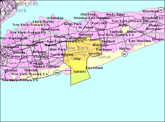
footnotes =The Town of Islip is located in southern Suffolk County,
New York (USA) on the south shore ofLong Island . As of the 2000 census, the town population was 322,612.New York Air Route Traffic Control Center is located in the Ronkonkoma section of Islip.Geography and Climate
According to the
United States Census Bureau , the town has a total area of 163.1square mile s (422.5km² ), of which, 105.3 square miles (272.7 km²) of it is land and 57.8 square miles (149.8 km²) of it (35.46%) is water.The town includes part of Fire Island and the
Great South Bay . Its southern boundary is theAtlantic Ocean .Demographics
As of the
census GR|2 of 2000, there were 322,612 people, 98,936 households, and 78,555 families residing in the town. Thepopulation density was 3,064.5 people per square mile (1,183.1/km²). There were 104,278 housing units at an average density of 990.5/sq mi (382.4/km²). The racial makeup of the town was 77.25% White, 9.02% Black or African American, 0.26% Native American, 2.17% Asian, 0.05% Pacific Islander, 8.32% from other races, and 2.93% from two or more races. Hispanic or Latino of any race were 20.16% of the population.There were 98,936 households out of which 39.4% had children under the age of 18 living with them, 62.4% were married couples living together, 12.3% had a female householder with no husband present, and 20.6% were non-families. 16.2% of all households were made up of individuals and 6.4% had someone living alone who was 65 years of age or older. The average household size was 3.22 and the average family size was 3.55.
In the town the population was spread out with 27.4% under the age of 18, 8.1% from 18 to 24, 32.4% from 25 to 44, 22.2% from 45 to 64, and 9.9% who were 65 years of age or older. The median age was 35 years. For every 100 females there were 96.7 males. For every 100 females age 18 and over, there were 93.1 males.
According to a 2006 estimate, the median income for a household in the CDP was $74,991, and the median income for a family was $82,190. [http://factfinder.census.gov/servlet/ACSSAFFFacts?_event=Search&geo_id=06000US3605934000&_geoContext=01000US%7C04000US36%7C05000US36059%7C06000US3605934000&_street=&_county=islip&_cityTown=islip&_state=04000US36&_zip=&_lang=en&_sse=on&ActiveGeoDiv=geoSelect&_useEV=&pctxt=fph&pgsl=060&_submenuId=factsheet_1&ds_name=ACS_2006_SAFF&_ci_nbr=null&qr_name=null®=null%3Anull&_keyword=&_industry=] Males had a median income of $45,069 versus $31,660 for females. The
per capita income for the town was $23,699. About 4.4% of families and 6.6% of the population were below thepoverty line , including 7.9% of those under age 18 and 7.0% of those age 65 or over.History
Mobro garbage
In 1987 the City found that it had filled its landfill capacity. The city agreed to ship its garbage to Morehead City,
North Carolina , where there were plans to convert it intomethane . OnMarch 22 ,1987 , the tugboat "Break of Day" towed the barge "Mobro 4000 " and its cargo of over 3,100 tons of trash. While in transit, a rumor spread that the 16 bundles of trash that contained hospital gowns, syringes, and diapers was a contaminant that affected the entire load. In consequence, the state ofNorth Carolina refused to accept the waste. After an 11-day delay, the "Mobro" made way to its home port inLouisiana , but that state, too, declined the waste. Similarly, Alabama inote|Alabama is named in Katz|Katz, three other states, and the nations ofMexico ,Belize , and theBahamas refused the load before the operators abandoned the plan and returned toNew York .inote|News of the Odd|OddnewsLowell Harrelson , the owner of the garbage, tried to negotiate for the "Mobro" to dock near the Borough ofQueens , whence the refuse would be carried back to Islip by trucks.Claire Shulman , the President of Queens, was not consulted, however; she obtained a temporary restraining order that forced the waste to stay at sea. The "Mobro" and its decaying cargo stayed off the shores ofBrooklyn until July, when the vessel was granted a federal anchorage inNew Jersey . The court hearings ran until October, when it was agreed that the cargo should be incinerated in Brooklyn. The 430 tons of ash that remained from this process was added to the landfill in Islip.inote|News of the Odd|OddnewsIn response to the garbage barge incident, the town of Islip developed
Keep Islip Clean , WRAP, and other environmentally friendly initiatives to help bolster the image of the town.Governance
The town is governed by a
town supervisor , which is a similar position to that of amayor , and four councilmembers elected at an at-large basis. There is also a town clerk and receiver of taxes, both duly elected. All of the elected officials serve staggered four year terms that are up for election in odd years, except when special election is held pursuant to state law.The town board has jurisdiction over governmental affairs within the town's boundaries, excluding incorporated villages which have their own local government. Such things include passing a budget and enacting new laws.
Communities and locations
Villages (incorporated)
* Brightwaters
* Islandia
* Ocean Beach
* SaltaireHamlets (unincorporated)
* Bay Shore
* Bayport
* Baywood
* Bohemia
* Brentwood
* Central Islip
* East Islip
* Great River
* Hauppauge " (partially; shared with the Town of Smithtown)"
* Holbrook "(partially; shared with the Town of Brookhaven)"
* Holtsville "(partially; shared with the Town of Brookhaven)"
* Islip
* Islip Terrace
* North Bay Shore
* North Great River
* Oakdale
* Ronkonkoma
* Sayville
* West Bay Shore
* West Islip
* West SayvilleOther communities
*
Dunewood
*Fair Harbor
* Fire Island, many Islip communities are on this barrier islandState Parks
*Connetquot River State Park Preserve ( [http://nysparks.state.ny.us/parks/info.asp?parkID=69 Website] )
*Bayard Cutting Arboretum State Park ( [http://nysparks.state.ny.us/parks/info.asp?parkID=43 Website] )
*Heckscher State Park ( [http://nysparks.state.ny.us/parks/info.asp?parkID=153 Website] )Trivia
*On
July 17 ,1996 ,TWA Flight 800 crashed off the coast ofLong Island near Islip
*On the First Sunday of March Town of Islip and East Islip AOH has the annual St. Patrick's Day Parade starting at East Islip Library on Montauk Hwy and goes west, ending on Irish Lane. It Largest St. Patrick’s Day parade on Long Island and most resembles the New York City parade since it does not include floats. The 2008 St. Patrick's Day Parade held on March 2 was the first time the parade had a Green Line like the New York City St. Patrick's Day Parade held on March 17.References
* [http://www.newsoftheodd.com/article1018.html 'Garbage Barge Begins Lengthy Trek (March 22, 1987)', "News of the Odd"] Retrieved
May 21 2005
* [http://www.bos.frb.org/economic/nerr/rr2002/q1/waste.htm Katz, Jane. 'What a Waste' "Regional Review" (Boston: Federal Reserve Bank of Boston) Quarter 1, 2002]External links
* [http://www.isliptown.org Town of Islip, Economic Development Division]
* [http://www.keepislipclean.org/ Keep Islip Clean]

Wikimedia Foundation. 2010.