- Dryden (village), New York
-
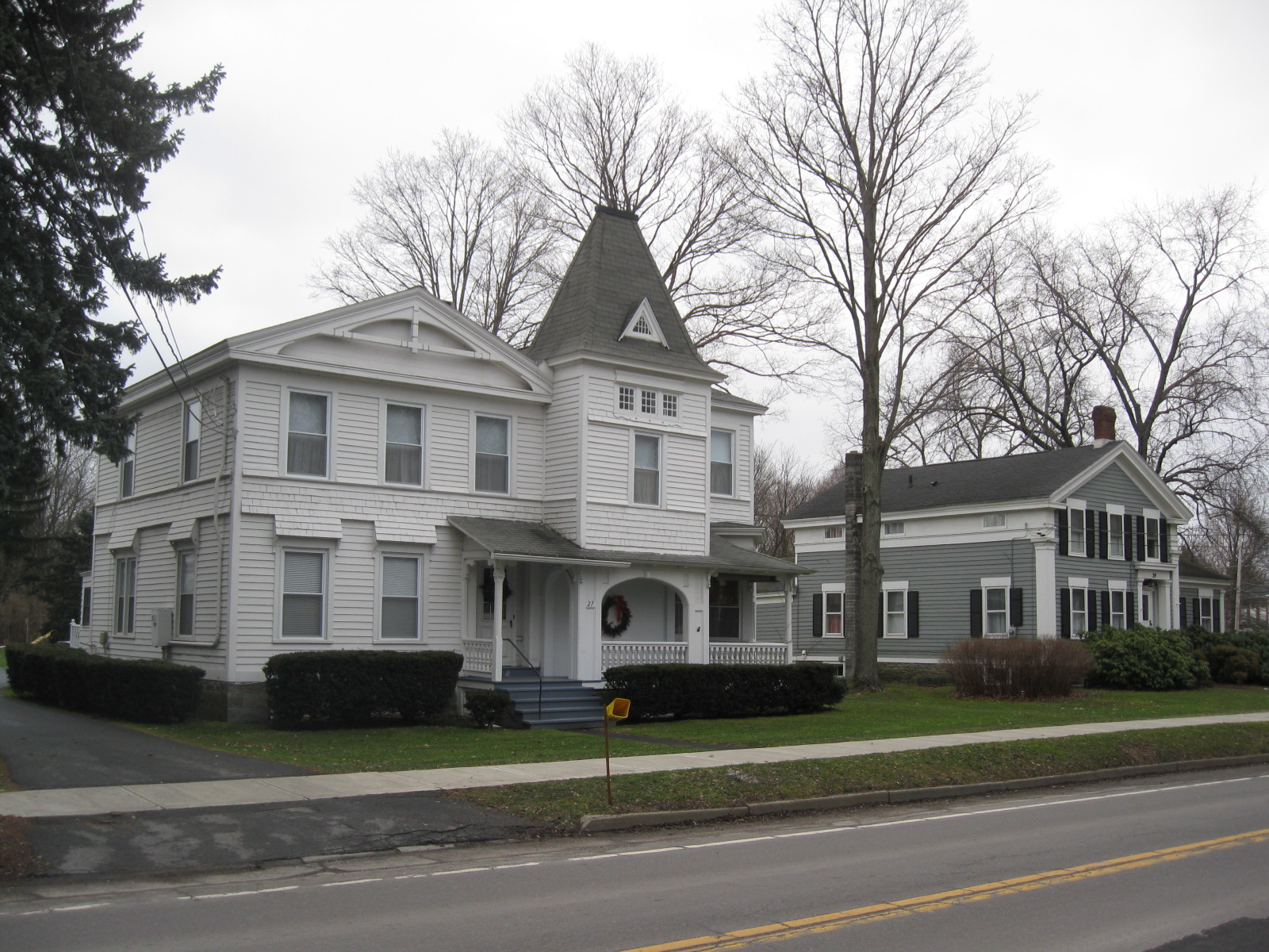
Dryden, New York — Village — Dryden Historic District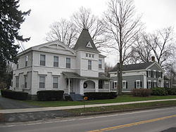 Location within the state of New York
 Dryden, New York
Coordinates: 42°29′21″N 76°17′59″W / 42.48917°N 76.29972°WCoordinates: 42°29′21″N 76°17′59″W / 42.48917°N 76.29972°W Country United States State New York County Tompkins Government - Mayor Randall B. Sterling Area - Total 1.7 sq mi (4.3 km2) - Land 1.7 sq mi (4.3 km2) - Water 0.0 sq mi (0.0 km2) Elevation 1,089 ft (332 m) Population (2000) - Total 1,832 - Density 1,104.9/sq mi (426.6/km2) Time zone Eastern (EST) (UTC-5) - Summer (DST) EDT (UTC-4) ZIP code 13053 Area code(s) 607 FIPS code 36-20951 GNIS feature ID 0948704 Dryden is a village in Tompkins County, New York, United States. The population was 1,832 at the 2000 census. The name was assigned by a clerk interested in the classics to honor John Dryden, poet and playwright.
The Village of Dryden is in the Town of Dryden and is east of Ithaca. It is near the border of Cortland County.
Contents
History
The village is in the former Central New York Military Tract.
The first settler in the town located on the site of the future village in 1797.
The village of Dryden was incorporated in 1857.
Residents of note
John Miller, first governor of North Dakota.
Geography
Dryden is located at 42°29′21″N 76°17′58″W / 42.48917°N 76.29944°W (42.489188, -76.299589)[1].
According to the United States Census Bureau, the village has a total area of 1.7 square miles (4.3 km²).None of the area is covered with water.
New York State Route 13 intersects New York State Route 38 in the village.
Demographics
As of the census[2] of 2000, there were 1,832 people, 772 households, and 469 families residing in the village. The population density was 1,104.9 people per square mile (426.1/km²). There were 811 housing units at an average density of 489.1 per square mile (188.6/km²). The racial makeup of the village was 96.18% White, 1.26% Black or African American, 0.33% Native American, 0.27% Asian, 0.49% from other races, and 1.47% from two or more races. Hispanic or Latino of any race were 1.36% of the population.
There were 772 households out of which 30.8% had children under the age of 18 living with them, 49.2% were married couples living together, 7.8% had a female householder with no husband present, and 39.2% were non-families. 33.4% of all households were made up of individuals and 10.9% had someone living alone who was 65 years of age or older. The average household size was 2.37 and the average family size was 3.06.
In the village the population was spread out with 26.4% under the age of 18, 8.9% from 18 to 24, 28.9% from 25 to 44, 24.3% from 45 to 64, and 11.5% who were 65 years of age or older. The median age was 37 years. For every 100 females there were 98.1 males. For every 100 females age 18 and over, there were 95.1 males.
The median income for a household in the village was $43,977, and the median income for a family was $54,489. Males had a median income of $38,897 versus $26,809 for females. The per capita income for the village was $20,613. About 5.1% of families and 9.9% of the population were below the poverty line, including 14.1% of those under age 18 and 4.7% of those age 65 or over.
References
- ^ "US Gazetteer files: 2010, 2000, and 1990". United States Census Bureau. 2011-02-12. http://www.census.gov/geo/www/gazetteer/gazette.html. Retrieved 2011-04-23.
- ^ "American FactFinder". United States Census Bureau. http://factfinder.census.gov. Retrieved 2008-01-31.
External links
Municipalities and communities of Tompkins County, New York County seat: Ithaca City 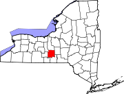
Towns Villages Cayuga Heights | Dryden | Freeville | Groton | Lansing | Trumansburg
CDPs Other
hamletsCategories:- Villages in New York
- Populated places in Tompkins County, New York


Wikimedia Foundation. 2010.