- Pelham (village), New York
-
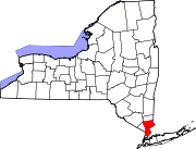
Pelham, New York — Village — Location within the state of New York
 Pelham, New York
Coordinates: 40°54′38″N 73°48′27″W / 40.91056°N 73.8075°WCoordinates: 40°54′38″N 73°48′27″W / 40.91056°N 73.8075°W Country United States State New York County Westchester Area – Total 0.8 sq mi (2.1 km2) – Land 0.8 sq mi (2.1 km2) – Water 0.0 sq mi (0.0 km2) Elevation 72 ft (22 m) Population (2010) – Total 6,910 – Density 8,522.3/sq mi (3,290.5/km2) Time zone Eastern (EST) (UTC-5) – Summer (DST) EDT (UTC-4) ZIP code 10803 Area code(s) 914 FIPS code 36-57001 GNIS feature ID 0960106 Website http://www.pelhamgov.com Pelham is a village in Westchester County, New York, United States. The population was 6,910 at the 2010 census.[1] As a village, it is located in the Town of Pelham.
Contents
History
On June 27, 1654, Thomas Pell purchased 9,166 acres (37.09 km2) from the Native American tribe of the Siwanoys. The purchase included an area which is known today as Pelham, New Rochelle, and portions of Bronx County. Among the land that he purchased, of course, was all the land that constitutes today's village of Pelham. Upon his death in 1669, Thomas Pell left the land to his nephew and sole heir, John Pell.
The original Village of Pelham was incorporated in 1896, bounded by the New Haven Railroad's main line to north, Colonial Avenue to the south, New Rochelle to the west, and the Hutchinson River to the east. The Village of North Pelham was incorporated on August 29, 1896. Its boundaries were the New Haven Railroad to the south, New Rochelle to the west and northwest, and the Hutchinson River to the east and northeast. By 1940, the Village of Pelham's population was 1,918 and the Village of North Pelham had a population of 5,046. In June 1975, the Village of North Pelham merged with the existing Village of Pelham.[2]
Geography
According to the United States Census Bureau, the village has a total area of 0.8 square miles (2.1 km²), all of it land.
Demographics
As of the census[3] of 2000, there were 6,400 people, 2,287 households, and 1,687 families residing in the village. The population density was 7,785.5 people per square mile (3,013.5/km²). There were 2,337 housing units at an average density of 2,842.9 per square mile (1,100.4/km²). The racial makeup of the village was 83.22% White, 6.66% Black or African American, 0.09% Native American, 4.95% Asian, 2.47% from other races, and 2.61% from two or more races. Hispanic or Latino of any race were 7.20% of the population.
There were 2,287 households out of which 39.7% had children under the age of 18 living with them, 58.9% were married couples living together, 11.6% had a female householder with no husband present, and 26.2% were non-families. 20.9% of all households were made up of individuals and 8.3% had someone living with them who was 65 years of age or older. The average household size was 2.79 and the average family size was 3.30.
In the village the population was spread out with 27.7% under the age of 18, 6.0% from 18 to 24, 30.7% from 25 to 44, 23.5% from 45 to 64, and 12.0% who were 65 years of age or older. The median age was 37 years. For every 100 females there were 92.4 males. For every 100 females age 18 and over, there were 87.0 males.
The median income for a household in the village was $82,430, and the median income for a family was $95,929. Males had a median income of $67,339 versus $41,364 for females. The per capita income for the village was $43,397. About 1.3% of families and 3.3% of the population were below the poverty line, including 4% of those under age 18 and 4% of those age 65 or over.
References
- ^ "Profile of General Population and Housing Characteristics: 2010 Demographic Profile Data (DP-1): Pelham village, New York". U.S. Census Bureau, American Factfinder. http://factfinder2.census.gov. Retrieved November 18, 2011.
- ^ Blake A. Bell. "A Chronology of the History of Pelham". Historic Pelham. http://www.historicpelham.com/timeline.htm. Retrieved 2011-01-31.
- ^ "American FactFinder". United States Census Bureau. http://factfinder.census.gov. Retrieved 2008-01-31.
External links
- Village of Pelham official website
- Historic Pelham Web Site by Town Historian
- Historic Pelham Daily Blog by Town Historian
Municipalities and communities of Westchester County, New York Cities Mount Vernon | New Rochelle | Peekskill | Rye | White Plains | Yonkers
Towns Bedford | Cortlandt | Eastchester | Greenburgh | Harrison | Lewisboro | Mamaroneck | Mount Kisco | Mount Pleasant | New Castle | North Castle | North Salem | Ossining | Pelham | Pound Ridge | Rye | Scarsdale | Somers | Yorktown
Villages Ardsley | Briarcliff Manor | Bronxville | Buchanan | Croton-on-Hudson | Dobbs Ferry | Elmsford | Harrison | Hastings-on-Hudson | Irvington | Larchmont | Mamaroneck | Mount Kisco | Ossining | Pelham | Pelham Manor | Pleasantville | Port Chester | Rye Brook | Scarsdale | Sleepy Hollow | Tarrytown | Tuckahoe
CDPs Armonk | Bedford (Bedford Village) | Chappaqua | Crompond | Crugers | Eastchester | Fairview | Golden's Bridge | Greenville | Hartsdale | Hawthorne | Heritage Hills | Jefferson Valley | Lake Mohegan | Lincolndale | Peach Lake‡ | Scotts Corners | Shenorock | Shrub Oak | Thornwood | Valhalla | Verplanck | Yorktown Heights
Other
hamletsBanksville | Bedford Corners | Bedford Hills | Cortlandt Manor | Granite Springs | Katonah | Millwood | Montrose | Pocantico Hills | Purchase | South Salem | Waccabuc
Footnotes ‡This populated place also has portions in an adjacent county or counties
Categories:- Villages in New York
- Populated places in Westchester County, New York


Wikimedia Foundation. 2010.