- Rajasthan
-
Rajasthan
राजस्थान— State — Clockwise from top: The Oberoi Vanyavilas, Dilwara Temples, Hawa Mahal,Rajasthan Desert, City Palace, Lake Palace, Umaid Bhavan Palace

SealLocation of Rajasthan in India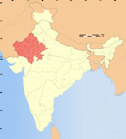 Map of Rajasthan
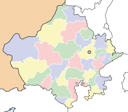
Coordinates (Jaipur): 26°34′22″N 73°50′20″E / 26.57268°N 73.83902°ECoordinates: 26°34′22″N 73°50′20″E / 26.57268°N 73.83902°E Country  India
IndiaEstablished 1 November 1956 Capital Jaipur Largest city Jaipur Districts 33 total Government – Governor Dr. Shivraj Patil – Chief Minister Ashok Gehlot (INC) – Legislature Unicameral (200 seats) – Parliamentary constituency 25 – High Court Rajasthan High Court Area – Total 342,269 km2 (132,150.8 sq mi) Area rank 1st Population (2011) – Total 68,621,012 – Rank 8th – Density 200.5/km2 (519.3/sq mi) Time zone IST (UTC+05:30) ISO 3166 code IN-RJ HDI  0.537 (medium)
HDI rank 21st (2005) Literacy 68% (20th) Official languages Hindi Website rajasthan.gov.in Rājasthān (Hindi: राजस्थान, Rajasthani: राजस्थाण, pronounced [raːdʒəsˈt̪ʰaːn] (
 listen)) the land of Rajasthanis, ("the land of kings"[1] or "the land of colours"[2]), is the largest state of the Republic of India by area. It is located in the northwest of India. It encompasses most of the area of the large, inhospitable Great Indian Desert (Thar Desert), which has an edge paralleling the Sutlej-Indus river valley along its border with Pakistan. The state is bordered by Pakistan to the west, Gujarat to the southwest, Madhya Pradesh to the southeast, Uttar Pradesh and Haryana to the northeast and Punjab to the north. Rajasthan covers an area of 132,150 sq mi or 342,239 km². The proportion of the state's total area to the total area of the country is 10.41 per cent.
Jaipur is the capital and the largest city of the state. Geographical features include the Thar Desert along north-western Rajasthan and the termination of the Ghaggar River near the archaeological ruins at Kalibanga of the Indus Valley Civilization, which are the oldest in the Indian subcontinent discovered so far.
One of the world's oldest mountain ranges, the Aravalli Range, cradles the only hill station of Rajasthan, Mount Abu, famous for Dilwara Temples, a sacred pilgrimage for Jains. Eastern Rajasthan has the world famous Keoladeo National Park near Bharatpur, a World Heritage Site[3] known for its bird life. It also has two national tiger reserves, Ranthambore and Sariska Tiger Reserve, and a famous temple in Khatu, Sikar district, dedicated to Khatu Shyam Ji. Rajasthan was formed on 30 March 1949, when the region known until then as Rajputana, consisting of erstwhile princely states ruled by Rajputs, Jats, Gurjars, and Muslims, merged into the Dominion of India.
Contents
Etymology
The first mention of word Rajasthan comes from the work of James Tod (Annals) in 1829 A.D.[4] Rajasthan literally means a Land of Kingdoms. George Thomas (Military Memories) was the first in 1800 A.D., to term this region as Rajputana.[4]John Keay in his book, India: A History stated that the Rajputana name was coined by the British, but that the word even achieved a retrospective authenticity: in an 1829 translation of Ferishta's history of early Islamic India, John Briggs discarded the phrase Indian princes, as rendered in Dow's earlier version, and substituted Rajpoot princes.[5] Rajasthan was essentially the country of the Gurjars.[6] R. C. Majumdar explained that the region was long known as Gurjaratra that is Country protected or ruled by the Gurjars, early form of Gujarat, before it came to be called Rajputana.[7]
The only difference between erstwhile Rajputana and Rajasthan is that certain portions of what had been British India, in the former province of Ajmer-Merwara, were included. Portions lying geographically outside of Rajputana such as the Sumel-Tappa area were included in Madhya Pradesh.[8]
History
Main article: History of RajasthanThe Indus Valley Civilization, one of the world's first and oldest civilizations, was located in parts of what is now Rajasthan. Kalibangan in Hanumangarh district, Rajasthan was a major provincial capital of the Indus Valley Civilization.[9] It is believed that Western Kshatrapas (405-35 BC) were Saka rulers of the western part of India (Saurashtra and Malwa: modern Gujarat, Southern Sindh, Maharashtra, Rajasthan). They were successors to the Indo-Scythians, and were contemporaneous with the Kushans who ruled the northern part of the Indian subcontinent. The Indo-Scythians invaded the area of Ujjain and establish the Saka era (with Saka calendar), marking the beginning of the long-lived Saka Western Satraps state.[10]
 Ladies in Rajasthan wearing colorful lehenga-cholis
Traditionally the Meenas, Rajputs, charans, Yadavs, Jats, Bhils, Gurjars, Bishnois and other tribes made a great contribution in building the state of Rajasthan. All these tribes suffered great difficulties in protecting their culture and the land. Millions[11] of them were martyred trying to protect their land. Gurjars had been exterminated in Bhinmal and Ajmer areas fighting with the invaders. Bhils once ruled Kota.[11] Meenas were rulers of Bundi and Dhundhar region.[citation needed]
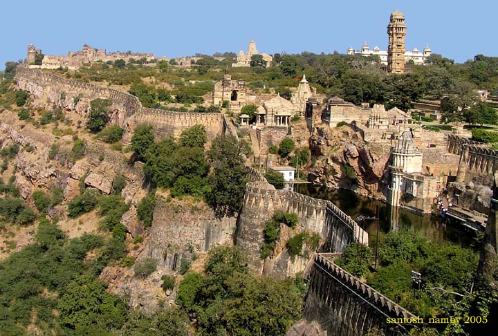
 The Chittorgarh Fort is one of the largest forts in Asia.
Gurjars ruled many dynasties in this part of the country. In fact this region was long known as Gurjaratra.[7] Up to the tenth century almost the whole of North India, excepting Bengal, owned supremacy of Gurjars with their seat of power at Kannauj.[12] Gurjar Pratihar Empire acted as barrier for Arab invaders from 6th to 11th century. The chief credit of Gurjara Pratihara empire lies in its successfully resistance to the foreign invasions from the west, from the days of Junaid. Historian Majumdar, say that this was frankly recognized by the Arab writers themselves. He further clears that historians of India have wondered at the slow progress of Muslim invaders in India, as compared with their rapid advance in other parts of the world. Now, there can be little doubt that it was the power of the Gurjara Pratihara army that effectively barred the progress of the Muslims beyond the confines of Sindh, their first conquest for nearly three hundred years.[13]
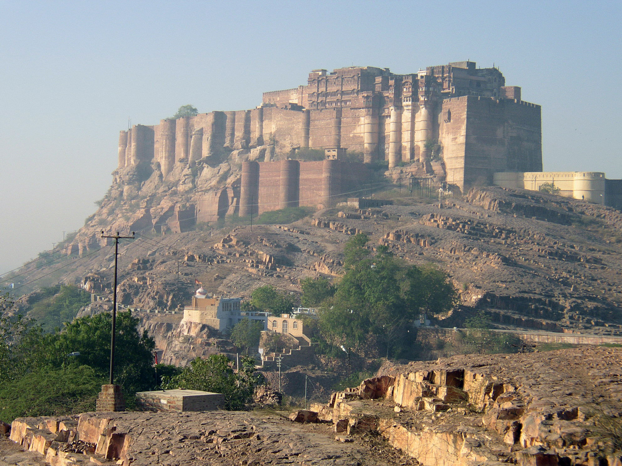
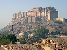 The iconic Mehrangarh Fort built by Rao Jodha in 1459.
The earlier contributions of warriors and protectors of the land Vishnois, Ahirs, Gurjars, Jats, Bhils and Meenas were neglected and lost in history due to stories of valour shown by certain specific clans in later years graining more prominence over older acts of bravery.[14]
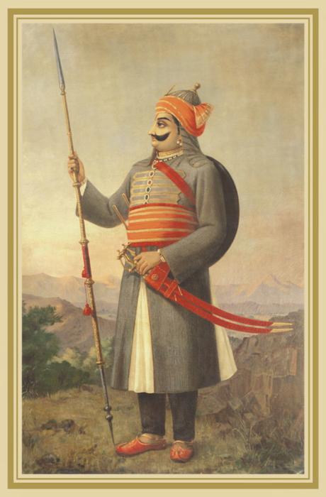
Rajasthan means the Land of the Kings. Modern Rajasthan includes most of Rajputana, which comprises mainly the erstwhile Rajput kingdoms as well as two Jat kingdoms and a Muslim kingdom. Marwar (Jodhpur), Bikaner, Mewar (Udaipur), Alwar and Dhundhar (Jaipur) were some of the main Rajput states. The Jats were rulers in Bharatpur and Dholpur. Tonk was ruled by a Muslim Nawab. Rajput families rose to prominence in the 6th century CE. The Rajputs put a very valiant resistance to the Islamic invasions and protected this land with their warfare and chivalry for more than 500 years. They also resisted Mughal incursions into India, but contributed to the slower than anticipated access to the Indian Subcontinent. Later the Mughals, with a technique based on a combination of treachery and skilled warfare were able to set firm a grip on northern India, including Rajasthan. The fighter spirit and valour of Rajputs impressed the Mughals to such an extent that even after defeating the Rajputs, the Mughals held their valour and value in the highest esteem. Mewar led other kingdoms in its resistance to outside rule. Most notably Rana Sanga fought the Battle of Khanua against Babur, the founder of the Mughal empire.
Samrat Hem Chandra Vikramaditya, the Hindu Emperor, also known as Hemu in the history of India was born in the village of Machheri in Alwar District in the year 1501. He had won 22 battles against Afghans, from Punjab to Bengal and had defeated Akbar's forces twice at Agra and Delhi in 1556,[15] before acceeding to the throne of Delhi and establishing 'Hindu Raj' in North India, albeit for a short duration, from Purana Quila in Delhi. He was killed in the Second Battle of Panipat.


Maharana Pratap of Mewar resisted Akbar in the famous Battle of Haldighati {1576) and later operated from hilly areas of his kingdom. Bhils were Maharana's main allies during these wars. Most of these attacks were evenly met as the Mughal forces outnumbered Mewar Rajputs in all the wars fought between them. The Haldighati war was fought between 10,000 Mewaris and a 100,000 strong Mughal force (including many Rajputs like Kachwahas from Dhundhar).
Over the years the Mughals began to have internal disputes which took their concentration away at times. The Mughal Empire eventually weakened to which several groups across their kingdom saw opportunities to establish their power whilst the army was fighting somewhere else. The Rajputs saw this as an opportunity to reassert their independence. With the decline of the Mughal Empire in the 18th century, Rajputana came under attack by the Marathas and Pindaris, and the Maratha general Scindia captured Ajmer.
The Rajput kings following a rapid defeat, concluded treaties with the British in the early 19th century, accepting British sovereignty in return for local autonomy. Following the Mughal tradition as well as its strategic location Ajmer became a province of British India, while the autonomous Rajput states, the Muslim state Tonk, and the Jat states (Bharatpur and Dholpur) were organized into the Rajputana Agency.
Rajasthan's formerly independent kingdom created a rich architectural and cultural heritage, seen even today in their numerous forts and palaces (Mahals and Havelis) which are enriched by features of Muslim and Jain architecture.
The development of the frescos in Rajasthan is linked with the history of the Marwaris, who have also played a crucial role in the economic development of the region. Many wealthy families throughout Indian history have links to Marwar. These families include the legendary Birla, Bhandari, Bajaj, Mittal and Mirza families[citation needed].
Geography
 The Aravalli Range adds diversity to the landscape of Rajasthan.
 The Thar Desert
 The hills around Jaipur.
The main geographic features of Rajasthan are the Thar Desert and the Aravalli Range, which runs through the state from southwest to northeast, almost from one end to the other, for more than 850 km. Mount Abu is at the southwestern end of the range, separated from the main ranges by the West Banas River, although a series of broken ridges continues into Haryana in the direction of Delhi where it can be seen as outcrops in the form of the Raisina Hill and the ridges farther north. About three-fifths of Rajasthan lies northwest of the Aravallis, leaving two-fifths on the east and south.
The northwestern portion of Rajasthan is generally sandy and dry. Most of the region is covered by the Thar Desert, which extends into adjoining portions of Pakistan. The Aravalli Range does not intercept the moisture-giving southwest monsoon winds off the Arabian Sea, as it lies in a direction parallel to that of the coming monsoon winds, leaving the northwestern region in a rain shadow. The Thar Desert is thinly populated; the town of Bikaner is the largest city in the desert. The Northwestern thorn scrub forests lie in a band around the Thar Desert, between the desert and the Aravallis. This region receives less than 400 mm of rain in an average year. Temperatures can exceed 45 °C in the summer months and drop below freezing in the winter. The Godwar, Marwar, and Shekhawati regions lie in the thorn scrub forest zone, along with the city of Jodhpur. The Luni River and its tributaries are the major river system of Godwar and Marwar regions, draining the western slopes of the Aravallis and emptying southwest into the great Rann of Kutch wetland in neighboring Gujarat. This river is saline in the lower reaches and remains potable only up to Balotara in Barmer district. The Ghaggar River, which originates in Haryana, is an intermittent stream that disappears into the sands of the Thar Desert in the northern corner of the state and is seen as a remnant of the primitive Saraswati river.
The Aravalli Range and the lands to the east and southeast of the range are generally more fertile and better watered. This region is home to the Kathiarbar-Gir dry deciduous forests ecoregion, with tropical dry broadleaf forests that include teak, Acacia, and other trees. The hilly Vagad region lies in southernmost Rajasthan, on the border with Gujarat. With the exception of Mount Abu, Vagad is the wettest region in Rajasthan, and the most heavily forested. North of Vagad lies the Mewar region, home to the cities of Udaipur and Chittaurgarh. The Hadoti region lies to the southeast, on the border with Madhya Pradesh. North of Hadoti and Mewar is the Dhundhar region, home to the state capital of Jaipur. Mewat, the easternmost region of Rajasthan, borders Haryana and Uttar Pradesh. Eastern and southeastern Rajasthan is drained by the Banas and Chambal rivers, tributaries of the Ganges.
The Aravali Range runs across the state from the southwest peak Guru Shikhar (Mount Abu), which is 1,722 m in height, to Khetri in the northeast. This divides the state into 60% in the northwest of the range and 40% in the southeast. The northwest tract is sandy and unproductive with little water but improves gradually from desert land in the far west and northwest to comparatively fertile and habitable land towards the east. The area includes the Thar Desert. The south-eastern area, higher in elevation (100 to 350 m above sea level) and more fertile, has a very diversified topography. in the south lies the hilly tract of Mewar. In the southeast, a large area within the districts of Kota and Bundi forms a tableland. To the northeast of these districts is a rugged region (badlands) following the line of the Chambal River. Farther north the country levels out; the flat plains of the northeastern Bharatpur district are part of an alluvial basin. Merta City is the center of Rajasthan.
Language
Main article: Rajasthani LanguageRajasthani (although constitutional status is pending) is the main spoken language although Hindi and English are used for official purpose.[16] It is spoken by 130 million people in Rajasthan and other states of India.[17]
Economy
Main article: Economy of Rajasthan A marble quarry in Kishangarh Ajmer
 Industrial plant near Jodhpur, Rajasthan.
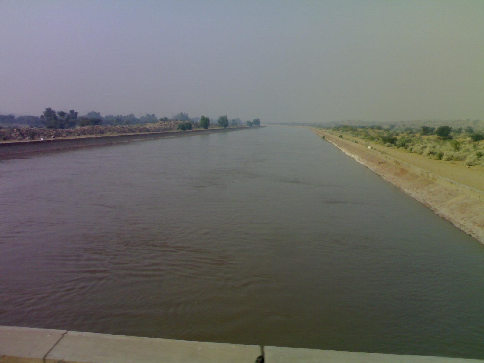
Rajasthan's economy is primarily agricultural and pastoral. Wheat and barley are cultivated over large areas, as are pulses, sugarcane, and oilseeds. Cotton and tobacco are the state's cash crops. Rajasthan is among the largest producers of edible oils in India and the second largest producer of oilseeds. Rajasthan is also the biggest wool-producing state in India and the main opium producer and consumer. There are mainly two crop seasons. The water for irrigation comes from wells and tanks. The Indira Gandhi Canal irrigates northwestern Rajasthan.
 Rajasthan Canal(Indira Gandhi Canal) passing through Thar desert near Chhatargarh Bikaner district,Rajasthan
The main industries are mineral based, agriculture based, and textiles. Rajasthan is the second largest producer of polyester fibre in India. The Pali and Bhilwara District produces more cloth than Bhiwandi, Maharashtra and the bhilwara is the largest city in suitings production and export and Pali is largest city in cotton and polyster in blouse pes and rubia production and export. Several prominent chemical and engineering companies are located in the city of Kota, in southern Rajasthan. Rajasthan is pre-eminent in quarrying and mining in India. The Taj Mahal was built from the white marble which was mined from a town called Makrana. The state is the second largest source of cement in India. It has rich salt deposits at Sambhar, copper mines at Khetri, Jhunjhunu and zinc mines at Dariba, Zawar mines at Zawarmala for zinc, Rampura Aghucha (opencast) near Bhilwara. Dimensional stone mining is also undertaken in Rajasthan. Jodhpur sandstone is mostly used in monuments, important buildings and residential buildings. This stone is termed as "chittar patthar".
Rajasthan is now the preferred destination for IT companies and North India's largest integrated IT park is located in Jaipur and is named as Mahindra World City Jaipur covering nearly 3,000 acres (12 km2) of land. Some of the companies operating in Rajasthan include Infosys, Genpact, Wipro, Truworth, Deutsche Bank, NEI, MICO, Honda Siel Cars, Coca Cola and Procter & Gamble.
Tourism
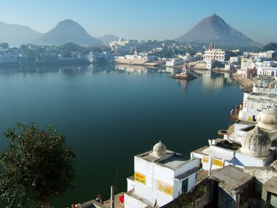
Main article: Tourism in Rajasthan Lake of Pushkar in Ajmer
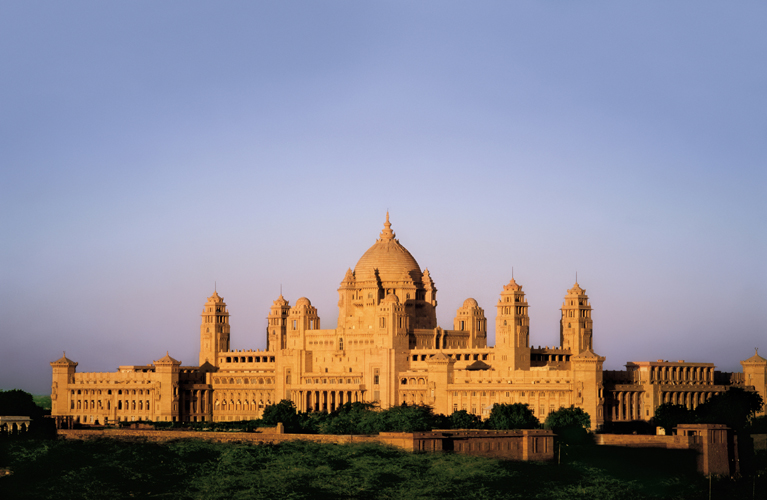
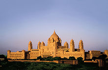 The Umaid Bhawan Palace is one of the largest royal palaces in the world.
 The Jain temple of Ranakpur.
Rajasthan attracted 14% of total foreign visitors during 2009-2010 which is fourth highest in all states of India. It positioned fourth place also in Domestic tourist visitors.[18] Endowed with natural beauty and a great history, tourism is a flourishing industry in Rajasthan. The palaces of Jaipur, Ajmer-Pushkar, lakes of Udaipur, and desert forts of Jodhpur, targarh fort (star fort) in bundi, Bikaner and Jaisalmer rank among the most preferred destinations in India for many tourists both Indian and foreign. Tourism accounts for eight percent of the state's domestic product. Many old and neglected palaces and forts have been converted into heritage hotels. Tourism has increased employment in the hospitality sector.
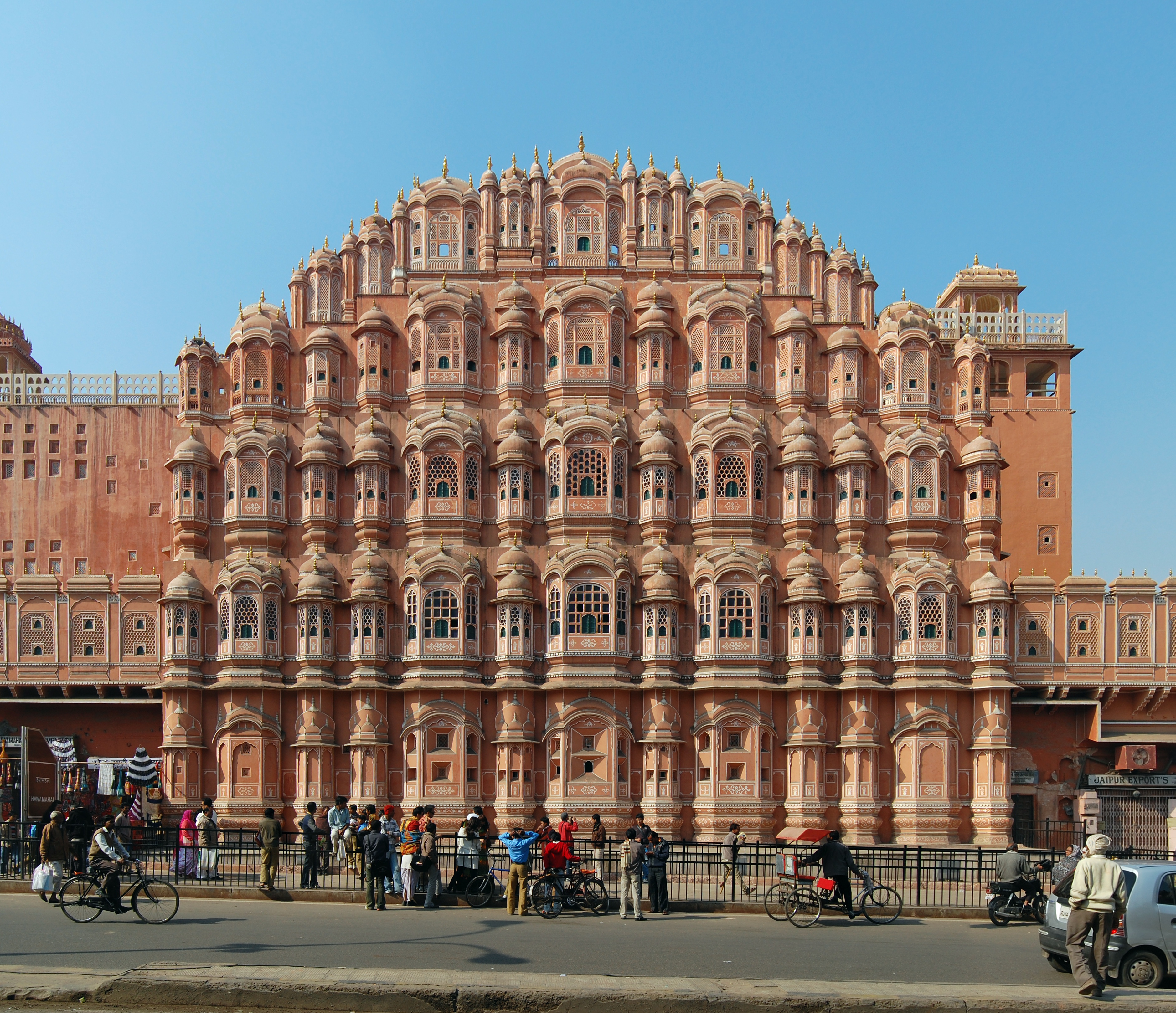
Rajasthan is famous for the majestic forts, intricately carved temples and decorated havelis, which were built by Rajput kings in previous ages, they were the soul of pre-Muslim era Rajasthan. Jantar Mantar, Dilwara Temples, Chittorgarh Fort, Lake Palace, bundi palace ,City Palaces, Jaisalmer [ancient miniature in bundi ] Havelis are part of the true architectural heritage of India. Jaipur, the Pink City, is noted for the ancient houses made of a type of sand stone dominated by a pink hue ,in budi maximum houses are painted blue. At Ajmer, the white marble Bara-dari on the Anasagar lake is exquisite. Jain Temples dot Rajasthan from north to south and east to west. Dilwara Temples of Mount Abu, Ranakpur Temple dedicated to Lord Adinath in Pali Dist., Jain temples in the fort complexes of Chittor, Jaisalmer and Kumbhalgarh, Lodurva Jain temples, Bhandasar and Karni mata Temple of Bikaner are some of the best examples.
Rajasthan is often called a shopper's paradise. Rajasthan is famous for textiles, semi-precious stones and handicrafts. The attractive designs of jewellery and clothes are eye-catching and invite shoppers. Rajasthani furniture has intricate carvings and bright colours. Rajasthani handicrafts are in demand due to the intricate work on them. Above all, Rajasthan's shopping appeals to both tourists and people from other parts of India due to its cheap prices for quality goods.
Bikaner is famous for its namkeens, Jaipur for its jewellery, Jodhpur for sweets and Jaisalmer for yellow stone, wall paintings of bundi.
Culture
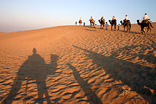 Camel ride in the Thar desert near Jaisalmer.
 A decorated Indian elephant during a fair in Jaipur, India
 Rajasthani Up-Down Dolls found in the road-side shops of Jaisalmer, Rajasthan
Rajasthan is culturally rich and has artistic and cultural traditions which reflect the ancient Indian way of life. There is rich and varied folk culture from villages which is often depicted and is symbolic of the state. Highly cultivated classical music and dance with its own distinct style is part of the cultural tradition of Rajasthan. The music is uncomplicated and songs depict day-to-day relationships and chores, more often focused around fetching water from wells or ponds.
The Ghoomar dance from Udaipur and Kalbeliya dance of Jaisalmer have gained international recognition. Folk music is a vital part of Rajasthani culture. Kathputli, Bhopa, Chang, Teratali, Ghindr, Kachchhighori, Tejaji etc. are the examples of the traditional Rajasthani culture. Folk songs are commonly ballads which relate heroic deeds and love stories; and religious or devotional songs known as bhajans and banis (often accompanied by musical instruments like dholak, sitar, sarangi etc.) are also sung.
Rajasthan is known for its traditional, colorful art.wall painting in bundi . The block prints, tie and dye prints, Bagaru prints, Sanganer prints, and Zari embroidery are major export products from Rajasthan. Handicraft items like wooden furniture and handicrafts, carpets, and blue pottery are some of the things commonly found here. Rajasthan is a shoppers' paradise, with beautiful goods found at low prices. Reflecting the colorful Rajasthani culture, Rajasthani clothes have a lot of mirror-work and embroidery. A Rajasthani traditional dress for females comprises an ankle length skirt and a short top, also known as a lehenga or a chaniya choli. A piece of cloth is used to cover the head, both for protection from heat and maintenance of modesty. Rajasthani dresses are usually designed in bright colours like blue, yellow and orange.
The main religious festivals are Deepawali, Holi, Gangaur, Teej, Gogaji, Shri Devnarayan Jayanti, Makar Sankranti and Janmashtami, as the main religion is Hinduism. Rajasthan's desert festival is celebrated with great zest and zeal. This festival is held once a year during winter. Dressed in brilliantly hued costumes, the people of the desert dance and sing haunting ballads of valor, romance and tragedy. There are fairs with snake charmers, puppeteers, acrobats and folk performers. Camels, of course, play a stellar role in this festival.
Administration
Government
Main article: Government of RajasthanThe current government in Rajasthan is that of Indian National Congress. The current Chief Minister is Ashok Gehlot.
Politics
Main article: Politics of RajasthanThe Political life of Rajasthan is dominated by two major parties Bharatiya Janata Party (BJP), and Indian National Congress.
Districts
Main article: Districts of RajasthanRajasthan is divided into 33 districts and seven divisions:
- Ajmer Division: Ajmer, Bhilwara, Nagaur, Tonk.
- Bharatpur Division: Bharatpur, Dholpur, Karauli, Sawai Madhopur.
- Bikaner Division: Bikaner, Churu, SriGanganagar, Hanumangarh.
- Jaipur Division: Jaipur, Alwar, Jhunjhunu, Sikar, Dausa.
- Jodhpur Division: Barmer, Jaisalmer, Jalore, Jodhpur, Pali, Sirohi.
- Kota Division: Baran, Bundi, Jhalawar, Kota.
- Udaipur Division: Banswara, Chittorgarh, Pratapgarh, Dungarpur, Udaipur, Rajsamand
Demographics
 Locals performing traditional folk dance in Jaisalmer.
Population Growth Census Pop. %± 1951 15,971,000 — 1961 20,156,000 26.2% 1971 25,766,000 27.8% 1981 34,262,000 33.0% 1991 44,006,000 28.4% 2001 56,507,000 28.4% 2011 68,621,000 21.4% Source:Census of India[19] Rajasthan has a mainly Rajasthani population. Hindus account for 88.8% of the population.[20] Muslims make up 8.5%, Sikhs 1.4% and Jains 1.2% of the population.[20] The state of Rajasthan is also populated by Sindhis, who came to Rajasthan from Sindh province (now in Pakistan) during the India-Pakistan separation in 1947.
The mother tongue of the majority of people in Rajasthan is Rajasthani. Rajasthani and Hindi are the most widely used languages in Rajasthan. Rajasthani is used as a medium of instruction, along with Hindi and English, in some schools. Some other languages used in Rajasthan are Gujarati, Sindhi and Punjabi.
See also: List of people from RajasthanEducation
 Non-formal education center in Udaipur, Rajasthan. Educational program by Seva Mandir, an NGO working for the development of the rural and tribal population in Udaipur and Rajsamand districts of southern Rajasthan
During recent years, Rajasthan has made significant progress in the area of education. The state government has been making sustained efforts to improve the educational standard. In recent decades, the literacy rate of Rajasthan has increased significantly. In 1991, the state's literacy rate was only 38.55% (54.99% male and 20.44% female). In 2001, the literacy rate increased to 60.41% (75.70% male and 43.85% female). This was the highest leap in the percentage of literacy recorded in India (the rise in female literacy being 23%).[21] At the Census 2011, Rajasthan had a literacy rate of 67.06% (80.51% male and 52.66% female). Although Rajasthan's literacy rate is below the national average of 74.04% and although its female literacy rate is the lowest in the country (closely followed by Bihar at 53.33%), the state has been praised for its efforts and achievements in raising both male and female literacy rates.[22][23]
Rajasthan has nine universities and more than two hundred and fifty colleges, fifty five thousand primary and seven thousand four hundred secondary schools. There are forty-one engineering colleges with an annual enrollment of about 11,500 students. The state has twenty-three polytechnics and one-hundred and fifty-two Industrial Training Institute (ITIs) that impart vocational training to the students.[24]
Flora and fauna
Though a large percentage of the total area is desert, and even though there is little forest cover, Rajasthan has a rich and varied flora and fauna. The natural vegetation is classed as Northern Desert Thorn Forest (Champion 1936). These occur in small clumps scattered in a more or less open forms. Density and size of patches increase from west to east following the increase in rainfall.
Some wildlife species, which are fast vanishing in other parts of India, are found in the desert in large numbers such as the Great Indian Bustard (Ardeotis nigriceps), the Blackbuck (Antilope cervicapra), the Indian Gazelle (Gazella bennettii) and the Indian Wild Ass.
The Desert National Park, Jaisalmer, spread over an area of 3162 km², is an excellent example of the ecosystem of the Thar Desert, and its diverse fauna. Great Indian Bustard, Blackbuck, chinkara, desert fox, Bengal fox, wolf, desert cat etc. can be easily seen here. Seashells and massive fossilized tree trunks in this park record the geological history of the desert. The region is a haven for migratory and resident birds of the desert. One can see many eagles, harriers, falcons, buzzards, kestrel and vultures. Short-toed Eagles (Circaetus gallicus), Tawny Eagles (Aquila rapax), Spotted Eagles (Aquila clanga), Laggar Falcons (Falco jugger) and kestrels are the commonest of these.
The Ranthambore National Park located in Sawai Madhopur, is one of the finest Tiger Reserves in the Country which became a part of Project Tiger in 1973.
The Sariska Tiger Reserve located in Alwar district, 200 km from Delhi and 107 km from Jaipur covers an area of approximately 800 km2.The area was declared a National Park in 1979.
Tal Chhapar Sanctuary is a very small sanctuary in Sujangarh, Churu District, 210 km from Jaipur, in the Shekhawati region. This sanctuary is home to a large population of graceful Blackbuck. Desert Fox and desert cat can also be spotted along with typical avifauna such as partridge and sand grouse.
Wildlife
Rajasthan is also noted for National Parks and Wildlife Sanctuaries. There are four national park and wildlife sanctuaries named the Keoladeo National Park of Bharatpur, Sariska Tiger Reserve of Alwar, Ranthambore National Park of Sawai Madhopur, and Desert National Park of Jaisalmer.
Ranthambore National Park and Sariska Wildlife Sanctuary are both known worldwide for their tiger population and considered by both wilderness lovers and photographers as the best places in India to spot tigers. At one point, due to poaching and negligence, tigers became extinct here, but recently 5 tigers have been shifted here[citation needed] . Prominent among the wildlife sanctuaries are Mount Abu Sanctuary, Bhensrod Garh Sanctuary, Darrah Sanctuary, Jaisamand Sanctuary, Kumbhalgarh Wildlife Sanctuary, Jawahar Sagar sanctuary and Sita Mata Wildlife Sanctuary.
There are a variety of wildlife species in Rajasthan, notably including the apex predator Caracal, Caracal caracal.[25]
Transport
Rajasthan is connected by many national highways. Most renowned being NH 8, which is India's first 4–8 lane highway. Rajasthan also has an inter-city surface transport system both in terms of railways and bus network. All chief cities are connected by air, rail and road.
By Air: There are three main airports at Rajasthan- Jaipur airport, Udaipur airport, and Jodhpur airport. These airports connect Rajasthan with the major cities of India such as Delhi and Mumbai. There are two other airports in Kota and Jaisalmer, but are not open for commercial/civilian flights.
By Rail: Rajasthan is connected with the main cities of India by rail. Jaipur, Kota, Bikaner, Ajmer, Udaipur and Jodhpur are the principal railway stations in Rajasthan. Kota City is the only Electrified Section served by three Rajdhani Expresses and trains to all major cities of India.
By Road: Rajasthan is well connected to the main cities of the country including Delhi, Ahmedabad and Indore by State and National Highways and served by Rajasthan State Road Transport Corporation (RSRTC) and Private operators.
Statistics
- Population:68.6 million (2011 Census, estimated at more than 68 million now)
- Cities and Towns: 222
- Major cities: Jaipur, Jodhpur, Kota, Udaipur, Ajmer, Bikaner Bharatpur, Alwar, Bhilwara, Sri Ganganagar, Sikar and Hanumangarh.
- Roads: 1,51,914 km. (8,798 km National Highway)
- National highways crossing Rajasthan: Delhi-Ahmedabad, Agra-Bikaner, Jaipur-Bhopal, Bhatinda-Kandla, Shivpuri-Kota, Kota-Udaipur and Pali-Ambala.
- Climate: Generally dry with monsoon during July–August
- Districts: 33
- Languages: English and Hindi commonly used, as well as indigenous Rajasthani languages, Braj Bhasha etc.
- Literacy: 67.063%(According to Census2011)
NH 71B is the Smallest in Rajasthan
See also
- Districts of Rajasthan
- Kathputli (Puppet)
- Keoladeo National Park
- List of people from Rajasthan
- Marwaris
- Rajasthani people
- Rajasthani languages
- Ranthambore National Park
- Sariska Tiger Reserve
References
- ^ http://www.gfcmail.com/sqlimages/michelin/2068559013.pdf
- ^ Let's Know Handicrafts of India by Amar Tyagi, p. 52
- ^ "World Heritage List". http://whc.unesco.org/en/list/340.
- ^ a b F. K. Kapil (1999). Rajputana states, 1817-1950. Book Treasure. p. 1. http://books.google.com/books?id=eCZuAAAAMAAJ. Retrieved 24 June 2011.
- ^ John Keay (2001). India: a history. Grove Press. pp. 231–232. ISBN 0-8021-3797-0, ISBN 978-0-8021-3797-5. http://books.google.co.in/books?id=ibLUu6RlvqwC&pg=PA231&dq. "Colonel James tod, who as the first British official to visit Rajasthan spent most of the 1820s exploring its political potential, formed a very different idea of "Rashboots".....and the whole region thenceforth became, for the British, 'Rajputana'.The word even achieved a retrospective authenticity, in 1829 translation of Ferishta's history of early Islamic India, John Briggs discarded the pharse 'Indian princes', as rendered in Dow's earlier version, and substituted 'Rajpoot princes'."
- ^ Asiatic Society of Bombay; Royal Asiatic Society of Great Britain and Ireland. Bombay Branch (1904). Journal of the Asiatic Society of Bombay, Volume 21. p. 416. "But this much is certain that Rajputana was essentially the country of the Gurjaras"
- ^ a b R.C. Majumdar (1994). Ancient India. Motilal Banarsidass Publ.. p. 263. ISBN 81-208-0436-8, ISBN 978-81-208-0436-4. http://books.google.co.in/books?id=XNxiN5tzKOgC&pg=PA263&dq.
- ^ http://www.fortauwa.com/rajasthan-tour-travels.html
- ^ INDUS VALLEY CIVILIZATION Related Articles arsenical bronze writing, literatur
- ^ "The dynastic art of the Kushans", John Rosenfield, p 130
- ^ a b Thakur Deshraj, Jat Itihas (Hindi), Maharaja Suraj Mal Smarak Shiksha Sansthan, Delhi, 1934, 2nd edition 1992 pp 587–588.
- ^ Asiatic Society of Bombay; Royal Asiatic Society of Great Britain and Ireland. Bombay Branch (1904). Journal of the Asiatic Society of Bombay, Volume 21. p. 432. "Up to the tenth century almost the whole of North India, excepting Bengal, owned their supremacy at Kannauj."
- ^ Radhey Shyam Chaurasia (2002). History of Ancient India: Earliest Times to 1000 A. D.. Atlantic Publishers & Distributors. p. 207 to 208. ISBN 81-269-0027-X, ISBN 978-81-269-0027-5.
- ^ Dr Natthan Singh, Jat-Itihas, (Jat History), Jat Samaj Kalyan Parishad, F-13, Dr Rajendra Prasad Colony, Tansen marg, Gwalior, M.P, India 474 002 2004, page-91
- ^ Bhardwaj, K. K. "Hemu-Napoleon of Medieval India", Mittal Publications, New Delhi, p.25
- ^ Grierson, George A. 1918. Linguistic Survey of India (Volume VIII, Part II). Calcutta: Government of India Press
- ^ Census of India, 2001. Rajasthan. New Delhi: Government Press
- ^ India Inbound Tourism Statistics, India Inbound Visitors Summary, India Tourism Statistics Inbound tourism Growth Statistics India
- ^ "Census Population" (PDF). Census of India. Ministry of Finance India. http://indiabudget.nic.in/es2006-07/chapt2007/tab97.pdf. Retrieved 18 December 2008.
- ^ a b Indian Census
- ^ http://www.rajliteracy.org/Literacy.html
- ^ http://www.census2011.co.in/news/81-rajasthan-literacy-rate-now-67-06-census-data.html
- ^ http://infopiper.com/2011/rajasthan-population-2011-growth-rate-literacy-sex-ratio-in-census-2011/
- ^ http://www.mapsofindia.com/maps/rajasthan/education/
- ^ C. Michael Hogan. 2009. Caracal: Caracal caracal, GlobalTwitcher.com, ed. N. Stromberg
- Gahlot, Sukhvirsingh. 1992. RAJASTHAN: Historical & Cultural. J. S. Gahlot Research Institute, Jodhpur.
- Somani, Ram Vallabh. 1993. History of Rajasthan. Jain Pustak Mandir, Jaipur.
- Tod, James & Crooke, William. 1829. Annals & Antiquities of Rajasthan or the Central and Western Rajput States of India. 3 Vols. Reprint: Low Price Publications, Delhi. 1990. ISBN 81-85395-68-3 (set of 3 vols.)
- Mathur, P.C., 1995. Social and Economic Dynamics of Rajasthan Politics (Jaipur, Aaalekh)
- Video of Rajasthan, India . http://www.youtube.com/DjBobbyLosAngeles#p/u/6/jxjZlzQl-Zw
External links

Punjab,  Pakistan
Punjab Haryana Sindh, Pakistan
Uttar Pradesh  Rajasthan

Gujarat Madhya Pradesh State of Rajasthan (India) Major cities 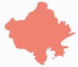
Divisions Districts Ajmer · Alwar · Banswara · Baran · Barmer · Bharatpur · Bhilwara · Bikaner · Bundi · Chittorgarh · Churu · Dausa · Dholpur · Dungarpur · Hanumangarh · Jaipur · Jaisalmer · Jalore · Jhalawar · Jhunjhunu · Jodhpur · Karauli · Kota · Nagaur · Pali · Pratapgarh · Rajsamand · Sawai Madhopur · Sikar · Sirohi · Sri Ganganagar · Tonk · UdaipurStates and territories of India States 
Union Territories Categories:- States and territories of India
- Rajasthan
- States and territories established in 1956


Wikimedia Foundation. 2010.