- Merton (town), Wisconsin
-
Merton — Town — Location within the state of Wisconsin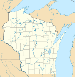
 Merton
Coordinates: 43°8′29″N 88°18′42″W / 43.14139°N 88.31167°WCoordinates: 43°8′29″N 88°18′42″W / 43.14139°N 88.31167°W Country United States State Wisconsin County Waukesha Area – Total 28.3 sq mi (73.2 km2) – Land 25.8 sq mi (66.7 km2) – Water 2.5 sq mi (6.5 km2) Population (2000) – Total 7,988 – Density 282.6/sq mi (109.1/km2) Time zone Central (CST) (UTC-6) – Summer (DST) CDT (UTC-5) ZIP codes FIPS code GNIS feature ID Website Official website Merton is a town in Waukesha County, Wisconsin, United States. The population was 7,988 at the 2000 census. The Village of Merton is located partially within the town. To local residents, the town of Merton is not called Merton, but is rather split up into the smaller unincorporated communities of Stone Bank, North Lake, and Monches. The pioneer Swedish-American settlement of Nya Upsala was at one time located within Merton.
Contents
Geography
According to the United States Census Bureau, the town has a total area of 28.3 square miles (73.2 km²), of which, 25.7 square miles (66.7 km²) of it is land and 2.5 square miles (6.5 km²) of it (8.88%) is water. Located in the Lake Country area of Waukesha County.
Demographics
As of the census[1] of 2000, there were 7,988 people, 2,706 households, and 2,278 families residing in the town. The population density was 310.3 people per square mile (119.8/km²). There were 2,932 housing units at an average density of 113.9 per square mile (44.0/km²). The racial makeup of the town was 98.65% White, 0.15% Black or African American, 0.13% Native American, 0.50% Asian, 0.05% Pacific Islander, 0.20% from other races, and 0.33% from two or more races. 1.01% of the population were Hispanic or Latino of any race.
There were 2,706 households out of which 43.2% had children under the age of 18 living with them, 77.9% were married couples living together, 4.2% had a female householder with no husband present, and 15.8% were non-families. 13.0% of all households were made up of individuals and 4.7% had someone living alone who was 65 years of age or older. The average household size was 2.95 and the average family size was 3.26.
In the town the population was spread out with 30.6% under the age of 18, 5.3% from 18 to 24, 28.5% from 25 to 44, 27.0% from 45 to 64, and 8.6% who were 65 years of age or older. The median age was 38 years. For every 100 females there were 105.4 males. For every 100 females age 18 and over, there were 102.7 males.
The median income for a household in the town was $78,937, and the median income for a family was $83,331. Males had a median income of $54,438 versus $35,672 for females. The per capita income for the town was $34,633. About 1.0% of families and 1.3% of the population were below the poverty line, including 1.3% of those under age 18 and 2.2% of those age 65 or over.
Notable people
- James Barney Marsh, bridge designer, was born in the Town of Merton.
References
- ^ "American FactFinder". United States Census Bureau. http://factfinder.census.gov. Retrieved 2008-01-31.
External links
Municipalities and communities of Waukesha County, Wisconsin Cities Brookfield | Delafield | Milwaukee‡ | Muskego | New Berlin | Oconomowoc | Pewaukee | Waukesha

Villages Big Bend | Butler | Chenequa | Dousman | Eagle | Elm Grove | Hartland | Lac La Belle‡ | Lannon | Menomonee Falls | Merton | Mukwonago‡ | Nashotah | North Prairie | Pewaukee | Oconomowoc Lake | Sussex | Wales
Towns CDP Unincorporated
communitiesColgate‡ | Genesee Depot | Goerke's Corners | Lake Five | Mapleton | Monches | Monterey | North Lake | Saylesville | Stone Bank | Summit Center | Summit Corners | Vernon
Ghost towns Footnotes ‡This populated place also has portions in an adjacent county or counties
Categories:- Towns in Waukesha County, Wisconsin


Wikimedia Foundation. 2010.