- Division No. 17, Alberta
-
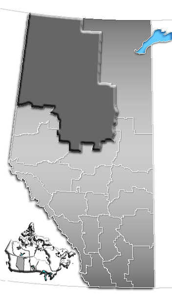
Division No. 17 Alberta, Canada Area 192,084.34 km2 (74,164.18 sq mi) Population 59,282 (2006)[1] Division No. 17 is a census division in Alberta, Canada. It spans the central and northwest portions of northern Alberta and its largest urban community is the Town of Slave Lake. Division No. 17 is the largest census division in Alberta according to area and also has the lowest population density.[2]
Contents
Census subdivisions
The following census subdivisions (municipalities or municipal equivalents) are located within Alberta's Division No. 17.[3][4]
- Villages
- Specialized municipalities
- Municipal districts
- Indian reserves
- Beaver Ranch 163
- Boyer 164
- Bushe River 207
- Child Lake 164A
- Clear Hills 152C
- Drift Pile River 150
- Fort Vermilion 173B
- Fox Lake 162
- Hay Lake 209
- Jean Baptiste Gambler 183
- John d'Or Prairie 215
- Kapawe'no First Nation
- Freeman 150B
- Grouard 230
- Halcro 150C
- Pakashan 150D
- Loon Lake 235
- Sawridge 150G
- Sawridge 150H
- Sucker Creek 150A
- Swan River 150E
- Tall Cree 173
- Tall Cree 173A
- Upper Hay River 212
- Utikoomak Lake 155
- Utikoomak Lake 155A
- Wabasca 166
- Wabasca 166A
- Wabasca 166B
- Wabasca 166C
- Wabasca 166D
- Woodland Cree 226
- Woodland Cree 228
- Indian settlements
- Carcajou 187
- Desmarais
- Little Buffalo
Demographics
In 2006, Division No. 17 had a population of 59,282 living in 21,347 dwellings, a 3.1% increase from 2001. The census division has a land area of 192,084.34 km2 (74,164.18 sq mi) and a population density of 0.3 inhabitants per square kilometre.[1]
See also
- List of census divisions of Alberta
- List of communities in Alberta
References
- ^ a b Statistics Canada (Census 2006). "Division No. 17 - Community Statistics". http://www12.statcan.ca/english/census06/data/profiles/community/Details/Page.cfm?Lang=E&Geo1=CD&Code1=4817&Geo2=PR&Code2=48&Data=Count&SearchText=Division%20No.%2017&SearchType=Begins&SearchPR=01&B1=All&GeoLevel=&GeoCode=4817. Retrieved 2007-06-06.
- ^ "Population and dwelling counts, for Canada, provinces and territories, and census divisions, 2006 and 2001 censuses - 100% data (Alberta)". Statistics Canada. 2010-01-06. http://www12.statcan.gc.ca/census-recensement/2006/dp-pd/hlt/97-550/Index.cfm?TPL=P1C&Page=RETR&LANG=Eng&T=702&PR=48&S=0&O=D&RPP=25. Retrieved 2011-08-30.
- ^ "2006 Community Profiles, Geographic hierarchy – Division No. 17 (Census division)". Statistics Canada. 2010-12-07. http://www12.statcan.ca/census-recensement/2006/dp-pd/prof/92-591/details/page_Hierarchy-Hierarchie.cfm?Lang=E&Tab=4&Geo1=CD&Code1=4817&Geo2=PR&Code2=48&Data=Count&SearchText=Division_No._17&SearchType=Begins&SearchPR=01&B1=All&Custom=. Retrieved 2011-08-30.
- ^ "2011 Municipal Codes". Alberta Municipal Affairs. 2011-01-05. http://www.municipalaffairs.alberta.ca/documents/msb/2011code.pdf. Retrieved 2011-08-30.
-
- Statistics Canada 2001 Census Community Profile: Census Division No. 17, Alberta

British Columbia Northwest Territories Division No. 16 Division No. 19 
Division No. 16  Division No. 17

Division No. 18 Division No. 13 Division No. 12  Subdivisions of Alberta
Subdivisions Regions · Census divisions · Municipal districts (counties) · Specialized municipalities · School districts · Regional health authoritiesCommunities Cities · Towns · Villages · Summer villages · Hamlets · Indian reserves · Métis settlements · Ghost towns · Designated placesCities and Urban
Service AreasAirdrie · Brooks · Calgary · Camrose · Cold Lake · Edmonton (capital) · Fort McMurray · Fort Saskatchewan · Grande Prairie · Lacombe · Leduc · Lethbridge · Lloydminster · Medicine Hat · Red Deer · Sherwood Park · Spruce Grove · St. Albert · WetaskiwinCensus divisions
Categories:- Census divisions of Alberta
- Peace Country
- Alberta geography stubs
Wikimedia Foundation. 2010.