- Ubangi River
-
This article is about the African river. For misuse of Ubangi for African women with lip plates, see Lip plate#Ubangi misnomer.
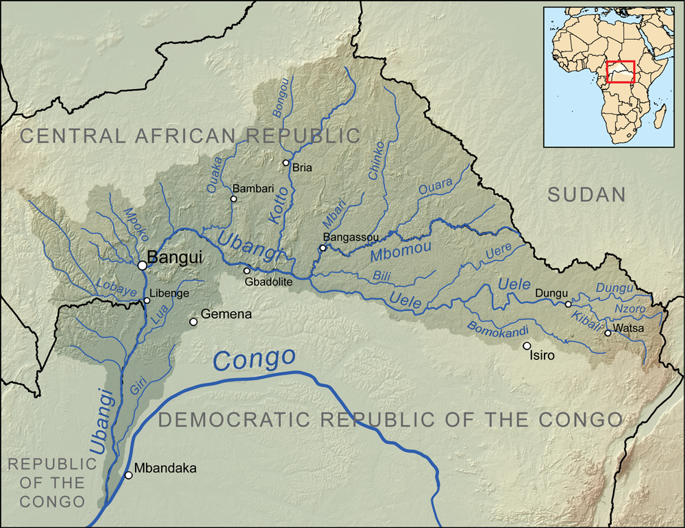
 Map showing the Ubangi River drainage basin.
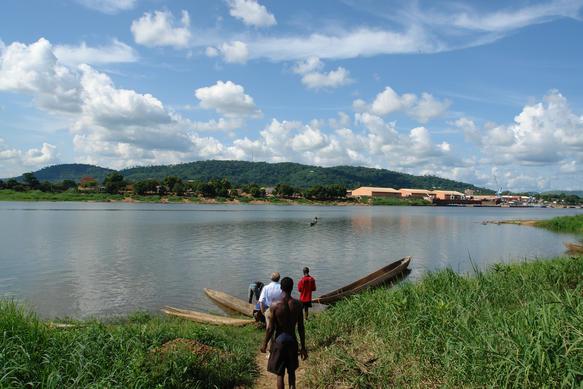
 Ubangi River at the outskirts of Bangui.
The Ubangi River (
 /juːˈbæŋɡi/ or /uːˈbæŋɡi/), also spelled Oubangui, is the largest right-bank tributary of the Congo River of Central Africa. It begins at the confluence of the Mbomou and Uele Rivers and flows west, then bends to the southwest and passes through Bangui, after which it flows south to the Congo at Liranga. The Ubangi's length is about 1,060 kilometres (660 mi). Its total length with the Uele, its longest tributary, is 2,270 kilometres (1,410 mi). The Ubangi's drainage basin is about 772,800 square kilometres (298,400 sq mi) and includes portions of the Democratic Republic of the Congo, Central African Republic, and Republic of Congo. Its discharge at Bangui ranges from about 800 cubic metres per second (28,000 cu ft/s) to 11,000 cubic metres per second (390,000 cu ft/s), with an average flow of about 4,000 cubic metres per second (140,000 cu ft/s).[1]
Together with the Congo River, it provides an important transport artery for river boats between Bangui and Brazzaville.
From its source to 100 kilometres (62 mi) below Bangui, the Ubangi defines the boundary between the Central African Republic and the Democratic Republic of the Congo (DRC). Thereafter, it forms the boundary between the DRC and the Republic of Congo until it empties into the Congo River.
In the 1960s,[citation needed] a plan was proposed to divert waters from the Ubangi to the Chari River which empties into Lake Chad. According to the plan, the water from the Ubangi would revitalize that lake and provide livelihood in fishing and enhanced agriculture to tens of millions of central Africans and Sahelians. Inter-basin water transfer schemes were proposed in the 1980s and 1990s by Nigerian engineer J. Umolu (ZCN Scheme) and Italian firm Bonifica (Transaqua Scheme).[2][3][4][5][6] In 1994, the Lake Chad Basin Commission (LCBC) proposed a similar project and at a March 2008 summit, the heads of state of the LCBC member countries committed to the diversion project.[7] In April, 2008, the LCBC advertised a request for proposals for a feasibility study.
References
- ^ Bossche, J.P. vanden; G. M. Bernacsek (1990). Source Book for the Inland Fishery Resources of Africa, Volume 1. Food and Agriculture Organization of the United Nations. p. 338. ISBN 9789251029831. http://books.google.com/books?id=WLZRxM9vfXoC&pg=PA338.
- ^ Journal of Environmental Hydrology, Vol. 7, 1999
- ^ New Scientist, March 23, 1991 Africa at a Watershed (Ubangi - Lake Chad Inter-basin transfer)
- ^ Umolu, J. C.; 1990, Macro Perspectives for Nigeria’s Water Resources Planning, Proc. of the First Biennial National Hydrology Symposium, Maiduguri, Nigeria, pp. 218–262 (discussion of Ubangi-Lake Chad diversion schemes)
- ^ The Changing Geography of Africa and the Middle East By Graham Chapman, Kathleen M. Baker, University of London School of Oriental and African Studies, 1992 Routledge.
- ^ Combating Climate Induced Water And Energy Deficiencies In West Central Africa (Ubangi - Lake Chad Inter-basin transfer)
- ^ Voice of America News, March 28, 2008 African Leaders Team Up to Rescue Lake Chad
External links
- Map showing the Ubangi Subbasin at World Resources Institute
- International Commission of the Congo-Oubangui-Sangha Bassin
Coordinates: 0°30′S 17°42′E / 0.5°S 17.7°E
Rivers of the Republic of the Congo Rivers Rivers of the Democratic Republic of the Congo Rivers Rivers of the Central African Republic Rivers Categories:- Rivers of the Republic of the Congo
- Rivers of the Democratic Republic of the Congo
- Rivers of the Central African Republic
- Ubangi River
- Central African Republic–Democratic Republic of the Congo border
- Democratic Republic of the Congo–Republic of the Congo border
- International rivers of Africa
- Tributaries of the Congo River
Wikimedia Foundation. 2010.