- Atlantic City Expressway
-
Atlantic City Expressway

Route information Maintained by South Jersey Transportation Authority Length: 44.19 mi[1] (71.12 km) Existed: 1964 – present Major junctions West end:  Route 42 in Washington Township
 Route 73 in Winslow Township
 Route 54 in Hammonton
 Route 50 in Hamilton Township
 G.S. Pkwy. in Egg Harbor Township
 US 9 in Pleasantville
 ACE Conn. in Atlantic City
East end: Baltic Avenue in Atlantic City Highway system New Jersey State Highway Routes
Interstate and US← Route 445 446 Route 446X → The Atlantic City Expressway (officially numbered, but unsigned, as Route 446 and abbreviated A.C. Expressway, ACE, or ACX, and known locally as "the Expressway") is a 44.19-mile (71.12 km), controlled-access toll road in New Jersey, managed and operated by the South Jersey Transportation Authority. It serves as an extension of the freeway portion of Route 42 in Turnersville (which is itself an extension of Interstate 76) southeast to Atlantic City. It connects the Philadelphia metropolitan area with Atlantic City and other Jersey Shore resorts. In addition to providing a route between the Delaware Valley and Atlantic City, as well as other Shore Points, the expressway also serves other Southern New Jersey communities, including Hammonton and Mays Landing. The expressway intersects many major roads, including Route 73 in Winslow Township, Route 54 in Hammonton, Route 50 in Hamilton Township, the Garden State Parkway in Egg Harbor Township, and U.S. Route 9 in Pleasantville.
The Atlantic City Expressway has an open system of tolling, with two mainline toll plazas (Egg Harbor in Hamilton Township and Pleasantville) and seven exits with ramp tolls. The total cost to travel the length of the Atlantic City Expressway is currently $3.75 and E-ZPass is accepted. In 2008, two separate plans were made to raise the tolls along the road, one proposed by Governor Jon Corzine and one proposed by the South Jersey Transportation Authority that would increase tolls 50%. The latter toll increase took place effective November 18, 2008. The expressway features one service area, Farley Plaza, in Hamilton Township a short distance west of the Egg Harbor Toll Plaza, as well as a gas station and mini-mart near the Atlantic City Welcome Center in Pleasantville. In a few years, the road is expected to use all-electronic tolling.
Plans for the road go back to the 1930s, when a parkway was proposed between Camden and Atlantic City that was never built. Plans resurfaced for the road in the 1950s when a group of officials led by State Senator Frank S. Farley pushed for a road to help the area economy. The New Jersey Expressway Authority was created in 1962 to be responsible for building an expressway. The Atlantic City Expressway was built between 1962 and 1965 at a total cost of $39.8 million. The South Jersey Transportation Authority assumed control of the road in 1991 from the New Jersey Expressway Authority.
Contents
Route description
Gloucester and Camden Counties

The Atlantic City Expressway begins at Route 42 in Turnersville in Washington Township, Gloucester County, where it continues north as the North–South Freeway, a part of Route 42. Here, Route 42 continues south on the Black Horse Pike and Route 168 continues north on the Black Horse Pike. A westbound exit provides a connection to northbound Route 168.[1] The expressway then heads southeast, straddling between Washington Township and Gloucester Township, Camden County. On the Gloucester Township/Winslow Township border, the Atlantic City Expressway features a diamond interchange with County Route 689.[1] Past CR 689, there is a full interchange with County Route 536 Spur.[1] The expressway passes under County Route 536 and then features a partial interchange with County Route 723, with an eastbound exit and a westbound entrance. It then meets Route 73 at another partial interchange, with a westbound exit and an eastbound entrance.[1]
Atlantic County
The Atlantic City Expressway crosses into Hammonton, Atlantic County. Continuing to the southeast, it encounters Route 54 at a full interchange.[1] It then enters Hamilton Township and passes under County Route 559.[1] The lanes of the Atlantic City Expressway in both directions split for the Farley Service Plaza, which is located in the median of the expressway.[2] Past the Farley Service Plaza, the Atlantic City Expressway meets the mainline Egg Harbor Toll Plaza. It then features a full interchange with Route 50, with the westbound exit and eastbound entrance being E-ZPass only.[1][3] It meets County Route 670, with another partial interchange featuring an eastbound off-ramp and a westbound on-ramp that provides access to the Atlantic City Race Track.[4] Next, it has a eastbound exit and westbound entrance for County Route 575, which provides access to U.S. Route 40, U.S. Route 322, and the Hamilton Mall.[4] To and from the east, a ramp runs from the Atlantic City Expressway to the US 40/US 322 split.[1]
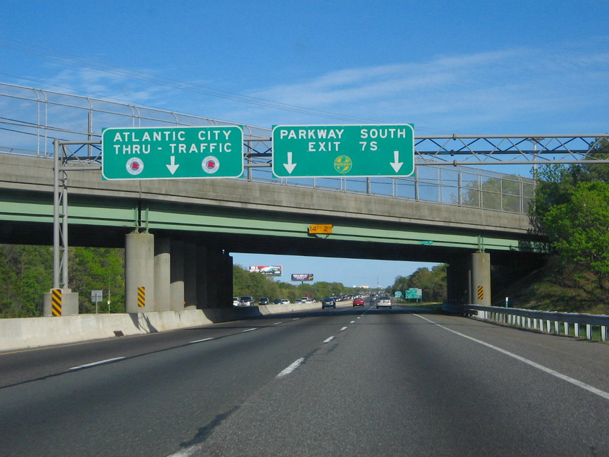
 Eastbound on the Atlantic City Expressway approaching the Garden State Parkway in Egg Harbor Township.
The Atlantic City Expressway then enters Egg Harbor Township. It interchanges with County Route 646, which provides access to the Atlantic City International Airport,[4] and passes under County Route 563.[1] It then features a cloverleaf interchange with the Garden State Parkway and crosses into Pleasantville. The expressway meets U.S. Route 9 at a diamond interchange. It passes under County Route 585 and features a partial interchange with North Franklin Boulevard, with a westbound exit and eastbound entrance.[1]
The Atlantic City Expressway continues to the Pleasantville Toll Plaza. Past the toll plaza, the travel lanes separate and a long parking area, used by Atlantic City casino employees, lies within the median of the expressway.[5] It then encounters the Atlantic City Welcome Center and Service Plaza[6] and enters Atlantic City. Upon entering Atlantic City, the expressway features an eastbound exit and westbound entrance to US 40/US 322.[1] It then continues southeast, crossing the Beach Thorofare, and soon after encounters an eastbound exit and westbound entrance for the Atlantic City-Brigantine Connector, which provides access to the Atlantic City Convention Center, the Marina district, and Brigantine.[4] It then ends at a traffic light at the intersection with Baltic Avenue, where it becomes the one-way pair of Missouri Avenue eastbound (also known as Christopher Columbus Boulevard and County Route 692[7]) and Arkansas Avenue westbound.[1]
In 2006, the Atlantic City Expressway counted almost 68 million toll-paying vehicles.[6] The speed limit on the Atlantic City Expressway is 65 miles per hour (105 km/h) with "conditions permitting" on the posted sign for most of the route. Call boxes are located every mile on either side.[8]
History
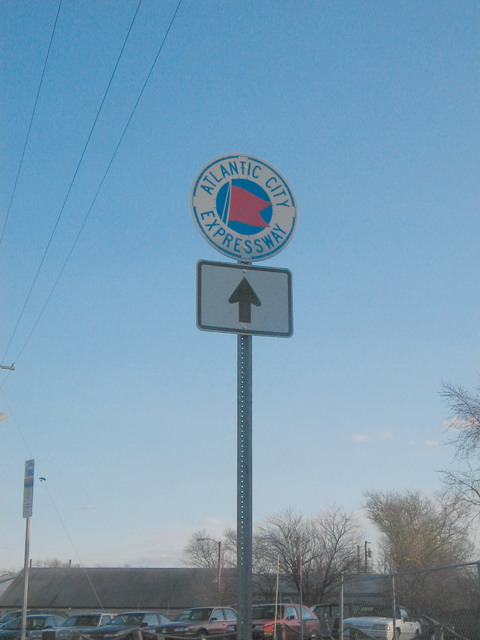
 Typical signage for the Atlantic City Expressway.
The road was originally planned as a parkway in 1932, running from the Ben Franklin Bridge in Camden to Atlantic City, but it never materialized. The idea for a limited access road between the Philadelphia area and Atlantic City resurfaced in the 1950s when South Jersey officials, led by State Senator Frank S. Farley, pushed for an expressway between the two areas to help the economy of Southern New Jersey.[5] In 1959, the North–South Freeway (Interstate 76 and Route 42) was completed as an expressway between Camden and Turnersville.[9] The New Jersey State Highway Department authorized traffic studies for a toll road between Turnersville and Atlantic City in 1958 and 1959, and the New Jersey Expressway Authority Act in 1962 called for a five-member agency (the New Jersey Expressway Authority) with representatives from four Southern New Jersey counties to be responsible for issuing bonds to build and maintain the Atlantic City Expressway.[5]
Construction of the Atlantic City Expressway started in the summer of 1962. The design was to feature a 300- to 400-foot-wide roadway with 12-foot-wide travel lanes and right shoulders as well as 3-foot-wide left shoulders. The portion between Route 42 in Turnersville and the Garden State Parkway in Egg Harbor Township was completed on July 31, 1964,[10] and the portion between the Garden State Parkway and Atlantic City was finished in July 1965. Construction of the Atlantic City Expressway cost a total of $39.8 million. It was constructed as an alternative to U.S. Route 30, commonly known as the White Horse Pike, U.S. Route 40, and U.S. Route 322, commonly known as the Black Horse Pike, for travelers going to Atlantic City.[5] Tolls on the Atlantic City Expressway initially cost $0.75 at the Egg Harbor toll plaza and $0.15 at the Pleasantville toll plaza.[10]
Following its completion, the Atlantic City Expressway saw mixed traffic results. While the total number of vehicles on the Atlantic City Expressway increased, the percentage of eastbound vehicles decreased to 37% in 1973 while Atlantic City declined as a tourist destination. However, the percentage of eastbound vehicles jumped to more than 50% in the late 1980s after gambling was legalized in Atlantic City in 1978.[5] In 1991, the South Jersey Transportation Authority was created by the New Jersey Legislature to operate the Atlantic City Expressway, the Atlantic City International Airport, and operations of the Atlantic County Transportation Authority.[6]
In recent years, many improvements have been made to the Atlantic City Expressway. A new interchange with County Route 689 on the Gloucester Township/Winslow Township border was completed in 2000 at a cost of $5 million. The Atlantic City-Brigantine Connector was completed on July 31, 2001 to connect the Atlantic City Expressway to the Marina district and Brigantine.[10] In 2005, the Atlantic City Expressway added a third lane in both directions between the Garden State Parkway and Atlantic City and in the eastbound direction between Route 73 and the Garden State Parkway. In addition, the Pleasantville Toll Plaza was reconstructed, replacing the older cash booths with newer technology.[5]
On November 21, 2008, construction began on the reconstruction of Interchange 17, with completion on June 18, 2010.[11][12][13] As a result of reconstructing this interchange, the SJTA approved raising the interchange toll to $3.00. This new rate is charged to motorists heading to or from the east along the Atlantic City Expressway at Route 50.[14] The proposal drew opposition from area officials who felt the proposed rate was too high.[15] The westbound exit and eastbound entrance at Interchange 17 was designed to be E-ZPass only, the first such interchange on the Atlantic City Expressway.[3]
Toll plazas and rest area
Automobiles currently must pay a $3.00 toll at the Egg Harbor Toll Plaza, which is located east of the Farley Service Plaza at milepost 17.5, and a $0.75 toll near Pleasantville.[16] Both mainline toll plazas have Express E-ZPass lanes through the center of the plaza. Exits between the two toll plazas may also charge a small fee, depending on the distance. A $0.75 toll for cars is currently charged at Exits 5, 9, 12, 28, and 33; in addition, a $0.40 toll for cars is currently charged at Exits 38 and 41.[16] A $3.00 E-ZPass only toll is charged for the westbound exit and eastbound entrance at Exit 17.[3][13]
On January 8, 2008, Governor Jon Corzine proposed a 50 percent increase in tolls on New Jersey's three toll roads in 2010, with increases of a similar percentage every four years after that, in order to help pay down the state debt. Each time tolls increased, there would be an additional increase for inflation since the last toll increase (for the first, since 2006). The roads would be maintained by a nonprofit public-benefit corporation, which would pay back bonds to the state. Under this plan, without considering inflation, tolls on the Atlantic City Expressway would have risen from $2.50 to $16.59 in 2022.[17] It was possible that commuters would receive discounts from the higher toll rates.[18] However, the proposal was not enacted due to opposition from leaders of the New Jersey Legislature.[19] On September 5, 2008, a proposal by the South Jersey Transportation Authority was created to raise tolls by 50 percent, from $2.50 to $3.75, in order to fund improvements to the road as well as to the Atlantic City International Airport.[20] This toll increase took place effective November 18, 2008.[16] In 2009, the South Jersey Transportation Authority considered making the tolls on the Atlantic City Expressway completely electronic, in which E-ZPass would be used. Vehicles without E-ZPass will be billed using license plate technology, with a 10% surcharge applied to their tolls.[21] The Atlantic City Expressway was expected to become an all-electronic toll road by Memorial Day weekend 2011.[22] However, the tolls on the road are not expected to become cashless until between 2013 and 2015.[23]
Farley Service Plaza, the only service area on the route, has a building containing several fast food restaurants and a gas station. It is located between the two sides of the road to service traffic coming in either direction.[1][2] In the mid-2000s, an additional gas station and mini-mart were opened in the narrow center median behind the Atlantic City Welcome Center by Exit 2.[2]
Future developments
Widening project
In 2007, it was announced that the mainline Expressway from milepost 7.0–31.0 will be widened in the westbound direction to accommodate a third lane from just north of the Garden State Parkway to Route 73. Interchange 17 (Route 50) will be reconstructed to form a full movement interchange (completed June 18, 2010), and the Egg Harbor Toll Plaza will receive Express E-ZPass lanes to maintain highway speed. Construction on these three projects is to be financed by a $25 million bond.[5][13] The Express E-ZPass was completed in May 2011, with the first phase completed in the summer of 2010.[22][23]
The work under the widening project also includes improvements to bridges, lighting, and guide signs. In addition, Intelligent Transportation System (ITS) technology, such as traffic cameras and variable message signs, will also be added to the Atlantic City Expressway to enhance safety and aid in monitoring traffic. The first phase will widen the road from the Garden State Parkway to the Egg Harbor Toll Plaza. The second phase will widen the road from the Egg Harbor Toll Plaza to milepost 24.5. The third phase will widen the road west to Route 73. The ITS components will be installed along these sections of the roadway through the course of each phase. The fourth phase will add ITS technology to the parts of the road that are not being widened.[24]
Atlantic City International Airport connector
The SJTA revealed plans for a major road improvement project that would link the Atlantic City International Airport directly to the Atlantic City Expressway, with construction beginning as early as 2013. The plan includes new ramps with two overpasses over the expressway. The road would connect Amelia Earhart Boulevard with an overpass above Airport Circle. Plans also call for building a service road with another overpass that would provide access to Delilah Road. Another project involves the installation of an overpass at the end of Amelia Earhart Boulevard next to the entrance to the FAA tech center. The proposed roadway would intrude upon a small section of a mobile home park and land owned by Egg Harbor Township.[25]
Exit list
County Location Mile[1] Exit[1][26] Destinations Notes Western terminus of Atlantic City Expressway.
Expressway defaults onto NJ 42 northbound.
Gloucester Washington Township 44.19 Route 42 north – Camden, Philadelphia44.0 44  To Route 168 – Sicklerville, Blackwood
Westbound exit and eastbound entrance; exit 44 is Route 42 exit 7 immediately after the expressway ends Camden Winslow Township 40.7 41  CR 689 (Berlin-Cross Keys Road) – Berlin, Cross Keys, Gloucester Township, Winslow Township
$0.40 toll on ramp[16] 38.4 38 


 CR 536 Spur (Williamstown Road) to US 322 – Williamstown, Berlin
$0.40 toll on ramp[16] 32.7 33  CR 723 (Williamstown-Winslow Road) – Winslow, Blue Anchor, Williamstown
Eastbound exit and westbound entrance. $0.75 toll on ramp[16] 31.4 31 Route 73 – Winslow, Blue AnchorWestbound exit and eastbound entrance Atlantic Hammonton 27.8 28 Route 54 – Hammonton, Vineland, Trenton$0.75 toll on ramp[16] Hamilton Township 21.5 Farley Service Plaza Egg Harbor Toll Plaza - Cars $3.00[16] 16.8 17 Route 50 – Egg Harbor City, Mays Landing$3.00 E-ZPass only toll on westbound exit and eastbound entrance[3] 13.5 14  CR 670 (Leipzig Avenue) – Atlantic City Race Track
Eastbound exit and westbound entrance 12.3 12 
 CR 575 to US 40 / US 322 – Mays Landing, Smithville
$0.75 toll on ramp[16] Egg Harbor Township 9.5 9  CR 646 – Absecon, Brigantine, A.C. International Airport
$0.75 toll on ramp[16] 7.2 7N G.S. Pkwy. north – New York7S G.S. Pkwy. south – Cape MayPleasantville 5.4 5 US 9 – Northfield, SmithvilleEastbound sign reads "Pleasantville". $0.75 toll on ramp[16] 4.8 4 Franklin Boulevard – Absecon, Pleasantville Westbound exit and eastbound entrance Pleasantville Toll Plaza - Cars $0.75[16] Atlantic City Welcome Center and Service Plaza Atlantic City 2.17 2 US 40 / US 322 – Atlantic City via Black Horse PikeEastbound exit and westbound entrance 0.14 1 ACE Conn. – Convention Center, Marina, BrigantineEastbound exit and westbound entrance 0.0 Midtown, Uptown, Downbeach At-grade intersection at Baltic Avenue Eastern terminus of Atlantic City Expressway
Road continues as CR 692 (Christopher Columbus Boulevard)
1.000 mi = 1.609 km; 1.000 km = 0.621 mi See also
 U.S. Roads portal
 New Jersey portal
References
- ^ a b c d e f g h i j k l m n o p "Route 446 straight line diagram". New Jersey Department of Transportation. http://www.state.nj.us/transportation/refdata/sldiag/00000446__-.pdf. Retrieved 2008-03-25.
- ^ a b c "Atlantic City Expressway -Farley Plaza". South Jersey Transportation Authority. http://www.acexpressway.com/acexpressway/farley_plaza.asp. Retrieved 2008-10-06.
- ^ a b c d "No cash at EZ Pass only exit on AC Expressway". WHYY-TV. June 18, 2010. http://whyy.org/cms/news/government-politics/2010/06/18/no-cash-at-ez-pass-only-exit-on-ac-expressway/40342. Retrieved 2010-10-07.
- ^ a b c d Google Maps (2009). Overview of the Atlantic City Expressway (Map). http://maps.google.com/maps?f=d&source=s_d&saddr=Rte+42+%26+Atlantic+City+Expy,+Blackwood,+Gloucester,+New+Jersey+08012&daddr=missouri+avenue+and+fairmount+avenue+atlantic+city,+nj&geocode=&hl=en&mra=ls&sll=39.363501,-74.489708&sspn=0.124755,0.219727&ie=UTF8&t=h&z=10. Retrieved 2009-04-01.
- ^ a b c d e f g Anderson, Steve. "Atlantic City Expressway". Eastern Roads. http://www.phillyroads.com/roads/atlantic-city/. Retrieved 2008-10-01.
- ^ a b c "About the A.C. Expressway". South Jersey Transportation Authority. http://www.acexpressway.com/acexpressway/about.asp. Retrieved 2008-10-04.
- ^ "County Route 692 straight line diagram". New Jersey Department of Transportation. http://www.state.nj.us/transportation/refdata/sldiag/01000692__-.pdf. Retrieved 2008-10-03.
- ^ "Atlantic City Expressway - Emergency Service Patrol (ESP)". South Jersey Transportation Authority. http://www.acexpressway.com/acexpressway/emergency_service.asp. Retrieved 2008-10-06.
- ^ Anderson, Steve. "NJ 42 Freeway". Eastern Roads. http://www.phillyroads.com/roads/NJ-42/. Retrieved 2008-10-05.
- ^ a b c "Atlantic City Expressway - History & Milestones". South Jersey Transportation Authority. http://www.acexpressway.com/acexpressway/history.asp. Retrieved 2008-10-06.
- ^ "SJTA begins construction of Atlantic City Expressway Interchange 17". South Jersey Transportation Authority. November 21, 2008. http://www.acexpressway.com/acexpressway/news_item.asp?PublicationID=20&ID=1187. Retrieved 2009-04-08.
- ^ "NEW TRAFFIC PATTERN UNTIL JULY 2009". South Jersey Transportation Authority. March 16, 2009. http://www.acexpressway.com/acexpressway/news_item.asp?PublicationID=20&ID=1269. Retrieved 2009-04-08.
- ^ a b c "AC EXPRESSWAY EXIT 17 NEW FULL INTERCHANGE PROVIDES ACCESS TO ECONOMIC GROWTH IN ATLANTIC COUNTY". South Jersey Transportation Authority. June 18, 2010. http://www.acexpressway.com/acexpressway/news_item.asp?PublicationID=20&ID=1738. Retrieved 2010-06-19.
- ^ "SJTA approves new $3 expressway toll in Hamilton Township". Press of Atlantic City. April 21, 2010. http://www.pressofatlanticcity.com/news/breaking/article_6c620500-4ce5-11df-a972-001cc4c002e0.html. Retrieved 2010-04-27.
- ^ Ortiz, Erik (April 20, 2010). "SJTA to review plans for $3 toll at Atlantic City Expressway interchange at Route 50". Press of Atlantic City. http://www.pressofatlanticcity.com/news/press/atlantic/article_b6b77dc8-4c1e-11df-bf48-001cc4c03286.html. Retrieved 2010-04-27.
- ^ a b c d e f g h i j k l "Map, Tolls & Interchange Info". South Jersey Transportation Authority. http://www.acexpressway.com/acexpressway/toll_info.asp. Retrieved 2008-10-04.
- ^ McCoy, Craig R. (January 9, 2008). "Corzine calls for 50% toll increase". The Philadelphia Inquirer.
- ^ Nussbaum, Paul (January 11, 2008). "Corzine: Toll-hike breaks are likely". The Philadelphia Inquirer.
- ^ Jones, Richard G. and David W. Chen (April 30, 2008). "Corzine Weighs Options on Toll Increases". The New York Times. http://www.nytimes.com/2008/04/30/nyregion/30toll.html?scp=1&sq=atlantic%20city%20expressway%20toll%20increase&st=cse. Retrieved 2008-10-07.
- ^ Nussbaum, Paul (September 6, 2008). "A.C. Expressway toll hike of 50% planned". The Philadelphia Inquirer.
- ^ Owens, Joseph P. (June 30, 2009). "Atlantic City Expressway authority considers going cash-free, but drivers will still pay the toll". The Express-Times. http://www.lehighvalleylive.com/breaking-news/index.ssf/2009/06/atlantic_city_expressway_autho.html. Retrieved 2010-04-26.
- ^ a b Rao, Maya (September 4, 2010). "Atlantic City Expressway plans all-electronic tolling". The Philadelphia Inquirer. http://www.philly.com/inquirer/local/20100904_Atlantic_City_Expressway_plans_all-electronic_tolling.html. Retrieved 2010-10-07.
- ^ a b Nussbaum, Paul (May 21, 2011). "E-ZPass lanes open at Egg Harbor toll plaza of Atlantic City Expressway". The Philadelphia Inquirer. http://articles.philly.com/2011-05-21/news/29568902_1_e-zpass-lanes-e-zpass-customers-express-e-zpass. Retrieved May 28, 2011.
- ^ "Third Lane Widening Westbound Atlantic City Expressway". South Jersey Transportation Authority. http://www.sjta.com/acexpressway/projects.asp?cp=1&pi=5. Retrieved 2011-02-24.
- ^ Watson, Sarah (April 14, 2011). "Project would link Atlantic City International Airport directly to the Atlantic City Expressway by 2013". Press of Atlantic City. http://www.pressofatlanticcity.com/news/breaking/project-would-link-atlantic-city-international-airport-directly-to-the/article_3c5d0ef2-663b-11e0-b504-001cc4c03286.html. Retrieved April 17, 2011.
- ^ "Map of the Atlantic City Expressway". South Jersey Transportation Authority. http://www.acexpressway.com/acexpressway/acx_map.asp. Retrieved 2010-10-07.
External links
- Atlantic City Expressway Official Website
- South Jersey Transportation Authority (Owner of Atlantic City Expressway)
- NJ State Highways: 445-895 - Atlantic City Expressway
- Atlantic City Expressway Secret NJ 446 pictures
- Atlantic City Expressway at Phillyroads.com
Controlled-access highways and Expressways in New Jersey Interstate Highways U.S. and state highways Toll roads and other highways Atlantic City Expressway (Brigantine Connector) • Garden State Parkway • New Jersey Turnpike • Palisades Interstate ParkwayRoad transportation infrastructure of the metro Philadelphia area Interstates U.S. Routes Pennsylvania Routes New Jersey Routes Delaware Routes Named roads/streets Benjamin Franklin Parkway · Broad Street · City Avenue · Front Street · Girard Avenue · Market Street · Roosevelt Boulevard · South Street · Chestnut Street · Walnut Street
Pennsylvania Turnpike · New Jersey Turnpike · Delaware Turnpike · Atlantic City Expressway · Schuylkill Expressway · Delaware Expressway · Blue Route · Vine St Expressway · North South Freeway · Lancaster Avenue · Bethlehem Pike · Baltimore Pike · Black Horse PikeBridges Delaware Memorial Bridge · Commodore Barry Bridge · Walt Whitman Bridge · Ben Franklin Bridge · Betsy Ross Bridge · Tacony–Palmyra Bridge · Burlington–Bristol Bridge · Delaware River – Turnpike Toll BridgeCategories:- State highways in New Jersey
- Toll roads in New Jersey
- Limited access New Jersey state routes
- Transportation in Atlantic County, New Jersey
- Transportation in Camden County, New Jersey
- Transportation in Gloucester County, New Jersey


Wikimedia Foundation. 2010.