- Northwest Parkway
-
Northwest Parkway Route information Length: 8.052 mi (12.958 km) Major junctions West end:  US 36 at Broomfield
East end: 
 I-25 / E-470 at Broomfield
Location Counties: Broomfield, Boulder Highway system  Interchange of the Northwest Parkway, Interstate 25, and E-470
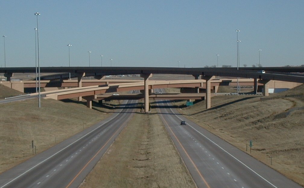
The Northwest Parkway is an 8-mile (13 km) toll road running from the intersection of I-25 and E-470 to US 36 at 96th Street. Both termini are in Broomfield, Colorado, northwest of Denver. In combination with E-470 (47 miles) and SH 470 (27 miles), the Northwest Parkway forms a partial beltway of approximately 85 miles (137 km) around the Denver-Aurora Metropolitan Area. Some 19 miles (31 km) lie between the west end of the Northwest Parkway and the northwest end of SH 470, the opposite end of the beltway.[1]
The Northwest Parkway was funded entirely with private money and charges a $3 toll. The toll rate of approximately 27 cents per mile is one of the highest rates of any toll road in the United States.[citation needed][2] Tolls may be paid using highway-speed electronic tolling.
Contents
Route description
Northwest Parkway begins as a continuation of E-470 westward. Following a stack interchange with Interstate 25,[3] the parkway crosses Huron Street in suburban Broomfield, surrounded by fields. After intersecting Sheridan Parkway the route passes a small pond, followed by an intersection with Lowell Blvd. Near Dillon Road the parkway interchanges with U.S. Route 287 in Lafayette before reentering Broomfield at its west end at 96th Street.[3]
History
The Northwest Parkway opened to the public in November 2003. In November 2005, a new intersection opened at Sheridan Boulevard in northern Broomfield. In August 2001, the cities of Westminster and Arvada put into motion the completion of an extension of the Northwest Parkway, sometimes termed W-470, to connect to SH 470, I-70 and US 6 in Golden. The city of Golden struck down the proposal, but in a compromise with the Colorado Department of Transportation, an environmental impact study is being done with a goal of CDOT to complete the beltway by 2015. Most likely, Indiana Street and SH 93 would be used to complete the beltway.
Lease to foreign consortium
In 2007, the board of directors of the Northwest Parkway agreed to lease the operations of the highway to a consortium for 99 years. The two companies of the consortium are Brisa - Auto-estradas de Portugal and Companhia de Concessões Rodoviárias. According to the Boulder Daily Camera, this was the fourth time in two years that operations of an existing toll road in the USA had been turned over to a private company under a long-term lease.[4]
The Northwest Parkway had been consistently generating less income than envisioned when it was funded by three local governments — Broomfield, Lafayette, and Weld County. The parkway was built with $416.4 million in bonds, to be paid back with toll revenue over 35 years. Due to the road's under-utilization, the bond debt was downgraded in 2006. Utilization in 2007 was 12,000 cars per day, well below the 18,500 expected by 2004, one year after opening.[5]
Exit list
County Location Mile[6] # Destinations Notes Broomfield 46.398
46.95047 I-25 – Fort Collins, DenverEast end of Northwest Parkway; continues east as E-470 48.070 48 Sheridan Parkway 49.280 Toll plaza Boulder Lafayette 52.360 52  US 287 / Dillon Road – Lafayette, Broomfield
Broomfield 54.450 96th Street – Louisville At-grade; west end of Northwest Parkway 1.000 mi = 1.609 km; 1.000 km = 0.621 mi See also
References
- ^ Overview of Northwest Parkway
- ^ Roads take their toll on wallets
- ^ a b "Bing Maps". http://www.bing.com/maps/#JmNwPTM5Ljk2NzAxNzE3Mzc2NzA5fi0xMDUuMDU3OTU5OTY2MzYxNTImbHZsPTEyJnN0eT1yJnJ0cD1wb3MuMzkuOTgyMTM4MTAzMzk0Nl8tMTA0Ljk4OTkzMjA2MDA5NzJfbmVhciUyME5vcnRod2VzdCUyMFBrd3klMkMlMjBCcm9vbWZpZWxkJTJDJTIwQ08lMjA4MDAyM19fX2FffnBvcy4zOS45NDk1MDc3MTMzMTc4N18tMTA1LjEyNTk3OTc4MTE1MDgyX19fX2FfJm1vZGU9RCZydG9wPTB+MH4wfg==. Retrieved 2010-06-01.
- ^ Wallace, Alicia (2007-12-24). "Business Briefs". Boulder Daily Camera. Archived from the original on 2008-01-18. http://web.archive.org/web/20080118074537/http://www.dailycamera.com/news/2007/dec/24/cover-story-2007-the-year-in-business/. Retrieved 2008-02-17.
- ^ Avery, Greg (2007-03-05). "Road to riches: Private company may purchase Northwest Parkway". Boulder Daily Camera. http://www.dailycamera.com/news/2007/mar/05/road-to-riches/. Retrieved 2008-02-17.[dead link]
- ^ Colorado Department of Transportation, Highway Data, accessed January 2008: note that not every interval between mileposts is exactly a mile, explaining why more exits than expected are at the exact milepost
External links
Freeways in the Denver-Aurora Metropolitan Area Radial Circumferential Connecting Proposed W-470Categories:- Toll roads in Colorado
- Transportation in Boulder County, Colorado
- Transportation in Broomfield County, Colorado
- Denver metropolitan area
- Interstate 70
- Freeways in the United States
Wikimedia Foundation. 2010.