- Main Street Square (METRORail station)
-
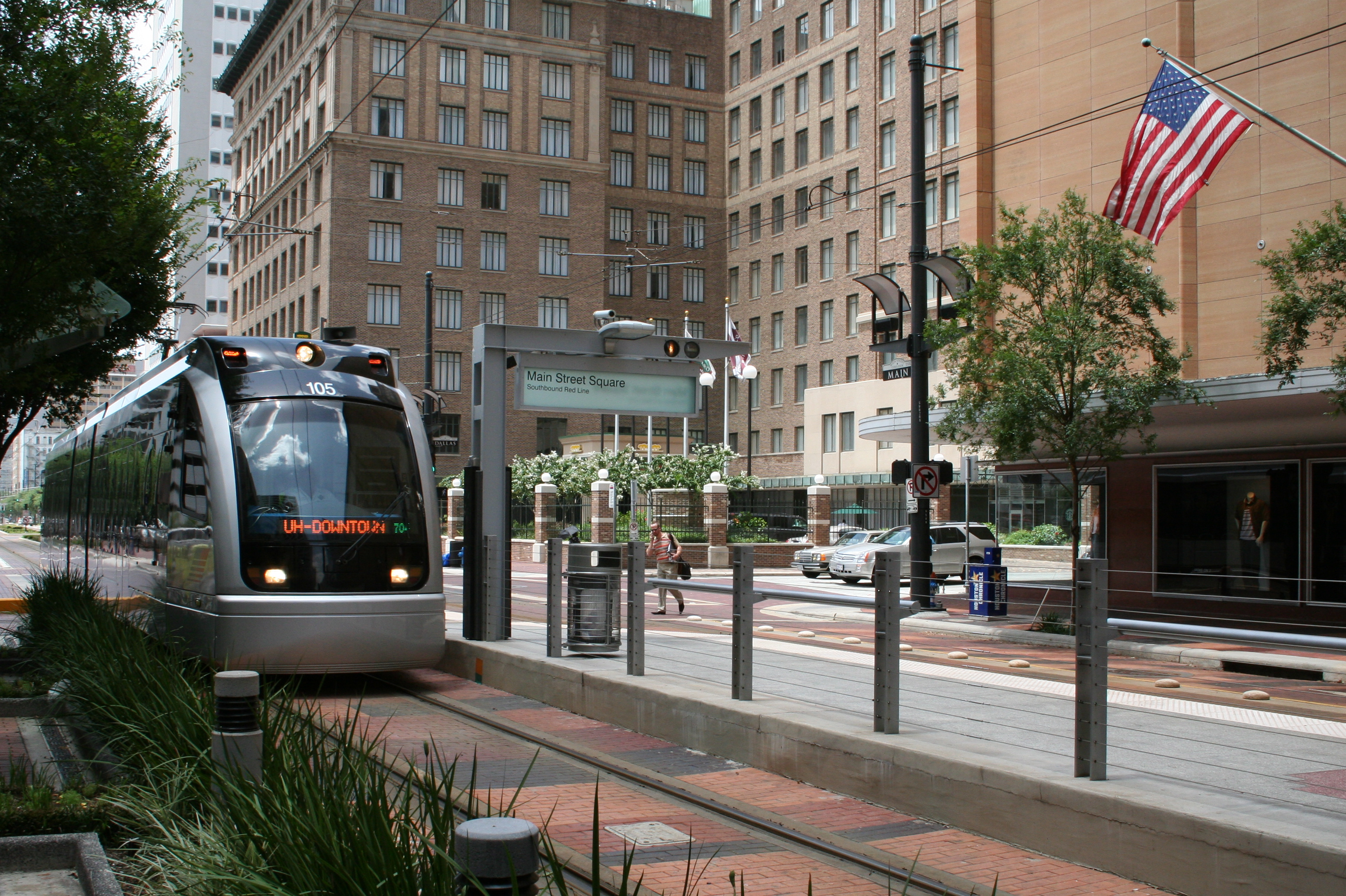
Main Street Square 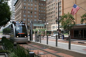
Station statistics Address Main Street; Between Walker & McKinney and Lamar & Dallas Lines Red Line Platforms Split Island Tracks Two Parking Not Available Bicycle facilities Adjacent sidewalk racks, Bicycles allowed on train during off peak times (Weekdays: 9am-3pm & 8pm-Close; Weekends: All Times). Other information Opened January 1, 2004 Accessible 
Owned by METRO Services Preceding station METRORail Following station toward Fannin SouthRed Line toward UH–DowntownMain Street Square is a station on the METRORail Red Line in Houston, Texas (USA). This is the 3rd station heading south along the rail line. This station is located in the heart of downtown - With lots of shopping and offices nearby.
The station is located on Main Street in Downtown Houston and has two separate platforms. The northbound platform is located between the Walker and McKinney Streets, while the southbound platform is located between Lamar and Dallas Streets. These two platforms are divided by the Main Street Square fountain.
Points of interest
Attractions located within a short walk of the station include Houston City Hall, the main branch of the Houston Public Library, Discovery Green, Toyota Center, George R. Brown Convention Center, Macy's and the Hobby Center for the Performing Arts.
Connecting Bus Routes
All of these routes connect at or nearby both of the station platforms.
LOCAL: 1 Hospital, 3 Langley/West Gray, 5 Kashmere Gardens/Southmore, 6 Jensen/Tanglewood, 9 North Main/Gulfton, 11 Almeda/Nance, 15 Fulton, 18 Kirby Limited, 20 Canal/Long Point Limited, 24 Northline, 30 Clinton/Cullen, 40 Telephone/Pecore, 44 Acres Homes Limited, 48 Navigation/West Dallas, 50 Harrisburg/Heights, 52 Hirsch/Scott, 53 Briar Forest Limited, 56 Airline Limited, 60 South MacGregor/Hardy, 66 Yale, 70 Memorial, 77 Liberty/MLK, 78 Alabama/Irvington, 79 West Little York, 80 Dowling/Lyons, 81 Westheimer/Westwood, 82 Westheimer/Sharpstown, 85 Antoine.
LIMITED: 102 Bush IAH Limited, 108 Veterans Memorial Limited, 131 Memorial Limited, 137 Northshore Limited.
COMMUTER: 202 Kuykendahl, 204 Spring, 209 North Corridor Combined, 212 Seton Lake, 221 Kingsland, 244 Monroe, 246 Bay Area, 247 Fuqua, 249 Gulf Corridor Combined, 255 Kingwood, 256 Eastex, 257 Townsen, 259 Eastex Corridor Combined, 262 Westwood, 265 West Bellfort, 269 Southwest Corridor Combined.
SHUTTLE & CIRCULATOR: 313 Allen Parkway Special.
Stations UH–Downtown • Preston • Main Street Square • Bell • Downtown Transit Center • McGowen • Ensemble/HCC • Wheeler • Museum District • Hermann Park/Rice U • Memorial Hermann Hospital/Houston Zoo • Dryden/TMC • TMC Transit Center • Smith Lands • Reliant Park • Fannin SouthCoordinates: 29°45′26.64″N 95°21′52.33″W / 29.7574°N 95.3645361°W
Categories:- METRORail stations
- Railway stations opened in 2004
Wikimedia Foundation. 2010.