- Arkansas River
-
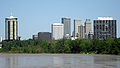
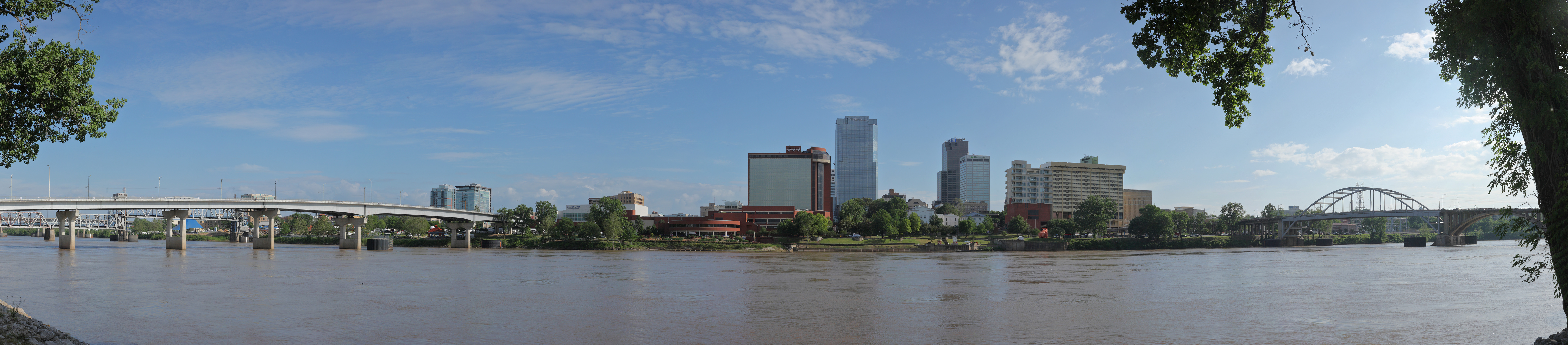
Arkansas River River  The lower part of the Arkansas River near Little Rock, Arkansas
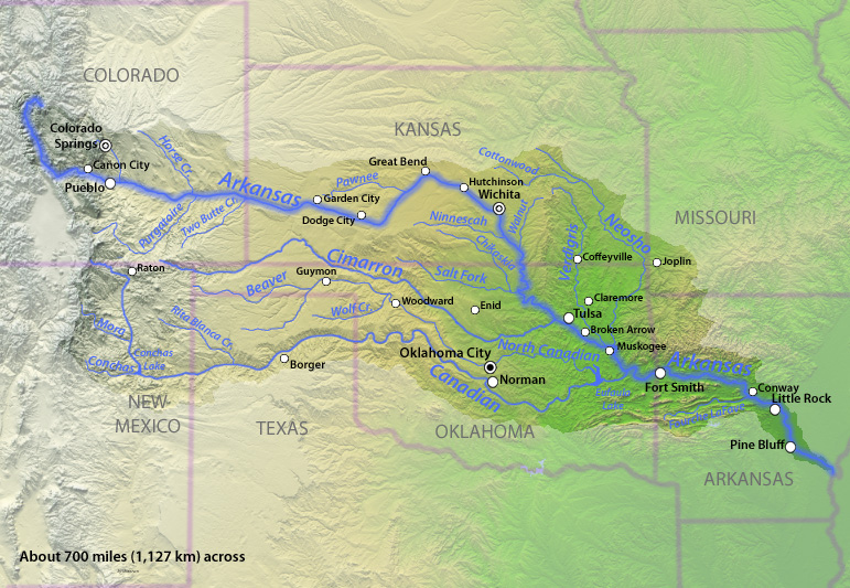
Country United States States Colorado, Kansas, Oklahoma, Arkansas Region Great Plains Part of Mississippi River watershed Tributaries - left Fountain Creek, Pawnee River, Verdigris River, Neosho River - right Cimarron River, Canadian River Cities Pueblo, CO, Wichita, KS, Tulsa, OK, Muskogee, OK, Fort Smith, AR, Little Rock, AR, Pine Bluff, AR Source Confluence of East Fork Arkansas River and Tennessee Creek - location Near Leadville, Rocky Mountains, Colorado - elevation 9,728 ft (2,965 m) - coordinates 39°15′30″N 106°20′38″W / 39.25833°N 106.34389°W [1] Mouth Mississippi River - location Franklin Township, Desha County, near Napoleon, Arkansas - elevation 108 ft (33 m) [1] - coordinates 33°46′30″N 91°04′15″W / 33.775°N 91.07083°W [1] Length 1,460 mi (2,350 km), West-east [2] Basin 168,002 sq mi (435,123 km2) [3] Discharge for Dardanelle, Arkansas, river mile 219.5 (river kilometer 353.3) - average 40,517 cu ft/s (1,147 m3/s) [4] - max 683,000 cu ft/s (19,340 m3/s) - min 1,207 cu ft/s (34 m3/s)  The Arkansas River flows through Colorado, Kansas, Oklahoma, and Arkansas, and its watershed also drains parts of Texas, New Mexico and Missouri.
The Arkansas River is a major tributary of the Mississippi River. The Arkansas generally flows to the east and southeast as it traverses the U.S. states of Colorado, Kansas, Oklahoma, and Arkansas. The river's initial basin starts in the Western United States in Colorado, specifically the Arkansas River Valley where the headwaters derive from the snowpack in the Collegiate Peaks. Then it flows east into the Midwest via Kansas, and finally into the South through Oklahoma and Arkansas.
At 1,469 miles (2,364 km), it is the sixth longest river in the United States,[5] the second-longest tributary in the Mississippi-Missouri system, and the 45th longest river in the world. Its origin is in the Rocky Mountains in Lake County, Colorado, near Leadville. In 1859 placer gold was discovered in the Leadville area bringing thousands seeking to strike it rich, however the easily recovered placer gold was quickly exhausted.[6] The Arkansas River's mouth is at Napoleon, Arkansas, and its drainage basin covers nearly 170,000 sq mi (440,300 km²).[3] In terms of volume, the river is much smaller than both the Missouri and Ohio Rivers, with a mean discharge of roughly 41,000 cubic feet per second (1,200 m3/s).
The Arkansas from its headwaters to the 100th meridian west formed part of the US-Mexico border from the Adams-Onís Treaty (in force 1821) until the Texas Annexation or Treaty of Guadelupe Hidalgo.
Contents
Pronunciations
Name pronunciation varies by region. Many people in midwestern states, including Kansas and Colorado, pronounce it /ɑrˈkænzəz/ ar-kan-zəz, while people in the state of Arkansas typically pronounce it /ˈɑrkənsɔː/ ar-kən-saw according to a state law passed in 1881.[7]
Hydrography
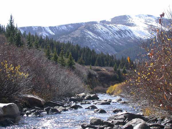
 The headwaters of the Arkansas near Leadville, Colorado
The Arkansas has three distinct sections in its long path through central North America.
At its headwaters, the Arkansas runs as a steep mountain torrent through the Rockies in its narrow valley, dropping 4,600 feet (1.4 km) in 120 miles (193 km). This section (including The Numbers near Granite, Colorado, Brown's Canyon, and the Royal Gorge) sees extensive whitewater rafting in the spring and summer.
At Cañon City, Colorado, the Arkansas River valley widens and flattens markedly. Just west of Pueblo, Colorado, the river enters the Great Plains. Through the rest of Colorado, through Kansas, and through most of Oklahoma it is a typical Great Plains riverway, with wide shallow banks subject to seasonal flooding. Tributaries include the Canadian River and the Cimarron River (both flowing from northeastern New Mexico) and the Salt Fork Arkansas River.
The river is navigable by barges and large river craft to Catoosa, Oklahoma because of a series of locks and dams referred to below (McClellan-Kerr Arkansas River Navigation System). Above Catoosa, the Arkansas River waterway itself is navigable only by small craft such as rafts or canoes.
Through western Arkansas, the river valley is home to high, isolated, flat-topped mesas, buttes, or monadnocks such as Mount Nebo and Petit Jean Mountain, and Mount Magazine, the highest point in the state. The river valley widens and shallows just west of Little Rock, Arkansas and continues eastward across the plains and forests of eastern Arkansas until it connects with the Mississippi River.
Water flow in the Arkansas River (as measured in central Kansas) has dropped from approximately 248 cubic feet per second (7 m³/s) average from 1944-1963 to 53 cubic feet per second (1.5 m³/s) average from 1984–2003, largely because of the pumping of groundwater for irrigation in eastern Colorado and western Kansas.
Important cities along the Arkansas river include Pueblo, Colorado; Wichita, Kansas; Tulsa, Oklahoma; Fort Smith and Little Rock, Arkansas.
The I-40 Bridge Disaster of May 2002 took place on I-40's crossing of Kerr Reservoir on the Arkansas River near Webbers Falls, Oklahoma.
Allocation problems
Since 1902, Kansas has claimed that Colorado takes too much of the river's water, resulting in a number of lawsuits before the U.S. Supreme Court that continue to this day,[8] generally under the name of Kansas v. Colorado. The problems over the possession and use of Arkansas River water by Colorado and Kansas led to the creation of an interstate compact or agreement between the two states.[8] While Congress approved the Arkansas River Compact in 1949,[8] it did not stop further disputes by the two states over water rights to the river.
Riverway commerce
Main article: McClellan-Kerr Arkansas River Navigation SystemThe McClellan-Kerr Arkansas River Navigation System begins at the Tulsa Port of Catoosa on the Verdigris River, and runs via an extensive Lock and Dam system to the Mississippi River.
Through Oklahoma and Arkansas, dams artificially deepen and widen this modestly sized river to build it into a commercially navigable body of water. From the mouth of the Verdigris, until the McClellan-Kerr system moves over to the White River near Arkansas Post, the Arkansas sustains commercial barge traffic and offers passenger and recreational use and is little more than a series of reservoirs.
Watershed trails
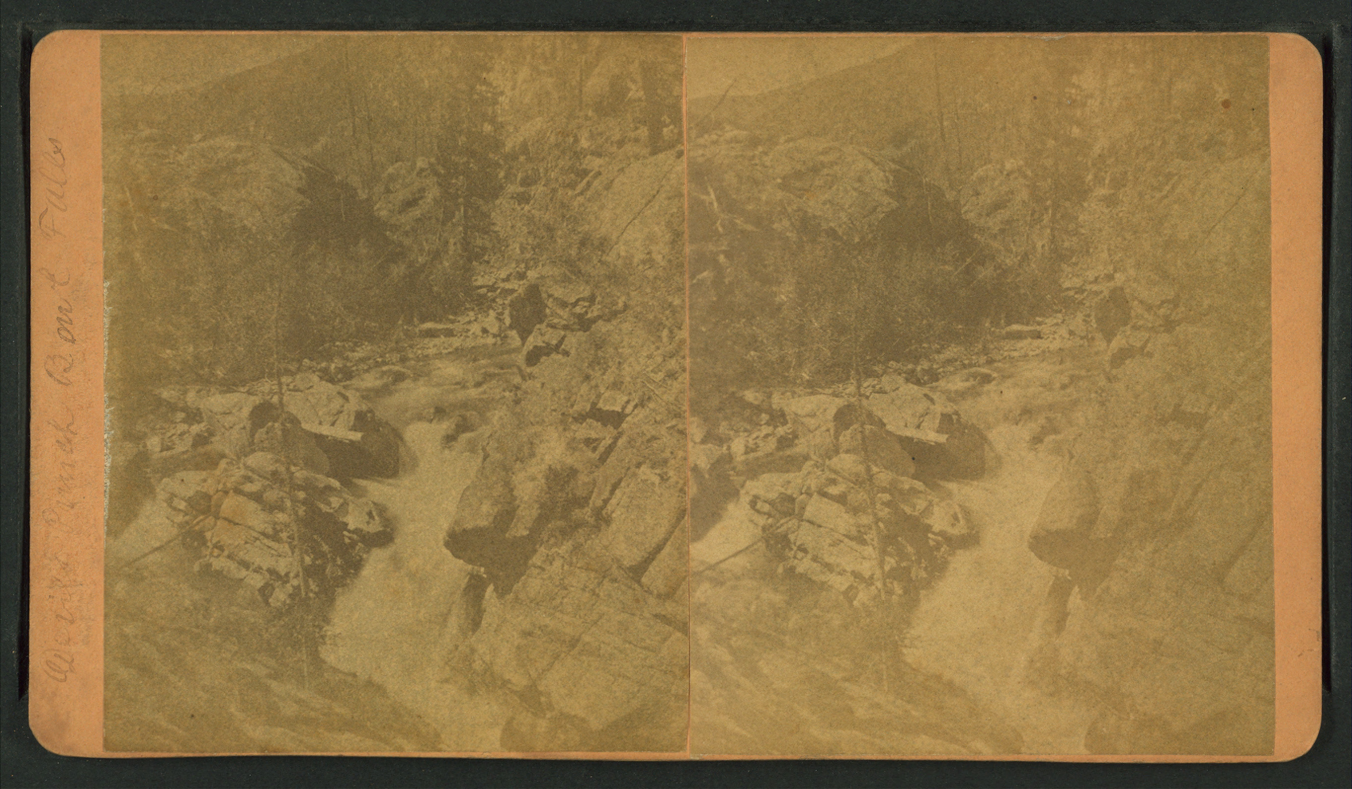
 Devil's Punch Bowl falls, from Robert N. Dennis collection of stereoscopic views
Many nations of Native Americans lived near, or along, the 1,450 mile (2334 km) stretch of the Arkansas River for thousands of years.[citation needed] The first Europeans to see the river were members of the Spanish Coronado expedition on June 29, 1541. Also in the 1540s, Hernando de Soto discovered the junction of the Arkansas with the Mississippi. The name "Arkansas" was first applied by Father Jacques Marquette, who called the river Akansa in his journal of 1673.
In 1819, the Adams-Onís Treaty set the Arkansas as part of the frontier between the United States and Spanish Mexico. This continued until the United States annexed Texas after the Mexican-American War, in 1846.
Later, the Santa Fe Trail followed the Arkansas through much of Kansas, except for the Cimarron Cutoff from Cimarron, Kansas, to Cimarron, New Mexico, via Cimarron County, Oklahoma along the Cimarron River.
In the 1880s, Charles "Buffalo" Jones, one of the co-founders of Garden City, Kansas, organized four irrigation companies to take water one hundred miles from the Arkansas River to cultivate 75,000 acres (300 km2) of land.[9]
Angling
The headwaters of the Arkansas River, in central Colorado, has been known for exceptional trout fishing, particularly fly fishing, since the 19th century when Cutthroat trout dominated the river.[10] Today, Brown trout dominate the river, which also contains Rainbow trout. Trout Unlimited considers the Arkansas one of the top 100 trout streams in America,[11] a reputation the river has had since the 1950s.[12] From Leadville to Pueblo, the Arkansas river is serviced by numerous fly shops and guides operating in Buena Vista, Salida, Cañon City and Pueblo. The Colorado Division of Wildlife provides regular online fishing reports for the river.[13][14]
A fish kill occurred on December 29, 2010 in which an estimated 100,000 freshwater drum lined the Arkansas River bank.[15][16] An investigation was conducted by the Arkansas Game and Fish Commission, found that the dead fish "cover 17 miles of river from the Ozark Lock and Dam downstream to River Mile 240, directly south of Hartman, Arkansas."[16] The commission has sampled some of the dead fish and has stated that it could take up to 30 days for full test results.[16] Although the cause of death has yet to be determined, state officials have suggested that a disease is the cause.[17] Residents are advised not to eat the fish as the cause of death remains undetermined.[18]
Gallery
 The Arkansas River passing through Little Rock, Arkansas, as viewed from the north bank.
-

Downtown Wichita, Kansas, skyline at night from The Keeper of the Plains at the Arkansas River
-

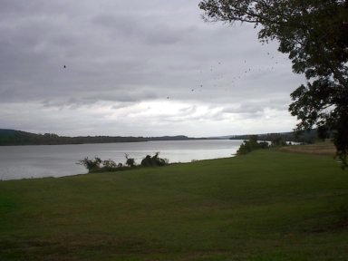
Arkansas River, looking across to North Little Rock
-

Drought can reduce the Arkansas River so much that trees along the river cannot survive.
-

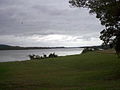
John Martin Dam and Reservoir on the Arkansas River in Bent County, Colorado
-

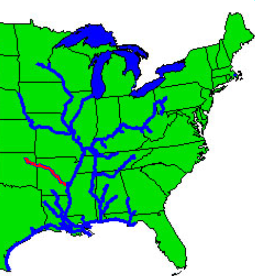
Inland waterway system with McClellan-Kerr Navigational Channel shown in red.
-

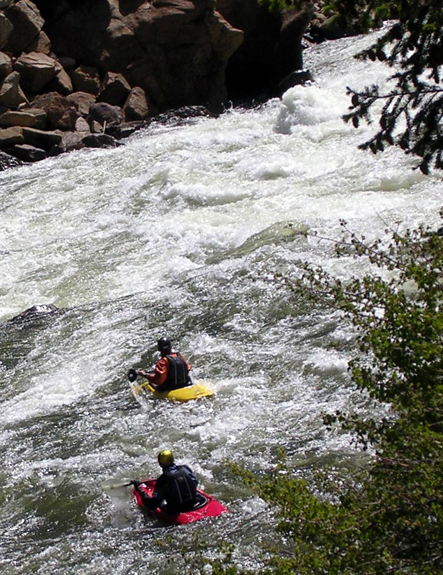
Whitewater kayaking on the Arkansas River
-
The Arkansas River in Tulsa, Oklahoma.
-
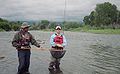
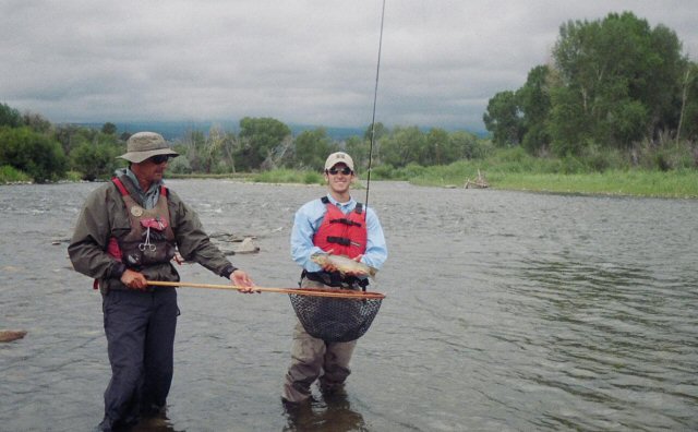
Fly Fishermen on the Arkansas River near Salida, Colorado
-

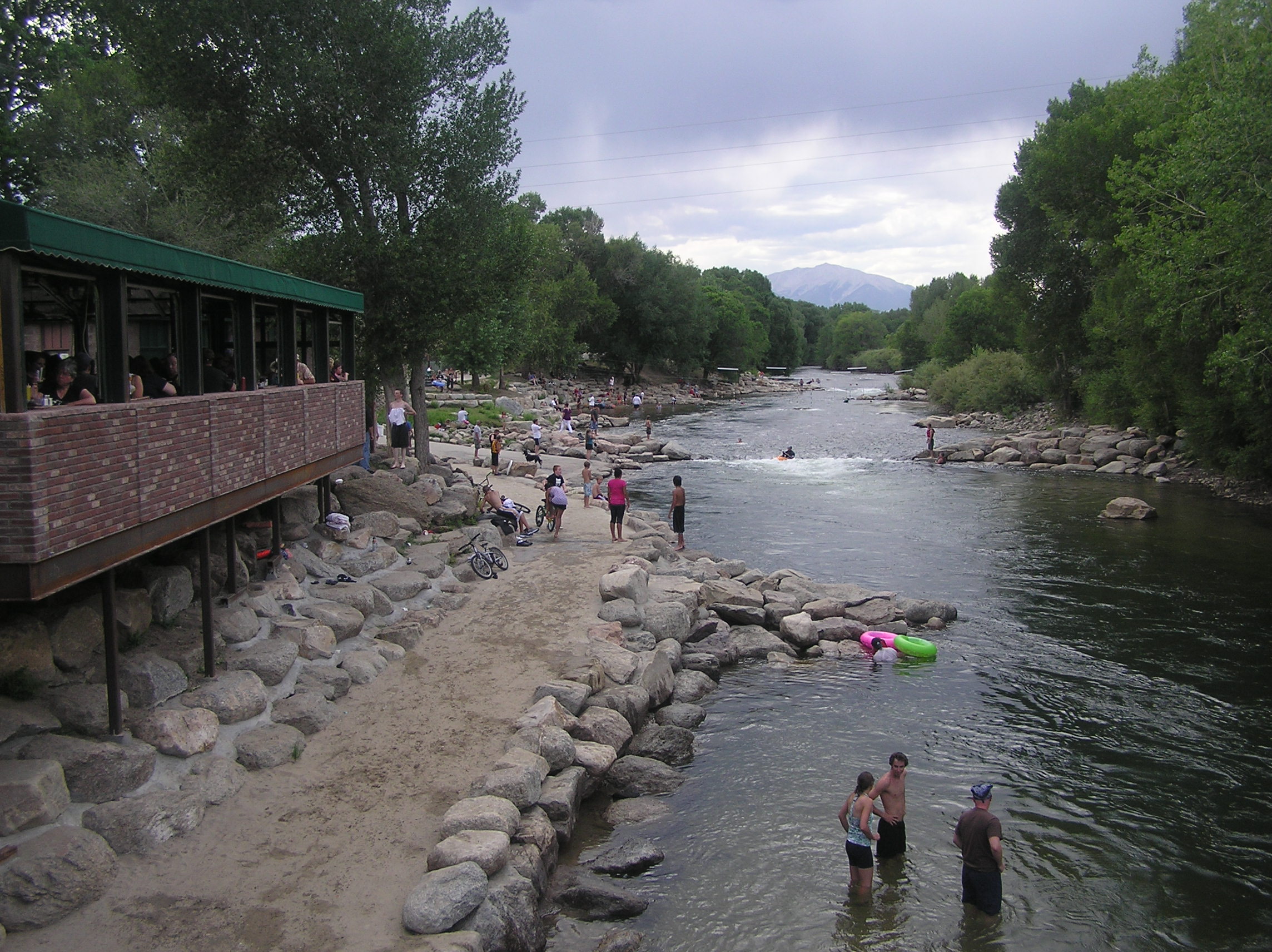
Arkansas River in Salida, Colorado
-
The Arkansas River in Natural Steps, Arkansas
See also
- Ackerman Island
- Kansas v. Colorado
- List of crossings of the Arkansas River
- List of longest main-stem rivers in the United States
- Listing of rivers for each state: Colorado, Kansas, Oklahoma, Arkansas
- McClellan-Kerr Arkansas River Navigation System
References
- ^ a b c "Arkansas River". Geographic Names Information System, U.S. Geological Survey. 1980-04-30. http://geonames.usgs.gov/pls/gnispublic/f?p=gnispq:3:::NO::P3_FID:78956. Retrieved 2010-09-20.
- ^ a b See watershed maps: 1
- ^ "USGS Gage #07258000 on the Arkansas River near Dardanelle, AR (monthly flow data)". Water Resources of the United States. U.S. Geological Survey. http://nwis.waterdata.usgs.gov/nwis/monthly/?referred_module=sw&site_no=07258000&por_07258000_2=279276,00060,2,1937-10,2004-08&format=html_table&date_format=YYYY-MM-DD&rdb_compression=file&submitted_form=parameter_selection_list. Retrieved 2011-01-03.
- ^ J.C. Kammerer (May 1990). Largest Rivers in the United States. United States Geological Survey. http://pubs.usgs.gov/of/1987/ofr87-242/. Retrieved 2007-04-05.
- ^ http://www.westernmininghistory.com/articles/58/page1
- ^ Stewart, George R. (1967). Names on the Land. Houghton Mifflin Company. pp. 335–340.
- ^ a b c Kansas v. Colorado 514 U.S. 673 (1995), 185 U.S. 125 (1902)
- ^ Charles Jesse "Buffalo" Jones exhibit, Finney County Historical Museum, Garden City, Kansas
- ^ Harris, William C. (September 1892). "The Trouts of Colorado and Utah". The American Angler XXI (12): 515–528.
- ^ Ross, John (2005). Trout Unlimited's Guide to America's 100 Best Trout Streams. Guilford, CT: Lyons Press. pp. 241–243. ISBN 1592285856.
- ^ Campbell, Duncan (1960). 88 Top Trout Streams of the West. Newport Beach, CA: Western Outdoors. pp. 64–65.
- ^ Bartholomew, Marty (1998). Fly Fisher's Guide to Colorado. Belgrade, MT: Wilderness Adventures Press. pp. 38–49. ISBN 9781885106568.
- ^ Colorado Division of Wildlife Fishing Reports
- ^ "Experts Close In On What Killed Fish - NW Arkansas News Story - KHBS NW Arkansas". KHBS. 5:51 pm CST January 3, 2011. http://www.4029tv.com/r/26356470/detail.html. Retrieved 4 January 2011.
- ^ a b c "Arkansas River Fish Kill Investigation Continues". Arkansas Game and Fish Commission. 01/03/2011. http://www.agfc.com/Pages/newsDetails.aspx?show=147. Retrieved 4 January 2011.
- ^ "Massive fish kill blankets Arkansas River - CNN.com". CNN. January 3, 2011 -- Updated 1200 GMT (2000 HKT). http://edition.cnn.com/2011/US/01/02/arkansas.fish.kill/index.html. Retrieved 4 January 2011.
- ^ Gay, Mara (Jan 3, 2011 – 11:13 AM). "First Birds Fall, Now 100,000 Fish Dead in Arkansas". AOL news. http://www.aolnews.com/2011/01/03/first-birds-fall-now-100-000-fish-dead-in-arkansas/. Retrieved 4 January 2011.
External links
- Friends of the Arkansas River
- Aquifer saturation map for Equus Beds Aquifer Recharge Project
- Arkansas River Coalition
- Full Scale Map
- Santa Fe Trail Research
- Wichita Water Center Tours
- Animated Map of navigation system
- Encyclopedia of Oklahoma History and Culture - Arkansas River
Categories:- Arkansas River
- Rivers of Arkansas
- Rivers of Colorado
- Rivers of Kansas
- Rivers of Oklahoma
- Tributaries of the Mississippi River
- Regions of Arkansas
- Fish kill
- Geography of Desha County, Arkansas
- Geography of Arkansas County, Arkansas
- Geography of Lincoln County, Arkansas
- Geography of Jefferson County, Arkansas
- Geography of Pulaski County, Arkansas
- Geography of Faulkner County, Arkansas
- Geography of Perry County, Arkansas
- Geography of Conway County, Arkansas
- Geography of Pope County, Arkansas
- Geography of Yell County, Arkansas
- Geography of Logan County, Arkansas
- Geography of Johnson County, Arkansas
- Geography of Franklin County, Arkansas
- Geography of Crawford County, Arkansas
- Geography of Sebastian County, Arkansas
- Geography of Edwards County, Kansas
- Geography of Fremont County, Colorado
- Geography of Sedgwick County, Kansas
- Geography of Tulsa, Oklahoma
- Geography of Ford County, Kansas
- Geography of Hamilton County, Kansas
- Geography of Reno County, Kansas
- Geography of Rice County, Kansas


Wikimedia Foundation. 2010.