- Chattahoochee River
-
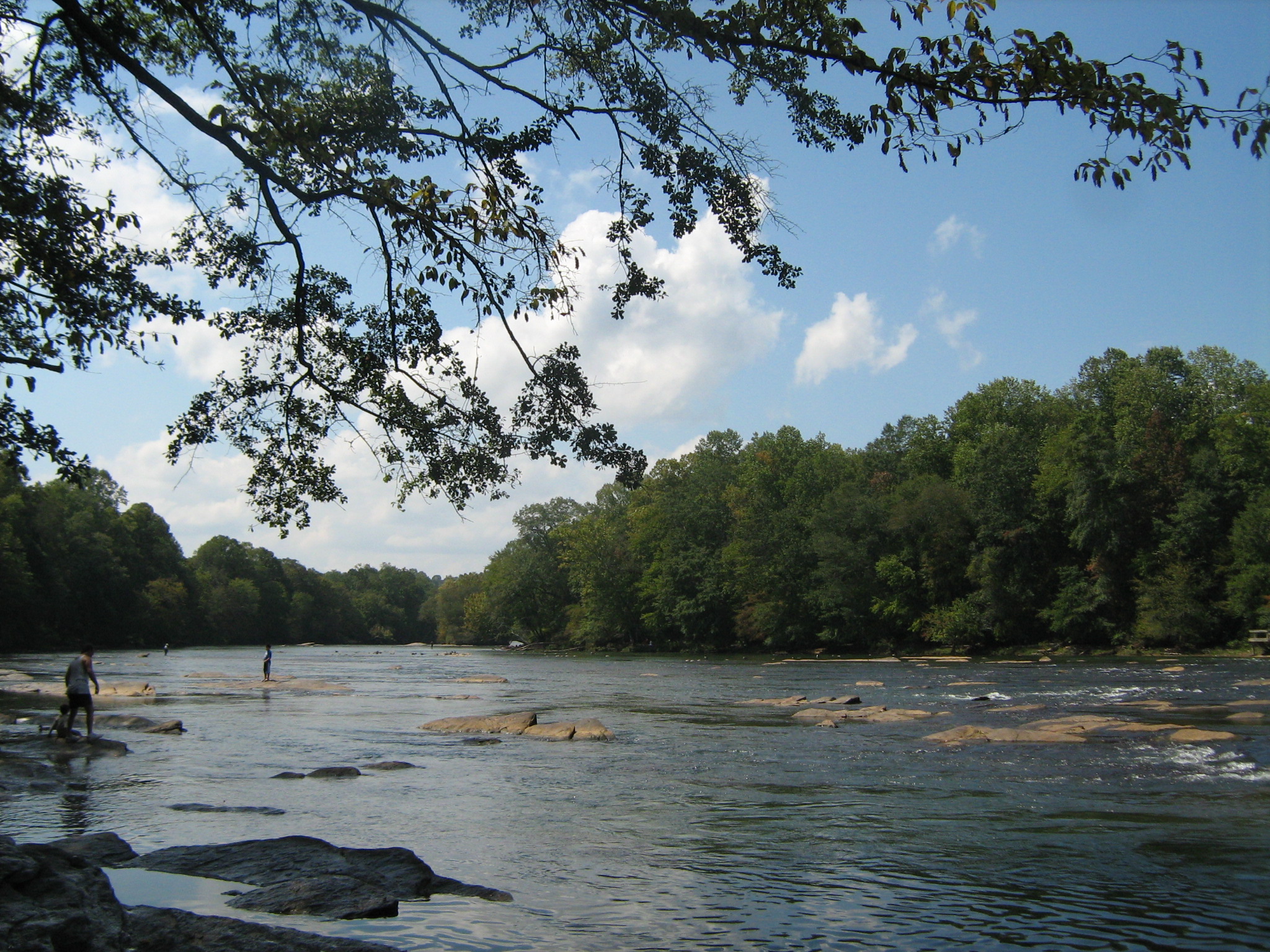
Chattahoochee River 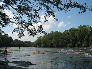 Chattahoochee River at Jones Bridge Park in Peachtree Corners, Georgia
Country United States States Georgia, Alabama, Florida Source near Jacks Knob - location Blue Ridge Mountains, Chattahoochee National Forest, Georgia - elevation 3,550 ft (1,082 m) [1] - coordinates 34°49′26″N 83°47′28″W / 34.82389°N 83.79111°W [2] Mouth Apalachicola River - location confluence with Flint River, near Jim Woodruff Dam - elevation 75 ft (23 m) [2] - coordinates 30°42′32″N 84°51′50″W / 30.70889°N 84.86389°W [2] Length 430 mi (692 km) [3] Basin 8,770 sq mi (22,714 km2) [3] Discharge - average 10,090 cu ft/s (286 m3/s) [4] - max 195,000 cu ft/s (5,522 m3/s) - min 0 cu ft/s (0 m3/s)  Map of the Apalachicola River system with the Chattahoochee highlighted in dark blue.
The Chattahoochee River flows through or along the borders of the U.S. states of Georgia, Alabama, and Florida. It is a tributary of the Apalachicola River, a relatively short river formed by the confluence of the Chattahoochee and Flint Rivers and emptying into Apalachicola Bay in the Gulf of Mexico. The Chattahoochee River is about 430 miles (690 km) long.[3] The Chattahoochee, Flint, and Apalachicola Rivers together make up the Apalachiacola-Chattahoochee-Flint River Basin (ACF River Basin).[3] The Chattahoochee makes up the largest part of the ACF's drainage basin.
Contents
Course
The Chattahoochee River originates in northeastern Georgia from a spring on Coon Den Ridge,[5] near Jacks Knob, in the southern Blue Ridge Mountains, a sub-range of the Appalachian Mountains. Its headwaters flow south from ridges that form the Tennessee Valley Divide. The Appalachian Trail crosses the river's uppermost headwaters. The Chattahoochee's source and upper course lies within Chattahoochee National Forest.
From its source in the Blue Ridge Mountains the Chattahoochee River flows southwesterly to Atlanta and through its suburbs. It eventually turns due south to form the southern half of the Georgia/Alabama state line. Flowing through a series of reservoirs, it flows by Columbus, Georgia, the third-largest city in Georgia, and Fort Benning of the U.S. Army. At Columbus, it crosses the Fall Line of the eastern United States. From Lake Oliver to Fort Benning, the Chattahoochee Riverwalk provides cycling, rollerblading, and walking along 15 miles (24 km) of the river's banks. Farther south it merges with the Flint River and other tributaries at Lake Seminole, near Bainbridge to form the Florida Panhandle's Apalachicola River. Although it is the same river, this portion acquired a different name in colonial times.
Name
The name Chattahoochee is thought to come from a Muskogean word meaning "rocks-marked" (or "painted"), from chato ("rock) plus huchi ("marked").[2] This possibly refers to the many colorful granite outcroppings along the northeast-to-southwest segment of the river. Much of that segment of the river runs through the Brevard fault zone. Another common name for the Chattahoochee River is 'The Hooch'
History
Early History
The vicinity of the Chattahoochee River has been inhabited since at least 1000 BC. The Kolomoki mounds located in the Kolomoki Mounds Historic Park near present-day Blakey, GA in Early County in southwest Georgia, were built during that era. [6][7]
Removal of Native Americans
In more recent Native American history the Chattahoochee served as a dividing line between the Cherokee and the Muscogee (Creek) nations. The removal of Native Americans for European-American settlement in the land adjacent to the river took place during a series of treaties, land lotteries, and forced removals lasting from 1820 through 1832, resulting first in the removal of Muscogee from the southeastern side of the river, and then the Cherokee from the northwest.[8]
The American Civil War
The Chattahoochee River was of considerable strategic importance during the Atlanta Campaign of the American Civil War.
The portion of the Chattahoochee between the tributaries of Proctor Creek and Nickajack Creek on the Cobb County and Fulton County lines in metropolitan Atlanta are the site of the nine remaining "Shoupades". The Shoupades were fortifications named after their designer, Confederate Brigadier General Francis A. Shoup. That portion of the Confederate line was known as Johnston's River Line after General Joseph E. Johnston. Shoup approached Johnston on June 18, 1864, a month prior to the Battle of Atlanta about building fortifications. Johnston agreed, and Shoup supervised the building of 36 small elevated earth and wooden triangular fortifications, arranged in a saw tooth pattern to maximize the crossfire. The Shoupades were impressive enough that Sherman made a decision to cross the river at a point to the northeast. The nine remaining Shoupades (which consist of the earthworks portion of the original earth and wooden structures) are endangered by development. [9]
Sidney Lanier
The beauty of the Chattahoochee River is commemorated in the epic poem The Song of the Chattahoochee, (1877)[10] by the noted Georgian poet Sidney Lanier. Lake Lanier on the Chattahoochee is named for him.
Recent History
The non-profit organization "Upper Chattahoochee Riverkeeper" oversees the northern half of the river.
Modifications
Several reservoir lakes, including Lake Lanier, Walter F. George Lake, West Point Lake, George W. Andrews Lake, and others are controlled by the United States Army Corps of Engineers, which provides hydroelectricity, flood control, domestic and industrial water, recreation, and navigation for river barge. The Georgia Power Company also owns a small series of dams along the middle portion of the river (the Columbus area) between West Point Lake and Lake Walter F. George. Several smaller and older lakes and dams also provide these services on a much smaller and more localized scale, including Bull Sluice Lake, which is held by Morgan Falls Dam. This dam was built by the Georgia Railway and Power Company in 1902 to provide electric power for the Atlanta trolley system, long since replaced by other forms of transportation.
River borders
At various points, the Chattahoochee serves as the boundary between several counties and cities, as well as forming the lower half of the boundary between Alabama and Georgia.
Within Georgia, it divides:
- Habersham County and White County
- Forsyth County and Gwinnett County
- Fulton County and Gwinnett County
- Sandy Springs and Roswell
- Cobb County and Fulton County
- Douglas County and Fulton County
- Carroll County and Fulton County
- Carroll County and Coweta County
Atlanta
 The Ramblin' Raft Race, an annual event in Atlanta, was cancelled in 1980 due to environmental concerns
Atlanta itself is built upon the crest of a large ridge, rather than on the river proper. This has contributed to keeping much of the natural scenic beauty of the section that runs through metropolitan Atlanta safe. Other sections of the river bank north of the metropolis are protected by the boundaries of the Chattahoochee River National Recreation Area[11] which is spread across several disconnected areas.
The river traverses through much of Atlanta's wealthy northern suburbs, contributing to the hilly topography the city's northern suburbs are famous for. Wealthy suburban communities in northern metro Atlanta that abut the river include: Vinings, Buckhead, Sandy Springs, East Cobb, Roswell, Dunwoody, Peachtree Corners, Johns Creek, and Berkeley Lake.
Controversy has come to the river rather recently[when?] because of the enormous growth of metropolitan Atlanta, and the resulting great increase in water withdrawals from the river. Oysters in the Apalachicola Bay, Florida, depend on the brackish water mixture of river and ocean water, and the alternating freshwater and saltwater flows that the river and the tides provide. Interbasin water transfers also occur, where water is withdrawn from the Chattahoochee, but then discharged as treated sewage water into another river, such as the Oconee River, which flows to the Atlantic Seaboard. The Congress of the United States has been asked to intervene to put navigation of the lower Chattahoochee, south of Columbus, by river barge last on the priority lists, since many people consider this to be a waste of water during droughts, and an aggravation of the fight between Georgia, Florida, and Alabama over rights to the river water. The lawsuit is now in court, and that may take quite a few years to resolve.[when?]
Flooding
The most recent floods on the Chattahoochee River were the Early November 2009 floods. The flooding was caused when Tropical Storm Ida tore through the Piedmont. Then, downstream from Roswell the Chattahoochee River remained in moderate flood. Streams affected by the Early November 2009 Floods:
- Chattahoochee River
- Vickery Creek
- Johns Creek
- Sweetwater Creek
- Nancy Creek
- Peachtree Creek
- Oconee River
The second most recent major flood along the river occurred during the 2009 Georgia floods, with 28.10 feet (8.56 m) of water recorded at Vinings at the northwestern Atlanta city limit. The flood was over 5 feet (1.5 m) higher than the previous flood recorded in September 2004, as a result of Hurricane Fred. Numerous tributaries also swelled far over and beyond their banks. These were the highest water levels seen since 1990, and the second-highest ever since the large Buford Dam was built upstream. The National Weather Service in Peachtree City estimated that this was a 500-year flood event.
Gauges
Stream gauges are located:
- at Helen (near downtown) HELG1
- near Cornelia (6 miles or 10 km northwest of) DCNG1
- near Buford (4 miles or 6 km northwest of) immediately down from Buford Dam BUFG1
- near Norcross (5 miles or 8 km north of) on Medlock Bridge Road NCRG1
- near Roswell (4 miles or 6 km southeast of) just off old Riverside Road RWLG1
- below Morgan Falls Dam TW MGFG1
- at Vinings (3 miles or 5 km southwest of) and Atlanta on Pace's Ferry Road bridge VING1
- near Campbellton (1 mile or 2 km northwest of) and Fairburn on Georgia 92 bridge FBNG1
- at Whitesburg (2 miles or 3 km southeast of) at Main Street (Georgia 18) bridge WHTG1
- at Franklin at Main Street (U.S. 27) bridge in downtown FRNG1
- at West Point (1 mile or 2 km "northeast", actually north, of the center of town) WTPG1
- at Columbus on 4th Street N (U.S. 280) bridge to Phenix City, Alabama CMUG1
- at Walter F. George Dam (USACE) in Fort Gaines FOGG1
- at George W. Andrews Lake & dam (USACE) south of Columbia, Alabamathen recent in ]November 11, 2009it flooded Vinnings again. COLA1
Water-level forecasts are regularly issued only at Vinings/Atlanta. Forecasts are issued only during high water at Norcross, Whitesburg, West Point, and the Lake Walter F. George and Andrews dams. All other locations have observations only.
Tributaries
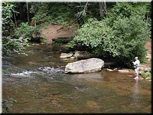
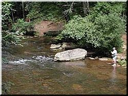 The upper Chattahoochee River at the Upper Chattahoochee River Campground north of Helen, White County, Georgia
 Chattahoochee River at River Park on Willeo Road, Fulton County, Georgia
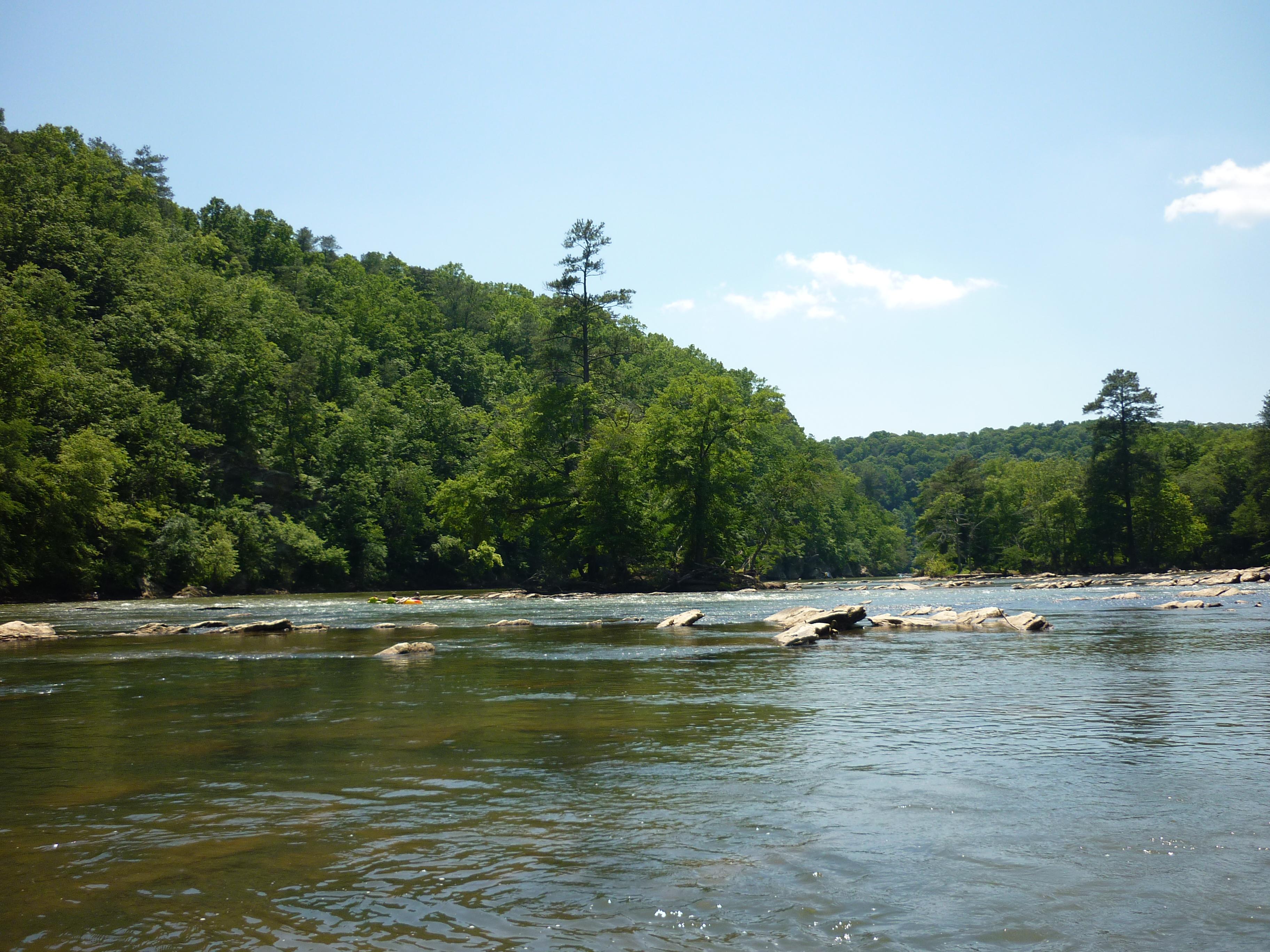
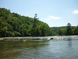 The Chattahoochee River at the Devil's Shoals, East Palisades Park, Fulton County, Georgia
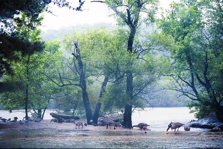
Tributary creeks, streams, and rivers, as well as lakes, along with the county they are in:
- Soque River (Habersham)
- Helen gauge (HDCG1)
- Big Creek (Hall)
- Lake Lanier and Buford Dam (Dawson, Forsyth, Gwinnett, Hall, and Lumpkin)
- Chestatee River (Dawson/Hall border, Forsyth/Hall border, and Lumpkin)
- Six Mile Creek (Forsyth)
- James Creek (Forsyth)
- Johns Creek (Forsyth and north Fulton, city of Johns Creek, Georgia)
- Bald Ridge Creek (Forsyth)
- Audry Mill Creek (North Fulton)
- Crooked Creek (DeKalb)
- Young Deer Creek (Forsyth)
- Four Mile Creek (Forsyth)
- Dick Creek (Forsyth)
- Level Creek (Gwinnett)
- Haw Creek (Forsyth)
- Two Mile Creek (Forsyth)
- Shoal Creek (Gwinnett and Hall)
- Suwanee Creek (Gwinnett)
- Brushy Creek (Gwinnett)
- Richland Creek (Gwinnett)
- Rogers Creek (Gwinnett)
- Norcross gauge (NCRG1)
- Mavern Creek (north Fulton)
- Old Mill Creek (north Fulton)
- Vickery Creek (Forsyth, north Fulton)
- Roswell gauge (RWLG1)
- Willeo Creek (Cobb/Fulton border)
- Bull Sluice Lake and Morgan Falls Dam
- Ball Mill Creek (DeKalb and Fulton)
- Beech Creek (Fulton)
- Summerbrook Creek (Fulton)
- Mountain Health Creek (Fulton)
- Arrowhead Creek (Cobb)
- Mulberry Creek (Cobb)
- Nancy Creek (DeKalb and Fulton)
- Nannyberry Creek (Cobb)
- Nickajack Creek (Cobb)
- Owl Creek (Cobb)
- Rottenwood Creek (Cobb)
- Sope Creek (Cobb)
- Trout Lily Creek (Cobb)
- Vinings gauge at Pace's Ferry (VING1)
- Peachtree Creek (Fulton)
- Proctor Creek (Fulton)
- Cabin Creek (Fulton)
- Camp Creek (Fulton)
- Charlie's Trapping Creek (Fulton)
- Crooked Creek (Fulton and Gwinnett)
- Dog River (Douglas)
- Hewlett Creek (Fulton)
- Long Island Creek (Fulton)
- Marsh Creek (Fulton)
- Whitewater Creek (Fulton)
- Sandy Creek (Fulton)
- Sweetwater Creek (Cobb, Douglas, and Paulding)
- Pea Creek (south Fulton)
- Pine Creek (south Fulton)
- Deep Creek (south Fulton)
- Mill Branch (south Fulton)
- Brock Branch (south Fulton)
- Browns Lake (south Fulton)
- Anneewakee Creek (Douglas)
- Basket Creek (Douglas)
- Bear Creek (Douglas)
- Bear Creek (south Fulton)
- Tuggle Creek (south Fulton)
- White Oak Creek (south Fulton)
- Turkey Creek (south Fulton)
- Gilberts Branch (Douglas)
- Hurricane Creek (Carroll and Douglas)
- Wolf Creek (Carroll)
- Snake Creek (Carroll)
- Wahoo Creek (Coweta)
- Whitesburg gauge (WHTG1)
- Mulberry Creek (Harris and Talbot)
- Pataula Creek (Clay, Quitman, Randolph, and Stewart)
- Bull Creek (Muscogee)
- Upatoi Creek (Chattahoochee/Muscogee border and Marion/Talbot border)
- West Point gauge (WTPG1)
- West Point Lake (Chambers, AL, Heard, GA, and Troup, GA)
- Lake Harding (Harris, GA and Lee, AL)
- Goat Rock Lake (Harris, GA and Lee, AL)
- Lake Oliver (Lee, AL, Russell, AL, and Muscogee, GA)
- Columbus gauge (CMUG1)
- Walter F. George Lake (Barbour, Henry, Houston, and Russell, AL and Clay, Quitman, and Stewart, GA)
- Omussee Creek (Houston, AL)
- Lake Seminole (Jackson, FL, Decatur, GA, and Seminole, GA)
Note that the above list is incomplete, and that each item is not in the exact order in which it joins the Chattahoochee. (For confluences now inundated by lakes, it may be impossible to determine from current maps exactly where they were.)
Popular culture
The Chattahoochee River was featured in Call of Juarez: Bound In Blood.
Country music artist Alan Jackson released his song "Chattahoochee" in 1993 as a single off his album A Lot About Livin' (And a Little 'bout Love). "Chattahoochee" received CMA awards for Single of the Year and Song of the Year.[12]
In Backyard Baseball 2003, Tim Hudson mentions the Chattahoochee River.
Rapper Yung Berg in an online video, tosses his 'Transformers' chain into the Chattahoochee River.
See also
- Metropolitan River Protection Act
- List of Alabama rivers
- List of Florida rivers
- List of Georgia rivers
Notes
- ^ Calculated in Google Maps and Google Earth
- ^ a b c d U.S. Geological Survey Geographic Names Information System: Chattahoochee River
- ^ a b c d "Chattahoochee-Flint River Basin". River Basin Center. http://www.rivercenter.uga.edu/education/k12resources/basinsofga2.htm. Retrieved 4 August 2010.
- ^ "Water resources data for the United States, Water Year 2009; gage 02343801, Chattahoochee River near Columbia, GA". USGS. http://wdr.water.usgs.gov/wy2009/pdfs/02343801.2009.pdf. Retrieved 4 August 2010.
- ^ "Facts about the Chattahoochee River". Chattahoochee Riverway Project. http://ga2.er.usgs.gov/bacteria/chattfacts.cfm. Retrieved 4 August 2010.
- ^ "Chattahoochee River". New Georgia Encyclopedia. http://www.georgiaencyclopedia.org/nge/Article.jsp?path=/LandResources/Geography/MajorRiverSystems-1&id=h-950. Retrieved 27 November 2010.
- ^ "Kolomoki Mounds". New Georgia Encyclopedia. http://www.georgiaencyclopedia.org/nge/Article.jsp?id=h-574. Retrieved 27 November 2010.
- ^ "Land Lottery System". New Georgia Encyclopedia. http://www.georgiaencyclopedia.org/nge/Article.jsp?path=/HistoryArchaeology/AntebellumEra/Events-7&id=h-3299. Retrieved 27 November 2010.
- ^ "Endangered Sites". Georgia Battlefields Association. http://www.georgiabattlefields.org/endangered04.htm. Retrieved 27 November 2010.
- ^ "The Song of the Chattahoochee". About North Georgia. http://ngeorgia.com/poetry/songofthechattahoochee.html. Retrieved 27 November 2010.
- ^ http://www.nps.gov/chat/planyourvisit/upload/CHATParkMap.pdf
- ^ "Alan Jackson Biography". About.com. http://countrymusic.about.com/cs/alanjackson/p/blprajackson.htm. Retrieved 2007-08-07.
External links
Atlanta landmarks Museums Apex Museum · Atlanta Contemporary Art Center · Atlanta Cyclorama & Civil War Museum · Atlanta History Center · Callanwolde Fine Arts Center · Delta Heritage Museum · Fernbank Museum of Natural History · Fernbank Science Center · Hammonds House Museum · High Museum of Art · Imagine It! The Children's Museum of Atlanta · Jimmy Carter Library and Museum · Joel Chandler Harris House (Wren's Nest) · King Plow Arts Center · Margaret Mitchell House & Museum · Martin Luther King, Jr., National Historic Site · Michael C. Carlos Museum · Museum of Contemporary Art of Georgia · Museum of Design Atlanta · Rhodes Memorial Hall House Museum · Robert C. Williams Paper Museum · William Breman Jewish Heritage & Holocaust Museum · World of Coca-Cola
Skyscrapers Downtown 25 Park Place · 40 Marietta Street · 55 Marietta Street · 191 Peachtree Tower · 270 Peachtree Street · Atlanta Hilton · Briarcliff Hotel · Candler Building · Centennial Hill (55 Allen Plaza · Peachtree Summit · 30 Allen Plaza · TWELVE Centennial Park · 45 Allen Plaza/W Atlanta Downtown Hotel & Residences) · Centennial Tower · Coastal States Building · Equitable Building · Flatiron Building · Georgia Power · Georgian Terrace Hotel · Georgia-Pacific Tower · Healey Building · Hurt Building · Hyatt Regency Atlanta · J. Mack Robinson College of Business Administration Building · Marriott Marquis · One Park Tower · Peachtree Center (North Tower · South Tower · International Tower · Harris Tower · Marquis One · Marquis Two) · Rhodes-Haverty Building · Richard B. Russell Federal Building · Robert W. Woodruff Volunteer Service Center · Sam Nunn Atlanta Federal Center · Southern Bell Telephone Company Building · State of Georgia Building · SunTrust Plaza · The Metropolitan · Westin Peachtree Plaza Hotel · William-Oliver Building · Winecoff Hotel
Midtown 1010 Midtown · 1075 Peachtree · 1100 Peachtree · 1180 Peachtree · 1280 West · AT&T Midtown Center · Atlantic Center Plaza · Bank of America Plaza · The Campanile · Coca-Cola · Colony Square (Colony Square 100 · Colony Square 400 · W Atlanta-Midtown) · CNN Center · Four Seasons Hotel Atlanta/GLG Grand · Mayfair Condominiums · One Atlantic Center · One Georgia Center · Promenade II · The Proscenium · Spire · Viewpoint · Atlantic Station (171 17th Street · 201 17th Street · 271 17th Street · The Atlantic · TWELVE Atlantic Station)
Buckhead 2828 Peachtree · 3344 Peachtree · 3630 Peachtree · Atlanta Plaza · Buckhead Grand · Mansion on Peachtree · Paramount at Buckhead · Park Avenue Condominiums · Park Place · Realm · Resurgens Plaza · Terminus (Terminus 100 · Terminus 200 · 10 Terminus Place) · The Pinnacle · Tower Place
Perimeter Center Concourse Corporate Center V & VI (King & Queen towers) · Park Towers I & II · Three Ravinia Drive
Former 688 Club · Atlanta-Fulton County Stadium · Atlantic Steel Mill · Coca-Cola Olympic City · DeGive's Opera House · Equitable Building (1892) · 3rd Georgia Governor's Mansion (John H. James mansion) · Henry Grady Hotel · Kimball House · Loew's Grand Theatre · Masonic Temple · National Museum of Patriotism · Omni Coliseum · Piedmont Hotel · Ponce de Leon amusement park · Ponce de Leon Park (ballpark) · Ponce de Leon Springs · Rich's · Riverbend Apartments · Roxy Theatre · SciTrek · State Square · Terminal Station · Turner Broadcasting tower · Union Stations: 1853 · 1871 · 1930
Planned Atlanta Symphony Center · Center for Civil & Human Rights
Categories:- ACF basin
- Borders of Alabama
- Borders of Georgia (U.S. state)
- Chattahoochee River
- Geography of Columbus, Georgia
- Rivers of Alabama
- Rivers of Florida
- Rivers of Georgia (U.S. state)
- Roswell, Georgia
- Place names in Alabama of Native American origin
- Geography of Chambers County, Alabama
- Geography of Lee County, Alabama
- Geography of Chattahoochee County, Georgia
- Geography of Habersham County, Georgia
- Geography of White County, Georgia
- Geography of Forsyth County, Georgia
- Geography of Gwinnett County, Georgia
- Geography of Fulton County, Georgia
- Geography of Cobb County, Georgia
- Geography of Douglas County, Georgia
- Geography of Carroll County, Georgia
- Geography of Coweta County, Georgia
- Geography of Muscogee County, Georgia
- Geography of Early County, Georgia
Wikimedia Foundation. 2010.