- Maryland Route 210
-
Maryland Route 210
Indian Head Highway 
Route information Maintained by MDSHA Length: 20.86 mi[1][2] (33.57 km) Major junctions South end: Naval Surface Warfare Center in Indian Head  MD 225
 MD 227
 MD 228
 MD 373
 I-295
I-295

 I-95 / I-495
 MD 414
North end: South Capitol Street at the Washington, D.C line Highway system Maryland highway system
Interstate • US • State • Minor • Former • Turnpikes←  MD 208
MD 212  →
→Maryland Route 210 (MD 210), or Indian Head Highway, is a state highway in Prince George's and Charles counties in Maryland. At its northern end, MD 210 starts from the end of South Capitol Street in Washington, D.C., connecting the U.S. Capitol with Indian Head, Maryland. This state route is accessed from the Capital Beltway by way of Exit 2A (northbound only), Exit 3 (northbound and southbound) and from ramps to and from the southern terminus of Interstate 295. Maryland Route 210 is part of the National Highway System as an arterial route from the Washington, D.C. city line to Maryland Route 228. The Metrobus system provides local bus transportation for various stops along the highway.
Contents
Route description

Maryland Route 210 begins in Indian Head, Maryland in Charles County along the four-lane, divided, arterial Indian Head Highway, beginning at an intersection with Potomac Avenue within the town. It is located close to the Naval Surface Warfare Center. The section of the highway in Charles County features many direct intersections, with homes and businesses directly fronting the road. The route then heads northeast out of the town into woodland, passing through Potomac Heights and Bryans Road as it exits Charles County.
Once it enters Prince George's County, however, the frequency of intersections greatly decreases; all other access to the highway is restricted largely to frontage roads. The route continues through woodland as it meets the western terminus of MD 228, which features one of only a few continuous-flow intersections (CFI) in the United States, this particular one built in 2000. As the route turns to the north, it passes through several unincorporated communities, such as Accokeek, Fort Washington, and Oxon Hill, with increasingly dense population, including numerous adjacent apartment projects. When the route passes through Forest Heights, it meets an interchange with the Capital Beltway, which provides a direct connection to I-295, and proceeds north to the Washington, D.C. line, at the Eastover shopping center, where it continues into Washington as South Capitol Street.
Recent events
In the early morning hours of February 16, 2008, eight spectators of a drag race died and at least four others were injured when a vehicle that was involved in a second, separate race ran through a crowd, which was standing in the middle of Route 210 in Accokeek.[3]
History
The highway was originally constructed in 1942, known as the Indian Head Naval Reservation Access Road.[4][5]
In recent years, development in Charles County and Prince Georges County has prompted the state to start various traffic alleviation projects along the Maryland Route 210, such as lane widening from the Interstate 295 merge onto the highway to the Charles County line. The northern half of the highway from Interstate 295 to Maryland Route 228 is designated and funded for road construction under the Woodrow Wilson Bridge project, including replacing every at-grade intersection with controlled-access ramp interchanges, with the overall goal of decreasing constant bottlenecks in the area.[6]
Junction list
County Location Mile[1][2] Intersection Notes Charles Indian Head 0.00 Potomac Avenue Southern terminus 1.60 MD 225 east (Hawthorne Road) – Smallwood State ParkBryans Road 3.67 MD 227 (Livingston Road)Prince George's Accokeek 9.37 MD 228 east (Berry Road) – WaldorfContinuous-flow intersection 9.86 MD 373 east (Livingston Road) – AccokeekForest Heights 19.34 I-295 north – WashingtonInterchange 19.52 MD 414 (Oxon Hill Road)Interchange 19.58 I-95 / I-495 (Capital Beltway) – Baltimore, Alexandria, VA, Richmond, VAI-95/495 exit 3 20.86 South Capitol Street north Washington, D.C. border, northern terminus References
- ^ a b Maryland State Highway Administration (2008). "Highway Location Reference: Charles County" (PDF). http://www.sha.maryland.gov/KeepingCurrent/performTrafficStudies/dataAndStats/hwyLocationRef/2008_hlr_all/co08.pdf. Retrieved 2010-05-04.
- ^ a b Maryland State Highway Administration (2008). "Highway Location Reference: Prince George's County" (PDF). http://apps.roads.maryland.gov/keepingcurrent/performTrafficStudies/dataAndStats/hwyLocationRef/2008_hlr_all/co16.pdf. Retrieved 2010-04-19.
- ^ Vogel, Steve; Rucker, Philip; Shaver, Katherine. "Car Plows Into Crowd Watching Pr. George's Street Race, Killing 8". The Washington Post. http://www.washingtonpost.com/wp-dyn/content/story/2008/02/16/ST2008021601389.html. Retrieved 2008-03-26.
- ^ "Charter for Forest Heights". http://www.mdmunicipal.org/documents%5Cpubdocs%5Ccharters/forestheightscharter.doc. Retrieved 2007-12-11.[dead link]
- ^ "BCHDP Planning Study II - Broad Creek History". Maryland National Park and Planning Commission. pp. 30. http://www.mncppc.org/county/BCHD/BCHDPlanning_Study/BCHDP%20Planning%20StudyII.pdf.
- ^ Maryland State Highway Administration, MD 210 Project Information
External links
Roads in Prince George's County, Maryland Maryland State Highways 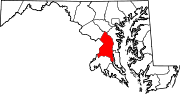
U.S. Routes Interstate Highways Roads by name Accokeek Road • Brandywine Road • Cherry Hill Road • Croom Road • Indian Head Highway • Oxon Hill Road • Piscataway Road • Saint Barnabas Road • Woodyard RoadRoads in Charles County, Maryland State highways 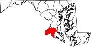
U.S. Highways Categories:- State highways in Maryland
- Roads in Charles County, Maryland
- Roads in Prince George's County, Maryland


Wikimedia Foundation. 2010.