- South Georgia and the South Sandwich Islands
-
South Georgia and the South Sandwich Islands 

Flag Coat of arms Motto: "Leo Terram Propriam Protegat" (Latin)
"Let the Lion protect his own land"
or "May the Lion protect his own land"Anthem: "God Save the Queen" 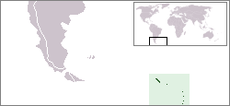 Region map
Capital King Edward Point (Grytviken)
54°17′S 36°30′W / 54.283°S 36.5°WOfficial language(s) English Government British Overseas Territory - Monarch Elizabeth II - Commissioner Nigel Haywood Area - Total 3,903 km2
1,507 sq miPopulation - 2006 estimate 30 - Density 0.005/km2 (n/a)
0.013/sq miCurrency Pound sterling ( GBP)Time zone (UTC-2) Drives on the left ISO 3166 code GS Internet TLD .gs  South Georgia glacier and penguin colony
South Georgia Island 
Central South Georgia: Cumberland Bay; Thatcher Peninsula with King Edward Cove (Grytviken); Allardyce Range with the summit Mt. Paget (NASA imagery)
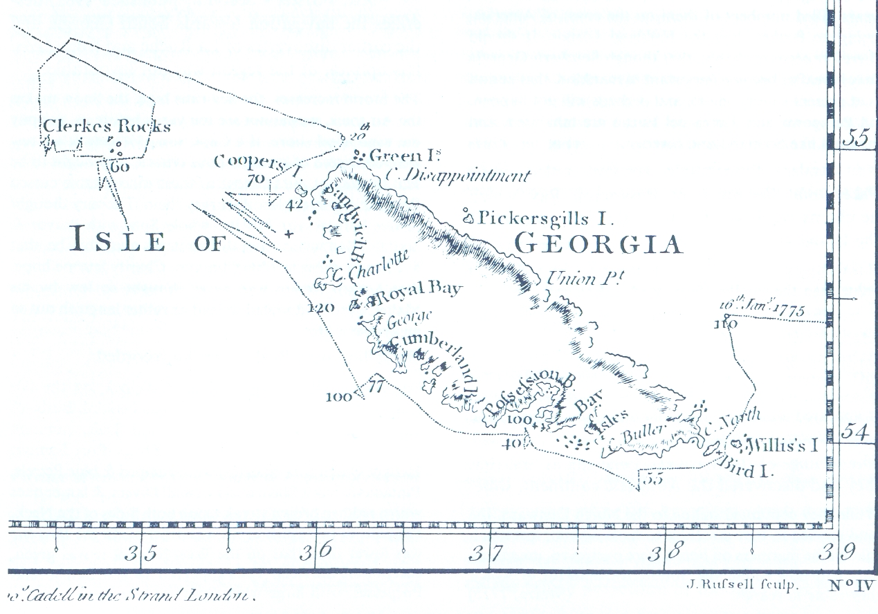
Map by James Cook (1777, South-up)Geography Location Antarctic Highest elevation 2,934 m (9,626 ft) Highest point Mt Paget Country South Georgia and the South Sandwich IslandsDemographics Population 30 (as of 2006) Ethnic groups Britons South Georgia and the South Sandwich Islands (SGSSI) is a British overseas territory and overseas territory of the European Union in the southern Atlantic Ocean. It is a remote and inhospitable collection of islands, consisting of South Georgia and a chain of smaller islands, known as the South Sandwich Islands. South Georgia is 167.4 kilometres (104 mi) long and 1.4 to 37 km (0.9 to 23.0 miles) wide[1] and is by far the largest island in the territory. The South Sandwich Islands lie about 520 kilometres (320 mi) southeast of South Georgia.[1] The total land area of the territory is 3,903 square kilometres (1,507 sq mi).[2]
There is no native population on the islands; the present inhabitants are the British Government Officer, Deputy Postmaster, scientists, and support staff from the British Antarctic Survey who maintain scientific bases at Bird Island and at the capital, King Edward Point, as well as museum staff at nearby Grytviken.
The United Kingdom claimed sovereignty over South Georgia in 1775 and the South Sandwich Islands in 1908. In 1908 the United Kingdom annexed both South Georgia and the South Sandwich Islands. The territory of "South Georgia and the South Sandwich Islands" was formed in 1985; previously it had been governed as part of the Falkland Islands Dependencies. Argentina claimed South Georgia in 1927 and claimed the South Sandwich Islands in 1938.
Argentina maintained a naval station, Corbeta Uruguay on Thule Island in the South Sandwich Islands, from 1976 until 1982 when it was closed by the Royal Navy. The Argentine claim over South Georgia contributed to the 1982 Falklands War, during which Argentine forces briefly occupied the island. Argentina continues to claim sovereignty over South Georgia and the South Sandwich Islands.
Contents
History
Main article: History of South Georgia and the South Sandwich IslandsSouth Georgia
The Island of South Georgia is said to have been first sighted in 1675 by Anthony de la Roché, a London merchant, and was named Roche Island on a number of early maps. It was sighted by a commercial Spanish ship named León operating out of Saint-Malo on 28 June or 29 June 1756.[3]
Captain James Cook circumnavigated the island in 1775 and made the first landing. He claimed the territory for the Kingdom of Great Britain, and named it "the Isle of Georgia" in honour of King George III. British arrangements for the government of South Georgia were first established under the 1843 British Letters Patent.
In 1882–1883, a German expedition for the First International Polar Year was stationed at Royal Bay on the southeast side of the island. The scientists of this group observed the transit of Venus and recorded waves produced by the 1883 eruption of Krakatoa.
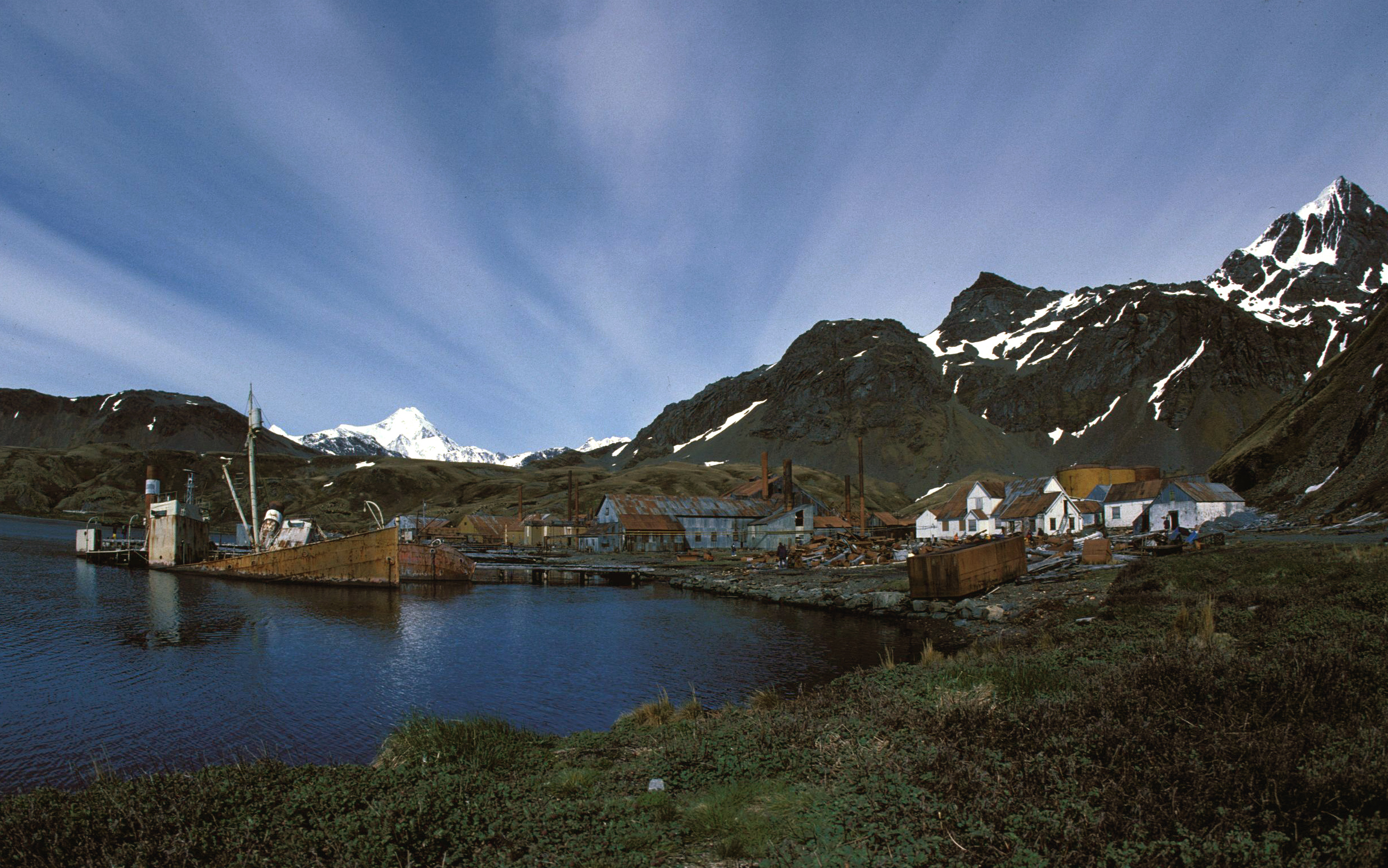
Throughout the 19th century, South Georgia was a sealers' base as well as a whalers' base beginning in the 20th century, until whaling ended in the 1960s. A Norwegian, Carl Anton Larsen, established the first land-based whaling station and first permanent habitation at Grytviken in 1904. It operated through his Argentine Fishing Company, which settled in Grytviken.[4][5] The station remained in operation until 1965.
Whaling stations operated under leases granted by the (British) Governor of the Falkland Islands. The seven stations, all on the north coast with its sheltered harbours were, starting from the west:
- Prince Olav Harbour (from 1911–1916 factory ship and small land-based station 1917–1931)
- Leith Harbour (1909–1965)
- Stromness (from 1907 factory ship, land-based station 1913–1931, repair yard to 1960/1961)
- Husvik (from 1907 factory ship, land-based station 1910–1960, not in operation 1930–1945)
- Grytviken (1904–1964)
- Godthul (1908–1929, only a rudimentary land base, main operations on factory ship)
- Ocean Harbour (1909–1920)
With the end of the whaling industry, the stations were abandoned. Apart from a few preserved buildings such as the museum and church at Grytviken, only their decaying remains survive.
 The church at Grytviken
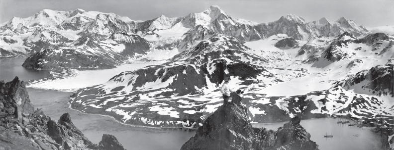
 A panorama view of South Georgia; taken by Frank Hurley during the Imperial Trans-Antarctic Expedition
From 1905, the Argentine Meteorological Office cooperated in maintaining a meteorological observatory at Grytviken under the British lease requirements of the whaling station until these changed in 1949.
In 1908 the United Kingdom issued a further Letters Patent to establish constitutional arrangements for its possessions in the South Atlantic. The Letters Patent covered South Georgia, the South Orkneys, the South Shetlands, the South Sandwich Islands, and Graham Land. (The claim was extended in 1917 to include a sector of Antarctica reaching to the South Pole.)
In 1909 an administrative centre and residence were established at King Edward Point on South Georgia, near the whaling station of Grytviken. A permanent local British administration and resident Magistrate exercised effective possession, enforcement of British law, and regulation of all economic, scientific and other activities in the territory, which was then governed as the Falkland Islands Dependencies.
In about 1912, what is according to some accounts the largest whale ever caught, a blue whale of 33.58 metres (110 ft), was landed at Grytviken.[6][7]
In April 1916, Ernest Shackleton's Imperial Trans-Antarctic Expedition became stranded on Elephant Island, some 800 miles (1,300 km) southwest of South Georgia. Shackleton and five companions set out in a small boat to summon help, and on 10 May, after an epic voyage, they landed at King Haakon Bay on South Georgia's south coast. While three stayed at the coast, Shackleton and the two others went on to cover 22 miles (35 km) overland to reach help at Stromness whaling station. The remaining 22 members of the expedition, who had stayed on Elephant Island, were subsequently rescued. In January 1922, during a later expedition, Shackleton died on board ship off South Georgia. He is buried at Grytviken.
Argentina claimed South Georgia in 1927.[8]
 Historical and modern settlements of South Georgia Island
During World War II the Royal Navy deployed an armed merchant vessel to patrol South Georgian and Antarctic waters against German raiders, along with two four-inch shore guns (still present) protecting Cumberland Bay and Stromness Bay, manned by volunteers from among the Norwegian whalers. The base at King Edward Point was expanded as a research facility in 1949/1950 by the British Antarctic Survey, which until 1962 was called the Falkland Islands Dependencies Survey.
The Falklands War was precipitated on 19 March 1982 when a group of Argentinians, posing as scrap metal merchants, occupied the abandoned whaling station at Leith Harbour on South Georgia. On 3 April the Argentine troops attacked and occupied Grytviken. Among the commanding officers of the Argentine Garrison was Alfredo Astiz, a Captain in the Argentine Navy who, years later, was convicted of felonies committed during the Dirty War in Argentina.
The island was recaptured by British forces on 25 April in Operation Paraquet. In 1985 South Georgia and the South Sandwich Islands ceased to be administered as a Falkland Islands Dependency and became a separate territory. The King Edward Point base, which had become a small military garrison after the Falklands war, returned to civilian use in 2001 and is now operated by the British Antarctic Survey.
South Sandwich Islands
Captain James Cook discovered the southern eight islands of the Sandwich Islands Group in 1775, although he lumped the southernmost three together, and their status as separate islands was not established until 1820 by Fabian Gottlieb von Bellingshausen.[9] The northern three islands were discovered by Bellingshausen in 1819. The islands were tentatively named "Sandwich Land" by Cook, although he also commented that they might be a group of islands rather than a single body of land. The name was chosen in honour of the 4th Earl of Sandwich, 1st Lord of the Admiralty. The word "South" was later added to distinguish them from the "Sandwich Islands", now known as Hawaii.
The United Kingdom formally annexed the South Sandwich Islands through the 1908 Letters Patent, grouping them with other British-held territory in Antarctica as the Falkland Islands Dependencies.
Argentina claimed the South Sandwich Islands in 1938, and challenged British sovereignty in the Islands on several occasions. From 25 January 1955, through mid-1956 Argentina maintained the summer station Teniente Esquivel at Ferguson Bay on the southeastern coast of Thule Island. Argentina maintained a naval base (Corbeta Uruguay) from 1976 to 1982, in the lee (southern east coast) of the same island. Although the British discovered the presence of the Argentine base in 1978, protested and tried to resolve the issue by diplomatic means, no effort was made to remove them by force until after the Falklands War. The base was removed on 20 June 1982.
On 10 February 2008, a 6.5 magnitude earthquake had its epicentre 205 km (127 mi) SSE of Bristol Island.[10] On 30 June 2008 at 06:17:53 UTC, a 7.0 magnitude earthquake struck the region. Its epicentre was at 58.160S 21.893W, 283 km (176 mi) ENE (73 degrees) of Bristol Island.[11]
Geography
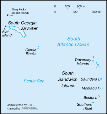
 CIA map of the Islands
South Georgia and the South Sandwich Islands are a collection of islands in the South Atlantic Ocean. Most of the islands, rising steeply from the sea, are rugged and mountainous. At higher elevations the islands are permanently covered with ice and snow.
South Georgia Group
The South Georgia Group (Spanish name Georgias del Sur) lies about 1,390 kilometres (864 mi) east-southeast of the Falkland Islands, at 54°–55°S, 36°–38°W. It comprises South Georgia Island itself (by far the largest island in the territory), and the islands that immediately surround it and some remote and isolated islets to the west and east-southeast. It has a total land area of 3,756 km2 (1,450 sq mi), including satellite islands (but excluding the South Sandwich Islands which form a separate island group).
Islands in the South Georgia Group
South Georgia Island (San Pedro in Spanish), lies at 54°15′S 36°45′W / 54.25°S 36.75°WCoordinates: 54°15′S 36°45′W / 54.25°S 36.75°W and has an area of 3,528 km2 (1,362 sq mi). It is mountainous and largely barren. Eleven peaks rise to over 2,000 metres (6,562 ft) high, their slopes furrowed with deep gorges filled with glaciers; the largest is Fortuna Glacier. The highest peak is Mount Paget in the Allardyce Range at 2,934 metres (9,626 ft).
Geologically, the island consists of gneiss and argillaceous schists, with no trace of fossils, showing that the island is, like the Falkland Islands, a surviving fragment of some greater land-mass now vanished, most probably indicating a former extension of the Andean system.
Smaller islands and islets off the coast of South Georgia Island include:
 View of Grytviken.
- Annenkov Island
- Bird Island
- Cooper Island
- Grass Island
- Pickersgill Islands
- Welcome Islands
- Willis Islands
- Trinity Island
The following remote rocks are also considered part of the South Georgia Group:
- Shag Rocks 185 km (115 mi) west-northwest of South Georgia Island
- Black Rock 169 km (105 mi) west-northwest of South Georgia Island and 16 km (9.9 mi) southeast of the Shag Rocks
- Clerke Rocks 56 km (35 mi) east-southeast of South Georgia Island
South Sandwich Islands
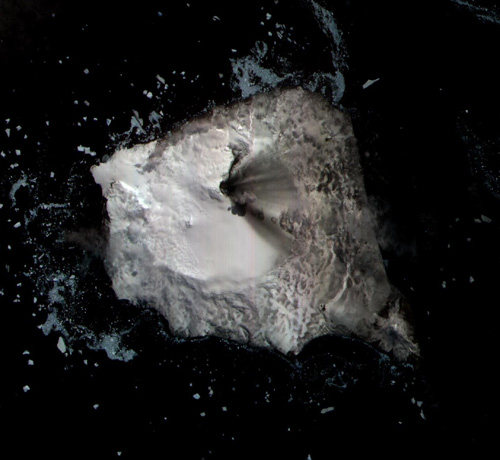
 NASA satellite photograph of Montagu Island
The South Sandwich Islands (Spanish name: Islas Sandwich del Sur) comprise 11 mostly volcanic islands (excluding tiny satellite islands and offshore rocks), with some active volcanoes. They form an island arc running north-south in the region 56°18'–59°27'S, 26°23'–28°08'W, between about 350 miles (560 km) and 500 miles (800 km) southeast of South Georgia.
The northernmost of the South Sandwich Islands form the Traversay Islands and Candlemas Islands groups, while the southernmost make up Southern Thule. The three largest islands – Saunders, Montagu and Bristol – lie between the two. The Islands' highest point is Mount Belinda (1,370 m/4,495 ft) on Montagu Island.
The South Sandwich Islands are uninhabited, though a permanently manned Argentine research station was located on Thule Island from 1976 to 1982 (for details, see "History" section above). There are automatic weather stations on Thule (Morrell) Island and Zavodovski. To the northwest of Zavodovski Island is the Protector Shoal, a submarine volcano.
The following table lists the South Sandwich Islands from north to south:
Island (Spanish Name) Area Highest Peak Location Traversay Islands Protector Shoal — −27 m (−88.6 ft) 55°54′S 28°06′W / 55.9°S 28.1°W Zavodovski 25 km2 (9.7 sq mi) Mount Curry: 550 m (1,800 ft) 56°18′S 27°34′W / 56.3°S 27.567°W Leskov 0.3 km2 (0.12 sq mi) Rudder Point: 190 m (620 ft) 56°40′S 28°08′W / 56.667°S 28.133°W Visokoi 35 km2 (14 sq mi) Mount Hodson: 915 m (3,002 ft) 56°42′S 27°13′W / 56.7°S 27.217°W Candlemas Islands (sometimes included with Traversay Islands) Candlemas (Candelaria) 14 km2 (5.4 sq mi) Mount Andromeda: 550 m (1,800 ft) 57°05′S 26°39′W / 57.083°S 26.65°W Vindication (Vindicación) 5 km2 (1.9 sq mi) Quadrant Peak: 430 m (1,410 ft) 57°06′S 26°47′W / 57.1°S 26.783°W Central islands Saunders 40 km2 (15 sq mi) Mount Michael: 990 m (3,250 ft) 57°48′S 26°28′W / 57.8°S 26.467°W Montagu (Jorge) 110 km2 (42 sq mi) Mount Belinda: 1,370 m (4,490 ft) 58°25′S 26°23′W / 58.417°S 26.383°W Bristol (Blanca) 46 km2 (18 sq mi) Mount Darnley: 1,100 m (3,600 ft) 59°03′S 26°30′W / 59.05°S 26.5°W Southern Thule (Tule del Sur) Bellingshausen 1 km2 (0.39 sq mi) Basilisk Peak: 255 m (837 ft) 59°25′S 27°05′W / 59.417°S 27.083°W Cook 20 km2 (7.7 sq mi) Mount Harmer: 1,115 m (3,658 ft) 59°26′S 27°09′W / 59.433°S 27.15°W Thule or Morrell Island 14 km2 (5.4 sq mi) Mount Larsen: 710 m (2,330 ft) 59°27′S 27°18′W / 59.45°S 27.3°W Vysokaya Bank — ? 59°43′S 27°58′W / 59.717°S 27.967°W South Sandwich Islands 310 km2 (120 sq mi) Mount Belinda: 1,370 m (4,490 ft) A series of six passages separates each of the islands or island groups in the chain. They are, from north to south: Zavodovski I. — Traverse passage — Visokoi I. — Brown's passage — Candlemas Is. — Shackleton's passage — Saunders I. — Larsen's passage — Montagu I. — Biscoe's passage — Bristol I. — Forster's passage — Southern Thule.
Climate
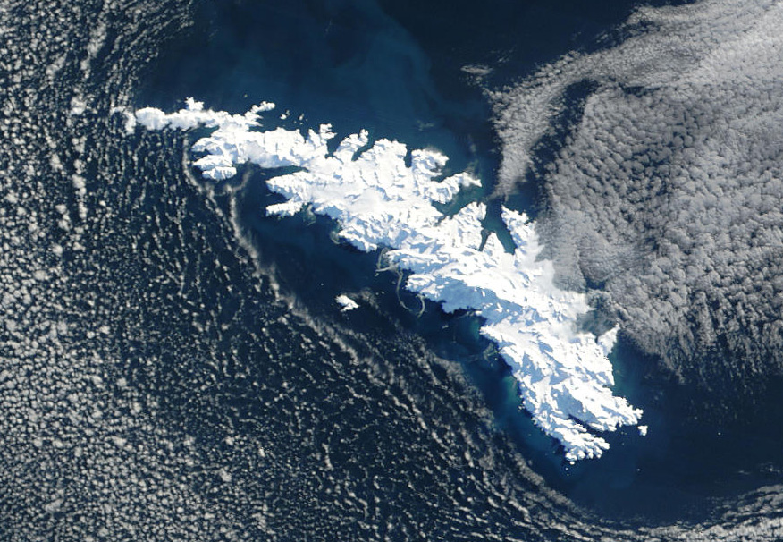
 NASA satellite image of South Georgia Island covered with snow.
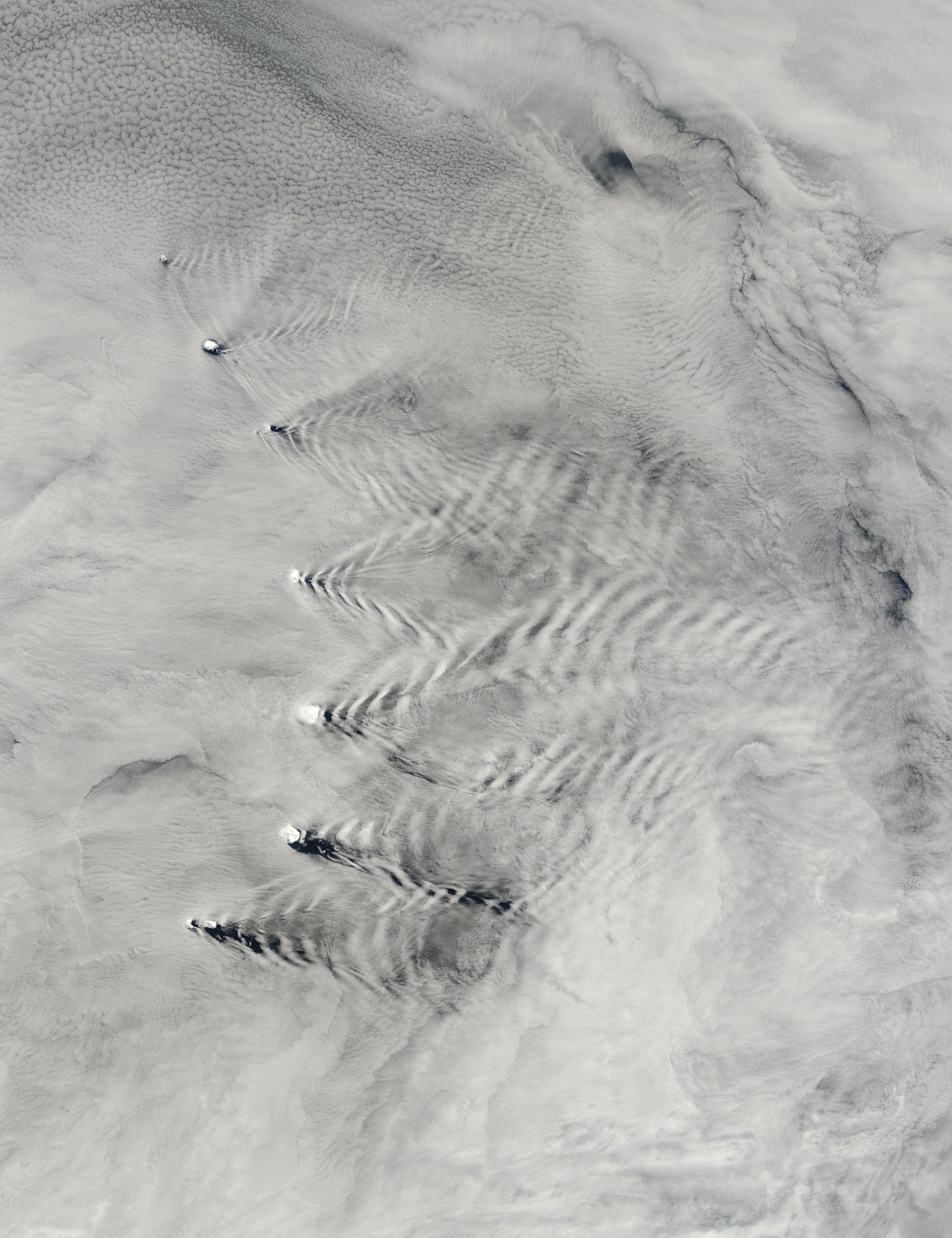
 The South Sandwich Islands conspire with air currents to make wave patterns in clouds.
The permanently cold sea maintains a cold maritime climate on the islands, and the weather is highly variable and harsh.[citation needed] Typical daily maximum temperatures in South Georgia at sea level are around 0 °C (32 °F) in winter (August) and 8 °C (46.4 °F) in summer (January). Winter minimum temperatures are typically about −5 °C (23 °F) and rarely dip below −10 °C (14 °F). Annual precipitation in South Georgia is about 1,500 mm (59.1 in), much of which falls as sleet or snow, which is possible in any month. Inland, the snow line in summer is at an altitude of about 300 m (984 ft).
Westerly winds blow throughout the year interspersed with periods of calm - Indeed, in 1963, 25% of winds were in the calm category at King Edward point, and the mean wind speed of around 8 knots is around half that of the Falkland Islands. This gives the eastern side of South Georgia (leeward side) a more pleasant climate than the exposed western side. The prevailing weather conditions generally make the islands difficult to approach by ship, though the north coast of South Georgia has several large bays which provide good anchorage.
Sunshine, as with many South Atlantic Islands, is low, at just 21.5% of possible, translating into around 1000 hours annually, however, a large part of this is due to the local topography. A study around 1960[12] showed sunshine recording instruments were obscured entirely during June, and significantly in other months. It was estimated theoretical sunshine exposure minus obstructions would be around 14% at Bird Island, and 35% at King Edward point - or in hourly terms ranging from around 650 hours in the West to 1500 hours in the East, illustrating the effect the Allardyce range has in breaking up cloud cover.
During mountain wind conditions, the winds blow straight up the western side and straight down the eastern side of the mountains and become much warmer and drier; this produces the most pleasant conditions when temperatures can occasionally rise over 20 °C (68 °F) on summer days. The highest recorded temperature was 23.5 °C (74.3 °F) at Grytviken.[13] and 26.3 °C (79.3 °F) at nearby King Edward point, both on the sheltered East side of the Islands. Conversely, the highest recorded temperature at Bird Island on the windward Western side is a mere 14.5 °C (58.1 °F). As one might expect, the sheltered eastern side can also record lower winter temperatures - The absolute minimum for Grytviken being −19.4 °C (−2.9 °F), King Edward Point −18.9 °C (−2.0 °F), but Bird Island just −11.4 °C (11.5 °F)
The seas surrounding South Georgia are cold throughout the year due to the proximity of the Antarctic Current. They usually remain free of pack ice in winter, though thin ice may form in sheltered bays, and icebergs are common.[14] Sea temperatures drop to 0 °C (32 °F) in late August and rise to around 4 °C (39.2 °F) only in early April.
The South Sandwich Islands are much colder than South Georgia, being further south and more exposed to cold outbreaks from the Antarctic continent. They are also surrounded by sea ice from the middle of May to late November (even longer at their southern end).[15] Recorded temperature extremes at South Thule Island have ranged from −29.8 °C (−21.6 °F) to 17.7 °C (63.9 °F).
Climate data for Bird Island, South Georgia, 1961-1990 Month Jan Feb Mar Apr May Jun Jul Aug Sep Oct Nov Dec Year Average high °C (°F) 5.5
(41.9)5.6
(42.1)4.4
(39.9)1.9
(35.4)−0.5
(31.1)−1.8
(28.8)−2.4
(27.7)−1.9
(28.6)−0.2
(31.6)1.6
(34.9)3.4
(38.1)4.5
(40.1)1.7 Average low °C (°F) 0.7
(33.3)1.4
(34.5)0.6
(33.1)−1
(30.2)−3.8
(25.2)−4.6
(23.7)−5.4
(22.3)−4.8
(23.4)−3.4
(25.9)−1.9
(28.6)−1.5
(29.3)−0.6
(30.9)−2 Precipitation mm (inches) 84
(3.31)80
(3.15)95
(3.74)123
(4.84)108
(4.25)108
(4.25)120
(4.72)114
(4.49)107
(4.21)98
(3.86)88
(3.46)77
(3.03)1,204
(47.4)Source: Climatic Research Unit, UEA [16] Climate data for Grytviken/King Edward Point, South Georgia, 1905-1982 Month Jan Feb Mar Apr May Jun Jul Aug Sep Oct Nov Dec Year Average high °C (°F) 8
(46)8.5
(47.3)7
(45)5
(41)3
(37)2
(36)1
(34)1
(34)2.5
(36.5)4
(39)6
(43)8
(46)4.5 Daily mean °C (°F) 4.7
(40.5)5.4
(41.7)4.5
(40.1)2.5
(36.5)0.1
(32.2)−1.2
(29.8)−1.5
(29.3)−1.5
(29.3)0.1
(32.2)1.7
(35.1)2.9
(37.2)3.7
(38.7)1.8 Average low °C (°F) 2
(36)2
(36)2
(36)0
(32)−3
(27)−4
(25)−4
(25)−3
(27)−2.5
(27.5)−1
(30)0
(32)1
(34)−0.5 Precipitation mm (inches) 97.3
(3.831)126.2
(4.969)142.6
(5.614)145.2
(5.717)153.0
(6.024)137.9
(5.429)145.2
(5.717)139.1
(5.476)109.9
(4.327)93.3
(3.673)94.4
(3.717)87.4
(3.441)1,472.6
(57.976)Source: Worldclimate (max & min estimated) [17] Government
Executive power is vested in The Queen and is exercised by the Commissioner, a post held by the Governor of the Falkland Islands. The current Commissioner is Nigel Haywood, who became Commissioner on 16 October 2010. A Senior Executive Officer (Martin Collins) deals with policy matters and is Director of SGSSI Fisheries, responsible for the allocation of fishing licences. An Executive Officer (Richard McKee) deals with administrative matters relating to the territory. There is also an Environmental Officer (Darren Christie). The Financial Secretary and Attorney General of the territory are appointed ex officio similar appointments in the Falkland Islands' Government.
As there are no permanent inhabitants on the islands, there is no legislative council and no elections are held. The UK Foreign Office manages the foreign relations of the territory. Since 1982 the territory celebrates Liberation Day on 14 June.
The constitution of the territory (adopted 3 October 1985), the manner in which its government is directed, and the availability of judicial review were discussed in a series of litigations in 2001 to 2005; see in particular Regina v. Secretary of State for Foreign and Commonwealth Affairs (Appellant) ex parte Quark Fishing Limited [2005] UKHL 57.[18] Although its government is entirely directed by the UK Foreign Office, it was held that its decisions under that direction could not be challenged as if they were in law decisions of a UK government department; thus the European Convention on Human Rights did not apply.
Economy
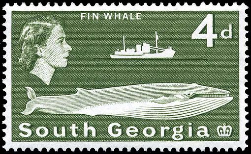
 This postage stamp depicting a fin whale was issued in 1963.
As there are no native inhabitants, economic activity in South Georgia and the South Sandwich Islands is limited. The territory has revenues of £3.9 million, 90% of which is derived from fishing licences (2002 figures).[19] Other sources of revenue are the sale of postage stamps and coins, tourism and customs and harbour dues.[citation needed]
Fishing
Fishing takes place around South Georgia and in adjacent waters in some months of the year, with fishing licences sold by the territory for Patagonian toothfish, cod icefish and krill. Fishing licences bring in millions of pounds a year, most of which is spent on fishery protection and research. All fisheries are regulated and managed in accordance with the Convention for the Conservation of Antarctic Marine Living Resources (CCAMLR) system.
In 2001 the South Georgia government was cited by the Marine Stewardship Council for its sustainable Patagonian toothfish fishery, certifying that South Georgia met the MSC's environmental standards. The certificate places limits on the timing and quantity of Patagonian toothfish that may be caught.[20]
Tourism
Tourism has become a larger source of income in recent years, with many cruise ships and sailing yachts visiting the area (the only way to visit South Georgia is by sea, since no airstrips presently exist on the Islands). The territory gains income from landing charges and the sale of souvenirs. Cruise ships often combine a Grytviken visit with a trip to the Antarctic Peninsula.
Charter yacht visits usually begin in the Falkland Islands, last between four and six weeks, and enable guests to visit remote harbours of South Georgia and the South Sandwich Islands. Sailing vessels are now required to anchor out and can no longer tie up to the old whaling piers on shore. One exception to this is the recently upgraded/repaired yacht berth at Grytviken. All other jetties at former whaling stations lie inside a 200 m (656 ft) exclusion zone; and berthing, or putting ropes ashore, at these, is forbidden. When visiting South Georgia, yachts are normally expected to report to the Government Officer at King Edward Point in the first instance, before moving round the island. [Capt. Ken Whittaker, Master, FPV "Pharos SG"[clarification needed]].
The island has featured in the Warren Miller video Storm.
Postage stamps
A large source of income from abroad also comes from the issue of South Georgia and the South Sandwich Islands postage stamps which are produced in the UK.
A reasonable issue policy (few sets of stamps are issued each year) along with attractive subject matter (especially whales) makes them popular with topical stamp collectors.
There are only four genuine first day cover sets from 16 March 1982 in existence. They were stamped at the South Georgia Post Office; all those in circulation were stamped elsewhere and sent out, but the only genuine ones were kept at the Post Office on South Georgia. These four sets were removed by a member of staff of the British Antarctic Survey in the few moments the Argentinians allowed them to gather their belongings. Everything else was burnt, but these four sets were saved and brought to the UK by Robert Headland, BAS.
Currency
The pound sterling is the official currency of the islands, and the same notes and coins are used as in the United Kingdom. Since 2001, commemorative local coins have been issued for numismatists.[21] For more information on British currency in the wider region see the Sterling Currency in the South Atlantic and the Antarctic.
Flora and fauna
- See also South Georgia Island nonmarine fauna.
 Southern Giant Petrel on South Georgia Island
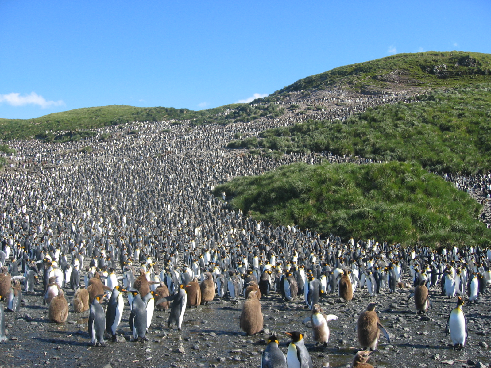
 120,000 King Penguins (Aptenodytes patagonicus) on Salisbury Plain.
 Wandering Albatross at South Georgia Island
The parts of the islands that are not permanently covered in snow or ice are part of the Scotia Sea Islands tundra ecoregion. Native vegetation on South Georgia is limited to grasses, mosses, lichens, ferns and a few other small flowering plants. A number of other introduced species have become naturalised; many of these were introduced by whalers in cattle fodder, and some are considered invasive.[22] There are no trees or shrubs.
South Georgia supports many sea birds, including albatross, a large colony of King Penguins and penguins of various other species, along with petrels, prions, shags, skuas, gulls and terns. There is one songbird which is unique to the archipelago, the South Georgia Pipit, and a duck, the South Georgia Pintail.
Seals are frequent on the islands, and whales may be seen in the surrounding waters. There are no native land mammals, though reindeer, brown rats and mice have been introduced through the activities of man. The latter have destroyed tens of millions of ground-nesting birds’ eggs and chicks, and scientists plan to eradicate the rats over four years starting 2011. It will be by far the largest rodent eradication attempt in the world to date.[23][24][25]
Reindeer were introduced to South Georgia in 1911 by Norwegian whalers for meat and for sport hunting. In February 2011 the authorities announced that, due to the reindeer's detrimental effect on native species and the threat of their spreading to presently pristine areas, a complete cull would take place, leading to the eradication of reindeer from the island.[26]
The seas around South Georgia have a high level of biodiversity.In a recent study (2009–11), South Georgia has been discovered to contain one of the highest levels of biodiversity among all the ecosystems on Earth.[27] The marine inhabitants endemic to this ecosystem outnumber (in respect to species) and surpass well-known regions such as the Galápagos or Ecuador in respect to biodiversity.[28] This marine ecosystem is thought to be vulnerable because its low temperatures mean that it can only repair itself very slowly.[29]
Military
Main article: Military of the Falkland Islands
After the Falklands War in 1982, a full-time British military presence was maintained at King Edward Point on South Georgia. This was scaled down during the 1990s, and the last detachment left South Georgia in March 2001, when the new station was built and occupied by the British Antarctic Survey.
The main British military facility in the region is at RAF Mount Pleasant and the adjacent Mare Harbour naval base on East Falkland. Other than that, a handful of British naval vessels patrol the region. They visit South Georgia a few times each year, sometimes deploying small patrols of infantry. Flights by RAF C-130 Hercules and Vickers VC10 aircraft occasionally patrol the territory.
A Royal Navy destroyer or frigate and a Royal Fleet Auxiliary vessel carry out the Atlantic Patrol Task (South) mission in the surrounding area.
HMS Endurance, the British Royal Navy ice patrol ship, operated in the South Georgia area during part of most southern summer seasons until her near loss in 2008. She carried out hydrological and mapping work as well as assisting with scientific fieldwork for the British Antarctic Survey, film and photographic units, and youth expedition group BSES Expeditions. It has been announced that Endurance is to be written off and a replacement vessel procured, an icebreaker to be named HMS Protector.[30]
See also
- Bibliography of South Georgia and the South Sandwich Islands
- Index of South Georgia and the South Sandwich Islands-related articles
- British Overseas Territories
- List of Antarctic and sub-Antarctic islands
- South Orkney Islands
- South Shetland Islands
Notes
- ^ a b Google Earth
- ^ CIA - The World Factbook 2002 - South Georgia and the South Sandwich Islands
- ^ Historia de las Relaciones Exteriores de la Argentina
- ^ La Infanteria de Marina en el conflicto del Atlántico Sur, Jorge Alberto Erecaborde. The original quote in Spanish is: La Compañia Argentina de Pesca SA, al amparo de las leyes argentinas y bajo su bandera, se instala en Grytviken".
- ^ Historia General de las Relaciones Exteriores de la República Argentina
- ^ The Island of South Georgia, The Whaling Museum, Sandefjord, Norway
- ^ Whaling, South Georgia Heritage Trust
- ^ R.K. Headland, The Island of South Georgia, Cambridge University Press, 1984. p. 238
- ^ Exploring polar frontiers: a historical encyclopedia, Volume 2, p. 157, William James Mills, 2003
- ^ 2008 February 10: Magnitude 6.5 - South Sandwich Islands region[dead link]: USGS
- ^ http://neic.usgs.gov (U.S. Geological Survey)
- ^ "British Antarctic Survey". British Antarctic Survey. http://www.antarctica.ac.uk/documents/bas_bulletins/bulletin15_08.pdf. Retrieved 10 July 2011.
- ^ Extreme Temperatures Around the World
- ^ South Georgia official website – environment – ocean
- ^ General Survey of Climatology V12, 2001, Edited by Landsberg, Elsevier publishing
- ^ "Climate Normals". Climatic Research Unit, UEA. July 2011. http://www.cru.uea.ac.uk/~timm/cty/obs/data/obs.South_Georgia.htm. Retrieved 10 July 2011.
- ^ "Climate Normals". Worldclimate. July 2011. http://www.worldclimate.com/cgi-bin/grid.pl?gr=S54W036. Retrieved 10 July 2011.
- ^ Quark Fishing Ltd, R (on the application of) v Secretary of State for Foreign and Commonwealth Affairs [2005] UKHL 57 (13 October 2005)
- ^ Commonwealth Secretariat website
- ^ Whole Foods Market (2006), "Welcome Back Chilean Sea Bass!", Whole Foods Market
- ^ http://dema-na.narod.ru/Countries_Krause/S.Georgia.html coins
- ^ http://dps.plants.ox.ac.uk/bol/southgeorgia
- ^ Hastings, Chris (7 March 2010). "South Georgia to poison millions of rats". Times Online. http://www.timesonline.co.uk/tol/news/environment/article7052509.ece.
- ^ Connor, Steve (8 March 2010). "Ecologists turn exterminators in the great rat hunt". The Independent. http://www.independent.co.uk/environment/nature/ecologists-turn-exterminators-in-the-great-rat-hunt-1917801.html.
- ^ Amos, Jonathan (4 May 2011). "'Success' in South Georgia rat eradication". BBC. http://www.bbc.co.uk/news/science-environment-13282806.
- ^ Management of introduced reindeer on South Georgia, Office of the Commissioner, 19 February 2011
- ^ "http://www.georgewright.org/node/4109". May 25, 2011. http://www.georgewright.org/node/4109.
- ^ Merco Press (27 May 2011). "South Georgia marine biodiversity richer than the Galapagos Islands". http://en.mercopress.com/2011/05/27/south-georgia-marine-biodiversity-richer-than-the-galapagos-islands.
- ^ The Antarctic island that's richer in biodiversity than the Galapagos
- ^ Michael Powell. HMS Protector will be Endurance replacement. The News. Portsmouth, 11 January 2011
References
- George Forster, A Voyage Round the World in His Britannic Majesty's Sloop Resolution Commanded by Capt. James Cook, during the Years 1772, 3, 4 and 5 (2 vols.) , London, 1777.
- R.K. Headland, The Island of South Georgia, Cambridge University Press, 1984. ISBN 0 521 25274 1
External links
- Government
- General information
- South Georgia and the South Sandwich Islands entry at The World Factbook
- South Georgia and the South Sandwich Islands at the Open Directory Project
- Wikimedia Atlas of South Georgia and the South Sandwich Islands
- Other
- South Georgia Association website
- South Georgia Heritage Trust
- Live picture from the South Georgia webcam
- Operation Paraquat
- Argentine invasion of South Georgia
- South Georgia Wiki
Sovereign states Dependencies and
other territories- Aruba
- Bonaire
- Curaçao
- Falkland Islands
- French Guiana
- South Georgia and the South Sandwich Islands
Climate of South America Sovereign states Dependencies and
other territories- Aruba
- Bonaire
- Curaçao
- Falkland Islands
- French Guiana
- South Georgia and the South Sandwich Islands
South Georgia and the South Sandwich Islands General Coat of arms · Commissioner · Flag · Foreign relations · History · Languages · List of South Georgians · Operation Paraquet · South Georgia Museum · .gs · Sovereignty · Invasion of South Georgia
Settlements and whaling stations South Georgia Islands Annenkov Island · Bird Island · Clerke Rocks · Cooper Island · Grass Island · Kupriyanov Islands · Pickersgill Islands · Saddle Island · Shag Rocks · South Georgia · Welcome Islands · Willis Islands · Trinity Island · Grassholm · Black Rocks · Black RockSouth Sandwich Islands Bellingshausen · Bristol · Candlemas · Cook · Leskov · Montagu · Saunders · Thule · Vindication · Visokoi · Zavodovski · Traversay IslandsLandmarks Allardyce Range · Fortuna Glacier · Gold Harbour · Larsen Harbour · Mount Belinda · Mount Paget · Peggotty Bluff · Salisbury Plain · Salvesen Range · Southern Thule · Thatcher Peninsula · Grace Glacier · Lucas Glacier · Bay of Isles · Point Abrahamsen · Sheep Point · Stromness Bay · Cumberland Bay · Possession Bay · Sheer Point · Busen PointCategories:- South Georgia and the South Sandwich Islands
- Volcanic arcs
- Special territories of the European Union
- Disputed islands
- English-speaking countries and territories
- States and territories established in 1985
- Territorial disputes of Argentina
- Antarctic region


Wikimedia Foundation. 2010.