- Geography of Switzerland
-
Geography of Switzerland 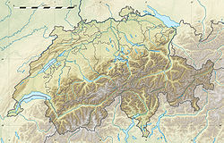
Continent Europe Region Western/Central Europe Coordinates 47° N 8° E Area Ranked 134
41,293.2 km2 (15,943.4 sq mi)
95.8% land
4.2% waterBorders Total land borders:
1,852 km (1,151 mi)
Italy: 734.2 km
France: 571.8 km
Germany: 345.7 km
Austria: 165.1 km
Liechtenstein: 41.1 kmHighest point Monte Rosa: 4,634 m Lowest point Lake Maggiore: 193 m Longest river Rhine: 375.5 km Largest lake Lake Geneva (shared with France, Lake Neuchâtel is the largest entirely in Switzerland  The Matterhorn, a symbol of Switzerland
Switzerland is a mountainous and landlocked country located in Western or Central Europe (depending on the definition). It is surrounded by 5 countries: Austria and Liechtenstein to the east, France to the west, Italy to the south and Germany to the north. Switzerland is one of the smallest countries in Europe, with a maximum north-south length of 220 kilometres (140 mi) and an east-west length of about 350 kilometres (220 mi).[1]
Switzerland is well known for the Alps in the south and south east. North of the Alps, the Swiss plateau runs along the east-west axis of the country. Most of the population of Switzerland lives on the rolling hills and plains of the plateau. The smaller Jura Mountains are located on the north west side of the plateau. Much of the northern border with Germany follows the Rhine River, though the Rhine enters Switzerland near Schaffhausen. The eastern border with Germany and a portion of Austria is drawn through Lake Constance (German: Bodensee). A portion of the southwest border with France is drawn through Lake Geneva.
Switzerland is divided into 26 sovereign cantons. The cantons along the Swiss plateau tend to be the most populous,[2] industrial and religiously Protestant.[3] The cantons in the Alps tend to be less populous, Catholic, and have an agrarian or tourism-based economy.[3]
Switzerland is also divided by language. There are four official languages; German 63.7% of population, French 20.4% of population, Italian 6.5% of population and Romansh 0.5% of population.[4] From Bern east (except Ticino) the population generally speaks German. West of Bern, the population generally speaks French. In the southern Canton of Ticino, most people speak Italian. Romansh, a group of dialects descended from Vulgar Latin, is spoken in several regions in the canton of Graubünden.
Physical description
Switzerland extends between the parallels 45°49'05 and 47°48'30 lat. and the meridians 5° 57'23 and 10°29'31 long. It forms an irregular quadrilateral, of which the greatest length from east to west is 360 kilometres (220 mi), and the greatest breadth from north to south is nearly 220 kilometres (140 mi). Its political boundaries often do not coincide with those of nature. The entire canton of Ticino is south of the Alps, as are the valleys of Simplon (Valais), Mesocco, Bregaglia, Poschiavo and Müstair (all in Graubünden); the whole canton of Schaffhausen and part of that of Basel are north of the Rhine, while a large part of Graubünden lies to the east of the Rhine basin, and Porrentruy is far down on the western slope of the Jura. Putting these exceptional cases aside, the physical geography of Switzerland may thus be described:
- On the south runs the main chain of the Alps which is joined, at Mont Dolent near Martigny, by the lower ranges that rise south of Lake Geneva, and which continues partly Swiss till close to Piz Lad on the east.
- To the north of this main chain there is another great range of mountains (wholly Swiss) only slightly inferior in extent and height, which starts from the hills known as the Jorat range above Lausanne, and culminates in the great snowy summits of the Bernese Alps and of the Tödi group, before trending to the north near Chur, and, after rising once more in the Säntis group, dies away on the southern shore of Lake Constance.
- The Swiss portion of the main chain of the Alps and the great northern outlier run parallel to each other from Martigny to near Chur, while for a short distance they actually unite near Pizzo Rotondo (west of the St Gotthard Pass), parting again near the Oberalp Pass (east of the St Gotthard). Between these two great snowclad ranges flow two of the mightiest European rivers, the Rhone towards the west and the Rhine towards the east, their headwaters being only separated by the tangled mountain mass between Pizzo Rotondo and the Oberalp Pass, which sends the Reuss towards the north and the Ticino towards the south.
- To the north of the great northern outlier rises the Jura range, a huge spur of the Alps (with which it is connected by the Jorat range), while between the northern outlier and the Jura extends what may be called the plains or plateau of Switzerland, consisting all but wholly of the undulating valley of the Aar (below Thun) with its numerous affluents. To that river valley, the valley of the Thur (a direct affluent of the Rhine), that lies between the Aar basin and the Rhine basin (Lake Constance) must be added.
Geology
Different geological phenomena shaped the actual landscapes of Switzerland. The alpine orogeny had the most visible consequences nowadays, this term designates the entire geological movements that conducted to the formation of the Alps.
A crystalline basement formed at the begin of the Paleozoic era, between 540 and 360 millions years ago. Later, between 205 and 96 millions years ago, the alpine ocean or Tethys Ocean formed between Eurasia and Africa. The ocean reached its maximum width at the end of Jurassic period, 135 millions years ago. The collision between the Eurasian and African plates made it progressively disappear. This plate collision, still in progress, began 100 millions years ago. The alpine chain resulted from this geological movement, the two plates creating folding zones. The Central Plateau is mainly composed of molasse, a sedimentary rock which formed at the bottom of the old ocean.
Switzerland is situated on a relatively quiet tectonic zone, although the city of Basel was completely destroyed in 1356 by an earthquake, the largest historical seismic event in central Europe. The most active regions are precisely the Rhine Rift Valley (region of Basel) and the Valais.
Physiographic divisions
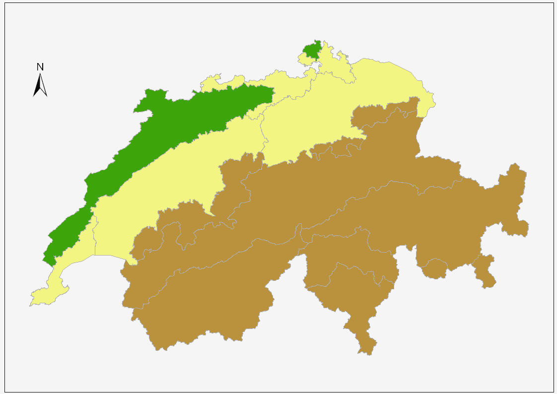
 The three main regions:JuraPlateauAlps
Switzerland is divided in three main geographic regions; the Swiss Alps, the Central Plateau and the Jura. They correspond each to clearly different geological realities. However two small regions are not part of those three. The first, north of the Rhine in the Basel area, is situated beyond the Jura. The second, on the south in the Mendrisio area, is located in the Po Valley. But these two territories are not extended in comparison to the total area of the country.
The Swiss Alps occupy the southern part of Switzerland. They were formed by the thrust of the African plate, which also caused the formation of the Jura in the north-east and the plateau between the two massifs. In terms of area the Alps constitute about 60% of the country, the plateau 30% and the Jura 10%.
The rugged terrain of the Jura and the Alps are very sparsely populated, except for some large valleys such as the Valais. Most of the population lives on the plateau where the country's major cities such as Geneva, Zurich and Bern are located.
Central Plateau
Main article: Swiss Plateau
The Swiss Plateau extends from Lake Geneva on the French border across central Switzerland to Lake Constance on the German and Austrian borders. The plateau has an average altitude of 580 metres (1,900 ft).[5] The entire plateau is covered with rolling hills, small lakes and rivers. Most of Switzerland's large lakes are located in the plateau. Both Lake Geneva (581.3 square kilometres (224.4 sq mi)) and Lake Constance (541.1 square kilometres (208.9 sq mi)) are located in the plateau but are shared with other countries. The largest lake totally in Switzerland, Lake Neuchâtel (218.3 square kilometres (84.3 sq mi)), is located in the Swiss Plateau.
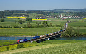
The Swiss Plateau is crossed by three great river valleys (Rhone, Rhine and Aar) and the smaller Thur River valley. While the headwaters of these four rivers all lie in the Alps, they all cut across the plateau between the Alps and the Jura mountains. The Rhone and Rhine valleys are separated from those of the Aar and the isolated Thur by the great northern outlier of the Alps, which consists of the Bernese Oberland and Glarus Alps. Two wide and undulating valleys (Aar and Thur) and two deeply cut trenches (Rhone and Rhine) thus lie on the northern slope of the Alps, to the north and south respectively of the great northern outlier of the Alps.[6] All four rivers wind back and forth and combine to form some of the major rivers in Europe. Near Schaffhausen the Rhine River passes through the Rhine Falls, Europe's largest waterfall. The Rhine Falls are 150 metres (490 ft) wide and 25 metres (82 ft).
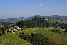 Rolling hills south of Bern
The plateau occupies about one third of the land area of Switzerland, and about two thirds of the population live in this area. The population density on the plateau averages about 450 people per km2 (1,166 per square mile).[5] In the regions around Lake Geneva, Lake Zurich and other cities, the population density exceeds 1000 people per km2.[7] As well as a majority of the population, the Swiss Plateau is also home to the majority of industry, manufacturing and farming in Switzerland. The farms are generally small and very organized. Most farms include small meadows alternating with fields with a variety of crops and small wooded areas.
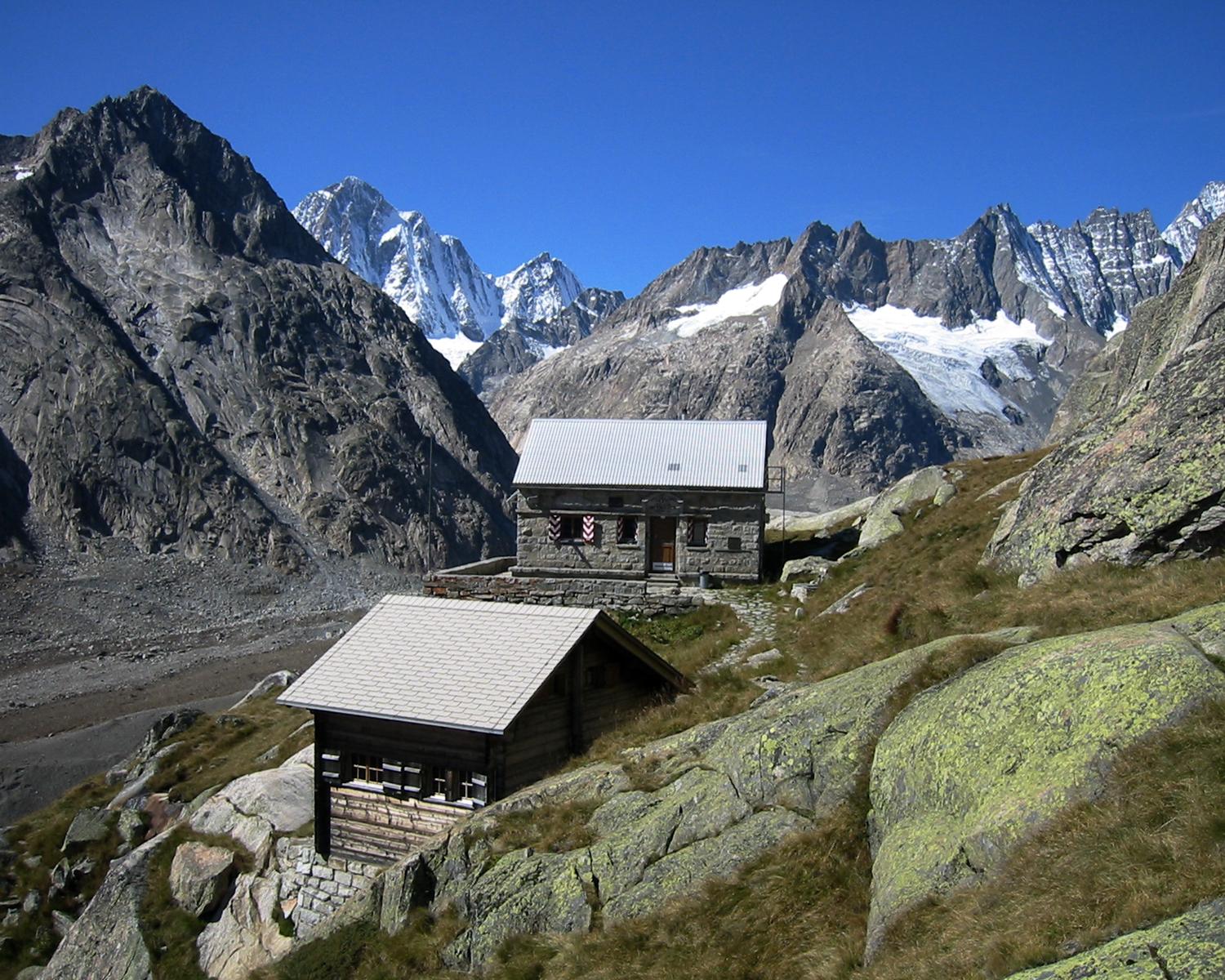
Alps
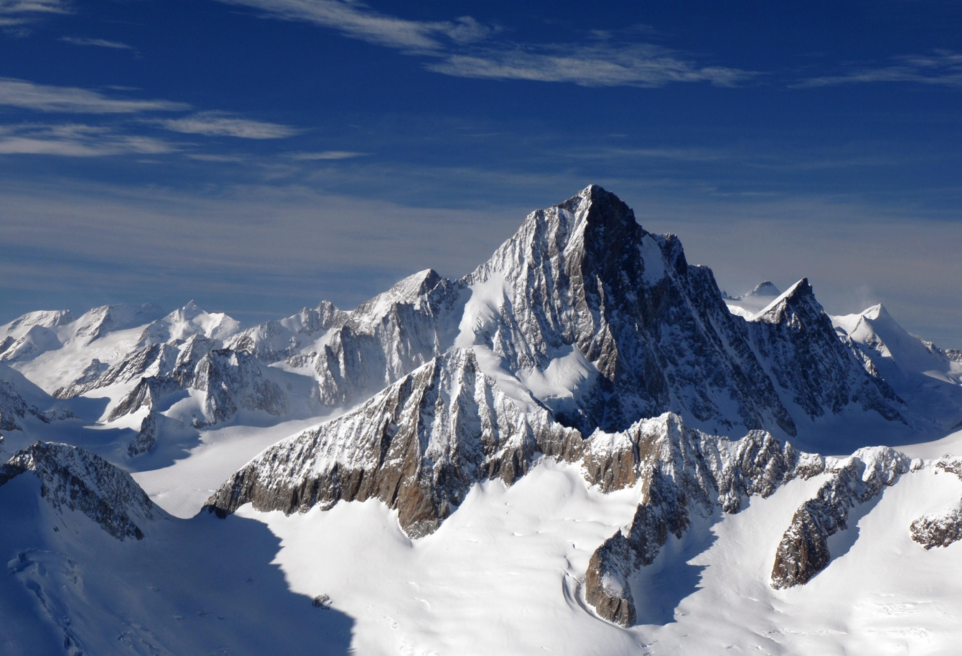
Main article: Swiss AlpsSee also: Geography of the Alps The Finsteraarhorn highest summit in the canton of Bern
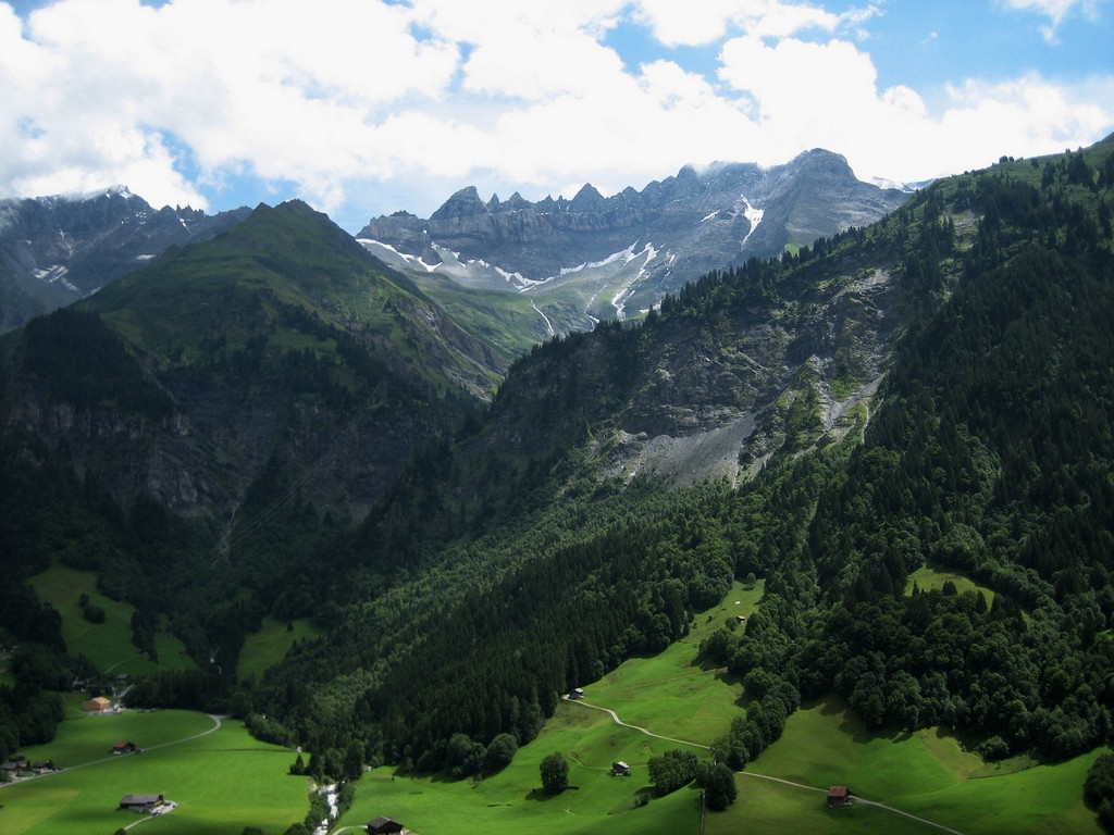
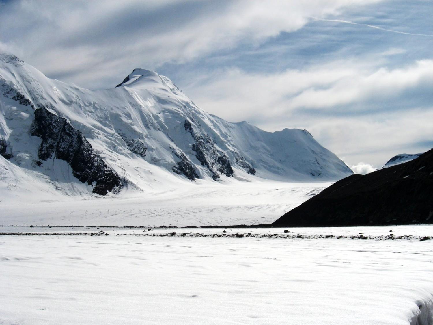
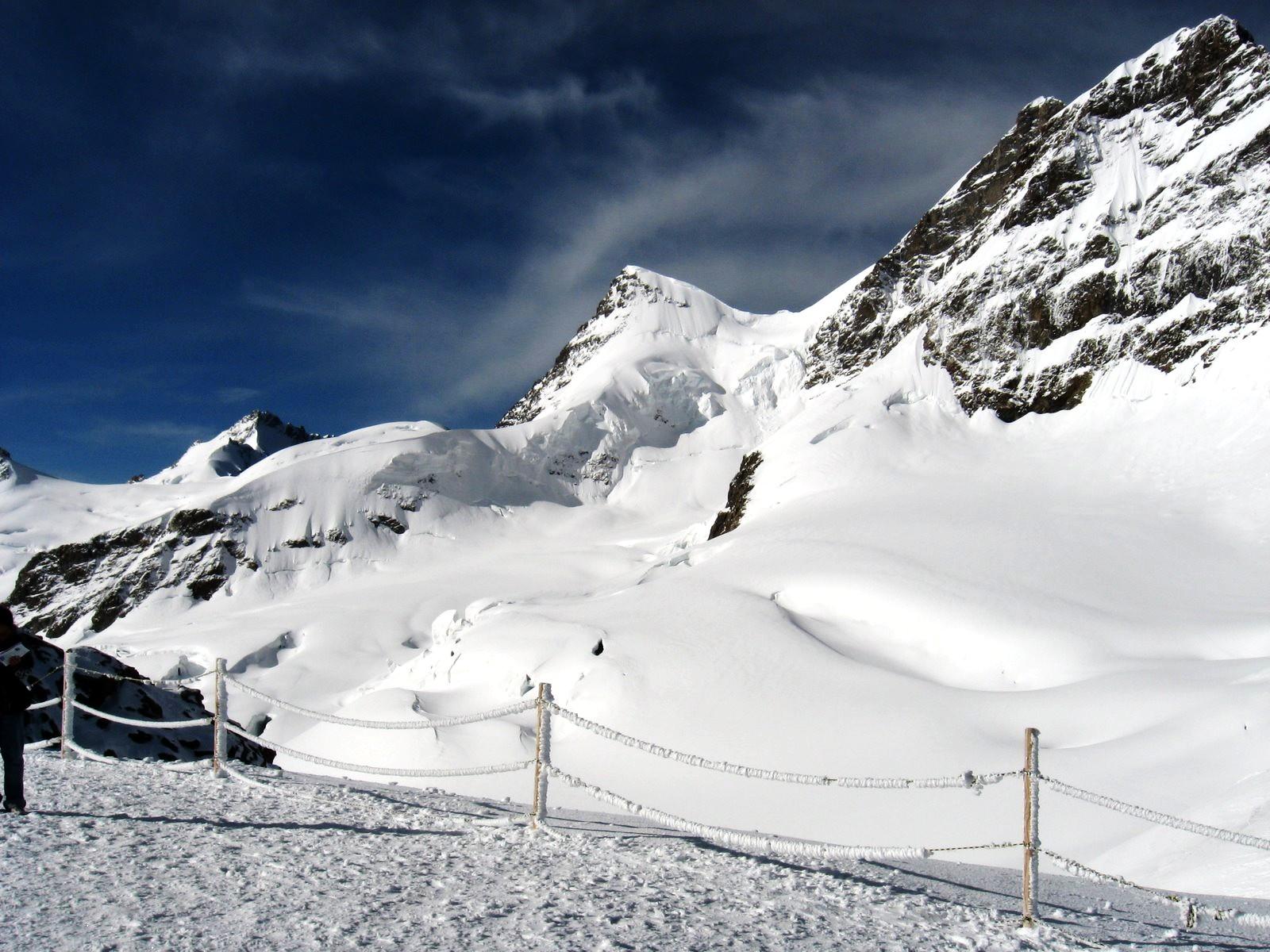
The Swiss Alps form part of a chain of mountains that stretch across southern Europe and isolate Northern Europe from the Mediterranean Sea. Several important passes through the Alps are located in Switzerland, and control of the passes has been important throughout Switzerland's history. The Alps have an average altitude of 1,700 metres (5,600 ft)[8] and cover nearly two thirds of the total surface area. Within the Alps there are 48 mountains that are 4,000 metres (13,000 ft) or higher.
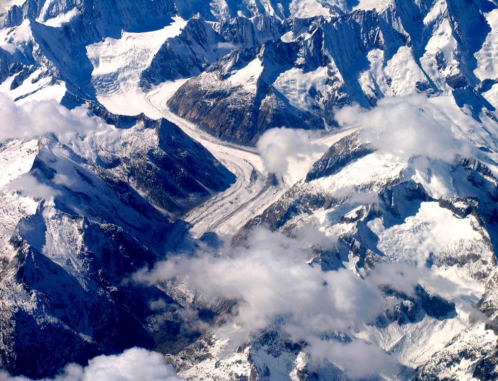
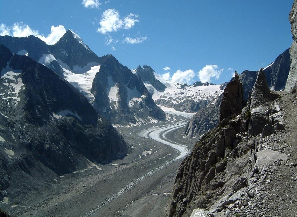
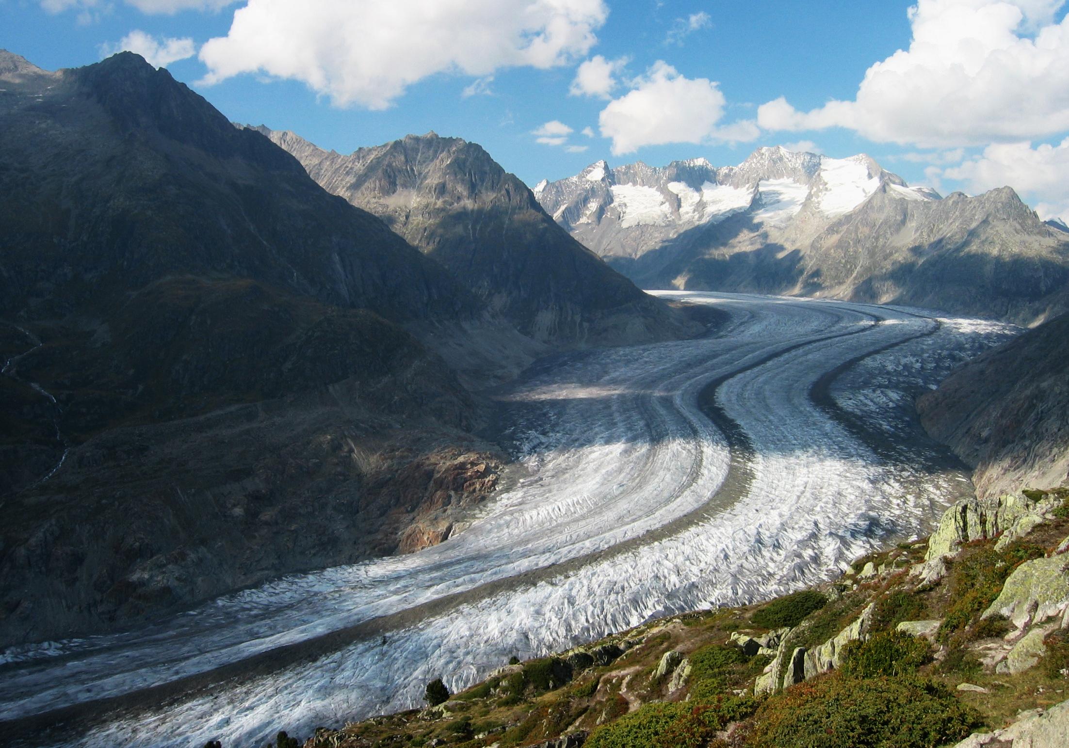
The Alps are the watershed of Western Europe. The Rhine River, together with its tributaries the Aare River and the Thur River drain about two thirds of the water into the North Sea. The Rhone and the Ticino drain about 18% of the water into the Mediterranean Sea. The Inn which becomes the Danube outside of Switzerland drains about 4.4% of the water into the Black Sea.[9] The Swiss Alps also contain many of Central Europe's glaciers. There are about 1,800 glaciers[8] which cover 1,200 square kilometres (460 sq mi) of the total glaciated area of the Alps.
The Alps are a popular tourist destination and are one of the most recognizable symbols of Switzerland. The tallest point in Switzerland, Monte Rosa (4,634 metres (15,203 ft)) in Canton Valais, is located in the Alps as is tallest mountain wholly in Switzerland, the Dom (4,545 metres (14,911 ft)). One of the most recognizable symbols of Switzerland, the Matterhorn is also located in the Alps. The Matterhorn (4,478 metres (14,692 ft)) is the seventh highest peak in the Swiss Alps and is the most photographed mountain in Switzerland. The tallest mountain in the northern outlier[6] or Bernese Alps is the Finsteraarhorn (4,274 metres (14,022 ft).
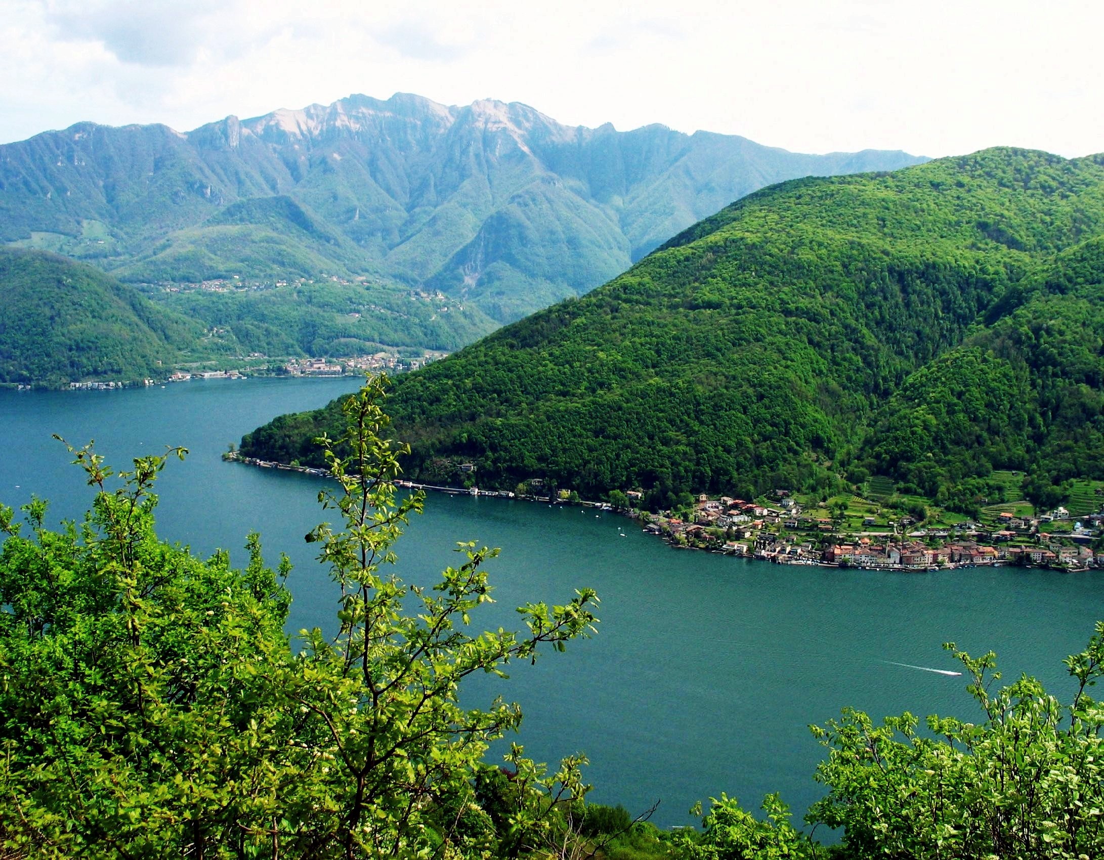
On the south face of the Alps is the canton of Ticino which is split geographically in two parts by the Monte Ceneri pass. The northern, more mountainous part, called Sopraceneri, is formed by the two major Swiss valleys around the lake Maggiore: Ticino valley and Maggia valley. The southern part, called Sottoceneri, is the region around the Lake Lugano. The lowest point in Switzerland is on Lake Maggiore (177 metres (581 ft)).[6]
Jura
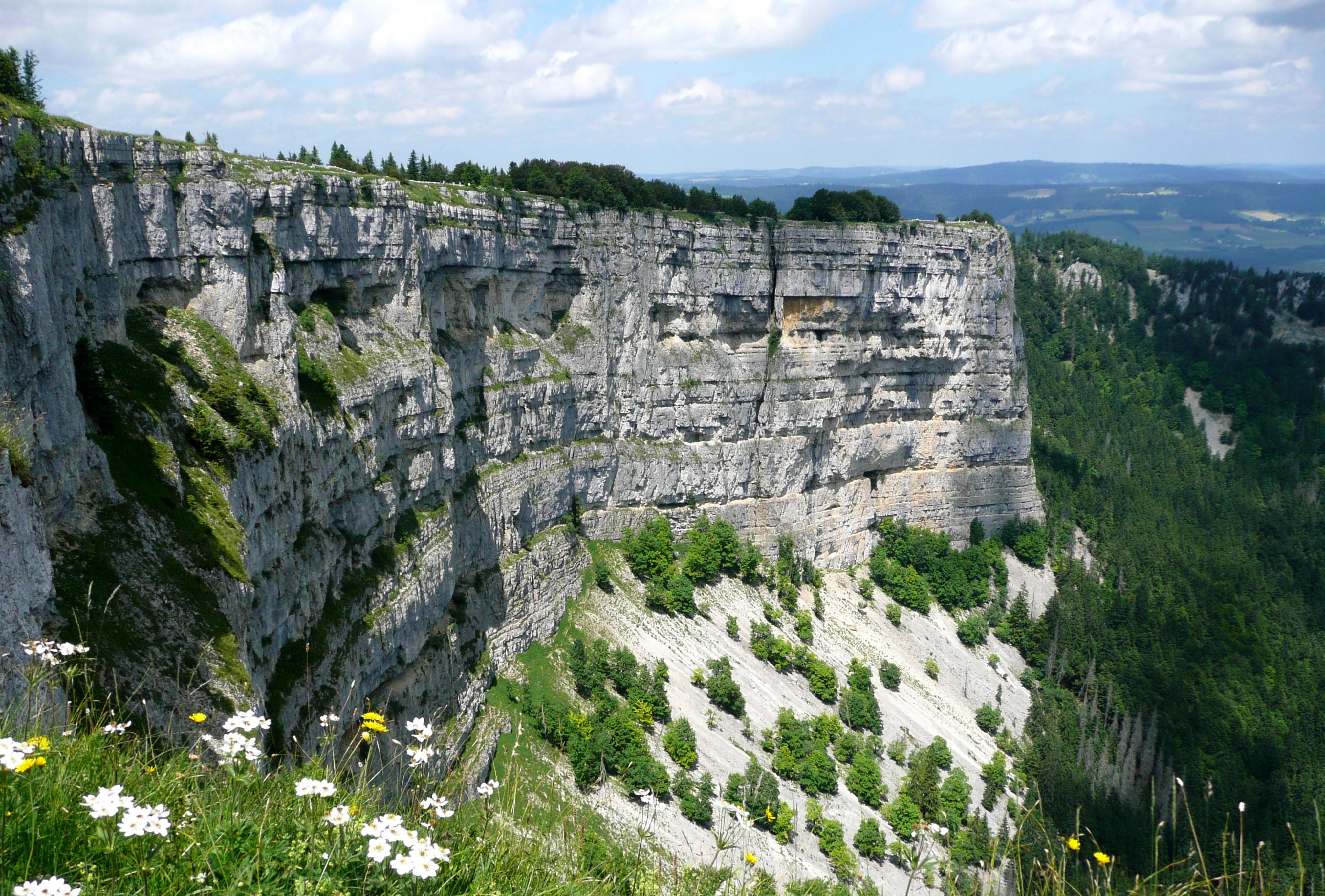
See also: Jura Mountains Creux du Van in Canton Neuchatel showing the limestone layers visible in the Jura Mountains
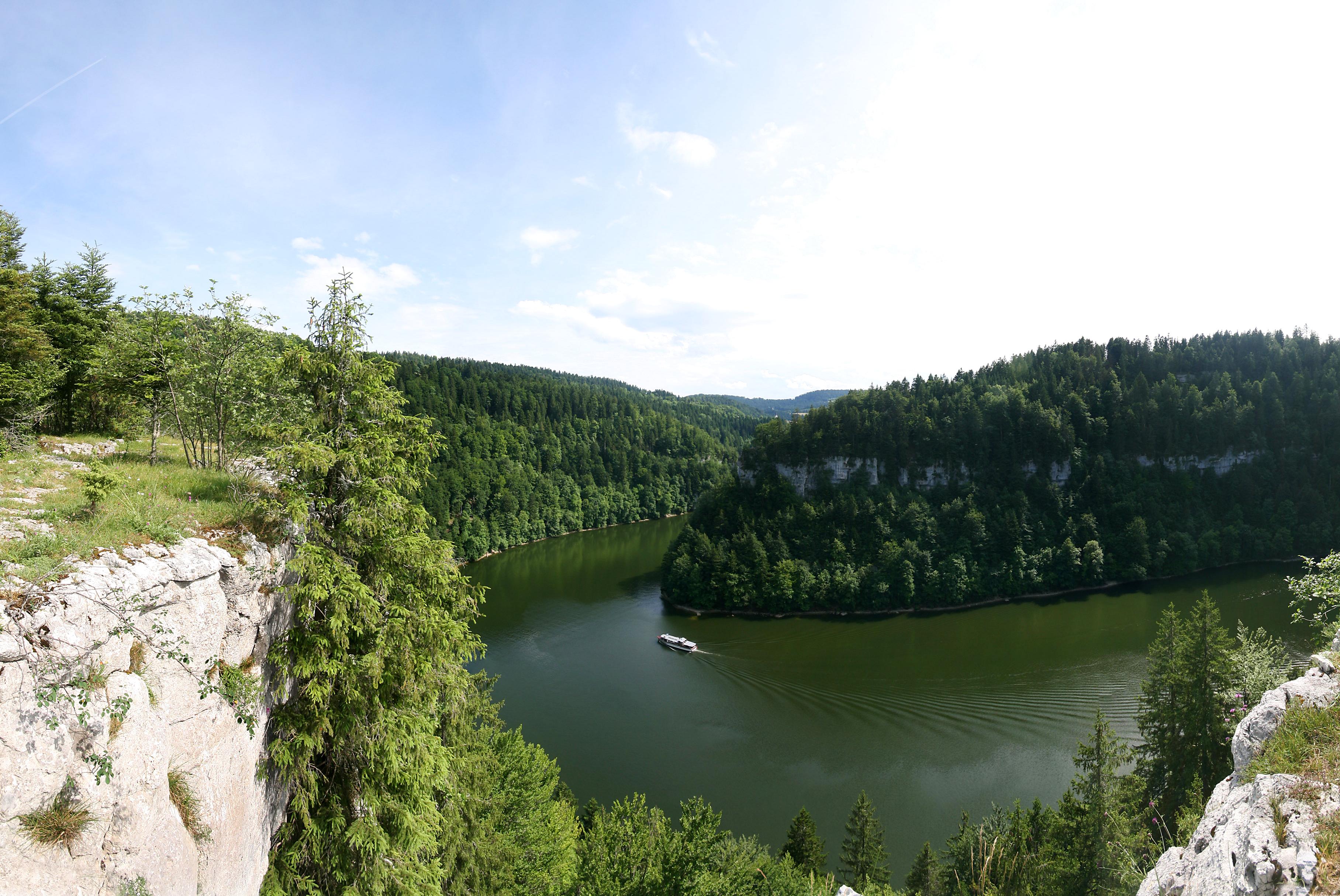
The Jura is a limestone range running from Lake Geneva to the Rhine river. This area makes up about 12% of Switzerland's land area. Located about 700 metres (2,300 ft) above sea level, this region is characterized by a limestone highland with deep river valleys.
The limestone rock in the Jura is a Jurassic period rock with numerous fossils and dinosaur tracks. The name Jurassic actually refers to the Jura region where these fossils were studied at the end of the 18th century.[10] The Jura is considered one of the most important sites for dinosaur footprints in the world. In one area near the village of Courtedoux, over 1,500 footprints were discovered in between 2002 and 2004 with an estimated 4,000-5,000 footprints still undiscovered.[11]
The range is being continually built up and decreasing in width by mountain building, accommodating the compression from alpine folding as the main Alpine orogenic front moves roughly northwards. The deformation becomes less pervasive away from the younger, more active Alpine mountain building.
Structurally, the Jura consists of a sequence of folds, the formation of which is facilitated by an evaporitic decollement layer. The box folds are still relatively young, and this is evident in that they define the shape of the overlying landscape, meaning that they have not existed long enough to experience erosion and thus are evidence of recent mountain building.
The folds comprise three major (lithological units) bands of building evidenced dated roughly by era: the Malm, Dogger, and Lias (part of the Jurassic Geologic period). Each era of folding represents effects on a previously shallow marine environment as evidenced by beds with particular carbonate sequences, containing abundant bioclasts and oolitic divisions between layers (called horizons).
The highest peak in the Jura range is Le Crêt de la Neige at 1,720 metres (5,640 ft), although previously it was believed to be 1,717.6 metres (5,635 ft). This could be caused by constant Tectonic Plate movements making such mountain ranges go higher.
Hydrology
Main article: Hydrology of Switzerland Many rivers, such as the Aar, take their source from the Alpine glaciers
Switzerland has 6 % of all freshwater reserves in Europe. The country shares five river basins and some of the largest lakes in western Europe with its neighbours. It is the source of several major European rivers that ultimately flow into the North Sea (Rhine), into the Mediterranean Sea (Rhone), into the Black Sea (Inn, through the Danube) and into the Adriatic Sea (Ticino, through the Po and Rom through the Adige).
Most of the great Swiss rivers, being in their origin mere mountain torrents, tend to overflow their banks, and hence much has been done to prevent this by embanking them, and regaining arable land from them. So the Rhine (between Bad Ragaz and Lake Constance), the Rhone, the Aar, the Reuss; and in particular the great work on the Linth (1807-1816) carried out by Hans Conrad Escher, who earned by his success the surname of "Von der Linth", and on the Zihl near the lakes of Neuchâtel and Biel, while the diversion of the Kander from its junction with the Aar to a channel by which it flows into Lake Thun was effected as early as 1714.
 The Rhone entering Lake Geneva
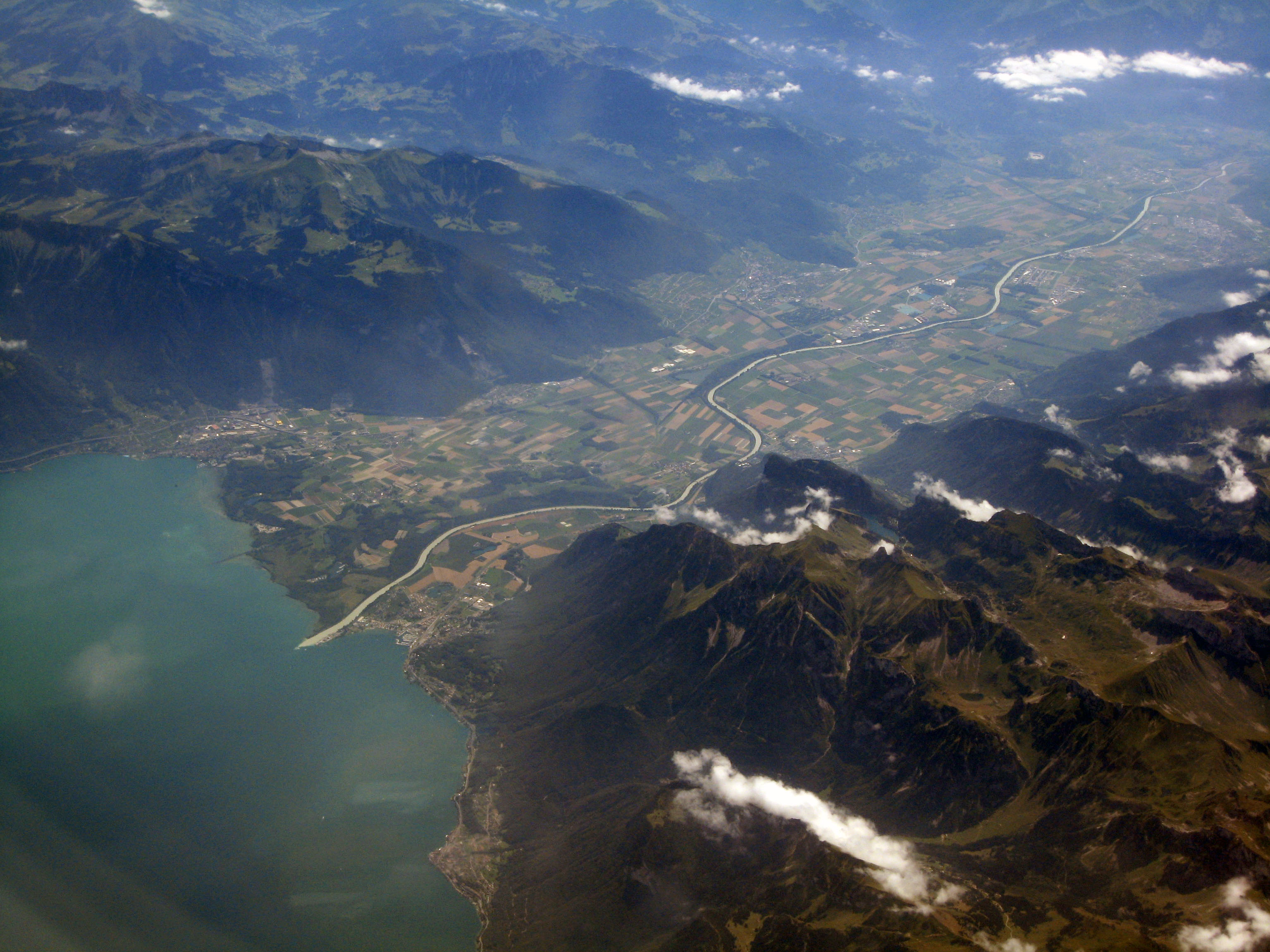
Switzerland has considerable reserves of groundwater and a large number of lakes, large and small, can be found in most areas. The two most extensive, those of Geneva and of Constance, balance each other, as it were, at the south-west and north-east corners of the land. But neither of these is wholly Swiss, this distinction being claimed by the next in size, that of Neuchâtel, Lake Maggiore (partly Swiss only) coming next in the list, and being followed by the wholly Swiss lakes of Lucerne and of Zurich. Then come Lake Lugano, Lake Thun, Lake Biel, Lake Zug, Lake Brienz, Lake Morat, Lake Walenstadt, and Lake Sempach. These fourteen only are over 4 sq. m. in extent. Eleven of them are in the Rhine basin (also in that of the Aar), two (Maggiore and Lugano) in that of the Po, and one (Geneva) in that of the Rhone. There are no large lakes in the Swiss portion of the Inn basin, the most extensive being that of Sils. Smaller Alpine lakes such as the Oeschinensee are innumerable, and often constitute popular tourist destination. Since the twentieth century a large number of dams have been built in the Alps and elsewhere, resulting in many artificial lakes. The largest is the Sihlsee (and fifteenth largest of all Swiss lakes) on the river Sihl, south of Lake Zurich.
In total, lakes and reservoirs contain 50 % of the stored water, glaciers 28 %, groundwater 20 % and rivers 2 %.[12]
Climate

 Climatic diversity between the regions of Centovalli (Ticino) and Appenzell (Northeastern Switzerland)
In Switzerland, where the height above sea-level ranges from 193 metres (Lake Maggiore) to 4,634 metres (Monte Rosa), many climates are naturally found, from the regions of olives, vines, oaks and beeches, pines and firs, to those of the high mountain pastures, rhododendrons, and of eternal snow.
In most inhabited regions of Switzerland, at lower altitudes, the weather is generally moderate. On the plateau, freezing temperatures generally occur during December-early March[13] with an average temperature of 9 °C (48.2 °F) for elevations between 500–600 metres (1,640–1,969 ft). On the Plateau the average precipitation is 1,000 millimetres (39 in) with a range of about 800–1,300 millimetres (31.5–51.2 in).[1] The higher elevations of the Jura and the Alps naturally cause lower temperatures and in the high Alps glaciers exist. The Jura and foothills (both north and south of the Alps) typically have more precipitation, with an average of 1,200–1,600 millimetres (47.2–63.0 in), while the high Alps may have over 2,500 millimetres (98.4 in).[1] Ticino, on the south side of the Alps, has sub-tropical vegetation and is usually 2°C - 4°C (3.6°F - 7.2°F) warmer, and wetter than the Swiss Plateau.
In the Köppen climate classification, the Swiss Plateau is classed as Maritime Temperate or Oceanic climate (Cfb) and the Alps are considered Tundra climates or (ET). A maritime temperate area will have changeable, often overcast weather. Summers are cool due to cloud cover and winters are milder than expected due to latitude. The Jura will be slightly cooler due to higher altitude. Within the Alps, temperatures and snow fall correlate to altitude.
Place Altitude of meteorological station (m) Average rainfall (mm per year) Average sunshine in August (%) Average sunshine in December (%) Average maximum temperature in July (°C) Average minimum temperature in January (°C) La Chaux-de-Fonds (Jura) 1018 1410 40 40 +19.6 -6.4 Bern (Swiss plateau) 565 1040 50 20 +23.5 -3.9 Sion (Valais) 482 600 60 50 +25.7 -4.8 Säntis (Eastern Switzerland, prealps) 2490 2900 55 30 +7.5 -10.3 Locarno-Monti (Ticino) 366 1850 60 60 +25.9 +0.1 - Climatic diversity (Period between 1961 and 1990).[14]
Political divisions and greater regions
See also: Subdivisions of SwitzerlandAs a federal state, Switzerland is composed of 26 cantons, which are further divided into districts and municipalities. Each canton was a fully sovereign state[15] with its own borders, army and currency from the Treaty of Westphalia (1648) until the establishment of the Swiss federal state in 1848. There are considerable differences between the individual cantons, most particularly in terms of population and geographical area; hence seven larger and more homogeneous regions have been defined. They do not, however, constitute administrative units and are mostly used for statistical and economical purposes.[16]
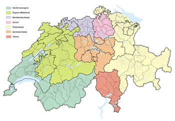
Regions Cantons Regions Cantons Northwestern
SwitzerlandAargau Central
SwitzerlandLucerne Basel-Landschaft Nidwalden Basel-Stadt Obwalden Espace
MittellandBern Schwyz Fribourg Uri Jura Zug Neuchâtel Eastern
SwitzerlandAppenzell Ausserrhoden Solothurn Appenzell Innerrhoden Lake Geneva Geneva Glarus Valais Graubünden Vaud Schaffhausen Zurich Zurich St. Gallen Ticino Ticino Thurgau Land use
Land use
Source: FSO (1992–1997)[17]Main areas Surface
(in %)Land use Surface
(in ha)Surfaces of housing and infrastructure 6,8 Building areas 137,564 Industrial areas 20,233 Special infrastructure areas 16,111 Green spaces and recreation areas 15,860 Transportation areas 89,329 Agricultural land 36,9 Orchards, vineyards, horticulture 60,956 Arable land, local pastures 926,378 Alpine pastures 537,802 Forests 30,8 Forest 1,102,160 Scrub forests 60,514 Other woodlands 108,978 Unproductive areas 25,5 Lakes 142,234 Rivers 31,724 Unproductive vegetation 263,051 Unvegetated surfaces 615,597 The Swiss territory is divided into four major types of land use. As of 2001[update], 36.9%[18] of the land in Switzerland was used for farming. 30.8% of the country is covered with forests and woodlands,[18] with an additional 6.8% covered with houses or buildings.[1] About one-fourth (25.5%) of the country is either mountains, lakes or rivers and can not be used.[1]
Surfaces of housing and infrastructure
The habitat is mainly developed in the Swiss Plateau and the northern slopes of the Alps, near lakes and along major rivers. It occupies 14.6% of the Plateau, the Jura (7.4%), the southern (4.3%) and the northern Alps (4%), and finally the western central Alps (2.9%) and Eastern Alps (1.6%).
Habitat areas and infrastructure grow around the urban areas but also in the countryside, at the expense of agricultural land. This growth, called Suburbanization, is particularly pronounced along the main transport routes such as motorways and railways. New roads lead to a significant increase in construction activity in the affected regions. Many people who work in the city prefer to live in the countryside to take advantage of cheaper land and better quality of life. This is also reflected in the construction statistics: single-family homes arise mainly in rural areas, multi-family homes in the cities. Household structures are also evolving and tend to become smaller. In twelve years, the area devoted to housing increased by 25% while the increase of the population was only 9%.
Farmland
Although it is declining, agriculture represents the most important use of the territory in Switzerland. Farmlands dominates the Plateau, occupying just over half of the area. The situation is similar in the Jura (44%), on the northern slopes of the Alps (38.2%) and in the eastern Central Alps (31.4%). In the mountainous regions of the western Central Alps (Valais) and in the south, the agricultural areas (mostly pastures) are proportionately lower.
In 1993 it was estimated that 250 square kilometres (97 sq mi) (or about 0.6%) of the entire country was irrigated[4] meaning that most Swiss farms receive enough rainfall to grow.
The protection of forested areas led to numerous conflicts of interests around the farmland, especially on the Plateau and near urban areas where the habitat area development and infrastructure tend to reduce the amount of arable land. Conversely, the number of farms in the mountains tend to decrease, many areas are left for the benefit of woodlands to the detriment of landscape diversity. This decline is particularly marked in Valais and Ticino.
Forests
Forests cover less than a third of the territory, but the area is increasing year by year. The reforestation is essentially natural, mainly in the Alps where the forest areas reoccupy those abandoned by farmers. Afforestation contributes 13% to reforestation, and is conducted for compensation following a clearance or to provide protection against natural hazards in the mountainous areas (avalanches, landslides). Forests are more predominant in the Jura and in the southern Alps, occupying respectively 47.7% and 47.2% of the soil in these regions. On the northern slopes of the Alps, Alpine forest occupy 33.2% and on the Plateau 24.6%. It is in the Central Alps that forest areas occupy less floor with about 22% coverage.
Unproductive areas
The unproductive areas correspond to all areas occupied by rocks, boulders, ice, snow fields and unproductive vegetation beyond the limits of forests. Lakes, rivers and wetlands are also unproductive areas. Occupying 25.5% of Swiss soil, these surfaces are in very slight decline (-0.1% over 10 years). They are predominant in the Central Alps (half of the soil), on the contrary they only cover 10% of the surface of the plateau and 1% of the Swiss Jura. The uncultivated mountain areas are exploited by the tourism and the production of hydroelectricity. Climatic conditions strongly affect the landscape of these areas: water seepage, landslides, avalanches, torrents in spate. Man intervenes on 0.2% of this surface area to create infrastructure protecting against floods or avalanches. The channels of communication, with many works of art occupy a portion of these surfaces.
In the plains, lakes and streams near areas of habitat are used for recreation and relaxation. Habitats, damp or dry, and nature reserves are managed and these areas contribute to maintain biodiversity.
Population
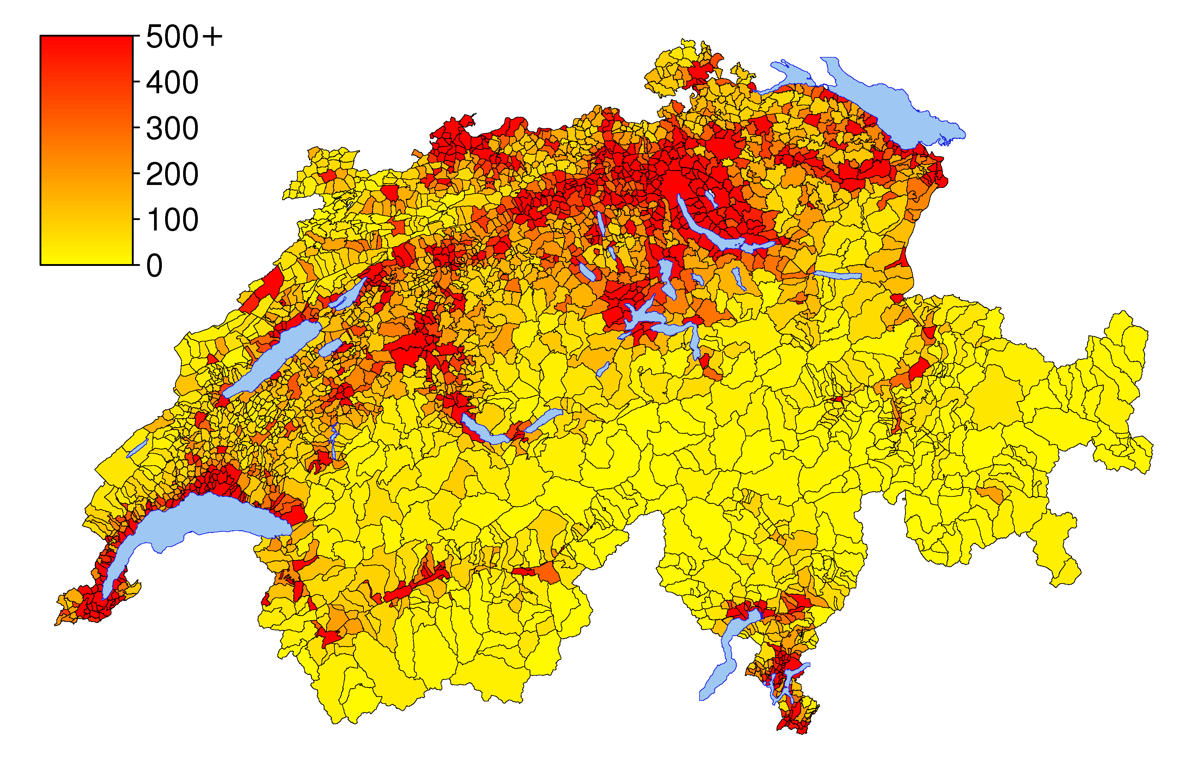
Main article: Demographics of Switzerland Density of population by municipality (2007)
The population of Switzerland is heavily urbanised. In 2009, 74% of the 7,785,800 inhabitants lived in urban areas. The distribution of population is shaped by the topography of the country, the plateau being the most populous area and including the major cities of Switzerland. With a population density of 450 inhabitants per km2, it is one of the most densely populated region in Europe. There are large disparities of population densities between the cantons lying in the plateau and those lying in the Alps. Thus, the population densities of the cantons of Lucerne, Solothurn and Zurich are respectively 261.0, 319.7 and 813.6 inhabitants per km2. On the other hand, the cantons of Uri and Graubünden are experiencing very low population densities, respectively 33.4 and 27.0 inhabitants per km2. In the southern Alps, the canton of Ticino is also experiencing a population density less than the national average, with 122.5 against 194.7 inhab/km2.[19]
Environment

With the delicate alpine and glacial environments making up a significant portion of the country and providing a major industry, Switzerland has been concerned with environmental issues. Some of the main issues are listed below.
Air
The main environmental issues in Switzerland's air is air pollution from vehicle emissions and open-air burning as well as acid rain.[4] In 2004, the average amount of Carbon Dioxide (CO2) emission per resident was 6 tonnes (6.6 short tons; 5.9 long tons)[18] and in 2005 was 6.2 tonnes (6.8 short tons; 6.1 long tons).[20] With these numbers, Switzerland is 31st to 33rd among the 45 nations listed by United Nations Millennium Development Goals Indicators as developed nations and 69th worldwide.[20] Switzerland expects by 2010 to reduce their total greenhouse gas emissions by 8% to 10% over emissions in 1990.[1]
The population (as of 2005[update]) uses 3.76 Tonne of oil equivalent per person per year, of which 43.7% comes from petroleum and 19% from nuclear power.[18]
Water
The major water issue in Switzerland is water pollution from the increased use of agricultural fertilizers as well as hydrocarbon pollution from transport and industry.[4] While improvements have been made, there are still issues with eutrophication (an increase in nitrogen and phosphates) in many lakes in the Swiss Plateau.[1]
The total renewable water resources of Switzerland, as of 2005[update], is 53.3 km3 (1.17×10¹³ imp gal; 1.41×10¹³ US gal).[4] Of which the total freshwater withdrawal is 2.5 km3 (5.5×10¹¹ imp gal; 6.6×10¹¹ US gal) per year. This breaks down to a per capita freshwater withdrawal of 348 m3 (77,000 imp gal; 92,000 US gal) per year. Of that water (as of 2002[update]), 24% is used for in households, 74% in industry and only 2% is used for agriculture.[4]
Biodiversity
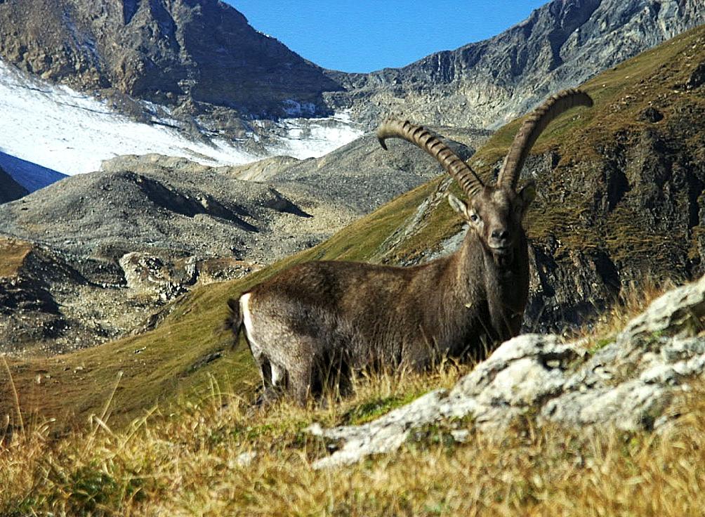
 An alpine ibex in the Lötschental
Switzerland is facing a loss of biodiversity.[4] While the country is quite small, the wide range of climates allow a variety of organisms to flourish. There are about 50,000 animal and plant species living in Switzerland.[1] While most species that live on north and south foothills of the Alps are generally doing well, the Swiss Plateau is seeing a decrease in many species. The pressure from city and agricultural growth is reducing or eliminating the habitat of many species that once flourished along the plateau. There are about 60 species that are considered endangered that live in Switzerland.[1] To help offset this, 28.6% of the country is set aside as a protected natural area.[20]
International agreements
Party to:
- Air Pollution
- Air Pollution-Nitrogen Oxides
- Air Pollution-Sulphur 85, Air Pollution-Sulphur 94
- Air Pollution-Volatile Organic Compounds
- Air Pollution-Persistent Organic Pollutants
- Antarctic Treaty
- Biodiversity
- Climate Change
- Desertification
- Endangered Species
- Environmental Modification
- Hazardous Wastes
- Marine Dumping
- Marine Life Conservation
- Nuclear Test Ban
- Ozone Layer Protection
- Ship Pollution
- Tropical Timber 83
- Tropical Timber 94
- Wetlands
- Whaling
Signed, but not ratified:
Area and boundaries
Area:
total: 41,290 km2 (15,940 sq mi)
land: 39,770 km2 (15,360 sq mi)
water: 1,520 km2 (590 sq mi)Land boundaries:
Country km mi Cantons Italy 734.2 460 Valais, Ticino, Graubünden France 571.8 356 Basel-City, Basel-Country, Solothurn, Jura, Neuchâtel, Vaud, Canton of Geneva, Valais Germany 345.7 208 Basel-City, Basel-Country, Aargau, Zurich, Schaffhausen, Thurgau, St. Gallen Austria 165.1 102 St. Gallen, Graubünden Liechtenstein 41.1 25 St. Gallen, Graubünden Total 1852 1,151 the ones mentioned above Elevation extremes:
lowest point: Lake Maggiore: 193 m (633 ft)
highest point: Monte Rosa: 4,634 m (15,203 ft)See also: Extreme points of Switzerland
Western or Central Europe?
International Geographical Union at a conference (1994) in Prague included Switzerland to Central Europe.[21]
While defined as a Central European country, Switzerland is viewed by the United Nations and some other institutions as being part of Western Europe.[22] However, it is United Nations which proposed the term Central Europe in 1996 [23] After the Autumn of the Nations there is no universally accepted subdivision of Europe and the issue how to name and define the Central European region is subject to debates. The United Nations Statistics division and the National Geographic Society locate Switzerland (along with Austria on the east) among the nations of Western Europe. The World Factbook and various encyclopaedias such as Britannica, Encarta, Meyers grosses Taschenlexikon, Encyclopaedia Larousse and Columbia locate the country in the westernmost part of Central Europe. Switzerland also belongs to the region named Mitteleuropa (from German: Middle Europe). Both terms have not merely a geographical meaning; but also a cultural and a political one.
Geographically, Switzerland is situated approximately 15 degrees of longitude away from the extreme west of continental Europe and 50 degrees away from the Ural Mountains, which form the eastern border of the continent.
Natural World Heritage Sites
Topography
- List of mountain passes in Switzerland
- List of mountain ranges in Switzerland
- List of mountains in Switzerland
- List of rivers of Switzerland
See also
- Geography of the Alps
- Swiss cartography
- Valleys of the Alps
- Little Switzerland (landscape)
Notes
References
- ^ a b c d e f g h i Bundesamt fur Statistik (Federal Department of Statistics) (2009). "Land and Environment (Raum und Umwelt: Panorama)". http://www.bfs.admin.ch/bfs/portal/de/index/themen/02/01/pan.html. Retrieved 2009-09-25. (German) (French)
- ^ Switzerland: Statistical information
- ^ a b Swiss Federal Statistics Office, in German
- ^ a b c d e f g h CIA - The World Factbook - Switzerland
- ^ a b The Swiss Plateau - Switzerland - Information
- ^ a b c "Switzerland". Encyclopædia Britannica. 26. 1911. pp. 239–40. http://en.wikisource.org/wiki/1911_Encyclop%C3%A6dia_Britannica/Switzerland/Geography. Retrieved 2008-11-12.
- ^ Swiss Federal Statistics Office Map (German)
- ^ a b The Alps - Switzerland - Information
- ^ Geography of Switzerland
- ^ The Jura - Switzerland - Information
- ^ Swissinfo article, August 26, 2004
- ^ Switzerland National Report, Convention on Protection and Use of Transboundary Watercourses and International Lakes. unece.org
- ^ Weather - Switzerland Tourism
- ^ Cartes et diagrammes, pp. 14 - 15, Atlas mondial suisse, édition 2002, Conférence suisse des directeurs cantonaux de l'instruction publique (CDIP) ISBN 3-292-00232-X
- ^ Cantons, In the Old Confederation until 1798 in German, French and Italian in the online Historical Dictionary of Switzerland.
- ^ Nomenklaturen – Grossregionen admin.ch
- ^ Zustand und Entwicklung der Bodennutzung - Arealstatistik 1979/85 und 1992/97. Bundesamt für Statistik, 2010. Retrieved on 2010-06-03.
- ^ a b c d Bundesamt fur Statistik (Federal Department of Statistics) (2008). "Statistics for Switzerland". http://www.bfs.admin.ch/bfs/portal/de/index/international/laenderportraets/schweiz/blank/kennzahlen.html. Retrieved 2008-12-01. (German)
- ^ Population size and population composition – Data, indicators bfs.admin.ch. Retrieved 2011-04-11
- ^ a b c United Nations Millennium Development Goals Indicators accessed December 2, 2008
- ^ http://www.springerlink.com/content/p4308k60457x3n41/
- ^ Geographical region un.org
- ^ http://www.docstoc.com/docs/53115069/A-Subdivision-of-Europe-into-Larger-Regions-by-Cultural
External links
Geography of Europe Sovereign
states- Albania
- Andorra
- Armenia
- Austria
- Azerbaijan
- Belarus
- Belgium
- Bosnia and Herzegovina
- Bulgaria
- Croatia
- Cyprus
- Czech Republic
- Denmark
- Estonia
- Finland
- France
- Georgia
- Germany
- Greece
- Hungary
- Iceland
- Ireland
- Italy
- Kazakhstan
- Latvia
- Liechtenstein
- Lithuania
- Luxembourg
- Macedonia
- Malta
- Moldova
- Monaco
- Montenegro
- Netherlands
- Norway
- Poland
- Portugal
- Romania
- Russia
- San Marino
- Serbia
- Slovakia
- Slovenia
- Spain
- Sweden
- Switzerland
- Turkey
- Ukraine
- United Kingdom
- (England
- Northern Ireland
- Scotland
- Wales)
- Vatican City
States with limited
recognitionDependencies
and other territories- Åland
- Faroe Islands
- Gibraltar
- Guernsey
- Jan Mayen
- Jersey
- Isle of Man
- Svalbard
Other entities Climate of Europe Sovereign
states- Albania
- Andorra
- Armenia
- Austria
- Azerbaijan
- Belarus
- Belgium
- Bosnia and Herzegovina
- Bulgaria
- Croatia
- Cyprus
- Czech Republic
- Denmark
- Estonia
- Finland
- France
- Georgia
- Germany
- Greece
- Hungary
- Iceland
- Ireland
- Italy
- Kazakhstan
- Latvia
- Liechtenstein
- Lithuania
- Luxembourg
- Macedonia
- Malta
- Moldova
- Monaco
- Montenegro
- Netherlands
- Norway
- Poland
- Portugal
- Romania
- Russia
- San Marino
- Serbia
- Slovakia
- Slovenia
- Spain
- Sweden
- Switzerland
- Turkey
- Ukraine
- United Kingdom
- (England
- Northern Ireland
- Scotland
- Wales)
- Vatican City
States with limited
recognition- Abkhazia
- Kosovo
- Nagorno-Karabakh
- Northern Cyprus
- South Ossetia
- Transnistria
Dependencies
and other territoriesOther entities - European Union
- Sovereign Military Order of Malta
 Switzerland topics
History Early History · Old Confederacy · Reformation · Early Modern Switzerland · Napoleonic era · Restauration · During the World Wars · Modern historyLaw Constitution · Civil Code · Law enforcement · Nationality law · Copyright law · Gun politics · Human rights · LGBT rightsPolitics Geography AreasTopicsCantons · Cities · Extreme points · Lakes · Islands · Rivers · Glaciers · Mountains · Mountain passes · CartographyEconomy SIX Swiss Exchange · Berne eXchange · Swiss franc · Banking (list) · Swiss National Bank · Companies · Energy · Science and technology · Taxation · Tourism · Transport · TelecommunicationsMilitary Demographics Culture Symbols Portal Categories:


Wikimedia Foundation. 2010.