- Ohio Caverns
-
Ohio Caverns 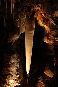
The Crystal King in the CavernsNearest city West Liberty, Ohio Coordinates 40°14′N 83°41′W / 40.233°N 83.683°WCoordinates: 40°14′N 83°41′W / 40.233°N 83.683°W Ohio Caverns is a show cave located 30 miles (48 km) from Dayton, Ohio near West Liberty, in Salem Township, Champaign County, Ohio in the United States. A popular tourist destination and member of the National Caving Association, it is the largest of all the cave systems in Ohio and contains many crystal formations. Approximately 90% of its stalactite and stalagmite formations are still active. The cavern system was originally an aquifer, holding an underground river of melted glacier water. This river eventually receded to lower levels of the ground and is now unseen.
Contents
Formation
The Ohio Caverns are located in the Bellefontaine Outlier, which is an outcropping of Devonian-age bedrock surrounded by Silurian-age carbonates. Most recently it has been proposed[who?] that in post-Devonian times there was a set of active parallel faults that down-dropped a block of Logan County, forming a graben, also called a rift valley.
Continued erosion of several glaciers would have been concentrated on areas around the graben, leaving this area without its protective layer of Bedford shale and more susceptible to erosion. The sunken graben area then became a topographical high, now the highest point in Ohio at the elevation of 1549 feet above sea level.[1]
History
Discovery
The tunnel system known today as the Ohio Caverns was discovered August 17, 1897 by Robert Noffsinger, a seventeen-year-old farmhand who worked on the land. After a heavy rain, Noffsinger found a sinkhole in the woods and, curious, decided to investigate. Noffsinger dug a few feet of soil until he hit the top of the ground’s limestone layer. After finding a crack in the limestone, Noffsinger broke through this rock as well. Immediately feeling the caverns’ 54 °F (12 °C) air, Noffsinger was even more curious. He returned later with an oil lantern and a rope and lowered himself into the ground, making him the first human in the Ohio Caverns.
Mt. Tabor Cave Tours
Noffsinger informed the landowner, a farmer named William Reams, of his discovery. Reams himself explored the cave and then decided to open the cave to the public. Advertised under the name Mt. Tabor Cave Tours, the business brought in hundreds of Ohioans during its 25-year run. These early tourists explored just over .25 miles (0.40 km) of the system but virtually destroyed it by removing crystal formations in that area and writing their names on the walls and ceilings.
Excavation
Reams sold the land in 1922 to two brothers, Allen and Ira Smith, who hired an unknown number of workers to help them excavate the rest of the caverns. The team spent three years digging with an array of spades and shovels to remove mud left in the tunnels by the underground river that eroded the tunnels. As they went, the Smith team strung 60-watt light bulbs from the walls and ceilings to help them see. These lights were powered by a Fordson tractor on the surface, as the area did not get electricity until the mid-1930s.
Four new exits were dug, one of which contained a horse-drawn wooden freight elevator. The group mapped approximately 3.5 miles (5.6 km) of tunnel and decided on the best route for a one-way tour. They closed one of the exits permanently with a crude rock wall and planted a tree over it. The elevator also was filled in with rocks, and a concrete wall in the cave now seals it shut. Keeping the style of entrance that Reams had used, iron doors were built at the two ends of the new tour route. A small entrance building was built over one end of the route, and 38 steps descend from the ground floor of the building through the basement and into the cave, 35 feet (11 m) below the surface. At the other end, a single flight of 60 concrete stairs was built. Reams' iron door and the current exit door have developed holes large enough for bats to enter the cave, and today some little brown bats and eastern pipistrelles take shelter in the cave, primarily in the winter.
The Ohio Caverns
The excavation team laid gravel in the pathways they had dug. The Smith family opened their business as the Ohio Caverns in 1925 with a 1 mile (1.6 km) guided tour route that did not include the .25-mile (0.40 km) section that Reams’ early visitors had explored and ravaged.
The rest of the twentieth century brought several changes for the caverns and park. On the surface, two picnic shelters, a dining hall (which has since been converted to a storage building), a playground, a restroom building, and a steel barn were built. Later, a small exit building was built to increase security at the exit stairwell, and the entrance building was renovated to now include a gift shop and a new basement containing offices and storage. In the cave, concrete was hand-laid on the floors in the 1970s. A professional cave lighter, whose team hid the new lights in concrete sconces in more creative and less obstructive places than the previous bare bulbs, was hired in the 1980s.
The Historical Tour
To celebrate the 100 year anniversary of Noffsinger’s discovery of the cave, the Ohio Caverns opened its Historical Tour in 1997. Reams' section of the cave was adorned with the bare bulbs and gravel floors of the early Ohio Caverns tours. The Historical Section was added as a 45-minute extension to the regular tour, and the Historical Tour has been offered as an option ever since.
Attractions
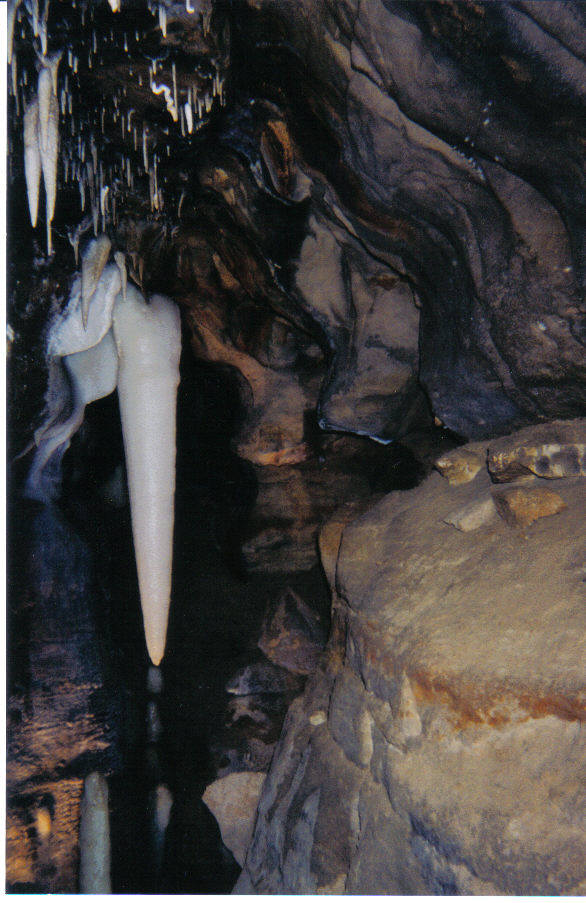
The Crystal Sea and Natural Bridge
The Crystal Sea is an artificial water-retention pool that holds excess water out of the walkway. Only about 1-inch (25 mm) deep, its name is derived from the reflection of the ceiling visible in the water. The Crystal Sea is very close to the site of the freight elevator used from 1922 to 1925 and is also close to a mud shelf above the pathway called the Natural Bridge, which holds between 10 and 20 crystal columns and is the original floor of the tunnel. The Smiths’ team left the columns intact during excavation and simply dug under them, forming the Natural Bridge.
Fantasy Land and The Old Town Pump
 The Old Town Pump
Fantasy Land holds more soda straws and helictites than any other area of the Ohio Caverns. It is called Fantasy Land for the many named formations in the room, one of which being The Old Town Pump, which resembles a hand pump. The Crystal King is also in Fantasy Land.
The Crystal King and Deepest Point
 The Crystal King
The Crystal King is the largest free-hanging stalactite in Ohio.[citation needed] At last measurement,[when?] the Crystal King was 4-foot-10.5-inch (1.486 m) long. It is estimated to weigh over 400 pounds (180 kg) and be over 200,000 years old. It is also noteworthy that the Crystal King and Fantasy Land are farther from the surface than any other point of the cave. The designated Deepest Point is 103 feet (31 m) underground.
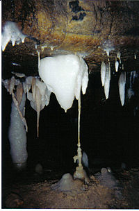
The Big Room and The Good Luck Crystal
The Big Room, at more than .5 acres (0.20 ha), is the largest room in the cave and holds hundreds of formations, including the tallest column, which is just over 5 ft (1.5 m) tall, and the newest column, which came together in the 1980s. The next column that will be formed in the caverns is also in The Big Room, and it is estimated to be formed within the next century. During the early days of the Smiths’ tours, touching formations was not prohibited, and there are many formations in the Big Room that are very close to the pathways and have therefore become permanently stained from the dirt and oil in human hands. One such formation, a 5-foot (1.5 m) tall stalagmite once called The Good Luck Crystal, was touched for "good luck" by almost every person who came through the Ohio Caverns for years until the staff noticed the developing brown stain. A no-touching rule has been enforced since, and The Good Luck Crystal has been renamed The Dirty Crystal.
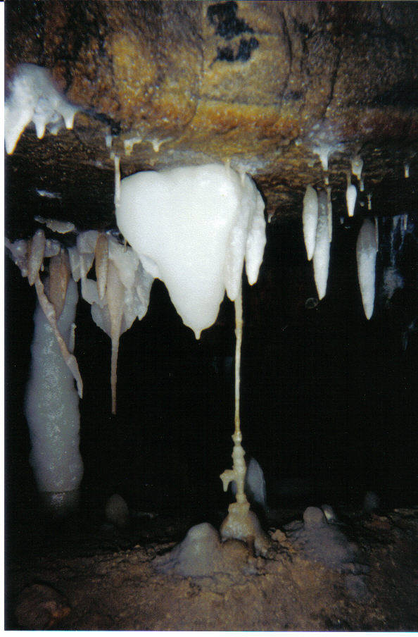
The Palace of the Gods and Dual Formations
The Palace of the Gods is the most photographed room in the caverns because of its variety of colors and formations.[citation needed] There are examples of every type of formation in the cave: iron oxide formations; manganese dioxide formations; calcite formations: stalactites, stalagmites, columns, flowstone, soda straws, and helictites; and Dual Formations. Dual Formations are extremely rare, and the Ohio Caverns is the only cave in North America and one of very few in the world known to have Dual Formations. A Dual Formation is characterized as being a formation growing on another formation. In the Palace of the Gods, there are calcite stalactites growing on the ends of iron oxide formations.
The Jewel Room
The Jewel Room once helped earn Ohio Caverns the nickname "America’s Most Colorful Cavern".[citation needed] Its color is split down the middle of the room so that one side of the room is primarily decorated in iron oxide while the other side is darker from manganese dioxide deposits. The Jewel Room was the last area finished by the Smith team and is therefore the end of the tour. There is an enormous pile in the Jewel Room of rocks from the construction of the exit stairway. At the end of each guided tour, a recording of the song Beautiful Ohio has been played since 1928.
The Historic Section
A tour of the Historic Section, also known as The Old Cave and Reams’ Cave, has been offered since 1997 as an extension of the regular tour. Unlike the concrete floors and hidden-sconce lights in the rest of the cave, there are bare light bulbs and gravel floors similar to the early years of Ohio Caverns tours. Attractions in the Historic Section include The Palace of Natural Art, a colorful natural rotunda; The Giant’s Coffin, a rock nicknamed so by Reams’ early tourists; and The Pulpit, which crudely resembles a church setting and even has an upright-standing rock that resembles a pulpit. Also in the Historic Section are several small crawling areas, including Lovers’ Lane and The Backscratcher, which were explored by Reams and his visitors but not excavated by the Smiths’ team. The Historic Section has very few speleothems because most of them were taken as souvenirs between 1897 and 1922, so its main commercial appeals are its color and graffiti.
References
- ^ Sprowls, K.M. Ground water pollution potential of Logan County, Ohio, Ground Water Pollution Potential Report 36. Columbus: Ohio Department of Natural Resources, 1995, 23-29.
External links
Categories:- Caves of Ohio
- Geography of Champaign County, Ohio
- Show caves in the United States
- Landmarks in Ohio
- Visitor attractions in Champaign County, Ohio

Wikimedia Foundation. 2010.