- Aghalee
Infobox Place Ireland
name = Aghalee
irish = Achadh Lí
scots =
crest
motto =
map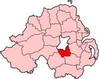
pin coords = left: 130px; top: 95px
north coord = 54.520235| west coord = 6.2711334
area = | elevation =
province =Ulster
county =County Armagh
NI district = Craigavon Borough
UK constituency = Upper Bann
EU constituency = Northern Ireland
stdcode = 028, +44 28
posttown =Craigavon
postcode = BT67
population = 774
census yr = 2001
web =
|Aghalee (derive|Irish|Acheli|field of the calves) is a small
village inCounty Antrim ,Northern Ireland . It is situated three miles from the south-east corner ofLough Neagh on the main road betweenLurgan and Antrim and about 13 kilometres to the west ofLisburn . The village is attractively placed on the steep, wooded slopes of Friary Glen, and is situated beside the now disused Lagan Navigational Canal. In the 2001 Census, Aghalee had a population of 774 people.Aghalee has a wide range of facilities including several places of worship, a community hall and several shops including a post office. The village contains a vocational training centre, a nursing home, telephone exchange, day nursery, doctor’s surgery and chemist. An
Ulsterbus service runs to and from Aghalee to Lisburn andBelfast .Although sometimes regarded as being part of
Craigavon inCounty Armagh due to its 'BT67' postcode, the village is inCounty Antrim sitting in the LisburnSTD code area (formerly 01846), with local numbers commencing '9265 xxxx'.History
Much of the early development of Aghalee was due to its strategic location beside the Lagan Navigational Canal which opened at the end of the 18th century. The village became a distribution centre for the surrounding area and developed as an important lock station on the Lagan Navigation, as it was one of the last sizeable settlements before the canal entered Lough Neagh. While the canal operated, trade continued on a significant scale. When the canal finally ceased to operate in 1954, the area began to decline in commercial importance. The population of the settlement decreased considerably in the latter part of the 19th century and the first part of the 20th century.
The village retains many of the 18th century structures and buildings belonging to the canal. From the 1970s Aghalee developed as a commuter area for Belfast and Craigavon and this was accompanied by significant population growth. In recent times, development has occurred on the lands to the west of the village core.
Aghalee is remembered in the Orange song, 'The Aghalee Heroes'.
2001 Census
Aghalee is classified as a Small Village or Hamlet by the [http://www.nisra.gov.uk/ NI Statistics and Research Agency (NISRA)] (ie with population between 500 and 1,000 people). On Census day (
29 April 2001 ) there were 774 people living in Aghalee. Of these:
*26.0% were aged under 16 years and 8.8% were aged 60 and over
*51.2% of the population were male and 48.8% were female
*10.6% were from aCatholic background and 85.0% were from a Protestant background
*2.7% of people aged 16-74 were unemployedFor more details see: [http://www.ninis.nisra.gov.uk/ NI Neighbourhood Information Service]
References
*Draft Belfast Metropolitan Area Plan 2015
External links
* [http://members.lycos.co.uk/aghalee/index.htm Aghalee Website]
* [http://www.clenaghans.com Clenaghans Restaurant and Accommodation]See also
* [http://www.clenaghans.com The local traditional bar restaurant, and accommodation business were Sir John Lavery, the famous artist lived many of years.]
*List of villages in Northern Ireland
*List of towns in Northern Ireland
Wikimedia Foundation. 2010.