- Salmo, British Columbia
Infobox Settlement
official_name = Village of Salmo
other_name =
native_name =
nickname =
settlement_type = Village
motto =
imagesize =
image_caption =
flag_size =
image_
seal_size =
image_shield =
shield_size =
city_logo =
citylogo_size =
mapsize =
map_caption =
mapsize1 =
map_caption1 =
image_dot_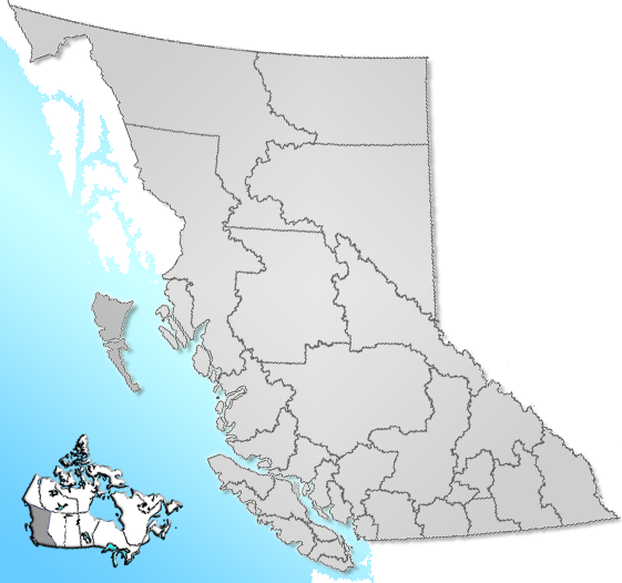
dot_mapsize = 220px
dot_map_caption = Location of Salmo inBritish Columbia
dot_x = 184 |dot_y = 176
pushpin_
pushpin_label_position =
pushpin_map_caption =
pushpin_mapsize =
subdivision_type = Country
subdivision_name = CAN
subdivision_type1 = Province
subdivision_name1 = BC
subdivision_type2 = Region
subdivision_name2 =Kootenays
subdivision_type3 = Regional district
subdivision_name3 = Central Kootenay
subdivision_type4 =
subdivision_name4 =
government_footnotes =
government_type =
leader_title = Governing body
leader_name = Salmo Village Council
leader_title1 =
leader_name1 =
leader_title2 =
leader_name2 =
leader_title3 =
leader_name3 =
leader_title4 =
leader_name4 =
established_title = Incorporated
established_date = 1946
established_title2 =
established_date2 =
established_title3 =
established_date3 =
area_magnitude =
unit_pref =
area_footnotes =
area_total_km2 = 2.38
area_land_km2 =
area_water_km2 =
area_total_sq_mi =
area_land_sq_mi =
area_water_sq_mi =
area_water_percent =
area_urban_km2 =
area_urban_sq_mi =
area_metro_km2 =
area_metro_sq_mi =
area_blank1_title =
area_blank1_km2 =
area_blank1_sq_mi =
population_as_of = 2006
population_footnotes =
population_note =
population_total = 1,007
population_density_km2 =
population_density_sq_mi =
population_metro =
population_density_metro_km2 =
population_density_metro_sq_mi =
population_urban =
population_density_urban_km2 =
population_density_urban_sq_mi =
population_blank1_title =
population_blank1 =
population_density_blank1_km2 =
population_density_blank1_sq_mi =
timezone = PST
utc_offset = -8
timezone_DST =
utc_offset_DST =
latd= 49|latm= 11|lats= 39|latNS=N
longd= 117|longm= 16|longs= 40|longEW=W
elevation_footnotes =
elevation_m = 670
elevation_ft =
postal_code_type =
postal_code =
area_code =
blank_name = Highways
blank_info = 3
6
blank1_name = Waterways
blank1_info =Salmo River
website =
footnotes = Salmo is avillage in theWest Kootenay region of southeasternBritish Columbia ,Canada . It is located in the Salmo River Valley, surrounded by the Selkirk Mountain range.Situated at the junction of the
Crowsnest Highway and Highway 6, Salmo is about a 30 minute drive from the communities of Castlegar, Nelson, and Trail. Salmo is the western terminus of the Salmo-Creston highway constructed in the late 1950s (now Highway 3) as a shortcut to avoid the long route north to Nelson and crossingKootenay Lake by ferry between Balfour and Kootenay Bay.Originally known as Salmon Siding (named for the original name of the
Salmo River , i.e. the Salmon River), the village was founded as a small mining town near theNelson and Fort Sheppard Railway during agold rush in 1896. The name of the town was changed to Salmo to avoid confusion with other places with similar names. When dams were created along theColumbia River in the 1960s and 1970s, Salmo's fish stocks were depleted.It is a quiet community with numerous outdoor activities including hiking, fishing, biking and skiing.
hambhala Music Festival
Since 1997, the quiet community of Salmo tends to get a bit louder with the arrival of the Shambhala Music Festival every August. A growingly popular annual event, Shambhala temporarily transforms the quiet Salmo River Ranch into a haven for all things strange. A free, parallel and even more alternative event, Scumbala, is held nearby at the same time.
External links
* [http://www.salmovillage.ca Village of Salmo]
* [http://www.salmobc.org Salmo Baptist Church]
* [http://www.salmofm.info Salmo FM Community Radio 92.1]
* [http://www.shambhalamusicfestival.com Shambhala Music Festival]
* [http://www.trailrosslandnews.com Trail Rossland News] Newspaper
Wikimedia Foundation. 2010.