- Zrenjanin
-
Zrenjanin
Зрењанин— City — City Hall and monument of king Peter I of Serbia

Coat of armsLocation of the municipality of Zrenjanin within Serbia
Coordinates: 45°22′N 20°23′E / 45.367°N 20.383°E Country Serbia District Central Banat Settlements 22 Government – Mayor Mileta Mihajlov (DS) Area[1] – Municipality 1,324 km2 (511.2 sq mi) Population (2011 census)[2] – Town 79,773 – Municipality 132,051 Time zone CET (UTC+1) – Summer (DST) CEST (UTC+2) Postal code 23000 Area code +381 23 Car plates ZR Website www.zrenjanin.rs  Court House
Zrenjanin (Serbian Cyrillic: Зрењанин, pronounced [zrɛ̌ɲanin]) is a city and municipality located in the eastern part of Serbian province of Vojvodina. It is the administrative centre of the Central Banat District of Serbia. In 2002, the city's population was 79,773, while the Zrenjanin municipality had 132,051 inhabitants.
Zrenjanin is the largest city in the Serbian Banat, the third largest city in Vojvodina (after Novi Sad and Subotica) and the sixth largest city of Serbia.
Contents
Name
The city was named after Žarko Zrenjanin Uča (1902–1942) in honour and remembrance of his name in 1946. He was one of the leaders of the Vojvodinian Communists and Partisans. During World War II, he was imprisoned and released[citation needed] after being tortured by the Nazis for months.[citation needed] Later he was killed while trying to escape from being recaptured. The former Serbian name of the city was Bečkerek (Бечкерек) or Veliki Bečkerek (Велики Бечкерек). In 1935 the city was renamed to Petrovgrad (Петровград) in honor of king Peter I of Serbia.
In Hungarian, the city is known as Nagybecskerek, in German as Großbetschkerek or Betschkerek, in Romanian as Becicherecul Mare or Zrenianin, in Slovak as Zreňanin, in Rusin as Зрењанин, in Croatian as Zrenjanin, and in Turkish as Beştelek (meaning five melons) or Beçkerek.
It is assumed[by whom?][citation needed] that Zrenjanin's original name, Bečkerek/Becskerek, comes from Hungarian word kerek ("forest, grove") and the surname of the 14th century nobleman, Imre Becsei, who had large estates in the area. Therefore the name would be translated into English as "Becsei's Forest". The original name received an adjective meaning "great/big/major" in the languages of the Banat (Serbian: Veliki or Велики, Danube Swabian: Groß, Hungarian: Nagy, Romanian: Mare), to distinguish it from a village of the same name in the Romanian Banat, that is usually referred to as small Bečkerek (cf. Serbian: Mali Bečkerek or Мали Бечкерек, Danube Swabian: Kleinbetschkerek, Romanian: Becicherecu Mic, Hungarian: Kisbecskerek).
History
A Neolithic Tiszapolgár-Bodrogkeresztúr culture necropolis was found in Crna Bara, near Zrenjanin.[3]
The town of (Veliki) Bečkerek / (Nagy) Becskerek was first settled in the 14th century, the first mention of it dates from 1326. The merchant town on the Begej river became a property of the Serbian prince Stefan Lazarević in the 14th century. The town was ruled by the Kingdom of Hungary until 1551 when it was conquered by the Ottoman Empire.
 Mehmed-paša Sokolović, the founder of the vakuf of Bečkerek
The Ottoman army that conquered Bečkerek was led by Mehmed-paša Sokolović, an Ottoman statesman of Serb origin, hence the local Serbs from Bečkerek helped him to conquer the town. After the town fell, Mehmed-paša met with the leaders of local Serbs, and nominated beg Malković for administrator of Bečkerek. As a gratitude to Serbs for their help, Mehmed-paša later (in 1570) turned the town into his vakuf (foundation), built there many beautiful buildings, and granted local autonomy to it. During the Ottoman rule, the town of Bečkerek was divided into two parts (mahalas) - one Serb and another Muslim and was sanjak centre in Province of Temeşvar.
In 1716, Bečkerek was conquered by the Habsburg Monarchy and it developed significantly by Maria Theresia's order of 1769. According to the 1753 data, the town was mostly populated by Serbs and Germans. According to the 1773 data, the population of the town numbered 721 houses, of which 625 were Orthodox Christian, and 96 Roman Catholic. In 1779, Bečkerek became a seat of Torontal county. It was under control of Ottoman troops between 1788-1789 during Ottoman-Habsburg war.
Since great fire destroyed almost whole town in 1807, county seat was temporarly moved to Groß Sankt Nikolaus, until new county building was finished in 1820. Bečkerek got a theatre hall in 1839 and a gymnasium in 1846, as well as City Hall in 1820 and the Palace of Justice in 1908.
During the Revolution of 1848-1849, the town was one of de facto capitals of Serbian Vojvodina, a Serbian autonomous region within Habsburg Empire. Between 1849 and 1860, it was part of a separate Austrian crownland known as the Vojvodina of Serbia and Tamiš Banat. After the abolishment of this province, the town was included into Torontal County, and was the administrative center of this county. After 1867, Bečkerek was located within the Hungarian part of Austria-Hungary. In the beginning of the 20th century, the town was ethnically mixed.
 Small bridge, Reformation church and Court House
 Monument of Žarko Zrenjanin
According to the 1910 census, the city had 26,006 inhabitants, of which 9,148 most frequently spoke Hungarian language, 8,934 Serbian language, 6,811 German language, 456 Slovak language, and 339 Romanian language. The municipal area of the city had 54,715 inhabitants, of which 16,485 most frequently spoke German language, 14,445 Serbian language, 10,581 Romanian language, 8,573 Hungarian language, and 3,265 Slovak language. It is not certain whether Hungarians or Serbs were largest ethnic group in the city in this time, since 1910 census is considered partially inaccurate by most historians because this census did not recorded the population by ethnic origin or mother tongue, but by the "most frequently spoken language", thus the census results overstated the number of Hungarian speakers, since this was official language at the time and many non-Hungarian native speakers stated that they most frequently speak Hungarian language in everyday communication. The city was also home to 1,232 Jews, of whom many were native Hungarian speakers. Another problem is that the city and its municipal area were administered separatelly, thus the total population of the city and its municipal area counted together was 80,721 people, of whom 23,379 most frequently spoke Serbian language, 23,296 German language, 17,721 Hungarian language, 10,920 Romanian language, and 3,721 Slovak language.
After World War I, the city became part of the Kingdom of Serbs, Croats and Slovenes (later renamed to Yugoslavia). In 1921, the population of the city included 39% Serbs and Croats, 28% Germans, 27% Hungarians, and 6% Romanians. Between 1918 and 1922, it was a centre of a county within the Kingdom, between 1922 and 1929, it was part of the Belgrade oblast, and between 1929 and 1941 part of the Danube Banovina.
Between 1941 and 1944, it was under Axis occupation, and was part of the autonomous Banat within German-occupied Serbia. Beginning in 1945, Zrenjanin was part of the Autonomous Province of Vojvodina within the new Socialist Yugoslavia, and from 1992 to 2003 it was part of the Federal Republic of Yugoslavia, which was then transformed into the state union of Serbia and Montenegro. Since the 2006 independence of Montenegro, Zrenjanin has been part of an independent Serbia.
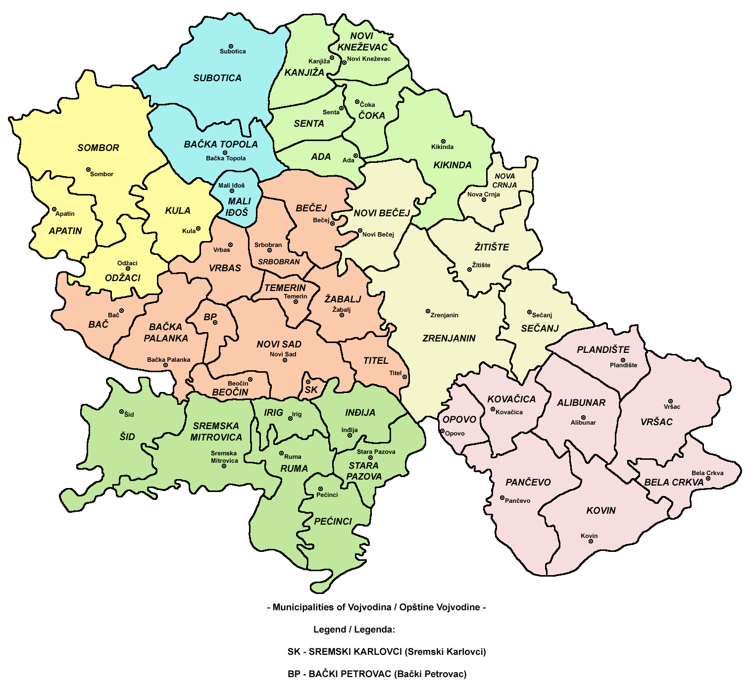
Inhabited places
 Map of Zrenjanin municipality
 Begej River in Zrenjanin (the bridge shown on the picture is located at same place were the former Eiffel Bridge used to stand)
 Serbian-orthodox Serbian Orthodox Uspenska church
 Central square and Zrenjanin's Roman Catholic cathedral
 Small bridge, Protestant church and Zrenjanin Court House
Zrenjanin municipality includes the city of Zrenjanin and the following villages:
- Aradac
- Banatski Despotovac
- Belo Blato
- Botoš
- Elemir
- Ečka
- Jankov Most
- Klek
- Knićanin
- Lazarevo
- Lukino Selo
- Lukićevo
- Melenci
- Mihajlovo
- Orlovat
- Perlez
- Stajićevo
- Taraš
- Tomaševac
- Farkaždin
- Čenta
City quarters
- Lesnina
- Zeleno Polje
- Centar
- Gradnulica
- Čontika
- Četvrti Jul
- Dolja
- Duvanika
- Mala Amerika
- Šumica
- Bagljaš
- Nova Kolonija
- Mužlja, a former village, joined with Zrenjanin in 1981
- Ruža Šulman
- Brigadira Ristića
- Duvanika
- Berbersko
- Putnikovo
- Bolnica
- Šećerana
- Dunavska
Demographics (2002 census)
Ethnic groups in the municipality
The population of the Zrenjanin municipality is composed of:
- Serbs = 98,794 (74.81%)
- Hungarians = 14,211 (10.76%)
- Yugoslavs = 2,559 (1.93%)
- Romanians = 2,511 (1.9%)
- Roma = 2,471 (1.87%)
- Slovaks = 2,403 (1.81%)
- others.
Settlements by ethnic majority
Settlements with Serb ethnic majority are: Zrenjanin, Banatski Despotovac, Botoš, Elemir, Ečka, Klek, Knićanin, Lazarevo, Lukićevo, Melenci, Orlovat, Perlez, Stajićevo, Taraš, Tomaševac, Farkaždin, and Čenta. Settlements with Hungarian ethnic majority are: Lukino Selo and Mihajlovo. Settlement with Romanian ethnic majority is Jankov Most. Ethnically mixed settlements are: Aradac (with relative Serb majority) and Belo Blato (with relative Slovak majority).
Ethnic groups in the town
The population of the Zrenjanin town is composed of:
- Serbs = 56,560 (70.9%)
- Hungarians = 11,605 (14.55%)
- Yugoslavs = 1,948 (2.44%)
- Roma = 1,577 (1.98%)
Religion
According to the 2002 census, most of the inhabitants of the Zrenjanin municipality are Orthodox Christians (77.28%). Other religions include Roman Catholic (12.01%), Protestant (2.13%), and other. Orthodox Christians in Zrenjanin belong to the Eparchy of Banat of the Serbian Orthodox Church with seat in Vršac. Zrenjanin is also the centre of the Roman Catholic diocese of the Banat region belonging to Serbia.
Main sights
 View of synagogue, which was demolished in 1941 by the Nazis.
 Main facade of the National museum building
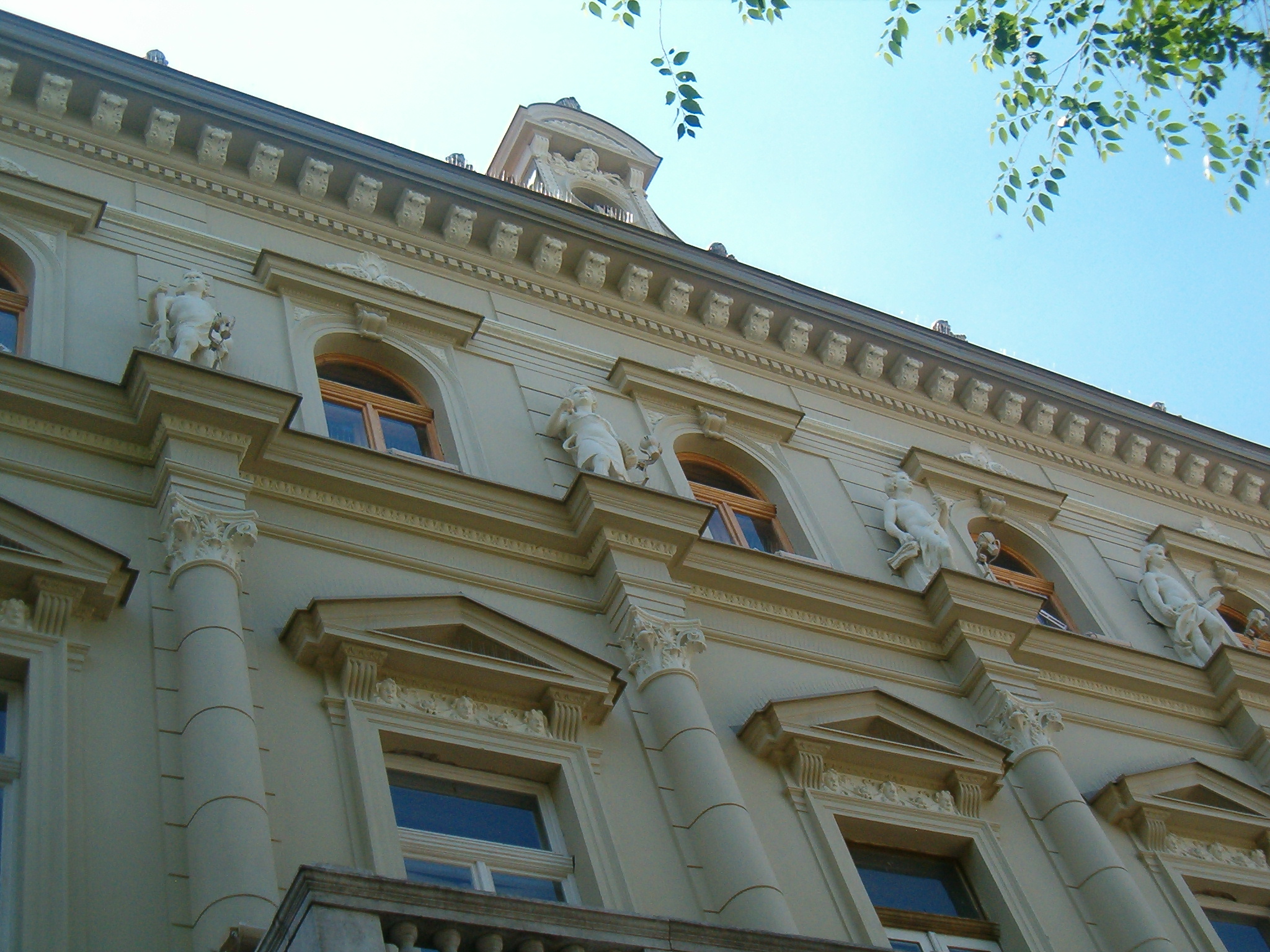
 Trade academy decorated with sgraffito technique
- City Hall, built in 1816, re-constructed in 1887, neobaroque, Gyula Partos and Ödön Lechner.
- Finance palace, today National museum, built in 1894 in Neorenaissance style by István Kiss.
- Theatre, built in 1839, classicism, the oldest theatre building in Serbia.
- Court House, built between 1906 and 1908, romanticism, Sandor Eigner and Marcus Rehmer.
- Uspenska Serbian Orthodox church, built in 1746, baroque, the oldest church in the city.
- Vavedenska church, built in 1777 in Baroque style.
- Evangelical church, built in 1837, classicism.
- Zrenjanin Cathedral, built between 1864 and 1868, romanesque, Stevan Đorđević.
- Protestant church, built in 1891, neogothic, Ferenc Zaboretzky.
- Zrenjanin Synagogue, built in 1896, Moorish Revival, Lipót Baumhorn, demolished in 1941 by Nazis.
- Bukovac palace, built in 1905, neorenaissance.
- Old Vojvodina hotel, built in 1886, neorenaissance, Bela Peklo.
- Grammar School, built in 1846, re-constructed in 1937 and later.
- Small bridge, built in 1904, the oldest bridge in the city.
- Trade academy, built in 1892, neorenaissance, István Kiss.
- Bence's house, built in 1909, secession.
- Dry Bridge, built in 1962, without river since 1985.
- Eiffel Bridge, built in 1904, replaced by a new bridge in 1969.
- Dunđerski palace, built in 1910, secession.
- House of Soko, built in 1927, academism, Dragiša Brašovan.
Tourism
Zrenjanin has many places of interest like City Hall, the Cathedral, Freedom Square, King Aleksandar I Street, etc.
Hotel "Vojvodina" is situated on Liberty Square . There is a Tourist Information Office in the building of National Museum (Subotićeva 1).
Sports
Zrenjanin has a long sports tradition. First clubs were established during 1880s. It was the home town of Proleter football club from 1947 until 2005. Today, FK Banat plays its games at Karađorđev Park Stadium in Serbian Premier League.
Transportation
 Taxi station in Petrovgrad (today Zrenjanin) in 1938, nearby Cathedral
Zrenjanin no longer has a public transport operator, for the first time in its recent history, following the privatization and subsequent bankruptcy of Autobanat. It used to operate as the city's public transport company and as the regional public transport service to the nearby cities of (Novi Sad, Belgrade, Kikinda, Vršac), etc.
In the past river traffic on the Begej river used to be most developed mode of caego transport. Veliki Bečkerek got a railway in 1883, when it linked the city to Velika Kikinda. There are many taxi companies in Zrenjanin and the regulations are either lacking or are not enforced by the authorities.[citation needed]
Notable citizens
- Dragan Ahmedović, Serbian composer
- Dezső Antalffy-Zsiross, Hungarian organist and composer
- Dejan Bodiroga, Serbian basketball player
- Ivan Boldirev, hockey player
- Branimir Brstina, Serbian actor
- Branko Cuic, Serbian basketball player
- Žarko Čabarkapa, Serbian basketball player
- Konstantin Danil, Serbian painter of Romanian origin
- Dejan Govedarica, Serbian football player
- Nikola Grbić, born in Zrenjanin, lived in Klek
- Vladimir Grbić, born in Zrenjanin, lived in Klek
- Vladimir Ivić, Serbian football player
- Đura Jakšić, Serbian painter, studying painting as a student of Danil
- Olivera Kovacevic, Serbian journalist
- Vilmos Lázár, Hungarian general
- Ivan Lenđer, Serbian swimmer
- Mile Lojpur, first Yugoslav rocker
- Željko Lučić, operatic baritone
- Todor Manojlović, Serbian writer
- Mirko Milosevic, Serbian handball player
- Zvonko Ninkov, Serbian journalist
- Zorica Novaković, Serbian poet [1]
- Maja Ognjenović, Serbian volleyball player
- Joe Penner (József Pintér), American radio and film comedian[4]
- Snežana Perić, Serbian professional karate competitor
- Emil Petrovics, Hungarian composer of South Slavic origin
- Čedomir Popov, Serbian academic
- Miodrag Popov, Serbian journalist
- Milorad Stanulov, Serbian rower
- Mario Szenessy, Hungarian-German author
- Nada Šargin, Serbian actress
- Ivana Španović, Serbian long jumper
- Duško Tošić, Serbian football player
- Zoran Tošić, Serbian football player
- Zvonimir Vujin, Serbian boxer
- Zvonimir Vukić, Serbian football player
- Rudolf Wegscheider, Austrian chemist
International relations
See also: List of twin towns and sister cities in SerbiaTwin towns — Sister cities
Zrenjanin is twinned with:
Trivia
- Zrenjanin is home to the oldest continually operating post office in Serbia, founded in 1737.
- During World War II, Zrenjanin might have been bombed by the Allies. The pilot mistook it for Timişoara (both cities lie on the Begej river and are "only" 100 km apart).
- Zrenjanin is sometimes referred to as The City of Bridges. There are eleven bridges.
- Wild Bill Hickok once visited the city, as did Franz Liszt and Kirk Douglas.[citation needed]
See also
Sources
- Milan Tutorov, Banatska rapsodija - istorika Zrenjanina i Banata, Novi Sad, 2001.
External links
- Official Website of the City of Zrenjanin (Serbian) (English)
- Zrenjanin Weekly Newspaper
- MojGrad023.info - Website of the City of Zrenjanin (Serbian)
- Autobanat - Public Transport Official Site
- Information Source about things related to city of Zrenjanin and its area (Serbian)
- News, forum, information and much more about Zrenjanin and Serbia (Serbian)
- The official website of the Tourist organization of Zrenjanin (Serbian)
- The official website of the Roman Catholic diocise of Zrenjanin (Serbian) (Hungarian) (English)
- Villa Daniel, Zrenjanin (Serbian)
- History of Zrenjanin (Hungarian)
- Website of the local weekly magazine "Zrenjanin" (Serbian)
- Zrenjanin Business Portal (Serbian) (English) (Hungarian) (Romanian) (German) (French)
References
- ^ "Municipalities of Serbia, 2006". Statistical Office of Serbia. http://webrzs.stat.gov.rs/axd/en/Zip/OG2006webE.zip. Retrieved 2010-11-28.
- ^ "2011 Census of Population, Households and Dwellings in the Republic of Serbia – FIRST RESULTS". Bulletin (Statistical Office of the Republic of Serbia) 540. 2011. ISSN 0354-3641. http://media.popis2011.stat.rs/2011/prvi_rezultati.pdf. Retrieved 2011-11-21.
- ^ http://www.rastko.rs/arheologija/ntasic-eneolit.html
- ^ Joe Penner biography (in Hungarian)
Cities, towns and villages in the Central Banat District Zrenjanin: Aradac • Banatski Despotovac • Belo Blato • Botoš • Elemir • Ečka • Jankov Most • Klek • Knićanin • Lazarevo • Lukino Selo • Lukićevo • Melenci • Mihajlovo • Orlovat • Perlez • Stajićevo • Taraš • Tomaševac • Farkaždin • Čenta
Žitište: Banatski Dvor • Banatsko Višnjićevo • Banatsko Karađorđevo • Međa • Novi Itebej • Ravni Topolovac • Srpski Itebej • Torak • Torda • Hetin • Čestereg
Nova Crnja: Aleksandrovo • Vojvoda Stepa • Radojevo • Srpska Crnja • Toba
Novi Bečej: Bočar • Kumane • Novo Miloševo
Sečanj: Banatska Dubica • Boka • Busenje • Jarkovac • Jaša Tomić • Konak • Krajišnik • Neuzina • Sutjeska • Šurjan
(*) bold are municipalitiesih
Categories:- Zrenjanin
- Places in Serbian Banat
- Populated places in Vojvodina
- Populated places established in the 14th century
- Municipalities of Vojvodina


Wikimedia Foundation. 2010.