- Lake Memphremagog
-
Lake Memphremagog 
Lake Memphremagog Location Memphrémagog Regional County Municipality, Quebec, Canada / Orleans County, Vermont, USA Coordinates 45°05′N 72°17′W / 45.083°N 72.283°WCoordinates: 45°05′N 72°17′W / 45.083°N 72.283°W Catchment area 687 sq mi (1,779 km2) Basin countries Canada / United States Max. length 32 mi (51 km) Surface area 102 km2 (39 sq mi) Average depth 15.5 m (51 ft) Max. depth 107 m (351 ft) Surface elevation 208 m (682 ft) Islands 20 Lake Memphremagog (Lac Memphrémagog in Quebec) is a fresh water glacial lake located between Newport, Vermont, United States and Magog, Quebec, Canada.[1] The lake is 27 miles (43 km) long with 73 percent of the lake's surface area in Quebec, where it drains into the Magog River.[2] However, three-quarters of its watershed, 489 square miles (1,270 km2), is in Vermont. The total is 687 square miles (1,780 km2), with 198 square miles (510 km2) located in Quebec.[3] In Vermont, the lake lies in parts of the towns of Derby and Newport, in addition to the city of Newport, all in Orleans County. In Quebec, the lake lies in parts of Austin, Magog, Ogden, Potton, Saint-Benoît-du-Lac, and Stanstead Township, all in Memphrémagog Regional County Municipality.
The lake elevation is 682 feet (208 m) and its maximum recorded depth is 285 feet (87 m) located near the international divide. The lake is the third deepest in Vermont[4][5] It contains 20 islands. Province Island, the largest, is divided by the international border.[6] The name Memphremagog is derived from Algonkian, in which it means "where there is a big expanse of water".
Contents
Ecology
Like many other lakes, Memphremagog is faced with accumulating phosphorus, sediments, and other pollutants from a variety of sources. In addition, exotic species infestations are a concern, with an existing Eurasian water milfoil population and the potential for a zebra mussel infestation. Since the 1970s, significant efforts have been made to reduce the polluting effects of direct discharges into the lake and its tributaries, and lake quality has improved.
In 1994, a Lake Memphremagog Watershed Association was formed to focus on solving lake and river issues.[7]
Testing done in 2008 was unable to determine the cause of excessive nitrogen and phosphorus.[8]
In 2010, a study revealed that farms contribute disproportionately to nutrient loads. Although farms have 16% of total land use in the drainage area, they produce 44% of the runoff. Baseline nutrients for a lake are 14 micrograms of phosphorus per liter of water. The lake was measured at 17 micrograms, 18% above normal. Although the acreage devoted to farming has decreased, the retired land has most often been developed, itself a source of runoff.[9]
Hydrology
Three Vermont rivers directly empty into the lake: the Clyde, Barton, and the Black.
In the middle of the winter, the ice can become 3 feet (0.9 m) thick.[10]
Natural history
Memphre
Some claim Lake Memphremagog contains a reptile-like monster named Memphre (or Memphré), which has received sightings since the 18th century and continues on in the folklore of the area in a similar vein as the Loch Ness Monster.[11] It is claimed that Memphre has been spotted as recently as 2000.[12]
History
 Saint-Benoît-du-Lac Abbey is located in the village of Saint-Benoît-du-Lac, Quebec. The village is on the western shore of Lake Memphremagog
In 1753, the Abenakis brought the ransomed John Stark down the lake and came ashore where Newport is now.
Rogers' Rangers were forced to retreat south following their attack on Saint-Francis, Quebec in 1759. To confound their avenging pursuers, they split up on the east shore of the lake.[13]
The Mountain Maid paddlewheeler operated from 1850 to 1870.[14] The Lady of the Lake steam excursion/ferry paddlewheeler started operating in 1867. It stopped operations in 1917. It was based in Newport. The Anthemis steamer was built in 1909 to carry 300 people. It stopped operating after 1945.[14]
In August 1942, a single-engined Royal Canadian Air Force training plane crashed into the lake near the west shore near Newport, killing the pilot, its only occupant.[15]
In 2010 the U.S. Fish and Wildlife Service accepted a bequest of 420 acres (170 ha) undeveloped land on the shores the lake on Eagle Point along the border with Canada. [16]
Lighthouses
Lake Memphremagog is known to have had at least three lighthouses used in aiding boaters in navigating the waters of the large lake. All three of the original lighthouses have been demolished.
Maxfield Point Light
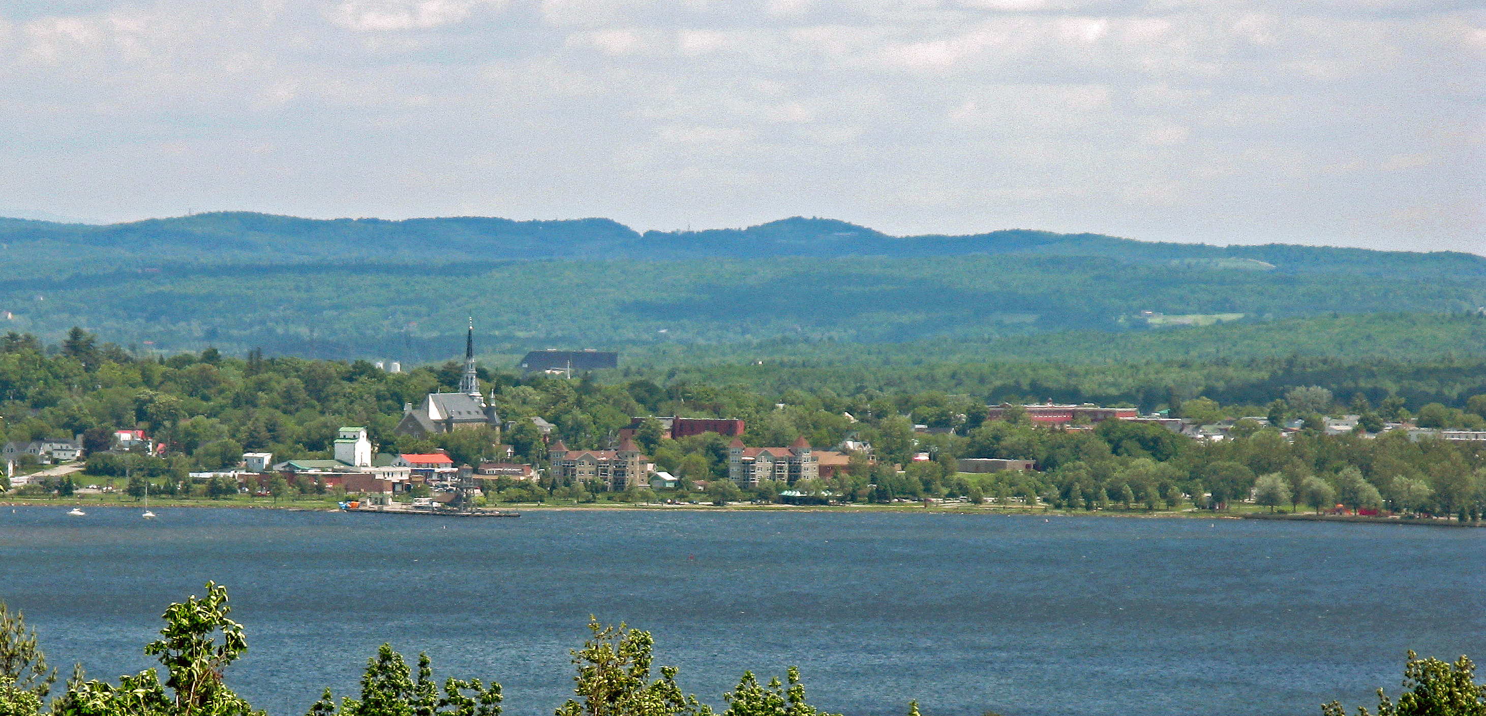
 The small city of Magog, Quebec
The Maxfield Point Light was a small lighthouse constructed on the Vermont side of Lake Memphremagog in 1879. A conical, cast iron structure, it was 25 feet (7.6 m) tall, with a focal plane 40 feet (12.2 m) above sea level. It showed a fixed white light, visible for 10 (16 km) miles. The lighthouse no longer exists; it is unknown what happened to it, or when it was deactivated.[17]
Newport Wharf Light
The Newport Wharf Light was a tower that was built in the Newport section of Lake Memphremagog in 1879. The lighthouse was a steel skeleton tower, painted red, that was fixed on a concrete foundation. The tower showed a fixed red light that was visible for up to 12 miles (19.3 km), with the height of the focal plane being 37 feet (11.2 m). As with the Maxfield Point Lighthouse, the date this lighthouse was demolished is unknown.[18]
Whipple Point Light
Whipple Point Light was a tower that was built on the end of a pier on Whipple Point in Lake Memphremagog. Built in 1879, the tower was constructed of wood in a hexagonal shape and stood 13 feet (4 m). The light was fixed white and was visible from up to 10 miles (16 km) away, with a focal plane of 25 feet (7.6 m). The lighthouse was deactivated around 1906 and was demolished at an unknown date.[19]
Economy
The watershed in Vermont is largely agricultural and forest land with residential development increasing in recent years in both Vermont and Quebec.
Pop Culture
The Canadian band The Tragically Hip mentions Lake Memphremagog in their 2002 unreleased song Problem Bears; part of their In Violet Light album sessions.
References
- ^ "Géographie physique et Quaternaire, 1999, vol. 53". Late Wisconsinan Deglaciation and Glacial Lake Development in the Appalachians of Southeastern Quebec. http://www.erudit.org/revue/gpq/1999/v53/n1/004859ar.html. Retrieved 2006-12-24.
- ^ The Spell of Lake Memphremagog
- ^ Vermont Department of Environmental Conservation (March 21, 2007). Meeting to establish Lake Memphremagog association. The Chronicle.
- ^ Behind Lake Champlain at 405 feet (123 m) deep and Lake Willoughby at 302 feet (92 m) deep
- ^ Lake Memphremagog Fishing in Orleans County
- ^ Jacques Boisvert. "Province Island". http://magogquebec.homestead.com/files/province_island.html. Retrieved 2006-11-04. "It is the largest island in Lake Memphremagog, being 77 acres, of which 7 acres, are in the United States."
- ^ Lake Memphremagog
- ^ The Chronicle, July 1, 2009, page 2A, "Search continues for sources of pollution," Richard Creaser
- ^ Creaser, Richard (18 August 2010). "Watershed association seeks to combat farm runoff". Barton, Vermont: the Chronicle. pp. 16.
- ^ Wheeler, Scott (February 2007). Standing On Thin Ice. Vermont Northland Journal.
- ^ Vermont Living Magazine
- ^ Vermonter.com
- ^ Darrell Hoyt (1985). Sketches of Orleans, Vermont. Mempremagog Press. ISBN 0-9610860-2-5., page 1
- ^ a b Wheeler, Scott (August 2007). "Remembering the Days of the Big Tour Boats with Dreams of Bringing Them Back to Life". Vermont's Northland Journal: 3–6.
- ^ "Salvage Operations on Crashed Plane Now Underway". Derby, Vermont: the November 13, 1943 Newport Daily Express as quoted in the Northland Journal. September 2008. pp. 29–30.
- ^ "US accepts stunning gift of land": accessed 31 August 2010.]
- ^ Lighthouses at Lighthouse Depot ... Lighthouse Explorer Database ... Maxfield Point Lighthouse
- ^ Lighthouses at Lighthouse Depot ... Lighthouse Explorer Database ... Newport Wharf Light
- ^ Lighthouses at Lighthouse Depot ... Lighthouse Explorer Database ... Whipple Point Lighthouse
External links
- Lake Memphremagog environmental document
- Basin Planning
- Restoring Water Quality in the Lake Memphremagog Basin: Clyde River Phase I & II Stream Geomorphic Assessments
- The International Dracontology Society of Lake Memphremagog
- Memphre, the Sea Serpent of Lake Memphremagog
- Memphré Quebec
- International Lake Environment Committee
Categories:- Derby, Vermont
- Estrie
- Lake Memphremagog
- Newport (city), Vermont
- Newport (town), Vermont
- Vermont culture
- Canada–United States border
- International lakes of North America
- Glacial lakes of the United States
- Glacial lakes of Canada
- Geography of Orleans County, Vermont


Wikimedia Foundation. 2010.