- Broadmoor, New Orleans
Geobox Neighborhood
name = Broadmoor
native_name =
other_name =
other_name1 =
category = New Orleans Neighborhood
image_size = 200px
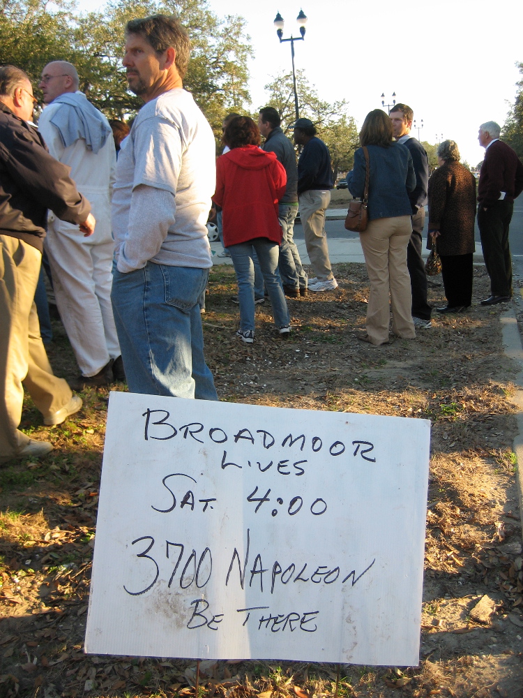
image_caption = Broadmoor Lives! Post Katrina rally
flag_size =
symbol =
symbol_size =
etymology_type =
etymology =
nickname =
motto =
country = United States
state = Louisiana
region_type = City
region = New Orleans
district_type = Planning District
district = District 3, Uptown/Carrollton
area_imperial = 0.56
area_land_imperial = 0.56
area_water_imperial = 0.00
area_water_percentage = auto
area_percentage_round = 2
area_round = 1
location =
lat_d = 29
lat_m = 56
lat_s = 56
lat_NS = N
long_d = 90
long_m = 06
long_s = 15
long_EW = W
elevation_imperial = 2
elevation_round = 0
population_as_of = 2000
population = 7232
population_density_imperial = auto
established_type =
established =
mayor =
timezone = CST
utc_offset = -6
timezone_DST = CDT
utc_offset_DST = -5
postal_code =
postal_code_type = ZIP Codes
area_code = 504
area_code_type =
code2_type =
code2 =
free_type =
free =
free1_type =
free1 =
map_size =
map_caption =
map_locator =
map_locator_x =
map_locator_y =
website =Broadmoor is a neighborhood of the city of New Orleans. A subdistrict of the Uptown/
Carrolton Area, its boundaries as defined by the City Planning Commission are: Eve Street to the north, Washington Avenue and Toledano Street to the east, South Claiborne Avenue to the south, and Jefferson Avenue, South Rocheblave Street, Nashville Avenue, and Octavia Street to the west.Broadmoor is low lying ground in New Orleans, and was only substantially developed beginning in the early 20th century after improved drainage was initiated (see:
Drainage in New Orleans ). Before being developed, the area was a large marsh and was a fishing spot for Uptowners. Early construction were mostly high raised houses for fear of repeats of historic floods, but after decades with little problem more low lying residential structures were built in Broadmoor.Broadmoor resident musician and producer
Dave Bartholomew named hisBroadmoor Records label after the neighborhood.Broadmoor was hit hard by the
May 8th 1995 Louisiana Flood , after which extensive improvements of drainage were constructed.Broadmoor flooded badly in the aftermath of
Hurricane Katrina in 2005. ABring New Orleans Back Commission preliminary report map showed Broadmoor as a suggested area to be turned into park land; this suggestion is strongly objected to by residents, hundreds of whom were already back in their homes by January 2006, many living in the upstairs of two story homes while they worked on gutting and repairing their flooded ground floors.Geography
Broadmoor is located at coor dms|29|56|56|N|90|06|15|W|city GR|1 and has an elevation of convert|2|ft|1GR|3. According to the
United States Census Bureau , the district has a total area of convert|0.56|sqmi|1. convert|0.56|sqmi|1 of which is land and convert|0.00|sqmi|1 (0.00%) of which is water.Adjacent Neighborhoods
* Gert Town (north)
* Central City (east)
* Milan (south)
* Freret (south)
* Marlyville/Fontainebleau (west)Boundaries
The City Planning Commission defines the boundaries of Broadmoor as these streets: Eve Street, Washington Avenue, Toledano Street, South Claiborne Avenue, Jefferson Avenue, South Rocheblave Street, Nashville Avenue, and Octavia Street. [cite web|url=http://gnocdc.org/orleans/3/63/index.html|title=Broadmoor Neighborhood|author=Greater New Orleans Community Data Center|accessdate=2007-10-19]
Demographics
As of the
census GR|2 of 2000, there were 7,232 people, 2,915 households, and 1,788 families residing in the neighborhood. Thepopulation density was 12,914 /mi² (4,986 /km²). The racial makeup of the neighborhood was 68.2% African American, 25.8% White, 0.6% Asian, 0.2% Native American, 0.2% from other races, and 1.3% from two or more races. Hispanic or Latino of any race were 3.7% of the population.ee also
*
New Orleans neighborhoods References
External links
* [http://www.broadmoorimprovement.com Broadmoor Improvement Association]
* [http://www.nolaflash.com/zeke/g/060406BroadmoorTour/ April 6th, 2006 Tour of Broadmoor]
Wikimedia Foundation. 2010.