Downhill House — was a mansion built in the 18th century for Frederick Hervey, 4th Earl of Bristol at Downhill, Northern Ireland. Much of the building was destroyed by fire in 1851 before being rebuilt in the 1870s. It fell into disrepair after the Second World… … Wikipedia
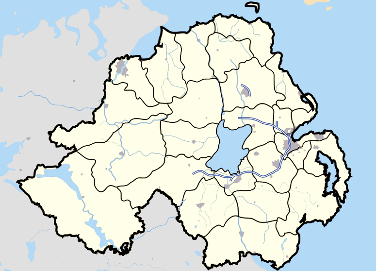
Downhill, County Londonderry — Downhill (formerly called Dunbo, from Irish: Dún Bó, meaning fort of the cows )[1] is a small village and townland near Castlerock in County Londonderry, Northern Ireland. Contents 1 History 2 Transport … Wikipedia
Silver Strand bikeway — In the San Diego area, the Silver Strand bikeway is an easy, 9 mile bicycle and pedestrian path from Ferry Landing Marketplace to Imperial Beach at sea level with no elevation gain. It is regarded as the most beautiful and most cyclist friendly… … Wikipedia
Mussenden Temple — Coordinates: 55°10′05″N 6°48′22″W / 55.168°N 6.806°W / 55.168; 6.806 … Wikipedia
Coastal landforms of Ireland — Ireland is an island surrounded by water,[1] with a 7,500 kilometre coastline.[2] This list catalogues about 400 of the coastal landforms of the island including bays, estuaries, harbours, headlands, and many others.[3][4][5] Most offshore… … Wikipedia
Binevenagh — Infobox Mountain Name = Binevenagh Photo = Caption = Elevation = 385 m (1,263 ft) Location = County Londonderry, Northern Ireland Range = Sperrin Mountains Prominence = 170 m (558 ft) Coordinates = Topographic Easiest route = Grid ref Ireland =… … Wikipedia
cell — cell1 cell like, adj. /sel/, n. 1. a small room, as in a convent or prison. 2. any of various small compartments or bounded areas forming part of a whole. 3. a small group acting as a unit within a larger organization: a local cell of the… … Universalium
skiing — /skee ing/, n. the act or sport of gliding on skis. [1890 95; SKI + ING1] * * * I Sport and mode of transportation involving moving over snow on a pair of long flat runners (skis) attached to shoes or boots. Skiing was born in northern Europe;… … Universalium
Norway at the 1994 Winter Olympics — Norway at the Olympic Games Flag of Norway – Flag bearers … Wikipedia
History of skiing — Skiing, or traveling over snow on wooden runners, has a recorded history of almost five millennia. Ancient history The first hints to the existence of skis are on 4500 to 5000 year old rock drawings, e.g. at Rødøy in Norway (discovered 1933) or… … Wikipedia
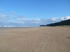
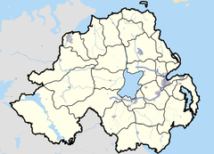
 Downhill Strand
 Downhill Strand shown within Northern Ireland