- Merrion Centre, Leeds
-
Merrion Centre 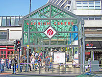
The southern entrance of the Merrion Centre, as of 5 May 2007Location Leeds city centre, Leeds, England Opening date 1964 Owner Town Centre Securities (formerly Leeds City Council) No. of stores and services 90[1] plus market stalls Total retail floor area 800,000 ft² including none retail areas.[2] No. of floors 2 (main retail area only) The centre has 20 floors of office space.  The Interior of the Merrion Centre
The Merrion Centre in Leeds, England is a shopping centre opened in 1964. From construction to the present day the centre has been owned and managed by Town Centre Securities. Originally open air, the centre had since had a roof installed during the 1970s onwards. It is an early example of a mixed-use development including offices, car parking, retail (including a Morrisons supermarket) and entertainment including a bowling alley, a nightclub and several public houses. Currently most retail in the centre is aimed more towards the budget end of the market which means the centre is especially popular with working class people and students. The Merrion Market area features a range of independent stalls, shops and cafés ranging from mainstream but downmarket to idiosyncratic.
The centre had originally included an Odeon Cinema when it opened, however this closed in 1977 following a screening of Gone with the Wind. It remains empty and unused to this day only opening occasionally for events such as Heritage Open Days. The cinema inside is notable in the fact that other than the removal of the seating, it is unchanged since closing with original operating manuals and film posters in place and is admired by fans of 1960s and 1970s culture. The ground floor entrance is opposite the entrance to Morrisons and has been blocked up and replaced with Cash Machines.
One of the nightclubs within The Merrion Centre was the now-legendary 'Bar Phono', widely reputed to be the birthplace of the Gothic subculture.[citation needed]
The former Barclays Bank on the front of the Merrion Centre has since been converted into 'Oceana', which has become a new popular Leeds nightclub.
The Merrion Centre is currently[when?] undergoing minor refurbishment. The western side of the centre has been re-clad in part and the interior is being painted. New tenants have moved in such as a new Sainsbury's Local. The centre's Morrisons supermarket has been rebranded to fit the company's new corporate image, with minor refurbishment inside. Photographs have been put up inside the supermarket showing the shop in 1973, with photographs depicting amongst other things the tobacco and deli counters.
There are plaques in the floor at each entrance stating "Private property, no public right of way" to prevent the walkthoughs becoming public footpaths.
Woolworths' relocation to the Merrion Centre, from Briggate (now the House of Fraser) in the early 1990s provided the centre with another major retailer and increased footfall. The Morrisons in the centre is the main supermarket in the city centre and has seen a surge in custom since the building of many city centre flats in the property boom of the 2000s. However most of these are towards the southern end of the city centre, and for them the Morrisons in The Penny Hill Centre, Hunslet is nearer and also offers free parking.
 The Wade Lane side of the Merrion Centre, showing the Merrion Superstore
 The Georgian Arcade in the Merrion Centre has at times almost been a dead mall.
 Morrisons in the Merrion Centre
 Wade House, one of two office blocks over the Merrion Centre
 The open square to the rear of the Merrion Centre
 Offices within the Merrion Centre as seen from the car park
 Woolworths during its final sale following the groups administration, this meant the loss of a major tenant for the centre.
Contents
Criticisms of the centre's design
- It has been commented[who?] that since the centre was fully enclosed in the 1970s, the large open entrances have led to the inner halls becoming something of a wind tunnel.
- The mock Georgian wing of the shopping centre has never been fully occupied since the centre opened, although there are more shops there currently. The positioning of the wing (towards the rear of the shopping centre, down the side of Morrisons) has led to it almost becoming a 'Dead Mall' at certain times in the centre's history.
- Since introducing a smoking ban in January 2007 (in all enclosed areas except the public houses), the ban has been largely ignored. Many other shopping centres have similar experiences. The Horsefair Centre in Wetherby has a similar issue. Both centres are enclosed, however have no doors at the entrances, meaning people are likely to walk in through the street smoking. The experience of 2009 suggests that the ban is now fully observed throughout the Centre.
- The entrance onto Merrion Street (probably the most used one) has a fairly steep ramp, making access difficult for some elderly and disabled customers.
- The sunken square towards the rear of the centre has been an unused space since the subway closed in 2000. For many years this had two outdoor escalators, although they soon fell into disrepair after their installation in the early 1970s, and stood for many years unused. They were fenced off for public safety. In 2007 they were replaced with steps.
Praise
- When opened in 1964, the Yorkshire Evening Post said the centre emulated what every successful large town and city wanted to build.
- The centre offers a great deal of variety, boasting a supermarket, many high street shops, a market hall, a hotel, several pubs, bars and a night club as well as a bowling alley and a great deal of office space. The centre offers basic amenities to many in nearby residential areas such as Lovell Park and Little London.
The future of the Centre
Much of The Merrion Centre remains almost unchanged since its construction. With many other cities renovating their equivalents of The Merrion Centre (the reconstruction of the Bullring, Birmingham, the Arndale Centre in Manchester being partially rebuilt and Eldon Square in Newcastle Upon Tyne being renovated), Leeds city centre's largest shopping centre was beginning to look dated. In June 2007 phase one of the renovation began, concentrating on the western side of the centre.[2]
Trivia
- The Merrion Centre had a subway which linked it to the Woodhouse Lane Car Park, Millennium Square and Leeds Metropolitan University. This however has been closed since 2000 with the subway being used as a storage area for Millennium Square events. It is possible to look down into it from Claypit Lane - from here billboards for Morrisons, Kellogg's Frosties and Radio Times dating from the early 90s can be seen.
= Main tenants
- Morrisons
- Home Bargains
- Boots the Chemist
- Birthdays
- Sainsburys Local
- Poundstretcher
- Wilkinson
- Superdrug
- Holland & Barrett
- Cooplands
- Greggs the Baker
- ModelZone
- Merrion News
- John Scheerer Music
- Yorkshire Bank
- Max Spielmann
- KRCS Apple Centre
- eurochange
Gallery
-

Entrance from Wade Lane
-

The Lounge Bar (formerly General Wade)
-

Wade Lane entrance to the Merrion Market
-

Interior of Merrion Market
See also
- Shopping in Leeds
- Architecture in Leeds
References
External links
Categories:- Shopping centres in Leeds


Wikimedia Foundation. 2010.