- National Register of Historic Places listings in Elmore County, Alabama
-
 Location of Elmore County in Alabama
This is a list of the National Register of Historic Places listings in Elmore County, Alabama.
This is intended to be a complete list of the properties and districts on the National Register of Historic Places in Elmore County, Alabama, United States. Latitude and longitude coordinates are provided for many National Register properties and districts; these locations may be seen together in a Google map.[1]
There are 12 properties and districts listed on the National Register in the county, including 1 National Historic Landmark.
-
- This National Park Service list is complete through NPS recent listings posted November 10, 2011.[2]
Current listings
[3] Landmark name Image Date listed Location City or town Summary 1 Alabama State Penitentiary 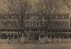
May 8, 1973 Northeast of Wetumpka on U.S. Route 231
32°33′02″N 86°11′28″W / 32.550556°N 86.191111°WWetumpka 2 East Wetumpka Commercial Historic District 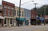
February 20, 1992 Roughly Company St. from Spring St. to E. Bridge St. and E. Bridge and Commerce Sts. from Main to Hill Sts.
32°32′16″N 86°12′16″W / 32.537717°N 86.204572°WWetumpka 3 First Baptist Church of Wetumpka 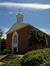
October 24, 2008 205 W. Bridge St.
32°32′21″N 86°12′35″W / 32.53923°N 86.20972°WWetumpka 4 First Presbyterian Church of Wetumpka 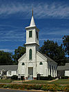
October 8, 1976 W. Bridge St.
32°32′21″N 86°12′31″W / 32.539167°N 86.208611°WWetumpka 5 First United Methodist Church 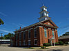
February 15, 1973 308 Tuskeena St.
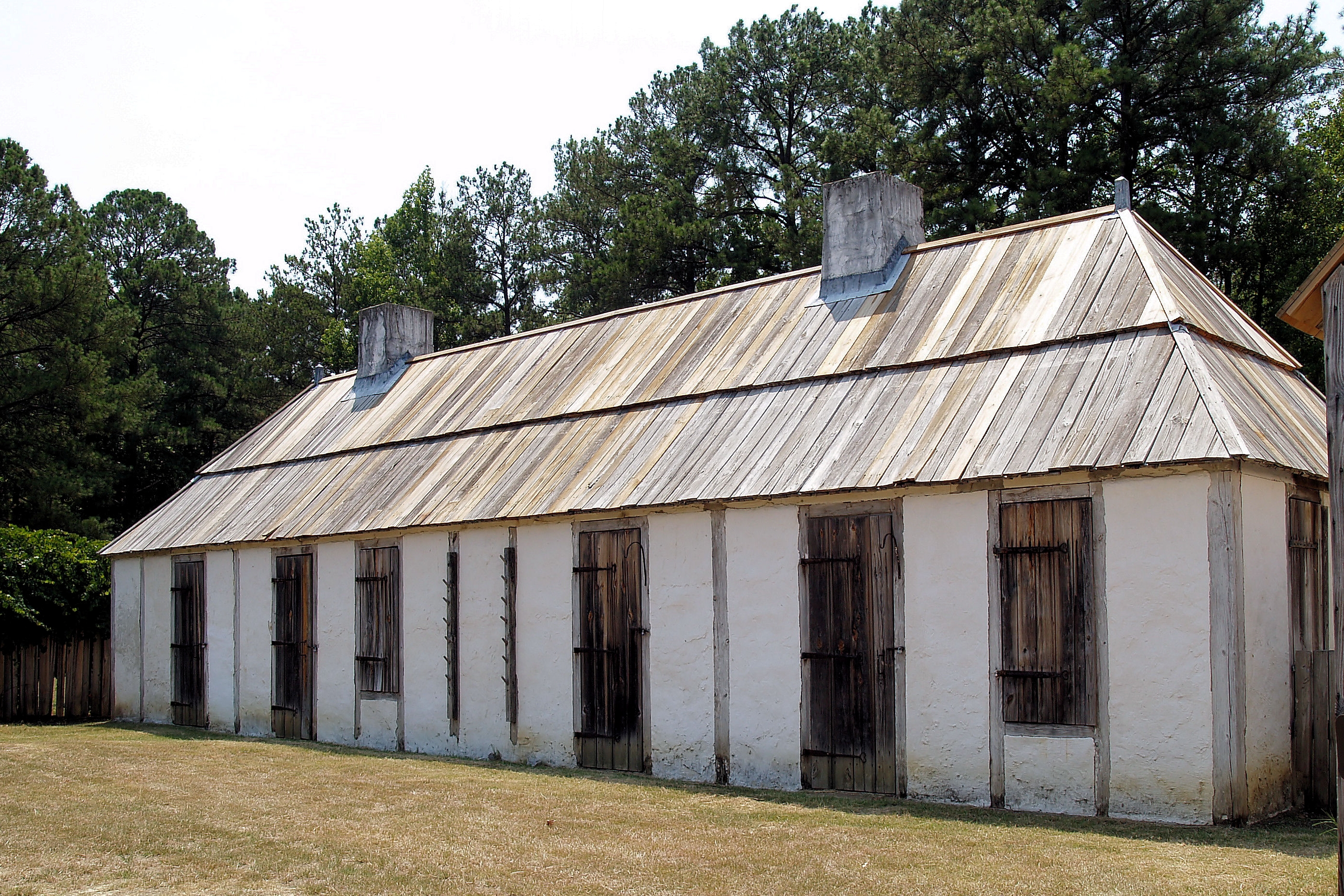
32°32′25″N 86°12′12″W / 32.540278°N 86.203333°WWetumpka 6 Fort Toulouse 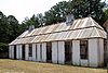
October 15, 1966 4 miles (6.4 km) southwest of Wetumpka at the confluence of the Coosa and Tallapoosa rivers
32°30′16″N 86°15′26″W / 32.504433°N 86.257286°WWetumpka 7 Abel Hagerty House January 14, 2008 4690 Jasmine Hill Rd.
32°28′22″N 86°11′04″W / 32.472868°N 86.184479°WWetumpka 8 Hickory Ground March 10, 1980 Southwest of Wetumpka
32°31′16″N 86°15′24″W / 32.52120°N 86.25654°WWetumpka 9 Robinson Springs United Methodist Church 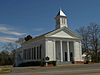
March 1, 1982 State Routes 14 and 143
32°30′55″N 86°22′28″W / 32.515278°N 86.374444°WMillbrook 10 Tallassee Commercial Historic District 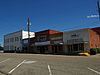
March 6, 1992 Roughly 3 blocks on the southern side of Barnett Boulevard between old River Rd. and DuBois St.
32°31′57″N 85°53′44″W / 32.532514°N 85.895506°WTallassee 11 Tallassee Mills 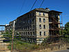
April 26, 2010 1844 Old Mill Rd.
32°31′57″N 85°53′24″W / 32.532458°N 85.889869°WTallassee 12 Wetumpka L&N Depot 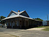
July 1, 1975 Coosa St.
32°32′26″N 86°12′41″W / 32.540556°N 86.211389°WWetumpka See also
- List of National Historic Landmarks in Alabama
- National Register of Historic Places listings in Alabama
References
- ^ The latitude and longitude information provided in this table was derived originally from the National Register Information System, which has been found to be fairly accurate for about 99% of listings. For about 1% of NRIS original coordinates, experience has shown that one or both coordinates are typos or otherwise extremely far off; some corrections may have been made. A more subtle problem causes many locations to be off by up to 150 yards, depending on location in the country: most NRIS coordinates were derived from tracing out latitude and longitudes off of USGS topographical quadrant maps created under the North American Datum of 1927, which differs from the current, highly accurate WGS84 GPS system used by Google maps. Chicago is about right, but NRIS longitudes in Washington are higher by about 4.5 seconds, and are lower by about 2.0 seconds in Maine. Latitudes differ by about 1.0 second in Florida. Some locations in this table may have been corrected to current GPS standards.
- ^ "National Register of Historic Places: Weekly List Actions". National Park Service, United States Department of the Interior. Retrieved on November 10, 2011.
- ^ Numbers represent an ordering by significant words. Various colorings, defined here, differentiate National Historic Landmark sites and National Register of Historic Places Districts from other NRHP buildings, structures, sites or objects.
U.S. National Register of Historic Places in Alabama Lists by county Autauga • Baldwin • Barbour • Bibb • Blount • Bullock • Butler • Calhoun • Chambers • Cherokee • Chilton • Choctaw • Clarke • Clay • Cleburne • Coffee • Colbert • Conecuh • Coosa • Covington • Crenshaw • Cullman • Dale • Dallas • DeKalb • Elmore • Escambia • Etowah • Fayette • Franklin • Geneva • Greene • Hale • Henry • Houston • Jackson • Jefferson • Lamar • Lauderdale • Lawrence • Lee • Limestone • Lowndes • Macon • Madison • Marengo • Marion • Marshall • Mobile • Monroe • Montgomery • Morgan • Perry • Pickens • Pike • Randolph • Russell • St. Clair • Shelby • Sumter • Talladega • Tallapoosa • Tuscaloosa • Walker • Washington • Wilcox • Winston

Lists by city Other lists Municipalities and communities of Elmore County, Alabama Cities Millbrook‡ | Prattville‡ | Tallassee‡ | Wetumpka

Towns Coosada | Deatsville | Eclectic | Elmore
CDP Unincorporated
communityEquality‡
Footnotes ‡This populated place also has portions in an adjacent county or counties
Categories:- National Register of Historic Places in Elmore County, Alabama
-


Wikimedia Foundation. 2010.