- National Register of Historic Places listings in Greene County, Alabama
-
 Location of Greene County in Alabama
This is a list of the National Register of Historic Places listings in Greene County, Alabama.
This is intended to be a complete list of the properties and districts on the National Register of Historic Places in Greene County, Alabama, United States. Latitude and longitude coordinates are provided for many National Register properties and districts; these locations may be seen together in a Google map.[1]
There are 35 properties and districts listed on the National Register in the county.
-
- This National Park Service list is complete through NPS recent listings posted November 10, 2011.[2]
Current listings
[3] Landmark name Image Date listed Location City or town Summary 1 David Rinehart Anthony House 
April 2, 1982 307 Wilson Ave.
32°50′27″N 87°53′25″W / 32.840833°N 87.890278°WEutaw Destroyed. Was located across from First Presbyterian Church. Site now occupied by a modern bank building. 2 Boligee Hill 
February 19, 1982 Southeast of Boligee
32°45′35″N 87°59′20″W / 32.759722°N 87.988889°WBoligee 3 Gustave Braune House April 2, 1982 236 Prairie Ave.
32°50′18″N 87°53′15″W / 32.838333°N 87.8875°WEutaw 4 Capt. Nathan Carpenter House 
July 23, 1999 2.5 miles southeast of Clinton
32°54′05″N 87°58′12″W / 32.901389°N 87.97°WEutaw 1852 Greek Revival plantation house.[4] 5 Samuel W. Cockrell House December 6, 1982 210 Wilson Ave.
32°50′10″N 87°53′24″W / 32.836111°N 87.89°WEutaw 6 John Coleman House December 6, 1982 1160 Mesopotamia St.
32°51′36″N 87°55′24″W / 32.86°N 87.923333°WEutaw 7 Coleman-Banks House 
December 18, 1970 430 Springfield Ave.
32°50′34″N 87°53′15″W / 32.842778°N 87.8875°WEutaw 8 Attoway R. Davis Home April 2, 1982 305 Main St.
32°50′27″N 87°53′27″W / 32.840833°N 87.890833°WEutaw 9 John W. Elliott House April 2, 1982 244 Prairie Ave.
32°50′19″N 87°53′15″W / 32.838611°N 87.8875°WEutaw Also known as the Wilson House, built by John W. Elliott about 1850. Has been moved elsewhere since listing, site is now a parking lot.[5] 10 First Presbyterian Church 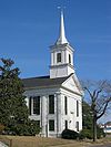
December 16, 1974 Main St. and Wilson Ave.
32°50′28″N 87°53′26″W / 32.841111°N 87.890556°WEutaw 11 Glenville April 2, 1982 200 Scears Dr.
32°50′14″N 87°54′22″W / 32.837222°N 87.906111°WEutaw 12 Rev. John H. Gray House April 2, 1982 709 Mesopotamia St.
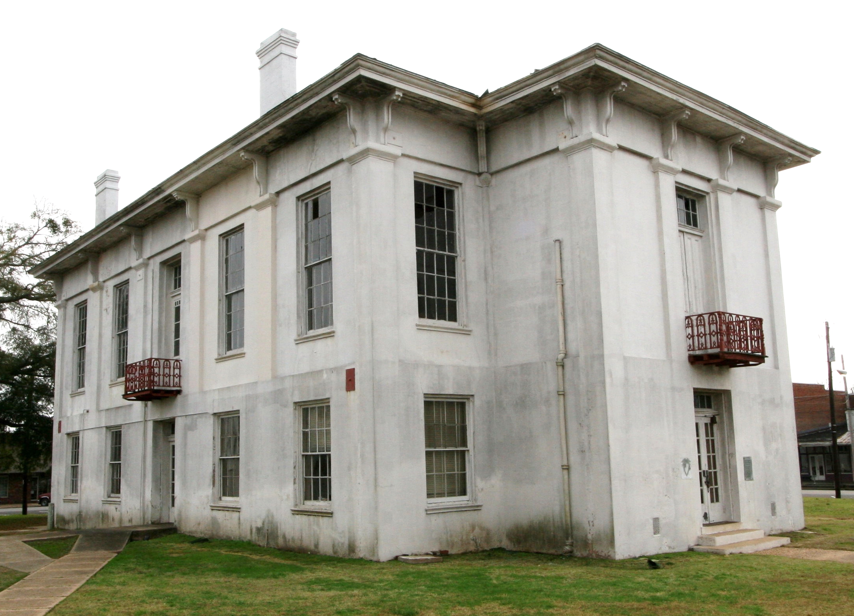
32°50′56″N 87°54′03″W / 32.848889°N 87.900833°WEutaw 13 Greene County Courthouse 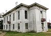
March 24, 1971 Courthouse Sq.
32°50′28″N 87°53′13″W / 32.841111°N 87.886944°WEutaw 14 Greene County Courthouse Square District December 31, 1979 U.S. Route 11 and State Route 7
32°50′25″N 87°53′17″W / 32.840278°N 87.888056°WEutaw 15 Benjamin D. Gullett House April 2, 1982 317 Main St.
32°50′25″N 87°53′24″W / 32.840278°N 87.89°WEutaw 16 Stephen Fowler Hale House April 2, 1982 223 Wilson Ave.
32°50′16″N 87°53′27″W / 32.837778°N 87.890833°WEutaw 17 William C. Jones House April 2, 1982 507 Mesopotamia St.
32°50′37″N 87°53′44″W / 32.843611°N 87.895556°WEutaw 18 Kirkwood 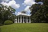
May 17, 1976 111 Kirkwood Dr.
32°50′47″N 87°53′45″W / 32.846389°N 87.895833°WEutaw 19 Dr. Willis Meriwether House 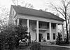
April 2, 1982 243 Wilson Ave.
32°50′21″N 87°53′26″W / 32.839167°N 87.890556°WEutaw 20 Samuel R. Murphy House April 2, 1982 1150 Mesopotamia St.
32°51′22″N 87°54′26″W / 32.856111°N 87.907222°WEutaw 21 William Perkins House 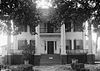
April 2, 1982 89 Spencer St.
32°50′18″N 87°53′21″W / 32.838333°N 87.889167°WEutaw 22 William F. Pierce House November 17, 1983 309 Womack Ave.
32°50′30″N 87°53′46″W / 32.841667°N 87.896111°WEutaw 23 Littleberry Pippen House April 2, 1982 431 Springfield Ave.
32°50′34″N 87°53′17″W / 32.842778°N 87.888056°WEutaw 24 Edwin Reese House 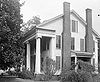
April 2, 1982 244 Wilson Ave.
32°50′23″N 87°53′23″W / 32.839722°N 87.889722°WEutaw 25 William A. Rogers House April 2, 1982 1149 Mesopotamia St.
32°51′22″N 87°54′22″W / 32.856111°N 87.906111°WEutaw 26 Rosemount 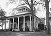
May 27, 1971 1 mile (1.6 km) northwest of Forkland
32°40′16″N 87°54′28″W / 32.671111°N 87.907778°WForkland 27 St. John's-In-The-Prairie 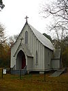
November 20, 1975 State Route 4
32°38′51″N 87°52′54″W / 32.6475°N 87.881667°WForkland 28 Phillip Schoppert House April 2, 1982 230 Prairie Ave.
32°50′17″N 87°53′15″W / 32.838056°N 87.8875°WEutaw 29 Thornhill 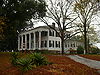
May 10, 1984 Northwest of Forkland
32°41′14″N 87°55′54″W / 32.687222°N 87.931667°WForkland 30 Iredell P. Vaughan House April 2, 1982 409 Wilson Ave.
32°50′31″N 87°53′27″W / 32.841944°N 87.890833°WEutaw 31 William Peter Webb House April 2, 1982 401 Main St.
32°50′30″N 87°53′33″W / 32.841667°N 87.8925°WEutaw 32 Asa White House 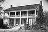
April 2, 1982 314 Mesopotamia St.
32°50′35″N 87°53′29″W / 32.843056°N 87.891389°WEutaw 33 William B. Wills House September 22, 1983 108 Ashby Dr.
32°50′50″N 87°53′43″W / 32.847222°N 87.895278°WEutaw 34 Catlin Wilson House 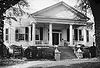
April 2, 1982 237 Wilson Ave.
32°50′20″N 87°53′26″W / 32.838889°N 87.890556°WEutaw 35 Daniel R. Wright House April 2, 1982 501 Pickens St.
32°50′34″N 87°53′00″W / 32.842778°N 87.883333°WEutaw See also
- Antebellum Homes in Eutaw Thematic Resource
- List of National Historic Landmarks in Alabama
- National Register of Historic Places listings in Alabama
References
- ^ The latitude and longitude information provided in this table was derived originally from the National Register Information System, which has been found to be fairly accurate for about 99% of listings. For about 1% of NRIS original coordinates, experience has shown that one or both coordinates are typos or otherwise extremely far off; some corrections may have been made. A more subtle problem causes many locations to be off by up to 150 yards, depending on location in the country: most NRIS coordinates were derived from tracing out latitude and longitudes off of USGS topographical quadrant maps created under the North American Datum of 1927, which differs from the current, highly accurate WGS84 GPS system used by Google maps. Chicago is about right, but NRIS longitudes in Washington are higher by about 4.5 seconds, and are lower by about 2.0 seconds in Maine. Latitudes differ by about 1.0 second in Florida. Some locations in this table may have been corrected to current GPS standards.
- ^ "National Register of Historic Places: Weekly List Actions". National Park Service, United States Department of the Interior. Retrieved on November 10, 2011.
- ^ Numbers represent an ordering by significant words. Various colorings, defined here, differentiate National Historic Landmark sites and National Register of Historic Places Districts from other NRHP buildings, structures, sites or objects.
- ^ Rupinski, Patrick (January 24, 2011). "Couple selling antebellum mansion in west Ala". The Gadsden Times. Gadsden, Alabama. http://www.gadsdentimes.com/article/20110124/APN/1101240505. Retrieved January 26, 2011.
- ^ Kimberly, Jacobson (2007). Greene County and Mesopotamia Cemetery. Arcadia Publishing. p. 75.
U.S. National Register of Historic Places in Alabama Lists by county Autauga • Baldwin • Barbour • Bibb • Blount • Bullock • Butler • Calhoun • Chambers • Cherokee • Chilton • Choctaw • Clarke • Clay • Cleburne • Coffee • Colbert • Conecuh • Coosa • Covington • Crenshaw • Cullman • Dale • Dallas • DeKalb • Elmore • Escambia • Etowah • Fayette • Franklin • Geneva • Greene • Hale • Henry • Houston • Jackson • Jefferson • Lamar • Lauderdale • Lawrence • Lee • Limestone • Lowndes • Macon • Madison • Marengo • Marion • Marshall • Mobile • Monroe • Montgomery • Morgan • Perry • Pickens • Pike • Randolph • Russell • St. Clair • Shelby • Sumter • Talladega • Tallapoosa • Tuscaloosa • Walker • Washington • Wilcox • Winston

Lists by city Other lists Municipalities and communities of Greene County, Alabama Cities 
Towns Unincorporated
communitiesCategories:- National Register of Historic Places in Greene County, Alabama
-


Wikimedia Foundation. 2010.