National Register of Historic Places listings in Mobile County, Alabama
- National Register of Historic Places listings in Mobile County, Alabama
-

Location of Mobile County in Alabama
This is a list of the National Register of Historic Places listings in Mobile County, Alabama.
This is intended to be a complete list of the properties and districts on the National Register of Historic Places in Mobile County, Alabama, United States. Latitude and longitude coordinates are provided for many National Register properties and districts; these locations may be seen together in a Google map.[1]
There are 124 properties and districts listed on the National Register in Mobile County, including 4 National Historic Landmarks. 102 of these sites, including all of the National Historic Landmarks, are located in Mobile, and are listed separately; the remaining 22 sites are listed here.
-
- This National Park Service list is complete through NPS recent listings posted November 10, 2011.[2]
Current listings
Mobile
Outside of Mobile
| [3] |
Landmark name |
Image |
Date listed |
Location |
City or town |
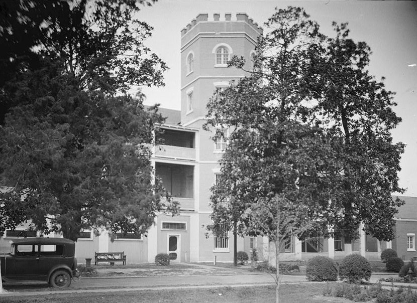
Summary |
| 1 |
Hiram B. Austin House |
|
01988-02-11February 11, 1988 |
12995 Dauphin Island Pkwy.
30°25′11″N 88°06′15″W / 30.419722°N 88.104167°W / 30.419722; -88.104167 (Hiram B. Austin House) |
Mon Louis Island |
|
| 2 |
Barr's Subdivision Historic District |
|
01990-01-25January 25, 1990 |
Roughly along U.S. 45 and Howard Ave. between LeBaron and State
31°05′30″N 88°14′21″W / 31.091667°N 88.239167°W / 31.091667; -88.239167 (Barr's Subdivision Historic District) |
Citronelle |
|
| 3 |
Bellingrath Gardens and Home |
|
01982-10-19October 19, 1982 |
South of Theodore off State Route 59
30°25′53″N 88°08′22″W / 30.431389°N 88.139444°W / 30.431389; -88.139444 (Bellingrath Gardens and Home) |
Theodore |
|
| 4 |
Bishop Manor Estate |
|
01985-02-14February 14, 1985 |
Argyl Rd.
30°27′01″N 88°15′35″W / 30.450278°N 88.259722°W / 30.450278; -88.259722 (Bishop Manor Estate) |
St. Elmo |
|
| 5 |
Central Core Historic District |
|
01990-01-25January 25, 1990 |
Roughly State St. and LeBaron Ave. from Mobile to 2nd Sts.
31°05′28″N 88°13′19″W / 31.091111°N 88.221944°W / 31.091111; -88.221944 (Central Core Historic District) |
Citronelle |
|
| 6 |
Chickasaw Shipyard Village Historic District |
|
02004-09-03September 3, 2004 |
Bounded by Jefferson St., Jackson St., Yeend Ave., and Chickasaw Creek
30°46′01″N 88°03′56″W / 30.766944°N 88.065556°W / 30.766944; -88.065556 (Chickasaw Shipyard Village Historic District) |
Chickasaw |
|
| 7 |
Citronelle Railroad Historic District |
|
01990-01-25January 25, 1990 |
Roughly Centre and Main from Union to Faye
31°05′09″N 88°13′43″W / 31.085833°N 88.228611°W / 31.085833; -88.228611 (Citronelle Railroad Historic District) |
Citronelle |
|
| 8 |
Willis G. Clark House |
|
01990-01-25January 25, 1990 |
East of U.S. Route 45 south of Citronelle
31°00′10″N 88°12′34″W / 31.002778°N 88.209444°W / 31.002778; -88.209444 (Willis G. Clark House) |
Citronelle |
|
| 9 |
Davis-Oak Grove District |
|
01988-05-03May 3, 1988 |
Western side of Oak Grove Rd. just north of Kali Oka Rd.
30°51′41″N 88°11′13″W / 30.861389°N 88.186944°W / 30.861389; -88.186944 (Davis-Oak Grove District) |
Mauvilla |
|
| 10 |
Ellicott Stone |
|
01973-04-11April 11, 1973 |
1 mile south of Bucks off U.S. Route 43
31°00′05″N 88°00′02″W / 31.001389°N 88.000556°W / 31.001389; -88.000556 (Ellicott Stone) |
Bucks |
|
| 11 |
Fort Gaines |
|
01976-12-12December 12, 1976 |
South of Mobile on the eastern end of Dauphin Island
30°14′52″N 88°04′31″W / 30.247778°N 88.075278°W / 30.247778; -88.075278 (Fort Gaines) |
Dauphin Island |
|
| 12 |
Charles Denby Garrison Sr. House |
|
02009-09-09September 9, 2009 |
County Road 55, approximately 1 mile northwest of its junction with State Route 158
30°48′54″N 88°07′58″W / 30.815°N 88.132778°W / 30.815; -88.132778 (Charles Denby Garrison Sr. House) |
Prichard |
|
| 13 |
Grand Bay Historic District |
|
01990-06-28June 28, 1990 |
Junction of Dezauche Ln. and Freeland
30°28′34″N 88°20′32″W / 30.476111°N 88.342222°W / 30.476111; -88.342222 (Grand Bay Historic District) |
Grand Bay |
|
| 14 |
Indian Mound Park |
|
01973-08-14August 14, 1973 |
Off Cadillac Ave. on the northern side of Dauphin Island
30°15′24″N 88°6′25″W / 30.25667°N 88.10694°W / 30.25667; -88.10694 (Indian Mound Park)[4]
|
Dauphin Island |
|
| 15 |
George Leatherbury House |
|
01990-06-14June 14, 1990 |
Shell Belt Rd. southeast of Sans Souci Beach
30°22′47″N 88°15′04″W / 30.379722°N 88.251111°W / 30.379722; -88.251111 (George Leatherbury House) |
Coden |
|
| 16 |
Jacob Magee House |
|
01988-02-12February 12, 1988 |
County Road 45 north of Kushla Mcleod Rd.
30°49′18″N 88°09′49″W / 30.821667°N 88.163611°W / 30.821667; -88.163611 (Jacob Magee House) |
Kushla |
|
| 17 |
Middle Bay Light |
|
01974-12-30December 30, 1974 |
Middle of Mobile Bay
30°26′10″N 88°01′05″W / 30.436111°N 88.018056°W / 30.436111; -88.018056 (Middle Bay Light) |
Mobile Bay |
|
| 18 |
Mount Vernon Arsenal-Searcy Hospital Complex |
|
01988-05-26May 26, 1988 |
Coy Smith Highway, ½ mile east of State Route 43
31°05′16″N 88°01′43″W / 31.087778°N 88.028611°W / 31.087778; -88.028611 (Mount Vernon Arsenal-Searcy Hospital Complex) |
Mt. Vernon |
|
| 19 |
Nanna Hubba Bluff |
|
01974-10-01October 1, 1974 |
Overlooking the Tombigbee River in the northeastern corner of Mobile County
31°9′26″N 87°58′33″W / 31.15722°N 87.97583°W / 31.15722; -87.97583 (Nanna Hubba Bluff)[5]
|
Calvert |
|
| 20 |
Old Mobile Site; Fort Louis De La Louisiane |
|
01976-05-06May 6, 1976 |
Twenty-Seven Mile Bluff on the Mobile River
30°58′01″N 87°59′32″W / 30.96701°N 87.99212°W / 30.96701; -87.99212 (Old Mobile Site)
|
Le Moyne |
|
| 21 |
Tanner Farmhouse |
|
02008-05-20May 20, 2008 |
6885 Walter Tanner Rd.
30°50′10″N 88°21′48″W / 30.836099°N 88.363402°W / 30.836099; -88.363402 (Tanner Farmhouse)
|
Wilmer |
|
| 22 |
N.Q. and Virginia M. Thompson House |
|
01990-01-25January 25, 1990 |
7850 LeBaron Ave.
31°05′41″N 88°13′42″W / 31.094722°N 88.228333°W / 31.094722; -88.228333 (N.Q. and Virginia M. Thompson House) |
Citronelle |
|
See also
References
- ^ The latitude and longitude information provided in this table was derived originally from the National Register Information System, which has been found to be fairly accurate for about 99% of listings. For about 1% of NRIS original coordinates, experience has shown that one or both coordinates are typos or otherwise extremely far off; some corrections may have been made. A more subtle problem causes many locations to be off by up to 150 yards, depending on location in the country: most NRIS coordinates were derived from tracing out latitude and longitudes off of USGS topographical quadrant maps created under the North American Datum of 1927, which differs from the current, highly accurate WGS84 GPS system used by Google maps. Chicago is about right, but NRIS longitudes in Washington are higher by about 4.5 seconds, and are lower by about 2.0 seconds in Maine. Latitudes differ by about 1.0 second in Florida. Some locations in this table may have been corrected to current GPS standards.
- ^ "National Register of Historic Places: Weekly List Actions". National Park Service, United States Department of the Interior. Retrieved on November 10, 2011.
- ^ Numbers represent an ordering by significant words. Various colorings, defined here, differentiate National Historic Landmark sites and National Register of Historic Places Districts from other NRHP buildings, structures, sites or objects.
- ^ Location derived from its GNIS feature record; the NRIS lists the site as "Address Restricted"
- ^ Location derived from its GNIS feature record; the NRIS lists the site as "Address Restricted"
Categories:
- National Register of Historic Places in Mobile County, Alabama
Wikimedia Foundation.
2010.
Look at other dictionaries:
National Register of Historic Places listings in Baldwin County, Alabama — Location of Baldwin County in Alabama This is a list of the National Register of Historic Places listings in Baldwin County, Alabama. This is intended to be a complete list of the properties and districts on the National Register of Historic… … Wikipedia
National Register of Historic Places listings in Marengo County, Alabama — Location of Marengo County in Alabama This is a list of the National Register of Historic Places listings in Marengo County, Alabama. This is intended to be a complete list of the properties and districts on the National Register of Historic… … Wikipedia
National Register of Historic Places listings in Montgomery County, Alabama — Location of Montgomery County in Alabama This is a list of the National Register of Historic Places listings in Montgomery County, Alabama. This is intended to be a complete list of the properties and districts on the National Register of… … Wikipedia
National Register of Historic Places listings in Wilcox County, Alabama — Location of Wilcox County in Alabama This is a list of the National Register of Historic Places listings in Wilcox County, Alabama. This is intended to be a complete list of the properties and districts on the National Register of Historic Places … Wikipedia
National Register of Historic Places listings in Dallas County, Alabama — Location of Dallas County in Alabama This is a list of the National Register of Historic Places listings in Dallas County, Alabama. This is intended to be a complete list of the properties and districts on the National Register of Historic Places … Wikipedia
National Register of Historic Places listings in Hale County, Alabama — Location of Hale County in Alabama This is a list of the National Register of Historic Places listings in Hale County, Alabama. This is intended to be a complete list of the properties and districts on the National Register of Historic Places in… … Wikipedia
National Register of Historic Places listings in Clarke County, Alabama — Location of Clarke County in Alabama This is a list of the National Register of Historic Places listings in Clarke County, Alabama. This is intended to be a complete list of the properties and districts on the National Register of Historic Places … Wikipedia
National Register of Historic Places listings in Jefferson County, Alabama — Location of Jefferson County in Alabama This is a list of the National Register of Historic Places listings in Jefferson County, Alabama. This is intended to be a complete list of the properties and districts on the National Register of Historic… … Wikipedia
National Register of Historic Places listings in Lee County, Alabama — Location of Lee County in Alabama This is a list of the National Register of Historic Places listings in Lee County, Alabama. This is intended to be a complete list of the properties and districts on the National Register of Historic Places in… … Wikipedia
National Register of Historic Places listings in Tuscaloosa County, Alabama — Location of Tuscaloosa County in Alabama This is a list of the National Register of Historic Places listings in Tuscaloosa County, Alabama. This is intended to be a complete list of the properties and districts on the National Register of… … Wikipedia