- National Register of Historic Places listings in Montgomery County, Alabama
-
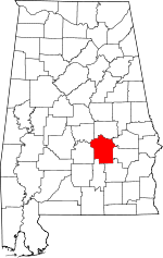 Location of Montgomery County in Alabama
This is a list of the National Register of Historic Places listings in Montgomery County, Alabama.
This is intended to be a complete list of the properties and districts on the National Register of Historic Places in Montgomery County, Alabama, United States. Latitude and longitude coordinates are provided for many National Register properties and districts; these locations may be seen together in a Google map.[1]
There are 61 properties and districts listed on the National Register in the county, including 3 National Historic Landmarks. One historic district once listed on the Register has been removed.
-
- This National Park Service list is complete through NPS recent listings posted November 10, 2011.[2]
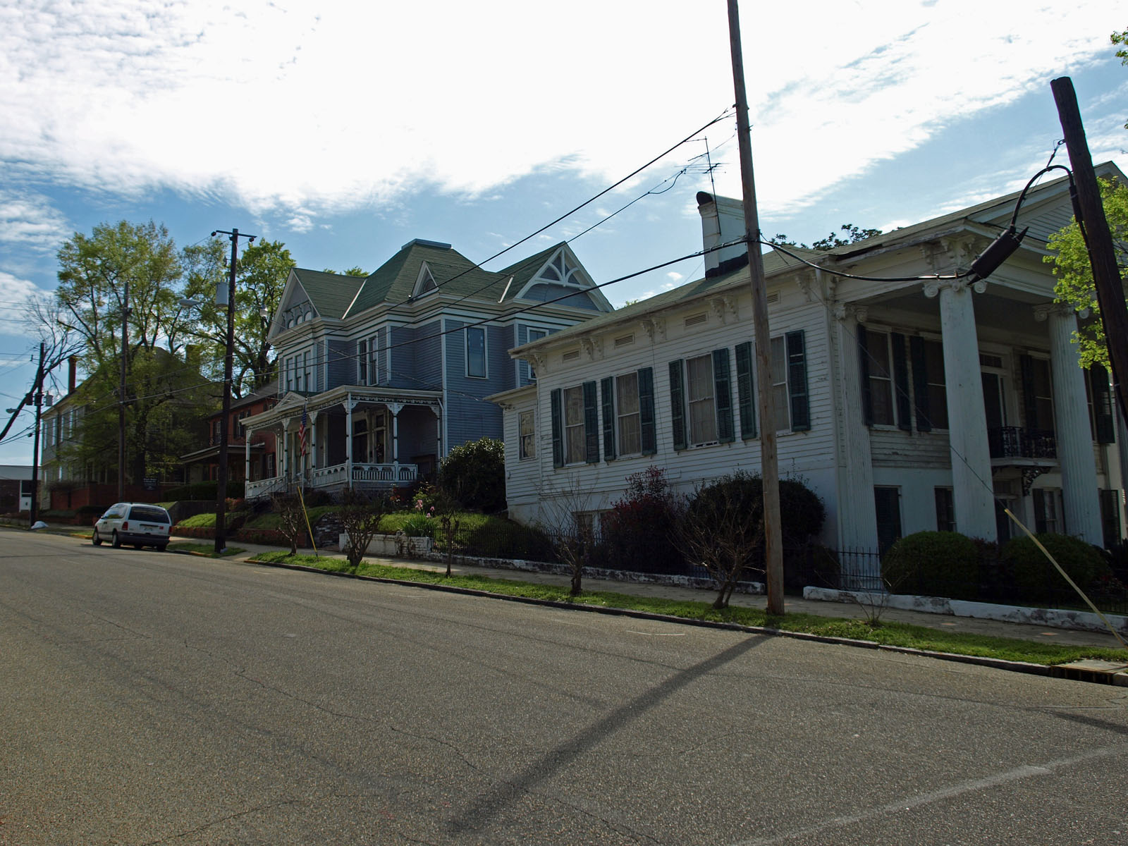
Current listings
[3] Landmark name Image Date listed Location City or town Summary 1 Alabama State Capitol 
October 15, 1966 Goat Hill, eastern end of Dexter Ave.
32°22′39″N 86°18′03″W / 32.3775°N 86.300833°WMontgomery 2 Alabama State University Historic District 
October 8, 1998 915 S. Jackson St.
32°21′51″N 86°17′51″W / 32.364167°N 86.2975°WMontgomery 3 Bell Building 
December 15, 1981 207 Montgomery St.
32°22′35″N 86°18′38″W / 32.376389°N 86.310556°WMontgomery 4 Brame House September 17, 1980 402-404 S. Hull St.
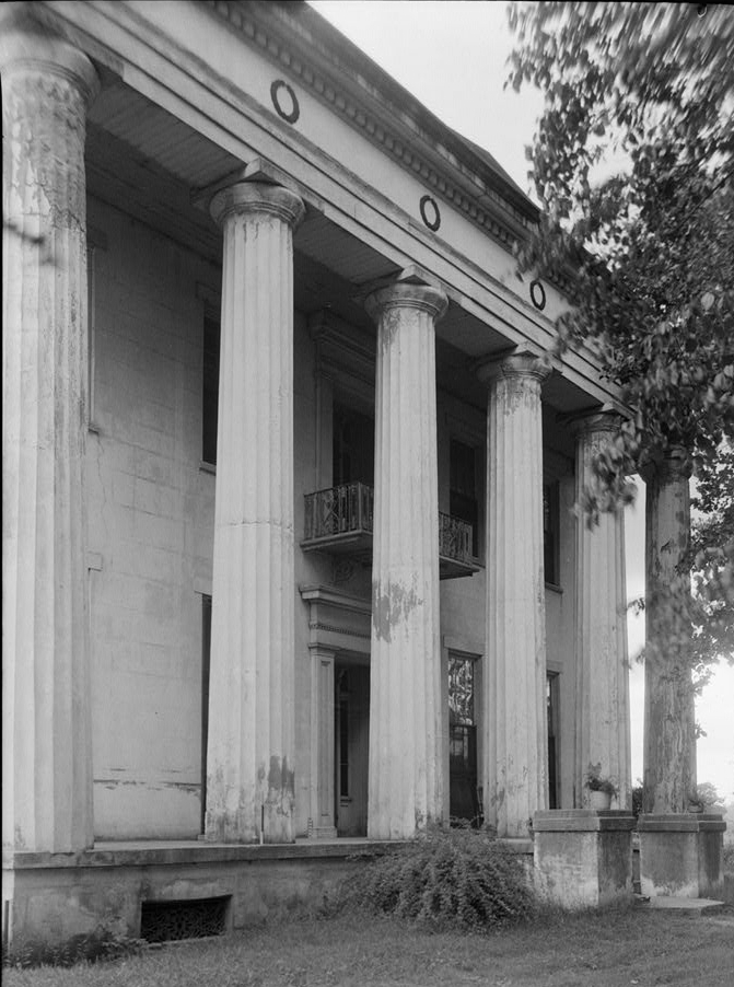
32°22′24″N 86°18′13″W / 32.373333°N 86.303611°WMontgomery 5 Patrick Henry Brittan House 
December 13, 1979 507 Columbus St.
32°22′56″N 86°18′08″W / 32.382222°N 86.302222°WMontgomery 6 Building 800-Austin Hall 
March 2, 1988 2nd St. at Maxwell Air Force Base
32°22′40″N 86°21′03″W / 32.377778°N 86.350833°WMontgomery 7 Building 836-Community College of the Air Force Building 
March 2, 1988 Maxwell Boulevard at Maxwell Air Force Base
32°22′48″N 86°21′07″W / 32.38°N 86.351944°WMontgomery 8 Cassimus House 
August 13, 1976 110 N. Jackson St.
32°22′43″N 86°17′47″W / 32.378611°N 86.296389°WMontgomery 9 City of St. Jude Historic District 
June 18, 1990 2048 W. Fairview Ave.
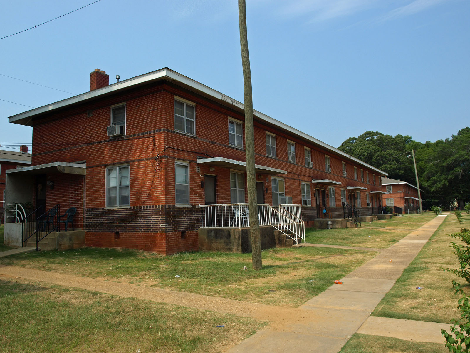
32°21′10″N 86°19′37″W / 32.352778°N 86.326944°WMontgomery 10 Cleveland Court Apartments 620–638 
October 29, 2001 620-638 Cleveland Ct.
32°21′47″N 86°19′03″W / 32.363056°N 86.3175°WMontgomery 11 Cloverdale Historic District 
September 12, 1985 Roughly bounded by Norman Bridge and Cloverdale Rd., Fairview and Felder Aves. and Boultier St.
32°21′18″N 86°17′42″W / 32.355°N 86.295°WMontgomery 12 Cottage Hill Historic District 
November 7, 1976 Roughly bounded by Goldthwaite, Bell, Holt, and Clayton Sts.
32°22′29″N 86°19′05″W / 32.374722°N 86.318056°WMontgomery 13 Court Square Historic District 
March 1, 1982 21-35 Court St., 1-2 Dexter Ave., 18-24 N. Court St., and Court Sq.; also roughly Dexter Ave. and Perry, Court, and Monroe Sts.
32°22′38″N 86°18′32″W / 32.377222°N 86.308889°WMontgomery Second set of boundaries represents a boundary increase, the Court Square-Dexter Avenue Historic District Boundary Increase, listed on August 30, 1984 14 Jefferson Davis Hotel 
March 13, 1979 Catoma and Montgomery Sts.
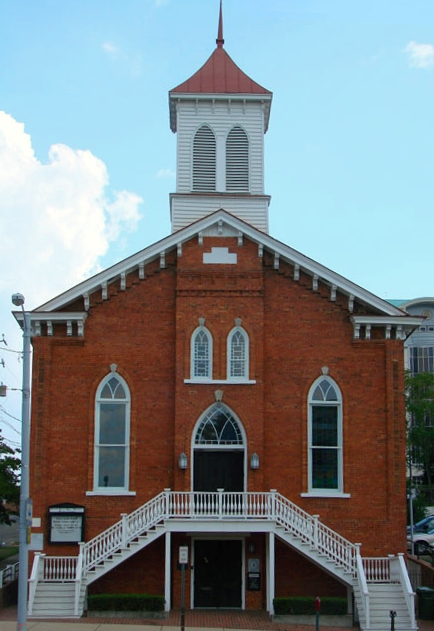
32°22′33″N 86°18′45″W / 32.375833°N 86.3125°WMontgomery 15 Dexter Avenue Baptist Church 
July 1, 1974 454 Dexter Ave.
32°22′38″N 86°18′10″W / 32.377222°N 86.302778°WMontgomery 16 Dowe Historic District 
December 29, 1988 320 and 334 Washington Ave. and 114-116 S. Hull St.
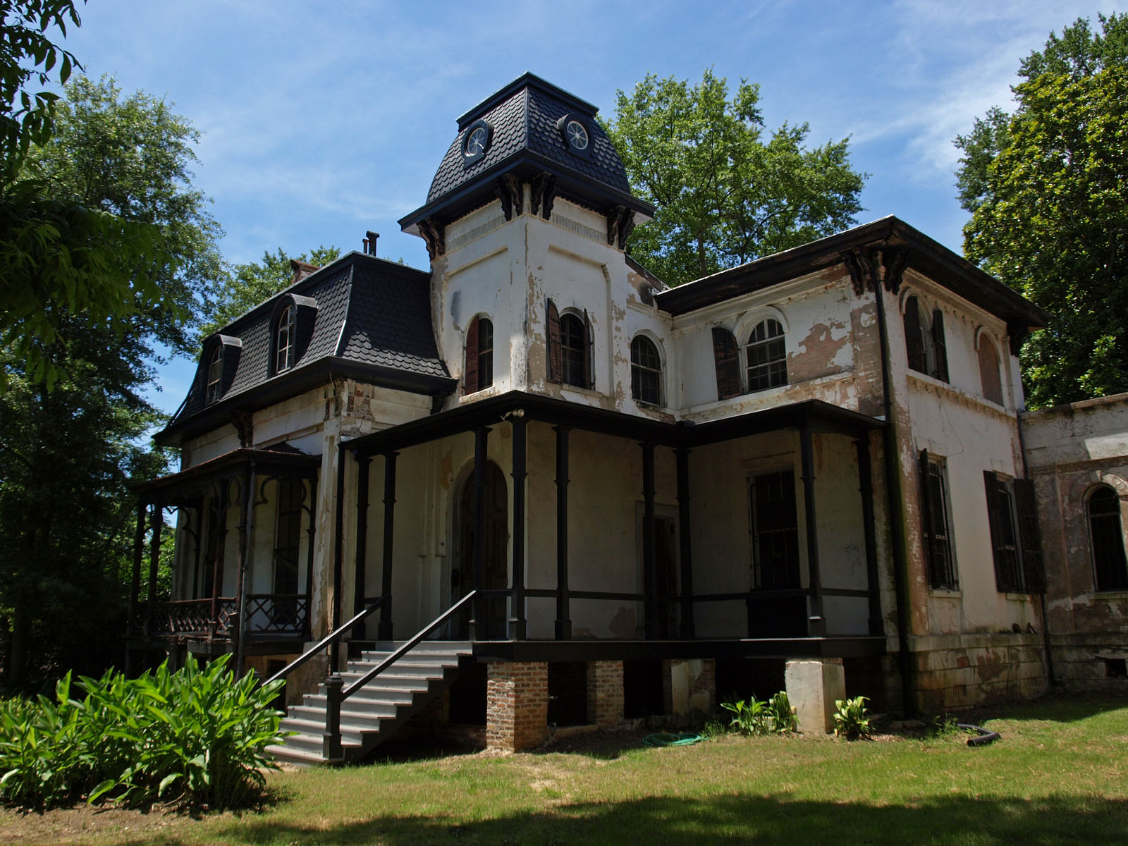
32°22′34″N 86°18′14″W / 32.376111°N 86.303889°WMontgomery 17 Edgewood 
April 24, 1973 3175 Thomas Ave.
32°20′48″N 86°17′11″W / 32.346667°N 86.286389°WMontgomery 18 First White House of the Confederacy 
June 25, 1974 644 Washington Ave.
32°22′34″N 86°18′00″W / 32.376111°N 86.3°WMontgomery 19 Garden District 
September 13, 1984 Roughly bounded by Norman Bridge Rd., Court St., and Jeff Davis and Fairview Aves.
32°21′29″N 86°18′19″W / 32.358056°N 86.305278°WMontgomery 20 Gay House 
March 15, 1975 230 Noble Ave.
32°21′46″N 86°18′17″W / 32.362778°N 86.304722°WMontgomery 21 Gerald-Dowdell House 
April 28, 1980 405 S. Hull St.
32°22′25″N 86°18′12″W / 32.373611°N 86.303333°WMontgomery 22 Governor's Mansion 
July 3, 1972 1142 S. Perry St.
32°21′43″N 86°18′26″W / 32.361944°N 86.307222°WMontgomery 23 Grace Episcopal Church 
February 19, 1982 906 Pike Rd.
32°21′18″N 86°05′50″W / 32.355°N 86.097222°WMount Meigs 24 Harrington Archaeological Site 
January 25, 1979 Address Restricted Montgomery 25 Huntingdon College Campus Historic District 
February 24, 2000 1500 E. Fairview Ave.
32°20′59″N 86°17′06″W / 32.349722°N 86.285°WMontgomery 26 Jefferson Franklin Jackson House 
May 17, 1984 409 S. Union St.
32°22′24″N 86°17′56″W / 32.373333°N 86.298889°WMontgomery 27 Jere Shine Site December 8, 1978 Address Restricted Montgomery 28 Gov. Thomas G. Jones House 
December 8, 1978 323 Adams Ave.
32°22′32″N 86°18′14″W / 32.375556°N 86.303889°WMontgomery 29 Lower Commerce Street Historic District 
March 29, 1979 Roughly bounded by railroad tracks, Commerce, N. Court, and Bibb Sts.; also roughly bounded by railroad tracks, N. Court, Commerce, Coosa, and Tallapoosa Sts; also roughly bounded by the former Central of Georgia railroad tracks, N. Lawrence St., Madison Ave., and Commerce St.
32°22′49″N 86°18′38″W / 32.380278°N 86.310556°WMontgomery Second and third sets of boundaries represent boundary increases of February 25, 1982 and January 15, 1987 30 Maxwell Air Force Base Senior Officers' Quarters Historic District 
March 2, 1988 West Dr., N. Juniper and S. Juniper Sts., Inner Circle, Center Dr., Sequoia, and East Dr. at Maxwell Air Force Base
32°22′51″N 86°20′24″W / 32.380833°N 86.34°WMontgomery 31 McBryde-Screws-Tyson House 
November 28, 1980 433 Mildred St.
32°22′13″N 86°18′54″W / 32.370278°N 86.315°WMontgomery 32 Montgomery Greyhound Bus Station 
May 16, 2011 210 S. Court St.
32°22′29″N 86°18′33″W / 32.374722°N 86.309167°WMontgomery Site of a clash between Freedom riders and protesters in 1961. Today serves as a civil rights museum. 33 Montgomery Union Station and Trainshed 
July 24, 1973 Water St.
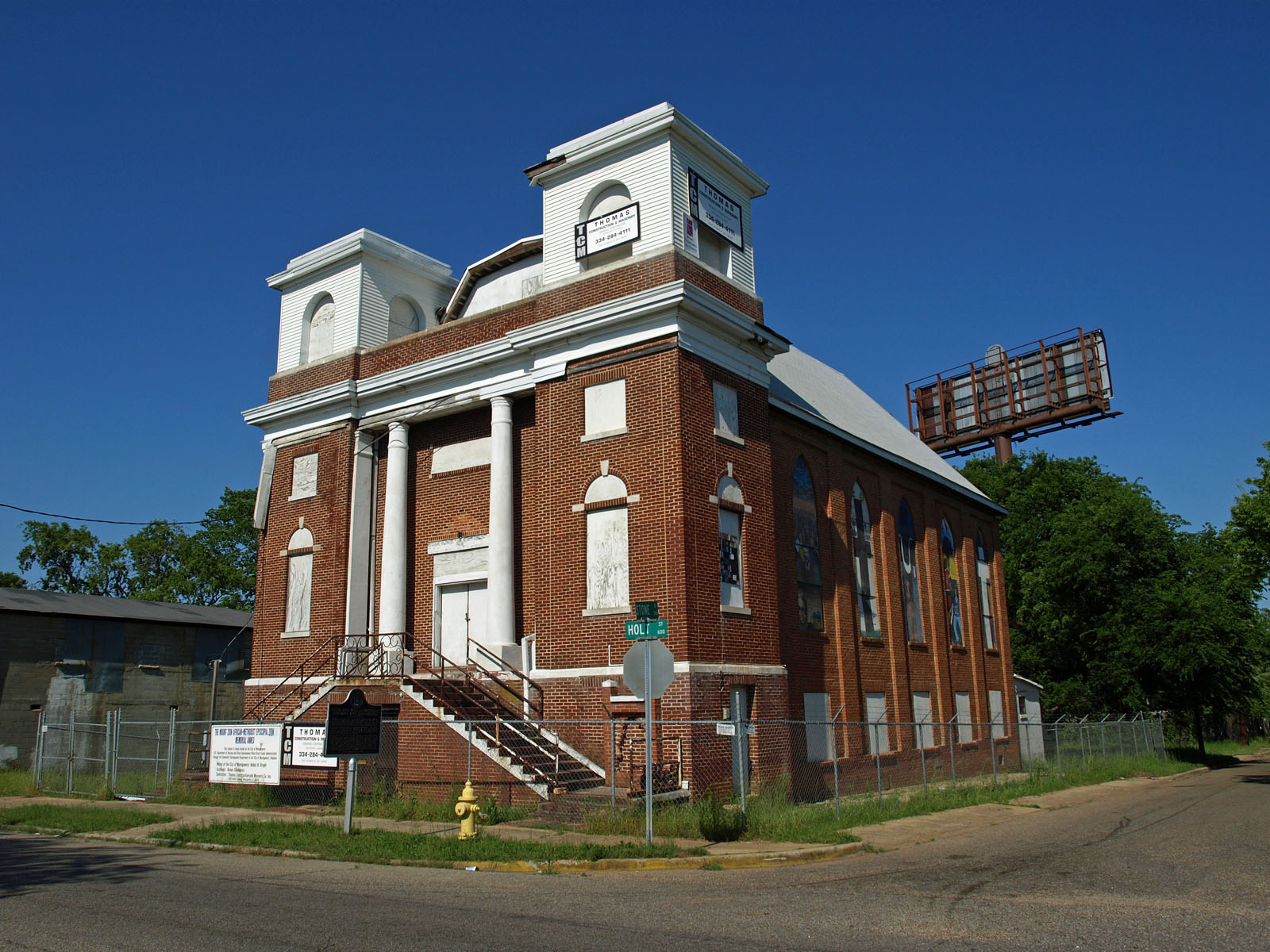
32°22′49″N 86°18′52″W / 32.380278°N 86.314444°WMontgomery 34 Mt. Zion AME Zion Church 
October 4, 2002 467 Holt St.
32°22′06″N 86°19′14″W / 32.368333°N 86.320556°WMontgomery 35 Muklassa August 28, 1973 Address Restricted Montgomery 36 The Murphy House 
March 24, 1972 22 Bibb St.
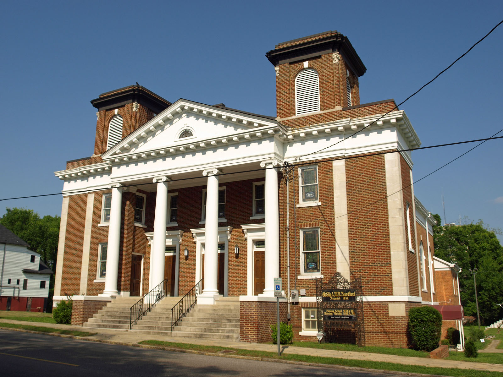
32°22′48″N 86°18′34″W / 32.38°N 86.309444°WMontgomery 37 Old Ship African Methodist Episcopal Zion Church 
January 24, 1991 483 Holcombe St.
32°22′17″N 86°18′42″W / 32.371389°N 86.311667°WMontgomery 38 Opp Cottage 
May 4, 1976 33 W. Jefferson Davis Ave.
32°21′57″N 86°18′36″W / 32.365833°N 86.31°WMontgomery 39 Ordeman-Shaw Historic District 
May 13, 1971 Bounded by McDonough, Decatur, Madison, and Randolph Sts.
32°22′54″N 86°18′14″W / 32.381667°N 86.303889°WMontgomery 40 Pastorium, Dexter Avenue Baptist Church 
March 10, 1982 309 S. Jackson St.
32°22′23″N 86°17′46″W / 32.373056°N 86.296111°WMontgomery 41 Pepperman House 
March 1, 1982 17 Mildred St.
32°22′15″N 86°18′35″W / 32.370833°N 86.309722°WMontgomery 42 Perry Street Historic District 
December 16, 1971 Roughly bounded by McDonough St. on the east, Sayre St. on the west, Washington St. on the north, and Donaldson St. on the south
32°22′26″N 86°18′27″W / 32.373889°N 86.3075°WMontgomery 43 Powder Magazine 
April 13, 1973 End of Eugene St.
32°22′53″N 86°19′41″W / 32.381389°N 86.328056°WMontgomery American Civil War-era building for gunpowder storage. Located in Powder Magazine Park, the building is currently under restoration. 44 St. John's Episcopal Church 
February 24, 1975 113 Madison Ave.
32°22′49″N 86°18′26″W / 32.380278°N 86.307222°WMontgomery 45 Sayre Street School 
February 19, 1982 506 Sayre St.
32°22′14″N 86°18′38″W / 32.370556°N 86.310556°WMontgomery 46 Scott Street Firehouse 
February 12, 1981 418 Scott St.
32°22′25″N 86°18′10″W / 32.373611°N 86.302778°WMontgomery 47 Semple House 
September 27, 1972 S. Court & High Sts.
32°22′19″N 86°18′31″W / 32.371944°N 86.308611°WMontgomery 48 Shepherd Building 
May 22, 1986 312 Montgomery St.
32°22′34″N 86°18′43″W / 32.376111°N 86.311944°WMontgomery 49 Smith-Joseph-Stratton House 
April 11, 1985 302 Alabama St.
32°22′26″N 86°18′17″W / 32.373889°N 86.304722°WMontgomery 50 South Perry Street Historic District 
August 30, 1984 Roughly Perry St. between Washington St. and Dexter Ave.
32°22′36″N 86°18′27″W / 32.376667°N 86.3075°WMontgomery 51 Stay House 
September 10, 1979 631 S. Hull St
32°22′10″N 86°18′11″W / 32.369444°N 86.303056°WMontgomery 52 Steiner-Lobman and Teague Hardware Buildings 
January 31, 1979 184 and 172 Commerce St.
32°22′49″N 86°18′41″W / 32.380278°N 86.311389°WMontgomery 53 Stone Plantation 
December 31, 2001 5001 Old Selma Rd.
32°21′02″N 86°25′31″W / 32.350556°N 86.425278°WMontgomery 54 Tankersley Rosenwald School 
January 22, 2009 10 miles south of Montgomery on U.S. Route 31 to Pettus Rd. to School Spur on the western side
32°08′32″N 86°21′24″W / 32.142222°N 86.356667°WHope Hull 55 Dr. C.A. Thigpen House 
December 13, 1977 1412 S. Perry St.
32°21′33″N 86°18′25″W / 32.359167°N 86.306944°WMontgomery 56 Tulane Building 
March 21, 1979 800 High St.
32°22′19″N 86°17′52″W / 32.371944°N 86.297778°WMontgomery 57 Tyson-Maner House 
May 10, 1979 469 S. McDonough St.
32°22′19″N 86°18′16″W / 32.371944°N 86.304444°WMontgomery 58 United States Post Office and Courthouse-Montgomery 
June 3, 1998 Church St. between Moulton and Lee Sts.
32°22′30″N 86°18′34″W / 32.375°N 86.309444°WMontgomery 59 Winter Building 
January 14, 1972 2 Dexter Ave.
32°22′38″N 86°18′32″W / 32.377222°N 86.308889°WMontgomery 60 Winter Place 
May 31, 2006 454 S. Goldthwaite St.
32°22′17″N 86°18′56″W / 32.371389°N 86.315556°WMontgomery 61 William Lowndes Yancey Law Office 
November 7, 1973 Washington and Perry Sts.
32°22′35″N 86°18′26″W / 32.376389°N 86.307222°WMontgomery Former listings
Landmark name Image Date listed/removed Location City or Town Summary 1 North Lawrence-Monroe Street Historic District Listed August 30, 1984
Removed October 6, 2011132-148, 216, and 220 Monroe St. and 14, 22, 28-40, and 56 N. Lawrence St.
32°22′41″N 86°18′21″W / 32.37806°N 86.30583°WMontgomery See also
- List of National Historic Landmarks in Alabama
- National Register of Historic Places listings in Alabama
References
- ^ The latitude and longitude information provided in this table was derived originally from the National Register Information System, which has been found to be fairly accurate for about 99% of listings. For about 1% of NRIS original coordinates, experience has shown that one or both coordinates are typos or otherwise extremely far off; some corrections may have been made. A more subtle problem causes many locations to be off by up to 150 yards, depending on location in the country: most NRIS coordinates were derived from tracing out latitude and longitudes off of USGS topographical quadrant maps created under the North American Datum of 1927, which differs from the current, highly accurate WGS84 GPS system used by Google maps. Chicago is about right, but NRIS longitudes in Washington are higher by about 4.5 seconds, and are lower by about 2.0 seconds in Maine. Latitudes differ by about 1.0 second in Florida. Some locations in this table may have been corrected to current GPS standards.
- ^ "National Register of Historic Places: Weekly List Actions". National Park Service, United States Department of the Interior. Retrieved on November 10, 2011.
- ^ Numbers represent an ordering by significant words. Various colorings, defined here, differentiate National Historic Landmark sites and National Register of Historic Places Districts from other NRHP buildings, structures, sites or objects.
U.S. National Register of Historic Places in Alabama Lists by county Autauga • Baldwin • Barbour • Bibb • Blount • Bullock • Butler • Calhoun • Chambers • Cherokee • Chilton • Choctaw • Clarke • Clay • Cleburne • Coffee • Colbert • Conecuh • Coosa • Covington • Crenshaw • Cullman • Dale • Dallas • DeKalb • Elmore • Escambia • Etowah • Fayette • Franklin • Geneva • Greene • Hale • Henry • Houston • Jackson • Jefferson • Lamar • Lauderdale • Lawrence • Lee • Limestone • Lowndes • Macon • Madison • Marengo • Marion • Marshall • Mobile • Monroe • Montgomery • Morgan • Perry • Pickens • Pike • Randolph • Russell • St. Clair • Shelby • Sumter • Talladega • Tallapoosa • Tuscaloosa • Walker • Washington • Wilcox • Winston

Lists by city Other lists National Register of Historic Places in Montgomery County, Alabama National Historic Landmarks 
Historic districts Alabama State University Historic District | City of St. Jude Historic District | Cloverdale Historic District | Cottage Hill Historic District | Court Square Historic District | Dowe Historic District | Garden District | Huntingdon College Campus Historic District | Lower Commerce Street Historic District | Maxwell Air Force Base Senior Officers' Quarters Historic District | North Lawrence-Monroe Street Historic District | Ordeman-Shaw Historic District | Perry Street Historic District | South Perry Street Historic District
Other properties Bell Building | Brame House | Patrick Henry Brittan House | Building 800-Austin Hall | Building 836-Community College of the Air Force Building | Cassimus House | Cleveland Court Apartments 620–638 | Jefferson Davis Hotel | Edgewood | First White House of the Confederacy | Gay House | Gerald-Dowdell House | Governor's Mansion | Grace Episcopal Church | Harrington Archaeological Site | Jefferson Franklin Jackson House | Jere Shine Site | Gov. Thomas G. Jones House | McBryde-Screws-Tyson House | Mt. Zion AME Zion Church | Muklassa | The Murphy House | Old Ship African Methodist Episcopal Zion Church | Opp Cottage | Pastorium, Dexter Avenue Baptist Church | Pepperman House | Powder Magazine | St. John's Episcopal Church | Sayre Street School | Scott Street Firehouse | Semple House | Shepherd Building | Smith-Joseph-Stratton House | Stay House | Steiner-Lobman and Teague Hardware Buildings | Stone Plantation | Tankersley Rosenwald School | Dr. C.A. Thigpen House | Tulane Building | Tyson-Maner House | United States Post Office and Courthouse-Montgomery | Winter Building | Winter Place | William Lowndes Yancey Law Office
See also: National Register of Historic Places listings in Montgomery County, Alabama and List of National Historic Landmarks in AlabamaMunicipalities and communities of Montgomery County, Alabama Cities 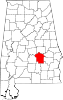
Unincorporated
communitiesAda | Boylston | Cecil | Grady | Hope Hull | Mount Meigs | Ramer | Waugh
Categories:- National Register of Historic Places in Montgomery County, Alabama
-


Wikimedia Foundation. 2010.