- Sequoia National Park
-
Sequoia National Park IUCN Category II (National Park)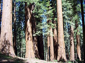
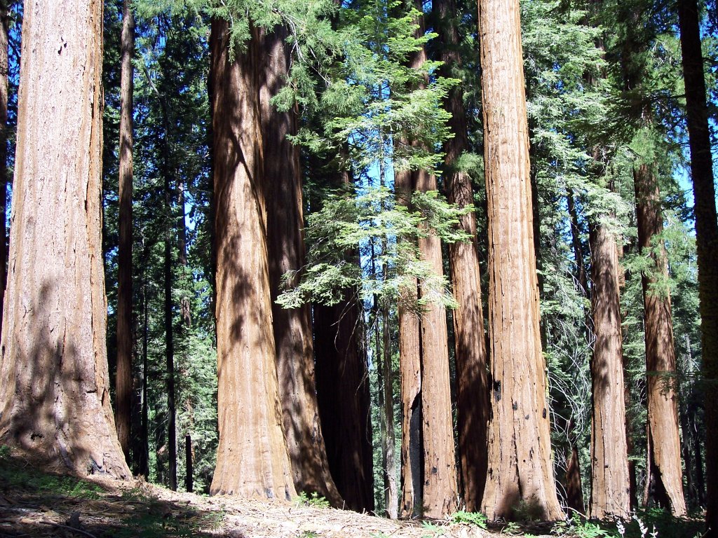
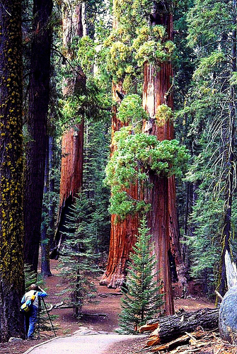
Giant sequoia trees in the Giant Forest, Sequoia National Park

Location Tulare County, California, United States Nearest city Visalia, California Coordinates 36°33′53″N 118°46′24″W / 36.56472°N 118.77337°WCoordinates: 36°33′53″N 118°46′24″W / 36.56472°N 118.77337°W Area 404,051 acres (1,635 km2)[1] Established September 25, 1890 Visitors 965,170 (in 2009)[2] Governing body National Park Service Sequoia National Park is a national park in the southern Sierra Nevada east of Visalia, California, in the United States. It was established on September 25, 1890. The park spans 404,051 acres (1,635 km2). Encompassing a vertical relief of nearly 13,000 feet (4,000 m),[1] the park contains among its natural resources the highest point in the contiguous 48 United States, Mount Whitney, at 14,505 feet (4,421 m) above sea level. The park is south of and contiguous with Kings Canyon National Park; the two are administered by the National Park Service together.
The park is famous for its giant sequoia trees, including the General Sherman tree, the largest tree on Earth. The General Sherman tree grows in the Giant Forest, which contains five out of the ten largest trees in the world. The Giant Forest is connected by the Generals Highway to Kings Canyon National Park's General Grant Grove, home to the General Grant tree among other giant sequoias. The park's giant sequoia forests are part of 202,430 acres (81,921 ha) of old-growth forests shared by Sequoia and Kings Canyon National Parks.[3] Indeed, the parks preserve a landscape that still resembles the southern Sierra Nevada before Euro-American settlement.[4]
Contents
Front country
Many park visitors enter Sequoia National Park through its southern entrance near the town of Three Rivers at Ash Mountain at 1,700 ft (520 m) elevation. The lower elevations around Ash Mountain contain the only National Park Service-protected California Foothills ecosystem, consisting of blue oak woodlands, foothills chaparral, grasslands, yucca plants, and steep, mild river valleys. The foothills region is also home to abundant wildlife: bobcats, foxes, ground squirrels, rattlesnakes, and mule deer are commonly seen in this area, and more rarely, reclusive mountain lions are seen as well. The California Black Oak is a key transition species between the chaparral and higher elevation conifer forest.[5]
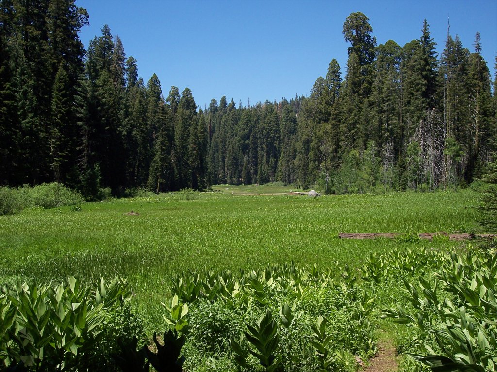
At higher elevations in the front country, between 5,500 and 9,000 feet (1,700 and 2,700 m) in elevation, the landscape becomes montane forest-dominated coniferous belt. Found here are Ponderosa, Jeffrey, sugar, and lodgepole pine trees, as well as abundant white and red fir. Found here too are the mighty giant sequoia trees, the most massive living single-stem trees on earth. Between the trees, spring and summer snowmelts sometimes fan out to form lush, though delicate, meadows. In this region, visitors often see mule deer, Douglas squirrels, and American black bears, which sometimes break into unattended cars to eat food left by careless visitors.
Back country

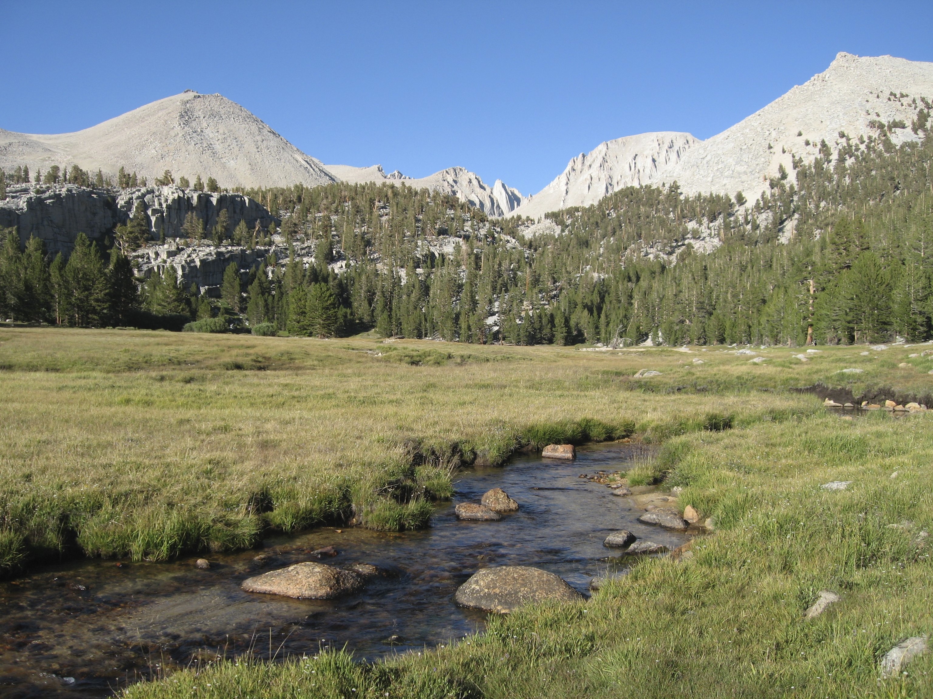
 Crabtree Meadows, west of Mt. Whitney
The vast majority of the park is roadless wilderness; in fact, to the surprise of many visitors, no road crosses the Sierra Nevada within the park's boundaries. 84% of Sequoia and Kings Canyon National Parks is designated as Wilderness[6] and is accessible only by foot or by horse.
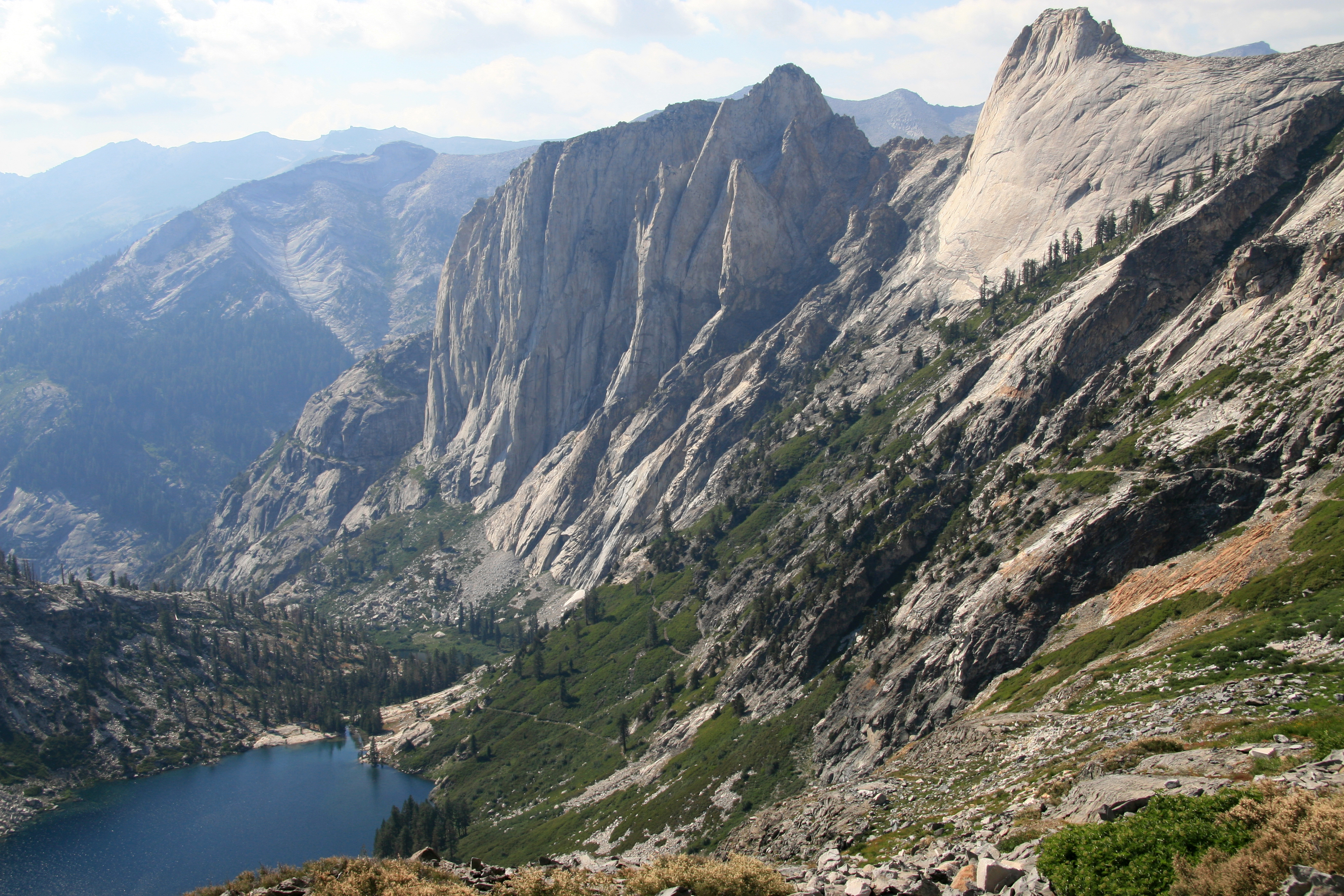
Sequoia's backcountry offers a vast expanse of high-alpine wonders. Covering the highest-elevation region of the High Sierra, the backcountry includes Mount Whitney on the eastern border of the park, accessible from the Giant Forest via the High Sierra Trail. On a traveler's path along this 35-mile (56 km) backcountry trail, one passes through about 10 miles (16 km) of montane forest before reaching the backcountry resort of Bearpaw Meadow, just short of the Great Western Divide. Bearpaw Meadow offers rustic tent cabins and gourmet meals cooked by a seasonal resident park crew.
Continuing along the High Sierra Trail over the Great Western Divide via Kaweah Gap, one passes from the Kaweah River Drainage, with its characteristic V-shaped river valleys, and into the Kern River drainage, where an ancient fault line has aided glaciers in the last ice age to create a U-shaped canyon that is almost perfectly straight for nearly 20 miles (32 km). On the floor of this canyon, at least 2 days hike from the nearest road, is the Kern Canyon hot spring, a popular resting point for weary backpackers. From the floor of Kern Canyon, the trail ascends again over 8,000 ft (2,400 m) to the summit of Mount Whitney. At Mount Whitney, the High Sierra Trail meets with the John Muir Trail and the Pacific Crest Trail, which continue northward along the Sierra crest and into the backcountry of Kings Canyon National Park.
Human history
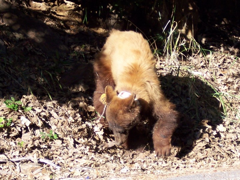
 American Black Bear, marked with a tracking collar. This bear has most likely been fed by visitors and is being monitored by the National Park Service to make sure it returns to its natural habits.
The area which now comprises Sequoia National Park was first home to Monachee (or Western Mono) Native Americans, who resided mainly in the Kaweah River drainage in the Foothills region of the park, though evidence of seasonal habitation exists even as high as the Giant Forest. In the summertime, Native Americans would travel over the high mountain passes to trade with tribes to the East. To this day, pictographs can be found at several sites within the park, notably at Hospital Rock and Potwisha, as well as bedrock mortars used to process acorns, a staple food for the Monachee people.
By the time the first European settlers arrived in the area, smallpox had already spread to the region, decimating Native American populations. The first European settler to homestead in the area was Hale Tharp, who famously built a home out of a hollowed-out fallen giant sequoia log in the Giant Forest next to Log Meadow. Tharp allowed his cattle to graze the meadow, but at the same time had a respect for the grandeur of the forest and led early battles against logging in the area. From time to time, Tharp received visits from John Muir, who would stay at Tharp's log cabin. Tharp's Log can still be visited today in its original location in the Giant Forest.
However, Tharp's attempts to conserve the giant sequoias were at first met with only limited success. In the 1880s, white settlers seeking to create a utopian society founded the Kaweah Colony, which sought economic success in trading Sequoia timber. However, Sequoia trees, unlike their coast redwood relatives, were later discovered to splinter easily and therefore were ill-suited to timber harvesting, though thousands of trees were felled before logging operations finally ceased.
The National Park Service incorporated the Giant Forest into Sequoia National Park in 1890, the year of its founding, promptly ceasing all logging operations in the Giant Forest. The park has expanded several times over the decades to its present size; one of the most recent expansions occurred in 1978, when grassroots efforts, spearheaded by the Sierra Club, fought off attempts by the Walt Disney Corporation to purchase a high-alpine former mining site south of the park for use as a ski resort. This site was annexed to the park to become Mineral King, the highest-elevation developed site within the park and a popular destination for backpackers.
Speleology
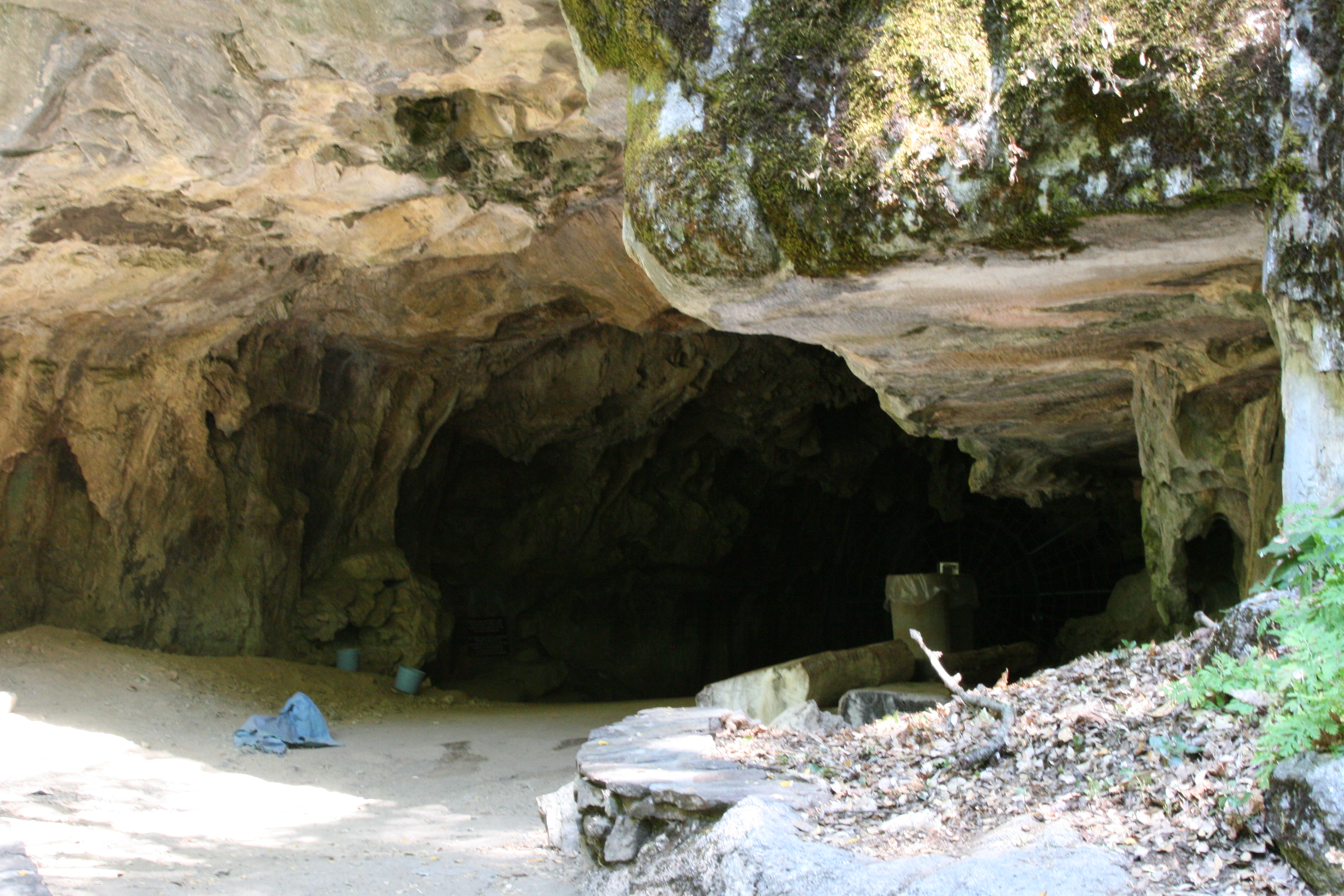
 Calcite formations in Crystal Cave
 Entrance to Crystal Cave
The park is home to over 240 known caves, and potentially hundreds more. The caves in the park include California's longest cave at over 20 miles (32 km), Lilburn Cave, as well as recently discovered caves that remain strictly off-limits to all but a handful of specialists who visit on rare occasions to study cave geology and biology. The only cave open to park visitors remains Crystal Cave, the park's second-longest at over 3.4 miles (5.5 km) and remarkably well-preserved for the volume of visitation it receives annually. It was discovered on April 28, 1918 by Alex Medley and Cassius Webster.[7] The cave is a constant 9 °C (48 °F), and only accessible by guided tour.
In 2003, the Sequoia National History Association (SNHA) created the Protect Sequoia Caves Program after vandals damaged areas at the entrance to Crystal Cave.[8]
Park caves, like most caves in the Sierra Nevada of California, are mostly solution caves dissolved from marble. Marble rock is essentially limestone that was metamorphosed by the heat and pressure of the formation and uplift of the Sierra Nevada Batholith (ca. 50-10 million years ago). The batholith's rapid uplift over the past 10 million years led to a rapid erosion of the metamorphic rocks in the higher elevations, exposing the granite beneath; therefore, most Sierra Nevada caves are found in the middle and lower elevations (below 7,000 ft/2,100 m), though some caves are found in the park at elevations as high as 10,000 ft (3,000 m) such as the White Chief cave in Mineral King. These caves are carved out of the rock by the abundant seasonal streams in the park; most of the larger park caves currently have or have had sinking streams running through them.
Caves are discovered every year in the park; in fact, 17 have been discovered since 2003 alone. The most recently discovered major cave in the park, in September 2006, has been named Ursa Minor.[9] Park caves are valued by scientists and cavers alike for their pristine beauty, variety, and endemic cave life.
Park attractions
 Sherman Tree Trail
 Tunnel Tree in 1940
 Crescent Meadow in the Giant Forest, called by John Muir the "Gem of the Sierra"
 View of Moro Rock from Potwisha, near Hospital Rock
In addition to hiking, camping, fishing, and backpacking, the following attractions are highlights with many park visitors:
- Sherman Tree Trail An 0.8-mile roundtrip paved trail that descends from the parking lot to the base of the General Sherman tree that meanders through a grove of giant sequoia trees.
- Tunnel Log is a tunnel cut through a fallen giant sequoia tree in Sequoia National Park. The tree, which measured 275 feet (84 m) tall and 21 feet (6.4 m) in diameter, fell across a park road in 1937 due to natural causes. The following year, a crew cut an 8-foot (2.4 m) tall, 17-foot (5.2 m) wide tunnel through the trunk, making the road passable again.
- Crescent Meadow is a small, sequoia-rimmed meadow in the Giant Forest region of Sequoia National Park. This sierran montane meadow marks the western terminus of the High Sierra Trail, which stretches from the meadow across the Great Western Divide to Mount Whitney. Pioneer Hale Tharp homesteaded in this and nearby Log Meadow. Conservationist John Muir visited this meadow many times and praised it highly calling it the "Gem of the Sierras". The meadow lies at the end of a three mile paved road which leaves the Generals Highway near the Giant Forest Museum.
- Moro Rock is a granite dome located in the center of the park, at the head of Moro Creek, between Giant Forest and Crescent Meadow. A 400-step stairway, built in the 1930s by the Civilian Conservation Corps, is cut into and poured onto the rock, so that visitors can hike to the top. The stairway is listed on the National Register of Historic Places. The view from the rock encompasses much of the Park, including the Great Western Divide. It has an elevation of 6,725 feet (2,050 m).
- Campgrounds in the park include three in the foothills area: Potwisha (42 sites), Buckeye Flat (28 sites), and South Fork (10 sites). Four campgrounds are at higher, conifer-dominated elevations, ranging from 6,650 to 7,500 feet (2,000 to 2,300 m): Atwell Mill (21 sites), Cold Springs (40 sites), Lodgepole (214 sites), and Dorst Creek (204 sites).
See also
- African-American Heritage Sites (U.S. National Park Service)
- Buffalo Soldier
- Ecology of the Sierra Nevada
- Fauna of the Sierra Nevada
- List of books about the Sierra Nevada for further reading
- List of largest giant sequoias
- List of plants of the Sierra Nevada (U.S.)
- National Register of Historic Places listings in Sequoia-Kings Canyon National Parks
References
- ^ a b "Listing of acreage as of 12/31/2010". Public Use Statistic Office, National Park Service. http://www.nature.nps.gov/stats/Acreage/acrebypark10cy.pdf.
- ^ "Five Year Annual Recreation Visits Report". Public Use Statistic Office, National Park Service. http://www.nature.nps.gov/stats/viewReport.cfm?selectedReport=SystemComparisonReport.cfm.
- ^ Bolsinger, CL; Waddell, KL (1993), Area of old-growth forests in California, Oregon, and Washington, United States Forest Service, Pacific Northwest Research Station, Resource Bulletin PNW-RB-197, http://www.fs.fed.us/pnw/pubs/pnw_rb197.pdf
- ^ Franklin, Jerry, F; Fites-Kaufmann, Jo Ann (1996), "Assessment of Late-Successional Forests of the Sierra Nevada", Status of the Sierra Nevada (III: Biological and Physical Elements of the Sierra Nevada ed.), Sierra Nevada Ecosystem Project. Final Report to Congress, pp. 627–71, http://ceres.ca.gov/snep/pubs/v2s3.html
- ^ C. Michael Hogan (2008) California Black Oak: Quercus kelloggii, GlobalTwitcher.com, ed. Nicklas Stromberg
- ^ Sierra Nevada Wilderness Education Project http://sierranevadawild.gov/wild/sequoiakings-canyon
- ^ Despain, Joel (1995), Crystal Cave: A Guidebook to the Underground World of Sequoia National Park, Sequoia Natural History Association, ISBN 1-878441-06-x
- ^ Crystal Cave. Sequoia National History Association. Last accessed January 27, 2007.
- ^ Magical underground world: Just-discovered cave in Sequoia National Park http://www.sfgate.com/cgi-bin/article.cgi?f=/c/a/2006/09/24/CAVE.TMP&feed=rss.news
External links
- NPS: official Sequoia and Kings Canyon National Parks website
- Sequoia National Park Webcam
- Sequoia National Park Webcam time lapse animations
- NPS: Online Map
- QTVRs in Sequoia National Park
- Lary M. Dilsaver and William C. Tweed, Challenge of the Big Trees [Comprehensive natural and human history of the park: full text of book online]
- Pictures from a Mineral King loop hike
National parks of the United States Acadia • American Samoa • Arches • Badlands • Big Bend • Biscayne • Black Canyon of the Gunnison • Bryce Canyon • Canyonlands • Capitol Reef • Carlsbad Caverns • Channel Islands • Congaree • Crater Lake • Cuyahoga Valley • Death Valley • Denali • Dry Tortugas • Everglades • Gates of the Arctic • Glacier • Glacier Bay • Grand Canyon • Grand Teton • Great Basin • Great Sand Dunes • Great Smoky Mountains • Guadalupe Mountains • Haleakalā • Hawaiʻi Volcanoes • Hot Springs • Isle Royale • Joshua Tree • Katmai • Kenai Fjords • Kings Canyon • Kobuk Valley • Lake Clark • Lassen Volcanic • Mammoth Cave • Mesa Verde • Mount Rainier • North Cascades • Olympic • Petrified Forest • Redwood • Rocky Mountain • Saguaro • Sequoia • Shenandoah • Theodore Roosevelt • Virgin Islands • Voyageurs • Wind Cave • Wrangell-St. Elias • Yellowstone • Yosemite • Zion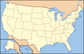
Protected areas of California National Park System National Parks Channel Islands · Death Valley · Joshua Tree · Kings Canyon · Lassen Volcanic · Redwood · Sequoia · YosemiteNational Preserves National Monuments Cabrillo · Devils Postpile · Lava Beds · Muir Woods · Pinnacles · World War II Valor in the Pacific National MonumentNational Seashores National Historical Parks National Historic Sites National Memorials Port Chicago Naval MagazineNational Recreation Areas National Forests National Forests Angeles · Cleveland · Eldorado · Inyo · Klamath · Lassen · Los Padres · Mendocino · Modoc · Plumas · San Bernardino · Sequoia · Shasta-Trinity · Sierra · Six Rivers · Stanislaus · TahoeNational Wilderness
Preservation SystemAgua Tibia · Ansel Adams · Bucks Lake · Caribou · Carson-Iceberg · Castle Crags · Cucamonga · Desolation · Dick Smith · Dinkey Lakes · Emigrant · Golden Trout · Hoover · Inyo Mountains · Ishi · Jennie Lakes · John Muir · Kaiser · Marble Mountain · Mokelumne · Mount Shasta Wilderness · North Fork · San Gabriel · Sanhedrin · San Jacinto · San Rafael · Sespe · Siskiyou · Snow Mountain · South Fork Eel River · South Sierra · South Warner · Thousand Lakes · Trinity Alps · Ventana · Yolla Bolly-Middle Eel · YukiOther State Forests Boggs Mountain Demonstration · Ellen Pickett · Jackson Demonstration · Las Posadas · LaTour Demonstration · Mount Zion · Mountain Home Demonstration · Soquel Demonstration
National Wildlife Refuges Antioch Dunes · Bitter Creek · Blue Ridge · Butte Sink · Castle Rock · Clear Lake · Coachella Valley · Colusa · Delevan · Don Edwards San Francisco Bay · Ellicott Slough · Farallon · Guadalupe-Nipomo Dunes · Hopper Mountain · Humboldt Bay · Kern · Lower Klamath · Marin Islands · Merced · Modoc · Pixley · Sacramento · Sacramento River · Salinas River · San Diego Bay · San Diego · San Joaquin River · San Luis · San Pablo Bay · Seal Beach · Sonny Bono Salton Sea · Stone Lakes · Sutter · Tijuana Slough · Tule LakeState Wildlife Areas Wildlife Areas Antelope Valley · Ash Creek · Bass Hill · Battle Creek · Big Lagoon · Big Sandy · Biscar · Butte Valley · Buttermilk Country · Cache Creek · Camp Cady · Cantara/Ney Springs · Cedar Roughs · Cinder Flats · Collins Eddy · Colusa Bypass · Coon Hollow · Cottonwood Creek · Crescent City Marsh · Crocker Meadows · Daugherty Hill · Decker Island · Doyle · Dutch Flat · Eastlker River · Eel River · Elk Creek Wetlands · Elk River · Fay Slough · Feather River · Fitzhugh Creek · Fremont Weir · Grass Lake · Gray Lodge · Green Creek · Grizzly Island · Hallelujah Junction · Heenan Lake · Hill Slough · Hollenbeck Canyon · Honey Lake · Hope Valley · Horseshoe Ranch · Imperial · Indian Valley · Kelso Peak and Old Dad Mountains · Kinsman Flat · Knoxville · Laguna · Lake Berryessa · Lake Earl · Lake Sonoma · Little Panoche Reservoir · Los Banos · Lower Sherman Island · Mad River Slough · Marble Mountains · Mendota · Merrill's Landing · Miner Slough · Monache Meadows · Morro Bay · Moss Landing · Mouth of Cottonwood Creek · Napa-Sonoma Marshes · North Grasslands · O'Neill Forebay · Oroville · Petaluma Marsh · Pickel Meadow · Pine Creek · Point Edith · Putah Creek · Rector Reservoir · Red Lake · Rhode Island · Sacramento River · San Felipe Valley · San Jacinto · San Luis Obispo · San Luis Reservoir · San Pablo Bay · Santa Rosa · Shasta Valley · Silver Creek · Slinkard/Little Antelope · Smithneck Creek · South Fork · Spenceville · Surprise Valley · Sutter Bypass · Tehama · Truckee River · Upper Butte Basin · Volta · Warner Valley · Waukell Creek · West Hilmar · Westlker River · White Slough · Willow Creek · Yolo BypassEcological Reserves Albany Mudflats · Alkali Sink · Allensworth · Atascadero Creek Marsh · Bair Island · Baldwin Lake · Batiquitos Lagoon · Blue Sky · Boden Canyon · Boggs Lake · Bolsa Chica · Bonny Doon · Buena Vista Lagoon · Butler Slough · Butte Creek Canyon · Butte Creek House · Buttonwillow · By Day Creek · Calhoun Cut · Canebrake · Carlsbad Highlands · Carmel Bay · Carrizo Canyon · Carrizo Plains · China Point · Clover Creek · Coachella Valley · Coal Canyon · Corte Madera Marsh · Crestridge · Dairy Mart Ponds · Dales Lake · Del Mar Landing · Eden Landing · Elkhorn Slough · Estelle Mountain · Fall River Mills · Fish Slough · Fremont Valley · Goleta Slough · Indian Joe Spring · Kaweah · Kerman · King Clone · Laguna Laurel · Loch Lomond Vernal Pool · Lokern · Magnesia Spring · Marin Islands · Mattole River · McGinty Mountain · Morro Dunes · Morro Rock · Napa River · North Table Mountain · Oasis Spring · Panoche Hills · Peytonia Slough · Pine Hill · Piute Creek · Pleasant Valley · Point Lobos · Rancho Jamul · Redwood Shores · River Springs Lakes · Saline Valley · San Dieguito Lagoon · San Elijo Lagoon · San Felipe Creek · San Joaquin River · Santa Rosa Plateau · Springville · Stone Corral · Sycamore Canyon · Sycuan Peak · Thomes Creek · Tomales Bay · Upper Newport Bay · Watsonville Slough · West Mojave Desert · Woodbridge · YaudanchiMarine Protected Areas Abalone Cove · Agua Hedionda Lagoon · Albany Mudflats · Anacapa · Anacapa · Año Nuevo · Asilomar · Atascadero Beach · Bair Island · Batiquitos Lagoon · Big Creek · Big Creek · Big Sycamore Canyon · Bodega · Bolsa Chica · Buena Vista Lagoon · Cambria · Cardiff and San Elijo · Carmel Bay · Carmel Pinnacles · Carrington Point · Catalina Marine Science Center · Corte Madera Marsh · Crystal Cove · Dana Point · Del Mar Landing · Doheny · Doheny · Duxbury Reef · Edward F. Ricketts · Elkhorn Slough · Elkhorn Slough · Encinitas · Estero de Limantour · Fagan Marsh · Farallon Islands · Farnsworth Bank · Fort Ross · Gerstle Cove · Goleta Slough · Greyhound Rock · Gull Island · Harris Point · Heisler Park · Hopkins · Irvine Coast · James V. Fitzgerald · Judith Rock · Julia Pfeiffer Burns · La Jolla · Laguna Beach · Lovers Cove (Catalina Island) · Lovers Point · MacKerricher · Manchester and Arena Rock · Marin Islands · Mia J. Tegner · Moro Cojo Slough · Morro Bay · Morro Bay · Morro Beach · Natural Bridges · Niguel · Pacific Grove Marine Gardens · Painted Cave · Peytonia Slough · Piedras Blancas · Piedras Blancas · Pismo · Pismo-Oceano Beach · Point Buchon · Point Buchon · Point Cabrillo · Point Fermin · Point Lobos · Point Reyes Headlands · Point Sur · Point Sur · Portuguese Ledge · Punta Gorda · Redwood Shores · Refugio · Richardson Rock · Robert E. Badham · Robert W. Crown · Russian Gulch · Russian River · Salt Point · San Diego-Scripps · San Dieguito Lagoon · San Elijo Lagoon · Santa Barbara Island · Scorpion · Skunk Point · Sonoma Coast · Soquel Canyon · South Laguna Beach · South Point · Tomales Bay · Upper Newport Bay · Van Damme · Vandenberg · White Rock (Cambria)National Landscape Conservation System National Monuments National Conservation Areas California Desert · King RangeWilderness Areas Argus Range · Big Maria Mountains · Bigelow Cholla Garden · Bighorn Mountain · Black Mountain · Bright Star · Bristol Mountains · Cadiz Dunes · Carrizo Gorge · Chemehuevi Mountains · Chimney Peak · Chuckwalla Mountains · Chumash · Cleghorn Lakes · Clipper Mountain · Coso Range · Coyote Mountains · Darwin Falls · Dead Mountains · Dick Smith · El Paso Mountains · Fish Creek Mountains · Funeral Mountains · Golden Valley · Grass Valley · Headwaters Forest Reserve · Hollow Hills · Ibex · Indian Pass · Inyo Mountains · Jacumba · Kelso Dunes · Kiavah · Kingston Range · Little Chuckwalla Mountains · Little Picacho · Machesna Mountain · Matilija · Malpais Mesa · Manly Peak · Mecca Hills · Mesquite · Newberry Mountains · Nopah Range · North Algodones Dunes · North Mesquite Mountains · Old Woman Mountains · Orocopia Mountains · Otay Mountain · Owens Peak · Pahrump Valley · Palen/McCoy · Palo Verde Mountains · Picacho Peak · Piper Mountain · Piute Mountains · Red Buttes · Resting Spring Range · Rice Valley · Riverside Mountains · Rodman Mountains · Sacatar Trail · Saddle Peak Hills · San Gorgonio · Santa Lucia · Santa Rosa · Sawtooth Mountains · Sespe · Sheephole Valley · South Nopah Range · Stateline · Stepladder Mountains · Surprise Canyon · Sylvania Mountains · Trilobite · Turtle Mountains · Whipple Mountains ·National Marine Sanctuaries National Estuarine Research Reserves Elkhorn Slough · San Francisco Bay · Tijuana River Estuary
University of California Natural Reserve System Año Nuevo Island · Bodega Marine · Box Springs · Boyd Deep Canyon Desert Research Center · Burns Piñon Ridge · Carpinteria Salt Marsh · Chickering American River · Coal Oil Point · Dawson Los Monos Canyon · Eagle Lake Field Station · Elliott Chaparral · Emerson Oaks · Fort Ord · Hastings · James San Jacinto Mountains · Jenny Pygmy Forest · Jepson Prairie · Kendall-Frost Mission Bay Marsh · Kenneth S. Norris Rancho Marino · Landels-Hill Big Creek · McLaughlin · Motte Rimrock · Quail Ridge · Sagehen Creek Field Station · San Joaquin Freshwater Marsh · Santa Cruz Island · Scripps Coastal · Sedgwick · Stebbins Cold Canyon · Steele Burnand Anza-Borrego · Stunt Ranch Santa Monica Mountains · Sweeney Granite Mountains Desert Research Center · Valentine Eastern Sierra · Younger LagoonHeritage registers: World Heritage Sites · World Network of Biosphere Reserves · National Register of Historic Places · National Historic Landmarks · National Natural Landmarks · California Historical Landmarks · California Points of Historical Interest · California Register of Historical Resources
National Park Travelers Club Conventions 2003: Delaware Water Gap National Recreation Area • 2004: Rocky Mountain National Park • 2005: Mammoth Cave National Park • 2006: Sleeping Bear Dunes National Lakeshore • 2007: Olympic National Park • 2008: Lowell National Historical Park • 2009: Sequoia National Park • 2010: El Malpais National Monument • 2011: National Mall • 2012 (planned): Apostle Islands National LakeshoreCategories:- IUCN Category II
- Sequoia National Park
- Protected areas of the Sierra Nevada (U.S.)
- Parks in Tulare County, California
- Old growth forests
- Protected areas established in 1890
- Biosphere reserves of the United States
- National parks in California
- Sierra Nevada (U.S.)
- Campgrounds in California


Wikimedia Foundation. 2010.