- Newington Causeway
-
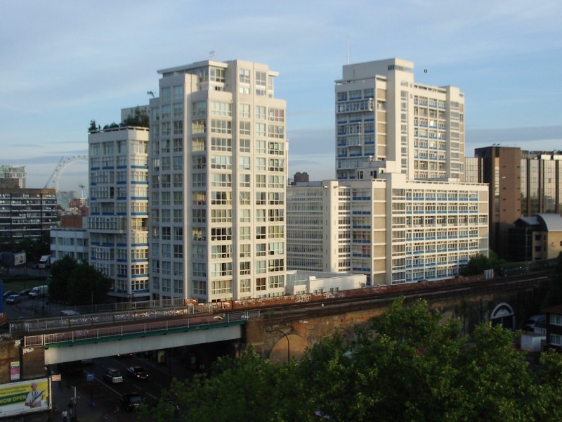
 View of Metro Central Heights, designed by Ernő Goldfinger, at the southern end of Newington Causeway.
 Entrance to the Elephant and Castle tube station at the junction of Newington Causeway with the Elephant and Castle roundabout.
Newington Causeway is a road in Southwark, London, England, between the Elephant and Castle and Borough High Street. The Elephant and Castle tube station is at the southern end.
In 1912, an outpatients' department of the South London Hospital for Women and Children was opened in Newington Causeway, using money raised by Harriet Shaw Weaver, publisher of The Freewoman, and other feminists [1].
Metro Central Heights (originally known as Alexander Fleming House), an early 1960s multi-storey office building designed by Ernő Goldfinger, is located here. The Ministry of Sound, a famous nightclub, is in Gaunt Street just off Newington Causeway. Also here is Inner London Sessions House, a Crown Court, and the Newington Court Business Centre.
The Institute of Optometry, formerly the London Refraction Hospital, is located at 56–62 Newington Causeway.[2] The Salvation Army UK and Republic of Ireland Territorial Headquarters are located in a large building at 101 Newington Causeway.[3]
The road forms part of the A3.
Major adjoining roads and streets
- Borough High Street
- Borough Road
- Elephant and Castle roundabout
- Gaunt Street
- Harper Road
- Southwark Bridge Road
See also
References
- ^ Elston, M.A., Colley, Eleanor Davies (1874–1934), Oxford Dictionary of National Biography, Oxford University Press, 2004.
- ^ The Institute of Optometry, 56–62 Newington Causeway, London, All In London, UK.
- ^ How can I contact The Salvation Army?, Salvation Army, UK.
External links
Coordinates: 51°29′52″N 0°05′54″W / 51.4979°N 0.0984°W
Categories:- Streets in Southwark
- The Salvation Army
- London road stubs

Wikimedia Foundation. 2010.