- Pioneer Square, Seattle, Washington
Infobox_nrhp | name =Pioneer Square-Skid Road District
nrhp_type =
caption = Pioneer Square
location=Seattle, Washington
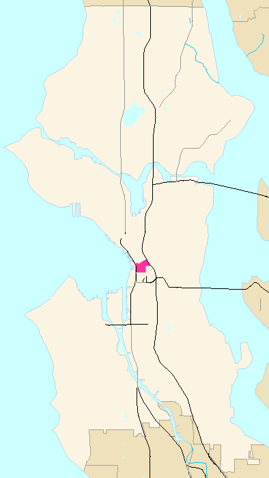
locmapin = Washington
area =
built =1853
architect= Multiple;Elmer H. Fisher (original) Multiple (increase) Multiple (2nd increase)
architecture= Late Victorian, Romanesque (original) Italianate, Other, Romanesque (increase) Chicago, Other (2nd increase)
added =June 22 ,1970 (original)July 07 ,1978 (increase)June 16 ,1988 (2nd increase)
governing_body = Local
refnum=70000086 (original) 78000341 (increase) 88000739 (2nd increase)cite web|url=http://www.nr.nps.gov/iwisapi/explorer.dll?IWS_SCHEMA=NRIS97&IWS_LOGIN=1&IWS_REPORT=100000001| title=Impromptu Web Query| work=National Register Information System / National Register of Historic Places|date=2007-12-31|publisher=National Park Service]Pioneer Square is the
neighborhood whereSeattle, Washington , USA was founded in 1852, following a brief six month settlement atAlki Point . The early structures in the neighborhood were mostly wooden, and nearly all burned in theGreat Seattle Fire of 1889. By the end of 1890, dozens of brick and stone buildings had been erected in their stead; to this day, the architectural character of the neighborhood derives from these late 19th century buildings, mostly examples ofRichardsonian Romanesque . [ [http://www.cityofseattle.net/neighborhoods/preservation/pioneersquare.htm Pioneer Square Preservation District] , Seattle Department of Neighborhoods. Accessed2007-11-29 .] [Jeffrey Karl Ochsner, and Dennis Alan Andersen, "Distant Corner: Seattle Architects and the Legacy of H. H. Richardson", University of Washington Press, Seattle, 2003. ISBN 0-295-98238-1. "passim."]The neighborhood takes its name from a small triangular plaza near the corner of First Avenue and Yesler Way, originally known as Pioneer Place. [Citation
last =Jones
first =Nard
author-link =Nard Jones
year = 1972
title =Seattle
place =Garden City, New York
publisher =Doubleday
isbn =0385018754
page = 195] The Pioneer Square-Skid Road Historic District, a historic district including that plaza and several surrounding blocks, is listed on theNational Register of Historic Places .Like virtually all Seattle neighborhoods, the Pioneer Square neighborhood lacks definitive borders. It is bounded roughly by Alaskan Way S. on the west, beyond which are the docks of
Elliott Bay ; by S. King Street on the south, beyond which is SoDo; by 5th Avenue S. on the east, beyond which is the International District; and it extends between one and two blocks north of Yesler Way, beyond which is the rest of Downtown. Because Yesler Way marks the boundary between two differentplat s, the street grid north of Yesler does not line up with the neighborhood's other streets (nor with the compass), so the northern "border" of the district zigzags along numerous streets.In some places, the Pioneer Square-Skid Road Historic District extends beyond these borders. It includes Union Station east of 4th Avenue S., and several city blocks south of S. King Street. [Map near top of Klondike Gold Rush National Historical Park, Administrative History, [http://www.nps.gov/archive/klgo/adhi/adhi11.htm Chapter 11: Establishing the Seattle Unit] . Accessed online
2007-11-26 .]History
The settlement's importance was guaranteed in 1852, when
Henry Yesler chose the site for his lumber mill, which was located on Elliott Bay at the foot of what is now Yesler Way, right on the border between the land claimed (and soon thereafter platted) by David Swinson "Doc" Maynard (to the south) and that platted byArthur Denny andCarson Boren .Much of the neighborhood is on landfill: in pioneer times, the area roughly between First and Second Avenue, bounded on the south by Jackson Street, and extending north almost to Yesler Way (about two-and-a-half city blocks) was a low-lying offshore island. The mainland shore roughly followed what is now Yesler Way to about Fourth Avenue, then ran southeast, at an angle of about 45 degrees to the current shoreline. Slightly inland were steep bluffs, which were largely smoothed away by regrading in the late 19th and early 20th century.
Yesler Way, originally Mill Street, is the main east-west street through the Pioneer Square neighborhood. Immediately south of the square itself, it was the dividing line between Maynard's original claim (to the south) and Boren's (to the north). It became "the Deadline", the northern border of the "restricted district," originally Maynardtown, later "Down in the Sawdust", the Lava Beds, the Tenderloin, White Chapel, or "Wrappyville" (after a particularly corrupt police chief), where low entertainment and vice were long tolerated. One of the earliest names, and one that stuck well into second half of the 20th century, was "
Skid Row ". [cite book
last = Morgan
first = Murray
title = Skid Road: Seattle, Her First Hundred Years
publisher =Ballantine Books
year = 1960
pages = 6-7
isbn = 0345243102]Late 19th century
to see what remains of the old storefronts.
Just before the fire, cable car service was instituted from Pioneer Square along Yesler Way to
Lake Washington and the Leschi neighborhood.20th century
During the
Klondike Gold Rush in 1897 and 1898, Seattle was a center for travel toAlaska . Thousands of so-called "sourdoughs" passed through Seattle making the city's merchants prosperous. A year later, in 1899, a group of businessmen stole aTlingit totem pole and placed it in Pioneer Place Park. When an arsonist destroyed the pole in 1938, the city sent the pieces back to the Tlingit tribe who carved a new one and gave it to Seattle (after finally getting paid for the one that was originally stolen). In addition to the totem pole, a wrought-iron Victorianpergola and a bust ofChief Seattle were added to the park in 1909.The year 1914 saw the completion of the
Smith Tower , which at the time was the tallest building west of theMississippi River . However, by that time, the heart of Downtown Seattle had moved north. The building of Second Avenue Extension in 1928-29 [http://web1.seattle.gov/dpd/historicalsite/QueryResult.aspx?ID=1711933663 Summary for 318 2nd Ave Extension / Parcel ID 5247800930] , Seattle Department of Neighborhoods. Accessed online2007-11-28 .] reconfigured the eastern portion of the neighborhood, by extending a piece of the north-of-Yesler street grid south past Yesler and "slicing into buildings in its path". The cable car line serving the area was shut down onAugust 10 ,1940 .1960s
In the 1960s, Pioneer Square became a target of
urban renewal . One proposal was to replace the buildings with parking garages to serve Downtown Seattle. In 1962, the historicSeattle Hotel was replaced with one such parking garage, commonly referred to as the "Sinking Ship" garage because of its appearance when viewed from 1st and Yesler; it stands to this day. Another proposal was to build a ring road which would have required destroying many of Pioneer Square's buildings. Many buildings were saved by the "benign neglect" of landownerSam Israel . [Paul Dorpat, [http://seattletimes.nwsource.com/pacificnw/2003/0126/nowthen.html An Art-full Restoration] , "Pacific Northwest" Magazine, a Sunday supplement to the "Seattle Times",January 26 ,2003 . Article about the Collins Building in Seattle's Pioneer Square neighborhood. Accessed online2007-12-01 .] Although he rarely sold any of his buildings, he sold the Union Trust Building to architect Ralph Anderson, whose rehabilitation of that building set the pattern for the neighborhood's rehabilitation. [Marcie Sillman, [https://www.kuow.org/DefaultProgram.asp?ID=12375 Downtown: The First Downtown] ,KUOW-FM ,March 12 ,2007 . Accessed online2007-12-03 .] In 1970, preservationists such asBill Speidel ,Victor Steinbrueck , and others succeeded in listing the neighborhood as historic district listed on theNational Register of Historic Places . Later that year, Pioneer Square became a city preservation district.1980s
Streetcar service returned to Pioneer Square onMay 29 ,1982 , with the opening of theWaterfront Streetcar .21st century
Today, Pioneer Square is home to art galleries, internet companies, cafés, sports bars, nightclubs, bookstores, and a unit of the
Klondike Gold Rush National Historical Park , the other unit of which is located in Skagway,Alaska . It is often described as the center of Seattle's nightlife.Crisis
In early 2001, Pioneer Square suffered three crises. First, on
January 15 , an eighteen-wheelersemi-truck crashed into the pergola, shattering it into thousands of pieces; it has since been restored. Next, onFebruary 27 , violence erupted in the neighborhood's Fat Tuesday festivities during which a young man,Kris Kime , was fatally beaten. Finally, the next day (February 28 ), a major earthquake damaged some of the buildings. Had most of them not undergoneseismic retrofit ting, the damage would likely have been much worse.Gallery
Notes
References
* Andrews, Mildred Tanner, editor, "Pioneer Square: Seattle's Oldest Neighborhood",University of Washington Press , Seattle and London 2005.
* Buerge, David, "Seattle in the 1880s", Historical Society of Seattle and King County, Seattle 1986.
* Morgan, Murray, "Skid Road", Ballantine Books (1960).
* Ochsner, Jeffrey Karl, and Andersen, Dennis Alan, “After the Fire: The Influence of H. H. Richardson on the Rebuilding of Seattle, 1889-1894,” "Columbia" 17 (Spring 2003), pages 7-15.
* Ochsner, Jeffrey Karl, and Andersen, Dennis Alan, "Distant Corner: Seattle Architects and the Legacy of H.H.Richardson",University of Washington Press , Seattle and London 2003.
* Ochsner, Jeffrey Karl, and Andersen, Dennis Alan, “Meeting the Danger of Fire: Design and Construction in Seattle after 1889.” "Pacific Northwest Quarterly" 93 (Summer 2002), pages 115-126.
* Warren, James R., "The Day Seattle Burned: June 6, 1889", Seattle 1989.External links
* [http://www.cityofseattle.net/neighborhoods/preservation/pioneersquare.htm Pioneer Square Preservation District] , Seattle Department of Neighborhoods
* [http://web1.seattle.gov/dpd/historicalsite/QueryResults.aspx?QRY=ATTR&YEBUS=&YEBUE=&ST=&NE=Pioneer+Square&AR= Historic sites in Pioneer Square] , Seattle Department of Neighborhoods: extensive information about historic buildings and structures in the Pioneer Square neighborhood.
* [http://seattlepi.nwsource.com/webtowns/article.asp?WTID=10&ID=107343 Seattle Post-Intelligencer: Pioneer Square]
* [http://www.historylink.org/_output.cfm?file_id=3392 Seattle/King Co. HistoryLink.org: Pioneer Square — Thumbnail History]
* [http://nwda-db.wsulibs.wsu.edu/findaid/ark:/80444/xv93380 Guide to the Pioneer Square Preservation District Records 1970-1997]
*Steven Dutch, [http://www.uwsp.edu/geo/projects/geoweb/participants/dutch/VTrips/SeattleUGrd.HTM Seattle Underground] , includes numerous pictures of the neighborhood and the "underground"
* [http://www.sceneinseattle.org Pioneer Squares Contemporary Art History]
* [http://www.pioneersquare.com Pioneer Square Seattle Hotel] The only hotel located in Seattle's Pioneer Square District.
* [http://www.cr.nps.gov/nr/twhp/55klondike/55klondike.htm "Gold Fever! Seattle Outfits the Klondike Gold Rush," a National Park Service Teaching with Historic Places (TwHP) lesson plan]
Wikimedia Foundation. 2010.