- Mong Pan
-
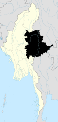
Mong Pan is a town and seat of Mong Pan Township in the southern Shan State of Burma. To the south it borders Mae Hong Son Province in Thailand and lies west of the Salween River. It lies along National Road 45.
 This article incorporates text from a publication now in the public domain: Chisholm, Hugh, ed (1911). Encyclopædia Britannica (11th ed.). Cambridge University Press.
Coordinates: 20°19′N 98°22′E / 20.317°N 98.367°E
Shan State Capital: TaunggyiTaunggyi District 
Loilem District Loilem Township · Nansang Township · Kunhing Township · Lai-Hka Township · Kyethi Township · Mong Kung Township · Mong Hsu TownshipLashio District Mu Se District Kyaukme District Kunlong District Kengtung District Mong Hsat District Tachileik District Mong Hpayak District Langkho District Danu Self-Administered Zone Pa-O Self-Administered Zone Pa Laung Self-Administered Zone Kokang Self-Administered Zone Konkyan Township · Laukkaing TownshipWa Self-Administered Division Hopang Township · Mongmaw Township · Panwai Township · Nahpan Township · Metman Township · Pangsang TownshipMain cities and towns Taunggyi · Ayetharyar · Nyaungshwe · Hopong · Hsi Hseng · Kalaw · Aungban · · Lawksawk · Pinlaung · Pekon · Loilen · Pang Long · Langkho · Nansang · Kunhing · Mong Nai · Lai-Hka · Mawkmai · Mong Pan · Hong Pai · Kyethi · Mong Kung · Mong Hsu · Mong Ton · Lashio · Hseni · Mongyai · Tangyan · Muse · Mongko · Nanhkan · Kutkai · Kyaukme · Nawnghkio · Hsipaw · Namtu · Namhsan · Mongmit · Mabein · Mantong · Kunlong · Hopang · Laukkaing · Chinshwehaw · Kengtung · Mong Khet · Mong Yang · Mong Hsat · Mong Ping · Tachileik · Mong Hpayak · Mong YawngCategories:- Populated places in Shan State
- Township capitals of Burma
- Shan State geography stubs


Wikimedia Foundation. 2010.