- Conington, South Cambridgeshire
-
Not to be confused with Conington, Huntingdonshire.
Coordinates: 52°16′39″N 0°03′57″W / 52.277522°N 0.065704°W
Conington 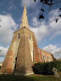
Conington Church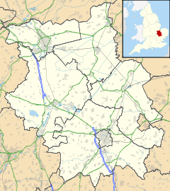
 Conington
Conington shown within CambridgeshireOS grid reference TL323663 District South Cambridgeshire Shire county Cambridgeshire Region East Country England Sovereign state United Kingdom EU Parliament East of England List of places: UK • England • Cambridgeshire Conington is a small village in the South Cambridgeshire district of Cambridgeshire with about 50 houses and 150 residents. It lies about 10 kilometres (6 mi) southeast of Huntingdon and 2 kilometres (1 mi) south of the A14 road. The church is dedicated to St. Mary. It has a wonky steeple and one of the bells is one of the oldest bells in Cambridgeshire. There are some pictures and a description of the church at the Cambridgeshire Churches website.[1]
The village has a pub called The White Swan.
References
External links
Categories:- Villages in Cambridgeshire
- Civil parishes in Cambridgeshire
- Cambridgeshire geography stubs


Wikimedia Foundation. 2010.