- Maguindanao
-
"Maguindanao" redirects here. For other uses, see Maguindanao (disambiguation).
Maguindanao — Province — 
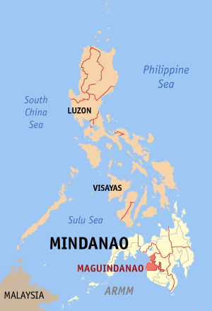
SealMap of the Philippines with Maguindanao highlighted
Coordinates: 7°08′N 124°18′E / 7.133°N 124.3°ECoordinates: 7°08′N 124°18′E / 7.133°N 124.3°E Country  Philippines
Region Autonomous Region in Muslim Mindanao (ARMM) Founded November 22, 1973 Capital Shariff Aguak Government – Governor Esmael Mangudadatu (Lakas-Kampi-CMD) Area – Total 7,142.0 km2 (2,757.5 sq mi) Area rank 11th out of 80 Population (2007) – Total 1,273,715 – Rank 16th out of 80 – Density 178.3/km2 (461.9/sq mi) – Density rank 45th out of 80 Divisions – Independent cities 1 – Component cities 0 – Municipalities 26 – Barangays 492
including independent cities: 529– Districts 1st and 2nd districts of Maguindanao (shared with Cotabato City) Time zone PHT (UTC+8) ZIP Code Spoken languages Bahasa Maguindanao Maguindanao (Filipino:Magindanaw) is a province of the Philippines located in the Autonomous Region in Muslim Mindanao (ARMM). Its capital is Shariff Aguak. It borders Lanao del Sur to the north, Cotabato to the east, and Sultan Kudarat to the south.
Contents
Geography
Maguindanao is composed of 26 municipalities, which are further subdivided into 492 barangays. Cotabato City is often grouped with Maguindanao, but it actually independent from the province.
The province is divided into two congressional districts. In October 2006, the first congressional district was split off into a new province, Shariff Kabunsuan. However, the ARMM's Act creating the province was nullified by the Supreme Court in July 2008, on the basis that creation of a province is a function of the Philippine legislature. The area has since reverted to the province of Maguindanao.
Municipality No. of
BarangaysPopulation
(2007)Area
(km²)Pop. density
(per km²)Ampatuan 11 33,702 Buluan 7 32,310 Datu Abdullah Sangki 10 33,259 Datu Anggal Midtimbang 7 23,713 Datu Hoffer Ampatuan 11[n 1] 22,471[n 1] Datu Paglas 23 29,979 Datu Piang 16[n 2] 18,995[n 2] Datu Salibo 17[n 3] 13,876[n 3] Datu Saudi-Ampatuan 9[n 4] 25,249[n 4] Datu Unsay 7[n 5] 22,622[n 5] Gen. S. K. Pendatun 19 36,038 Guindulungan 11 23,777 Mamasapano 14[n 6] 23,830[n 6] Mangudadatu 8 24,300 Pagagawan 11 32,995 Pagalungan 12 31,052 Paglat 8 23,432 Pandag 8 20,557 Rajah Buayan 11 24,973 Shariff Aguak (Maganoy) 14 41,725[n 7] Shariff Saydona Mustapha 16[n 8] 20,463[n 8] South Upi 11 32,014 Sultan sa Barongis (Lambayong) 12 25,767 Talayan 15 25,753 Talitay 9 21,964 Government
Maguindanao is divided into two congressional districts, which elect members to the House of Representatives. For the brief period that the province of Shariff Kabunsuan existed, Maguindanao became a lone-district province. Since the appointment of a new set of provincial officials for the reunified province of Maguindanao by the ARMM Governor in January 2009, the provincial government has reverted to the Sangguniang Panlalawigan setup (coterminous with the restored 1st and 2nd Congressional districts of Maguindanao) from before Shariff Kabunsuan was created.
Having elected to join the Autonomous Region in Muslim Mindanao (ARMM), Maguindanao also sends six representatives (three per district) to the ARMM Regional Legislative Assembly that convenes in Cotabato City.
History
Battle of Maguindanao Part of World War II Date January to September 1945 Location Maguindanao Result Filipino Victory Belligerents  Philippines
- Commonwealth Army of the Philippines
- Philippine Constabulary
- Recognized Maguindanaoan Guerrilla Units
 Empire of Japan
Strength 56,200 Filipino Troops
5,170 Maguindanaoan Guerrillas
740 Maguindanaoan Civilian Swordmen27,000 Japanese Troops Casualties and losses 260 killed
1,244 wounded6,000 killed
10,200 wounded
1,000 capturedShariff Mohammed Kabungsuwan of Johore introduced Islam in the area at the end of the 15th century. He subsequently married a local princess from the Iranun Tribe of Malabang and Maguindanao Province, and established the Sultanate of Maguindanao. The Cotabato Valley formed the sultanate's heartland but its influence extended from the Zamboanga Peninsula to Sarangani Bay and Davao.
The Spaniards launched expeditions to subdue the area throughout the colonial era but they never gained control of the region until the middle of the 19th century.
During the American period, Cotabato became a district of the Moro Province created in 1903 and a province of the Department of Mindanao and Sulu in 1914.
In 1942, the Japanese Imperial forces entered what is now Maguindanao.
In 1945, Maguindanao was liberated by allied Philippine Commonwealth troops and Maguindanaoan guerrilla units after defeating the Japanese Imperial forces in the Battle of Maguindanao during the Second World War.
The old province of Cotabato was divided in 1966 into Cotabato and South Cotabato. In 1973, the successor province of Cotabato was split into the provinces of Maguindanao, (North) Cotabato and Sultan Kudarat.
Maguindanao is the only Muslim-majority province of the four created out of the original Cotabato Province. In 1989, majority of its voters opted to join the Autonomous Region in Muslim Mindanao but Cotabato City did not, which, ironically, has since served as the provisional capital of the Autonomous Region in Muslim Mindanao (ARMM).
On October 31, 2006, Maguindanao voters approved the creation of a new province to be composed of 10 towns from the province. Of more than 500,000 voters registered, 285,372 favored the creation of the province, and 8,802 voted against it. The new province, Shariff Kabunsuan, became the country's 80th province and the 6th in the ARMM. It was composed of the towns of Datu Odin Sinsuat, Kabuntalan, Upi, Sultan Kudarat, Datu Blah T. Sinsuat, Sultan Mastura, Parang, Buldon, Matanog and Barira. However, in July 2008, the Supreme Court nullified the province's creation, restoring its municipalities to Maguindanao.
2009 election violence
Further information: Maguindanao massacre Maguindanao guerillas in 1999
On November 23, 2009, a 2010 gubernatorial election caravan supporting Esmael Mangudadatu, vice mayor of Buluan, was attacked.[1] Fifty-seven people were killed, including Mangudadatu's wife and sisters, supporters, local journalists, and bystanders.[2] On December 4, 2009 a number of homes belonging to the Ampatuan political family were raided in connection with the massacre.[3]
President Gloria Macapagal Arroyo officially declared martial law in the province of Maguindanao on December 5, 2009, Saturday morning.[4]
In a press conference past 7 am, Executive Secretary Eduardo Ermita announced Proclamation No. 1959 declaring a state of martial law and suspending the privilege of the writ of habeas corpus in the province of Maguindanao, except for certain areas identified as bailiwicks of the Moro Islamic Liberation Front (MILF) separatists.
The declaration of martial law will lead to the "arrests without warrants" of other members of the Ampatuan clan who have been linked to the November 23 massacre of 58 civilians.[5]
Musical heritage
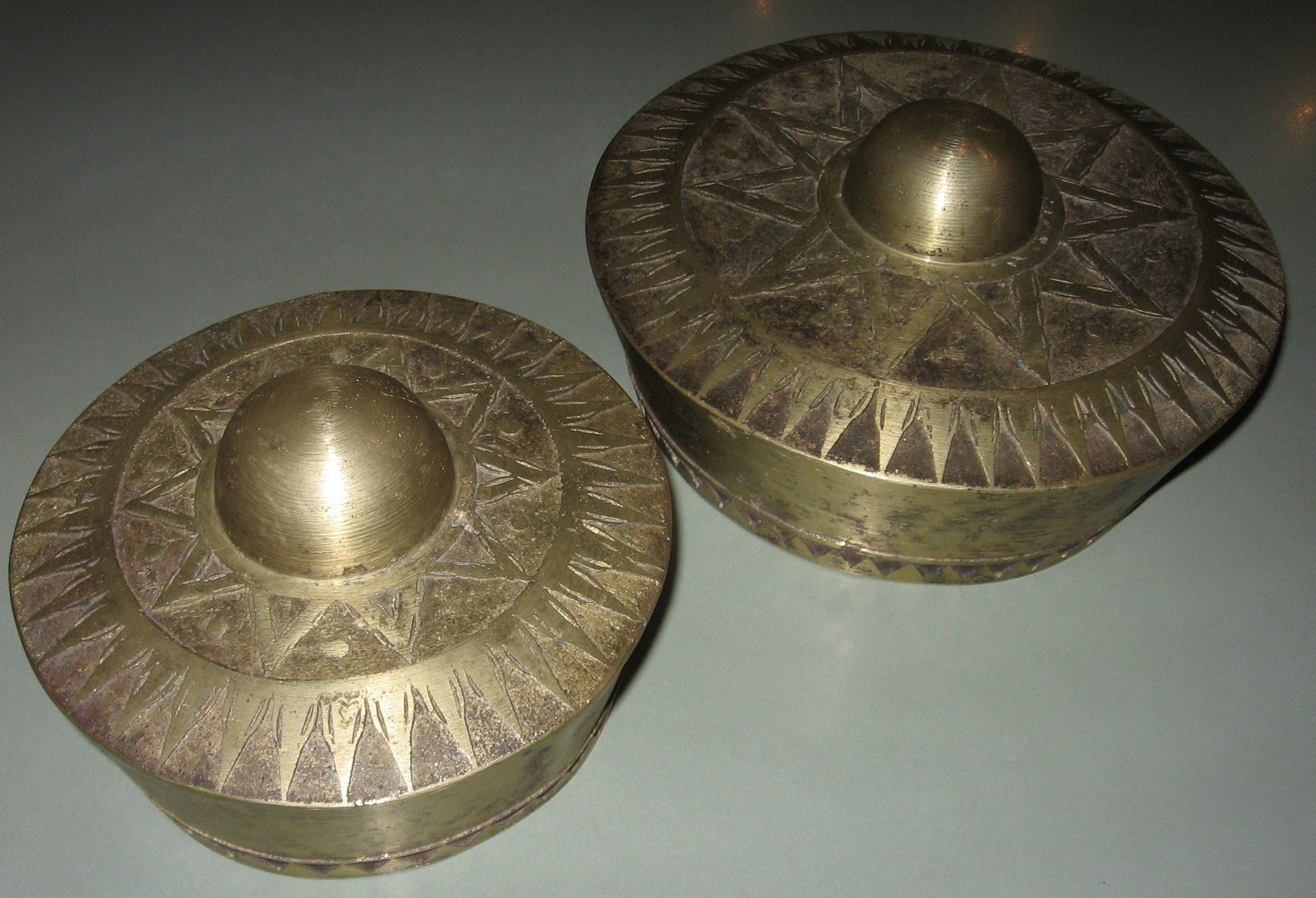
Main articles: Music of the Philippines and Kulintang The largest and smallest brass gong of the Philippine kulintang used as a main melodic instrument in the kulintang ensemble
The native Maguindanaon culture revolves around kulintang music, a specific type of gong music, found among both Muslim and non-Muslim groups of the Southern Philippines.
Notes
- ^ a b The number of barangays includes two barangays (Macalag and Tuntungan) that have been divided between this municipality and Datu Unsay. However, the population count does not include inhabitants from these divided barangays.
- ^ a b The number of barangays includes ten barangays (Alonganan, Balakanan, Buayan, Dado, Damabalas, Duaminanga, Kalipapa, Liong, Magaslong and Masigay) that have been divided between this municipality and Datu Salibo. However, the population count does not include inhabitants from these divided barangays.
- ^ a b The number of barangays includes ten barangays (Alonganan, Balakanan, Buayan, Dado, Damabalas, Duaminanga, Kalipapa, Liong, Magaslong and Masigay) that have been divided between this municipality and Datu Piang, and one barangay (Pagatin) that have been divided between this municipality and Datu Saudi-Ampatuan. However, the population count does not include inhabitants from these divided barangays.
- ^ a b The number of barangays includes one barangay (Pagatin) that has been divided between Datu Salibo and Shariff Saydona Mustapha, and possibly this municipality too (as legislation is unclear as to whether any portion of Brgy. Pagatin actually remains with Datu Saudi-Ampatuan). However, the population count does not include inhabitants from this barangay.
- ^ a b The number of barangays includes two barangays (Macalag and Tuntungan) that have been divided between this municipality and Datu Hoffer Ampatuan. However, the population count does not include inhabitants from these divided barangays.
- ^ a b The number of barangays includes one barangay (Libutan) that has been divided between this municipality and Shariff Saydona Mustapha. However, the population count does not include inhabitants from this barangay.
- ^ The population count does not include inhabitants from two barangays (Lapok and Tapikan), because at the time of the 2007 Census these two barangays still included the population of recently-created Brgys. Datu Bakal and Datu Kilay, now part of Shariff Saydona Mustapha.
- ^ a b The number of barangays includes one barangay (Pagatin) that has been divided between this municipality and Datu Salibo, and another barangay (Libutan) that has been divided between this municipality and Mamasapano. However, the population count does not include inhabitants from these divided barangays.
References
- ^ Conde, Carlos H. (November 23, 2009). "21 Reported Dead and 22 Missing in Mass Kidnapping Linked to Philippine Election". The New York Times. http://www.nytimes.com/2009/11/24/world/asia/24phils.html. Retrieved November 27, 2009.
- ^ Conde, Carlos H. (November 27, 2009). "Philippine Official Says Victims Were Sexually Mutilated". The New York Times. http://www.nytimes.com/2009/11/28/world/asia/28phils.html. Retrieved November 27, 2009.
- ^ RFI.fr
- ^ "Martial law in Philippines province after massacre". BBC News. 5 December 2009. http://news.bbc.co.uk/2/hi/asia-pacific/8396627.stm.
- ^ "Arroyo proclaims martial law in Maguindanao". ABS-CBN News. 5 December 2009. http://www.abs-cbnnews.com/nation/12/04/09/arroyo-orders-martial-law-maguindanao.
Municipalities - Ampatuan
- Buluan
- Datu Abdullah Sangki
- Datu Anggal Midtimbang
- Datu Hoffer Ampatuan
- Datu Montawal
- Datu Paglas
- Datu Piang
- Datu Salibo
- Datu Saudi-Ampatuan
- Datu Unsay
- General Salipada K. Pendatun
- Guindulungan
- Mamasapano
- Mangudadatu
- Pagalungan
- Paglat
- Pandag
- Rajah Buayan
- Shariff Aguak
- Shariff Saydona Mustapha
- South Upi
- Sultan sa Barongis
- Talayan
- Talitay
Independent component city (Administratively independent from the province, but grouped under Maguindanao by the National Statistics Office)Provinces Categories:- Maguindanao
- Provinces of the Philippines
- Predominantly Muslim Philippine provinces


Wikimedia Foundation. 2010.