- Phoenix Deer Valley Airport
-
Phoenix Deer Valley Airport 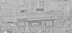
USGS aerial image, 1997 IATA: DVT – ICAO: KDVT – FAA LID: DVT Summary Airport type Public Owner City of Phoenix Serves Phoenix, Arizona Elevation AMSL 1,478 ft / 450 m Coordinates 33°41′18″N 112°04′57″W / 33.68833°N 112.0825°W Website Runways Direction Length Surface ft m 7R/25L 8,197 2,498 Asphalt 7L/25R 4,508 1,374 Asphalt Statistics (2009) Aircraft operations 402,335 UNIQ6,905,357,142e38d3b-ref-00,000,000-QINU Based aircraft (2008) 987 UNIQ6,905,357,142e38d3b-ref-00,000,003-QINU Sources: FAA[2], ACI[1] Phoenix Deer Valley Airport (IATA: DVT, ICAO: KDVT, FAA LID: DVT) is a public use airport located 15 nautical miles (28 km) north of the central business district of Phoenix, a city in Maricopa County, Arizona, United States. It is owned by the City of Phoenix.[2] According to the FAA's National Plan of Integrated Airport Systems for 2009–2013,[3] it is categorized as a reliever airport for the Phoenix Sky Harbor International Airport.[2]
In 2009, it recorded 402,335 aircraft movements, making it the 22nd busiest airport in the world in terms of aircraft movements.[1]
Contents
Usage
 Deer Valley
In 2009, Deer Valley was the busiest general aviation airport and 14th busiest in the United States.[4] There is no scheduled airline service. However charter service is still available through several companies. Two large flight training academies, Westwind School of Aeronautics and TransPac Aviation Academy, are located at Deer Valley. These two schools account for a majority of operations at the airport.
Facilities and aircraft
Phoenix Deer Valley Airport covers an area of 914 acres (370 ha) at an elevation of 1,478 feet (450 m) above mean sea level. It has two asphalt paved runways: 7R/25L is 8,197 by 100 feet (2,498 x 30 m) and 7L/25R is 4,508 by 75 feet (1,374 x 23 m).[2]
For the 12-month period ending December 31, 2008, the airport had 376,504 aircraft operations, an average of 1,031 per day: 65% general aviation, 35% military and <1% scheduled commercial. At that time there were 987 aircraft based at this airport: 85% single-engine, 10% multi-engine, 2% jet, 2% helicopter, <1% glider, and <1% military.[2]
References
- ^ a b c 2009 Busiest Airports by Aircraft Movements
- ^ a b c d e f FAA Airport Master Record for DVT (Form 5010 PDF). Federal Aviation Administration. Effective 29 July 2010.
- ^ National Plan of Integrated Airport Systems for 2009–2013: Appendix A: Part 1 (PDF, 1.33 MB). Federal Aviation Administration. Updated 15 October 2008.
- ^ City of Phoenix web site
External links
- Plane Crash at Deer Valley - Aug 4, 2010
- Phoenix Deer Valley Airport, official site
- Phoenix Deer Valley Airport at Arizona DOT website
- Deer Valley Flying Club
- Westwind School of Aeronautics
- TransPac Aviation Academy
- Westwind Air Service (charters)
- FAA Airport Diagram (PDF), effective 20 October 2011
- FAA Terminal Procedures for DVT, effective 20 October 2011
- Resources for this airport:
- AirNav airport information for KDVT
- ASN accident history for DVT
- FlightAware airport information and live flight tracker
- NOAA/NWS latest weather observations
- SkyVector aeronautical chart, Terminal Procedures for KDVT
- OpenNav airspace and charts for KDVT
Categories:- Airports in Maricopa County, Arizona


Wikimedia Foundation. 2010.