- Mtsamboro
-
Mtsamboro — Commune and town — Chissioua Mtsamboro
 Location in Mayotte
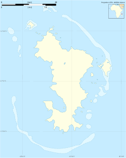
 Mtsamboro
Coordinates: 12°42′S 45°04′E / 12.7°S 45.067°ECoordinates: 12°42′S 45°04′E / 12.7°S 45.067°E Country  Mayotte, France
Area – Total 13.71 km2 (5.3 sq mi) Population (July 2007) – Total 6,917 Time zone EAT (UTC+3) Mtsamboro is a small fishing town and commune in the French overseas department in northwest Mayotte, in the Indian Ocean. Its total population according to the 2007 census is 6,917. Included in the commune are the Choazil Islands and Chissioua Mtsamboro. The main economic activity is fishing and orange production.
Contents
History
Archaeology has revealed an occupation existed in thirteenth and fourteenth centuries on the Jiva beach named Mshambara,[1] and traces of a medina dating from the fifteenth to seventeenth centuries in the quartier of Mjikura. Mtsamboro has an important place in the history of Mayotte: this town was the first capital of the Shirazi Sultanate as it hosted the first Sultan of Mayotte at the end of the fifteenth century. Mtsamboro was the main commercial port of the island and was visited by many European vessels. The town, like many others in Mayotte, was ruined and abandoned in the eighteenth century. In Mjikura are the ruins of a royal palace and tombs, an important location for the Sultans of Mayotte. [2][3]
Geography
 Map
Map
The village of Mtsamboro lies on the northwest coast of the island along National Road 1.[4] To the northeast is the village of Mtsahara and to the southwest is Mtsangadoua. Two small peninsulas jut out in the village area, the larger of which lies roughly a mile north of the village centre and separates the main village of Mtsamboro and Hamjago from Mtsahara.[4] The larger peninsula is also the nearest point of land to Choazil Island, which with another form the Choazil Islands.[4][5]This stretch of water is known as the Choazil Passage, part of the Mozambique Channel.[6] North of the Choazil Islands is the larger Chissioua Mtsamboro (widely known as Zamburu Island); both islands are under the administration of the commune of Mtsamboro. Chissiou Mtsamboro is separated from the Choazil Islands by the Zamburu Passage.[7]. Chissiou Mtsamboro is a mountainous island, providing shelter to the main stretch of beach, tucked away in the southwest of the island which contains a main settlement and numerous huts dotted along the beach. The area to the southeast is heavily forested and forms part of the Reserve Forestiere Des Cretes Du Nord.[4]To the east is a mountain called Dziani Bole, with an altitude of 472 metres.
Economy
The economy is mainly based around agriculture and fishing; it is notable area for orange production.[8]
Notable landmarks
The main mosque is Wemani Mosque. It contains the Collège de M'tsamboro and Hôtel Mtsamboro. There are at least 3 small sports grounds, two of which lie in very close proximity to the larger peninsula, near Mtsahara.[4]
References
- ^ Maestri, Edmond; Université de la Réunion (2002). Esclavage et abolitions dans l'océan indien: (1723 - 1860) : actes du colloque de Saint-Denis de la Réunion organisé par l'Université de la Réunion ..., 4 - 8 décembre 1998. L'Harmattan. ISBN 9782747530170. http://books.google.com/books?id=FBm5AAAAIAAJ. Retrieved 15 June 2011.
- ^ Mayotte. Petit Futé. p. 164. ISBN 9782746936065. http://books.google.com/books?id=XLuRd22JJFwC&pg=PA164. Retrieved 15 June 2011.
- ^ "Mayotte et les Comores, Escales Sur la Route des Indes". Babelio. http://www.babelio.com/livres/Liszkowski-Mayotte-et-les-Comores-Escales-Sur-la-Route-des-In/199575. Retrieved 16 June 2011.
- ^ a b c d e Google. Google Maps (Map).
- ^ United States. Hydrographic Office (1927). South Indian Ocean pilot: Islands westward of longitude 92 ̊east including Madagascar and the Comoro Islands. G.P.O.. http://books.google.com/books?id=54oNAQAAIAAJ. Retrieved 15 June 2011.
- ^ United States. Hydrographic Office (1 January 1952). Publications. p. 157. http://books.google.com/books?id=D3IPAQAAIAAJ. Retrieved 15 June 2011.
- ^ Rosser, William Henry; Imray, James Frederick (1867). The seaman's guide to the navigation of the Indian Ocean and China Sea: including a description of the wind, storms, tides, currents, &c., sailing directions; a full account of all the islands; with notes on making passages during the different seasons. J. Imray & Son. p. 364. http://books.google.com/books?id=_8BBAAAAIAAJ&pg=PA364. Retrieved 15 June 2011.
- ^ Auzias, Dominique; Labourdette, Jean-Paul (2008). Mayotte. Petit Futé. p. 160. ISBN 9782746919679. http://books.google.com/books?id=UP3GQlr5MoAC&pg=PA160. Retrieved 15 June 2011.
Categories:- Populated places in Mayotte
- Communes of Mayotte


Wikimedia Foundation. 2010.