- Roads in the United Kingdom
-
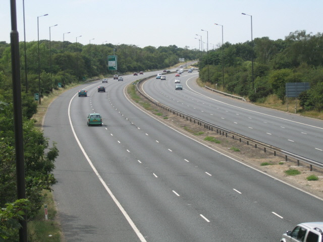
 The A2 at Leyton Cross, Dartford.
Roads in the United Kingdom form a network of varied quality and capacity. Road distances are shown in miles or yards and UK speed limits are in miles per hour (mph) or use of the national speed limit (NSL) symbol. Some vehicle categories have various lower maximum limits enforced by speed limiters. Enforcement of UK road speed limits increasingly uses speed guns, automated in-vehicle systems and automated roadside traffic cameras. A unified numbering system is in place for Great Britain, whilst in Northern Ireland there is no available explanation for the allocation of road numbers.[1]
The earliest specifically engineered roads were built during the British Iron Age. The road network was expanded during the Roman occupation. Some of these survive and others were lost. New roads were added in the mediæval period and from the 17th century onwards. Whilst control has been transferred from local to central bodies and back again, currently management and development of the road network is shared between local authorities, the devolved administrations of Scotland, Wales and Northern Ireland and the Highways Agency. Certain aspects of the legal framework remain under the competence of the United Kingdom parliament.
Although some roads have much older origins, the network was subject to major development from the 1950s to the mid-1990s. From then, construction of roads has become increasingly controversial with direct action campaigns by environmentalists in opposition.
Contents
Driving
See also: Driving in the United Kingdom and Road speed limits in the United KingdomIn the UK, vehicles drive on the left and on multi-lane carriageways drivers are expected to keep to the left lane except when overtaking.[2] In Great Britain, the Highway Code applies to drivers.[3] In Northern Ireland the Highway Code for Northern Ireland applies.[4]
UK speed limits are shown in mph[5] and are in increments of 10 ranging from 20 miles per hour (32 km/h) to 70 miles per hour (113 km/h). Unless a lower speed limit is posted on a road the national speed limit applies, which varies between class of vehicles and the type of road. In a built-up area (usually indicated by street lights),[6] unless signs indicate otherwise, a limit of 30 miles per hour (48 km/h) applies. Other limits are shown in the table.[7]
National speed limits on roads in the UK Type of vehicle Speed limit Single carriageway Dual carriageway Motorway mph km/h mph km/h mph km/h Car/motorcycle, car derived vans up to 2 tons 60 97 70 110 70 110 Car with caravan or trailer 50 80 60 97 60 97 Bus, Minibus or coach up to 13.12 yd long 50 80 60 97 70 110 Goods vehicle below 7.5 tons 50 80 60 97 70 110 Goods vehicle over 7.5 tons 40 64 50 80 60 97 Generally in the UK, goods vehicles are electronically speed limited to 90 km/h (56 mph)[citation needed]. For a road to be classed as a dual carriageway, the two directions of traffic flow must be physically separated by a central reservation.[8]
Classification
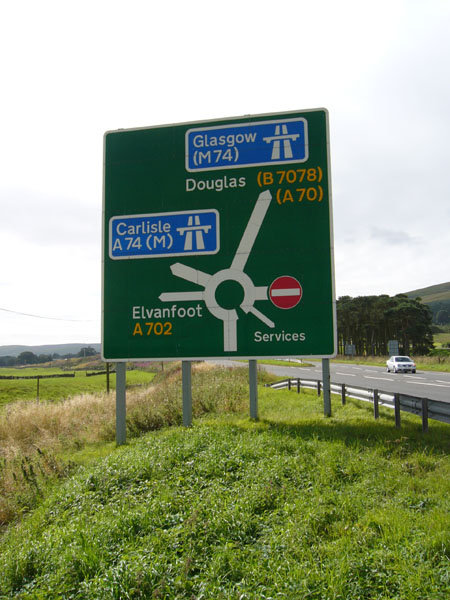
Main articles: Great Britain road numbering scheme and Motorway The colour scheme used to denote a primary route.
Roads in the UK are classified into M (Motorway), A,[9] and B[9] roads. For internal purposes, Local Authorities may also use C,[10] D[citation needed] and U[10] (the latter standing for 'Unclassified'[specify]). Each road is given a number which is combined with the prefix, for example M40, A40 and B1110. Roads in Great Britain are numbered according to a zonal system.[11] There is no available explanation for the allocation of road numbers in Northern Ireland.[1] Motorways are used for the majority of the major inter-urban routes and are designed to carry long distance traffic. Between them is the primary route network, which are A roads. A primary route is defined as:[8]
...a route, not being a route comprising any part of a motorway, in respect of which the Secretary of State —(a) in the case of a trunk road is of the opinion, and
(b) in any other case after consultation with the traffic authority for the road comprised in the route is of the opinion,
that it provides the most satisfactory route for through traffic between places of traffic importancePrimary destinations
Primary destinations are usually cities and large towns, to which, as a result of their size, a high volume of traffic is expected to go. However, in rural areas, smaller towns or villages may be awarded primary status if located at junctions of significant roads: for example, Llangurig in Wales and Crianlarich in Scotland. As a further example, Scotch Corner in northern England is not a village - only a hotel and a few other buildings - yet has the status of a primary destination resulting from its location at the interchange of the A1 and A66 roads. For similar reasons, certain airports, sea ports, bridges and tunnels have been designated as primary destinations.
The status of both primary destinations and roads is maintained by the Department for Transport in combination with the Highways Agency in England and Wales and the Scottish Government in Scotland.[specify] The concept of primary roads was introduced in the 1960s as part of a national reclassification of roads.[9]
Regional destinations
Regional destinations are commonly used on long distance routes throughout the country alongside primary destinations. They are displayed on signs in capitals to distinguish them from towns and cities.[12] The boundaries of these regional destinations are not specifically defined and apply to generalised areas.
- NORTH WALES
- SCOTLAND
- SOUTH WALES
- The EAST
- The LAKES
- The MIDLANDS
- The NORTH
- The NORTH EAST
- The NORTH WEST
- The SOUTH
- The SOUTH WEST
- The WEST
Signage
Main article: Road signs in the United Kingdom A typical roundabout sign on a primary road
Signage on the UK network conforms broadly to European norms, though a number of signs are unique to Britain and direction signs omit European route numbers. All length distances are shown in miles or yards,[13] speed is in miles per hour[5] whilst height and width restrictions are required to be shown in feet and inches (though the metric measurements may optionally also appear). Until recently the government was obliged to convert all signs to metric under a commitment made at the time of the UK's accession to the European Economic Community. The European Commission has now abandoned that requirement.[14]
The signage system currently in use was developed in the late 1950s and the early 1960s by the Anderson Committee, which established the motorway signing system, and by the Worboys Committee, which reformed signing for existing all-purpose (non-motorway) roads. It was introduced in 1965 and is governed by the Traffic Signs Regulations and General Directions.[specify] Signs may be of an informative, warning or instructional nature.[specify] Instructional signs are generally circular, warnings are triangular and informative signs are rectangular or square.[specify] Motorway informative signs use white text on a blue background, primary routes are indicated by green directional and distance signs with yellow text, whilst secondary roads use black text on a white background.[15]
Taxes and fees
Main article: Motoring taxation in the United KingdomMotoring taxation

Nearly all motorised vehicles registered in the United Kingdom are required to have a vehicle licence (tax disc) on display.[16] Fuel for motor vehicles is subject to fuel duty which is levied before adding VAT to the total cost per gallon.[17]
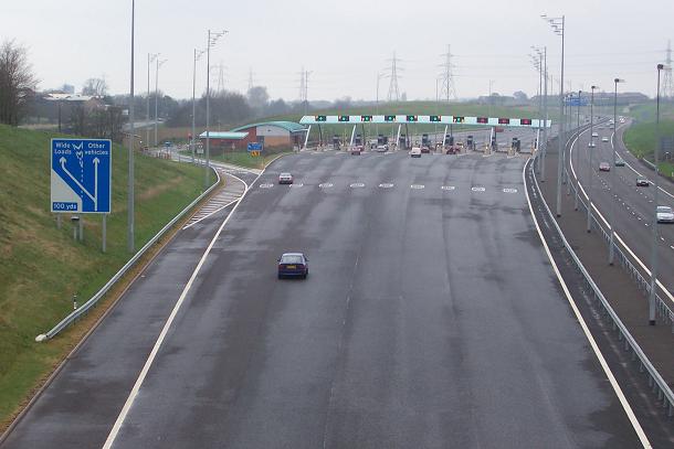
Tolls
Until the early 21st century, tolls were generally only applied to major bridges and tunnels, for example the Dartford Crossing[18] and Forth Road Bridge.[19] There were two public toll roads (Roydon Road in Stanstead Abbots and College Road in Dulwich) and about five private toll roads. The UK's first privately operated motorway opened in 2003. The M6 Toll (originally the Birmingham Northern Relief Road) is designed to relieve the M6 through Birmingham, which is one of the most heavily used roads in the country.[20] In 2005, the Government published proposals for a UK wide road pricing scheme. This was designed to be revenue neutral, with other motoring taxes to be reduced to compensate.[21] The plans have been extremely controversial with 1.8 million people signing a petition against them.[22]
Congestion charges
Main articles: London congestion charge and Manchester congestion chargeEngland's first modern-day congestion charge was introduced in Durham in October 2002.[23] In London, vehicles entering parts of central and west London are required to pay a daily charge under the London congestion charge. The power to introduce a form of congestion charge was given to any future mayor in the Greater London Authority Act 1999.[24] Having won the first mayoral election in 2000, Ken Livingstone opted to exercise these powers as promised in his independent manifesto,[25][26] and carried out a series of consultations with interested parties. The basic scheme was agreed in February 2002, and charging commenced, with some concessions accepted, on 17 February 2003. On introduction, the scheme was the largest ever undertaken by a capital city.[27] The extension of the zone into West London came into effect on 19 February 2007, despite the majority of residents opposing it in the two consultations.[28][29] In April 2003 the Dartford Crossing toll, which was due to be withdrawn that month as the cost of construction had been paid for and a sufficient maintenance fund accumulated, was instead converted into a congestion charge.[30]
Proposals in Edinburgh for a system of a £2 charge for one of two cordons were rejected following a public referendum in 2005 by 74% of the votes cast.[31]
A later proposal for a Manchester congestion charge scheme was cancelled in December 2008 when a majority of voters in each council area voted against it in a referendum.[32][33] Unlike the current version of the London charge, two cordons would have been used, one covering the urban area of Manchester and another covering the city centre.[34]
Road traffic safety
See also: Road speed limits in the United Kingdom and Reported Road Casualties Great BritainThe United Kingdom is among the best countries in the world for road safety and is still improving, but the improvement has not kept pace with those in Sweden and the Netherlands.[35]
In June 2008 the Road Safety Foundation reported that 30 per cent of the primary route network in Great Britain failed to rate as safe, and a quarter of all motorways were outside the safest risk band.[36]
The 8-mile (13 km) Cat and Fiddle Road between Macclesfield and Buxton was named as Britain’s most dangerous road. The single-carriageway road has been the scene of 43 fatal or serious collisions since 2001, nearly three-quarters of them involving motorcyclists. When collisions involving motorcyclists are removed from the analysis, the A61 between Barnsley and Wakefield was found to be the most dangerous road in Britain.[37]
Between 2003 and 2006, the most improved safety record was for the A453 from the A38 to Tamworth in Staffordshire. This rural single carriageway saw an 88 per cent drop in the number of fatal or serious collisions in the last six years, taking it from a medium risk road to one of the safest. According to the Foundation, this has been achieved by introducing traffic lights, speed limit reductions and village pedestrian facilities.[38]
Research undertaken in July 2008 has shown that investment in a safe road infrastructure programme could yield a one-third reduction in road deaths, saving as much as £6 billion per year.[39] A consortium of 13 major road safety stakeholders have formed the Campaign for Safe Road Design, which is calling on the UK Government to make safe road design a national transport priority.[40]
Administration
Responsibility for the road network differs between trunk and non trunk routes. Trunk roads, which are the most important roads, are administered by the Highways Agency in England, Transport Scotland in Scotland and the Department of Economy and Transport in Wales.[41] England's 6,500 miles (10,461 km) of trunk roads account for 33% of all road travel and 50% of lorry travel.[42] Scotland has 2,174 miles (3,499 km)[43] (about 7% of the total roads in Scotland), accounting for 35% of all road journeys and over 50% of lorry movements.[44] Wales has 1,000 miles (1,600 km) of trunk roads.[45] In London, Transport for London is responsible for all trunk roads and other major roads, which are part of the Transport for London Road Network.[41] All other roads are the responsibility of the relevant County Council or unitary authority.[41] In Northern Ireland, the Roads Service Northern Ireland is responsible for all 5,592 miles (8,999 km) roads.[41][46] The pan-British total is 24,559 km.
Whilst generally they are trunk roads, several motorways are the responsibility of local authorities, for example the M275.[47]
During design, planning, maintenance and construction, metric is used. As a result (and anticipating that the roadsigns themselves will one day be changed to display in metric units) recently-erected signs are increasingly being placed at metric intervals but display an imperial unit as required by the current road-signage rules.[citation needed] For example, a 110 yd marker might actually be placed at the 100 m distance. Since 2008, location marker posts have appeared on motorways and major A roads in England, situated generally at intervals of 500 metres (though the dimension is not given). These repeat the information given on the co-sited surveyors' marker post which, since the 1960's have reported distances on such roads in kilometres from a datum - usually the start of the road, or the planned start-point of the road.
History
Iron Age
The earliest evidence of engineered roads dates to the first century BC. A metalled and cambered road, 1.5 metres high and six metres wide, was unearthed at Bayston Hill quarry, near Shrewsbury.[48] A timber road was preserved in peat in Geldeston, Norfolk, with tree rings suggesting a date of 75 BC, likely built by the Iceni tribe.[49]
Roman Britain
See also: Roman roads in BritainRoads built in the first phase of Roman occupation (43–68 AD) connected London with the ports used in the invasion (Chichester and Richborough), and with the earlier legionary bases at Colchester (Camulodunum), Lincoln (Lindum), Wroxeter (Viroconium), Gloucester and Exeter.[50] As Roman influence expanded, so did the network, until around 180 A.D. when the known network was complete.[specify]
Few Roman roads extended into Scotland due to their inability to subjugate the local population. Part of the Scottish Lowlands came under Roman control in 142, and the Antonine Wall was constructed on the northern boundary. However, the Roman legions withdrew in 164 to their former northern boundary, Hadrian's Wall.
The primary function of Roman roads was to allow the rapid movement of troops and military supplies, but it also provided vital infrastructure for trade and the transport of goods. The roads were paved, a first for the island, and could carry heavy goods in all weathers.[51] Following the Roman withdrawal from Britain, road maintenance became a very ad-hoc activity.
Medieval roads
A network of roadways was developed in Britain in the middle ages to supplement the use of rivers as a system of transportation. Many of these roadways were developed as a result of trading of goods and services, such as wool, sheep, cattle and salt. They linked together market towns, towns with bridges, harbours and ports. Other roadways developed to meet the needs of pilgrims visiting shrines, such as Walsingham, and for transporting corpses from isolated communities to local graveyards.
Pre 20th century
See also: Turnpike trust and History of toll roads in the United KingdomThe first legislated control in England was introduced under the Highways Act 1555.[52] Road rates were introduced in England and Wales in the seventeenth century. The first turnpike road, whereby travellers paid tolls to be used for road upkeep, was authorised by the Highways Act 1663 for a section of the Great North Road in Hertfordshire.[52][53] The first turnpike trust was established by the Parliament of England through a Turnpike Act in 1706. Scotland continued to maintain its own Parliament until the Acts of Union 1707, when the two parliaments merged to form the Kingdom of Great Britain.
In the second half of the eighteenth century, turnpike trusts became numerous, with trusts also set up in Wales and lowland Scotland.[54] This expansion was facilitated by the ability to use mortgages to fund the work.[54] By 1821 there were 18,000 miles (29,000 km) of turnpike roads in England, with 1,000 trusts by 1845[55]
The Rebecca Riots in Wales between 1839 and 1843 against high toll.[56] The riots ceased after some ringleaders, John Jones (Shoni Sguborfawr) and David Davies (Dai'r Cantwr), were convicted and transported to Australia.[57] Following several attempts at reform, detrunking began in the 1860s with the last trust ending in 1885.[52] The protests prompted several reforms, including a Royal Commission into the question of toll roads. The Local Government Act 1888 created borough and county councils with responsibility for maintaining the major roads.[55]
After complaints about the first tram companies damaging the road surface, Parliament introduced the Tramways Act 1870, making tram companies responsible for the maintenance of the shared surface of the tramway and several feet either side, as a condition of being granted a licence.[58] This was a popular move as maintenance was removed from the public purse. The local authority could also purchase the whole line at a later date at a discount, or force the tram company to reinstate the road.
1900-1950
See also: Vehicle excise duty and driving licenceThe Roads Act of 1920 brought in the Road Fund, with the Government receiving revenue from excise duty on road vehicles and from the sale of licences for horse-drawn carriages and driving licences.[59] As road traffic began to grow, the condition of the road network became an issue, with most of it in a poor state of repair.[60] The new Ministry of Transport created a classification system for the important routes connecting large population centres or for through traffic, with the definitive list being published in 1922/3 and revised in 1926/7.[9][61]
High unemployment after the end of World War I led the Minister of Transport to provide grant funding to the County Councils to improve roads, particularly where labour was recruited from areas of high unemployment and adjoining areas, and men with dependants. Two unemployment relief programmes were run, the first from 1920 to 1925 and the second from 1929 to 1930.[59] Government grants were limited to trunk roads and bridges, with the money coming from the Road Fund.[59] Some 500 miles (800 km) of bypasses were built by 1935, about half of what was originally planned at the start of the programmes.[59] In 1930, responsibility for all roads was vested in the County councils.[52] The first inter-urban new road built in the UK was the East Lancs Road, which was built between 1929 and 1934 at a cost of £8 million.[54][62]
For the first time since the Roman occupation, the Ministry of Transport took direct control of the core road network through the Trunk Roads Act 1936.[63] During the 1930s both the Institution of Highway Engineers and The County Surveyors' Society had published plans for a network of high speed roads,[64] whilst the Minister of Transport, Leslie Burgin, also visited the autobahn under construction in Germany. Lancashire County Council proposed a new scheme for a motorway and it was agreed to go ahead. This was, however, postponed due to the start of World War II.[65]
During World War II, government plans were drawn up to create a new network of high speed routes across the country.[60] The passing of the Special Roads Act 1949 gave the government legal powers to build roads that were not automatically rights of way for certain types of user.
1950-1979
In 1958 the first motorway was opened as the Preston Bypass, now part of the M6 motorway.[66] The first major motorway to open was the M1 between Crick and Berrygrove.[66]
In 1963 a report on urban transport planning policy, Traffic in Towns, was produced for the UK Department of Transport by a team headed by the architect, civil engineer and planner Colin Buchanan.[67] While it advocated the construction and reorganisation of towns to accommodate the motor car and lorry, it stressed that this would have to be balanced with restrictions, in accordance with local needs. It highlighted the urgency of the problem of dealing with the expected massive growth in road traffic,[68] the damage it could cause to our towns and cities if unplanned,[69] the eventual need for demand management[70] but with implications of restricting the mass of the population from doing something they didn't see as wrong,[71] and of the inevitable need for a change in policy as the social costs increased.[72]
In 1966 a revision of design standards was proposed which would, it was stated, save "acres of land" and £22,000 per mile in construction costs. The revision involved reducing from 10 ft (3 m) to 5 ft (1.5 m) the width of roadside grass verges on newly constructed "rural" motorways, and removing 1 foot (0.3 m) of the width of the "marginal strips" that separated each carriageway from the central reservation.[73]
The 1968-9 Ministry of Transport report Roads in England planned to complement the new interurban routes with £1bn of new urban trunk roads outside London in order to "alleviate traffic congestion", complemented by parking controls, traffic management and public transport.[74]
The first 1,000 miles (1,600 km) of motorway had been built by 1972[75] and more motorways opened into the 1980s;[76]
Whilst roads outside urban areas continued to be built throughout the 1970s, the urban routes soon ran into opposition. Plans by the Greater London Council for a series of ringways were cancelled following extensive protests headed by Homes before Roads and a rise in costs.[77] Plans to widen the Archway Road in London[78] were also hit by determined opposition over a 20 year period from the 1970s.[79]
Whilst work on planning motorways in Northern Ireland had begun prior to the Second World War, the legal authority for motorways was not provided for until the Special Roads Act (Northern Ireland) 1963, similar to that in the 1949 Act.[80] The first motorway to open was the M1 motorway in 1962, though did so under temporary powers until the Special Roads Act had been passed.[81] Work on the motorways continued until the 1970s, when the oil crisis and The Troubles both intervened, causing the abandonment of many schemes.[82]
1979-1997
See also: Road protest in the United Kingdom#1979-1997The Conservative government of Margaret Thatcher from 1979 adopted a pro roads policy. During this period numerous road upgrades were built and the M25 motorway was completed. In 1989 it announced a large-scale roads programme (stated to be the largest since the Romans) in the Roads for Prosperity White Paper. It proposed 500 road schemes at a cost of £23 billion and foresaw an increase of road traffic of 142 percent by 2025.[83] It would have involved the doubling of the trunk road capacity with around 150 bypasses being built, caricatured in later years as predict and provide, whereby the government predicted the required capacity in forthcoming years and built roads to match.[84] From 1985 to 1995, the road network expanded by 24,000 miles (38,624 km).[85]
 The M3 motorway cutting at Twyford Down.
This road building programme continued into the start of the Premiership of John Major. In the early 1990s the government decided to complete the M3 motorway by building a six lane road in a cutting through Twyford Down. This attracted the first direct action protests against a major road in the country. Construction work was delayed considerably, and anti roads protesters gained large amounts of publicity.[86] The Newbury bypass saw some of the largest protests against a road in the UK. Proposed originally in the 1980s, the bypass was subject to strong support and opposition.[87] Also in this time frame, the M11 link road protest saw protracted disturbance during the upgrading of a section of the A12 through east London. Costs increased rapidly, the Newbury bypass being 50% over budget and many other schemes showed increases of 100%.[88]
The Standing Advisory Committee on Trunk Road Assessment had also concluded in 1994 that building new roads simply generated more traffic, and was therefore largely self-defeating.[89] By 1994, following the recession of the early 1990s a significant number of remaining schemes were cancelled, although the government still intended to continue with others using private financing.[90] The Secretary for state for transport, Dr Brian Mawhinney launched a 'Great Debate' about the future direction for transport in the UK and the required level of road building[91] stating that the road network was "broadly complete".[92]
A major Royal Commission report, 'Transport and the Environment' was published in October 1994 highlight the serious environmental consequences of UK's transport system in response to which the New Scientist commented "Rarely, if ever, can a ministry have emerged so badly from an official report as John MacGregor's old department" in an article titled "Head-on collision over transport: The British government has received its sternest warning yet that its unflagging support for the car is seriously at odds with its own green principles".[93]
The last new motorway in the United Kingdom (The M3 motorway in Northern Ireland) opened in 1994.[94] In 1996 the total length of motorways reached 2,000 miles (3,200 km).[95]
1997 - the present day
See also: Road protest in the United Kingdom#1997-the present dayAfter the election of the Labour government in 1997, most remaining road schemes were cancelled[96][97] and problem areas of the road network subject to multi-modal studies to investigate non-road alternatives, following the introduction of the A New Deal for Trunk Roads in England White Paper.[98]
In 1998, it was proposed to transfer parts of the English trunk road network to local councils, retaining central control for the network connecting major population centres, ports, airports, key cross-border links and the Trans-European Road Network.[99] Around 40% of the network was transferred to local authorities.[63]
In 2002 the government proposed a new major road building program with 360 miles (580 km) of the strategic road network to be widened, 80 major new trunk road schemes to improve safety and 100 new bypasses on trunk and local roads.[100] The protesters reformed.[101]
In 2004 the Government announced in the Queen's speech a major new funding source from transport schemes, the Transport Innovation Fund (TIF).
In 2007 a new Planning Bill was introduced to parliament which would speed up the process of approving new roads and other transport infrastructure but which has raised concerns that it may erode democracy[102] and be a "developer's charter".[103]
Traffic has increased by 80% between 1980 and 2005 whilst road capacity has increased by 10%.[104]
See also
- Transport in the United Kingdom
- Roads in the Isle of Man
- Roads in Northern Ireland
References
- ^ a b "Northern Ireland Assembly - WRITTEN ANSWERS Friday 15 December 2000". http://www.niassembly.gov.uk/qanda/writtenans/001215.htm. Retrieved 2007-11-19.
- ^ "133-143:Multi-lane carriageways". The Highway Code. HMSO. http://www.direct.gov.uk/en/TravelAndTransport/Highwaycode/DG_070308. Retrieved 2007-11-18.
- ^ "Introduction". Highway Code. HMSO. http://www.direct.gov.uk/en/TravelAndTransport/Highwaycode/DG_070236. Retrieved 2007-11-18.
- ^ "Highway Code for Northern Ireland" (PDF). Department of Environment. http://www.roadsafetyni.gov.uk/index/highwaycode.htm. Retrieved 30 March 2010.
- ^ a b "Call for metric road sign switch". BBC News (British Broadcasting Corporation). 2006-02-23. http://news.bbc.co.uk/1/hi/uk/4741894.stm. Retrieved 2007-12-29.
- ^ (PDF) DfT Circular 01/2006: Setting Local Speed Limits. Department for Transport. 2006-08-08. Archived from the original on 2007-02-06. http://web.archive.org/web/20070206194630/http://www.dft.gov.uk/pgr/roadsafety/speedmanagement/dftcircular106/dftcircular106newguidanceons4799. Retrieved 2007-02-10.
- ^ "117-126: Control of the vehicle". The Highway Code. HMSO. http://www.direct.gov.uk/en/TravelAndTransport/Highwaycode/DG_070304. Retrieved 2007-11-18.
- ^ a b Statutory Instrument 2002 No. 3113 The Traffic Signs Regulations 2002 , regulation 4.
- ^ a b c d "FOI Request - Road numbering" (PDF). Department for Transport. 2005-08-05. http://www.dft.gov.uk/foi/responses/2005/aug/roadnumbering/letteraboutroadclassification. Retrieved 2007-12-27.[dead link]
- ^ a b "Road speed limits to be reviewed". BBC News (British Broadcasting Corporation). 2007-12-13. http://news.bbc.co.uk/1/hi/england/cumbria/7143295.stm. Retrieved 2008-01-01.
- ^ "How the Motorways were Numbered". Pathetic Motorways. http://www.pathetic.org.uk/features/numbering/. Retrieved 2007-11-19.
- ^ http://www.dft.gov.uk/pgr/roads/tpm/ltnotes/ltn1-94.pdf
- ^ "Q&A: Pounds, pints and the EU". BBC News (British Broadcasting Corporation). 2007-09-11. http://news.bbc.co.uk/1/hi/world/europe/6988709.stm. Retrieved 2007-12-29.
- ^ "EU gives up on 'metric Britain'". BBC News (British Broadcasting Corporation). 2006-02-23. http://news.bbc.co.uk/1/hi/uk/6988521.stm. Retrieved 2007-12-29.
- ^ "The Highway Code". Department for Transport. http://www.direct.gov.uk/prod_consum_dg/idcplg?IdcService=GET_FILE&dID=96501&Rendition=Web. Retrieved 2007-11-18.
- ^ "Car tax rules". Directgov. http://www.direct.gov.uk/en/Motoring/OwningAVehicle/HowToTaxYourVehicle/DG_10021514. Retrieved 2007-11-18.
- ^ "UK fuel tax: The facts". BBC News (British Broadcasting Corporation). 2000-09-21. http://news.bbc.co.uk/1/hi/in_depth/world/2000/world_fuel_crisis/933648.stm. Retrieved 2008-01-05.
- ^ "Charging regime at the Dartford -Thurrock river crossings". Statement by The Minister of State for Transport (Dr Ladyman):. Department for Transport. 2006-10-19. Archived from the original on 2007-07-16. http://web.archive.org/web/20070716171405/http://www.dft.gov.uk/press/speechesstatements/statements/stacharregdart. Retrieved 2007-11-18.
- ^ "Prices". Forth Estuary Transport Authority. http://www.feta.gov.uk/index.php?option=com_content&task=view&id=51&Itemid=61. Retrieved 2007-11-18.
- ^ "M6 Toll (formerly Birmingham Northern Relief Road)". The Motorway Archive. The Motorway Archive Trust. http://www.iht.org/motorway/m6toll.htm. Retrieved 2007-11-18.
- ^ "'Pay-as-you-go' road charge plan". BBC News (British Broadcasting Corporation). 2005-06-06. http://news.bbc.co.uk/1/hi/uk/4610755.stm. Retrieved 2007-11-18.
- ^ "PM denies road toll 'stealth tax'". BBC News. 2007-02-21. http://news.bbc.co.uk/1/hi/uk_politics/6381153.stm. Retrieved 2007-11-18.
- ^ "Toll road lawyers in award hope". BBC News (British Broadcasting Corporation). 2006-04-09. http://news.bbc.co.uk/1/hi/england/wear/4893106.stm. Retrieved 2007-11-23.
- ^ "What does the mayor get to do?". BBC News (British Broadcasting Corporation). 2000-05-16. http://news.bbc.co.uk/1/hi/in_depth/uk_politics/2000/london_mayor/534814.stm. Retrieved 2007-05-26.
- ^ "Blair accuses Livingstone of £5 car toll". The Guardian (London: Guardian News and Media). 2006-08-07. http://www.guardian.co.uk/mayor/Story/0,2763,212441,00.html. Retrieved 2007-05-26.
- ^ "Drivers face £5 London toll". BBC News (British Broadcasting Corporation). 2001-10-07. http://news.bbc.co.uk/1/hi/uk_politics/1431419.stm. Retrieved 2007-05-26.
- ^ "Smooth start for congestion charge". BBC News (British Broadcasting Corporation). 2003-02-18. http://news.bbc.co.uk/1/hi/england/2770721.stm. Retrieved 2007-05-26.
- ^ "Congestion Charging Western Extension". Greater London Authority. Archived from the original on 2005-12-30. http://web.archive.org/web/20051230192344/http://www.london.gov.uk/mayor/congest/western-extension.jsp. Retrieved 2006-04-08.
- ^ Webster, Ben (2005-10-01). "Livingstone takes charge zone farther west despite opposition". The Times (London: News International Limited). http://www.timesonline.co.uk/article/0,,2-1805811,00.html. Retrieved 2006-04-09.
- ^ "Motorists 'let down' by toll u-turn". BBC News. 2003-04-01. http://news.bbc.co.uk/1/hi/england/2905225.stm. Retrieved 2008-02-28.
- ^ "Edinburgh rejects congestion plan". BBC News (British Broadcasting Corporation). 2005-02-22. http://news.bbc.co.uk/1/hi/scotland/4287145.stm. Retrieved 2007-11-22.
- ^ Salter, Alan (2007-05-25). "C-charge details revealed". Manchester Evening News (MEN Media). http://www.manchestereveningnews.co.uk/news/s/1007/1007736_ccharge_details_revealed.html. Retrieved 2007-11-19.
- ^ Ottewell, David (2008-12-12). "C-charge: A resounding 'NO'". Manchester Evening News (MEN Media). http://www.manchestereveningnews.co.uk/news/s/1085031_ccharge_a_resounding_no. Retrieved 2009-12-22.
- ^ "Congestion charging: FAQs". BBC Manchester. http://www.bbc.co.uk/manchester/content/articles/2007/01/24/240106_road_pricing_feature.shtml. Retrieved 2007-11-19.
- ^ iRAP:Safety in Great Britain
- ^ EuroRAP GB Tracking Survey Results 2008
- ^ Britain's persistently higher-risk roads (2001-2003 & 2004-2006)
- ^ Britain’s most improved roads (2001-2003 vs. 2004-2006)
- ^ Hill, Joanne. "Getting Ahead: Returning Britain to European leadership in road casualty reduction" (PDF). Campaign for Safe Road Design. http://www.saferoaddesign.com/media/1752/bookletweb.pdf. Retrieved 2008-10-01.
- ^ "SAFE ROAD DESIGN TO SAVE UK £6BN EVERY YEAR" (Word DOC). Campaign for Safe Road Design. http://www.saferoaddesign.com/media/2024/safe%20roads%20final.doc. Retrieved 2008-10-01.
- ^ a b c d "How roads are managed in the UK". Department for Transport. Archived from the original on 2007-10-25. http://web.archive.org/web/20071025014933/http://www.dft.gov.uk/transportforyou/roads/howroadsaremanagedintheuk. Retrieved 2007-11-18.
- ^ "Trunk Road Proposals and Your Home". Highways Agency. http://www.highways.gov.uk/aboutus/1450.aspx. Retrieved 2007-11-18.
- ^ "Scottish trunk road network and Transport Scotland". Transport Scotland. http://www.transportscotland.gov.uk/defaultpage1221cde0.aspx?pageID=20. Retrieved 2007-11-18.
- ^ "Road details". Transport Scotland. http://www.transportscotland.gov.uk/defaultpage1221cde0.aspx?pageID=268&rlID=1268&pubID=97&ChptId=872. Retrieved 2007-11-18.
- ^ "Transport - Who are we?". Welsh Assembly Government. http://new.wales.gov.uk/topics/transport/who/?lang=en. Retrieved 2007-11-18.
- ^ "What We Do". Roads Service Northern Ireland. http://www.roadsni.gov.uk/index/whatwedo.htm. Retrieved 2007-11-18.
- ^ Statutory Instrument 1997 No. 2683 The Portsmouth City Council (M275 Northbound Motorway Slip Road) Scheme 1996 Confirmation Instrument 1997
- ^ Morris, Steven (15 March 2011). "Britannia Superior: Why Roman roads may not be quite as Roman as we think". The Guardian. http://www.guardian.co.uk/science/2011/mar/15/britannia-roman-roads-iron-age. Retrieved 16 March 2011.
- ^ Ord, Louise (15 August 2011). "Iron Age road link to Iceni tribe". BBC News. http://www.bbc.co.uk/news/science-environment-14503302. Retrieved 16 August 2011.
- ^ Porter, John; Ron Bridle (2002). The Motorway Achievement. Thomas Telford. p. 3. ISBN 0727731963.
- ^ "Roman roads in Britain". Roman Occupation 43 AD-c410. Channel 4. http://www.channel4.com/history/microsites/T/timeteam/snapshot_romanroads.html. Retrieved 2007-12-28.
- ^ a b c d "Timeline of British Turnpike Trusts". University of Portsmouth, Department of Geography. http://www.geog.port.ac.uk/webmap/hantsmap/hantsmap/turnpike.htm. Retrieved 2007-11-18.
- ^ "The World's First Turnpike". Herts Heritage. Hertfordshire County Council. http://www.hertsheritage.org.uk/transport/turnpike.htm. Retrieved 2007-11-18.
- ^ a b c Morriss, Richard K. (2005). Roads: Archaeology and Architecture. Stroud: Tempus Publishing Limited. ISBN 0-7524-2887-X.
- ^ a b "Key dates in Land, Road, Building Great Britain 1200-1899". http://www.thepotteries.org/dates/land_roads.htm. Retrieved 2007-11-18.
- ^ Griffiths, Ivor Rebecca Riots - Part 1 bbc.co.uk
- ^ "ONES , JOHN (fl. 1811-1858 ; ‘ Shoni Sguborfawr ’), Rebecca rioter". National Library of Wales. http://yba.llgc.org.uk/en/s-JONE-JOH-1811.html. Retrieved 2010-01-12.
- ^ "Street Tramways". The Times. 1869-05-26.
- ^ a b c d Charlesworth, George (1984). A History of British Motorways. London: Thomas Telford Limited. ISBN 0-7277-0159-2.
- ^ a b "A history of the "motorway concept" before construction began in the UK". Motorway Archive. The Motorway Archive Trust. http://www.iht.org/motorway/v1chap1.htm. Retrieved 2007-11-18.
- ^ "In Depth - Road Numbers - How it happened". Letter to editor of Encyclopaedia Britannica from Ministry of Transport. 1941-03-06. http://www.cbrd.co.uk/indepth/roadnumbers/history.shtml. Retrieved 2007-12-28.
- ^ "Early Highways: Liverpool-East Lancashire Road A580". Lancashire County Council. http://www.lancashire.gov.uk/environment/historichighways/eastlancs/index.asp. Retrieved 2008-01-23.
- ^ a b "Trunk Roads Homepage". Cheshire County Council. Archived from the original on 2007-10-17. http://web.archive.org/web/20071017155210/http://cheshire.gov.uk/trunkroads/. Retrieved 2007-11-18.
- ^ "PROPOSALS FOR MOTORWAY NETWORKS PUBLISHED IN THE 1930's". Motorway Archive. The Motorway Archive Trust. 2007-11-18. http://www.iht.org/motorway/ukroadmaps.htm.
- ^ "Region: North West - The origins of the motorways of the region". Motorway Archive. The Motorway Archive Trust. 2007-11-18. http://www.iht.org/motorway/origmway.htm.
- ^ a b "Statistics". Motorway Archive. The Motorway Archive Trust. http://www.iht.org/motorway/stats.htm. Retrieved 2007-11-18.
- ^ "Professor Sir Colin Buchanan". Colin Buchanan and Partners Ltd. http://www.cbuchanan.co.uk/about/about.asp?abId=2&part=1.
- ^ Traffic in Towns, "It is impossible to spend any time on the study of the future of traffic in towns without at once being appalled by the magnitude of the emergency that is coming upon us. We are nourishing at immense cost a monster of great potential destructiveness, and yet we love him dearly. To refuse to accept the challenge it presents would be an act of defeatism."
- ^ Traffic in Towns, para 22: "The American policy of providing motorways for commuters can succeed, even in American conditions, only if there is a disregard for all considerations other than the free flow of traffic which seems sometimes to be almost ruthless. Our British cities are not only packed with buildings, they are also packed with history and to drive motorways through them on the American scale would inevitably destroy much that ought to be preserved.
- ^ Traffic in Towns, para 30: "Distasteful though we find the whole idea, we think that some deliberate limitation of the volume of motor traffic is quite unavoidable. The need for it just can't be escaped. Even when everything that it is possibly to do by way of building new roads and expanding public transport has been done, there would still be, in the absence of deliberate limitation, more cars trying to move into, or within our cities than could possibly be accommodated."
- ^ Traffic in Towns: Introduction para 31: "It is a difficult and dangerous thing, in a democracy, to try to prevent a substantial part of the population from doing things that they do not regard as wrong; black markets and corruption are the invariable fruit of such attempts to prohibition. Even if this overriding objection could be removed, there would still be severe difficulties in pushing any of the particular methods very far"
- ^ Traffic in Towns, para 68: "Indeed it can be said in advance that the measures required to deal with the full potential amount of motor traffic in big cities are so formidable that society will have to ask itself seriously how far it is prepared to go with the motor vehicle."
- ^ "News and views: revised motorway standards". Autocar: 1154. date 25 November 1966.
- ^ "Trunk roads to get priority in 1970s". The Times. 1969-10-30.
- ^ Porter, John; Ron Bridle (2002). The Motorway Achievement. Thomas Telford. p. 223. ISBN 0727731963. "...the construction industry was commissioned, in sequences of contracts spread over the years, to build 1,000 miles (1,600 km) of new motorway and duly so by 1972..."
- ^ "Opening dates for Motorways in the UK in chronological order". Motorway Archive. The Motorway Archive Trust. http://www.iht.org/motorway/openings.htm. Retrieved 2007-11-18.
- ^ "Post-war and beyond". cbrd. http://www.cbrd.co.uk/histories/ringways/postwarandbeyond.shtml. Retrieved 2007-11-18.
- ^ Adams, John (1981). Transport Planning, Vision and Practice. ISBN 9780710008442. http://books.google.com/?id=Hyg-AAAAIAAJ&pg=PA62&lpg=PA62&dq=archway+road+inquiry. Retrieved 2008-11-07.
- ^ "A road can be stopped". Road Block. http://www.roadblock.org.uk/resources/roadsvictories.pdf. Retrieved 2008-11-08.
- ^ "Conceptions and early history of the motorways in Northern Ireland". Motorway Archive. The Motorway Archive Trust. http://www.iht.org/motorway/niconcept.htm. Retrieved 2007-12-31.
- ^ "M1 Belfast to Dungannon and M12 to Craigavon". Motorway Archive. The Motorway Archive Trust. http://www.iht.org/motorway/m1ni.htm. Retrieved 2007-12-31.
- ^ "Westlink (M1 to M2)". Motorway Archive. The Motorway Archive Trust. http://www.iht.org/motorway/wlink.htm. Retrieved 2007-12-31.
- ^ "History and context". Towards a Sustainable Transport System: Growth in a Low Carbon World. London: Department for Transport. October 2007. ISBN 9780101722629. http://www.dft.gov.uk/about/strategy/transportstrategy/hmtlsustaintranssys?page=5. Retrieved 2007-11-18.
- ^ Kingsnorth, Paul (2003-06-30). "Do we have to set England alight again?". New Statesman. http://www.newstatesman.com/200306300008. Retrieved 2007-12-28.
- ^ Webster, Ben (2006-09-11). "Broken promises leave dozens of towns in queue for a bypass". The Times (London: News International). http://www.timesonline.co.uk/tol/news/uk/article635115.ece. Retrieved 2007-11-18.
- ^ "Features - Spiritual Places - Twyford Down". BBC Southampton. British Broadcasting Corporation. 2004-03-09. http://www.bbc.co.uk/southampton/features/spiritual_places/spiritual_places2.shtml. Retrieved 2007-11-18.
- ^ "1996: Green groups join bypass battle". BBC News - On This Day (British Broadcasting Corporation). 1996-01-18. http://news.bbc.co.uk/onthisday/hi/dates/stories/january/18/newsid_2530000/2530307.stm. Retrieved 2007-11-18.
- ^ "Anti-road protests 'boosted cost'". BBC News (British Broadcasting Corporation). 2006-04-15. http://news.bbc.co.uk/1/hi/uk/4911468.stm. Retrieved 2007-11-18.
- ^ Montague, Simon (1998-07-14). "Better late than never". BBC News (British Broadcasting Corporation). http://news.bbc.co.uk/1/hi/uk_politics/131885.stm. Retrieved 2007-12-28.
- ^ "PRIVATE FINANCE THE "CENTREPIECE" OF REVISED NATIONAL ROAD PROGRAMME - SIR GEORGE YOUNG". The Treasury. http://archive.treasury.gov.uk/pub/text/budget95/ogd8.txt. Retrieved 2008-11-08.
- ^ "Interview with Brian Mawhinney by John Humphrys". BBC. http://www.bbc.co.uk/otr/intext94-95//Mawhinney14.5.95.html. Retrieved 2008-11-08.
- ^ Parliamentary Debates, House of Commons, 1994-12-19, columns 874–875.
- ^ "Head-on collision over transport: The British government has received its sternest warning yet that its unflagging support for the car is seriously at odds with its own green principles". New Scientist. http://www.newscientist.com/article/mg14419512.300-headon-collision-over-transport-the-british-government-has-received-its-sternest-warning-yet-that-its-unflagging-support-for-the-car-is-seriously-at-odds-with-its-own-green-principles.html?full=true. Retrieved 2010-03-11.
- ^ "M3 Dock Street to Bridge end and Sydenham By-pass". Motorway Archive. The Motorway Archive Trust. http://www.iht.org/motorway/m3ni.htm. Retrieved 2007-12-31.
- ^ Porter, John; Ron Bridle (2002). The Motorway Achievement. Thomas Telford. p. 189. ISBN 0727731963. "With 2000 miles of motorway completed and in operation by 1996..."
- ^ "UK Politics - More than 100 road schemes shelved". BBC News (British Broadcasting Corporation). 1998-07-31. http://news.bbc.co.uk/1/hi/uk_politics/142959.stm. Retrieved 2007-11-18.
- ^ "UK Politics - Road scheme details in full". BBC News (British Broadcasting Corporation). 1998-07-31. http://news.bbc.co.uk/1/hi/uk_politics/143017.stm. Retrieved 2007-11-18.
- ^ "What are Multi-Modal Studies?". Multi-Modal Studies. Highways Agency. http://www.highways.gov.uk/knowledge/10567.aspx. Retrieved 2008-01-01.
- ^ "Chapter 3 - Integrated Transport". A new deal for transport: better for everyone - white paper. Department for Transport. http://www.dft.gov.uk/about/strategy/whitepapers/previous/anewdealfortransportbetterfo5695?page=6#a1027. Retrieved 2007-11-18.[dead link]
- ^ "Select Committee on Transport, Local Government and the Regions Eighth Report". House of Commons. http://www.publications.parliament.uk/pa/cm200102/cmselect/cmtlgr/558/55808.htm#a27. Retrieved 2008-01-16.
- ^ "Direct action road protest veterans delegation to Dept for Transport". indymedia. http://www.indymedia.org.uk/en/regions/westcountry/2004/07/295124.html. Retrieved 2008-01-13.
- ^ Grice, Andrew; Russell, Ben (2008-06-24). "Not in our backyard! A Bill that threatens historic right to protest". The Independent (London). http://www.independent.co.uk/news/uk/politics/not-in-our-backyard-a-bill-that-threatens-historic-right-to-protest-852824.html. Retrieved 2008-11-08.
- ^ "Planning bill could fast track environmental harm". RSPB. 2007-11-07. http://www.rspb.org.uk/news/details.asp?id=tcm:9-176817. Retrieved 2008-11-08.
- ^ Murray, Louise (2005-10-26). "Smooth-flowing traffic is on the way". Society - The Guardian (London: Guardian News and Media Limited). http://www.guardian.co.uk/society/2005/oct/26/epublic.technology12. Retrieved 2007-12-31.
External links
- Highways Agency network map
- Map of Scottish Trunk Roads
- International Transport Statistics Database: Transport in Great Britain
- EuroRAP GB Tracking Survey Results 2008
- Pathetic Motorways, a list of unusual or "lost" motorways in Britain
Roads in the United Kingdom Articles - Road numbering schemes: Great Britain
- Motoring taxation
- Driving
- Road signs
Zones A road lists :B road lists :Other lists Roads in Europe Sovereign
states- Albania
- Andorra
- Armenia
- Austria
- Azerbaijan
- Belarus
- Belgium
- Bosnia and Herzegovina
- Bulgaria
- Croatia
- Cyprus
- Czech Republic
- Denmark
- Estonia
- Finland
- France
- Georgia
- Germany
- Greece
- Hungary
- Iceland
- Ireland
- Italy
- Kazakhstan
- Latvia
- Liechtenstein
- Lithuania
- Luxembourg
- Macedonia
- Malta
- Moldova
- Monaco
- Montenegro
- Netherlands
- Norway
- Poland
- Portugal
- Romania
- Russia
- San Marino
- Serbia
- Slovakia
- Slovenia
- Spain
- Sweden
- Switzerland
- Turkey
- Ukraine
- United Kingdom
States with limited
recognition- Abkhazia
- Kosovo
- Nagorno-Karabakh
- Northern Cyprus
- South Ossetia
- Transnistria
Dependencies
and other territories- Åland
- Faroe Islands
- Gibraltar
- Guernsey
- Jan Mayen
- Jersey
- Isle of Man
- Svalbard
Other entities Categories:

Wikimedia Foundation. 2010.