- Sacramento, California
-
"Sacramento" redirects here. For other uses, see Sacramento (disambiguation).
Sacramento — City — Aerial View of Downtown Sacramento

FlagNickname(s): River City, Sac, Sacto, Sac-Town, Camellia City of the World, City of Trees, The Capitol City, Cap-City Motto: Urbs indomita
(Indomitable City)Location of Sacramento in Sacramento County, California Location in the United States
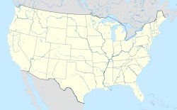
 Sacramento
Coordinates: 38°33′20″N 121°28′8″W / 38.55556°N 121.46889°WCoordinates: 38°33′20″N 121°28′8″W / 38.55556°N 121.46889°W Country United States State California County Sacramento County Government – Type Mayor-Council – Mayor Kevin Johnson Area[1] – City 100.105 sq mi (259.273 km2) – Land 97.915 sq mi (253.600 km2) – Water 2.190 sq mi (5.673 km2) 2.19% Elevation 25 ft (8 m) Population (2010) – City 466,488 – Density 4,660/sq mi (1,799.2/km2) – Metro 2.5 million – Demonym Sacramentan Time zone PST (UTC−8) – Summer (DST) PDT (UTC−7) ZIP code 942xx, 958xx Area code(s) 916 FIPS code 06-64000 GNIS feature ID 1659564 Website http://www.cityofsacramento.org/ Sacramento is the capital city of the U.S. state of California and the county seat of Sacramento County. It is located at the confluence of the Sacramento River and the American River in the northern portion of California's expansive Central Valley. With a population of 466,488 at the 2010 census, it is the sixth-largest city in California. Sacramento is the core cultural and economic center of the Sacramento metropolitan area which includes seven counties; with an estimated population of 2,527,123.[2] Its metropolitan area is the fourth largest in California after the Greater Los Angeles Area, San Francisco Bay Area, and the San Diego metropolitan area as well as the 22nd largest in the United States. A city attaining global status, Sacramento was cited by Time magazine as America's most ethnically and racially integrated city in 2002.[3][4]
Sacramento became a city through the efforts of the Swiss immigrant John Sutter, Sr., his son John Sutter, Jr., and James W. Marshall. Sacramento grew quickly thanks to the protection of Sutter's Fort, which was established by Sutter in 1839. During the California Gold Rush, Sacramento was a major distribution point, a commercial and agricultural center, and a terminus for wagon trains, stagecoaches, riverboats, the telegraph, the Pony Express, and the First Transcontinental Railroad.
California State University, Sacramento, more commonly known as Sacramento State or Sac State, is the major local university. It is one of the twenty-three campuses of the California State University system. In addition, the University of California, Davis, is located in nearby Davis, 15 miles (24 km) west of the capital. The UC Davis Medical Center, a world-renowned research hospital, is located in the city of Sacramento.
Contents
History
Main article: History of Sacramento, CaliforniaIndigenous culture
Nisenan (Southern Maidu) and Plains Miwok Indians have lived in the area for perhaps thousands of years. Unlike the settlers who would eventually make Sacramento their home, these Indians left little evidence of their existence. Traditionally, their diet was dominated by acorns taken from the plentiful oak trees in the region, and by fruits, bulbs, seeds, and roots gathered throughout the year.
In either 1799 or 1808, the Spanish explorer Gabriel Moraga discovered and named the Sacramento Valley and the Sacramento River. A Spanish writer with the Moraga expedition wrote, "Canopies of oaks and cottonwoods, many festooned with grapevines, overhung both sides of the blue current. Birds chattered in the trees and big fish darted through the pellucid depths. The air was like champagne, and (the Spaniards) drank deep of it, drank in the beauty around them. “Es como el sagrado sacramento! (This is like the Holy Sacrament.)”[5] The valley and the river were then christened after "the Most Holy Sacrament of the Body and Blood of Christ", referring to the Catholic sacrament of the Eucharist.
From pioneers to gold fever
 Inside the historical Sutter's Fort. Main building housing John Sutter's offices. 2009
The pioneer John Sutter arrived from Liestal, Switzerland in the Sacramento area with other settlers in August 1839 and established the trading colony and stockade Sutter's Fort (as New Helvetia or "New Switzerland") in 1840. Sutter received 2,000 fruit trees in 1847, which started the agriculture industry in the Sacramento Valley. In 1848, when gold was discovered by James W. Marshall at Sutter's Mill in Coloma (located some 50 miles (80.5 km), northeast of the fort), a large number of gold-seekers came to the area, increasing the population. John Sutter, Jr. then planned the City of Sacramento, in association with Sam Brannan against the wishes of his father, naming the city after the Sacramento River for commercial reasons. He hired topographical engineer William H. Warner to draft the official layout of the city, which included 26 lettered and 31 numbered streets (today's grid from C St. to Broadway and from Front St. to Alhambra Blvd.). However, a bitterness grew between the elder Sutter and his son as Sacramento became an overnight commercial success (Sutter's Fort, Mill and the town of Sutterville, all founded by John Sutter, Sr., would eventually fail).
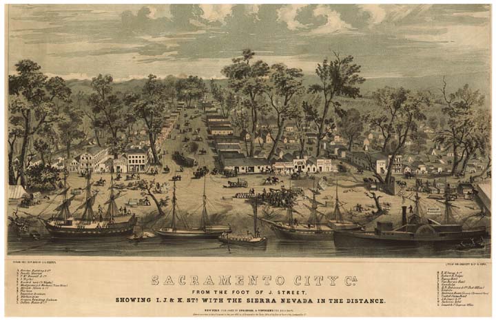
 Sacramento in 1849
The part of Sacramento originally laid out by William Warner is situated just east and south of where the American River meets the Sacramento River (though over time it has grown to extend significantly north, south, and east of there). A number of directly adjacent towns, cities or unincorporated county suburbs, such as Fair Oaks, Carmichael, Citrus Heights, Elk Grove, Folsom, Rancho Cordova, Roseville, Rocklin, West Sacramento, Natomas, Del Paso Heights, Orangevale, and North Highlands extend the greater Sacramento area.
The citizens of Sacramento adopted a city charter in 1849, which was recognized by the state legislature in 1850. Sacramento is the oldest incorporated city in California, incorporated on February 27, 1850.[6] During the early 1850s the Sacramento valley was devastated by floods, fires and cholera epidemics. Despite this, because of its position just downstream from the Mother Lode in the Sierra Nevada, the new city grew, quickly reaching a population of 10,000.
Remnants of downtown Sacramento's Chinatown
Throughout the early 1840s and 1850s, China was at war with Great Britain and France in the First and Second Opium Wars. The wars, along with endemic poverty in China, helped drive many Chinese immigrants to America. Many first came to San Francisco, which was then the largest city in California, which was known as "Dai Fow" (The Big City) and some came eventually to Sacramento (then the second-largest city in California), which is known as "Yee Fow" (Second City). Many of these immigrants came in hopes for a better life as well as the possibility of finding gold in the foothills east of Sacramento.
Sacramento's Chinatown was located on "I" Street from Second to Sixth Streets. At the time this area of "I" Street was considered a health hazard as, lying within a levee zone it was lower than other parts of the city which were situated on higher land. Throughout Sacramento's Chinatown history there were fires, acts of discrimination, and prejudicial legislation such as the Chinese Exclusion Act that was not repealed until 1943. The mysterious fires were thought to be set off by those who did not take a liking to the Chinese working class.[7] Ordinances on what was viable building material were set into place to try to get the Chinese to move out. Newspapers such as The Sacramento Union, at the time, wrote stories that portrayed the Chinese in an unfavorable light to inspire ethnic discrimination and drive the Chinese away. As the years passed, a railroad was created over parts of the Chinatown and further politics and laws would make it even harder for Chinese workers to sustain a living in Sacramento. While the east side of the country fought for higher wages and fewer working hours, many cities in the western United States wanted the Chinese out because of the belief that they were stealing jobs from the white working class.
The Chinese remained resilient despite these efforts. They built their buildings out of bricks just as the building guidelines established. They helped build part of the railroads that span the city as well as making a great contribution to the transcontinental railroad that spans the United States. They also helped build the levees within Sacramento and the surrounding cities. As a result, they are a well-recognized part of Sacramento's history and heritage.
While most of Sacramento's Chinatown has now been razed, a small Chinatown mall remains, as well as a museum dedicated to the history of Sacramento's Chinatown and the contributions Chinese Americans have made to the city. Amtrak sits along what was part of Sacramento's Chinatown "I" Street.[8][9]
Capital city
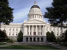 California's State Capitol Building
The California State Legislature, with the support of Governor John Bigler, moved to Sacramento in 1854. The capital of California under Spanish (and, subsequently, Mexican) rule had been Monterey, where in 1849 the first Constitutional Convention and state elections were held. The convention decided that San Jose would be the new state's capital. After 1850, when California's statehood was ratified, the legislature met in San Jose until 1851, Vallejo in 1852, and Benicia in 1853, before moving to Sacramento. In the 1879 Constitutional Convention, Sacramento was named to be the permanent state capital.
Begun in 1860 to be reminiscent of the United States Capitol in Washington, DC, the Classical Revival style California State Capitol was completed in 1874. In 1861, the legislative session was moved to the Merchants Exchange Building in San Francisco for one session because of massive flooding in Sacramento. The legislative chambers were first occupied in 1869 while construction continued. From 1862–1868, part of the Leland Stanford Mansion was used for the governor's offices during Stanford's tenure as the Governor; and the legislature met in the Sacramento County Courthouse.
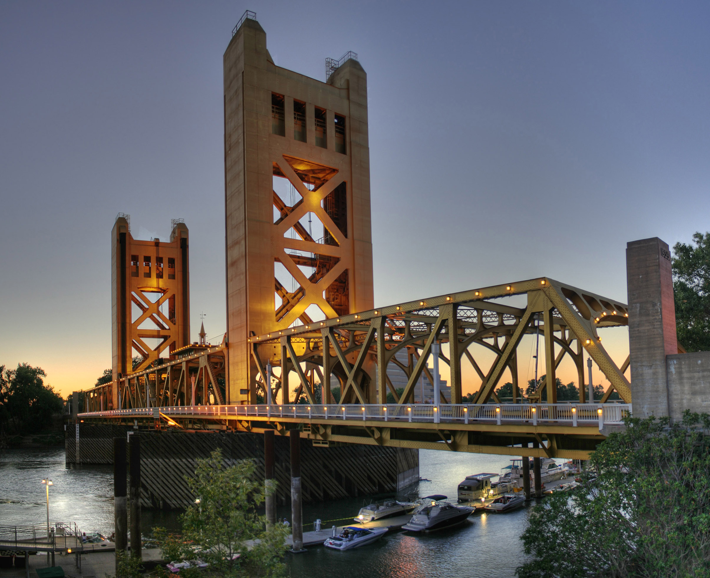
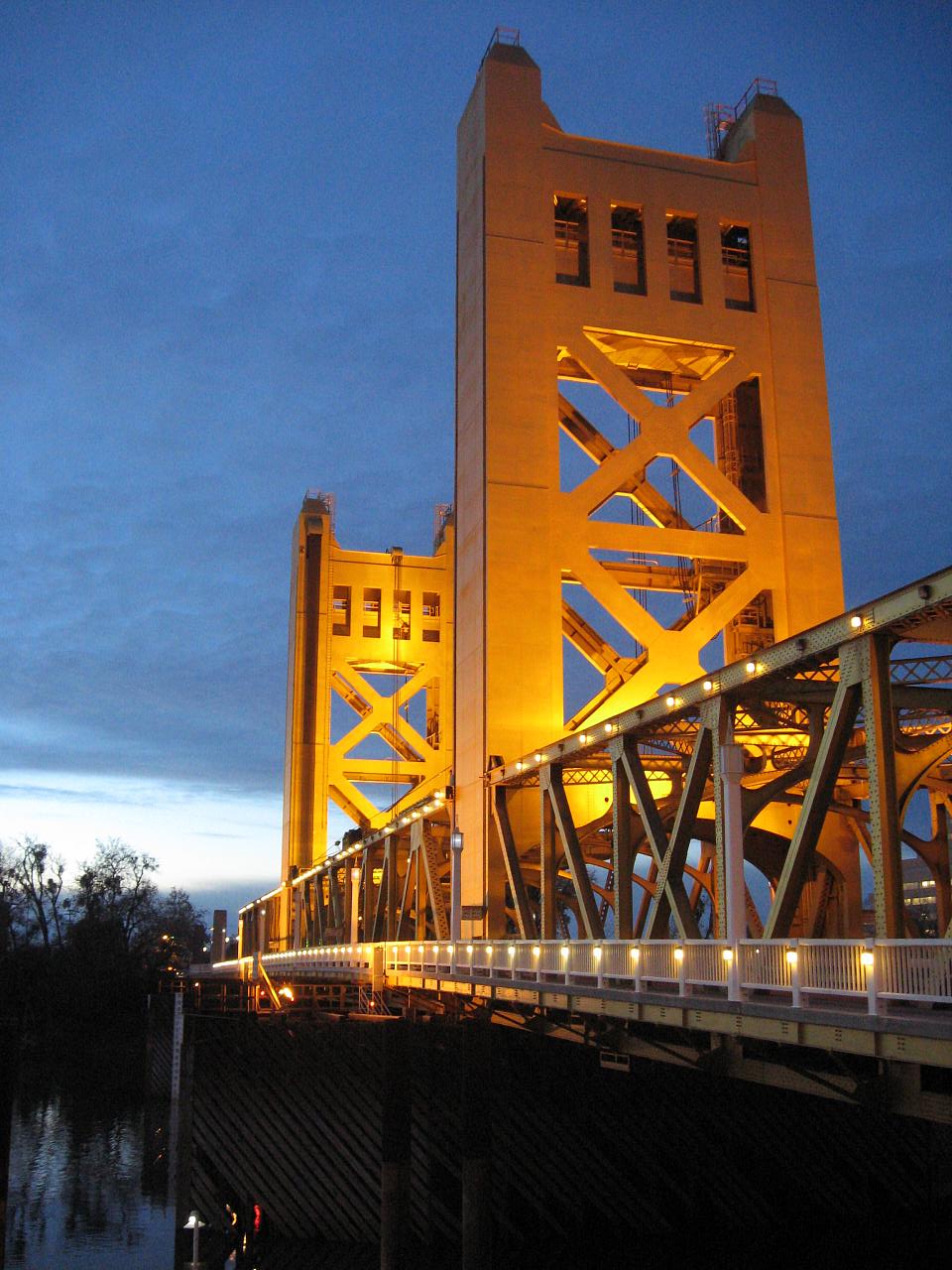
 The Tower Bridge, built in 1935, a popular landmark
With its new status and strategic location, Sacramento quickly prospered and became the western end of the Pony Express. Later it became a terminus of the First Transcontinental Railroad, which began construction in Sacramento in 1863 and was financed by "The Big Four" – Mark Hopkins, Charles Crocker, Collis P. Huntington, and Leland Stanford.
In 1850 and again in 1861, Sacramento citizens were faced with a completely flooded town. After the devastating 1850 flood, Sacramento experienced a cholera epidemic and a flu epidemic, which crippled the town for several years. In 1861, Governor Leland Stanford, who was inaugurated in early January 1861, had to attend his inauguration in a rowboat, which was not too far from his house in town on N street. The flood waters were so bad, the legend says, that when he returned to his house, he had to enter into it through the second floor window. From 1862 until the mid-1870s Sacramento raised the level of its downtown by building reinforced brick walls on its downtown streets, and filling the resulting street walls with dirt. Thus the previous first floors of buildings became the basements, with open space between the street and the building, previously the sidewalk, now at the basement level. Most property owners used screw jacks to raise their buildings to the new grade. The sidewalks were covered, initially by wooden sidewalks, then brick barrel vaults, and eventually replaced by concrete sidewalks. Over the years, many of these underground spaces have been filled or destroyed by subsequent development. However, it is still possible to view portions of the "Sacramento Underground".
 Sacramento City Hall
The same rivers that earlier brought death and destruction began to provide increasing levels of transportation and commerce. Both the American and especially Sacramento rivers would be key elements in the economic success of the city. In fact, Sacramento effectively controlled commerce on these rivers, and public works projects were funded though taxes levied on goods unloaded from boats and loaded onto rail cars in the historic Sacramento Rail Yards. Now both rivers are used extensively for recreation. The American River is a 5-mph (8-km/h) waterway for all power boats (including jet-ski and similar craft) (Source Sacramento County Parks & Recreation) and has become an international attraction for rafters and kayaking.
The Sacramento River sees many boaters, who can make day trips to nearby sloughs or continue along the Delta to the Bay Area and San Francisco. The Delta King, a paddlewheel steamboat which for eighteen months lay on the bottom of the San Francisco Bay, was refurbished and now boasts a hotel, a restaurant, and two different theaters for nightlife along the Old Sacramento riverfront.
The modern era
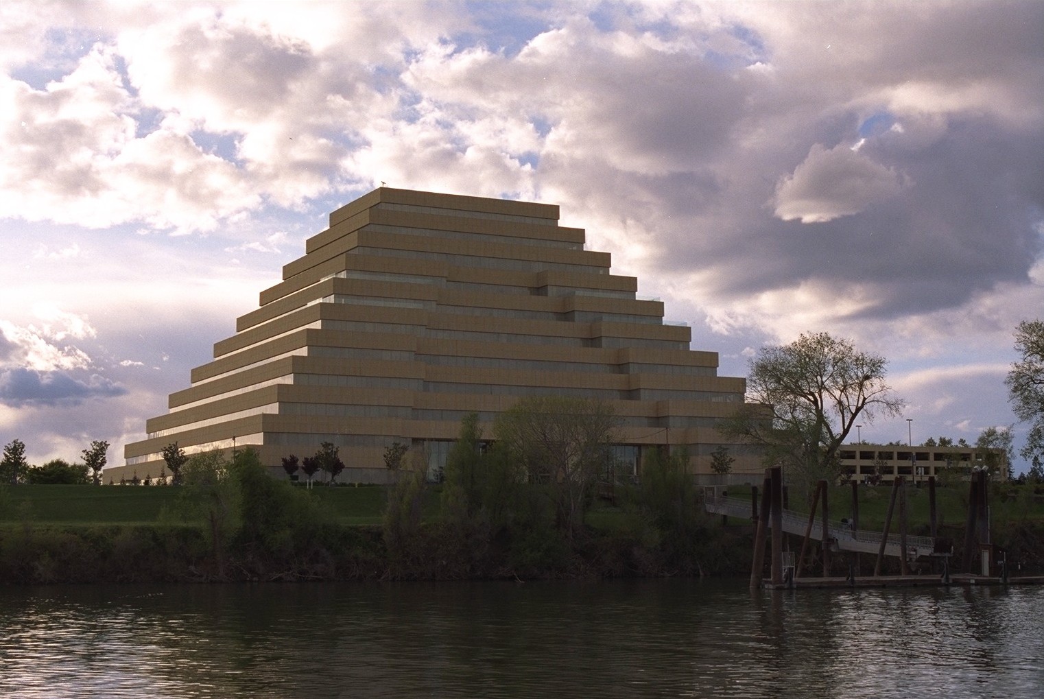
 The Ziggurat Building in the city of West Sacramento, viewed across the Sacramento River from the western edge of Sacramento
The city's current charter was adopted by voters in 1920, establishing a city council-and-manager form of government, still used today. As a charter city, Sacramento is exempt from many laws and regulations passed by the state legislature. The city has expanded continuously over the years. The 1964 merger of the City of North Sacramento with Sacramento substantially increased its population, and large annexations of the Natomas area eventually led to significant population growth throughout the 1970s, 1980s, and 1990s.
Sacramento County (along with a portion of adjacent Placer County) is served by a customer-owned electric utility, the Sacramento Municipal Utility District (SMUD). Sacramento voters approved the creation of SMUD in 1923. In April, 1946, after 12 years of litigation, a judge ordered Pacific Gas & Electric to transfer title of Sacramento's electric distribution system to SMUD. Today SMUD is the sixth-largest public electric utility in the U.S., and is a leader for innovative programs and services, including the development of clean fuel resources, such as solar power.[10] The Sacramento-Yolo Port District was created in 1947, and ground was broken on the Port of Sacramento in 1949. On June 29, 1963, with 5,000 spectators waiting to welcome her, the Motor Vessel Taipei Victory arrived.[11] The port was open for business. The Nationalist Chinese flagship, freshly painted for the historic event, was loaded with 5,000 tons of bagged rice for Mitsui Trading Co. bound for Okinawa and 1,000 tons of logs for Japan. She was the first ocean-going vessel in Sacramento since the steamship Harpoon in 1934. The Port of Sacramento has been plagued with operating losses in recent years and faces bankruptcy. This severe loss in business is due to the heavy competition from the Port of Stockton, which has a larger facility and a deeper channel. As of 2006, the city of West Sacramento took responsibility for the Port of Sacramento. During the Vietnam War era, the Port of Sacramento was the major terminus in the supply route for all military parts, hardware and other cargo going into Southeast Asia.
 West America Bank Building
In 1967, Ronald Reagan became the last Governor of California to live permanently in the city. A new executive mansion, constructed by private funds in a Sacramento suburb for Reagan, remained vacant for nearly forty years and was recently sold by the state.
The 1980s and 1990s saw the closure of several local military bases: McClellan Air Force Base, Mather Air Force Base, and Sacramento Army Depot. Also, in 1980, there was another flood. The flood's damage affected the "boat section" of Interstate 5. The culmination of a series of storms as well as a faulty valve are believed to have caused this damage.
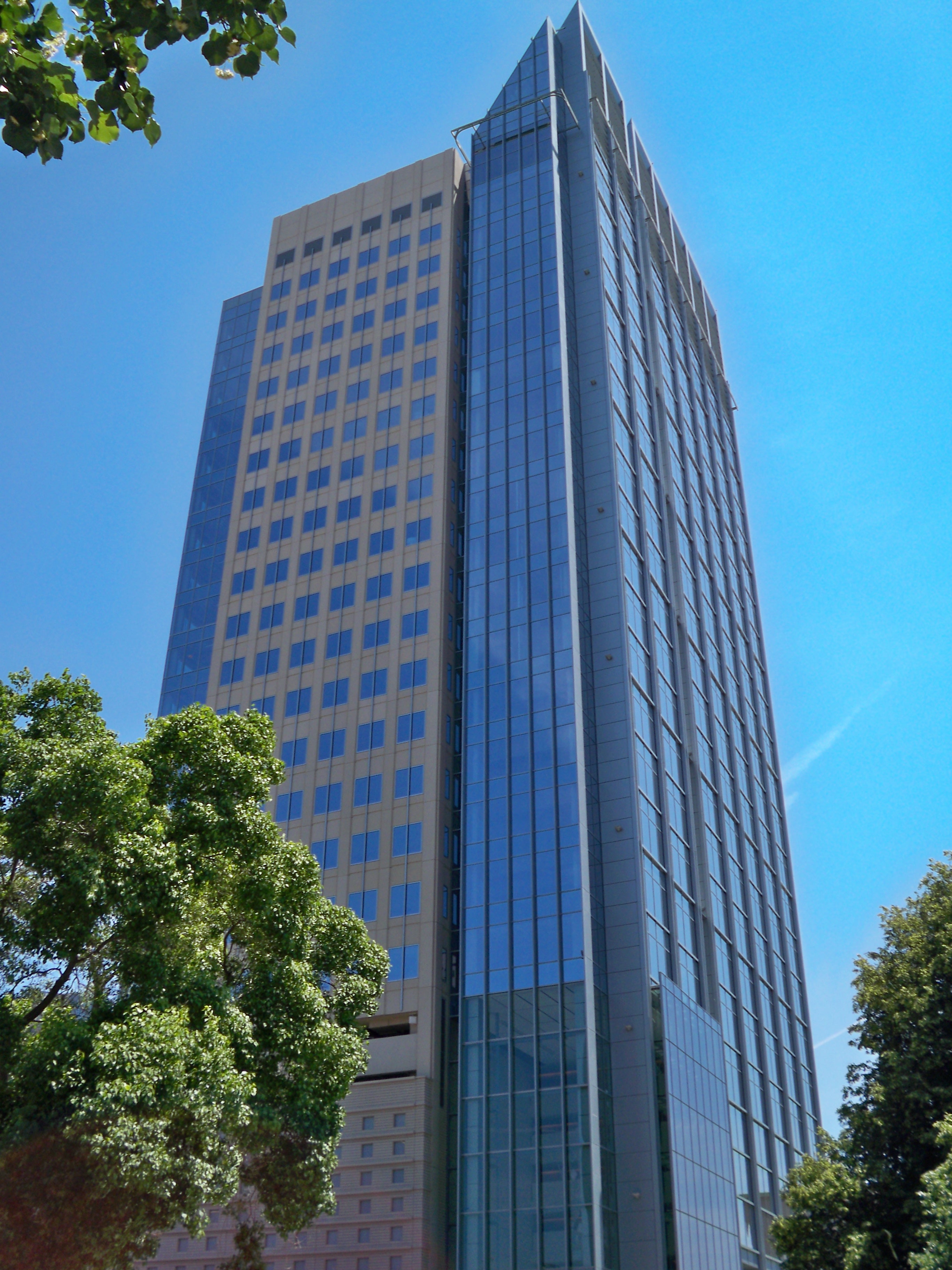
 US Bank Tower completed in 2008
In the early 1990s, Mayor Joe Serna attempted to lure the Los Angeles Raiders football team to Sacramento, selling $50 million in bonds as earnest money. When the deal fell through, the bond proceeds were used to construct several large projects, including expanding the Sacramento Convention Center Complex and refurbishing of the Memorial Auditorium. Serna renamed a city park for migrant worker rights activist Cesar Chavez. Through his effort, Sacramento became the first major city in the country to have a paid municipal holiday honoring Chavez.
In spite of military base closures and the decline of agricultural food processing, Sacramento has continued to experience population growth in recent years. Primary sources of population growth are an influx of residents from the nearby San Francisco Bay Area, as well as immigration from Asia and Latin America. From 1990 to 2000, the city's population grew by 14.7%. The Census Bureau estimates that from 2000 to 2007, the county's population increased by nearly 164,000 residents.[12]
In the late 1990s and early 2000s, Mayor Heather Fargo made several abortive attempts to provide taxpayer financing of a new sports arena for the Maloof brothers, owners of the Sacramento Kings NBA Basketball franchise. In November 2006, Sacramento voters soundly defeated a proposed sales tax hike to finance the plan. The defeat was due in part to competing plans for the new arena and its location.
In 2002, Time magazine featured an article recognizing Sacramento as the most diverse and integrated city in America.[13]
Despite a devolution of state bureaucracy, the state government remains by far Sacramento's largest employer. The City of Sacramento expends considerable effort to keep state agencies from moving outside the city limits.[14] In addition, many federal agencies have offices in Sacramento.
The California Supreme Court normally sits in nearby San Francisco.
Geography and climate
Geography
 The Sacramento River near the old pumping station
According to the United States Census Bureau, the city covers an area of 100.1 square miles (259 km2), 97.81% of it land, and 2.19% of it water.
Depth to groundwater is typically about 30 feet (9 m). Much of the land to the west of the city (in Yolo County) is a flood control basin. As a result, the greater metropolitan area sprawls only four miles (6 km) west of downtown (as West Sacramento, California) but 30 miles (48 km) northeast and east, into the Sierra Nevada foothills, and 10 miles (16 km) to the south into valley farmland.
The city is located at the confluence of the Sacramento River and the American River, and has a deep-water port connected to the San Francisco Bay by a channel through the Sacramento River Delta. It is the shipping and rail center for the Sacramento Valley. Food processing is among the major industries in the area.
Climate
Sacramento has a Mediterranean climate (Koppen Csa), characterized by damp to wet, mild winters and hot, dry summers. The wet season is generally October through April, though there may be a day or two of light rainfall in June or September. The mean annual temperature is 61.1 °F (16.2 °C), with monthly means ranging from 45.8 °F (7.7 °C) in December to 75.4 °F (24.1 °C) in July. Summer heat is often moderated by a sea breeze known as the "delta breeze" which comes through the Sacramento-San Joaquin River Delta from the San Francisco Bay.
On average, 96 days in the year experience some degree of fog, which usually occurs in the morning (tule fog). The foggiest months are December and January. Tule fog can be extremely dense, lowering visibility to less than 100 feet (30 m) and making driving conditions extremely hazardous. Chilling tule fog events have been known to last for several consecutive days or weeks. During Tule fog events, temperatures do not exceed 50 degrees.
Snowfall is exceptionally rare in Sacramento, which is only 25 feet (7.6 m) above sea level. The all-time record snowfall was 3.5 inches (9 cm), which occurred on January 4, 1888. Dustings occur every 5-10 years, with up to an inch accumulation in outlying areas. During especially cold winter and spring storms, intense showers do occasionally produce a significant amount of hail, which can create hazardous driving conditions. Significant snow accumulations occur each year in the foothills located 40 miles (64 km) east of the city.
On average, there are 74 days where the high exceeds 90 °F (32 °C), and 15 days where the high exceeds 100 °F (38 °C); On the other extreme, freezing nights occur 16 nights per year.[15] At Sacramento Executive Airport, extremes have ranged from 18 °F (−8 °C) on December 22, 1990 to 115 °F (46 °C) on June 15, 1961.[15]
The average annual precipitation is 17.93 inches (455 mm).[16] On average, precipitation falls on 62 days each year in Sacramento, and nearly all of this falls during the winter months. Average January rainfall is 3.84 inches (98 mm),[17] and measurable precipitation is rare during the summer months. In February 1992, Sacramento had 16 consecutive days of rain, resulting in an accumulation of 6.41 inches (163 mm) for the period (163 mm). A record 7.24 inches (184 mm) of rain fell on April 20, 1880. On rare occasions, monsoonal moisture surges from the Desert Southwest can bring upper-level moisture to the Sacramento region, leading to increased summer cloudiness, humidity, and even light showers and thunderstorms. Monsoon clouds do occur usually during late July through Early September. Sacramento is the second most flood susceptible city in the United States after New Orleans.[18]
Climate data for Sacramento (Sacramento International Airport) Month Jan Feb Mar Apr May Jun Jul Aug Sep Oct Nov Dec Year Record high °F (°C) 70
(21)76
(24)88
(31)95
(35)105
(41)115
(46)114
(46)110
(43)108
(42)104
(40)87
(31)69
(21)115
(46)Average high °F (°C) 55.5
(13.1)64.5
(18.1)66.5
(19.2)71.4
(21.9)80.0
(26.7)87.4
(30.8)92.4
(33.6)91.4
(33.0)87.5
(30.8)78.2
(25.7)63.7
(17.6)53.9
(12.2)73.7 Daily mean °F (°C) 46.3
(7.9)51.2
(10.7)54.5
(12.5)58.9
(14.9)65.5
(18.6)71.5
(21.9)75.4
(24.1)74.8
(23.8)71.7
(22.1)64.4
(18.0)53.3
(11.8)45.8
(7.7)61.1 Average low °F (°C) 38.8
(3.8)41.9
(5.5)44.2
(6.8)46.3
(7.9)50.9
(10.5)57.5
(14.2)61.5
(16.4)61.5
(16.4)55.8
(13.2)50.6
(10.3)42.8
(6.0)37.7
(3.2)48.4 Record low °F (°C) 20
(−7)23
(−5)26
(−3)31
(−1)34
(1)41
(5)48
(9)48
(9)43
(6)35
(2)26
(−3)18
(−8)18
(−8)Precipitation inches (mm) 3.84
(97.5)3.54
(89.9)2.80
(71.1)1.02
(25.9).53
(13.5).20
(5).05
(1.3).06
(1.5).36
(9.1).89
(22.6)2.19
(55.6)2.45
(62.2)17.93
(455.4)Avg. precipitation days (≥ 0.01 in) 10.5 9.1 9.4 4.9 2.9 1.2 .2 .4 1.5 3.6 7.2 8.2 59.1 Sunshine hours 145.7 203.4 279.0 330.0 406.1 420.0 440.2 406.1 348.0 297.6 195.0 142.6 3,613.7 Source no. 1: NOAA[15] Source no. 2: HKO[19] Cityscape


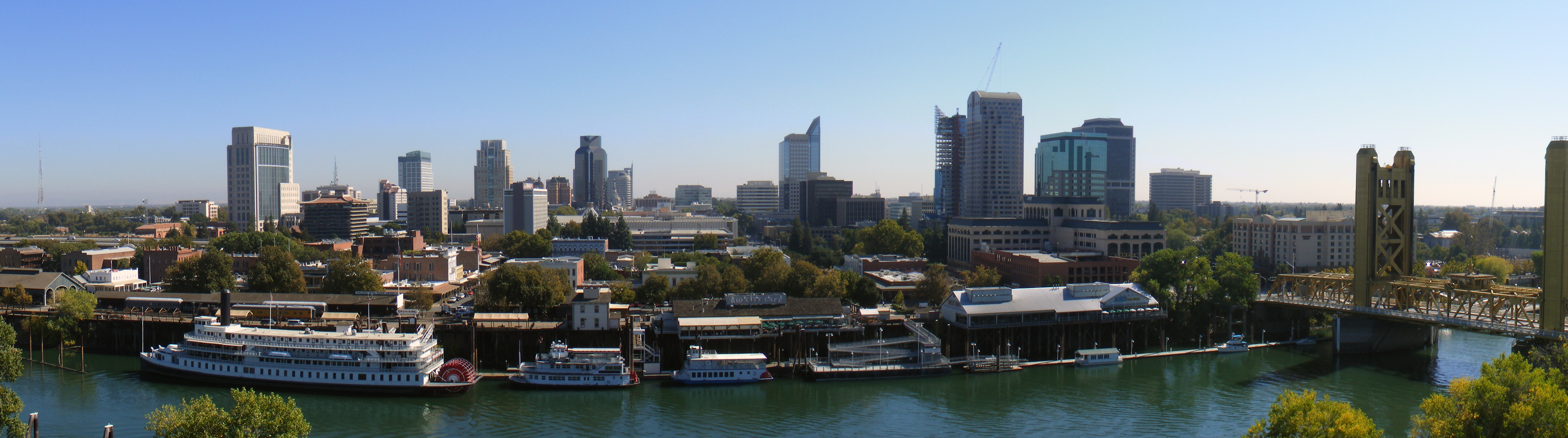
Panoramic view of downtown Sacramento from West Sacramento City neighborhoods
The city groups its neighborhoods into four areas:
Area one (central/eastern)
Alkali Flat, Boulevard Park, Campus Commons, Sacramento State, Dos Rios Triangle, Downtown, East Sacramento, Mansion Flats, Marshall School, Midtown, New Era Park, Newton Booth, Old Sacramento, Poverty Ridge, Richards, Richmond Grove, River Park, Elmhurst, Sierra Oaks, Southside Park.[20]
Area two (southwestern)
Airport, Carleton Tract, Freeport Manor, Golf Course Terrace, Greenhaven, Curtis Park, Hollywood Park, Land Park, Little Pocket, Mangan Park, Meadowview, Parkway, Pocket, Sacramento City College, South Land Park, Valley Hi / North Laguna, Z'Berg Park[21]
Area three (southeastern)
Alhambra Triangle, Avondale, Brentwood, Carleton Tract, Colonial Heights, Colonial Village, Colonial Village North, Curtis Park, Elmhurst, Fairgrounds, Florin, Industrial Park, Fruitridge Manor, Glen Elder, Glenbrook, Granite Regional Park, Lawrence Park, Med Center, North City Farms, Oak Park, Packard Bell, South City Farms, Southeast Village, Tahoe Park, Tahoe Park East, Tahoe Park South, Tallac Village, Vintage Park, Churchill Downs, and Woodbine.[22]
Area four (north of the American River)
Ben Ali, Del Paso Heights, Gardenland, Hagginwood, McClellan Heights West, Natomas (north, south, west), North Sacramento, Northgate, Robla, Swanston Estates, Terrace Manor, Valley View Acres, and Woodlake.[23]
Demographics
Historical populations Census Pop. %± 1850 6,820 — 1860 13,785 102.1% 1870 16,283 18.1% 1880 21,420 31.5% 1890 26,386 23.2% 1900 29,282 11.0% 1910 44,696 52.6% 1920 65,908 47.5% 1930 93,750 42.2% 1940 105,958 13.0% 1950 137,572 29.8% 1960 191,667 39.3% 1970 257,105 34.1% 1980 275,741 7.2% 1990 369,365 34.0% 2000 407,018 10.2% 2010 466,488 14.6% 2010
The 2010 United States Census[24] reported that Sacramento had a population of 466,488. The population density was 4,660.0 people per square mile (1,799.2/km²). The racial makeup of Sacramento was 210,006 (45.0%) White, 68,335 (14.6%) African American, 5,291 (1.1%) Native American, 85,503 (18.3%) Asian (4.2% Chinese, 3.3% Hmong, 2.8% Filipino, 1.8% Indian, 1.4% Vietnamese, 1.2% Laotian, 1.2% Japanese, 0.4% Pakistani, 0.3% Korean, 0.2% Cambodian), 6,655 (1.4%) Pacific Islander, 57,573 (12.3%) from other races, and 33,125 (7.1%) from two or more races. Hispanic or Latino of any race were 125,276 persons (26.9%); 22.6% of Sacramento's population is Mexican, 0.7% Puerto Rican, 0.5% Salvadoran, 0.2% Guatemalan, and 0.2% Nicaraguan.[25]
The Census reported that 458,174 people (98.2% of the population) lived in households, 4,268 (0.9%) lived in non-institutionalized group quarters, and 4,046 (0.9%) were institutionalized.
There were 174,624 households, out of which 57,870 (33.1%) had children under the age of 18 living in them, 65,556 (37.5%) were heterosexual married couples living together, 27,640 (15.8%) had a female householder with no husband present, 10,534 (6.0%) had a male householder with no wife present. There were 13,234 (7.6%) unmarried heterosexual partnerships, and 2,498 (1.4%) homosexual married couples or partnerships. 53,342 households (30.5%) were made up of individuals and 14,926 (8.5%) had someone living alone who was 65 years of age or older. The average household size was 2.62. There were 103,730 families (59.4% of all households); the average family size was 3.37.
The population was spread out with 116,121 people (24.9%) under the age of 18, 52,438 people (11.2%) aged 18 to 24, 139,093 people (29.8%) aged 25 to 44, 109,416 people (23.5%) aged 45 to 64, and 49,420 people (10.6%) who were 65 years of age or older. The median age was 33.0 years. For every 100 females there were 94.9 males. For every 100 females age 18 and over, there were 92.2 males.
There were 190,911 housing units at an average density of 1,907.1 per square mile (736.3/km²), of which 86,271 (49.4%) were owner-occupied, and 88,353 (50.6%) were occupied by renters. The homeowner vacancy rate was 2.8%; the rental vacancy rate was 8.3%. 231,593 people (49.6% of the population) lived in owner-occupied housing units and 226,581 people (48.6%) lived in rental housing units.
2000
As of the census[26] of 2000, there are 407,018 people, 154,581 households, and 91,202 families residing in the city. The population density is 4,189.2 people per square mile (1,617.4/km²). There are 163,957 housing units at an average density of 1,687.5 per square mile (651.5/km²). The racial makeup of the city is 41.1% White, 19.5% Black or African American, 1.3% Native American, 12.6% Asian, 0.9% Native Hawaiian and Pacific Islander, 11.0% from other races, and 6.4% from two or more races. 21.6% of the population are Hispanic or Latino of any race.
There are 154,581 households out of which 30.2% have children under the age of 18 living with them, 38.4% are married couples living together, 15.4% have a female householder with no husband present, and 41.0% are non-families. 32.0% of all households are made up of individuals and 9.2% have someone living alone who is 65 years of age or older. The average household size is 2.57 and the average family size is 3.35.
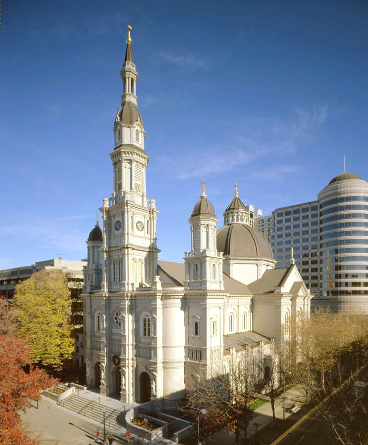
 The Roman Catholic Cathedral of the Blessed Sacrament in Cathedral Square, downtown.
In the city, the population is spread out with 27.3% under the age of 18, 10.4% from 18 to 24, 30.7% from 25 to 44, 20.2% from 45 to 64, and 11.4% who are 65 years of age or older. The median age is 33 years. For every 100 females there are 94.5 males. For every 100 females age 18 and over, there are 91.0 males.
The median income for a household in the city is $37,049, and the median income for a family is $42,051. Males have a median income of $35,946 versus $31,318 for females. The per capita income for the city is $18,721. 20.0% of the population and 15.3% of families are below the poverty line. Out of the total population, 29.5% of those under the age of 18 and 9.0% of those 65 and older are living below the poverty line.
Factors such as mild climate, a location at the crossroads of major interstate highways and railroads, and the availability of campsites along the rivers, as well as an outlook of tolerance, attract homeless people.
Sacramento is notably diverse racially, ethnically, and by household income, and has a notable lack of interracial disharmony. In 2002, Time magazine and the Civil Rights Project of Harvard University identified Sacramento as the most racially/ethnically integrated major city in America.[27] The U.S. Census Bureau also groups Sacramento with other U.S. cities having a "high diversity" rating of the diversity index.[28]
Government and politics
The city government consists of a mayor and city council. The mayor is elected in a citywide vote. The Sacramento City Council consists of eight members, all of which are elected from districts.
In the state legislature Sacramento is located in the 6th Senate District, represented by Democrat Darrell Steinberg, and in the 5th, 9th, and 10th Assembly Districts, represented by Democrats Richard Pan, Roger Dickinson, and Alyson Huber, respectively. Federally, most of Sacramento is located in California's 5th congressional district[29] and is represented by Democrat Doris Matsui. A portion of Sacramento is located in California's 3rd congressional district, represented by Republican Dan Lungren.
Economy
Sutter Health, Blue Diamond Growers, Aerojet, Teichert, and The McClatchy Company are among the companies based in Sacramento.
Top Employers
According to the City's 2010 Comprehensive Annual Financial Report,[30] the top employers in the city are:
# Employer # of Employees 1 State of California 73,273 2 Sacramento County 13,304 3 UC Davis Health System 8,496 4 Kaiser Permanente 7,979 5 Sutter Health 7,314 6 Sacramento City Unified School District 6,500 7 Elk Grove Unified School District 6,391 8 Intel 6,000 9 Mercy/Catholic Healthcare West 5,922 10 San Juan Unified School District 5,190 11 City of Sacramento 4,556 Education
Colleges and universities
The Sacramento area hosts a wide variety of higher educational opportunities. There are two major public universities, many private institutions, community colleges, and vocational schools.
Public
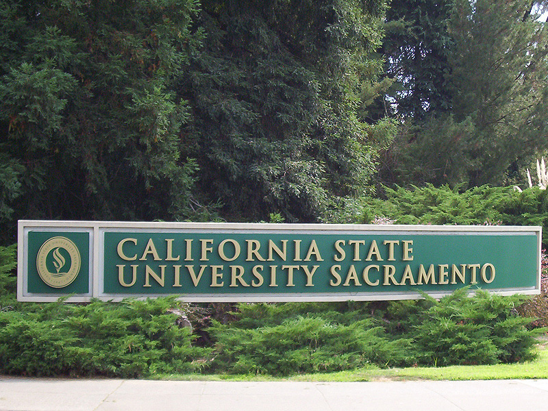
 Sacramento State north entrance
Sacramento is home to Sacramento State (California State University, Sacramento), founded as Sacramento State College in 1947. In 2004, enrollment was 22,555 undergraduates and 5,417 graduate students in the university's eight colleges. The university's mascot is the hornet, and the school colors are green and gold. The 300 acres (1.2 km2) campus is located along the American River Parkway a few miles east of downtown.
The University of California has a campus, UC Davis, in nearby Davis and also has a graduate center in downtown Sacramento. The UC Davis Graduate School of Management (GSM) is located in downtown Sacramento on One Capital Mall. Many students, about 400 out of 517, at the UC Davis GSM are working professionals and are completing their MBA part-time.[31] The part-time program is ranked in the top-20 and is well-known for its small class size, world class faculty, and involvement in the business community. UC also maintains the University of California Sacramento Center (UCCS) for undergraduate and graduate studies. Similar to the UC's Washington, DC, program, "Scholar Interns" engage in both academic studies and as well as internships, often with the state government. The UC Davis School of Medicine is located at the UC Davis Medical Center between the neighborhoods of Elmhurst, Tahoe Park, and Oak Park.
The Los Rios Community College District consists of several two-year colleges in the Sacramento area – American River College, Cosumnes River College, Sacramento City College, Folsom Lake College, plus a large number of outreach centers for those colleges. Sierra College is also on the outskirts of Sacramento in Rocklin.
Private
The Art Institute of California - Sacramento was established in 2007, and is a branch of The Art Institute of California - Los Angeles. The school is focused on educating students in the field of commercial arts. The school offers both a Bachelors of Science and an Associate of Science degree, as well as diplomas in some areas of study. Some majors the school offers are: Digital Film-making & Video Production, Culinary Management, Graphic Design, and Game Art & Design.
 National University, Sacramento, California campus
The National University Sacramento regional campus offers Bachelor's and Master's degrees in business, education, health-care and teaching credential programs.
A satellite campus of Alliant International University offers graduate and undergraduate programs of study, and the Professional School of Psychology is also based in Sacramento.
Sacramento is home to an unaccredited private institution, the University of Sacramento, a Roman Catholic university run by the Legionaries of Christ. Currently, the university offers course work in graduate programs.
The University of San Francisco has one of its four regional campuses in Sacramento. At the undergraduate level they offer degrees in Applied Economics, Information Systems, Organizational Behavior and Leadership, and Public Administration. At the graduate level, Master's programs are offered in: Information Security and Assurance, Information Systems, Organization Development, Project Management, Public Administration, Nonprofit Administration, and Counseling.[32]
The University of the Pacific, McGeorge School of Law, a top 100 law school according to U.S. News & World Report's annual rankings of U.S. law schools (2006, 2007 & 2008), is located in the Oak Park section of Sacramento.
The private University of Southern California has an extension in downtown Sacramento, called the State Capital Center. The campus, taught by main campus professors, Sacramento-based professors, and practitioners in the State Capitol and state agencies, offers Master of Public Administration, Masters of Public Policy, and Master of Public Health degrees.[33]
The Universal Technical Institute(UTI) is also located in Sacramento, it offers automotive programs in auto mechanical, auto body, and diesel.
Sacramento has a number of private vocational schools as well.
In the PBS KVIE building, there is also an extension of San Francisco's Golden Gate University.
Drexel University opened a satellite Graduate School in Sacramento in 2009.[34] Drexel's Sacramento campus is located at One Capital Mall.
K–12 schools
The Sacramento area is served by various public school districts, but mainly by the Sacramento City Unified and Twin Rivers Unified districts. As of 2009, the area's schools employed 9,600 elementary school teachers (not including special education teachers),[35] and 7,410 middle school teachers (not including special education or vocational teachers).[36]
Public schools
Several public school districts serve Sacramento. Sacramento City Unified School District serves most of Sacramento. Other portions are served by the Center Unified School District, Natomas Unified School District, San Juan Unified School District, Twin Rivers Unified School District (the North Sacramento School District, the Del Paso Heights School District, the Rio Linda Union School District, and the Grant Joint Union High School District merged), Folsom-Cordova Unified School District, and Robla School District.
The Valley Hi/North Laguna area, despite mostly being in the city limits of Sacramento, is served by the Elk Grove Unified School District.
Private schools
Independent schools
While Catholic institutions still dominate the independent school scene in the Sacramento area, in 1964, Sacramento Country Day School opened and offered Sacramento citizens an independent school that is affiliated with the California Association of Independent Schools. SCDS has grown to its present day status as a learning community for students from pre-kindergarten through twelfth grade. Additionally, the suburb of Fair Oaks hosts the expansive riverside campus of the Sacramento Waldorf School, a Steiner school adjacent to the Rudolf Steiner College, and the largest Waldorf school in North America. Sacramento Waldorf School educates students from pre-K through 12th grade on a secluded, pastoral site that incorporates a large, functioning biodynamic farm.
Other religious schools
Shalom School is the only Jewish day school in Sacramento.
Capital Christian School is a pre-school – 12th grade private, Christian school.[37] There is also a small Bible college on campus offering associates degrees in Bible studies or theology. Sacramento Adventist Academy is another religious school in Greater Sacramento. This is a K-12 institution, as well.
There is one Islamic school in Sacramento, Masjid Annur, founded in 1988.
Culture and arts
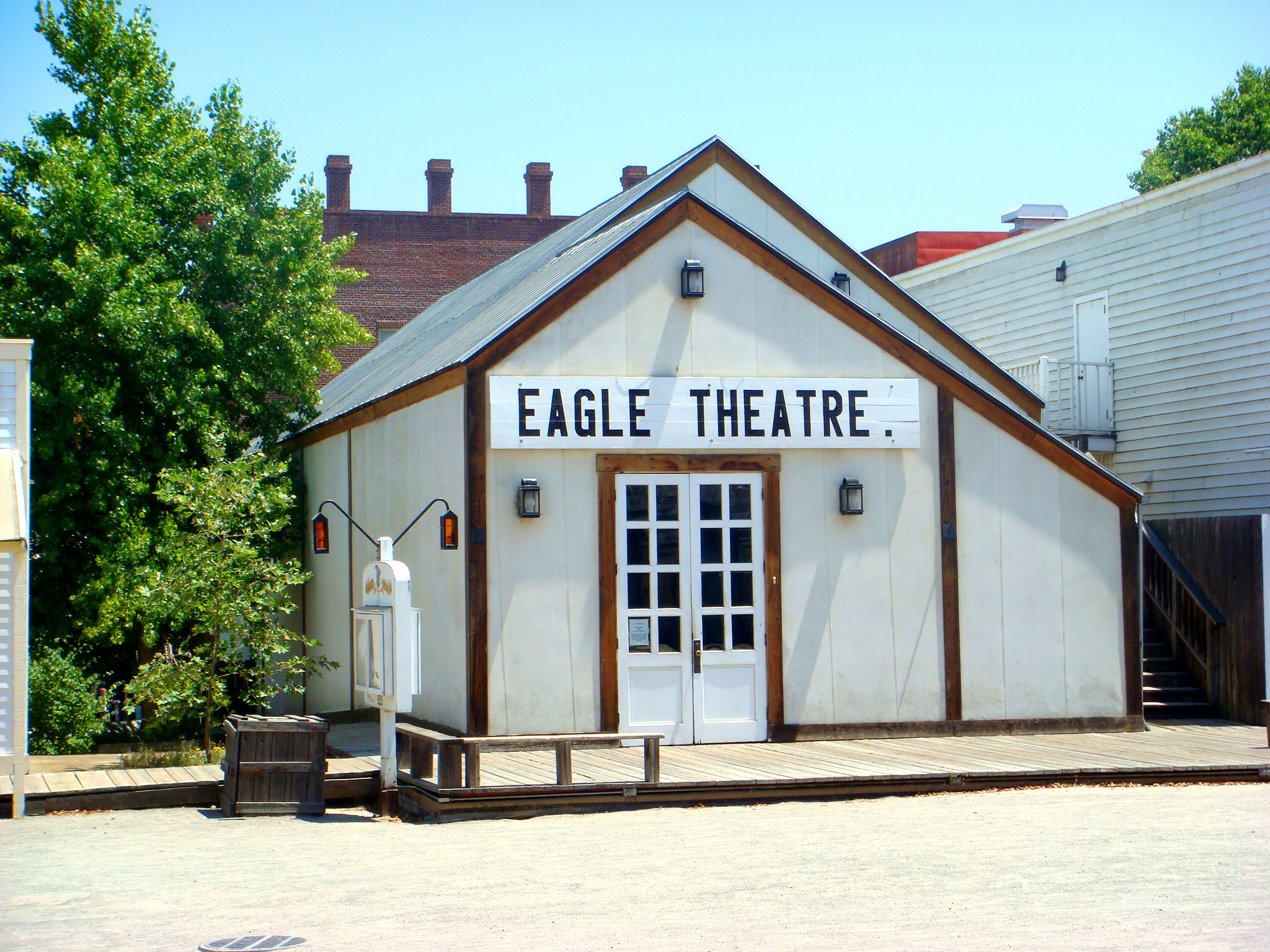
 Reconstruction of California's first permanent theatre, the Eagle Theatre
 The B.F. Hastings Building, western terminus of the Pony Express, in Old Sacramento.
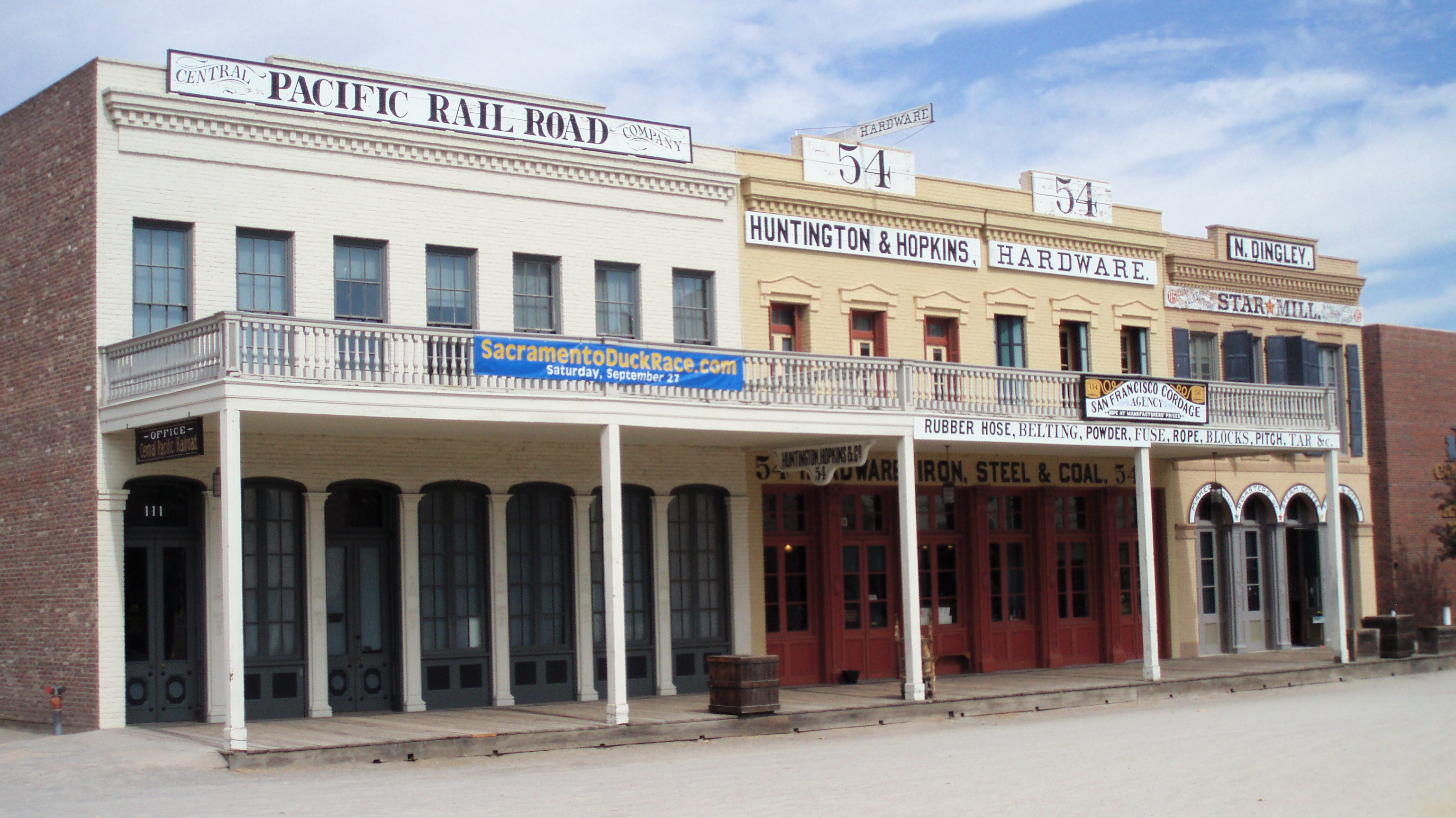
 The Big Four Building in Old Sacramento
Old town
The oldest part of the town besides Sutter's Fort is Old Sacramento, which consists of cobbled streets and many historic buildings, several from the 1850s and 1860s. Buildings have been preserved, restored or reconstructed, and the district is now a substantial tourist attraction, with rides on steam-hauled historic trains and paddle steamers.
The historic buildings also include the Lady Adams Building, built by the passengers and ship's carpenters of the ship Lady Adams.[38] Having survived the Great Conflagration of November 1852, it is the oldest surviving building in Sacramento other than Sutter's Fort.[38]
Another surviving landmark is the B.F. Hastings building, built in 1853. Early home of the California Supreme Court and the location of the office of Theodore Judah, it also was the western terminus of the Pony Express.[39]
The "Big Four Building", built in 1852, was home to the offices of Collis Huntington, Mark Hopkins, Leland Stanford, and Charles Crocker. The Central Pacific Railroad and Southern Pacific Railroad were founded there. The original building was destroyed in 1963 for the construction of Interstate 5, but was re-created using original elements in 1965. It is now a National Historic Landmark. Also of historic interest is the Eagle Theatre, a reconstruction of California's first permanent theatre in its original location.
Theater arts
 The Community Center Theatre (foreground)
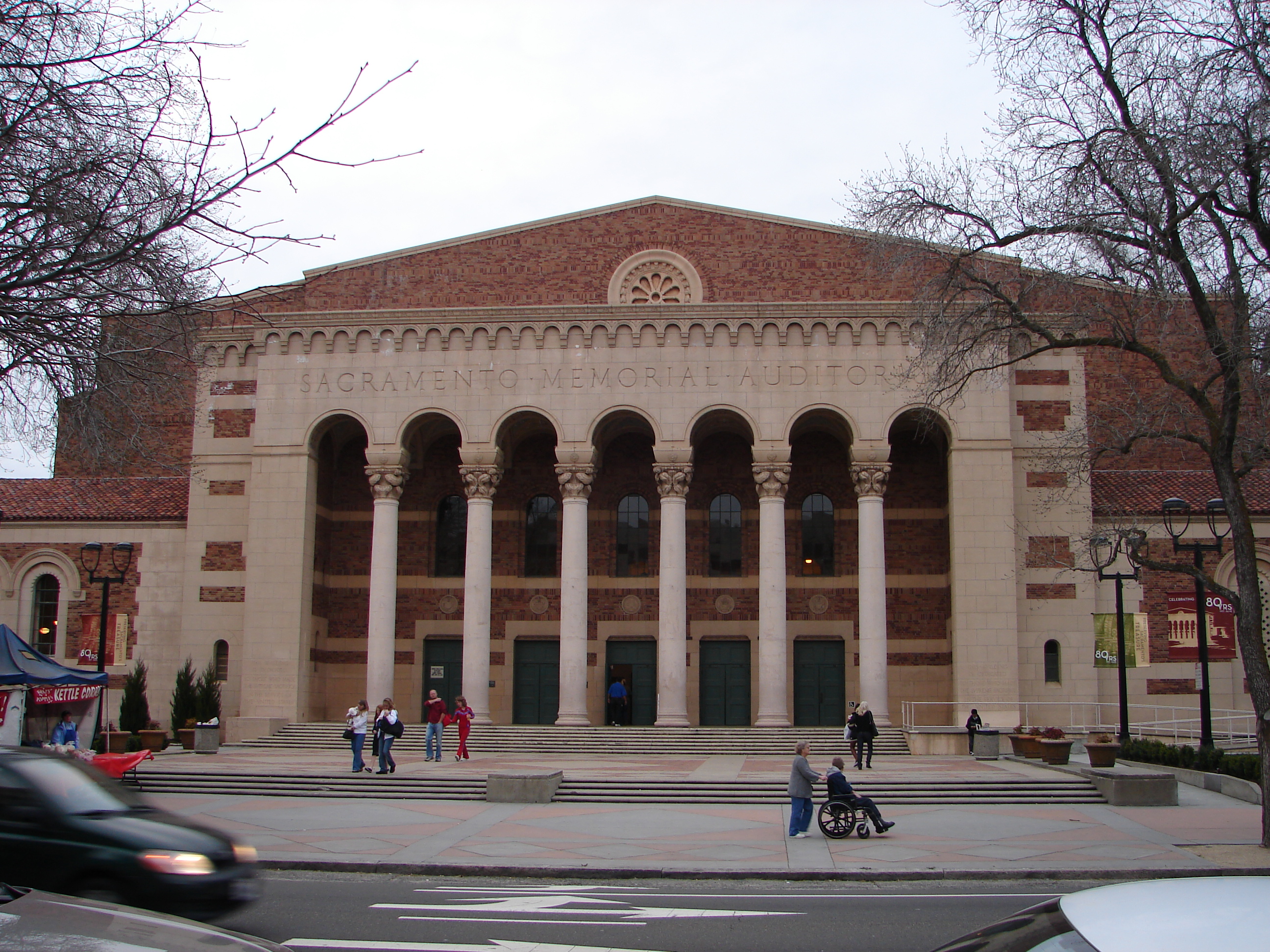
 The Sacramento Memorial Auditorium
 The Wells Fargo Pavilion, Music Circus
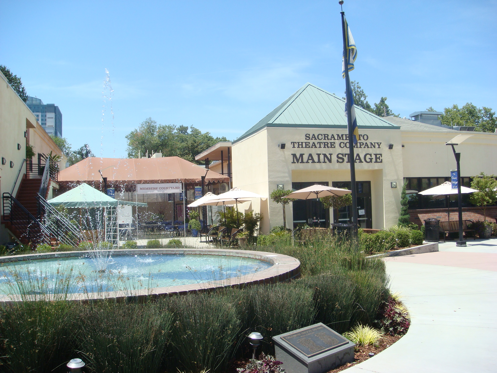
 Main Stage of the Sacramento Theatre Company
There are several major theatre venues for Sacramento. The Sacramento Convention Center Complex governs both the Community Center Theatre and Memorial Auditorium. The Wells Fargo Pavilion is the most recent addition. It is built atop the old Music Circus tent foundations. Next to that is the McClatchy Main stage, originally built as a television studio, which was renovated at the same time the pavilion was built. It is the smallest of the venues and provides seating for only 300. The Sacramento Ballet, Sacramento Philharmonic Orchestra and the Sacramento Opera perform at the Community Center Theatre.
Professional theatre is represented in Sacramento by a number of companies. California Musical Theatre and its Summer stock theatre, Music Circus, lure many directors, performers, and artists from New York to Los Angeles to work alongside a large local staff for their productions at the Wells Fargo Pavilion. During the fall, winter and spring seasons Broadway Sacramento brings bus and truck tours to the Convention Center Theatre. The Sacramento Theatre Company provides non-musical productions as an Equity House Theatre, performing in the McClatchy Main stage. At the B Street Theatre, smaller and more intimate professional productions are performed as well as a children's theatre. Rounding out the professional companies is Capital Stage, which performed aboard the Delta King until the end of the 2010-2011 season and was due to take up residence at its own venue along the J-Street corridor according to its marketing materials.
The Sacramento area has one of the largest collection of community theatres in California. Some of these include the 24th Street Theatre, El Dorado Musical Theatre, Runaway Stage Productions, River City Theatre Company, Flying Monkey Productions, The Actor's Theatre, KOLT Run Productions, Kookaburra Productions, Big Idea Theatre, Celebration Arts, Lambda Player, Light Opera Theatre of Sacramento, Synergy Stage and the historic Eagle Theatre. The Sacramento Shakespeare Festival provides entertainment under the stars every summer in William Land Park. Many of these theatres compete annually for the Elly Awards overseen by The Sacramento Area Regional Theatre Alliance or SARTA.
On Wednesday, June 13, 2007, it was announced that a new studio for the performing arts will be built alongside the Sacramento Theatre company and the Wells Fargo Pavilion. The new multi-million dollar complex will be named the "E. Claire Raley Studios for the Performing Arts" and will provide rehearsal space for four of the region's principal arts groups—Sacramento Ballet, California Musical Theatre, Sacramento Opera and the Sacramento Philharmonic Orchestra, centralizing most of the city's arts organizations.
Visual arts
The Sacramento Metropolitan Arts Commission is an organization which was established as the Sacramento arts council in 1977 to provide several arts programs for the city. These include Art in Public Places, Arts Education, Grants and Cultural Programs, Poet Laureate Program, Arts Stabilization Programs and Other Resources and opportunities.
Sacramento Second Saturday Art Walk is a program of local art galleries that stay open into the late evenings every second Saturday of each month, providing a unique experience for the local population as well as tourists to view original art and meet the artists themselves.
Museums
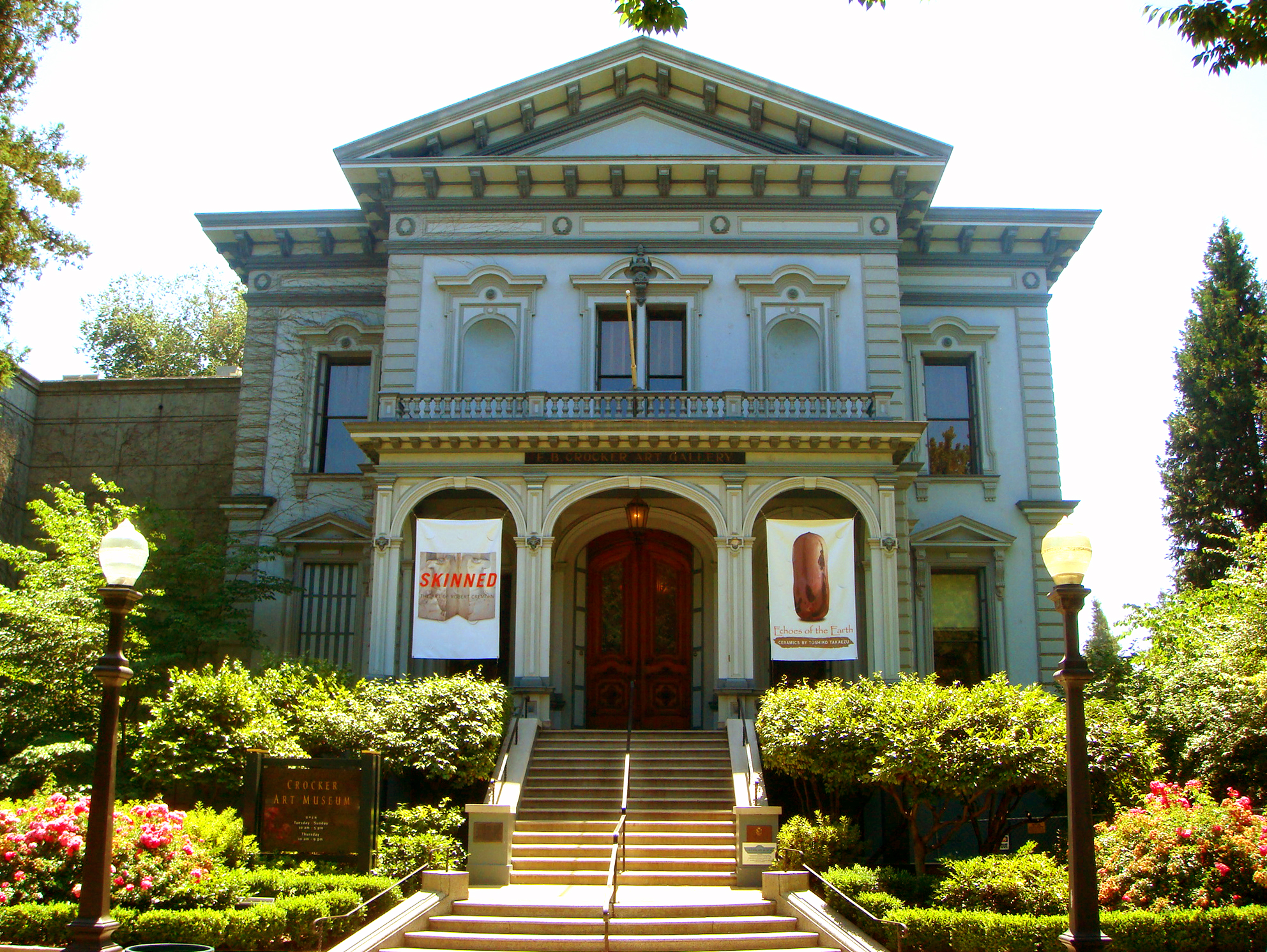
Sacramento has several major museums. The Crocker Art Museum, the oldest public art museum west of the Mississippi River, is one of the finest. On July 26, 2007, the Museum broke ground for an expansion that more than tripled the Museum's floor space. The modern architecture is very different from the Museum's original Victorian style building. Construction was completed in 2010.
Also of interest is the Governor's Mansion State Historic Park, a large Victorian Mansion which was home to 13 of California's Governors. The Leland Stanford Mansion State Historic Park, which was completely restored in 2006, serves as the State's official address for diplomatic and business receptions. Guided public tours are available. The California Museum for History, Women, and the Arts, home of the California Hall of Fame, is a cultural destination dedicated to telling the rich history of California and its unique influence on the world of ideas, innovation, art and culture. The Museum educates tens of thousands of school children through inspiring programs, sharing with world visitors California's rich art, history and cultural legacy through dynamic exhibits, and serving as a public forum and international meeting place. The California State Railroad Museum in Old Sacramento has historical exhibits and live steam locomotives that patrons may ride. The California Automobile Museum, located just south of Old Sacramento, is filled with automotive history and vehicles from 1880 to 2006 and is the oldest non-profit automotive museum in the West. The mission of it is to preserve, promote, and teach automotive culture and its influence on our lives – past, present and future. In addition, the Sacramento History Museum, located in the heart of Old Sacramento, focuses on the history of Sacramento from the region's pre-Gold Rush history through the present day.
There is a Museum Day held in Sacramento every year, when 26 museums in the greater Sacramento area offer free admission. The 2009 Sacramento Museum Day brought out more than 80,000 people, the largest number the event has gathered. Sacramento Museum Day is held every year on the first Saturday of February.
Music
Classical music is widely available. The Sacramento Philharmonic Orchestra, the Sacramento Baroque Soloists, the Sacramento Choral Society & Orchestra, the Sacramento Youth Symphony, the Sacramento Master Singers, the Sacramento Children's Chorus, and the Camellia Symphony each present a full season of concerts.
Each year, the city hosts the Sammies, the Sacramento Music Awards. Sacramento also has a reputation as a center for Dixieland jazz, because of the Sacramento Jazz Jubilee which is held every Memorial Day weekend. Events and performances are held in multiple locations throughout the city. Each year thousands of jazz fans from all over the world visit for this one weekend. Sacramento is also home to the Sacramento French Film Festival, a cultural event held every year in July that features U.S. premiers of French films and classic masterpieces of French cinema and the Sacramento Japanese Film Festival also held in July. In addition, Sacramento is home to the Trash Film Orgy, a summer film festival celebrating the absurd, B-movies, horror, monster, exploitation; as well as home to the Sacramento Horror Film Festival, which showcases feature-length and short films as well as live musical and theatrical performances in the horror and macabre genres.
A growing number of hardcore and metal bands hail from the Sacramento area, including Deftones, Dance Gavin Dance, Trash Talk,[40][41][42] and Far. Alternative rock bands Cake and !!! hail from Sacramento as do rock bands Papa Roach, Tesla, Oleander and Steel Breeze plus some other famous musicians like Bob Stubbs of Social Distortion and Craig Chaquico of Jefferson Starship. Scottish pop band Middle of the Road sung kindly of Sacramento in their 1972 European hit song "Sacramento".
Food
Sacramento has a growing food culture that has been publicized in many magazines such as Sactown and Sacramento magazine's "Best of" list. Food Network's own Guy Fieri owns a fusion-style restaurant called Tex Wasabi's in the neighboring suburb of Arden-Arcade. Many Sacramento eateries have also been featured on Guy's show Diners, Drive-ins, and Dives. The growing list of Sacramento restaurants featured on this program includes the well-known Squeeze Inn and Cafe Rolle, which is known for its French cuisine. Sacramento is also home to well known cookbook author, chef and owner of Biba's Restaurant, Biba Caggiano.
Sports and recreation
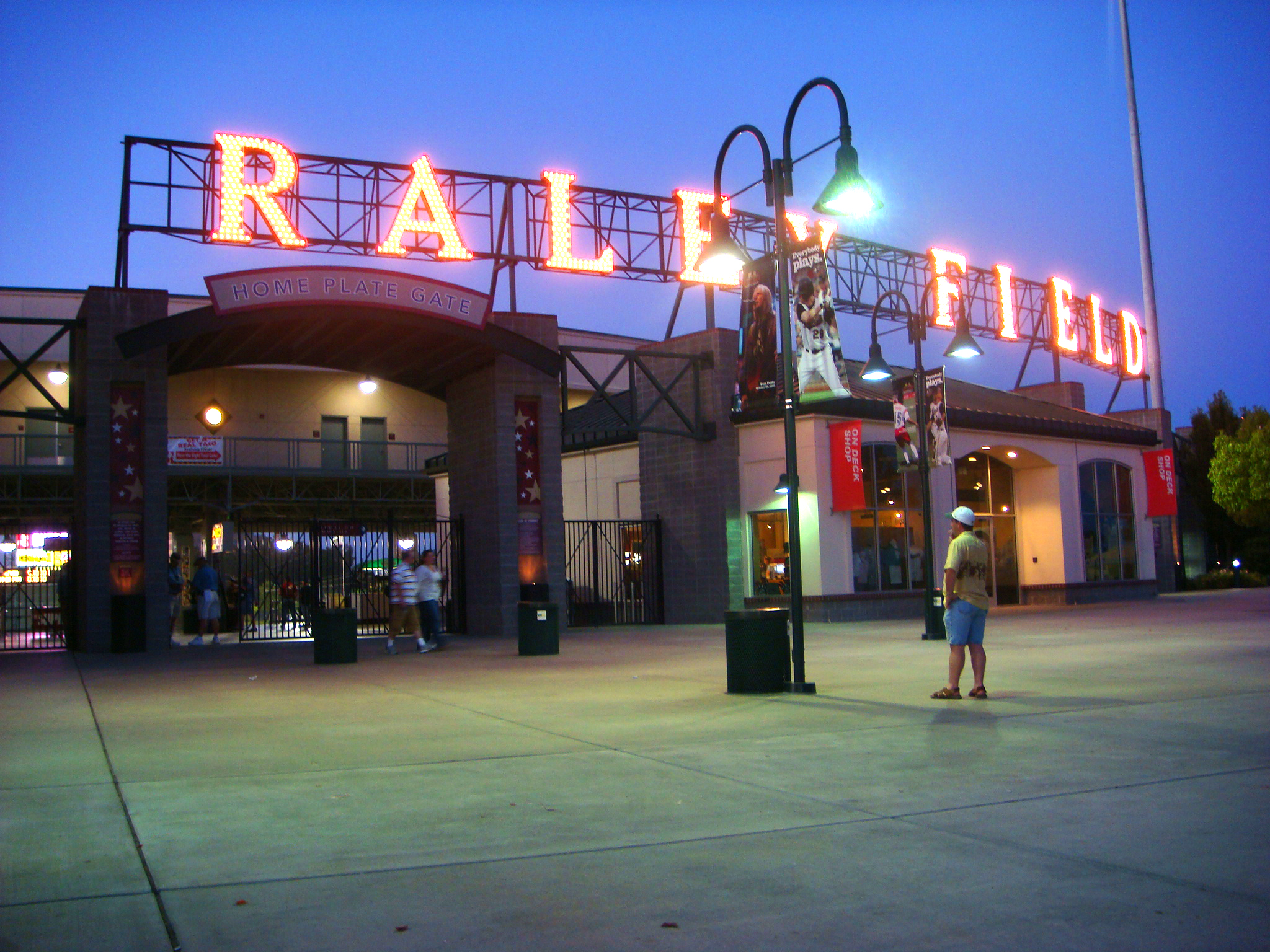
 Raley Field, home of the Sacramento Rivercats
Sacramento is home to the Sacramento Kings of the National Basketball Association. It was also formerly home to the now defunct Sacramento Monarchs of the Women's National Basketball Association. The Kings came to Sacramento from Kansas City in 1985, and the Monarchs were one of the eight founding members of the WNBA, which started in 1997. The Monarchs won the WNBA Championship in 2005 to become the first major, professional sports team in Sacramento to do so; however the Monarchs team folded in November 2009.
The Sacramento Solons, a minor league baseball team of the Pacific Coast League, played in Sacramento during several periods (1903, 1905, 1909–1914, 1918–1960, 1974–1976), mostly at Edmonds Field. In 2000, AAA minor league baseball returned to Sacramento with the Sacramento River Cats, an affiliate of the Oakland Athletics. The River Cats play in the recently constructed Raley Field, located in West Sacramento.
Teams in several smaller leagues have been and continue to be in Sacramento. The Sacramento Heatwave of the American Basketball Association currently plays at Folsom High School. In the past, the city hosted three professional football teams, the Sacramento Surge of the World League of American Football (who won the World Bowl II on June 6, 1992), the Sacramento Gold Miners of the Canadian Football League, and the Sacramento Attack of the Arena Football League. Sacramento was also home to an indoor soccer team, the Sacramento Knights of the Continental Indoor Soccer League (later called the World Indoor Soccer League). The Sacramento River Rats of Roller Hockey International also played in the city for several years. The Sacramento XSV (pronounced "excessive") of the National Professional Paintball League represents the City but is based in Modesto, CA. The newest sports team to come to Sacramento is the Sacramento Mountain Lions which is part of the United Football League (2009). They currently play at Hornet Stadium which is on the CSUS campus.
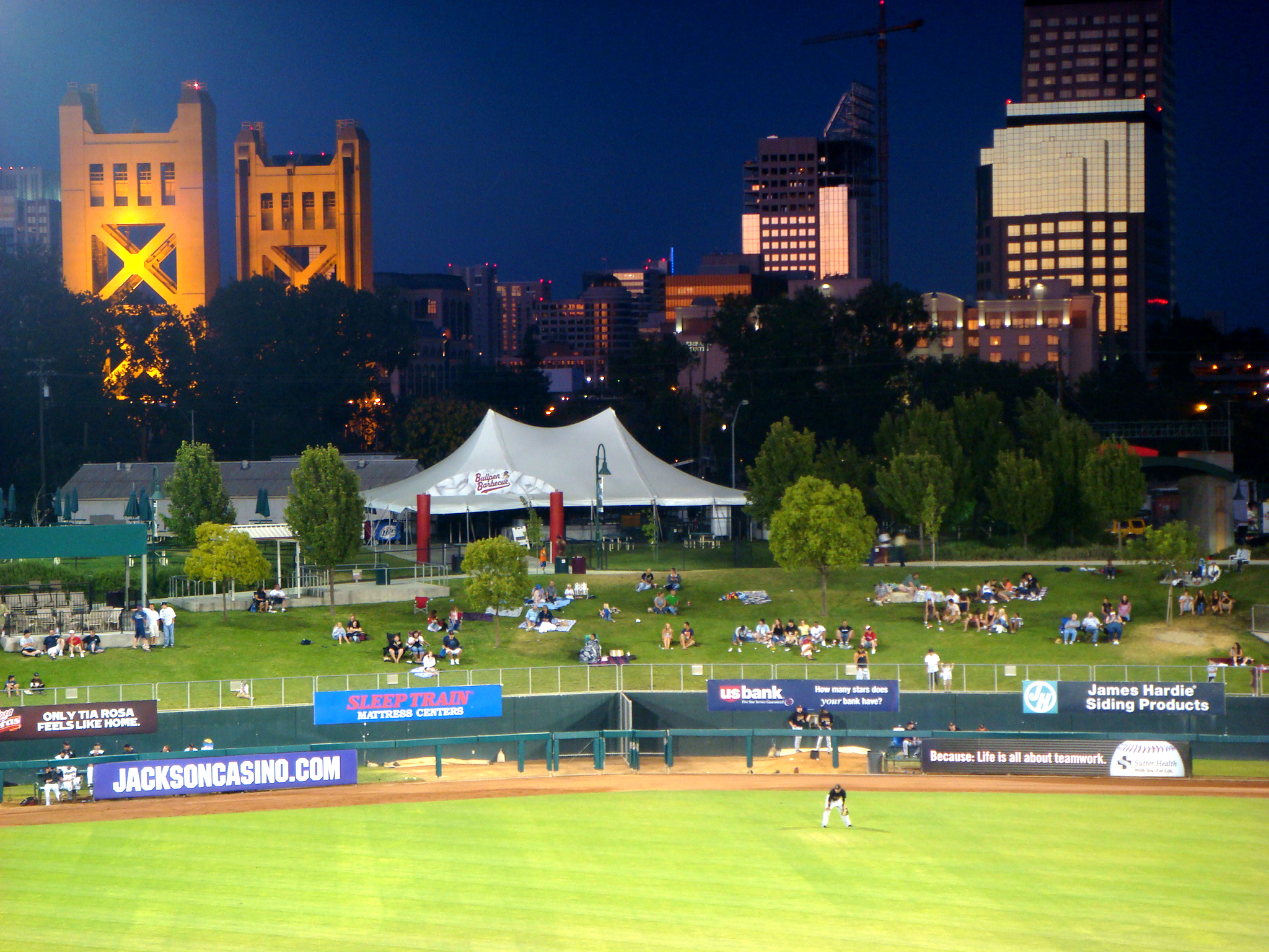
 View of the city skyline from Raley Field
Sacramento hosted the 2000 and 2004 USA Olympic Track & Field Trials and has frequently hosted the NCAA Men's Outdoor Track and Field Championship as well as the 1st and 2nd rounds of the NCAA Men's Division I Basketball Championship. The California International Marathon (est. 1983, runcim.org) finishes in front of the Capitol, and attracts a field of international elite runners who vie for a share of the $50,000 prize purse. The fast point-to-point course begins in Folsom and is also popular for runners seeking to achieve a Boston Marathon qualifying time and fitness runners. The Sacramento Mile is a national flat-track motorcycle racing event. From 1961 to 1980, Sacramento hosted the Camellia Bowl, which selected or helped select ten national champions in college football's lower divisions.
Sacramento is a hotbed for high school rugby. Jesuit High is the recent defending national champion (winning five times in total). Their arch-rival school Christian Brothers came in second nationwide. Burbank, Del Campo and Vacaville have also placed well in the national competition over the years. The Sacramento Valley High School Rugby Conference hosts the largest and arguably deepest preseason youth and high school rugby tournament in America.
Sacramento also hosts some recreational facilities and events. The Jedediah Smith Memorial Trail that runs between Old Sacramento and Folsom Lake grants access to the American River Parkway, a natural area that includes more than 5,000 acres (20 km2) of undeveloped land. It attracts cyclists and equestrians from across the state. The California State Fair is held in Sacramento each year at the end of the summer, ending on Labor Day. In 2010, the State Fair moves to July. More than one million people attended this fair in 2001.
Among other recreational options in Sacramento is Discovery Park, a 275-acre (1.1 km2) park studded with stands of mature trees and grasslands. This park is situated where the American River flows into the Sacramento River.
In amateur sports, Sacramento claims many prominent Olympians such as Mark Spitz, Debbie Meyer, Mike Burton, Summer Sanders, Jeff Float (all swimming), and Billy Mills (track). Coach Sherm Chavoor founded his world famous Arden Hills Swim Club just east of the city and trained Burton, Myer, Spitz and others.
Club League Sport Venue Established Championships Sacramento Kings NBA Basketball Power Balance Pavilion 1945 (1985) 1 NBA Championship, 2 NBL Championships (as Rochester Royals) Sacramento River Cats PCL Baseball Raley Field 1978 (2000) 2 Triple-A Titles, 4 League Titles Sacramento Mountain Lions UFL Football Hornet Stadium 2009 (2010) Sacramento Capitals WTT Tennis Allstate Stadium 1987 5 Championships Sacramento Heatwave ABA Basketball Natomas H.S. Event Center 2003 Sacramento Gold NPSL Soccer Cosumnes River College 2003 1 Championship Sacramento Sirens IWFL Football Foothill High School 2001 1 WAFL Title, 3 IWFL Titles F.C. Sacramento Pride WPSL Soccer Lincoln High School 1995 Mandarins DCI Drum & Bugle Corps DCI members tour nationally 1963 Class A-60/Division III Champions (1987, 1988, 1992, 1996, 1997, 1998, 1999), Division II Champions (2001) Notable residents
See also: Sacramento writers, Sacramento sports figures, and Sacramento entertainersNotable people with ties to Sacramento include actor Sam Elliott, actor Colin Hanks, baseball player Steve Sax, businessman and philanthropist Charles R. Schwab, U.S. Supreme Court Justice Anthony Kennedy, musician Craig Chaquico, musician Cynthia Robinson, Los Angeles public health "czar" Kim Harrison Eowan, designer architect Ray Eames, retired USMC Lieutenant General John F. Goodman, painter Wayne Thiebaud, photographer Michael Williamson, videographer Justin Carter, philosopher Cornel West, author J. Maarten Troost, astronaut Stephen Robinson, the mayor of Bakersfield from 1981–1985, and her husband, the then petroleum lobbyist Joe Shell, lived in Sacramento during the 1970s.
In addition to Huntington, Hopkins, Stanford, and Crocker, the city's more successful entrepreneurs have included Russ Solomon (Tower Records), Frank Fat, Buzz Oates (The Buzz Oates Group of Companies) and Sherwood "Shakey" Johnson (Shakey's Pizza).
Actors, singers, rap artists, bands, and other performers with ties to the city can be found under Sacramento entertainers. For sports figures with ties to Sacramento see Sacramento sports figures.
Transportation
Roads and highways
 Tower Bridge, Downtown Sacramento
The Sacramento region is served by several highways and freeways. Interstate 80 (I-80) is the major east-west route, connecting Sacramento with San Francisco in the west, and Reno in the east. Business 80 (the Capital City Freeway) splits from I-80 in West Sacramento, runs through Sacramento, and then rejoins its parent in the northwest portion of the city. U.S. Highway 50 also begins its eastern journey in West Sacramento, co-signed with Business 80, but then splits off and heads toward South Lake Tahoe as the El Dorado Freeway.
Interstate 5 (I-5) runs though Sacramento, heads north up to Redding, and then heads south near the western edge of the California Central Valley towards Los Angeles. California State Highway 99 runs through Sacramento, heading closer to the eastern edge of the Central Valley, connecting to Marysville and Yuba City in the north, and Fresno and Bakersfield in the south. California State Highway 160 approaches the city after running along the Sacramento River from Contra Costa County in the south, and then becomes a major city street in Downtown Sacramento before turning into the North Sacramento Freeway, going over the American River to Business 80.
Some Sacramento neighborhoods, such as Downtown Sacramento and Midtown Sacramento are very bicycle friendly as are many other communities in the region. As a result of litigation, Sacramento has undertaken to make all city facilities and sidewalks wheelchair accessible. In an effort to preserve its urban neighborhoods, Sacramento has constructed traffic-calming measures in many areas.
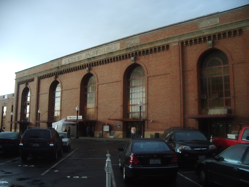
Amtrak service

Amtrak provides passenger rail service to the city of Sacramento. The Sacramento Valley Rail Station is located on the corner of 5th and I streets near the historic Old Town Sacramento and as of April, 2007, is currently undergoing extensive renovations. The station also serves as an Regional Transit light rail terminus.
Amtrak California operates the Capitol Corridor, a multiple-frequency service providing service from the capital city to its northeastern suburbs and the San Francisco Bay Area.[43]
Sacramento is also the northern terminus of the Amtrak California San Joaquins route which provide direct multiple-frequency passenger rail service to California's Central Valley as far as Bakersfield; Thruway Motorcoach connections are available from the trains at Bakersfield to Southern California and Southern Nevada.
Sacramento is also a stop along Amtrak's Coast Starlight route which provides scenic service to Seattle via Klamath Falls and Portland to the north and to Los Angeles via San Luis Obispo and Santa Barbara to the south.
Amtrak's California Zephyr also serves Sacramento daily and provides service to the east serving Reno, Salt Lake, Denver, Omaha, Chicago and intermediate cities.
The Sacramento Valley Rail Station also provides numerous Thruway Motorcoach routes. One route serves the cities of Marysville, Oroville, Chico, Corning, Red Bluff and Redding with additional service to Yreka and even Medford, Oregon. A second serves the cities of Roseville, Rocklin, Auburn, Colfax, Truckee, Reno and Sparks. The third and final thruway motorcoach route serves Placerville, Lake Tahoe, Stateline Casinos, and Carson City, Nevada. Each of these routes provides multiple frequencies each day.
Sacramento has the 2nd busiest Amtrak station in California and the 10th busiest in the country.
Walkability
A 2011 study by Walk Score ranked Sacramento 24th most walkable of fifty largest U.S. cities.[44]
Other transportation options
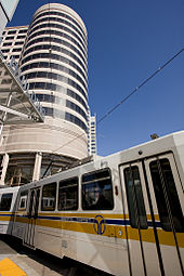 Regional Transit (RT) light rail train pulls onto K Street
The city and its suburbs are served by Sacramento Regional Transit District, which ranks as the ninth busiest in the United States. Sac RT is a bus and light-rail system, with 274 buses and light-rail providing service for 58,200 daily passengers. Light-rail lines have recently been expanded east as far as the city of Folsom. Sacramento's light rail system goes to the Sacramento Valley Rail Station, Meadowview RD. in south Sacramento and north to Watt/I-80 where I-80 and Business 80 meet.
Sacramento International Airport handles flights to and from various US destinations (including Hawaii) as well as Mexico, Canada and connecting flights to Europe, Asia, and South America.
Bicycling is an increasingly popular transportation mode in Sacramento, which enjoys a mild climate and flat terrain. Bicycling is especially common in the older neighborhoods of Sacramento's center, such as Alkali Flat, Midtown, McKinley Park, Land Park, and East Sacramento. Many employees who work downtown commute by bicycle from suburban communities on a dedicated bicycle path on the American River Parkway. Sacramento was designated as a Silver Level Bicycle Friendly Community by the League of American Bicyclists in September 2006. The advocacy organization Sacramento Area Bicycle Advocates co-sponsors the Sacramento Area Council of Governments' May is Bike Month campaign.
There is commuter bus service on two bus lines from Yuba County's Yuba Sutter Transit[45] and also from San Joaquin County on several SMART bus lines.
Sister cities
Sacramento has ten sister cities:[46]
 Manila/Pasay City, Philippines
 Chişinău, Moldova
 Hamilton, New Zealand
 Liestal, Switzerland
 Matsuyama, Japan
 Yongsan-gu, South Korea
 San Juan de Oriente, Nicaragua
 Bethlehem, Palestine
 Ahmedabad, India
 Jinan, China
Media
Television on TV
Channel Call Sign Network 3 KCRA-TV NBC 6 KVIE PBS 10 KXTV ABC 13 KOVR CBS 19 KUVS-TV Univision 27 TBA 3ABN 29 KSPX ION 31 KMAX-TV CW 32 KSTV-LP Azteca America 33 KCSO-LP Telemundo 40 KTXL Fox 58 KQCA MyNetworkTV 64 KTFK Telefutura Sacramento newspapers
The primary newspaper is The Sacramento Bee, founded in 1857 by James McClatchy. Its rival, the Sacramento Union, started publishing six years earlier in 1851; it closed its doors in 1994, with a revival attempt lasting from 2005 to 2009. Writer and journalist Mark Twain wrote for the Union in 1866. The Sacramento Bee is the flagship paper of The McClatchy Company, the second-largest newspaper publisher in the United States. The Sacramento Bee has won five Pulitzer Prizes in its history. It has won numerous other awards, including many for its progressive public service campaigns promoting free speech (the Bee often criticized government policy, and uncovered many scandals hurting Californians), anti-racism (the Bee supported the Union during the American Civil War and later publicly denounced the Ku Klux Klan), worker's rights (the Bee has a strong history of supporting unionization), and environmental protection (leading numerous tree-planting campaigns and fighting against environmental destruction in the Sierra Nevada).
- Sacramento Bee
- Sacramento Business Journal
- Sacramento News & Review
- The Sacramento Observer
- Capitol Weekly
- Sacramento Today
Magazines
- Sactown Magazine
- Sacramento Magazine
- Sacramento Parent Magazine
- Comstock's Magazine
- Government Technology Magazine
- SacramentoGrapevine.com, The local Interactive City Magazine
- Submerge Magazine
- Outword Magazine
Radio
Further information: List of radio stations in SacramentoSee also
- C. M. Goethe Arboretum
- List of mayors of Sacramento
- List of Sacramento entertainers
- Sacramento Metropolitan Fire District
References
- ^ U.S. Census
- ^ "Metropolitan and Micropolitan Statistical Area Estimates, July 1, 2009". US Census Bureau. http://www.census.gov/popest/metro/tables/2009/CBSA-EST2009-01.csv. Retrieved 2011-02-03.
- ^ GaWC. "The World According to GaWC". http://www.lboro.ac.uk/gawc/world2008t.html. Retrieved 2011-02-26.
- ^ Welcome to America's Most Diverse City – TIME. Time Magazine. Retrieved on 2008-03-27.
- ^ CathedralSacramento.org
- ^ City of Sacramento Municipal Homepage
- ^ NewsReview.com
- ^ Yeefowmuseum.org
- ^ Yeefow.com
- ^ UARP Relicensing Public Participation Community Oriented Utility
- ^ Avella, Steven M. (2003). Sacramento: Indomitable City. Arcadia Publishing. pp. 124. ISBN 0-738-52444-1.
- ^ Census.gov
- ^ Stodghill, Ron; Bower, Amanda (2002-08-25). "Welcome to America's Most Diverse City". Time. http://www.time.com/time/nation/article/0%2C8599%2C340694%2C00.html.
- ^ Vcarious.com
- ^ a b c "Climatography of the United States No. 20: Sacramento AP, CA 1971–2000" (PDF). National Oceanic and Atmospheric Administration. http://cdo.ncdc.noaa.gov/climatenormals/clim20/ca/047630.pdf. Retrieved 2010-09-21.
- ^ "California Nevada River Forecast Center". National Weather Service. http://www.cnrfc.noaa.gov/awipsProducts/RNOWRKCLI.php. Retrieved 2009-03-12.
- ^ "Climate for Sacramento, CA". RSSWeather.com. http://www.rssweather.com/climate/California/Sacramento/. Retrieved 2009-03-13.
- ^ http://www.time.com/time/nation/article/0,8599,2079360,00.html
- ^ "Climatological Normals of Sacramento". Hong Kong Observatory. http://www.weather.gov.hk/wxinfo/climat/world/eng/n_america/us/sacramento_e.htm. Retrieved 2010-09-21.
- ^ Area One (Central/Eastern)
- ^ Area Two (Southwestern)
- ^ Area Three (Southeastern)
- ^ Area Four (North of the American River)
- ^ All data are derived from the United States Census Bureau reports from the 2010 United States Census, and are accessible on-line here. The data on unmarried partnerships and same-sex married couples are from the Census report DEC_10_SF1_PCT15. All other housing and population data are from Census report DEC_10_DP_DPDP1. Both reports are viewable online or downloadable in a zip file containing a comma-delimited data file. The area data, from which densities are calculated, are available on-line here. Percentage totals may not add to 100% due to rounding. The Census Bureau defines families as a household containing one or more people related to the householder by birth, opposite-sex marriage, or adoption. People living in group quarters are tabulated by the Census Bureau as neither owners nor renters. For further details, see the text files accompanying the data files containing the Census reports mentioned above.
- ^ "American Factfinder". census.gov. http://factfinder2.census.gov/faces/nav/jsf/pages/searchresults.xhtml?refresh=t#none. Retrieved 2011-08-27.
- ^ "American FactFinder". United States Census Bureau. http://factfinder.census.gov. Retrieved 2008-01-31.
- ^ Stodghill, Ron; Bower, Amanda (2002-08-25). Welcome to America's Most Diverse City. Time. Retrieved on 2007-06-15.
- ^ The Geography of U.S. Diversity (PDF). United States Census. Retrieved on 2007-06-15.
- ^ "Will Gerrymandered Districts Stem the Wave of Voter Unrest?". Campaign Legal Center Blog. http://www.clcblog.org/blog_item-85.html. Retrieved 2008-02-10.
- ^ "City of Sacramento Comprehensive Annual Financial Report, Fiscal Year Ended June 30, 2010". City of Sacramento. p. 168. http://www.cityofsacramento.org/finance/accounting/documents/ElectronicFY10CAFR.pdf. Retrieved 26 September 2010.
- ^ UC Davis Graduate School of Management: About Us
- ^ University of San Francisco, Sacramento Regional Campus
- ^ USC SPPD in Sacramento
- ^ Sacbee.com
- ^ "Sacramento, Arden, Arcade, Roseville CA – Elementary School Teachers (Excluding Special Education) – Career, Salary & Employment Info". http://www.collegedegreereport.com/city-data/elementary-school-teachers-except-special-education/sacramento-arden-arcade-roseville.
- ^ "Sacramento, Arden, Arcade, Roseville CA – Middle School Teachers (Excluding Special & Vocational Education) – Career, Salary & Employment Info". http://www.collegedegreereport.com/city-data/middle-school-teachers-except-special-and-vocational-education/sacramento-arden-arcade-ros.
- ^ CCConline.cc
- ^ a b Sacramento Archives and Museum Collection Center and the Historic Old Sacramento Foundation. Old Sacramento and Downtown. Arcadia, 2006, 20.
- ^ Sacramento Archives and Museum Collection Center and the Historic Old Sacramento Foundation. Old Sacramento and Downtown. Arcadia, 2006, 23.
- ^ Deathwish Inc
- ^ "Trash Talk's anthology 'Shame' is released this week, Band Of The Week is in the bag!". Rock Sound. 2010-05-18. http://www.rocksound.tv/features/article/trash-talk. Retrieved 2010-06-20.
- ^ Diver, Mike (2010-05-05). "Trash Talk Eyes & Nines Review". BBC. http://www.bbc.co.uk/music/reviews/rbpn. Retrieved 2010-06-20.
- ^ AmtrakCapitols.com
- ^ "2011 City and Neighborhood Rankings". Walk Score. 2011. http://www.walkscore.com/rankings/cities/. Retrieved Aug 28, 2011.
- ^ Sacramento Commuter
- ^ "Sister Cities Council of Sacramento". http://www.cityofsacramento.org/SisterCities/. Retrieved 2009-12-28.
External links
- Official website
- Official tourism website from the Sacramento Convention and Visitors Bureau
- Old Sacramento – Official website
- Sacramento Wiki
Categories:- Populated places established in 1839
- Incorporated cities and towns in California
- Sacramento, California
- County seats in California
- Sacramento metropolitan area
- Cities in Sacramento County, California
- Sacramento River
- State capitals in the United States


Wikimedia Foundation. 2010.