- Mount Desert Island
-
Mount Desert Island 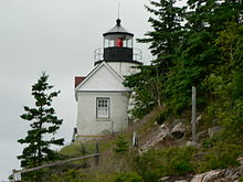
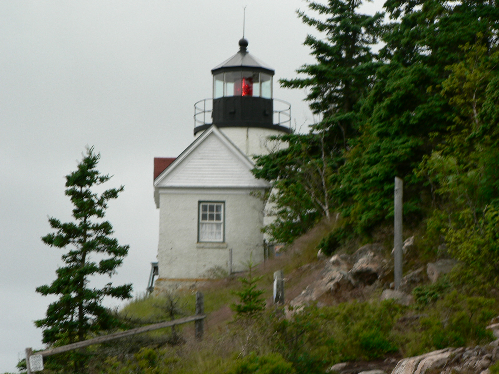
Bass Harbor Head Light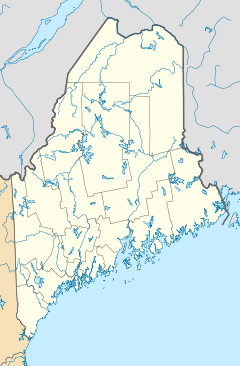
 Mount Desert Island (Maine)
Geography Location Atlantic Ocean Coordinates 44°20′34″N 68°18′26″W / 44.342827°N 68.307138°WCoordinates: 44°20′34″N 68°18′26″W / 44.342827°N 68.307138°W Area 108 sq mi (280 km2) Highest elevation 1,530 ft (466 m)[1] Highest point Cadillac Mountain Country United StatesState  Maine
MaineCounty Hancock County Largest city Bar Harbor (pop. 4,820 people [2]) Demographics Population 10,424[3] (as of 2000) Density 96.8 /sq mi (37.37 /km2) Ethnic groups mainly Caucasian Mount Desert Island (often abbreviated MDI[4]), in Hancock County, Maine, is the largest island off the coast of Maine. With an area of 108 square miles (280 km2) it is the 6th largest island in the contiguous United States.[5] Though it is often claimed to be the third largest island on the eastern seaboard of the United States,[6] it is actually second behind Long Island (and ahead of Martha's Vineyard).[5] The island has a year-round population of approximately 10,000, although it is estimated that two and a half million tourists a year visit Acadia National Park on the island. The island is home to numerous well-known summer colonies such as Northeast Harbor and Bar Harbor. Current notable summer residents include George Mitchell,[7] Tim Robbins, David Rockefeller, Susan Sarandon, and Martha Stewart.[8]
Contents
Origin of the name
Some natives stress the second syllable (de-ZERT), in the French fashion, although many others pronounce it in a fashion similar to the English name of a landscape devoid of vegetation (DEH-zert). French explorer Samuel de Champlain's observation that the summits of the island's mountains were free of vegetation as seen from the sea led him to call the island "île des Monts Déserts", or island of the Bare Mountains.
Towns and villages
There are four towns on Mount Desert Island:[9]
- Bar Harbor, with the villages of Eden, Hulls Cove, Salisbury Cove, and Town Hill;
- Mount Desert, with the villages of Hall Quarry, Northeast Harbor, Otter Creek, Pretty Marsh, Seal Harbor, and Somesville;
- Southwest Harbor, with the villages of Manset and Seawall;
- Tremont, with the villages of Bass Harbor, Bernard, Gotts Island, Seal Cove, and West Tremont.
History
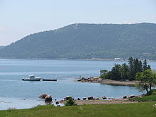
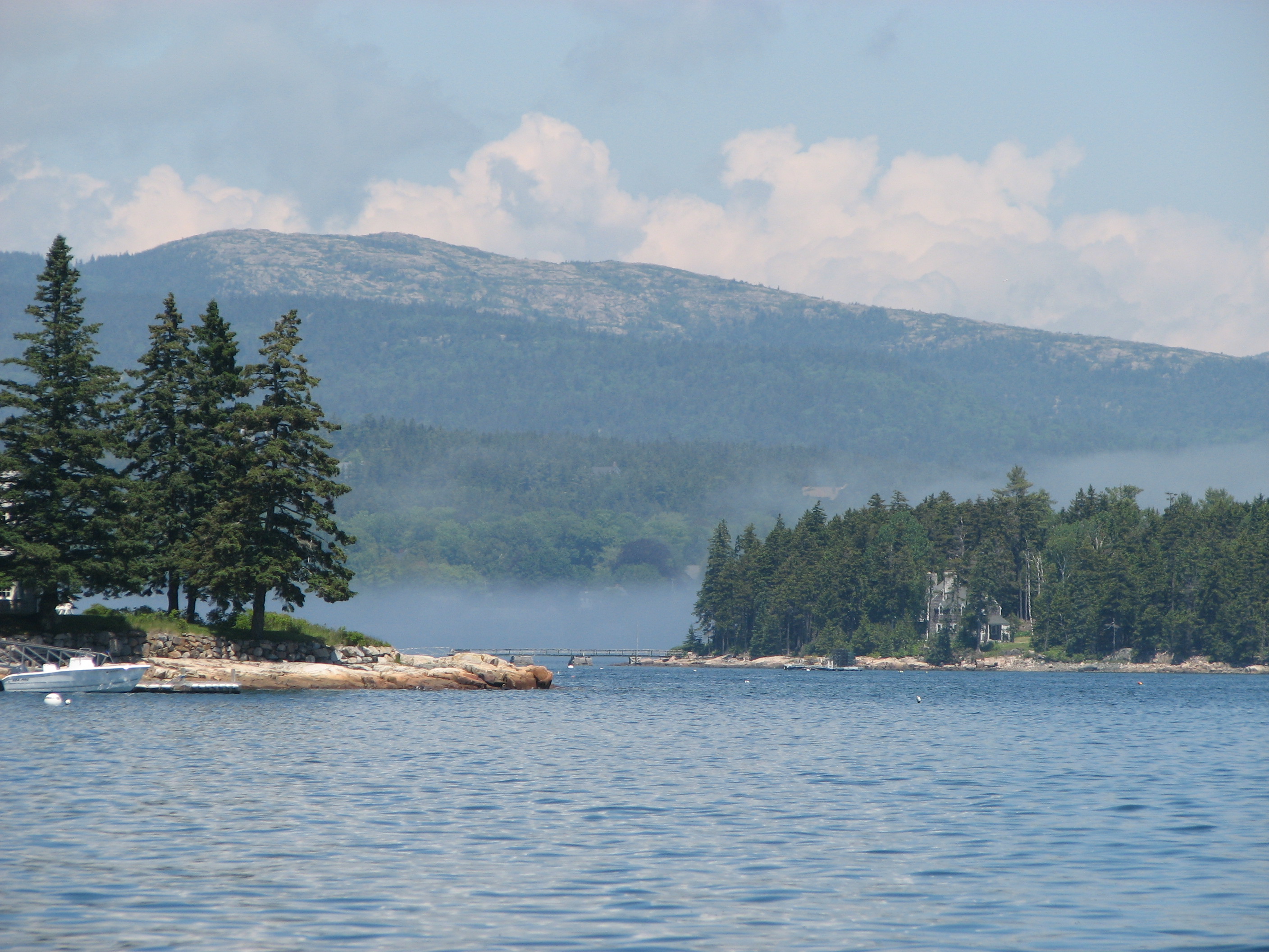
 View of the coast
From NPS history
Deep shell heaps indicate American Indian encampments dating back 6,000 years in Acadia National Park, but prehistoric records are scanty. The first written descriptions of Maine coast Indians, recorded 100 years after European trade contacts began, describe American Indians who lived off the land by hunting, fishing, collecting shellfish, and gathering plants and berries. The Wabanaki Indians knew Mount Desert Island as Pemetic, "the sloping land." They built bark-covered conical shelters, and traveled in exquisitely designed birch bark canoes. Historical notes record that the Wabanaki wintered in interior forests and spent their summers near the coast. Archeological evidence suggests the opposite pattern; in order to avoid harsh inland winters and to take advantage of salmon runs upstream, American Indians wintered on the coast and summered inland.[10]
French colony
The first meeting between the people of Pemetic and the Europeans is a matter of conjecture. But it was a Frenchman, Samuel de Champlain, who made the first important contribution to the historical record of Mount Desert Island. He led the expedition that landed on Mount Desert on September 5, 1604 and wrote in his journal, "The mountain summits are all bare and rocky..... I name it Isles des Monts Desert."[11] Champlain's visit to Mount Desert Island 16 years before the Pilgrims landed at Plymouth Rock destined it to become part of Acadia, a colony of New France, before it became a part of New England. Frenchman Bay is named in Champlain's honour.
Raid on Mount Desert Island (1613)
 Somes Sound
In 1613, French Jesuits, welcomed by Indians, established the first French mission in America—Saint Sauveur Mission—on what is now Fernald Point, near the entrance to Somes Sound. (St. Sauveur Mountain on the Island still bears the name of the mission.)
The French missionaries began to build a fort, plant their corn, and baptize the natives. Two months later, on 2 July 1613, Captain Samuel Argall of Virginia arrived on board the Treasurer and destroyed their mission.[12] Three of the missionaries were killed and three were wounded. The rest of the company, some twenty in all, were taken prisoner. Argall took many of the prisoners to Jamestown. He eventually returned to Saint-Sauveur and cut down the cross the Jesuits had planted, replacing it with a Protestant version. He then set fire to the few building that were there.[13] He then went on to burn the remaining French buildings on St. Croix Island and Port Royal, Nova Scotia.[13]
The English raid at Fernald Point signaled the dispute over the boundary between the French colony of Acadia to the north and the English colony of New England to the south. There is evidence that Claude de La Tour immediately challenged the English action by re-establishing a fur-trading post in the near-by village of Castine, Maine in the wake of Argall's raid.[14]
There was a brief period when it seemed Mount Desert would again become a center of French activity. In 1688, Antoine Laumet de La Mothe, sieur de Cadillac, an ambitious young man who had immigrated to New France and bestowed upon himself the title Sieur de la Mothe Cadillac, asked for and received 100,000 acres (400 km2) of land along the Maine coast, including all of Mount Desert. Cadillac's hopes of establishing a feudal estate in the New World, however, were short-lived. Although he and his bride resided here for a time, they soon abandoned their enterprise. Cadillac later gained lasting recognition as the founder of Detroit. The island's highest point, at 466 metres (1,529 ft) the highest point on the eastern seaboard of the United States, bears the name Cadillac Mountain, and is notable for the fact that its summit is among the first points in the United States touched by the rays of the rising sun.[15]
Raid on Acadia (1704)
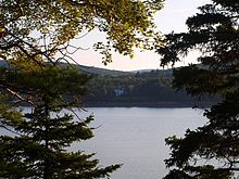 Shorefront at evening
During much of the seventeenth century, near-by Castine, Maine was the most southern settlement of Acadia. (Bristol, Maine was the most northern New England settlement.) No one settled in this contested territory and for the next 150 years, Mount Desert Island's importance was primarily its use as a landmark for seamen, as for example when John Winthrop, first governor of Massachusetts Bay Colony, sketched the island's mountains on his voyage to the New World.
During Queen Anne's War, in response to the French Raid on Deerfield, New Englander Major Benjamin Church raided the Acadian village of Castine, Maine before gathering at Mount Desert Island with other ships to continue to with the Raid on St. Stephen, New Brunswick, Raid on Grand Pre, the Raid on Piziquid, and the Raid on Chignecto.[16]
British Colony
In 1759, after a century and a half of conflict, British troops triumphed in Quebec, ending French dominion in Acadia. With Indians scattered and the fleur-de-lis banished, lands along the Maine coast opened for English settlement. Governor Francis Bernard of Massachusetts obtained a royal land grant on Mount Desert Island. In 1760, Bernard attempted to secure his claim by offering free land to settlers. Abraham Somes and James Richardson accepted the offer and settled their families at what is now Somesville.
American Revolution
The onset of the Revolutionary War ended Bernard's plans for Mount Desert Island. In its aftermath, Bernard, who had sided with the British government, lost his claim. Massachusetts, now free of British rule, granted the western half of Mount Desert Island to John Bernard, son of the governor, who, unlike his father, sided with the rebels. The eastern half of the island was granted to Marie Therese de Gregoire, granddaughter of Cadillac. Bernard and de Gregoire soon sold their landholdings to nonresident landlords.
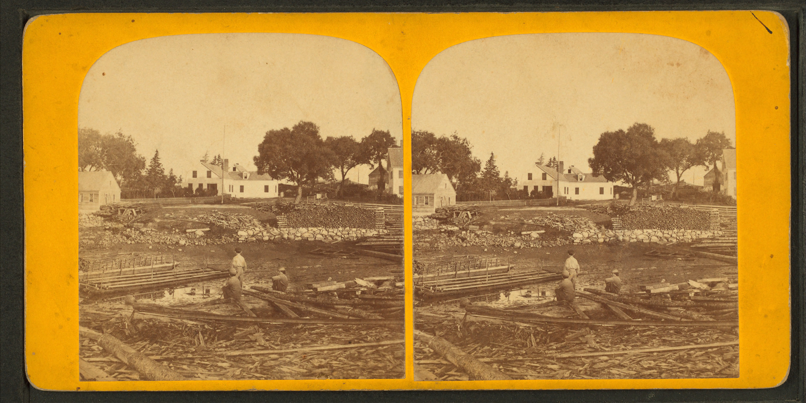
Their real estate transactions probably made very little difference to the increasing number of settlers homesteading on Mount Desert Island. By 1820, when Maine separated from Massachusetts and became a separate state, farming and lumbering vied with fishing and shipbuilding as major occupations. Settlers converted hundreds of acres of trees into wood products ranging from schooners and barns to baby cribs and hand tools. Farmers harvested wheat, rye, corn, and potatoes. By 1850, the familiar sights of fishermen and sailors, fish racks and shipyards, revealed a way of life linked to the sea. Quarrying of granite, which could be cut from hills close to deep water anchorage for shipment to major cities on the east coast, was also a major industry.
Rusticators
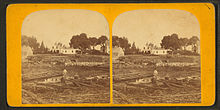 Somes' Hotel c. 1870, John D. Heywood
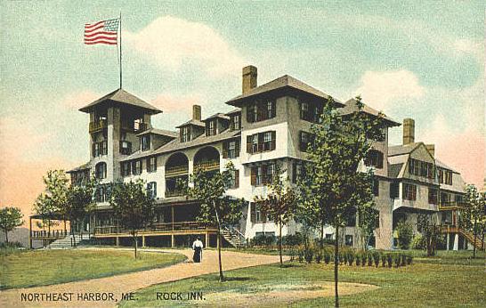
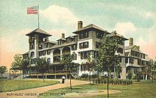 Rock Inn, Northeast Harbor c. 1908
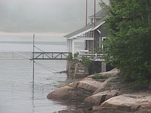 Seal Harbor Yacht Club
It was the outsiders, artists and journalists, who revealed and popularized this island to the world in the mid 19th century. Painters of the Hudson River School, including Thomas Cole and Frederic Church, glorified Mount Desert Island with their brushstrokes, inspiring patrons and friends to flock here. These were the "rusticators". Undaunted by crude accommodations and simple food, they sought out local fishermen and farmers to put them up for a modest fee. Summer after summer, the rusticators returned to renew friendships with local islanders and, most of all, to savor the fresh salt air, beautiful scenery, and relaxed pace. Soon the villagers' cottages and fishermen's huts filled to overflowing, and by 1880, 30 hotels competed for vacationers' dollars. Tourism was becoming the major industry. Catering to the rusticators and summer tourists visiting island towns, in particular Bar Harbor, Penobscot, Passamaquoddy, and other Wabanaki Indians sold baskets, bark canoes, bead work, carved clubs, and other crafts, offered guide services, and put on 'Indian shows.' During the summer season, dozens of families from several tribes lived in canvas tents and wooden shacks in the "Indian encampment" on the shores of Frenchman Bay.[17]
For a select handful of Americans, the 1880s and the "Gay Nineties" meant affluence on a scale without precedent. Mount Desert, still remote from the cities of the East, became a retreat for prominent people of the time. The Rockefellers, Morgans, Fords, Vanderbilts, Carnegies, and Astors, chose to spend their summers here. Not content with the simple lodgings then available, these families transformed the landscape of Mount Desert Island with elegant estates, ironically called "cottages." The landscape architect Beatrix Farrand, at the Cadwalder Rawle - Rhinelander Jones family summer home Reef Point Estate, designed the gardens for many of these people. Projects included the Chinese inspired garden at 'The Eyrie' for Abby Aldrich Rockefeller at Seal Harbor (1926–35), and the planting plans for subtle roads at Acadia National Park sponsored by John D. Rockefeller (c.1930).[18] Luxury, refinement, and ostentatious gatherings replaced buckboard rides, picnics, and day-long hikes of an earlier era. Some rusticators also formed "Village Improvement Societies" which constructed hiking trails and walking paths connecting the Island's villages to its interior mountains. For over 40 years, the wealthy held sway at Mount Desert, but the Great Depression and World War II marked the end of such extravagance. The final blow came in 1947 when a fire of monumental proportions consumed many of the great estates.
Acadia National Park
 Acadia National Park
 An Acadia carriage road
In 1901, George B. Dorr, disturbed by the growing development of the Bar Harbor area and the dangers he foresaw in the newly invented gasoline powered portable sawmill, established along with others the Hancock County Trustees of Public Reservations. The corporation, whose sole purpose was to preserve land for the perpetual use of the public, acquired 6,000 acres (24 km2) by 1913. Dorr offered the land to the federal government, and in 1916, President Wilson announced the creation of Sieur de Monts National Monument. Dorr continued to acquire property and renewed his efforts to obtain full national park status for his beloved preserve. In 1919, President Woodrow Wilson signed the act establishing Lafayette National Park, the first national park east of the Mississippi. Dorr, whose labors constituted "the greatest of one-man shows in the history of land conservation" became the first park superintendent.
John D. Rockefeller Jr. gifted the park with much of its land area. Like many rusticators, Rockefeller, whose family fortune was derived from the petroleum industry, wanted to keep the island free of automobiles; but local governments allowed the entry of automobiles on the island's roads. Rockefeller constructed approximately 80 kilometers (50 miles) of carriage roads around the eastern half of the island. These roads were closed to automobiles and included many scenic vistas and beautiful stone bridges. Approximately 65 kilometers (40 miles) of these roads are within Acadia National Park and open only to hikers, bicyclists, horseback riders, horse-drawn carriages and cross country skiers.
In 1929, the park name changed to "Acadia".
In 1950, Marguerite Yourcenar and Grace Frick bought a house, "Petite Plaisance", in Northeast Harbor on the island. Yourcenar wrote a large part of her novel Memoires d'Hadrien on the island, and she died there in 1987.[19] Their house is now a museum. Both ladies were cremated and their ashes are buried in the Brookside Cemetery in Somesville.
In 1969, College of the Atlantic, the island's first and only institution of higher education, was established in Bar Harbor.
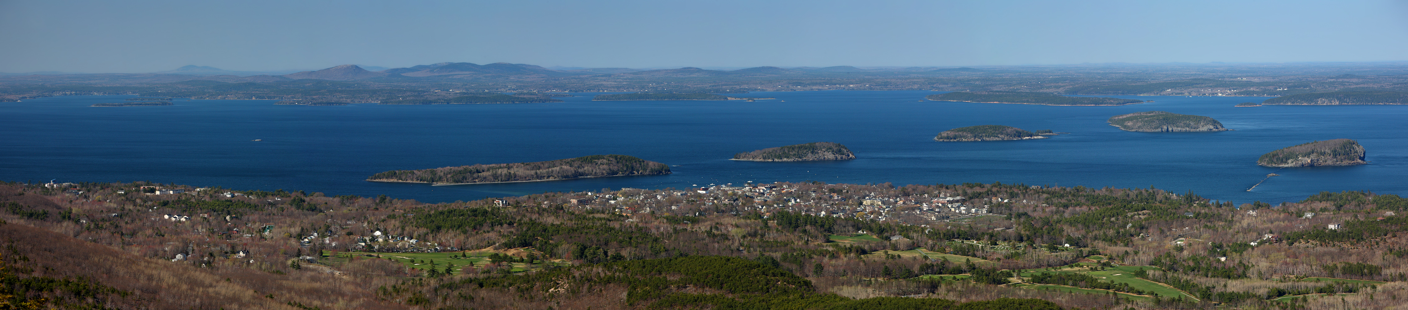
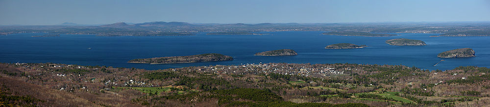 Frenchman Bay and Porcupine Islands around the town of Bar Harbor viewed from Cadillac Mountain on Mount Desert Island.
Geology
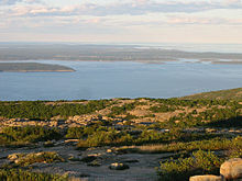 View atop Cadillac Mountain
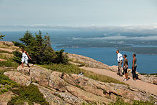
Mount Desert Island is rich in geological history dating back to approximately 550 million years ago. The earliest formation on the island is the Ellsworth Schist Formation, which was a sea-floor mud deposit created during the Cambrian period by volcanic ash. During the Ordovician period the collision of Laurentia, Gondwanaland, and Avalonia, referred to as the Taconic Orogeny, caused the formation to fold, thrust, and uplift above sea level, where later layers were eroded away and the schist was exposed. The Bar Harbor Formation, which is made up predominantly of sands and silts, and Cranberry Island Formation, made up from volcanic ash and magmatic debris, occurred under similar circumstances in the Silurian and Devonian periods, and were deposited on top of the Ellsworth Schist. However, due to less tectonic activity at that time, their deformation was less severe.[20]
As mentioned above, quarrying of granite was historically an important industry. Due to orogenic activity during the Devonian, Mount Desert Island has three granite units, the Cadillac Mountain granite, the fine grained Somesville granite, and the medium grained Somesville granite. Surrounding DCg, is a zone of brecciated material, known as DSz (Devonian Shatter Zone).[21]
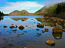
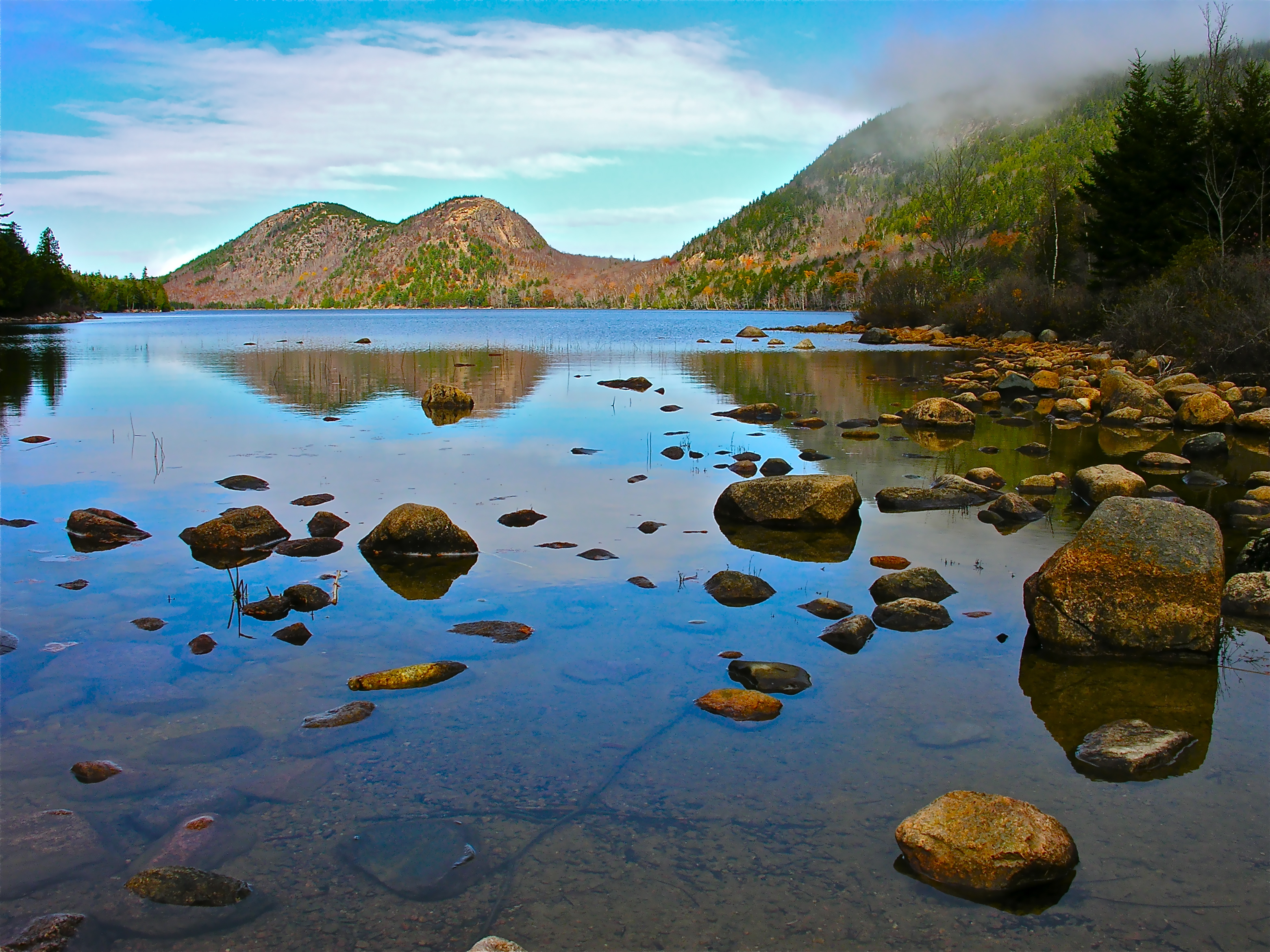
Most recently, Mount Desert Island was host to the Laurentide Ice Sheet as it extended and receded during the Pleistocene epoch. The glacier left a number of visible marks upon the landscape, such as Bubble Rock, a glacial erratic carried 19 miles by the ice sheet from a Lucerne granite outcrop and deposited precariously on the side of South Bubble Mountain in Acadia National Park. Other such examples are the moraines deposited at the southern ends of many of the glacier-carved valleys on the Island such as the Jordan Pond valley, indicating the extent of the glacier; and the beach sediments located in a regressional sequence beneath and around Jordan Pond, indicating the rebound of the continent after the glacier's recession approximately 25,000 years ago.[22]
Ecology
Excavations of old Indian sites in the Mount Desert Island region have yielded remains of the native mammals. Bones of wolf, North American beaver (Castor canadensis), deer, elk, Gray seal (Halichoerus grypus), the Indian dog, and Sea Mink (Neovison macrodon), as well as large numbers of raccoon, lynx, wolf, muskrat, and deer.[23] Although beaver were trapped to extinction on the island, two pairs of beaver that were released in 1920 by George B. Dorr at the brook between Bubble Pond and Eagle Lake have repopulated it. A large fire in 1947 cleared the eastern half of the island of its coniferous trees and permitted the growth of aspen, birch, alder, maple and other deciduous trees which enabled the beaver to thrive.[24]
Art
-
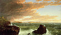
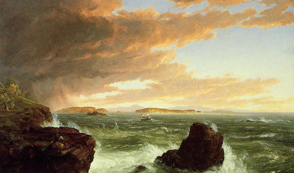
View Across Frenchman's Bay from Mount Desert Island After a Squall (1845) by Thomas Cole
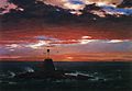
-
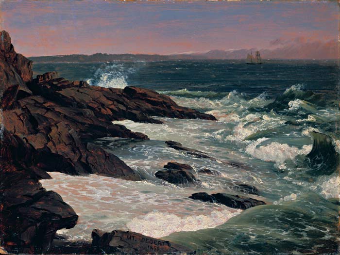
Fog off Mount Desert (1850), by Frederic Edwin Church
-
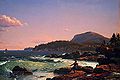
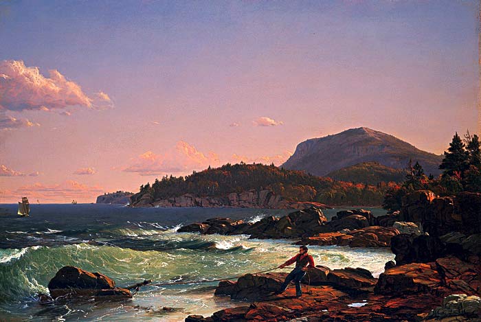
Newport Mountain, Mount Desert (1851), by Frederic Edwin Church
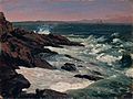
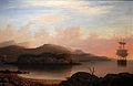
-
Beacon, off Mount Desert Island (1851) by Frederic Edwin Church
-
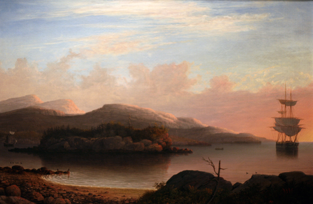
Entrance of Somes Sound, Mount Desert, Maine (1855) by Fitz Henry Lane
-
Off Mount Desert Island (1856) by Fitz Henry Lane
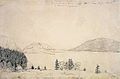
-
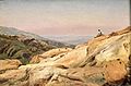
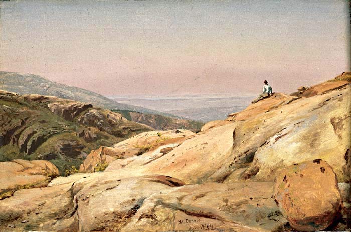
Mount Desert Island, Maine (1864) by Jervis McEntee
-

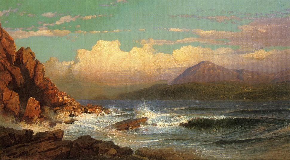
Mt. Desert, Maine (1866) by William Trost Richards
See also
- Otter Cliffs Radio Station
- Acadia National Park
- List of islands of Maine
References
- ^ "Acadia National Park Places To Go". U.S. National Park Service. 2006-08-07. http://www.nps.gov/acad/planyourvisit/placestogo.htm. Retrieved 2007-12-26.
- ^ Factfinder.census.gov
- ^ The total population of the island can be determined by adding the populations of the island's four towns (Bar Harbor, Mount Desert, Southwest Harbor, and Tremont); when using the numbers from the 2000 census, this gives a total of 10,424
- ^ http://www.seebarharbor.com/MountDesertIsland.html
- ^ a b Article Mount Desert Island on Encyclopædia Britannica on line
- ^ Google search: tens of thousands of hits for "mount desert island third largest eastern seaboard"
- ^ Calder, Amy (8 August 2010). "The man for the job". Maine Sunday Telegram. http://www.pressherald.com/news/The-man-for-the-job.html. Retrieved 8 August 2010.
- ^ Routhier, Ray (11 September 2009). "Martha Stewart's Maine home on TV Monday". Portland Press Herald. http://pressherald.mainetoday.com/updates/updates/martha-stewarts-maine-home-on-tv-monday-0. Retrieved 11 September 2009. "Martha Stewart will give viewers a personal tour of her home on Maine's Mount Desert Island."
- ^ Acadiamagic.com
- ^ For a freely accessible digital text on Wabanaki culture and history, see "Asticou's Island Domain: Wabanaki Peoples at Mount Desert Island 1500–2000," by Harald E.L. Prins and Bunny McBride (National Park Service, 2007) NPS.gov
- ^ Stewart, George (1945). Names on the Land: A Historical Account of Place-Naming in the United States. New York: Random House. pp. 29, 30.
- ^ Acadia National Park, Maine: Significance of St. Sauveur Mission, Established 1613, Mount Desert Island. Washington, D.C.: Office of History and Historic Architecture, Eastern Service Center, National Park Service, November 1970.
- ^ a b Griffiths, E. From Migrant to Acadian. McGill-Queen's University Press. 2005. pp. 23-24.
- ^ Griffiths, E. From Migrant to Acadian. McGill-Queen's University Press. 2005. p. 31
- ^ "Katahdin, Maine". Peakbagger.com. http://www.peakbagger.com/peak.aspx?pid=6820. Retrieved 2010-06-16. Analysis by Blanton C. Wiggin, published in the January 1972 issue of Yankee magazine, determined that the first sunrise in the U.S. occurs at Cadillac Mountain in the fall and winter, from October 7 to March 6.
- ^ Benjamin Church, Thomas Church, Samuel Gardner Drake. The history of King Philip's war ; also of expeditions against the French and Indians in its Eastern parts of New England, in the years 1689, 1692, i696 AND 1704. With some account of the divine providence towards Col. Benjamin Church.p. 261
- ^ McBride, Bunny; Prins, Harald E. L. (2009). Indians in Eden: Wabanakis and Rusticators on Maine's Mount Desert Island, 1840s–1920s. Camden: Down East Books.
- ^ Nolan, David, Beatrix. The Gardening Life of Beatrix Farrand, 1872–1959. Viking, Penguin Group, 1995. isbn 0-670-83217-0. pp. 208
- ^ George Rousseau, "Yourcenar", 2004.
- ^ Gilman, R.A., Chapman, C.A., Lowell, T.V., and Borns, H.W., 1988, Summary of the Bedrock Geologic History of Mount Desert Island, in The geology of Mount Desert Island: Augusta, Maine Geological Survey Bulletin 38.
- ^ Wiebe, R.A.: "Silicic magma chambers as traps for basaltic magmas: the Cadillac Mountain Intrusive Complex, Mount Desert Island", Journal of Geology, 1994.
- ^ Gilman, R.A., Chapman, C.A., Lowell, T.V., and Borns, H.W., 1988, Shaping of the Landscape by Glacial Erosion, in The geology of Mount Desert Island: Augusta, Maine Geological Survey Bulletin 38.
- ^ Richard H. Manville (1941-11). "Notes on the Mammals of Mount Desert Island, Maine". Journal of Mammalogy 23 (4): 391–398. JSTOR 1375049.
- ^ D. Muller-Schwarze, Susan Heckman (1980). "The Role of Scent Marking in Beaver". Journal of Chemical Ecology: 81–95. doi:10.1007/BF00987529. http://www.springerlink.com/content/gn1854160n421657/. Retrieved 2010-09-04.
Categories:- Mount Desert Island
- Islands of Maine
- Conflicts in Nova Scotia
- Islands of Hancock County, Maine


Wikimedia Foundation. 2010.