- Drumnacanvy
-
Coordinates: 54°24′40″N 6°24′09″W / 54.4110412°N 6.402496°W
Drumnacanvy Irish: Droim na Sheán Bui 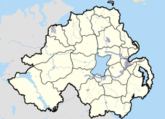

Drumnacanvy shown within Northern IrelandPopulation 915 (2001 Census) District Craigavon County County Armagh Country Northern Ireland Sovereign state United Kingdom Post town Portadown Postcode district BT63 Dialling code 028 EU Parliament Northern Ireland UK Parliament Upper Bann NI Assembly Upper Bann List of places: UK • Northern Ireland • Armagh Drumnacanvy (Irish: Droim na Sheán Bui, meaning "ridge of the old boy") is a small village and townland in County Armagh, Northern Ireland. It lies 3km east-southeast of Portadown. It is a dormitory settlement comprising mainly residential housing. The village is situated within the Green Belt and is set within undulating hills, with land to the west becoming progressively flatter. It is within the Craigavon Borough Council area.
The village also covers small parts of Drumlisnagrilly and Ballynaghy townlands.
2001 Census
Drumnacanvy is classified as a small village or hamlet by the NI Statistics and Research Agency (NISRA) (ie with population between 500 and 1,000). On Census day (29 April 2001) there were 915 people living in Drumnacanvy. Of these:
- 27.1% were aged under 16 years and 13.8% were aged 60 and over
- 48.7% of the population were male and 51.3% were female
- 7.8% were from a Catholic background and 90.1% were from a Protestant background
- 7.2% were born outside Northern Ireland and 0.8% were from an ethnic group other than white.
- 0.8% of people aged 16-74 were unemployed
The majority, with 78.7% of households, were one family households. For more details see: NI Neighbourhood Information Service
Poem
The following poem is set in Drumnacanvy, based on the Night of the Big Wind:
It came and it came and it came,
Like all the devil's bellows loosed out of hell,
Howlin' and screamin' and cuttin' an callin.'
It came and came, and came upon Drumnacanvy.The day a-fore was flat calm and quiet
Not a rush or bush or wisp of smoke
Either swayed or wafted, and words spoke in whispers.
A grave foreboding' ta them that lived in DrumnacanvyJust after the children were pit ta' bed
The breeze first and then the wind started blowin'
Tossing and gusting and comin' on steady.
Soon all was a blur and a whirl around Drumnacanvy.The fire was clamped doon and the lights pit out
As that winter night's gale gathered in.
A storm they were sure off, but sure it might pass
Pass bye and over the homes of Drumnacanvy.But nay sleep was had for ony that night,
As the devil's wind kept churnin'
Screechin' in over bog and field
Reaching and tearing at the very heart of DrumnacanvyFear gripped all like the devil's own grip
As now this screeching terror bate them.
Takin' the very thatch frae o'er their heeds
Twain thrashed wi' the haggard com of DrumnacanvyWho might say in this life he has ever met his maker,
Or indeed has ever crossed the path of Satan's works of evil.
That night as terror took its stand
Both were met on common ground, by the people of DrumnacanvyAt dawn of day when shaken men surveyed the scenes around
Only desolation, inhabitation, and sure starvation
Was seen across the measured ground
Where once stood the homes and barns and farms of Drumnacanvy.Aye! Surely the devil fought that night wi' The God of heaven
And God stayed not his mighty hand in torrent, rain, and thunder.
Never again does common man want to see their titanic struggles,
As he thinks upon the all forlorn, that plundered land of Drumnacanvy.References
- Craigavon Area Plan 2010
Categories:- County Armagh geography stubs
- Villages in County Armagh
- Townlands in County Armagh
Wikimedia Foundation. 2010.