- Buachaille Etive Mòr
-
Buachaille Etive Mòr Stob Dearg 
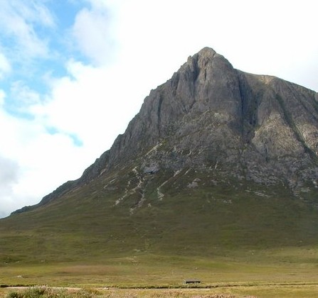
Stob Dearg from Glen EtiveElevation 1,022 m (3,353 ft) Prominence 533 m (1,749 ft) Parent peak Bidean nam Bian Listing Munro, Marilyn Translation Great Herdsman of Etive [1] (Gaelic) Pronunciation Scottish Gaelic: [ˈpuəxəʎə ˈeʰtʲə moːɾ],
English: /ˈbuːəxeɪl ˈɛtɪv ˈmɔr/Location Buachaille Etive Mòr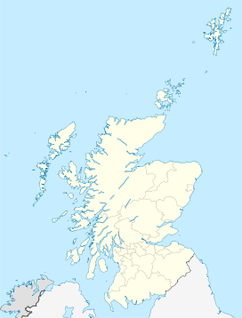
 Buachaille Etive Mòr
Location Glen Etive,  Scotland
Coordinates 56°38′50.29″N 4°53′52.07″W / 56.6473028°N 4.8977972°WCoordinates: 56°38′50.29″N 4°53′52.07″W / 56.6473028°N 4.8977972°W Topo map OS Landranger 41 OS grid NN223543 Listed summits of Buachaille Etive Mòr Name Grid ref Height Status Stob Dearg NN223543 1022 m (3352 ft) Munro, Marilyn Stob na Doire NN207532 1011 m (3317 ft) Munro top Stob na Bròige NN190525 956 m (3136 ft) Munro Stob Coire Altruim NN197530 941 m (3087 ft) Munro top Buachaille Etive Mòr (Scottish Gaelic: Buachaille Eite Mòr, meaning "the great herdsman of Etive"), generally known to climbers simply as The Buachaille or The Beuckle,[2] is a mountain at the head of Glen Etive in the Highlands of Scotland. Its almost perfect pyramidal form, as seen from the A82 road when travelling towards Glen Coe, makes it one of the most recognisable mountains in Scotland, and one of the most depicted on postcards and calendars.
Buachaille Etive Mòr takes the form of a ridge nearly five miles (8 km) in length, almost entirely encircled by the River Etive and its tributaries. The ridge contains four principal tops: from north-east to south-west these are Stob Dearg (1022 m), Stob na Doire (1011 m), Stob Coire Altruim (941 m) and Stob na Bròige (956 m). Stob Dearg and Stob na Bròige are both Munros; the latter was promoted to Munro status by the Scottish Mountaineering Club in 1997.
Ascent
The steep, craggy north-eastern face of Stob Dearg forms the classic aspect of the mountain as seen from the Kings House Hotel, and constitutes the most direct route of ascent for climbers and scramblers. Crowberry Ridge, a classic rock climb graded severe, was first climbed direct – and photographed – in 1900 by the Abraham brothers with Messrs Puttrell and Baker. Immediately to the left is Curved Ridge, one of the most famous scrambling routes.
Alternatively there is a somewhat eroded path leading steeply up the Coire na Tulaich which, in summer conditions, allows walkers to ascend the peaks, reaching the ridge about half a kilometre west of Stob Dearg.
Buachaille Etive Mòr is separated from its sister mountain of Buachaille Etive Beag to the west by the valley of Lairig Gartain. To the east lies Glen Etive, which provides an alternative route of ascent, heading up steep grassy slopes to the summit of Stob na Bròige. Another route follows the Allt Coire Altruim from the Lairig Gartain, reaching the ridge about two thirds of the way along from the north. This route is often used as descent route in conjunction with an ascent via Coire na Tulaich, forming a circular route with a walk out along the Lairig Gartain.
On 24 January 2009, three mountain climbers were killed and one was seriously injured, in an avalanche disaster.
See also
References
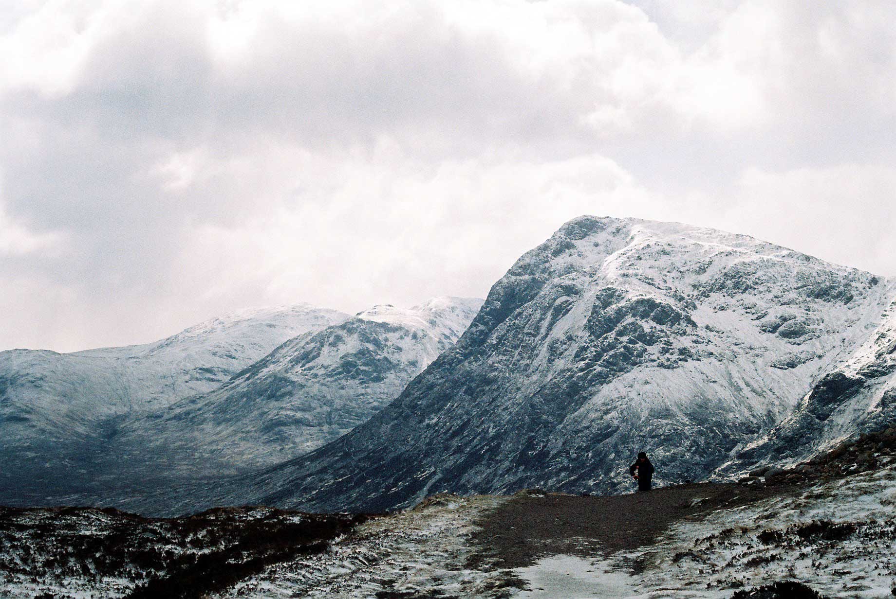
 The Buachaille's north-east face
- Chris Crocker, Database of British Hills (2005). Accessed 8 November 2006.
- Mountain Pictures , pictures of Buachaille etive mor Picture gallery of Buachaille Etive Mor
- ^ Peter Hodgkiss, The Central Highlands, Scottish Mountaineering Club District Guidebook, 5th ed. (Scottish Mountaineering Trust, 1994)
- ^ http://www.barnetts.org.uk/walking/buachaile/buachaille.htm
 Aonach Eagach: Meall Dearg and Sgor nam Fiannaidh · Beinn a' Bheithir: Sgorr Dhearg and Sgorr Dhonuill · Beinn a' Chochuill · Beinn Eunaich · Beinn Fhionnlaidh · Beinn nan Aighenan · Beinn Sgulaird · Ben Cruachan · Ben Starav · Buachaille Etive Beag: Stob Coire Raineach and Stob Dubh · Buachaille Etive Mòr: Sgor na Bròige and Stob Dearg · Creise · Glas Bheinn Mhòr · Meall a' Bhuiridh · Meall nan Eun · Sgor na h-Ulaidh · Stob a' Choire Odhair · Stob Coir' an Albannaich · Stob Coire Sgreamhach · Stob Diamh · Stob Ghabhar · Bidean nam Bian
 Categories:
- Munros
- Marilyns of Scotland
- Mountains and hills of the Central Highlands
- Climbing areas of Scotland


Wikimedia Foundation. 2010.