- Burnley
-
For the larger local government district, see Burnley (borough).For other meanings see Burnley (disambiguation)
Coordinates: 53°47′20″N 2°14′53″W / 53.789°N 2.248°W Burnley 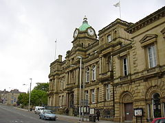
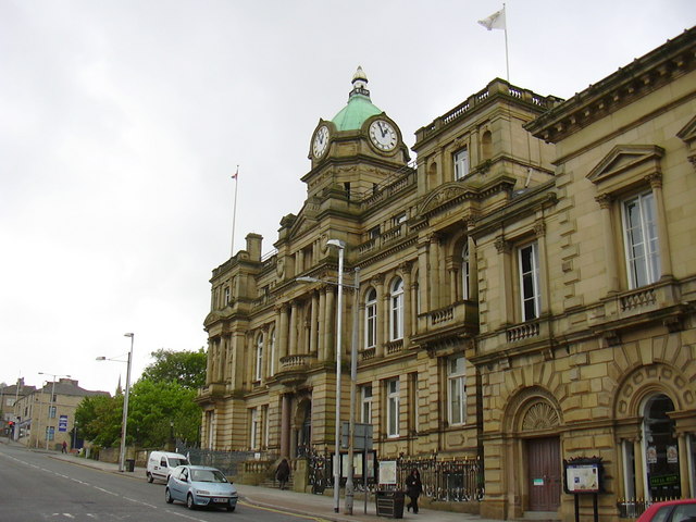
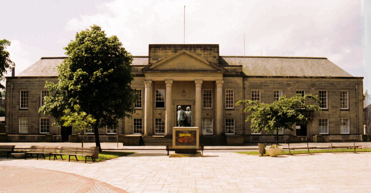
Burnley Town Hall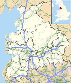
 Burnley
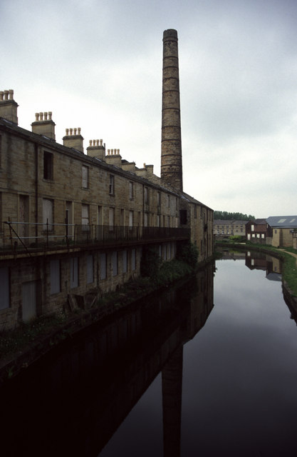
Burnley shown within LancashireArea 15.82 km2 (6.11 sq mi) [1] Population 73,021 (2001 Census) - Density 11,955 /sq mi (4,616 /km2) OS grid reference SD836326 - London 181 mi (290 km) SSE District Burnley Shire county Lancashire Region North West Country England Sovereign state United Kingdom Post town BURNLEY Postcode district BB10-12 Dialling code 01282 Police Lancashire Fire Lancashire Ambulance North West EU Parliament North West England UK Parliament Burnley List of places: UK • England • Lancashire  The Weavers' Triangle, with the Leeds and Liverpool Canal
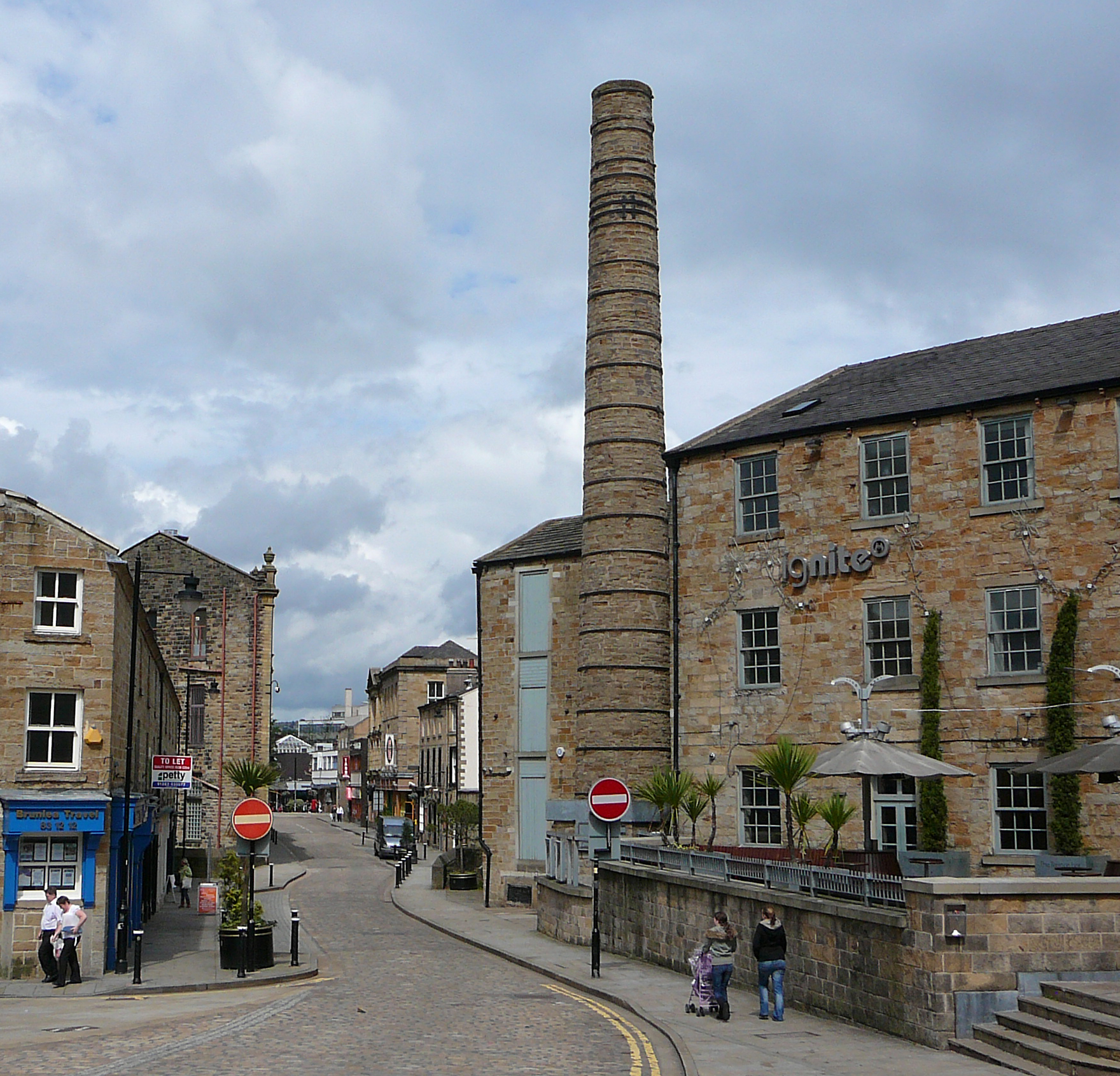
 Queen Street Mill Textile Museum
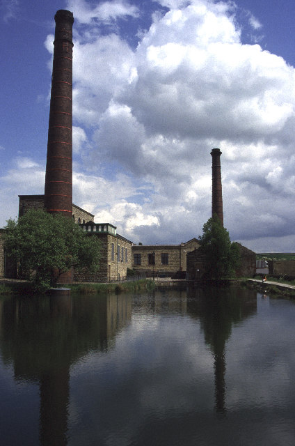
 Burnley wharf on the Leeds and Liverpool Canal
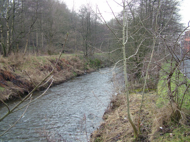
 The River Brun as it flows through Burnley
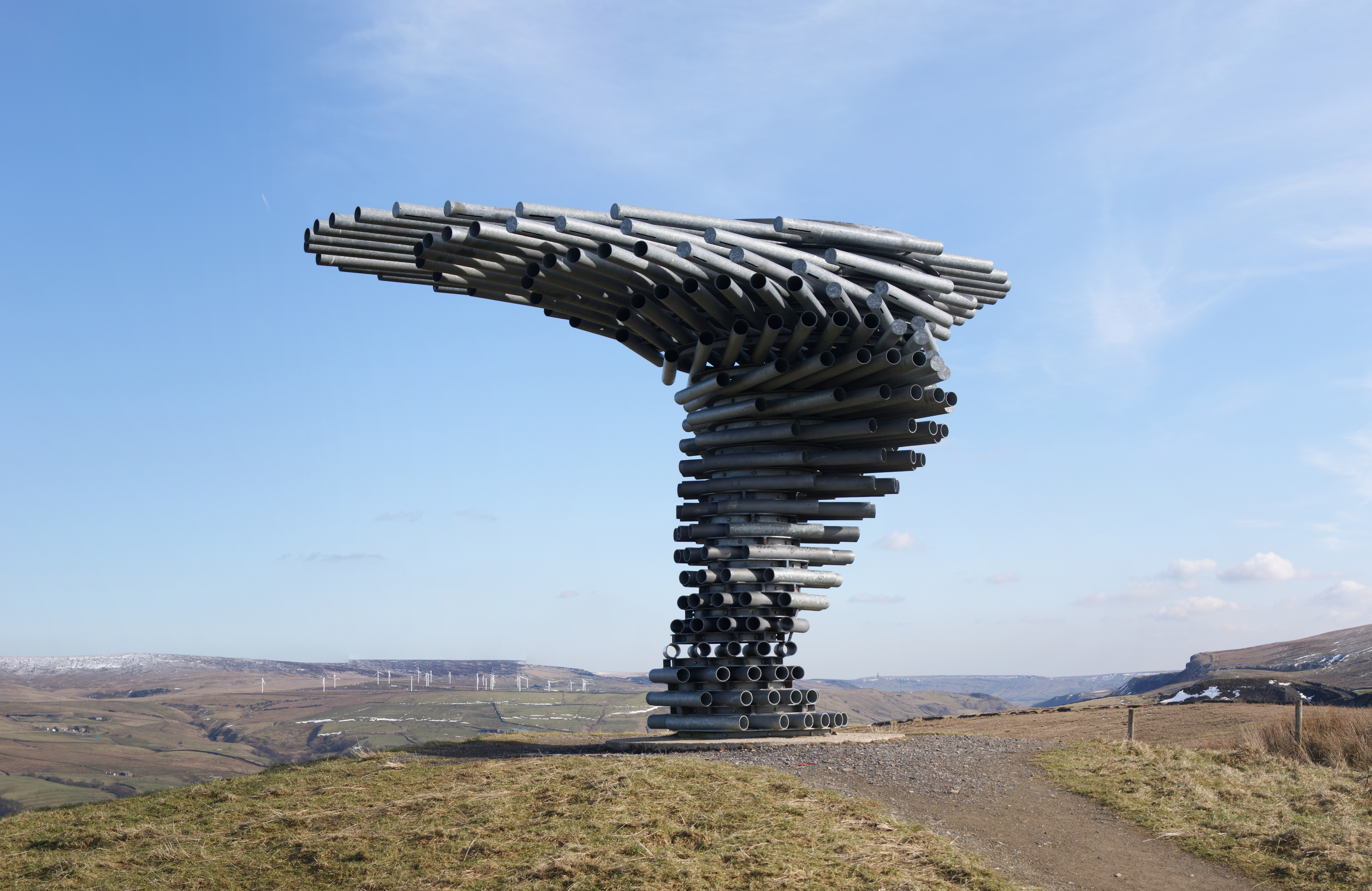
 The Singing Ringing Tree at Crown Point
 Gannow Tunnel on the Leeds and Liverpool Canal
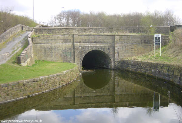
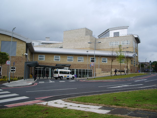
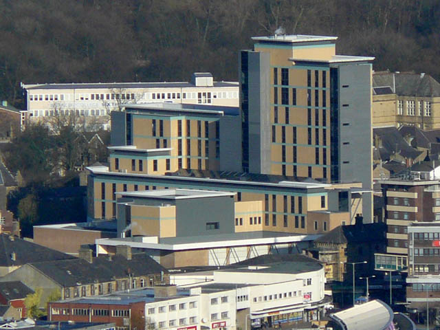
 Burnley General Hospital Phase 5
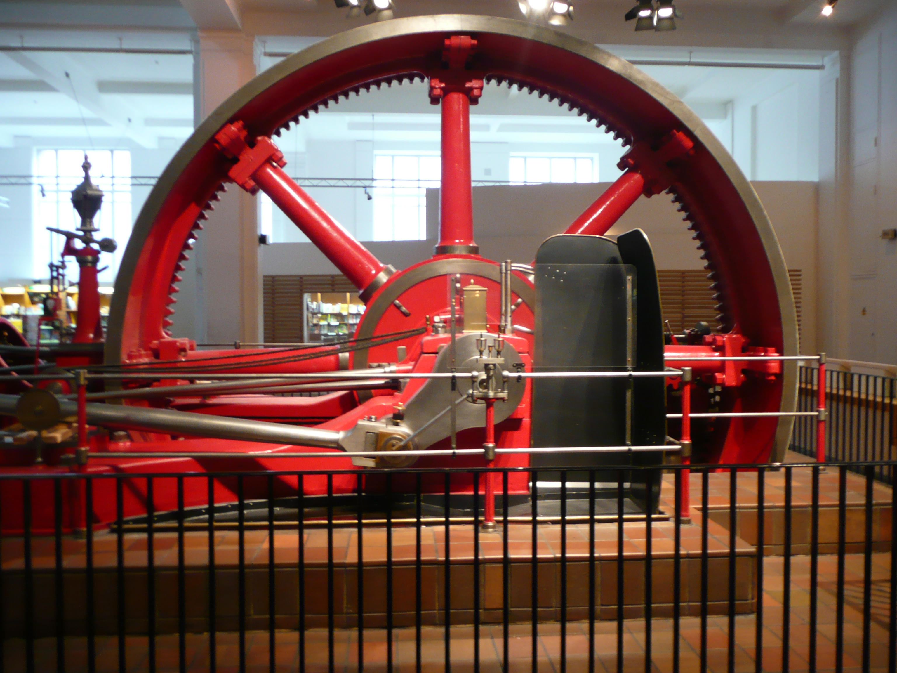
 Mill engine by Burnley Ironworks in the Science Museum
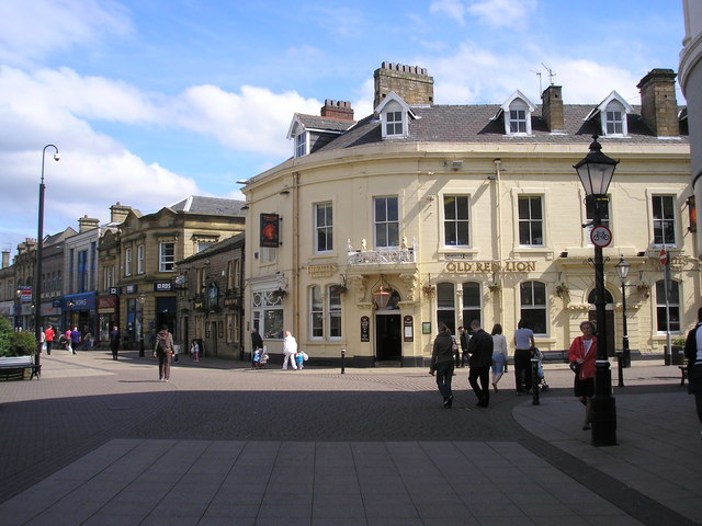
 St James Street, Burnley
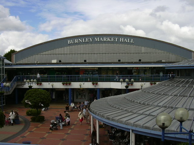
 Burnley Market
 Railway viaduct on the East Lancashire Line
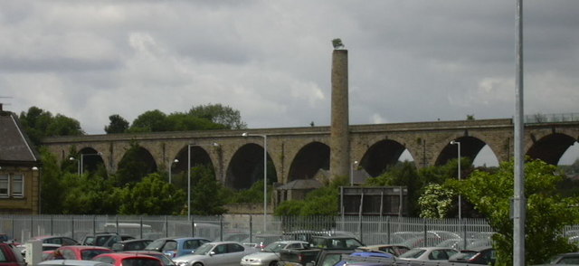
 Burnley Bus Station
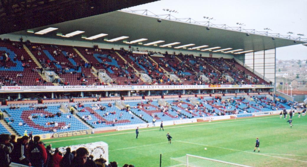
 Turf Moor, the home of Burnley FC
 St. Peter's Health & Sport centre
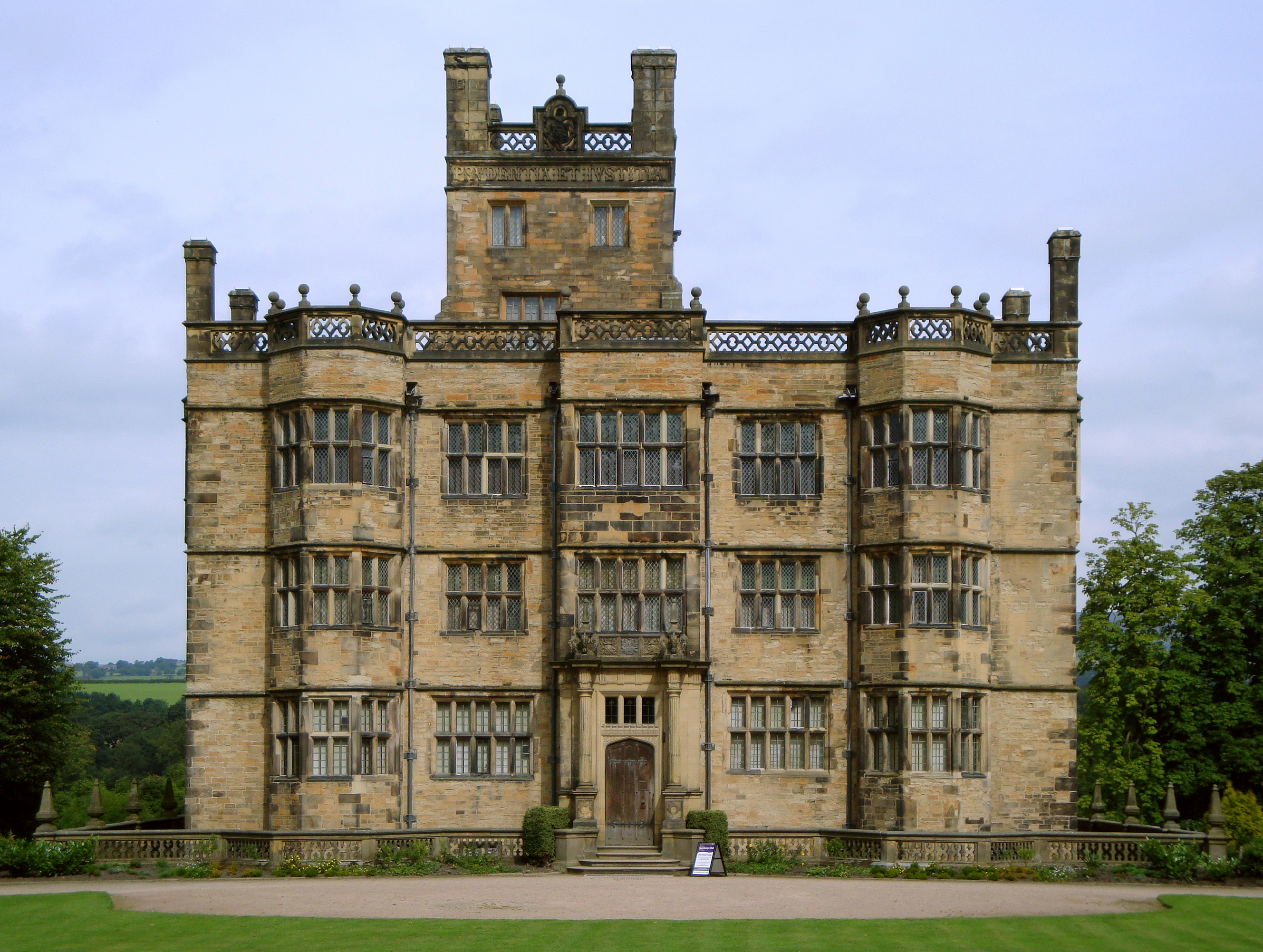
 Towneley Hall in Towneley Park
 The Library in the Winter of 2010
 Hammerton St, Burnley
 Police Station & Magistrates' Court by Bradshaw Gass & Hope
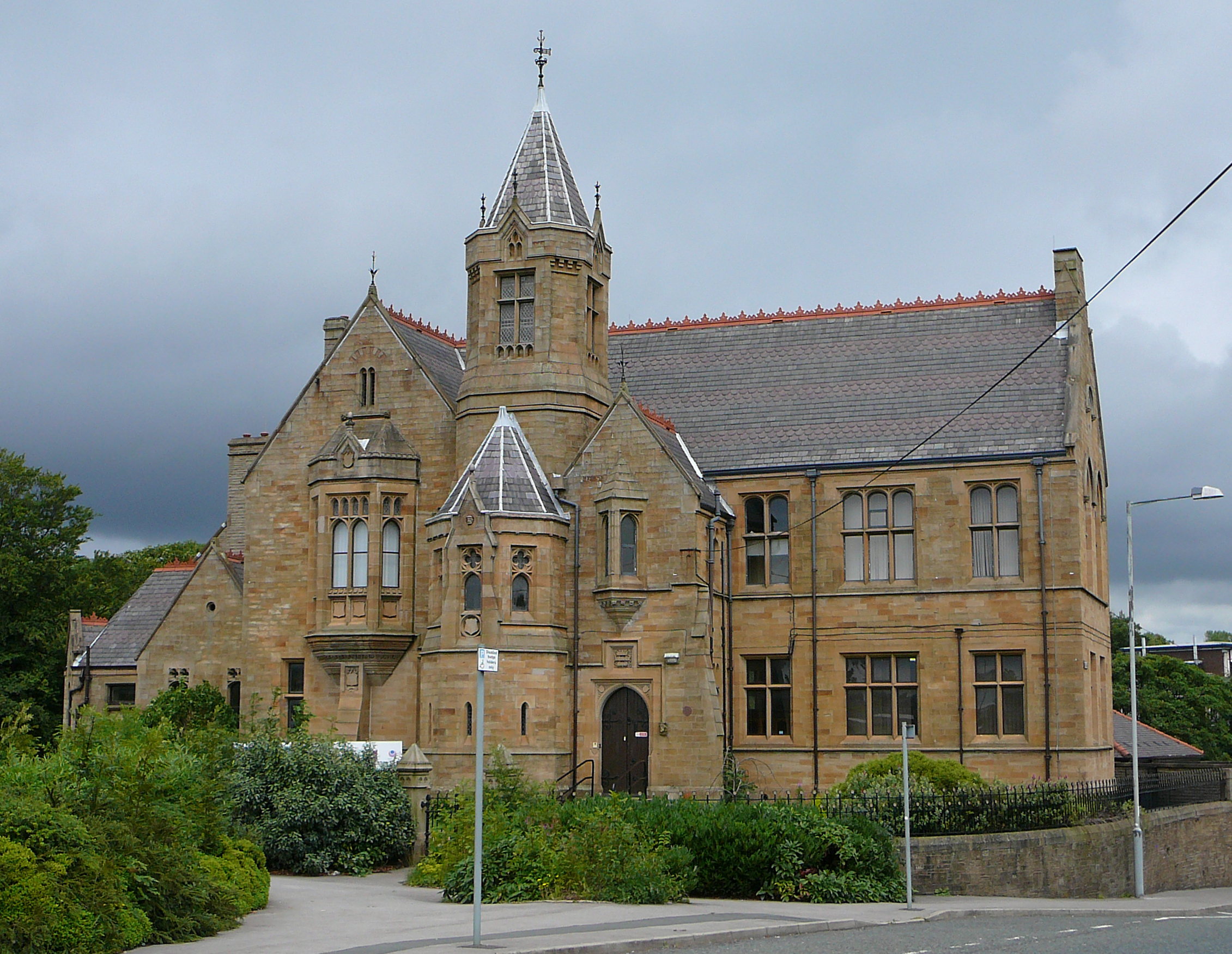
 Former Burnley Grammar School
 Shuttleworth College, in Padiham, the first of the new schools
Burnley is a market town in the Burnley borough of Lancashire, England, with a population of around 73,500. It lies 21 miles (34 km) north of Manchester and 25 miles (40 km) east of Preston, at the confluence of the River Calder and River Brun.
The town began to develop in the early medieval period as a number of farming hamlets surrounded by manor houses and royal forests, gaining a market over 700 years ago. However, its main period of expansion was during the Industrial Revolution, when it grew into one of Lancashire's most prominent mill towns. At its peak, it was one of the world's largest producers of cotton cloth, and a major centre of engineering.
Today, Burnley has a post-industrial economy and landscape, and is increasingly a dormitory town for Manchester, Leeds and the M65 corridor.[2]
Contents
History
Toponomy
The name Burnley is believed to have been derived from Brun Lea meaning 'meadow by the River Brun'.[3] Various other spellings have been used: Bronley (1241), Brunley (1251) and commonly Brumleye (1294) [4]
Origins
Stone Age flint tools and weapons have been found on the moors around the town,[3] as have numerous tumuli, stone circles, and some hill forts (see: Castercliff Camp, which dates from around 600 BC). Also, modern-day Back Lane, Sump Hall Lane and Noggarth Rd follow the route of a classic ridge road running east-west to the north of the town. This indicates that the area was populated during pre-history and was probably controlled by the Brigantes.
Limited coin finds indicate Roman influence in the area, although no evidence of a settlement has been found in the town. However, Gorple Road (running east from Worsthorne) appears to follow the route of a Roman one that possibly crossed the present day centre of town on the way to the fort at Ribchester. It has been claimed that earthworks near here, known as Ring Stones Camp (53°47′35″N 2°10′26″W / 53.793°N 2.174°W), Twist Castle (53°48′00″N 2°10′16″W / 53.800°N 2.171°W) and Beadle Hill (53°48′11″N 2°10′08″W / 53.803°N 2.169°W) are of Roman origin, but little archaeological information has been published to support this.
There is little evidence to show what happened in the wider area immediately after the Roman period, but it is believed to have become part of the kingdom of Rheged, before sometime later, possibly through invasion, becoming part of the kingdom of Northumbria. Local place names Padiham and Habergham show the influence of the Angles, suggesting that some had settled in the area by the early 7th century,[3] and some time after, the land became part of the hundred of Blackburnshire.
The same area was historically believed to be the likely location in 937 of the Battle of Brunanburh, one of the most important, but little known, battles in British history.
There is no definitive record of a settlement until after the Norman conquest of England. In 1122 a charter granted the church of Burnley to the monks of Pontefract Abbey.[3] In its early days, Burnley was a small farming community, gaining a corn mill in 1290,[5] a market in 1294, and a fulling mill in 1296.[3] At this point, it was within the manor of Ightenhill, one of five that made up the Honor of Clitheroe, then a far more significant settlement, and consisted of no more than 50 families.[3] Little survives of early Burnley apart from the Market Cross, erected in 1295, which now stands in the grounds of an annexe of Burnley College.[3]
Over the next three centuries, Burnley grew in size to about 1,200 inhabitants by 1550, still centred around the church, St Peter's, in what is now known as "Top o' th' Town". Prosperous residents built larger houses, including Gawthorpe Hall in Padiham and Towneley Hall, and in 1532 St Peter's Church was largely rebuilt.[3] Burnley's grammar school was founded in 1559, and moved into its own schoolhouse next to the church in 1602.[3] Burnley began to develop in this period into a small market town. It is known that weaving was established in the town by the middle of the 17th century[3] and in 1617 a new Market House was built. The town continued to be centred on St Peter's Church until the market was moved to the bottom of what is today Manchester Road at the end of the 18th century.[3]
Industrial Revolution
In the second half of the 18th century, the manufacture of cotton began to replace that of wool. Burnley's earliest known factories – dating from the mid-century – stood on the banks of the River Calder close to where it is joined by the River Brun, and relied on water power to drive the spinning machines. The first turnpike road through Burnley was begun in 1754, linking the town to Blackburn and Colne, and by the early 19th century there were daily stagecoach journeys to Blackburn, Skipton and Manchester, the last taking just over two hours.[3] The 18th century also saw the rapid development of coal mining: the drift mines and shallow bell-pits of earlier centuries were replaced by deeper shafts meeting industrial as well as domestic demand locally, and by 1800 there were over a dozen pits in the modern-day centre of the town alone.[3]
The arrival of the Leeds and Liverpool Canal in 1796 made possible transportation of goods in bulk, bringing a huge boost to the town's economy. Dozens of new mills were constructed, along with many foundries and ironworks that supplied the cotton mills and coal mines with machinery and cast and wrought iron for construction. The town became renowned for its mill-engines and the Burnley Loom was recognised as one of the best in the world.
Disaster struck the town in 1824, when first its only local bank (known as Holgate's) collapsed,[6] forcing the closure of some of the largest mills. This was followed by a summer drought, which caused serious problems for many of the others, leading to high levels of unemployment and possibly contributing to the national financial crisis of 1825.
By 1830 there were 32 steam engines in cotton mills throughout the rapidly expanding town,[3] an example of which, originally installed at Harle Syke Mill, is on display in the Science Museum (London).[7]
The Irish Potato Famine led to an influx of Irish families during the 1840s, who formed a community in one of the poorest districts. At one time the Park district (modern-day town centre, around Parker St.) was known as Irish Park.
In 1848 the East Lancashire Railway Company's extension from Accrington linked the town to the nation's nascent railway network for the first time.[3] This was another significant boost to the local economy and, by 1851, the town's population had reached almost 21,000.[3]
The Cotton Famine of 1861–1865, caused by the American Civil War, was again disastrous for the town. However, the resumption of trade led to a quick recovery and, by 1866, the town was the largest producer of cotton cloth in the world.[8]
Burnley was incorporated as a municipal borough in 1861, and became, under the Local Government Act 1888, a county borough outside the administrative county of Lancashire. By the 1880s the town was manufacturing more looms than anywhere in the country.[9]
The Burnley Electric Lighting Order was granted in 1890, giving the Burnley Corporation (which already controlled the water supply and the making and sale of gas) a monopoly on generating and selling electricity in the town. Building of the coal-powered Electricity Works began in 1891 in Grimshaw St, close to the canal (site of modern-day Tesco) and the first supply was inaugurated on 22 August 1893, initially to generate electricity for street lights.[10]
The start of the 20th century saw Burnley's textile industry at the height of its prosperity. By 1910, there were approximately 99,000 power looms in the town,[11] and it reached its peak population of over 100,000 in 1911. However, the First World War heralded the beginning of the collapse of the English textiles industry and the start of a steady decline in the town's population.[12]
The World Wars
In the First World War almost 4,000 men died, approximately 15% of the male working-age population.[13] 250 volunteers, known as the Burnley Pals, made up Z Company of 11th Battalion, the East Lancashire Regiment, a battalion that as a whole became known by the far more infamous name of the Accrington Pals. Victoria Crosses were awarded to two soldiers from the town, Hugh Colvin and Thomas Whitham, along with a third to resident (and only son of the chief constable) Alfred Victor Smith. A memorial to the fallen was erected in 1926 in Towneley Park.
In between the wars came the great depression of the 1930s.
In the Second World War, two Distinguished Service Orders and eight Distinguished Conduct Medals, along with a large number of lesser awards, were awarded to servicemen from the town. At Heights Farm was a bombing decoy nicknamed "Manchester on the moors". Burnley escaped the bombing, largely due to the town being near the limit of German bomber range, and its proximity to higher value targets in Manchester. Although the blackout was enforced, most of the aircraft in the sky above the town would have been friendly and on training missions, or returning to the factories for maintenance. Aircraft crashes did occur, however: In September 1942 a P-38 Lightning from the 14th Fighter Group USAAF crashed near Cliviger, and Black Hameldon Hill claimed a Halifax from No. 51 Squadron RAF in January 1943 and also a B-24 Liberator from the 491st Bombardment Group USAAF in February 1945. Lucas Industries set up shadow factories, producing a wide range of electrical parts for the war effort. Notably they were involved with the Rover Company's failed attempts (and Rolls-Royce's later successful ones) to produce Frank Whittle's pioneering jet engine design, the W.2 (Rolls-Royce Welland) in Barnoldswick. Magnesium Elektron's factory in Lowerhouse became the largest magnesium production facility in Britain.[14] An unexpected benefit of the conflict for the residents of Burnley occurred in 1940. The Old Vic Theatre Company and the Sadler's Wells Opera and Ballet Companies moved from London to the town’s Victoria Theatre. Burnley's main war memorial stands in Place de Vitry sur Seine next to the central library.
Post-World War II
There were widespread celebrations in the town in the summer of 1960, when Burnley FC won the old first division to become Football League champions. The Queen paid an official visit to the town in summer 1961, marking the 100th anniversary of Burnley's borough status. The rest of the decade saw large scale redevelopment in the town. Many buildings were demolished including the market hall, the cattle market, the Odeon cinema and hundreds of houses. New construction projects included the Charter Walk shopping centre, Centenary way and its flyover, the Keirby Hotel, a new central bus station, Trafalgar flats, and a number of office blocks. The town's largest coal mine, Bank Hall colliery, closed in April 1971 resulting in the loss of 571 jobs. The area of the mine has been restored as a park.[15] Under the Local Government Act 1972 Burnley's county borough status was abolished, and it was incorporated with neighbouring areas into the non-metropolitan district of Burnley.
In 1980 Burnley was connected to the motorway network, through the construction of the first and second sections of the M65. Although the route, next to the railway and over the former Clifton colliery site, was chosen to minimize the clearance of occupied land, Yatefield, Olive Mount and Whittlefield Mills, the Barracks, and several hundred more terrace houses had to be demolished. Unusually this route passed close to the town centre and had a partitioning effect on the districts of Gannow, Ightenhill, Whittlefield, Rose Grove and Lowerhouse to the north. The 1980s and '90s saw massive expansion of Ightenhill and Whittlefield. Developers such as Bovis, Barratt and Wainhomes built large housing estates, predominantly on greenfield land.
In the summer of 1992, the town came to national attention following rioting on the Stoops and Hargher Clough council estates in the south west of the town.[16]
The turn of the millennium brought with it some improvement projects, notably the "Forest of Burnley" scheme,[17] which planted approximately a million trees throughout the town and its outskirts, and the creation of the Lowerhouse Lodges local nature reserve.[18]
In June 2001, during a period of wider unrest, the town again received national attention following a series of violent disturbances arising from racial tension between elements of its white and Asian communities.[19]
October 2009 saw the official opening of Burnley's first purpose-built mosque. The £1.5M privately funded Jamia Masjid Ghausia Mosque in Daneshouse was the culmination of 10 years of fundraising in the local and wider Muslim communities.[20]
Governance
Burnley has three tiers of government: Local government responsibilities are shared by Burnley Borough Council and Lancashire County Council; at a national level the town gives its name to a seat in the United Kingdom parliament and as a result is subject to the European Parliament. While the town itself is unparished, the rest of the borough has one further, bottom tier of government, the parish or town council.[21]
Local:Borough
Composition of Burnley Borough Council (as of May 2010) Party Group Leader Seats Change Liberal Democrat Charlie Briggs 24 +1 Labour Julie Cooper 14 +2 Conservative Peter Doyle 5 -1 British National Party Sharon Wilkinson 2 -2 Total Seats 45 Main article: Burnley (borough)See also: Burnley local electionsBurnley Borough Council has been governed since 2008 by the Liberal Democrats, led since 2010 by Charlie Briggs. The mayor – a ceremonial post, which rotates annually – is currently Tony Lambert (Labour).
The borough comprises 15 wards, 12 of which – Bank Hall, Briercliffe, Brunshaw, Coal Clough with Deerplay, Daneshouse with Stoneyholme, Gannow, Lanehead, Queensgate, Rosegrove with Lowerhouse, Rosehill with Burnley Wood, Trinity, and Whittlefield with Ightenhill – fall within the town itself. The remaining three – Cliviger with Worsthorne, Gawthorpe, and Hapton with Park, cover the neighbouring town of Padiham and a number of villages.[22]
Local:County
Main article: Lancashire County CouncilSee also: Lancashire local electionsLancashire County Council was controlled by Labour from 1981 until the Conservative Party won control in the local council elections in June 2009.[23][24] The borough is represented on the council in six divisions: Burnley Central East, Burnley Central West, Burnley North East, Burnley Rural, Burnley South West, and Padiham & Burnley West.[25] In 2009 Liberal Democrats won five of the six county seats and the British National Party has a single councillor.[26] The election of BNP candidate Sharon Wilkinson to the council seat of Padiham and Burnley West made her the BNP's first County Councillor.[27]
National
Main article: Burnley (UK Parliament constituency)The town elects a single Member of Parliament, which since the general election in 2010 has been Gordon Birtwistle (Liberal Democrats). Richard Shaw was the town's first MP in 1868. Arguably its most notable MP was former leader of the Labour Party and Nobel Peace Prize Laureate Arthur Henderson. All but one of the seven MPs elected by Burnley between the First World War and 2010 have been from the Labour party.
Europe
Main article: North West England (European Parliament constituency)Burnley lies within the North West England European Parliament constituency, which elects nine MEPs by proportional representation – currently three Conservative, two Labour, one Liberal Democrat, one UKIP and one BNP.
Geography & Climate
Burnley[disputed ] Climate chart (explanation) J F M A M J J A S O N D 1654−11154−1135609192851359715895171012317101301481521151567217550Average max. and min. temperatures in °C Precipitation totals in mm Source: weather.yahoo.com 2010 Imperial conversion J F M A M J J A S O N D 6.539304.539305.343323.648363.355413.859463.763504.863505.15746652416.145366.94132Average max. and min. temperatures in °F Precipitation totals in inches The town lies in a natural three-forked valley at the confluence of the River Brun and the River Calder, surrounded by open fields, with wild moorland at higher altitudes. To the west of Burnley lie the towns of Padiham, Accrington and Blackburn, with Nelson and Colne to the north. The centre of the town stands at approximately 118 metres (387 ft) above sea level and 30 miles (48 km) east of the Irish Sea coast.
Areas in the town include: Burnley Wood, Rose Hill, Harle Syke, Haggate, Daneshouse, Stoneyholme, Burnley Lane, Heasandford, Brunshaw, Pike Hill, Gannow, Ightenhill, Whittlefield, Rose Grove, Habergham, and Lowerhouse. Although Reedley is considered to be a suburb of the town, it is actually part of the neighboring borough of Pendle.
To the north west of the town, and home of the Pendle Witches, is the imposing Pendle Hill, which rises to 557 metres (1,827 ft), beyond which lie Clitheroe and the Ribble Valley. To the south west, the Hameldon Hills rise to 409 metres (1,342 ft), on top of which are the Met Office north west England weather radar, a BBC radio transmitter, and a number of microwave communication towers. This site was the first place in the UK chosen for an unmanned weather radar, beginning operation in 1979; it is one of 18 that cover the British Isles.[28] Also since 2007 the three turbines of the Hameldon Hill wind farm have stood on its northern flank. To the east of the town lie the 511 metres (1,677 ft) Boulsworth Hill and the moors of the South Pennines, and to the south, the Forest of Rossendale. On the hills above the Cliviger area to the south east of the town stands Coal Clough wind farm, whose white turbines are visible from most of the town. Built in 1992 amidst local controversy, it was one of the first wind farm projects in the UK. Nearby, the landmark RIBA-award winning Panopticon Singing Ringing Tree, overlooking the town from the hills at Crown Point, was installed in 2006.[29]
Due to its hilly terrain and mining history, rural areas of modern Burnley encroach the urban ones to within a mile of the town centre on the south, north west and north east.
The Pennine Way passes six miles (10 km) east of Burnley; the Mary Towneley Loop, part of the Pennine Bridleway, the Brontë Way and the Burnley Way offer riders and walkers clearly-signed routes through the countryside immediately surrounding the town.
Burnley has a temperate maritime climate, with relatively cool summers and mild winters. There is regular but generally light precipitation throughout the year, contributing to a relatively high humidity level. While snowfall occasionally occurs during the winter months, the temperature is rarely low enough for it to build up on the ground in any quantity. The town is believed to be the first place in the UK where regular rainfall measurements were taken (by Richard Towneley, beginning in 1677).
Neighbouring towns, villages and places 
Clitheroe Pendle Hill Nelson Padiham 
South Pennines  Burnley

Accrington Rossendale Valley Todmorden Demography
The Borough of Burnley compared UK Census 2001[30] Burnley NW England England Total population 89,542 6,729,764 49,138,831 Foreign born 5.7% 5.1% 9.2% White 91.8% 94.4% 90.9% Asian 7.2% 4.5% 4.6% Black 0.1% 0.6% 2.3% Christian 74.5% 78.0% 71.7% Muslim 6.6% 3.0% 3.1% Hindu 0.3% 0.4% 1.1% No religion 11.0% 10.5% 14.6% Under 18 years old 25.6% 23.3% 22.7% Over 65 years old 15.1% 16.0% 15.9% Unemployed 3.1% 3.6% 3.3% Perm. sick / disabled 8.9% 7.7% 5.3% The United Kingdom Census 2001 showed a total resident population for Burnley of 73,021. The town is the main population centre in the Burnley-Nelson urban area, which has an estimated population of 149,796; for comparison purposes, this is about the same size as Huddersfield, Oxford or Poole.[31]
The racial composition of the borough is 91.77% White and 7.16% South Asian or South Asian / British, predominantly from Pakistan. The largest religious groups are Christian (74.46%) and Muslim (6.58%). 59.02% of adults between the ages of 16 and 74 are classed as economically active and in work.[32]
The town is noticeably segregated, with the majority of its Asian residents living in the neighbouring Daneshouse and Stoneyholme districts. In total, the size of its Asian community is much smaller than those in nearby towns such as Blackburn and Oldham.
In early 2010, the Lancashire Telegraph reported that Burnley topped Home Office figures for the highest number of burglaries per head in England and Wales between April 2008 – April 2009.[33] This claim (minus the dates) was repeated during one of the questions in the first of the televised 2010 general election debates.[34] However, in May 2010 the NPIA Local Crime Mapping System (believed to be the source of the data in the report) listed a 49.5% drop in this rate on the previous year.
Burnley has some of the lowest property prices in the country, with numerous streets appearing in the annual mouseprice.com most affordable streets in England & Wales report.[35][36][37][38] These streets are concentrated in areas of terrace housing in poorer neighbourhoods adjacent to the town centre. Between 2005 and 2010 approximately £65m of government funds was invested into these areas through the Elevate East Lancashire housing market renewal company (replaced by Regenerate Pennine Lancashire in 2010).Year 1911 1921 1931 1939 1951 1961 1971 2001 Population 106,322 103,157 89,258 85,400 84,987 80,559 76,489 73,021 Sources:
www.visionofbritain.org.ukEconomy and industry
Burnley's traditional employment base has been in decline for several decades. The last deep coal mine, Hapton Valley Colliery, closed in February 1981 and the last steam-powered mill, Queen Street Mill, in 1982. Over the next two decades, Burnley's two largest manufacturers both closed their factories: Prestige in July 1997 and Michelin in April 2002.[39][40] The town has struggled to recover: its employment growth between 1995 and 2004 placed it 55th of England's 56 largest towns and cities,[41] and as of 2007 it was the 21st most deprived local authority (out of 354) in the United Kingdom.[42] 13% of its working age population currently claims incapacity benefit (national average 7%).[43] The largest employment sector in the town is now public administration, education and health (31.2%), followed by manufacturing (21.9%).[44]
Home shopping firm Shop Direct announced in January 2010 that it was to close its Burnley call centre with the loss of 450 jobs.[45] The company, which owns Littlewoods, Additions Direct, Very, Empire Stores and Marshall Ward, had been in the town for over 30 years, originally as Great Universal Stores but now known as GUS plc.
Modern economic developments have been industrial estates and business parks with the following currently in Burnley:[46] Heasandford, Rossendale Road, and Healeywood Industrial Estates; Network 65, Shuttleworth Mead, Smallshaw & Chestnut, Elm Street, and Gannow Business Parks; and Burnham Gate Trading Estate. A further large business park, provisionally called Burnley Bridge, is being developed on a site near Hapton formerly belonging to Hepworth Plastics.[47]
Key manufacturing employers today are in highly specialised fields: Gardner Aerospace, Safran Aircelle (aerospace), GE subsidiary Unison Engine Components (aerospace), AMS Neve (professional audio), and TRW Automotive and Futaba-Tenneco UK (automotive components).[48] The town has also had a long association with Endsleigh Insurance Services, providing its main training facility and an important call centre. In 2004, the Lancashire Digital Technology Centre was established on land formerly occupied by the now-closed Michelin factory to provide support and incubation space for start-up technology companies.
Burnley is a sub-regional shopping destination, and is ranked in a similar position to nearby Blackburn in most consumer spending and footfall rankings[citation needed][clarification needed]. The town's main shopping area is St James Street, along with the nearby Charter Walk Shopping Centre. The YMCA claimed to have opened the largest charity shop in the UK in 2009, when they took over the former Woolworths store in the town centre.[49] This former Woolworths store has now been split into two large stores housing Peacocks and 99p Stores. The shopping centre was sold in 2001 by Great Portland Estates to Sapphire Retail Fund, which is 50% owned by the Reuben Bothers. In August 2010 the centre's future was thrown into doubt when Sapphire Retail Fund entered administration as a result of being unable to refinance its debts.[50] The centre was bought in March 2011 by London-based Addington Capital.
The town centre is home to a large number of high street multiples, including Marks and Spencer, W H Smith, New Look, Next, Miss Selfridge, River Island, HMV, Topshop, Burton, Dorothy Perkins, Evans, Ernest Jones, Argos, Clarks, JD Sports, JJB, Wilkinson, T J Hughes, Supercuts and Scotts, along with other shops, including specialist food shops, independent record shops and an independent bookshop. A large council-run market is open six days a week. On the edge of the town centre, four retail parks house stores including Currys, Argos Extra, Sports Direct, T.K. Maxx, Staples, Halfords, Comet and PC World; there are also a number of mill shops. A second town centre shopping centre, 'The Oval', is due to begin construction early 2011 and has secured Primark and Next as the anchors. Other stores which have at one time or another been linked to the development include Waterstones, GAP, Debenhams and BHS.
There are also branches of the DIY superstore Homebase, and various supermarkets including Sainsbury's, Tesco Extra, Asda, Iceland, Netto, Farmfoods and Aldi on the edges of the town centre, as well as a second Farmfoods, second Iceland, two Tesco Express stores and a Co-op superstore in suburban areas.
As well as traditional motor dealerships from Volkswagen, Ford, Vauxhall, Renault and Nissan, the town is home to the second Motorpoint car supermarket in the UK, as well as the only UK dealership of German supercar manufacturer Gumpert.[51]
Transport
Road
Burnley is served by Junctions 9, 10 and 11 of the M65 motorway, which runs west to Accrington, Blackburn and Preston (where it connects to the M6), and northeast to Nelson and Colne. From the town centre, the A646 runs to Todmorden, the A679 to Accrington, the A671 to Clitheroe, and the A682 (a nearby rural section of which has been classified as Britain's most dangerous road)[52] south to Rawtenstall and north east to Nelson and the Yorkshire Dales. The A56 dual carriageway skirts the western edge of the town, linking to the M66 motorway heading towards Manchester and the M62.
Rail
Rail services to and from Burnley are provided by Northern Rail. The town has four railway stations, Burnley Manchester Road, Burnley Central, Burnley Barracks and Rose Grove. A fifth station, Hapton, serves Padiham and Hapton to the west of the town, but inside the borough. Manchester Road station has an hourly semi-fast service west to Preston (the nearest station on the West Coast Main Line) and Blackpool North, and east to Leeds and York, whilst the Central and Barracks stations provide an hourly stopping service west to Blackpool South and Preston, and east to Nelson and Colne.
There are also plans for direct trains to Manchester by reinstating a section of track at the Hall Royd Junction of the Caldervale Line (known as the Todmorden curve). This will allow for direct train travel to Manchester Victoria, reducing the journey time to approximately 45 minutes. On 31 October 2011 it was announced by Deputy Prime Minister Nick Clegg that the scheme had been granted the money as part of the Regional Growth Fund and would go ahead.
Bus and coach
The main bus operator in Burnley is Transdev Burnley & Pendle, with Tyrer Bus operating some tendered town services. Other services are provided by Coastlinks Express (X27 to Southport), First (589 to Rochdale, 592 to Halifax), Transdev Lancashire United (152 to Preston), Pennine (215 to Skipton), and Rossendale Transport (483 to Bury). National Express operates three coach services to London each day, and one to Birmingham.
The town has good bus links into Manchester, compensating for the lack of a direct rail link. The X43/X44 Witch Way service (operated by Burnley & Pendle) runs from Nelson to Manchester, via Burnley and Rawtenstall, using a fleet of specially branded double-decker buses. The fastest journeys take 59 minutes.
The town's new bus station, designed by Manchester-based SBS Architects, won the UK Bus Award for Infrastructure in 2003.[53]
Canal
The Leeds and Liverpool Canal passes through the town, skirting its centre. Along the Burnley section there are number of notable features:
The 1,120 metres (3,675 ft) long and up to 18.25 metres (60 ft) high, almost perfectly level embankment known as the 'Straight Mile'. Built between 1796 and 1801 (before the invention of the Steam shovel), to avoid the need for locks, it is regarded as one of the original seven wonders of the British waterways.[54]
The 511 metres (1,677 ft) long Gannow Tunnel, notable because its route, through thick impermeable clays and shale that had been extensively mined, made it one of the most difficult tunnelling projects of the Canal Age.[55]
The much more modern (1980) Whittlefield motorway aqueduct is believed to be the first time a canal aqueduct was constructed over a motorway in the UK.
Since 2009, the Reedley Marina has provided a 100-berth facility, popular with pleasure boaters, on the northern edge of town.
Air
Although Burnley does not have an airport, there are four international airports within an hour's travel of the town. These are Manchester Airport at 31 miles (50 km), Liverpool John Lennon Airport at 41 miles (66 km), Leeds Bradford Airport at 24 miles (39 km), and Blackpool Airport at 33 miles (53 km).
Sport
The town's sporting scene is dominated by Burnley Football Club, which was founded in 1882. The club has played its home matches at Turf Moor since 1883, where attendance currently averages 20,000.[56] The club is very well supported in the town, in fact holding the record for the highest ratio of match attendance to town population in the country.[57] It was one of the 12 founder members of the Football League in 1888 and is one of only three English league clubs to have been champions of all four professional league divisions (along with Wolves and Preston). Nicknamed the Clarets, they played the 2009/10 season in the Premier League, 33 years since they last played in the top flight of English football, and 50 years since they won it (List of English football champions). Burnley's current manager, Eddie Howe, is one of the youngest managers in the Football League.
There are two members of the Lancashire Cricket League in the town. Burnley Cricket Club play their home matches at Turf Moor, their ground being adjacent to the football ground, while Lowerhouse Cricket Club play at Liverpool Road. The Burnley-born England Cricketer James Anderson started his career at Burnley Cricket Club.
Burnley is also home to Burnley Rugby Club (formerly Calder Vale Rugby Club 1926–2001). They field three senior sides, with teams at most junior age groups, and play at Holden Road, the site of Belvedere and Calder Vale Sports Club.
Burnley briefly had a speedway team in 1929 at Towneley Stadium, but withdrew from competition in mid-season, never to be seen again.
Burnley has good public sporting facilities for a town of its size. The £29m St Peter's Centre (opened in 2006) offers swimming, squash courts and a fitness suite, while the nearby Spirit of Sport complex includes a large sports hall, and several indoor courts and outdoor synthetic pitches.[58] There is an outdoor athletics track at Barden Lane, where the Burnley Athletic Club meets. For golfers, there are both 9-hole and 18-hole municipal golf courses at Towneley Park, along with an 18-hole pitch and putt course.[59] (The private Burnley Golf Club also welcomes visiting players.) There are tennis courts at Towneley Park, and at the Burnley Lawn Tennis Club, as well as eleven bowling greens around the town,[60] and a £235,000 skate park at Queens Park, which opened in 2003. There are also basketball, caving and judo clubs in the town. In 2001, the private Crow Wood centre was established in countryside on the edge of the town, offering a combination of spa and fitness facilities, and racquet and equestrian sports.
Culture and Entertainment
Museums and Galleries
In Burnley itself there is a small contemporary visual arts gallery, the Mid-Pennine Gallery, while on the outskirts of the town there are larger galleries in two stately homes, Towneley Hall, which was bought by Burnley Corporation in 1901,[61] and Gawthorpe Hall in Padiham, which is owned by Lancashire County Council and managed by the National Trust. There are also two local museums: the Weavers' Triangle Trust operates the Visitor Centre and Museum of Local History in the historic surroundings of the Weavers' Triangle, while the Queen Street Mill Textile Museum celebrates Burnley's weaving past.
Parks
There are several large parks in the town, including Towneley Park, once the deer park for the 15th century Towneley Hall, and three winners of the Green Flag Award, including Queens Park, which hosts a summer season of brass band concerts each year, and Thompson Park, which has a boating lake and miniature railway.[62]
Activities
There is a modern 24-lane ten pin bowling centre on Finsley Gate, operated by 1st Bowl. A 9-screen multiplex cinema opened in 1995 (with 3 3D screens as of 2010), operated by Apollo Cinemas. The town's theatre, named after its former use as the Mechanics Institute, hosts touring comedians and musical acts and amateur dramatics. A second performance space, the purpose-built £1.5m Burnley Youth Theatre, opened nearby in 2005. The Amnesty International Burnley group opened in 2011; meetings are held every month. The group mission is to conduct research and generate action to prevent and end grave abuses of human rights and to demand justice for those whose rights have been violated.
Festivals
Each year, Burnley hosts the two-day Burnley National Blues Festival, one of the largest Blues festivals in the country, drawing fans from all over Britain to venues spread across the town. In the 1970s, it was also an important venue for Northern Soul;[63] several local pubs still hold regular Northern Soul nights. In recent years, the town has also hosted an annual balloon festival in Towneley Park. A funfair is usually held around the second weekend in July at Fulledge Recreation Ground, which is also the venue for the town's main Guy Fawkes Night celebration.
Nightlife
Burnley has a lively nightlife, drawing clubbers from all over the North West. The town is dominated by the club Lava Ignite; other major bars and nightclubs include Barcode, Playhouse (formerly Fusion), Koko's, The Mix, Pharaoh's, Posh, Red Room, Rewind, Sanctuary Rock Bar and Smackwater Jacks. There are also chain-owned bars, such as Wetherspoons and Walkabout.
Curzon Street in Burnley was also the site of the legendary Angels (nightclub).
Burnley has a small gay scene, centred on the Guys as Dolls bar in St James Street.[64]
The local brewery, Moorhouse's, was founded in 1865, produces a range of award winning beers – including the very popular Pride of Pendle and Blond Witch – and currently operates six pubs in the area.
More Bénédictine is drunk in one local working men's club, the Burnley Miners' Club, than anywhere else in the world, after a local regiment stationed in Normandy during World War I brought back a taste for the drink.[65] This unusual fact was used in a question on 4th series of the BBC Show QI.[66] The Burnley Miners Club now has its own Benedictine Lounge.
Media
Local radio for Burnley and its surrounding area is currently provided by 2BR and BBC Radio Lancashire.
There are two local newspapers: the Burnley Express, published on Tuesdays and Fridays, and the daily Lancashire Telegraph, which publishes a local edition for Burnley and Pendle. There are also two free advertisement-supported newspapers called The Citizen and The Reporter, both of which are posted to homes throughout the town.
Burnley was one of seven sites chosen to be part of Channel 4's The Big Art project in which a group of 15 young people from all over the town commissioned artist Greyworld to create a piece of public art. The artwork, named "Invisible", is a series of UV paintings placed all around the town centre displaying "public heroes".
Filmography
Parts of the film Whistle Down the Wind (1961), and the television series All Quiet on the Preston Front and Juliet Bravo, were filmed in the town. (For example, Burnley Fire Station was the location of Social Services in the first series of Juliet Bravo, and Burnley Public Library was used for exterior shots of the magistrates' court in the same series.) Numerous locations in the town were used in the 1996–1998 BBC comedy drama Hetty Wainthropp Investigates.
Queen Street Mill textile museum was used for a scene in the 2010 Oscar winning film The King's Speech,[67] and for scenes in the 2004 BBC dramatisation of Elizabeth Gaskell's North and South, as well as Life on Mars (S1 E3; 2006). It has also featured in the following BBC documentaries: Fred Dibnah's Industrial Age (E2; 1999), Adam Hart-Davies' What the Victorians Did for Us (E1; 2001), and Jeremy Paxman's The Victorians (2009), as well as Who Do You Think You Are? (Bill Oddie episode), Flog It and UKTV History's The Re-Inventors (2006).
Towneley Hall featured in the BBC comedy drama Casanova (2005) and the BBC antiques quiz Antiques Master is currently filmed there.[68]
The canal embankment featured in the 2007 ITV documentary Locks and Quays (S2 E9) and two families in Burnley have been featured in the ITV series 60 Minute Makeover (S6 E28 and S7 E70).
Education
See also: List of Schools in BurnleyBurnley Grammar School was first established in St Peter's Church in 1559, with its first headmaster a former chantry priest, Gilbert Fairbank. In 1602, one of the governors, John Towneley, paid for a new schoolhouse to be built in the churchyard;[69] the school moved again in 1876 to a new building on Bank Parade, which can still be seen today.[70] The first technical school, in Elizabeth Street, was erected in 1892. The equivalent school for girls, Burnley Girls' High School, was established in 1909 on a site in Ormerod Road (along with the Technical School and Art School)[70] later moving to Kiddrow Lane in the 1960s. The tripartite system of Education established by the Education Act 1944 affected Burnley in the following ways: Heasandford Technical High School for Girls and Towneley Technical High School for Boys were established (Burnley Technical High School was formed in 1956 by the merger of the two),[71] as were Barden, Burnley Wood, Rosegrove & St. Mary's (Roman Catholic) Secondary Modern Schools.
The borough completed the move to comprehensive education in 1981,[72]
Secondary Schools: Habergham (mixed), Ivy Bank (mixed), Gawthorpe (mixed), Townley (mixed), Barden (boys), Walshaw (girls), St Theodores RC (boys), St Hilda's RC (Girls).
Further education: Habergham and St Theodores Sixth Forms and Burnley College (all mixed).
In 2003 a plan was devised to replace all the secondary schools and further education establishments in the town as part of the first wave of a nationwide programme funded by the Department for Education and Skills called Building Schools for the Future. Funding was secured in 2004 [73] and in 2006 the new schools opened (in the buildings of their predecessors).
Today there are five 11–16 secondary schools:
School Locality Description Ofsted Website Blessed Trinity RC Community College Burnley Secondary school 134997 website Hameldon Community College Burnley Secondary school 134995 website Sir John Thursby Community College Burnley Secondary school 134996 website Shuttleworth College Padiham Secondary school 134994 website Unity College Burnley Secondary school 135003 website Shuttleworth College moved into new buildings in 2008, Sir John Thursby in 2009, and Blessed Trinity, Hameldon and Unity in 2010.
Thomas Whitham Sixth Form, which forms a sixth element of the BSF programme, offers sixth form provision at its Burnley campus (opened 2008) on Barden Lane.
Burnley College is the borough's main tertiary education provider, offering vocational and professional training, adult education, and a small number of degree courses, as well as some GCSE courses and a full range of A levels. It moved to a new £80 million campus (in partnership with the University of Central Lancashire) off Princess Way in 2009. The Mohiuddin Trust charity subsequently purchased the former College site for £2m, and plan to open the Mohiuddin International Girls' College in October 2010,[74] initially for 500 students. The Birmingham based Trust, (whose other education projects are mainly based in Pakistan)[75] has stated that the college will offer mainstream education for women aged 16+ of both UK and foreign origin, with some boarding provision. Should the college expand to its maximum planned capacity of 1500 students it will be the largest Muslim faith school in England.[76]
Attainment
The town's educational attainment is below the national average at all levels. In 2009, 78% of children at the end of Key Stage 2 achieved at least Level 4 in English (national average 80%), and 77% in Mathematics (national average 79%). At the end of Key Stage 3, the numbers achieving at least Level 5 were 67% in English (national average 74%), and 67% in Mathematics (national average 76%). 54.3% of students at the end of Key Stage 4 achieved at least 5 A*-C grades at GCSE (national average 69.8%).[77] In 2007, three of the schools where listed in the bottom 5% nationally for adding value between the end of Key Stage 2 and the end of Key Stage 4.[78] During 2008/09 two were in Ofsted special measures, the last losing this status in June 2010.[79] A 2010 report commissioned by the BBC and compiled by Experian ranked the borough's workforce as having the worst GCSE results in England (in terms of the percentage of pupils gaining 5 or more grade A*-C).[80]
Twin towns
Burnley is twinned with:
 Vitry-sur-Seine, France (since 1958)
People
See also: Category:People from BurnleyArt
Keith Coventry, the winner of the 2010 John Moores Painting Prize, was born and educated in the town. He is one of the leading lights of the YBA (Young British Artists) movement of the 1990s, along with Damien Hirst and Tracey Emin, and his work appears in many important public collections, including the Tate galleries.
Entertainment
Probably the best-known Burnley figure in the field of entertainment is actor and gay rights activist Sir Ian McKellen,[82] who was born in the town in 1939. Other actors born in the town include Mary Mackenzie, Irene Sutcliffe and Julia Haworth (Coronation Street), Richard Moore[83] (Emmerdale), Alice Barry[84] and Jody Latham[85] (Shameless), Kathy Jamieson, Hannah Hobley (Benidorm), Natalie Gumede (Ideal) and film actor Lee Ingleby. Screenwriter Paul Abbott, creator of Shameless, television producer and executive Peter Salmon[86] and comedian Jeff Brown were also born in Burnley. Also Coronation Street regular Malcolm Hebden grew up in the town.
Musicians born in the town include Danbert Nobacon, Alice Nutter, Lou Watts and Boff Whalley (all of Chumbawamba),[87] Eric Haydock (bassist in The Hollies), classical composer John Pickard[88] and the DJ Anne Savage.
The 19th century author and clergyman Silas Hocking[89] wrote his most famous work, Her Benny (1879), while living in Burnley. Crime writer Stephen Booth is another native of the town,[90] as is journalist and broadcaster Tony Livesey and visual artist Keith Coventry.
Young British soprano Hollie Steel was also born in Burnley.[91]
Politics and the church
Phil Willis,[92] Liberal Democrat MP for Harrogate & Knaresborough, and Sir Vincent Fean,[93] HM ambassador to Libya, were born in Burnley, as was the 16th century Catholic martyr Robert Nutter.[94] Suffragette Ada Nield Chew died in Burnley in 1945. Baron Waddington of Read, the Home Secretary during the Poll Tax Riots and former Lord Privy Seal and Leader of the House of Lords, was also born in Burnley, as was the 16th century theologian William Whitaker.
Military
James Yorke Scarlett,[95] commander of the Heavy Brigade at the Battle of Balaclava. 2nd Lieutenant Hugh Colvin VC and Private Thomas Whitham VC who both served during World War I.
Burnley and the Royal Family
“ Recent years have not been at all kind to Burnley and all sorts of difficulties and challenges are placed in its way. But I hope my charities can make what small contribution they can, in partnership with the borough council and the NWDA, in this really crucial project to give, I hope, Burnley the future it deserves. ” Charles, Prince of Wales occasionally visits the town to undertake inspections on the youth programme that the Prince's Trust has in place to help 350 disadvantaged 14–25 year olds get their lives back on track in the borough. Prince Charles has set Burnley at the top of his priority list for his charity. The prince has focused his regeneration efforts on deprived parts of the country since a bid to improve Halifax in the 1980s. Prince Charles' interest in Burnley stems from a visit in 2005, when he saw first-hand the work being done to regenerate the town, at the time describing Burnley as a "remarkable town".
Science and industry
Engineer Sir Willis Jackson[96] was born and educated in the town. James Drake a pioneer of British motorways was also born here. 17th century mathematician Sir Jonas Moore was from Higham but is believed to have been educated at the Grammar School. Scottish cardiology pioneer Sir James Mackenzie lived and practiced medicine in the town for more than a quarter of a century.
Sport
Burnley's sporting figures include England and Lancashire cricketer James Anderson,[97] England and Everton Women's goalkeeper Rachel Brown,[98] Pakistan and Tranmere Rovers midfielder Adnan Ahmed, Ex-Bury FC manager Chris Casper,[99] Commonwealth Games Gold Medal-winning gymnast Craig Heap,[100] Antipodean racing driver Fabian Coulthard and Neil Hodgson, 2003 World Superbike champion. Ron Greenwood, former manager of the England football team, was born in Worsthorne.
 A panoramic image showing the town of Burnley from Crown point road. To the far top left of the image is the imposing Pendle Hill, with the Yorkshire Dales visible in the top central background. In the left of the image shows the town centre of Burnley and Turf Moor can be seen in the very centre of the picture. To the right the areas of Brunshaw and Pike Hill can be seen.
Notes
- ^ Office for National Statistics. Accessed 15 April 2008.
- ^ Lancashire County Council. Accessed 27 October 2007
- ^ a b c d e f g h i j k l m n o p Brian Hall (1977). Burnley: A Short History. Burnley: Burnley Historical Society. p. 40. ISBN 0-9500695-3-1.
- ^ A History of the county of Lancaster vol 6: Burnley Township @ UK History Accessed 2010
- ^ Lowe, John (1985). Burnley. Phillimore. p. 158. ISBN 978-0-85033-595-8.
- ^ Burnley Express Accessed 2010
- ^ Science Museum Accessed 2010
- ^ Burnley Borough Council. Accessed 6 September 2007.
- ^ Weavers triangle Accessed 2010
- ^ Burnley Express Accessed 2010
- ^ shttp://www.spinningtheweb.org.uk/m_display.php?irn=49&sub=nwcotton&theme=places&crumb=Burnley Spinning the Web Accessed 2010
- ^ www.visionofbritain.org.uk. Accessed 6 September 2007.
- ^ This is Lancashire Accessed 2010
- ^ magnesium.com Accessed 2010
- ^ "Bank Hall park - picture and location map". Geograph.org.uk. http://www.geograph.org.uk/photo/675291. Retrieved 2011-08-05.
- ^ The Independent 1992 riots Accessed 2010
- ^ Visit Burnley Accessed 2010
- ^ Lancashire Wildlife Trust Accessed 2010
- ^ Burnley Task Force report. Accessed 6 September 2007
- ^ Burnley Citizen Accessed 2010
- ^ Burnley Borough Council. Accessed 18 September 2007.
- ^ Burnley Borough Council. Accessed 6 November 2007.
- ^ Declared result for election held on 04 June 2009 Lancashire County Council – URL accessed 5 June 2009
- ^ Red rose county turns Tory blue bbc.co.uk URL accessed 5 June 2009
- ^ Lancashire County Council. Accessed 6 November 2007.
- ^ http://www.lep.co.uk/localelectionnews/Burnley-Results-and-overview.5339419.jp
- ^ First county council seat for BNP bbc.co.uk URL accessed 5 June 2009
- ^ Met Office Weather Radar Accessed 2010
- ^ www.panopticons.uk.net. Accessed 6 September 2007.
- ^ Office for National Statistics - Burnley page Accessed 2010
- ^ Office for National Statistics. Accessed 6 September 2007.
- ^ Office for National Statistics. 2001 census. Accessed 6 September 2007.
- ^ "Lancashire Telegraph report". Lancashiretelegraph.co.uk. 2010-02-05. http://www.lancashiretelegraph.co.uk/news/4910206.Burnley_named_as_burglary_capital_of_England. Retrieved 2011-08-05.
- ^ ITV1 (2010-04-15). "1st leaders debate video". Youtube.com. http://www.youtube.com/watch?v=rk5HvJmy_yg. Retrieved 2011-08-05.
- ^ "2008 Affordable Street Rankings" (PDF). http://www.mouseprice.com/Articles/public/upload/Most-Affordable-Street-Rankings-2008.pdf. Retrieved 2011-08-05.
- ^ "2009 Affordable Street Rankings" (PDF). http://www.mouseprice.com/Articles/(S(juimjr55mh1s02r5a2h2zp55))/GetFile.aspx?File=Mouseprice%20Most%20Affordable%20Streets%202009%20Report.pdf. Retrieved 2011-08-05.
- ^ "2010 Affordable Street Rankings" (PDF). http://www.mouseprice.com/Articles/(S(3ky4va55yrygmszsdrhpjk55))/GetFile.aspx?File=Mouseprice-most-affordable-streets-2010.pdf. Retrieved 2011-08-05.
- ^ "2011 Affordable Street Rankings" (PDF). http://www.mouseprice.com/Articles/(S(0boltf55ebw0n2nsilt533um))/GetFile.aspx?. Retrieved 2011-08-05.
- ^ "Prestige: some jobs are saved". Lancashire Evening Telegraph, 5 July 1997. Accessed 11 September 2007.
- ^ "End of an era". Lancashire Evening Telegraph, 30 December 2002. Accessed 11 September 2007.
- ^ Institute for Public Policy Research. Accessed 6 September 2007.
- ^ www.neighbourhood.statistics.gov.uk. Accessed 26 January 2008.
- ^ www.neighbourhood.statistics.gov.uk. Accessed 1 April 2008.
- ^ Office for National Statistics. Accessed 11 September 2007.
- ^ "website, accessed 30 June 2010". BBC News. 2010-06-30. http://news.bbc.co.uk/1/hi/england/lancashire/10458884.stm. Retrieved 2011-08-05.
- ^ Burnley Council Accessed 2010
- ^ This is Lancashire Accessed 2010
- ^ Central Lancashire City Region Development Programme. Accessed 11 September 2007.
- ^ YMCA Accessed 2010
- ^ Financial Times Accessed 2010
- ^ Gumpert Website Accessed 2010
- ^ www.bbc.co.uk, 24 June 2007. Accessed 6 September 2007.
- ^ www.ukbusawards.co.uk. Accessed 10 September 2007.
- ^ www.weaverstriangle.co.uk. Accessed 6 November 2007.
- ^ Burnley Express Accessed 2010
- ^ Internet Football Grounds Guide. Accessed 12 February 2008.
- ^ [1] Accessed 2010
- ^ Burnley Borough Council. Accessed 7 September 2007.
- ^ www.burnley.gov.uk. Accessed 4 December 2007.
- ^ Burnley Borough Council. Accessed 7 September 2007.
- ^ Towneley Hall Official Site. Accessed 24 September 2008.
- ^ www.greenflagaward.org.uk. Accessed 10 September 2007.
- ^ Roberts, Northern Soul Top 500, p.369
- ^ FLAG Burnley Accessed 2010
- ^ "The Tommies' tipple is back in vogue", Manchester Evening News, 2 August 2002. Accessed 23 October 2007.
- ^ List of QI episodes (D series)#Episode 6 "Drinks"
- ^ Burnley Express Accessed 2011
- ^ BBC Programmes Accessed 2010
- ^ Hall & Spencer, Burnley: A Pictorial History, p.[2]
- ^ a b www.visitburnley.com. Accessed 6 November 2007.
- ^ BTHS Index Accessed 2010
- ^ at which point the town had the following schools:Burnley St Peter's Heritage – Story of Church and Town. Accessed 13 November 2007.
- ^ This is Lancashire Accessed 2010
- ^ Burnley Express Accessed 2010
- ^ Mohiuddin Trust Accessed 2010
- ^ Times Educational Supplement Accessed 2010
- ^ Office for National Statistics Accessed 2010
- ^ www.bbc.co.uk. Accessed 10 January 2008.
- ^ "Third Burnley super school under fire", Lancashire Telegraph, 4 March 2008. Accessed 4 March 2008.
- ^ BBC News Accessed 2010
- ^ Minutes of Burnley Borough Council meeting, 14 February 2007. Accessed 21 August 2007.
- ^ Barratt, Ian McKellen: An Unofficial Biography, p.1
- ^ www.thisislancashire.co.uk. Accessed 22 October 2007.
- ^ Urban Talent Acting Agency. Accessed 22 October 2007.
- ^ www.tv.com. Accessed 22 October 2007.
- ^ "Salmon's leap of faith", The Guardian, 11 December 2006. Accessed 22 October 2007.
- ^ A Chumbawumba FAQ. Accessed 22 October 2007.
- ^ Rickards, 'Icarus Soaring: The Music of John Pickard', p.2
- ^ Burnley Borough Council. Accessed 23 October 2007.
- ^ Stephen Booth official site. Accessed 28 April 2008.
- ^ "Britain's Got Talent star Hollie supported all the way by her big brother (From This Is Lancashire)". Thisislancashire.co.uk. 2009-05-03. http://www.thisislancashire.co.uk/news/4339569.Britain_s_Got_Talent_star_Hollie_supported_all_the_way_by_her_big_brother/. Retrieved 2011-08-05.
- ^ Liberal Democrats official site. Accessed 23 October 2007.
- ^ www.omc.it. Accessed 24 October 2007.
- ^ Catholic Encyclopedia. Accessed 23 October 2007.
- ^ Chapples, General Scarlett: The Burnley Hero of Balaclava, p.6
- ^ www.aim25.ac.uk. Accessed 23 October 2007.
- ^ www.cricinfo.com. Accessed 24 October 2007.
- ^ www.bbc.co.uk. Accessed 24 October 2007.
- ^ Bury FC official site. Accessed 24 October 2007.
- ^ "Town says thanks to its golden boy", Burnley Citizen, 28 August 2002. Accessed 24 August 2007.
References
- Mike Barratt, Ian McKellen: An Unofficial Biography, Virgin Books, 2006 ISBN 0-7535-1074-X
- Steve Chapples, General Scarlett: The Burnley Hero of Balaclava, Arncliffe Press, 2006
- Brian Hall, Burnley: A Short History, Burnley Historical Society, 2002
- Brian Hall & Ken Spencer, Burnley: A Pictorial History, Phillimore, 1993 ISBN 0-85033-866-2
- Guy Rickards, 'Icarus Soaring: The Music of John Pickard' in Tempo, n.s., 201 (July 1997), pp. 2–5
- Kev Roberts, Northern Soul Top 500, Goldmine Publications, 2000 ISBN 0-9539291-0-8
Further reading
- Walter Bennett, The History of Burnley, 4 vols., Burnley Corporation, 1946–1951
- Ken Bolton & Roger Frost, Burnley, Francis Frith, 2006 ISBN 1-84589-131-7
- Mike Townend, Burnley, Tempus Publishing, 2004 ISBN 0-7524-1566-2
- Mike Townend, Burnley Revisited, Tempus Publishing, 2006 ISBN 0-7524-3996-0
External links
General information
- Burnley Borough Council Official council site
- Visit Burnley Official tourism site
Maps and photographs
- Ordnance Survey Map of Eastern Burnley in 1890
- Ordnance Survey Map of Western Burnley in 1890
- Ordnance Survey Map of Burnley in 1910
- Ordnance Survey Map of Burnley in 1953–55
- Photographs of Burnley at Geograph (UK)
- Burnley in 2007 | Photographs of the Leeds and Liverpool Canal in Burnley
- Image Burnley
Ceremonial county of Lancashire Unitary authorities Boroughs or districts Major settlements - Accrington
- Adlington
- Bacup
- Barnoldswick
- Blackburn
- Blackpool
- Brierfield
- Burnley
- Burscough
- Carnforth
- Chorley
- Clayton-le-Moors
- Cleveleys
- Clitheroe
- Colne
- Darwen
- Earby
- Fleetwood
- Garstang
- Great Harwood
- Haslingden
- Kirkham
- Lancaster
- Leyland
- Longridge
- Lytham St Annes
- Morecambe
- Nelson
- Ormskirk
- Oswaldtwistle
- Padiham
- Penwortham
- Poulton-le-Fylde
- Preesall
- Preston
- Rawtenstall
- Rishton
- Skelmersdale
- Wesham
- Whitworth
See also: List of civil parishes in Lancashire
Rivers Canals Topics Categories:- Burnley
- Market towns in Lancashire
- Towns in Lancashire


Wikimedia Foundation. 2010.