- Tierra del Fuego
-
For other uses, see Tierra del Fuego (disambiguation)."Land of Fire" redirects here. For the fictional nation, see World of Naruto#Land of Fire.
Patagonia 
Regions Eastern Patagonia Western Patagonia Tierra del Fuego Ecoregions Valdivian forests Magellanic forests Patagonian steppe National Parks Laguna San Rafael · Los Glaciares · Nahuel Huapi · Torres del Paine · Alberto de Agostini · Tierra del Fuego Political divisions Chile: Palena Province · Aisén Region · Magallanes Region Argentina: Neuquén Province · Río Negro Province · Chubut Province · Santa Cruz Province · Tierra del Fuego Province Tierra del Fuego (
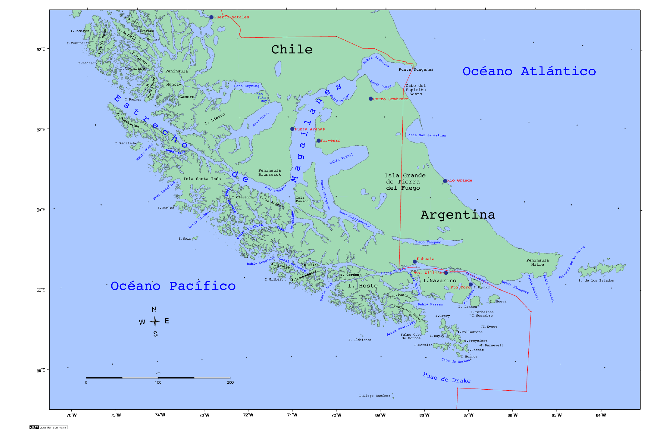
 /tiːˈɛərə dɛl ˈfweɪɡoʊ/, Spanish: [ˈtjera ðel ˈfweɣo]; Spanish for "Fireland") is an archipelago off the southernmost tip of the South American mainland, across the Strait of Magellan. The archipelago consists of a main island Isla Grande de Tierra del Fuego divided between Chile and Argentina with an area of 48,100 km2 (18,572 sq mi), and a group of smaller islands including Cape Horn. Initially discovered by Ferdinand Magellan's expedition in 1520, the islands were not settled by people of European descent until the second half of the 19th century at the height of the sheep farming and gold rush booms. Today's economic activity in the northern part of Tierra del Fuego is dominated by petroleum extraction while in the south tourism, manufacturing and Antarctic logistics are important. The numbers of the native Selk'nam and Yaghans were greatly reduced by introduced diseases and by unequal conflicts with settlers. Today the Selk'nam are practically extinct as a distinct people, with all of their very few descendants being mestizos and their language extinct. Some of the few remaining Yaghans have settled in Villa Ukika in Navarino Island, others have scattered across Chile and Argentina. Tierra del Fuego hosts large areas protected as national parks and reserves, most of them in the mountainous south.
Contents
History
 Satellite image of Tierra del Fuego
 View of Puerto Williams
 The city of Ushuaia
Prehistory and European exploration
The earliest human settlement occurred more than 10,000 years Before Present. The Yaghan people were some of the earliest known humans settling in Tierra del Fuego, with certain recognizable archeological sites at locations such as Navarino Island within the islands of Tierra del Fuego.[1]
The name Tierra del Fuego derives from the Portuguese explorer Ferdinand Magellan sailing for the Spanish Crown, who was the first European to visit these lands in 1520. He believed he was seeing the many fires (fuego in Spanish) of the Yaghan, which were visible from the sea and that the "Indians" were waiting in the forests to ambush his armada.[2] Originally called the "Land of Smoke", it was later changed to "Land of Fire".
The very existence of Tierra del Fuego as one or more islands and not as part of Terra Australis was first inferred by Francisco de Hoces in 1525, then by Francis Drake in 1578 and in 1616 by a Dutch VOC expedition who named Cape Horn.
Four native Fuegians, including "Jemmy Button" (Orundellico), were brought from Tierra del Fuego by Robert FitzRoy on his first voyage with the HMS Beagle in 1830. The surviving three were taken to meet the King and Queen in London and were to an extent celebrities. They returned to Tierra del Fuego in the Beagle with FitzRoy and Charles Darwin, who made extensive notes about his visit to the islands.
Colonization and extinction of Indians (1860–1910)
During the second half of the 19th century the archipelago began to come under Chilean and Argentine influence. Both countries sought actively to claim the whole archipelago based on de jure Spanish colonial titles. Salesian missions were established in Río Grande and Dawson Island.
An 1879 Chilean expedition led by Ramón Serrano Montaner reported large amounts of placer gold in the streams and river beds of Tierra del Fuego. This prompted a massive immigration to Isla Grande de Tierra del Fuego from 1883 and 1909. Numerous Argentinians, Chileans and Croatians settled in the main island leading to increased conflicts with native Selknam. Julius Popper, Romanian explorer, was one of the most successful entrepreneurs. Popper, who was granted rights by the Argentine government to exploit any gold deposits he found in Tierra del Fuego, has been pointed as a central figure in what is called the Selknam Genocide. The Selknam and Yaghan populations of Tierra del Fuego declined sharply due to persecution by settlers, diseases and mass transfer to the Salesian mission of Dawson Island, where despite the missionaries' efforts many perished.
According to the Boundary treaty of 1881 Tierra del Fuego was divided between Argentina and Chile; previously it was claimed by both countries in its entirety.
The gold rushes of the late 19th century led to the founding of numerous small settlements by immigrants, as such as Argentine Ushuaia in was founded in 1884 and Río Grande in 1921, and the Chilean settlements Puerto Toro and Porvenir in 1892 and 1899 respectively.
Contemporary history (1940–1990)
 Mine field in Isla Grande de Tierra del Fuego Chile, photograph from 2006.
 Tierra del Fuego, showing current (2011) international boundaries of Chile and Argentina.See also: Beagle conflict
During the 1940s Chile and Argentina formulated their Antarctic claims, and governments realized the key role of Tierra del Fuego's geographical proximity in backing their claims as well as to supply their Antarctic bases. In the 1950s Chilean military founded Puerto Williams to counter Ushuaia's monopoly as the only settlement in Beagle Channel, a zone where Argentina disputed the 1881 borders.
In the 1960s and 1970s sovereignty claims by Argentina over Picton, Lennox and Nueva Islands in Tierra del Fuego led the two countries to the brink of war in December 1978. Mine fields were deployed in some areas of Tierra del Fuego and bunkers built in the Chilean side as consequence of the threat of an Argentine invasion. The threat of war by Argentina caused the Chilean Pinochet regime to give logistical support and information to the British during the Falklands War of 1982. Chilean radars supplied the British with information of Argentine movements in Tierra del Fuego, from where the Argentine Air Force launched raids on targets in the Falklands.
In 1986 the Argentine congress decided to make the Argentine part of Tierra del Fuego into a new province. The law was not promulgated until 26 April 1990.[3]
Geography
 Tierra del Fuego
The archipelago consists of a main island (Isla Grande de Tierra del Fuego, often simply called Tierra del Fuego or Isla Grande) with an area of 48,100 km2 (18,572 sq mi), and a group of smaller islands. The main island is split between two countries: 18,507.3 km2 (7,146 sq mi) (38.57% of total) belongs to Argentina, while 29,484.7 km2 (11,384 sq mi) (61.43% of total) belongs to Chile.
Half of this island, and the islands west and south of it, are part of the Magallanes y Antártica Chilena Region, the capital and chief town of which is Punta Arenas, situated on the mainland across the strait. The biggest Chilean towns are Porvenir, capital of the Chilean Province of Tierra del Fuego, on the main island, and Puerto Williams, on Navarino Island, being the capital of the Antártica Chilena Province. Puerto Toro lies a few kilometers south of Puerto Williams and is arguably the southernmost village in the world.
The eastern part of the archipelago belongs to Argentina, being part of the Tierra del Fuego, Antarctic Territory and South Atlantic Islands Province; its capital is Ushuaia, the biggest city of the archipelago. The other important city in the region is Río Grande on the Atlantic coast.
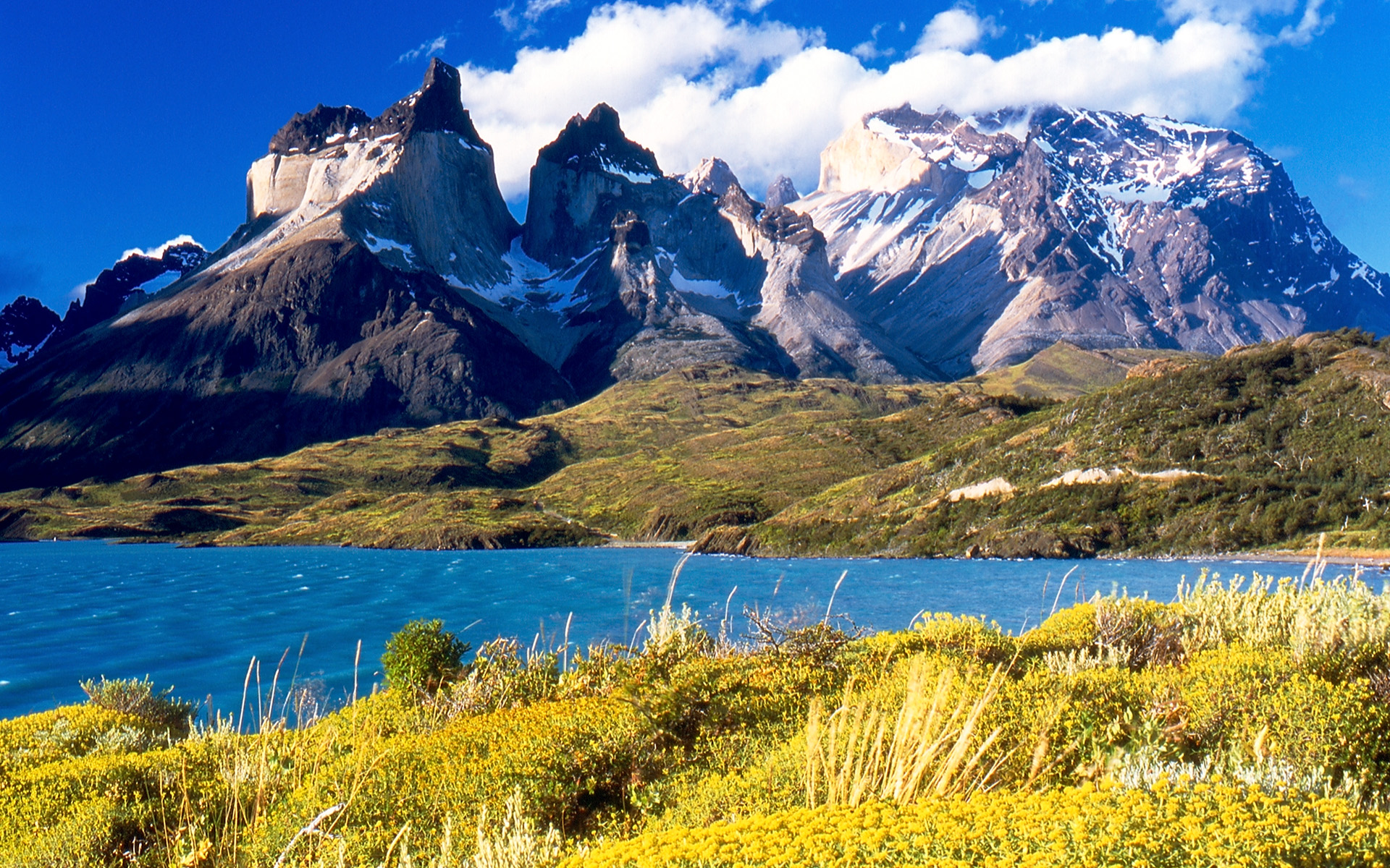
The Darwin Range ends in the Mount Bove; this range contains many glaciers that reach the ocean. Mount Darwin is the highest peak at 2,488 metres (8,163 ft).
Geology
The geology of the archipelago is characterized by the effects of the Andean orogeny and the repeated Pleistocene glaciations. The geology of the island can be divided into large east-west oriented units. The southwestern islands of the archipelago, including Cape Horn, are part of the Patagonian Batholith, while Cordillera Darwin and the area around Beagle Channel forms the principal codillera hosting the highest mountains. The Magallanes fold and thrust belt extends north of Almirantazgo Fjord and Fagnano Lake, and north of this lies the Magallanes foreland; an old sedimentary basin that hosts hydrocarbon reserves.[4] Orthogneiss dated at 525 million years of age is known to underlie some of the oil wells in northern Tierra del Fuego.[5]
The Magallanes-Fagnano Fault, a dextral strike slip fault crosses the southern part of the main island from west to east. It is an active seismic fault, located in inside and parallel to the Fuegian fold and thrust belt marks the boundary between a southern belt of Paleozoic metasediments and northern Mesozoic belts sedimentary sequences. The Fagnano Lake occupies an glacier-carved depression in a pull-apart basin developed along the Magallanes-Fagnano Fault zone.[6]
Climate
 Map showing annual isotherms and precipitation isolines in Magallanes Region. Puerto Williams' location is shown by a red dot.
This region has an oceanic climate (Köppen climate classification Cfc) with short, cool summers and long, wet, moderately mild winters: the precipitation averages 3,000 mm (118 in) a year in the far west, but precipitation decreases rapidly to the eastern side. Temperatures are steady throughout the year: in Ushuaia they hardly surpass 9 °C (48 °F) in summers and average 0 °C (32 °F) in winters. Snowfall can occur in summer. The cold and wet summers help preserve the ancient glaciers. The southernmost islands possess a sub antarctic climate typical of tundra that makes the growth of trees impossible. Some areas in the interior have a polar climate. Regions in the world with similar climates to southern Tierra del Fuego are: Aleutian islands, Iceland, Alaska Peninsula, Faroe Islands, Macquarie Island and Heard and McDonald Islands.
Flora
Only 30% of the islands have forests, which are classified as Magellanic sub polar; the northeast is made up by steppe and cool semi desert.
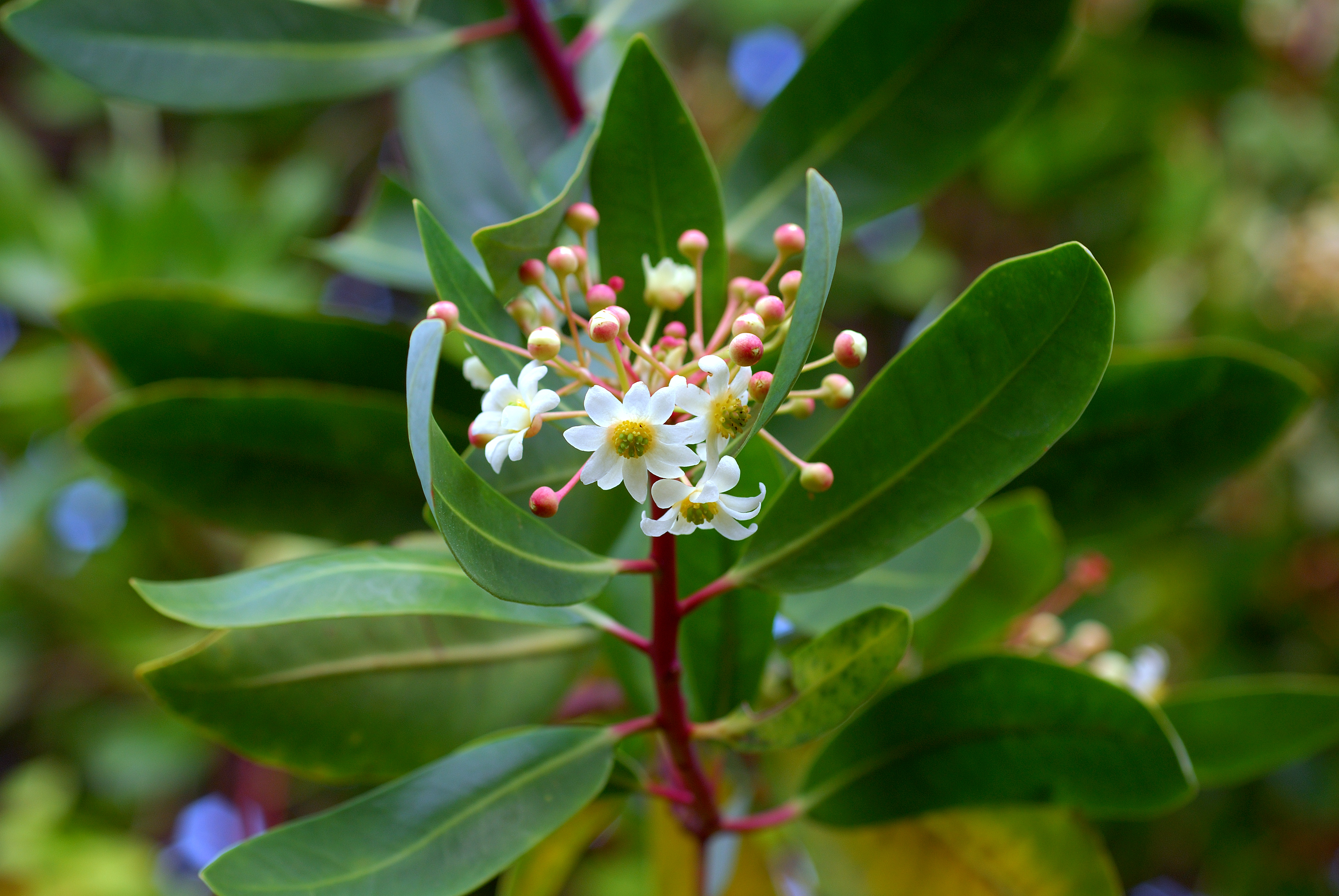
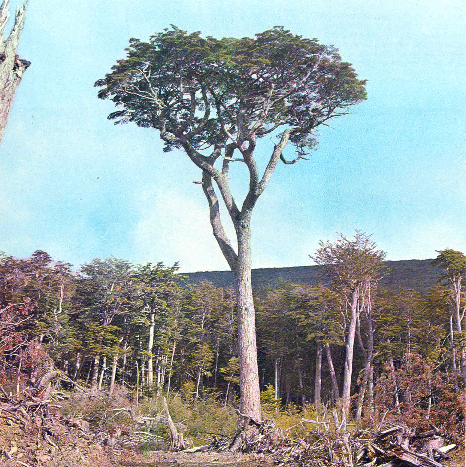
There are six species of tree found in Tierra del Fuego: Canelo or Winter's Bark (Drimys winteri), Maytenus magellanica, Pilgerodendron uviferum the southernmost conifer in the world , and three kinds of Southern Beech; Nothofagus antarctica, Nothofagus pumilio and the evergreen Nothofagus betuloides. Fruits grow in open spaces in these forests, such as beach strawberry (Fragaria chiloensis var. chiloensis forma chiloensis) and calafate (Berberis buxifolia), which were and are collected respectively by Indians and countrymen.[7] These forests are unique in the world for having developed in a climate with such cold summers. Tree cover extends very close to the southernmost tip of South America. Winds are so strong that trees in wind-exposed areas grow twisted by the force of winds, and people call the trees "flag-trees" for the shape that they need to take in the fight with the wind. Tree vegetation extends as far south as the Isla de los Estados, Navarino Island and the north of Hoste Island. At altitudes above 500 m (1,640 ft), dwarf nothofagus communities are found. Going further south, Wollaston Islands and the south of Hoste Island are covered by sub antarctic tundra.
- Flora in Tierra del Fuego
-

Drimys winteri flowers
Forests from Tierra del Fuego have expanded beyond local importance; they have been a source of trees that have been planted abroad in places with practically the same climate but which were originally devoid of trees like Faroe Islands and nearby archipelagos. Most species were gathered from the coldest places in Tierra del Fuego, sites mainly with tundra borders. This effort resulted in positive changes, as the heavy winds and cool summers in the Faroe Islands did not allow the growth of trees from other regions in the world. The imported trees are used ornamentally, as curtains against wind, and for fighting erosion caused by storms and grazing in the Faroe Islands.[8]
Fauna
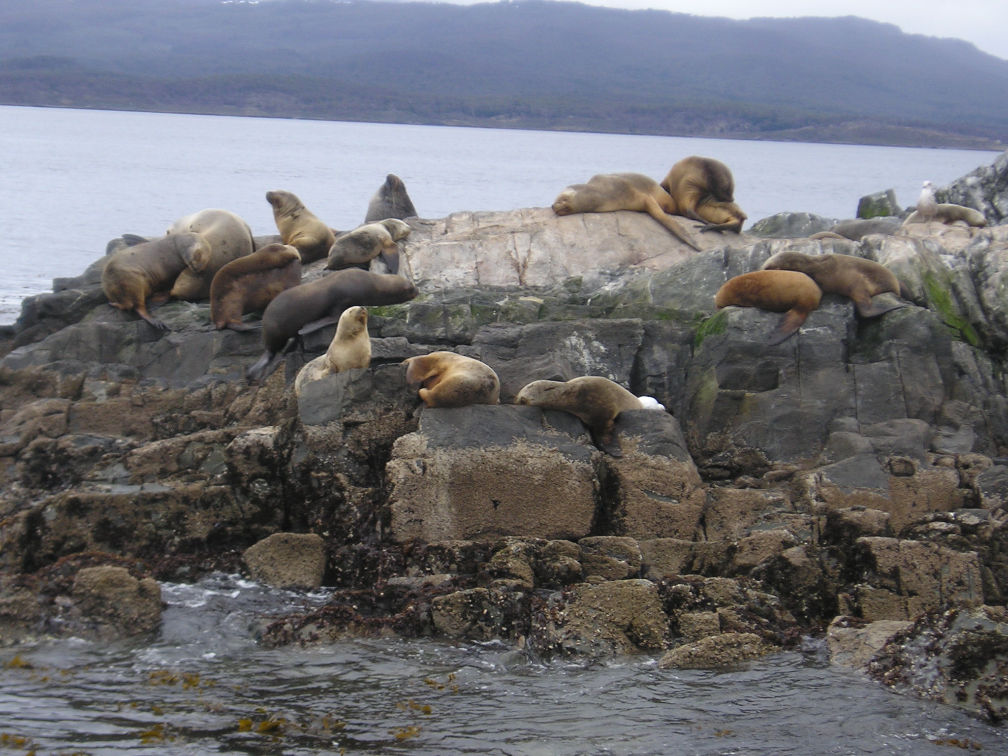
See also: Beaver eradication in Tierra del FuegoAmong the most notable animals in the archipelago that are found: Austral Parakeets, gulls, guanacos, foxes, kingfishers, condors, owls, and firecrown hummingbirds. North American beaver, introduced in the 1940s, have proliferated and caused considerable damage to the island's forests.[9]
Like mainland Chile and Argentina to the north, the archipelago boasts some of the finest trout fishing in the world. Sea Run Brown Trout often exceed 9 kg (20 lb), particularly in rivers such as the Rio Grande and San Pablo and in the Lago Fagnano. Much of this water is private, catch and release and fly fishing only.[citation needed]
Economy
Wood lodging was the economic driving force behind the colonization of this remote area. Today the main economic activities are fishing, natural gas and oil extraction, sheep farming and ecotourism. Tourism is gaining importance and becoming an ever more important part of the region’s economy attracting increasing numbers of upmarket visitors. Much of the tourism is based on claims of "southernmost" things, for example both Ushuaia and Puerto Williams claim to be the southernmost city in the world. On the Argentine side of Tierra del Fuego the government has promoted the establishment of several electronic companies.
Energy production is a crucial economic activity. On the Argentine side of Tierra del Fuego during the 2005 to 2010 period, petroleum and natural gas extraction contributed to 20% of the region’s economic output.[10]
See also
- Alberto de Agostini National Park
- Beagle conflict
- The Voyage of the Beagle
- Tierra del Fuego National Park
- Yaghan language (only one speaker left)
- Selknam Genocide
- Beaver eradication in Tierra del Fuego
Notes
- ^ Hogan, C. Michael (2008-04-04). "Bahia Wulaia Dome Middens". Megalithic Portal. http://www.megalithic.co.uk/article.php?sid=18795. Retrieved 2011-06-20.
- ^ Bergreen, Laurence (2003). Over the Edge of the World: Magellan's Terrifying Circumnavigation of the Globe. HarperCollins. p. 179. ISBN 0-06-093638.
- ^ "Historia de Tierra del Fuego" (in Spanish). Tierradelfuego.gov.ar. http://www.tierradelfuego.gov.ar/historia/ihistoria.php. Retrieved 2011-06-20.
- ^ Menichetti, M.; Lodolo, E.; Tassone, A. (March 2008). "Structural geology of the Fuegian Andes and Magallanes fold-and-thrust belt – Tierra del Fuego Island". Geologica Acta 6 (1). http://www.raco.cat/index.php/GeologicaActa/article/view/83442/108425. Retrieved 2011-06-20.
- ^ Hervé, Francisco; Miller, Hubert; Pimpirev Christo. 2003. Patagonia – Antarctica Connections before Gondwana Break-Up in Antarctica Contributions to Global Earth Sciences. Chapter 5.1
- ^ Lodolo, Emanuele; Menichetti, Marco; Bartole, Roberto; Ben‐Avraham, Zvi; Tassone, Alejandro; Lippai, Horacio (2003). "Magallanes-Fagnano continental transform fault (Tierra del Fuego, southernmost South America)". Tectonics 22 (6): 1076. doi:10.1029/2003TC001500.
- ^ Martínez Crovetto, Raúl. 1968. Estudios Etnobotánicos. Nombres de plantas y su utilidad según los indios Onas de Tierra del Fuego. Revista de la Facultad de Agronomía y Veterinaria de la Universidad del Nordeste, Corrientes, Argentina
- ^ Højgaard, A., J. Jóhansen, and S. Ødum (eds) 1989. A century of tree planting in the Faroe Islands. Føroya Frodskaparfelag, Torshavn.
- ^ Strieker, Gary (1999-07-09). "Argentina eager to rid island of beavers". Cable News Network. http://edition.cnn.com/NATURE/9907/09/argentina.beaver/. Retrieved 2007-06-30.
- ^ "Instituto Nacional de Estadística y Censos". http://www.indec.gov.ar.
References
- Bridges, Lucas. 1948. Uttermost Part of the Earth. Reprint with introduction by Gavin Young, Century Hutchinson, 1987. ISBN 0-7126-1493-1
- Keynes, Richard. 2002. Fossils, Finches and Fuegians: Charles Darwin's Adventures and Discoveries on the Beagle, 1832-1836. Harper Collins Publishers, London. Reprint: 2003.
- Bollen, Patrick. 2000. "Tierra del Fuego" B/W Photobook. Lannoo Publishers, Tielt, Belgium. ISBN 90-209-4040-6
External links
- Official website of Argentine Tierra del Fuego
- Chile Cultural Society - Tierra del Fuego
 Chisholm, Hugh, ed (1911). "Tierra del Fuego". Encyclopædia Britannica (11th ed.). Cambridge University Press.
Categories:- Tierra del Fuego
- Islands of Argentina
- Archipelagoes of Chile
- Regions of South America
- Islands of Magellan and Chilean Antarctica Region


Wikimedia Foundation. 2010.