- Clark Bridge
-
Not to be confused with the George Rogers Clark Memorial Bridge in Louisville, Kentucky.
Clark Bridge 
View from West Alton, MOOther name(s) Clark Superbridge Carries 4 lanes of US 67 Crosses Mississippi River Locale West Alton, Missouri and Alton, Illinois Design Cable-stayed bridge Total length 4,620 feet (1,408 m) Longest span 756 feet (230 m) Opened January 1994 Coordinates 38°52′56″N 90°10′44″W / 38.88222°N 90.17889°W The Clark Bridge is a cable-stayed bridge across the Mississippi River between West Alton, Missouri and Alton, Illinois. Named after explorer William Clark like the bridge it replaced, the cable-stayed bridge opened in 1994. It carries U.S. Route 67 across the river. It is the northernmost river crossing in the Saint Louis metropolitan area.
The new $85 million, 108-foot-wide bridge (33 m) replaced the old Clark Bridge, which was only 20 ft wide (6.1 m).[1] The truss bridge was built in 1928. The new bridge carries two lanes of divided traffic in each direction, as well as two bike lanes. The old bridge carried only two lanes (similar to the upstream Champ Clark Bridge).
The bridge is sometimes referred to as the Super Bridge. Its construction was featured in a NOVA documentary entitled Super Bridge, which highlighted the challenges of building the bridge, especially during the Great Flood of 1993. Designed by Hanson Engineers under contract to Illinois Department of Transportation (DOT), the Clark Bridge was the first in the United States in which "such a light steel-framed cable-stayed design was combined with a cable saddle type of pylon."[2] The bridge used 8,100 tons of structural steel; 44,100 cubic yards of concrete; and more than 160 miles of cable wrapped with four acres of yellow plastic piping.[3]
See also
- List of crossings of the Upper Mississippi River
- Lewis Bridge
-

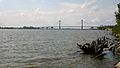
The Clark Bridge. View is upriver to the northwest from the Melvin Price Locks below the bridge
-

Clark Bridge as seen from the Missouri side of the Mississippi
-

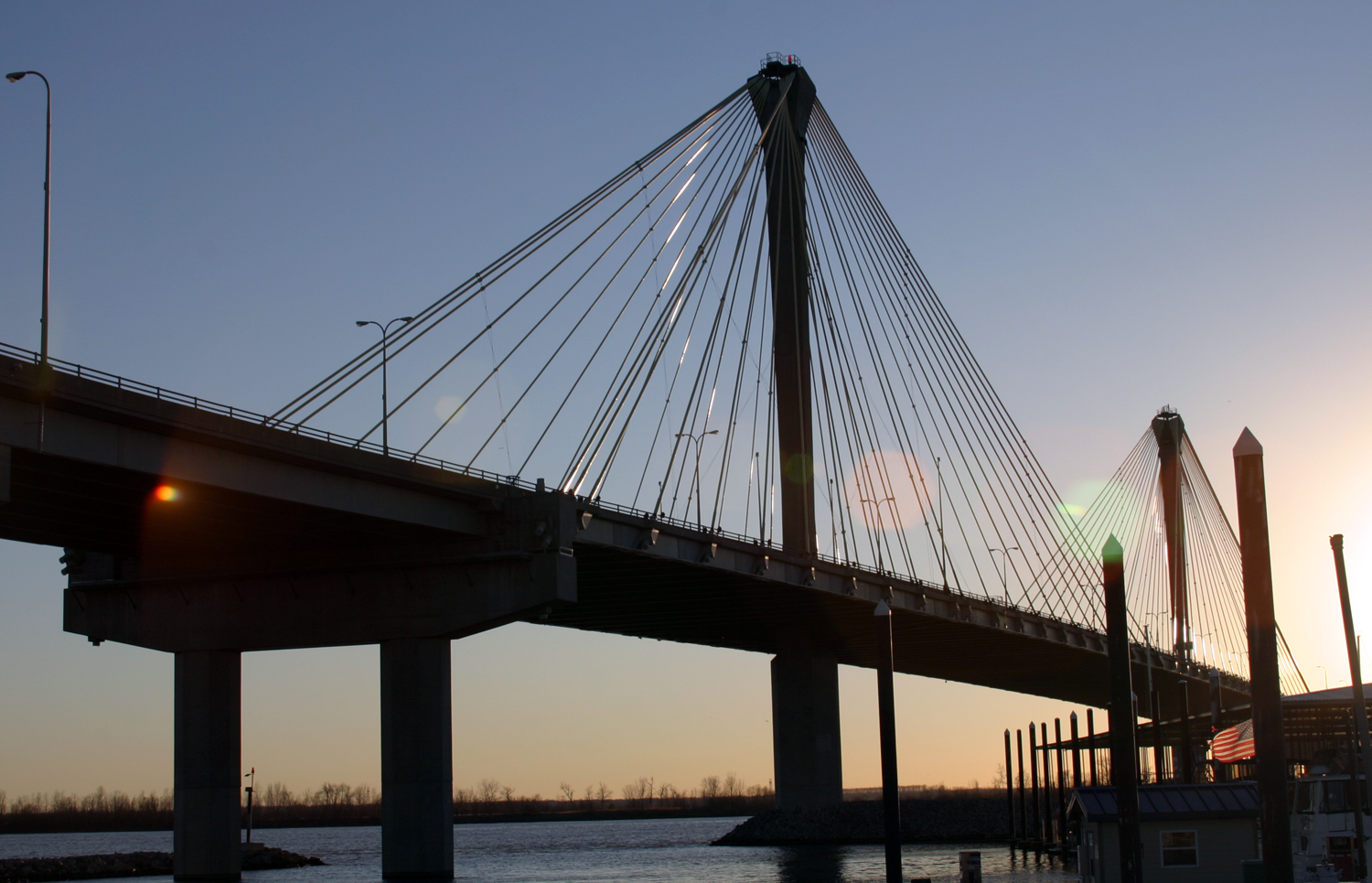
Clark Bridge seen from the Alton Marina
-
Bridges of the Mississippi River Upstream
Old Clark Bridge
Former
Clark Bridge
Downstream
New Chain of Rocks Bridge

Bridges, tunnels, and viaducts in Greater St Louis Bridges Eads Bridge • Poplar Street Bridge • New Mississippi River Bridge • McKinley Bridge • Martin Luther King Bridge • Merchants Bridge • Chain of Rocks Bridge • New Chain of Rocks Bridge • Lewis Bridge • Clark Bridge • Bellefontaine Bridge • MacArthur Bridge • Jefferson Barracks Bridge • Discovery Bridge • Wabash Bridge • Old St. Charles Bridge (now demolished) • Blanchette Memorial Bridge • Veterans Memorial Bridge • Daniel Boone Bridge • Washington Bridge • Bellerive BridgeTunnels Lindbergh Boulevard Tunnel • St. Louis Freight Tunnel • Tucker Boulevard Tunnel (now disused)Viaducts Tucker Boulevard Viaduct • Grand Boulevard Viaduct • Jefferson Avenue Viaduct • 18th Street Viaduct • 14th Street Viaduct • Kingshighway Boulevard Viaduct • South Kingshighway Boulevard Viaduct • Hampton Avenue Viaduct • Poplar Street Rail Viaduct • Lesperance Street Rail Viaduct • Westbelt Rail ViaductOperators References
- ^ David Goodyear and Ralph Salamie, "The Clark Bridge", Civil Engineering, August 1994, accessed 4 Aug 2009
- ^ David Goodyear and Ralph Salamie, "The Clark Bridge", Civil Engineering, August 1994, accessed 4 Aug 2009
- ^ "Clark Bridge - Alton, Illinois", Alton Web, accessed 4 Aug 2009
External links
- Clark Bridge at Structurae
- David Goodyear and Ralph Salamie, "The Clark Bridge", from Civil Engineering, August 1994
- "Super Bridge", PBS, Companion page for NOVA episode
Categories:- Transportation in Greater St. Louis
- Cable-stayed bridges in the United States
- Bridges over the Mississippi River
- Bridges in Greater St. Louis
- Bridges in St. Charles County, Missouri
- Bridges in Madison County, Illinois
- Alton, Illinois
- Bridges completed in 1994
- Buildings and structures completed in 1994
- Towers in Missouri
- Towers in Illinois
- Bridges on the U.S. Highway System
- Road bridges in Illinois
- Road bridges in Missouri
- United States bridge (structure) stubs
- Illinois building and structure stubs
- Missouri building and structure stubs


Wikimedia Foundation. 2010.