- Bristol Channel
-
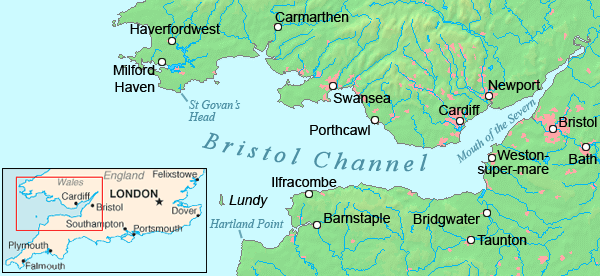
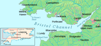 Map of the Bristol Channel
The Bristol Channel (Welsh: Môr Hafren, meaning 'Severn Sea') is a major inlet in the island of Great Britain, separating South Wales from Devon and Somerset in South West England. It extends from the lower estuary of the River Severn (Welsh: Afon Hafren) to the North Atlantic Ocean. It takes its name from the English city of Bristol, and is over 30 miles (50 km) across at its widest point.
Long stretches of the coastline of the Bristol Channel, on both the South Wales and West Country sides, are designated as Heritage Coast, including Exmoor, Bideford Bay, the Hartland Point peninsula, Lundy Island, Glamorgan, Gower Peninsula, South Pembrokeshire and Caldey Island.
Contents
Extent
The International Hydrographic Organization defines the limits of the Bristol Channel as "a line joining Hartland Point [in Devon] (51°01′N 4°32′W / 51.017°N 4.533°W) to St. Govan's Head [in Pembrokeshire] (51°36′N 4°55′W / 51.6°N 4.917°W)".[1]
The upper limit of the Channel is between Sand Point, Somerset and Lavernock Point in South Wales. East of this line is the Severn Estuary. Western and northern Pembrokeshire, and north Cornwall are outside the defined limits of the Bristol Channel, and are considered part of the seaboard of the Atlantic Ocean, more specifically the Celtic Sea.
Ecology
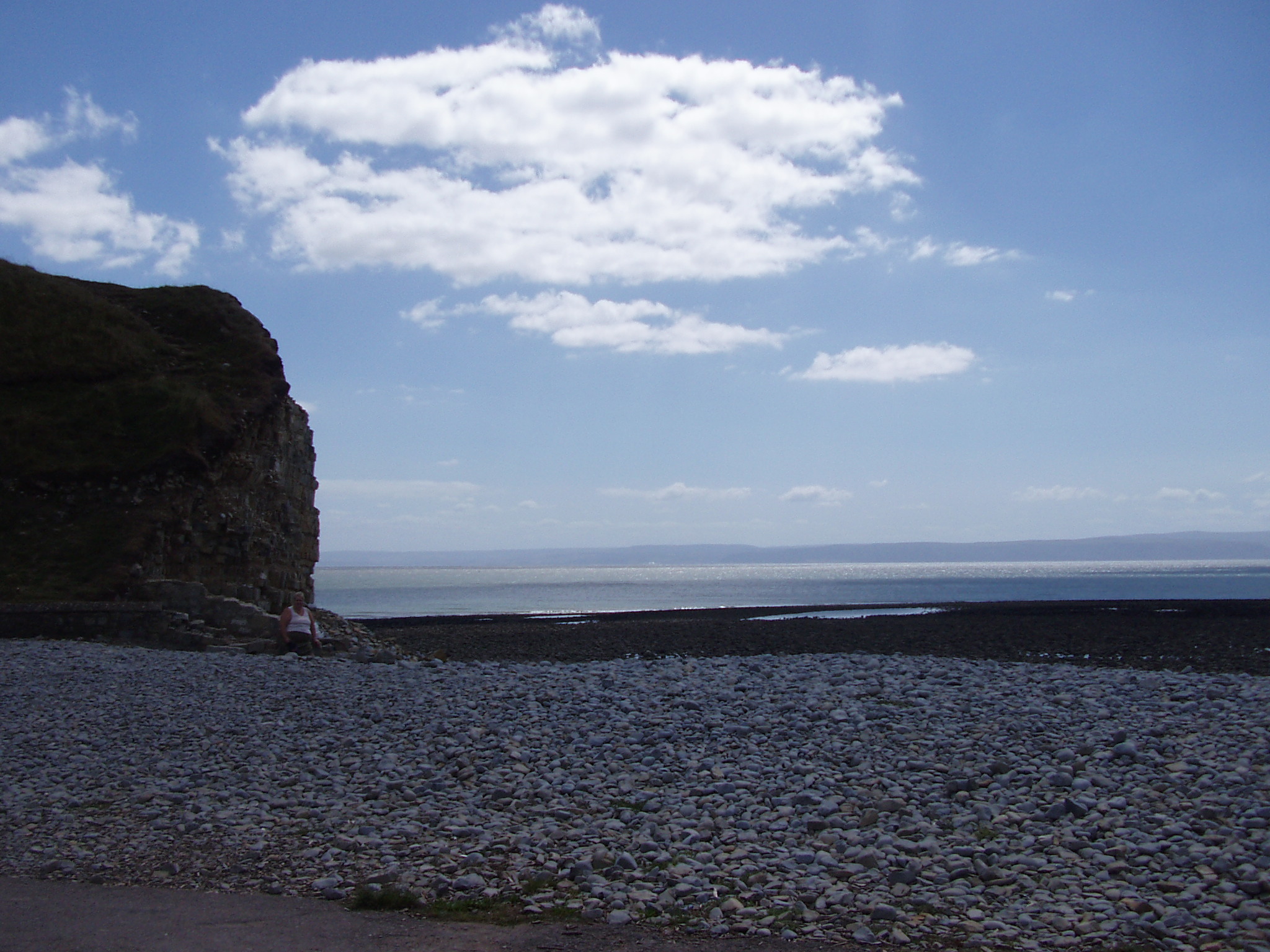
 The channel from Barry, Wales
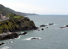
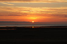
The Bristol Channel is an important area for wildlife, in particular waders, and has protected areas, including National Nature Reserves such as Bridgwater Bay at the mouth of the River Parrett. At low tide large parts of the channel become mud flats due to the tidal range of 15 metres (49 ft),[2] second only to Bay of Fundy in Eastern Canada.[3][4] Development schemes have been proposed along the channel, including an airport and a tidal barrier for electricity generation, but conservation issues have so far managed to block such schemes.
The largest islands in the Bristol Channel are Lundy, Steep Holm and Flat Holm. The islands and headlands provide some shelter for the upper reaches of the channel from storms. These islands are mostly uninhabited and protected as nature reserves, and are home to some unique wild flower species. In 1971 a proposal was made by the Lundy Field Society to establish a marine reserve. Provision for the establishment of statutory Marine Nature Reserves was included in the Wildlife and Countryside Act 1981, and on 21 November 1986 the Secretary of State for the Environment announced the designation of a statutory reserve at Lundy.[5] There is an outstanding variety of marine habitats and wildlife, and a large number of rare and unusual species in the waters around Lundy, including some species of seaweed, branching sponges, sea fans and cup corals.[6]
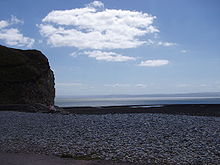
The Bristol Channel has some extensive and popular beaches and spectacular scenery, particularly on the coasts of Exmoor and Bideford Bay in North Devon and the Vale of Glamorgan and Gower Peninsula on the Glamorgan coast. The western stretch of Exmoor boasts Hangman cliffs, the highest cliffs in mainland Britain, culminating near Combe Martin in the "Great Hangman", a 1,043 ft (318 m) 'hog-backed' hill with a cliff-face of 820 ft (250 m); its sister cliff "The Little Hangman" has a cliff-face of 716 ft (218 m). On the Gower Peninsula, at its western extremity is the Worms Head, a headland of carboniferous limestone which is approachable on foot at low tide only. The beaches of Gower (at Rhossili, for example) and North Devon, such as Croyde and Woolacombe, win awards for their water quality and setting, as well as being renowned for surfing. In 2004, The Times "Travel" magazine selected Barafundle Bay in Pembrokeshire as one of the twelve best beaches in the world. In 2007, Oxwich Bay made the same magazine's Top 12 best beaches in the world list, and was also selected as Britain's best beach for 2007.
Coastal cities and towns
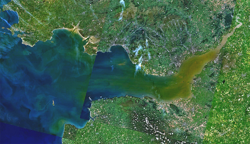
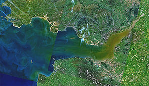 Satellite view of the Bristol Channel
The city of Swansea is the largest settlement on the Welsh coast of the Bristol Channel. Other major built-up areas include Barry (including Barry Island), Port Talbot and Llanelli. Smaller resort towns include Porthcawl, Mumbles, Saundersfoot and Tenby.
There are no cities on the English coast but the resorts of Burnham-on-Sea, Watchet, Minehead and Ilfracombe face directly onto the Bristol Channel, whilst Barnstaple and Bideford are sited on estuaries opening onto Bideford Bay at the westernmost end of the Bristol Channel. The city of Bristol, originally established on the River Avon but now with docks on the Severn estuary, is one of the most important ports in Britain and gives its name to the Channel which forms its seaward approach.
There are no road or rail crossings of the Bristol Channel so direct crossings are necessarily made by sea or air, or less directly by the road and rail crossings of the Severn estuary. The Channel can be a hazardous area of water because of its strong tides and the rarity of havens on the north Devon and Somerset coasts that can be entered in all states of the tide. Because of the treacherous waters, pilotage is an essential service for shipping. A specialised style of sailing boat, the Bristol Channel Pilot Cutter, developed in the area.
Paddle steamers
P and A Campbell of Bristol were the main operators of pleasure craft, particularly paddle steamers, from the mid-19th century to the late 1970s, together with the Barry Railway Company. These served harbours along both coasts, such as Ilfracombe and Weston-super-Mare.
This tradition is continued each summer by the PS Waverley, the last seagoing paddle steamer in the world, built in 1947. The steamer provides pleasure trips between the Welsh and English coasts and to the islands of the channel. Trips are also offered on the MV Balmoral, also owned by Waverley Excursions.
Marine rescue services
The Burnham-on-Sea Area Rescue Boat (BARB)[2] uses a hovercraft to rescue people from the treacherous mud flats on that part of the coast. A hovercraft was recently tested to determine the feasibility of setting up a similar rescue service in Weston-super-Mare. There are also RNLI lifeboats stationed along both sides of the Channel. In the Severn Estuary, in-shore rescue is provided by two independent lifeboat trusts, the Severn Area Rescue Association (SARA) and the Portishead and Bristol Lifeboat Trust.[7]
Renewable energy
Main article: Severn BarrageThe Bristol Channel and Severn Estuary have the potential to generate more renewable electricity than all other UK estuaries. It has been stated that, if harnessed, it could create up to 5% of the UK’s electricity, contributing significantly to UK climate change goals and European Union renewable energy targets. The Severn Tidal Power Feasibility Study was launched in 2008 by the UK Government to assess all tidal range technologies, including barrages, lagoons and others.[8] The study will look at the costs, benefits and impacts of a Severn tidal power scheme and will help Government decide whether it could or could not support such a scheme. Some of the options being looked at may include a road crossing downstream of the existing crossings of the estuary.
1607 flood
Main article: Bristol Channel floods, 1607On 30 January 1607 (New style) thousands of people were drowned, houses and villages swept away, farmland inundated and flocks destroyed when a flood hit the shores of the Channel. The devastation was particularly bad on the Welsh side, from Laugharne in Carmarthenshire to above Chepstow on the English border. Cardiff was the most badly affected town. There remain plaques up to 8 ft (2.4 m) above sea level to show how high the waters rose on the sides of the surviving churches. It was commemorated in a contemporary pamphlet "God's warning to the people of England by the great overflowing of the waters or floods."
The cause of the flood is uncertain and disputed. It had long been believed that the floods were caused by a combination of meteorological extremes and tidal peaks, but research published in 2002 showed some evidence of a tsunami in the Channel.[9] Although some evidence from the time describes events similar to a tsunami, there are also similarities to descriptions of the 1953 floods in East Anglia, which were caused by a storm surge. It has been shown that the tide and weather at the time were capable of generating such a surge.[10]
Religion
In 1835 John Ashley was on the shore at Clevedon with his son who asked him how the people on Flat Holm could go to church. For the next three months Ashley voluntarily ministered to the population of the island. From there he recognised the needs of the seafarers on the four hundred sailing vessels in the Bristol Channel and created the Bristol Channel Mission. He raised funds and in 1839 a specially designed mission cutter was built with a main cabin which could be converted into a chapel for 100 people, this later became first initiative of the Mission to Seafarers.[11]
Recreation
Surfing
Much of the coastline at the western end of the Bristol Channel faces west towards the Atlantic Ocean meaning that a combination of an off-shore (east) wind and a generous Atlantic swell produces excellent surf along the beaches. The heritage coasts of the Vale of Glamorgan, Bideford Bay and Gower are, along with the Atlantic coasts of Pembrokeshire and Cornwall, the key areas for surfing in the whole of Britain. Although slightly overshadowed by the Atlantic coasts of North Cornwall and West Pembrokeshire, both Gower and Bideford Bay nevertheless have several superb breaks—notably Croyde in Bideford Bay and Langland Bay on Gower—and surfing in Gower and Bideford Bay is enhanced by the golden beaches, clean blue waters, excellent water quality and good facilities close by to the main surf breaks.
Walking
The high quality of the landscape of much of both coasts of the Bristol Channel means that they are popular destinations for walkers. Sections of two national trails; the South West Coast Path and the Pembrokeshire Coast Path follow these shores along with various other shorter waymarked recreational routes. A continuous coastal path is being developed along the entire Welsh shore under the auspices of the Countryside Council for Wales.
Swimming Records
Ilfracombe to Swansea
The first person to swim the 30.5 nautical miles (56.5 km; 35.1 mi) from Ilfracombe to Swansea was Gethin Jones, who achieved the record on 13 September 2009, taking nearly 22 hours.[12]
Penarth to Clevedon
The youngest person to swim the Bristol Channel from Penarth to Clevedon is Gary Carpenter who at age 17 on August Bank Holiday 2007, swam the channel in 5 hours 35 minutes making him the youngest and fastest swimmer of the Bristol Channel. Gary Carpenter's coach Steve Price was the first ever person to swim from Penarth to Clevedon back in 1990.[13]
References
- ^ "Limits of Oceans and Seas, 3rd edition + corrections". International Hydrographic Organization. 1971. p. 42 [corrections to page 13]. http://www.iho-ohi.net/iho_pubs/standard/S-23/S23_1953.pdf. Retrieved 6 February 2010.
- ^ "Severn Estuary Barrage" (PDF). UK Environment Agency. 31 May 2006. Archived from the original on 2007-09-30. http://web.archive.org/web/20070930155720/http://www.environment-agency.gov.uk/commondata/acrobat/severnpositionmay2006_1508223.pd. Retrieved 2007-09-03.
- ^ Chan, Marjorie A.; Archer, Allen William (2003). Extreme Depositional Environments: Mega End Members in Geologic Time. Boulder, Colorado: Geological Society of America. pp. 151. ISBN 0813723701. http://books.google.com/?id=b3_1Ry0gDqEC&pg=PA152&lpg=PA152&dq=bristol+channel.
- ^ "Coast: Bristol Channel". BBC. http://www.bbc.co.uk/bristol/content/articles/2005/07/04/bristolchannel_feature.shtml. Retrieved 2007-08-27.
- ^ "Lundy Island Marine Nature Reserve". Lundy.org. http://www.lundy.org.uk/inf/zone.html. Retrieved 2007-09-05.
- ^ "Lundy Marine Nature Reserve". Lundy.org. http://www.lundy.org.uk/inf/mnr.html. Retrieved 2007-09-05.
- ^ Portishead and Bristol Lifeboat Trust
- ^ "Severn Tidal Power". Welsh Assembly Government. http://new.wales.gov.uk/topics/environmentcountryside/energy/renewable/severntidal/?lang=en. Retrieved 2010-11-09.
- ^ Haslett, Simon K.; Edward A. Bryant (2004). "The AD 1607 coastal flood in the bristol channel and severn estuary: historical records from Devon and Cornwall (UK)". Archaeology in the Severn Estuary 15: 81–89.
- ^ Horsburgh, K.J. and M. Horritt (2006) The Bristol Channel floods of 1607 – reconstruction and analysis. Weather, 61(10), 272-277.
- ^ Farr, Grahame (1954). Somerset Harbours. London: Christopher Johnson. pp. 49.
- ^ South Wales Evening Post, 15 September 2009
- ^ Western Daily Press, 27 August 2008 - Surprise at pier for Channel swimmer Gary [1]
Coordinates: 51°18′N 3°37′W / 51.3°N 3.617°WRiver Severn, Great Britain Administrative areas Settlements Llanidloes · Newtown · Welshpool · Shrewsbury · Ironbridge · Bridgnorth · Bewdley · Stourport · Worcester · Tewkesbury · Gloucester · Berkeley · Chepstow · AvonmouthMajor tributaries River Vyrnwy · River Tern · Cound Brook · River Stour · River Teme · Warwickshire Avon · River Wye · Bristol Avon · River UskFlows into Severn Estuary · Bristol ChannelLinked canals Major crossings Categories:- Estuaries of England
- Estuaries of Wales
- Geography of Devon
- Geography of Somerset
- River Severn
- Bristol Channel
- Borders of England
- Borders of Wales

Wikimedia Foundation. 2010.