- Peterborough County, Ontario
Infobox Settlement
name =
official_name =Peterborough County
other_name =
native_name =
nickname =
settlement_type =County
total_type =
motto =
imagesize =
image_caption =
flag_size =
image_
seal_size =
image_shield =
shield_size =
image_blank_emblem =
blank_emblem_type =
blank_emblem_size =
imagesize =
image_caption =
flag_size =
image_
seal_size =
image_shield =
shield_size =
image_blank_emblem =
blank_emblem_type =
blank_emblem_size =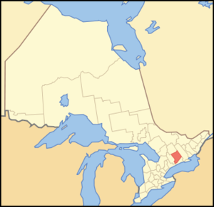
mapsize = 300px
map_caption = Location of Peterborough County
mapsize1 =
map_caption1 =
image_dot_
dot_mapsize =
dot_map_caption =
dot_x = |dot_y =
pushpin_
pushpin_label_position =
pushpin_map_caption =
pushpin_mapsize =
subdivision_type = Country
subdivision_name = CAN
subdivision_type1 = Province
subdivision_name1 = ONT
subdivision_type2 =
subdivision_name2 =
seat_type =County seat
seat = Peterborough
parts_type =Municipalities
parts_style =
parts =
p1 =Asphodel-Norwood
p2 =Cavan-Monaghan
p3=Douro-Dummer
p4=Galway-Cavendish-Harvey
p5=Havelock-Belmont-Methuen
p6=North Kawartha
p7=Otonabee-South Monaghan
p8=Smith-Ennismore-Lakefield
government_footnotes =
government_type =
leader_title =
leader_name =
leader_title1 =
leader_name1 =
established_title =Founded
established_date = 1838 as the District of Colborne
area_magnitude =
unit_pref =Imperial
area_footnotes =cite web |url=http://www12.statcan.ca/english/census06/data/profiles/community/Details/Page.cfm?Lang=E&Geo1=CD&Code1=3515&Geo2=PR&Code2=35&Data=Count&SearchText=Peterborough&SearchType=Begins&SearchPR=35&B1=All&Custom= |title=Community highlights for Peterborough |accessdate=2007-12-28 |date= |work= |publisher=]
area_total_km2 =
area_land_km2 = 3805.71
area_water_km2 =
area_total_sq_mi =
area_land_sq_mi =1469.39
area_water_sq_mi =
area_water_percent =
elevation_footnotes =
elevation_m =
elevation_ft =
elevation_max_m =
elevation_max_ft =
elevation_min_m =
elevation_min_ft =
population_as_of =2006
population_footnotes =
population_note =
population_total = 133080
population_density_km2 =35
population_density_sq_mi =90.6
timezone = EST
utc_offset = -5
timezone_DST = EDT
utc_offset_DST = -4
coor_type =
latd= |latm= |lats= |latNS=
longd= |longm= |longs= |longEW=
postal_code_type =
postal_code =
area_code =
website = [http://www.county.peterborough.on.ca/ www.county.peterborough.on.ca]
footnotes =Peterborough County (2006 population 133,080) is located in
Ontario ,Canada .The county was founded as the District of Colborne in 1838, centred around Peterborough, which became the County of Peterborough in 1850. In 1862, the County was redivided into Haliburton County, Peterborough County, and Victoria County (now the City of Kawartha Lakes). The centre of the County was originally the courthouse, which is still considered an important historical site. The southern section of the county is mix of agriculture, urban and lakefront properties. The northern section of the county is mostly sparsely populated wilderness with numerous rivers and lakes, mostly within the recently expanded
Kawartha Highlands Provincial Park .The county seat is Peterborough.
The County consists of eight townships:
*Asphodel-Norwood
*Cavan-Monaghan
*Douro-Dummer
*Galway-Cavendish-Harvey
*Havelock-Belmont-Methuen
*North Kawartha
*Otonabee-South Monaghan
*Smith-Ennismore-LakefieldThe City of Peterborough is within the Peterborough County
census division , but is separated from the county's administration.The County contains the Lang Pioneer Village, and the Kawarthas are a major tourist region.
Historic Townships
The county was named in honor of Col. Peter Robinson, who in 1825 brought 2,000 settlers from Ireland. The route taken was by way of Port Hope, Rice Lake and the Otonabee River, the same route used by the first settlers that entered this region in 1818.
* "Asphodel Township", Area, convert|37871|acre|sqmi km2|1 Opened in 1821 and named after the Greek word for lily.
* "Belmont and Methuen Townships", Area convert|81088|acre|sqmi km2|0, Opened in 1823 but by 1842 had only 33 householders, in 1866 only 185. Townships were mainly rock, lake and stream.
* "Burleigh" and "Anstruther Townships", Taxable area, convert|32160|acre|sqmi km2|0. First settled in 1861. First Post Office was called Burleigh. Separated from Dummer Township in 1865.
* "Chandos Township", area convert|56225|acre|sqmi km2|0. Opened n 1862 and named from one of the title of the Duke of Buckingham (Grenville Family)* "Douro Township", area convert|34446|acre|sqmi km2|0. Opened in 1821 and named in honor of one of the battles in the Peninsula.
* "Dummer Township". Area convert|68812|acre|sqmi km2|0. Opened in 1821 and named in honor of
William Dummer Powell , Chief Justice of Upper Canada. A Colony of immigrants came in 1831, of whom 150 were sent out by the Marquis of Bath.* "Ennismore Township". Area convert|17245|acre|sqmi km2|0. Opened in 1829 and named in honor of William Hare, Viscount Ennismore, M.P. For Cork who died in 1827. Originally it was called Emily Gore.
* "Galway and Cavendish Townships", Assessed Area convert|57218|acre|sqmi km2|0. Opened in 1857 and 1862 respectively.
* "Harvey Township". Area convert|68755|acre|sqmi km2|0. Opened in 1821 and named after Sir John Harvey, Deputy Adjutant General in Canada during the War of 1812. Was part of Smith township until 1866. First settler were retired officers who come in 1832, but did not succeed.
* "North Monaghan". Area convert|14096|acre|sqmi km2|0. Opened 1820.
* "Otonabee Township" Area convert|64024|acre|sqmi km2|0. Opened in 1820 and named from the River. The word in Indian signifies a delta.
* "Smith Township" Area convert|58043|acre|sqmi km2|1. Settled in October 1819 by Allen Otty.
Source: "Province of Ontario -- A History 1615 to 1927" by Jesse Edgar Middletwon & Fred Landon, copyright 1927, Dominion Publishing Company, Toronto
Major places
Cities
*
Peterborough, Ontario Towns/Villages
*
Lakefield, Ontario
*Norwood, Ontario
*Havelock, Ontario
*Douro, Ontario References
External links
* [http://www.county.peterborough.on.ca/ County of Peterborough]
* [http://www.thekawarthas.net/ The Kawarthas]
Wikimedia Foundation. 2010.