- Newtimber
-
Coordinates: 50°54′35″N 0°11′36″W / 50.90961°N 0.19324°W
Newtimber 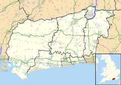
 Newtimber
Newtimber shown within West SussexArea 6.95 km2 (2.68 sq mi) [1] Population 96 [1] 2001 Census - Density 14 /km2 (36 /sq mi) OS grid reference TQ271138 - London 41 miles (66 km) N Parish Newtimber District Mid Sussex Shire county West Sussex Region South East Country England Sovereign state United Kingdom Post town HASSOCKS Postcode district BN6 Dialling code 01273 Police Sussex Fire West Sussex Ambulance South East Coast EU Parliament South East England UK Parliament Arundel and South Downs Website http://www.newtimber.co.uk/ List of places: UK • England • West Sussex Newtimber is a small village and civil parish in the Mid Sussex District of West Sussex, England. It is located north-west of Brighton, and is named after Newtimber Place and the small village named after it; the parish also includes the hamlet of Saddlescombe. It covers an area of 695 hectares (1,720 acres).
References
- ^ a b "2001 Census: West Sussex – Population by Parish". West Sussex County Council. http://www.westsussex.gov.uk/communityandliving/census2001/pop_parish_summary.pdf. Retrieved 10 April 2009.
External links
 Media related to Newtimber at Wikimedia Commons
Towns Villages and hamlets Albourne · Ansty · Ardingly · Ashurst Wood · Balcombe · Bolney · Clayton · Copthorne · Crawley Down · Cuckfield · Fulking · Goddards Green · Handcross · Hassocks · Hickstead · Horsted Keynes · Hurst Wickham · Hurstpierpoint · Keymer · Lindfield · Newtimber · Pease Pottage · Poynings · Pyecombe · Saddlescombe · Sayers Common · Scaynes Hill · Sharpthorne · Slaugham · Staplefield · Turners Hill · Twineham · Walstead · Warninglid · West HoathlyCivil parishes Categories:- Mid Sussex
- Villages in West Sussex
- West Sussex geography stubs

Wikimedia Foundation. 2010.