- Mânzăleşti
-
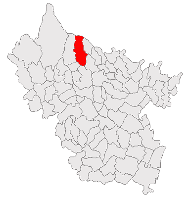
Mânzăleşti — Commune — 
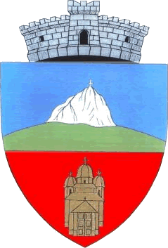
Coat of armsLocation of Mânzăleşti
Coordinates: 45°30′N 26°39′E / 45.5°N 26.65°ECoordinates: 45°30′N 26°39′E / 45.5°N 26.65°E Country Romania County Buzău County Component villages Beşlii, Buştea, Cireşu, Ghizdita, Gura Bădicului, Jghiab, Mânzăleşti, Plavăţu, Poiana Vâlcului, Satu Vechi, Trestioara, Valea Cotoarei, Valea Ursului Government – Mayor Ion Cristea (since 2004) (PNL) Population (2002)[1] – Total 3,026 Postal code Website minzalesti.home.ro (Romanian) Mânzăleşti (Romanian pronunciation: [mɨnzəˈleʃtʲ]) is a commune in the north of Buzău County, Romania. It is composed of thirteen villages: Beşlii, Buştea, Cireşu, Ghizdita, Gura Bădicului, Jghiab, Mânzăleşti, Plavăţu, Poiana Vâlcului, Satu Vechi, Trestioara, Valea Cotoarei and Valea Ursului.
Contents
Location
Mânzăleşti is located in the hilly part of Buzău county, in the valley of the Slănic river, a tributary of the Buzău river. Due to its location in a high-altitude region, the commune occupies a wide range of altitudes, from 400m in the Slănic river valley to 1,364m at the Cerdac peak.
Neighbours
- The commune of Niculele, Vrancea, to the north
- The commune of Bisoca, to the east
- The communes of Chiliile, Căneşti and Vintilă-Vodă to the south
- The commune of Lopătari to the east
History
The first document mentioning a village from the Mânzăleşti commune is a property act of February 3, 1522, by which the prince of Wallachia, Radu de la Afumaţi, gave ownership of the land of Peceneaga, from Menedic all the way to Cheia, to Negru Braga, his brothers and sons. The name Menedic refers to the present-day Meledic plateau, which lies close to the confluence of the Jgheab River and the Slănic River.
Throughout its medieval history, the commune was made up of several yeoman villages: Mânzăleşti-Măneşti, Ciomagi, Răghineşti and Ichimeşti, as well as the serf settlements on the Meledic and Poiana Ascunsă lands.
Landmarks
- The cave on the Meledic plateau, considered the longest cave carved in salt in the world.
- The Găvanu Eastern Orthodox monastery, dating back to the 18th century.
- The white mountain, a 13 meter high stone, showing wind and water erosion.
Notes
References
Buzău County, Romania Cities Buzău (county seat) · Râmnicu Sărat

Towns Communes Amaru · Bălăceanu · Balta Albă · Beceni · Berca · Bisoca · Blăjani · Boldu · Bozioru · Brădeanu · Brăeşti · Breaza · Buda · C.A. Rosetti · Calvini · Căneşti · Cătina · Cernăteşti · Chiliile · Chiojdu · Cilibia · Cislău · Cochirleanca · Colţi · Costeşti · Cozieni · Florica · Gălbinaşi · Gherăseni · Ghergheasa · Glodeanu Sărat · Glodeanu-Siliştea · Grebănu · Gura Teghii · Largu · Lopătari · Luciu · Măgura · Mărăcineni · Mărgăriteşti · Mânzăleşti · Merei · Mihăileşti · Movila Banului · Murgeşti · Năeni · Odăile · Padina · Pardoşi · Pănătău · Pârscov · Pietroasele · Podgoria · Poşta Câlnău · Puieşti · Racoviţeni · Râmnicelu · Robeasca · Ruşeţu · Săgeata · Săhăteni · Săpoca · Săruleşti · Scorţoasa · Scutelnici · Siriu · Smeeni · Stâlpu · Tisău · Topliceni · Ţinteşti · Ulmeni · Unguriu · Vadu Paşii · Valea Râmnicului · Valea Salciei · Vâlcelele · Verneşti · Vintilă Vodă · Vipereşti · Zărneşti · Ziduri
Categories:- Communes in Buzău County
Wikimedia Foundation. 2010.