- Corumbá de Goiás
-
Corumbá de Goiás State Goiás Geographical coordinates: 15°55′27″S 48°48′31″W / 15.92417°S 48.80861°W Area: 1,062.4 km² Population: 9,190 (IBGE 2007) Urban and Rural Population: 5,448 / 3,742 Population density: 8.65 inhab/km² (2007) Elevation: 950 m above sea level Postcode (CEP): 72960-000 IBGE statistical microregion: Entorno de Brasília Became a city: 1875 Mayor: Emílio de Paiva Jacinto Distance to Goiânia: 110 km. Website: [1] 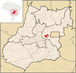

Corumbá de Goiás is a small town and municipality in central Goiás state, Brazil. It is one of the oldest cities in the state and still preserves vestiges of its colonial heritage. The Areias River passes through the municipality.
Contents
Location and Geography
Located in the micro-region of Entorno de Brasília, the town belongs to the area of influence of the Geoeconomical Region of Brasília and is linked by highways BR-070 and BR-414. Important distances are: 110 km to Goiânia, 45 km to Anápolis and 130 km to Brasília. Corumbá is bounded by the following municipalities: Pirenópolis, Cocalzinho de Goiás, Santo Antônio do Descoberto, Alexânia and Abadiânia.[2]
Due to variations in elevation, temperatures are quite varied. The average is around 26°C; The rains obey a tropical pattern and are at their strongest in the period of October to March.
Nature is the tourist attraction of the town. The region is full of waterfalls, caverns, and rivers. The Salto de Corumbá is known throughout the region and attracts many tourists from Brasília and Goiânia. The Corumbá River crosses the town and has beaches and rapids.
The town is one of the oldest in the state and still preserves part of the houses from past centuries, with special notice given to the Igreja Matriz de Nossa Senhora da Penha de França. Corumbá, like neighboring Pirenópolis, receives a great number of tourists for the Festival of the Cavalhadas, which are mock battles between Moors and Christians.
History
The settlement of Corumbá de Goiás began in 1731 when miners looked for gold at the confluence of the Corumbá River and the Bagagem River. In 1734 a chapel was built honoring Nossa Senhora da Penha da França. In 1840 the town was already a parish with its first priest Manoel Inocêncio da Costa Campos. In 1849 it was raised to the status of "vila" (like a municipality today) only to lose this status in 1863, becoming a district of Meia Ponte, which is today called Pirenópolis. The Vila de Corumbá became a city in 1902 changing its name to Corumbá de Goiás because of the confusion with the more important Corumbá in Mato Grosso. Corumbá de Goiás had grown to 20,212 inhabitants in 1980 with 17,765 living in the rural area. Between 1991 and 1996 the population dropped 15% with the rural population being reduced to 4,109 inhabitants. The population continued to diminish gradually until stabilizing after 2000.[3]
Economy
The economy is poorly developed due to the isolation of the town and is based on rural agricultural production and touristic activities. There is some cattle raising (59,000 head in 2006) both for beef and for milk. In 2007 there were two financial institutions. There was one dairy: S. Teixeira Produtos Alimentícios Ltda. (22/05/2006).[4]
Agricultural data 2006
- Farms: 841
- Total area: 55,844 ha.
- Area of permanent crops: 263 ha.
- Area of perennial crops: 3,895 ha.
- Area of natural pasture: 40,296 ha.
- Area of woodland and forests: 9,952 ha.
- Persons dependent on farming: 2,100
- Number of tractors: 158
- Cattle herd: 59,000
- Main crop: corn with 1,300 planted hectares producing 5,200 tons [5]
Health and education
- Schools: 22 with 2,413 students (2006)
- Hospitals: 02 with 29 beds (2007)
- Literacy rate (2000): 82%
- Infant mortality rate (2000): 24.45
- MHDI (2000): 0.716
- State ranking: 182 (out of 242 municipalities in 2000)
- National ranking: 2,701 (out of 5,507 municipalities in 2000) [6]
References
- ^ www.corumbatur.com.br
- ^ Sepin Anuário Estatístico do Estado de Goiás - 2005
- ^ Sepin Séries Históricas
- ^ Perfil dos Municípios
- ^ IBGE
- ^ frigoletto.com.br
See also List of municipalities in Goiás
Categories:- Populated places in Goiás

Wikimedia Foundation. 2010.